Tag

featured

Browsing

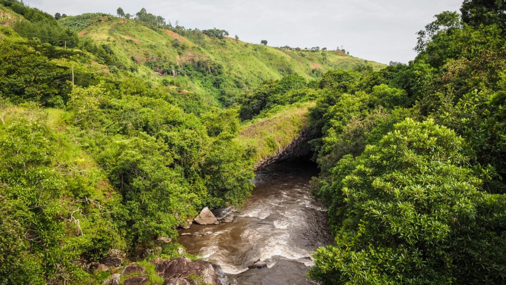
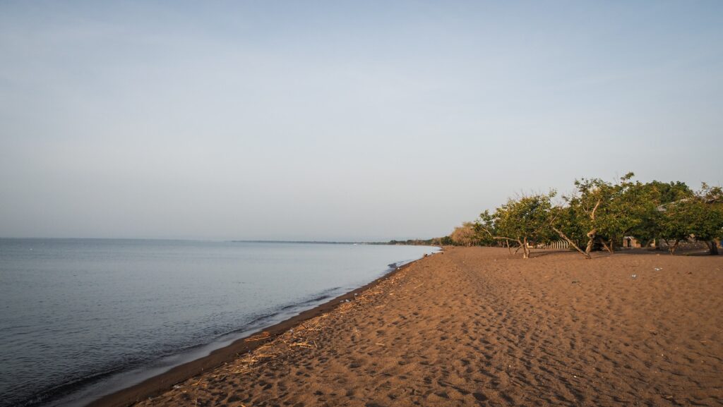
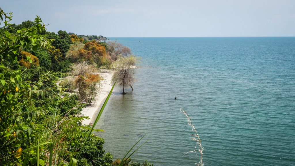
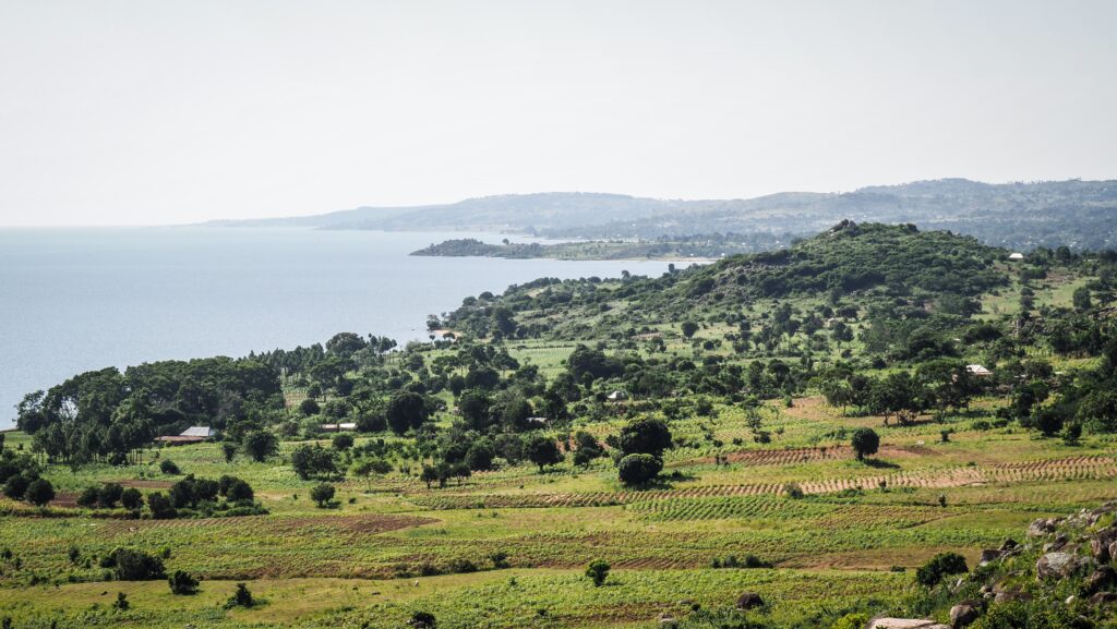
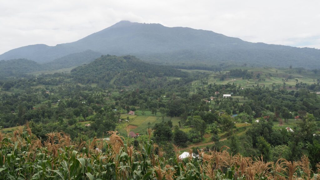
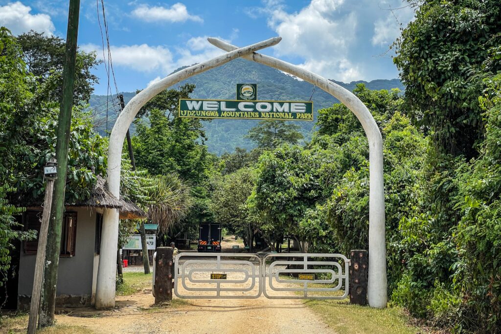
Udzungwa National Park is a protected area in south-central Tanzania. It lies in the Eastern Arc Mountains, a chain of ancient forested mountains stretching across Tanzania and Kenya. The park’s elevation ranges from about 250 meters to over 2,500 meters above sea level, creating a range of ecosystems from lowland tropical forests to montane forests. Its climate is humid and tropical, with heavy rains typically falling from March to May and lighter rains from November to December.

The park covers over 1,900 square kilometres. The plant life is extremely diverse, with over 2,500 plant species recorded, many of which are endemic. This botanical richness is due to the park’s isolation and varied altitudes, allowing unique species to evolve. You’ll find everything from giant trees and dense ferns to delicate orchids and medicinal plants used by local communities.

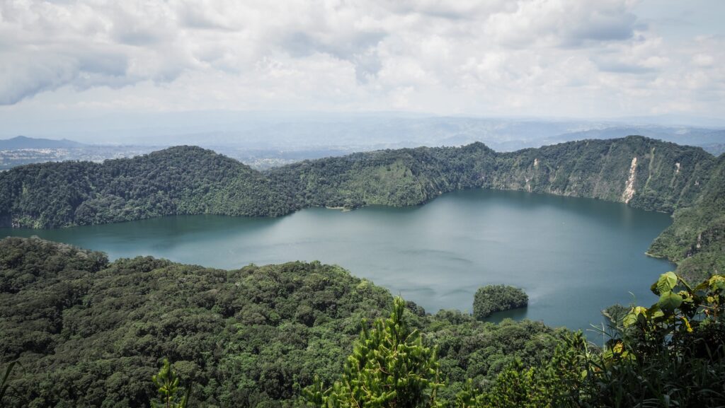
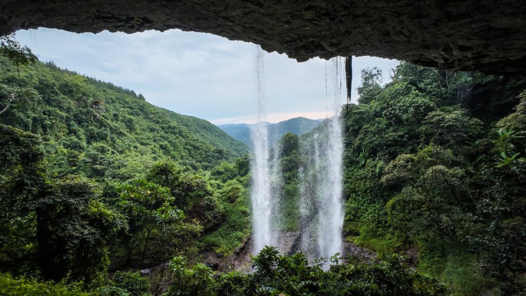
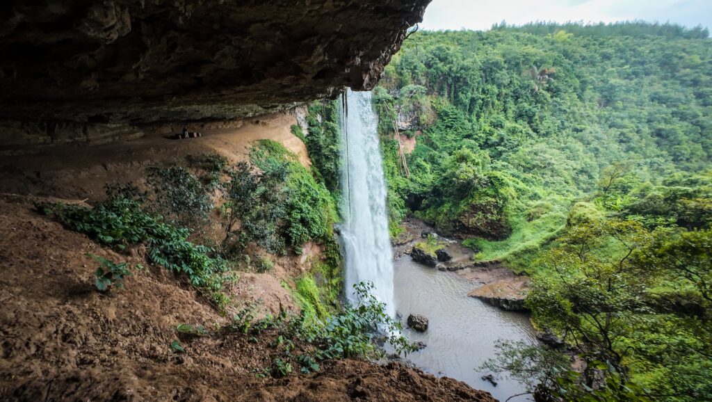
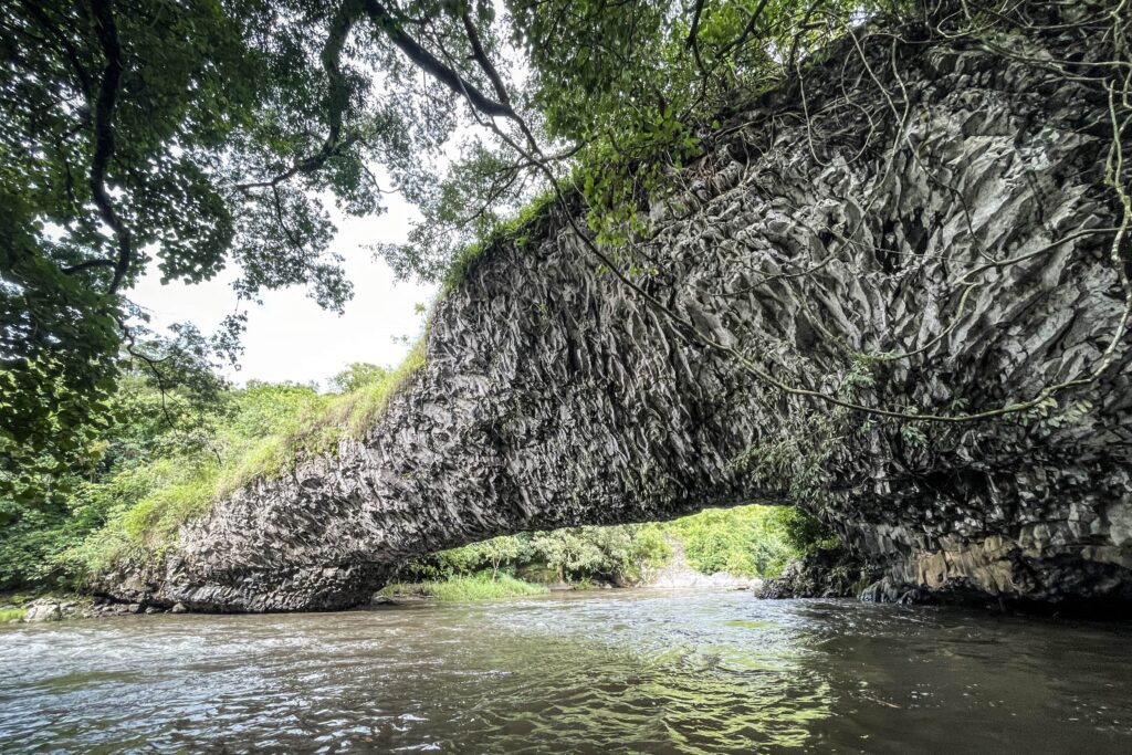
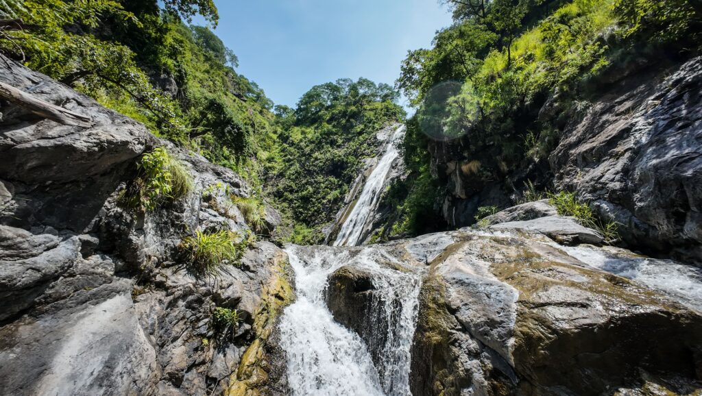
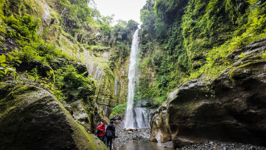
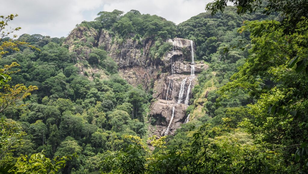
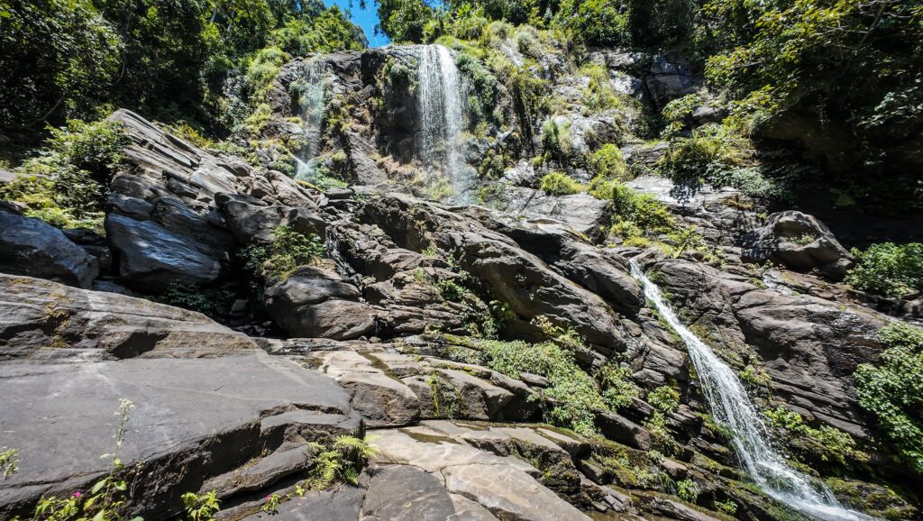
One of its key features is its ecological diversity — it’s home to rare primates, such as the Sanje mangabey and the Udzungwa red colobus, which are found nowhere else in the world. Visitors often hike to waterfalls, including the scenic Sanje Falls, and explore various trails that range from easy walks to more demanding treks into the highlands.

Unlike many other parks in Tanzania, Udzungwa doesn’t have large numbers of traditional safari animals like lions or elephants, but it’s a hotspot for birdwatching, plant diversity, and scientific research. Its remote, uncommercialized nature makes it appealing for those seeking an off-the-beaten-path wilderness experience.

How to get there?

By Road:

The most direct route is by car or bus, travelling southwest from Dar es Salaam to the town of Mikumi, and then on to the village of Mang’ula, which is the main gateway to the park. The total drive takes about 6 to 8 hours, depending on road conditions and traffic. The roads are mostly paved.

Once the bus drops you off in Mikumi, you can either change to a minibus or opt for a shared tuk-tuk. A tuk-tuk ride takes about 1.5 hours, but it is surprisingly affordable (10,000 TZS). You may need to squeeze as other passengers are picked up on the way.

By Train:

A more adventurous and scenic option is to take the TAZARA (Tanzania-Zambia Railway) line from Dar es Salaam to Mang’ula Station. This line passes through the heart of the countryside, offering views of rural villages, wildlife, and forested landscapes. Trains run a few times a week, and while the journey is longer than by car (often 10+ hours), it offers a unique, slow-travel experience.

By Air:

There’s no airport directly serving Udzungwa, but you can fly into Mikumi Airstrip (near Mikumi National Park) from Dar es Salaam or other domestic locations, then take a short drive to Udzungwa. This is faster but more expensive and requires pre-arranged charter flights or local air services.

Final Access:

Once in a hotel in Mang’ula, you can easily find a boda-boda (motorbike) rider to take you to the park entrance.

Udzungwa Mountains, Tanzania
The entrance to the National Park

The best time to visit

The best time to visit Udzungwa National Park is during the dry season, which runs from June to October. During these months, the trails are more accessible, hiking is easier, and visibility is generally better for spotting wildlife like primates and birds.

The rainy seasons, particularly from March to May, can make the trails slippery and some areas difficult to access, especially the more remote or elevated parts of the park. That said, the forest is lush and vibrant during the rains, which appeals to travellers interested in plant life, waterfalls at full flow, and fewer crowds. I visited the park at the beginning of March, and it was still very dry, and the rains were yet to come.

The short rains from November to December can still be a decent time to go if you’re prepared for occasional showers and want to avoid peak season.

Where to stay?

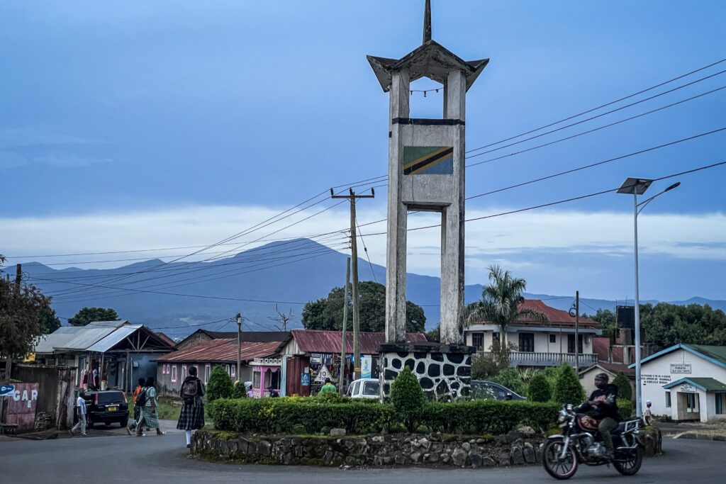
I can recommend Mwanga Royal Motel in Mangula Town. I found on Google Maps the day before and got a room with AC upon arrival. The room was very small, but come on, the real AC isn’t that common in Tanzania, especially for 25.000 TZS per night!

They also have a restaurant and sell drinks, so it is really a very convenient place. There were plenty of motorbike taxis on the street in front, and I could get to the national park headquarters in less than 10 minutes.

How much does it cost?

Park Entry Fees

Adults (Non-Tanzanians): $30 per person per day, plus 18% VAT, totalling approximately $35.40. 

Children (5–15 years): $5 per day, plus 18% VAT.

Tanzanian Citizens: Significantly lower rates apply.

These fees grant access to the park for 24 hours.

Guided Hiking Costs

All hikes in Udzungwa require a licensed guide and sometimes an armed ranger. They charge you about 20 USD each per day.

Long Distance Hikes:

If you decide to climb Mwanihana Peak, the hike takes 2-3 days and requires taking a guide, an armed ranger, porters, camping equipment, food and water. The cost increases significantly, and you should expect to pay between 400 USD – 500 USD. If you go with a group, some costs can be shared.

Hiking to Luhombero Peak, the highest point in Udzungwa Mountains National Park, spans 5 to 6 days and costs between 800 USD – 1200 USD per person.

My experience

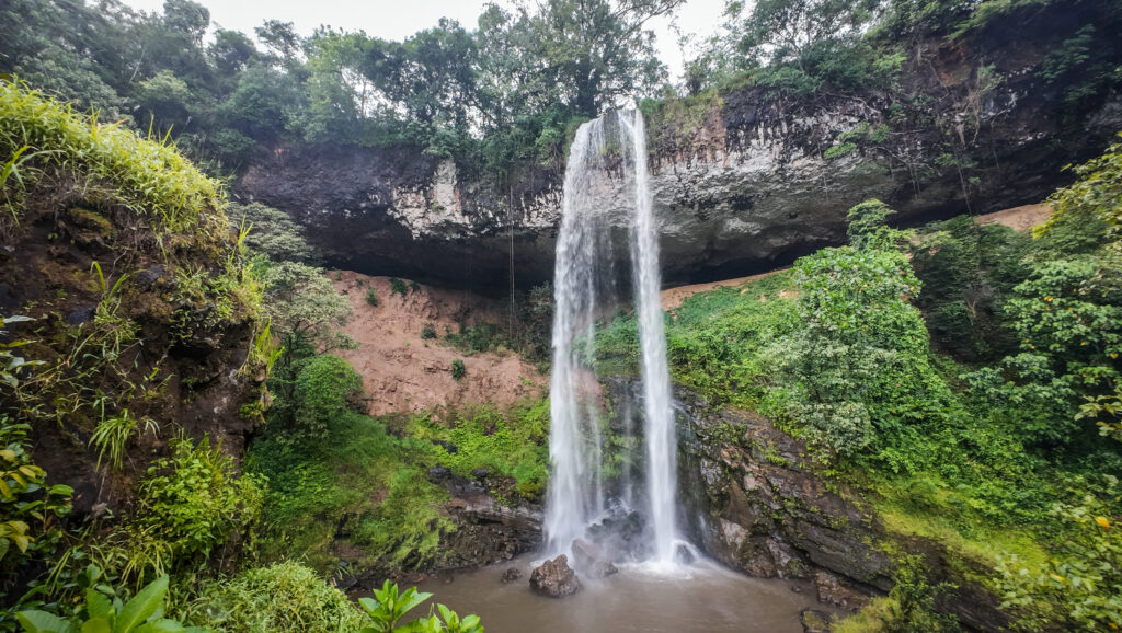
Day 1: Sanje Waterfalls, Prince Bernard Waterfall

The first day of the hiking adventure in Udzungwa. After a quick breakfast at my hotel, I took a boda-boda and arrived at the national park headquarters. I was immediately approached by the guide, and after discussing options in front of the big map, we agreed to go to Sanje Waterfall. I paid all the required fees and then we walked to the main road to catch a tuk-tuk to the trailhead.

The hike wasn’t too difficult, but the path was going up and down, and it was humid, so I was sweating a lot. Luckily, I had a big bottle of water with me as well as some snacks. There were almost no other tourists in the park, besides two other women doing the same route.

Udzungwa Mountains, Tanzania
The viewpoint

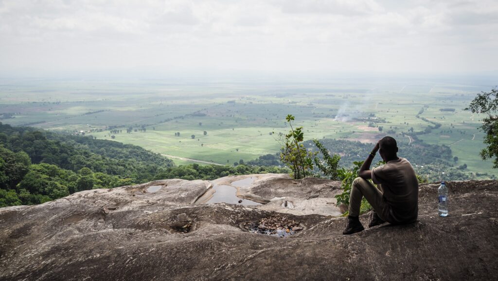
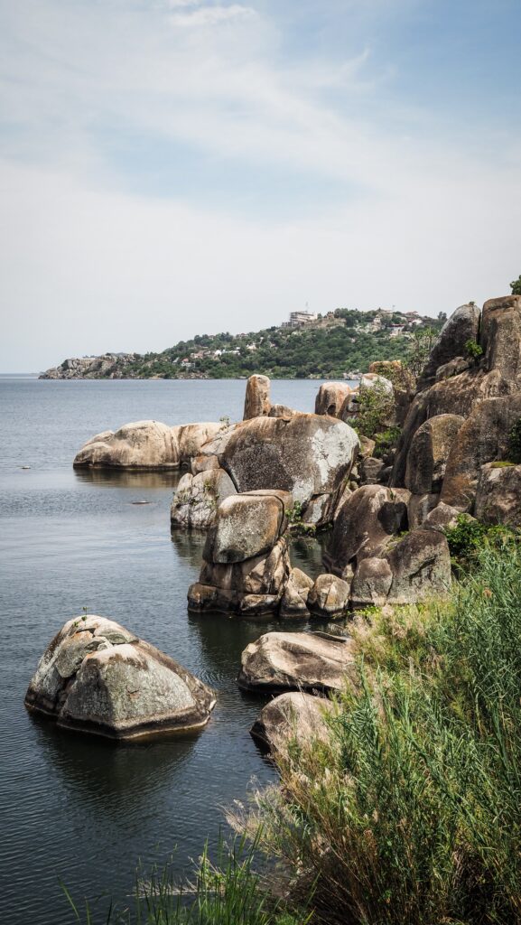
First, we approached the bottom of the waterfall and took some photos on the scenic bridge. From there, we continued climbing up to the middle section and the viewpoint to the plains and sugar cane plantations. Finally, we reached the end of the trail and enjoyed a break with snacks in front of a beautiful waterfall.

We came back taking a bit different way, which was nice as the hike turned out to be a loop. Near the main road, we met local vendors selling souvenirs and drinks, so I bought two coconuts. The price had to be negotiated because the initial one was out of range. Sometimes I wonder where Tanzanians get this enthusiasm from.

Udzungwa Mountains, Tanzania
The view of Sanje Waterfalls
Udzungwa Mountains, Tanzania
The last waterfall on the trail

The whole hike took us about 3-4 hours, and it was still quite early, so I asked the guide if there were other attractions that we could check out. We took a tuk-tuk again, which dropped us near the entrance to the trail leading to Mwanihana Peak. Getting to the top takes a minimum of 2 days, but there is another waterfall about 15 15-minute walk from the main road, so we decided to check it out. Unfortunately, it was very average. I hope one day I will be able to climb Mwanihana, although the price for a solo hiker is discouraging. Enjoying nature in Tanzania isn’t cheap!

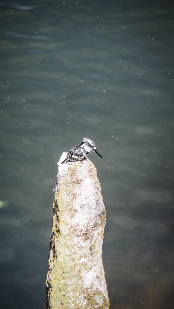
We returned the same way and came back to the headquarters, where we did one more short hike to see Prince Bernard Waterfall. There was barely any water flowing, but at least we were able to see a deer and some monkeys.

Overall, it was an enjoyable day, but at that time of the year (beginning of March), the water level in the waterfalls was low. I discussed the details about the next day with my guide, and we decided to make a loop hike to the Hidden Valley.

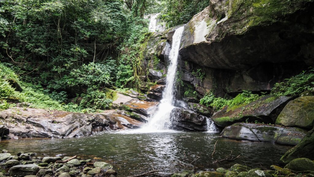
Day 2: Hidden Valley

This time I had to take with me not only a guide, but an armed ranger as the trail goes deeper in the forest, and there was a risk of encountering elephants. He was carrying a heavy gun, but didn’t even take any water or snacks with him. The trail was in the forest the whole way. First, we were going up, occasionally through very overgrown bush. It seemed that not many tourists take that route, but of course, I didn’t mind. There was a nice waterfall nearby, so we made a short detour to reach it and rest at its base.

Udzungwa Mountains, Tanzania
The waterfall in Hidden Valley

Then, we walked around the mountain and started descending back to the main road. Sometimes it was really steep!

It was a good hike, which took us about 4-5 hours, and I appreciated the feeling of being deeper in the forest, but there weren’t any spectacular panoramas, and we didn’t encounter any wildlife. The ranger was there just in case, but for most of the time, he was lagging, and we couldn’t even see him behind. However, the guide was very useful, as the trail is not marked on any offline maps, and there were sections where it was totally overgrown.

Other available hikes

Spotting Sanje Mangabeys

Sanje mangabeys are a rare and unique species of monkey found only in the Udzungwa Mountains. They’re medium-sized primates with shaggy brown-gray fur, expressive faces, and long tails that help them balance as they move through the trees.

What makes them particularly interesting is their behaviour and limited range. They live in social groups and spend time both in the trees and on the ground, which is unusual for monkeys in dense rainforest environments. They’re intelligent and often communicate with a wide range of vocalisations, facial expressions, and body language. Because they’re only found in a small area, and their forest habitat is shrinking due to human activity, Sanje mangabeys are considered endangered.

Seeing them in the wild is a special experience. Inform the national park headquarters that you are interested in spotting them one day before your visit. The rangers will do their best to locate the primates and take you on a hike to see them.
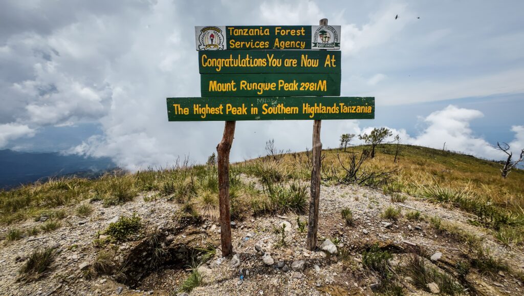
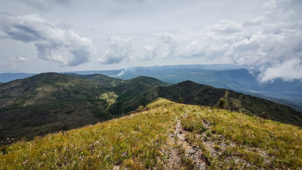
Mwanihana Peak

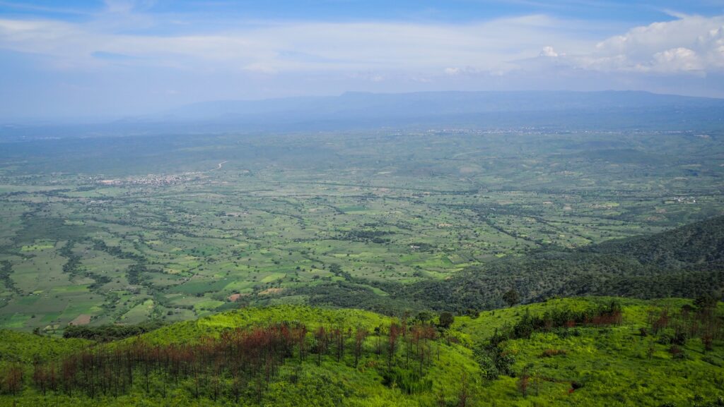
The trail to Mwanihana Peak climbs up to 2,150 meters, offering spectacular views over the Kilombero Valley and into the dense forest below. It’s remote and quiet. Most hikers take about 3 days and 2 nights to complete the trek, but it’s also doable in 2 days and 1 night. You start near Mang’ula village, where the park headquarters help organise guides and permits. The first day eases you into the forest, so expect to cross wooden bridges, follow streams, and sleep under the canopy at a remote campsite. Day two is the real climb, where you’ll summit Mwanihana and feel like you’re standing above the clouds. Then you descend on day three, usually tired, muddy, and grinning.

You might spot rare monkeys like the red colobus or Sanje mangabey, as well as hornbills, turacos, and colourful butterflies. The forest shifts as you climb: miombo woodlands give way to thick rainforest, which thins out into cool highland bamboo zones.

Luhombero Peak

At 2,579 meters, Luhombero is the highest point in Udzungwa, but it remains one of the least hiked. It’s rugged, remote, and takes 5 to 6 days of serious trekking to reach. Expect steep climbs, slippery roots, and the occasional river crossing. Your nights are spent camping deep in the forest, often at simple sites near streams or clearings.

Each day brings a new kind of terrain: lowland forests buzzing with insects and birds, towering bamboo groves, misty highlands, and eventually wind-swept ridges with views stretching across southern Tanzania.

This trek is demanding. You’ll need to be reasonably fit and mentally prepared for long days, basic camps, and no phone signal. A licensed guide is required, and most people also hike with porters and a cook. Some arrange everything through local tour companies, while others coordinate directly with park authorities.

Mikumi National Park is a large wildlife reserve in southern Tanzania, known for its rich variety of animals and accessible location. It is often compared to the Serengeti because of its wide, open grasslands. Visitors can expect to see elephants, lions, zebras, giraffes, hippos, and even rare animals like African wild dogs. Because it’s not as crowded as some other parks, Mikumi offers a quieter, more relaxed safari experience. It’s especially popular for short trips from Dar es Salaam since it’s only a few hours away by road.

It covers over 3,000 square kilometres and is the fourth-largest national park in Tanzania. It’s bordered by the Uluguru Mountains to the north and connects with the vast Nyerere National Park (formerly part of the Selous Game Reserve) to the south, which allows wildlife to move freely between the two areas.

The heart of the park is the Mkata floodplain, a wide, flat area where animals gather, especially during the dry season. This makes wildlife spotting relatively easy. Lions in Mikumi are known to lounge in the shade of trees or even climb them occasionally, while large herds of buffalo and antelope can often be seen grazing. Bird lovers can enjoy spotting over 400 species, including colourful rollers, hornbills, and fish eagles.

Roads inside the park are fairly good compared to more remote reserves, so it’s well-suited for a self-drive or guided day trip. Accommodations range from basic campsites to comfortable lodges, some even located inside the park itself.

How to get there?

You can reach Mikumi National Park fairly easily, especially from Dar es Salaam. The most common way to get there is by road. It’s about a 5-hour drive along a paved highway that cuts right through the park. This makes the journey scenic, with the chance to spot animals even before you officially enter the park area. Many visitors either drive themselves, hire a private car, or book a tour that includes transport.

If you prefer a slower, more scenic route, there’s a train from Dar es Salaam to a nearby town called Kilosa. From there, you’d need to take a taxi or private car to reach Mikumi.

For air travel, while there’s no large airport directly at the park, you can fly to Iringa or even arrange a private or chartered flight to a small airstrip closer to Mikumi, which some safari companies include in their packages, especially the ones operating from Zanzibar.

Is it worth doing a 1-day safari from Zanzibar with a charter flight? Well, I was glad I didn’t. The planes started landing about one hour after I entered the park with my driver, and they left about 3 PM, while my safari finished after 6 PM. My opinion is that if you want to do a safari, do it right. A rushed fly-in and fly-out tour sounds like just a taste of adventure. If you want to see real Tanzania, escape Zanzibar madness as soon as possible.

To get to Mikumi from Zanzibar independently, you’d first take a ferry to the mainland, then continue by car or bus to the park.

Mikumi National Park, Tanzania

The best time to visit

The best time to visit Mikumi National Park is during the dry season, which runs from around June to October. During these months, the weather is cooler, and animals tend to gather around water sources, making them easier to spot on safari drives. The grass is shorter and the roads are in better condition, which also helps with visibility and access.

While the park is open year-round, the rainy season (especially March to May) can make travel more difficult. Roads may become muddy, and animals spread out, making sightings a bit trickier. That said, the rainy months also bring lush green landscapes and are ideal for birdwatching, as many migratory species arrive then.

I visited the park at the beginning of March and despite a few minutes of drizzling, the weather was perfect and we saw quite many animals!

Where to stay?

I can recommend Simanga Lodge in Mikumi Town, which was suggested to me by my safari tour operator. Clean and spacious room with a mosquito net and a hot shower. A shop and some restaurants are within walking distance. All of that for 25.000 TZS per night, which was an excellent deal.

How much does it cost?

Safari from Mikumi

I did a huge research of safari tour operators in Mikumi Town, contacting all of them and asking if they have any groups of tourists that I can join to share costs. Unfortunately, the beginning of March is a low season, and there were no other options than hiring a private driver. I decided to go with TanzAmerica Safaris, as they were easy to contact on WhatsApp and offered the best price – 165 USD for a car with driver, lunch and all entry fees. Cons of travelling solo!

Safari from Zanzibar

A 1-day tour by charter flight from Zanzibar costs about 450 – 700 USD per person, depending on the operator and your negotiation skills.

Self-drive

If you’re planning a self-driving visit to Mikumi National Park in Tanzania, it’s important to be aware of the associated fees.

Entrance Fees (Per Person, Per Day):

Foreign Non-Residents: 30 USD

Foreign Residents/Expatriates in Tanzania: 15 USD

East African Community (EAC) Citizens: 5,000 Tanzanian Shillings

Children (Aged 5–15): 10 USD for foreign non-residents; 2,000 Tanzanian Shillings for EAC citizens

Children Under 5: Free

Vehicle Entry Fee:

Foreign Tourists: $10 per vehicle

EAC Residents: 5,000 Tanzanian Shillings per vehicle

Additional Fees:

Concession Fee (for overnight stays within the park): 25 USD per adult; 10 USD per child

Public Campsites: 30 USD per adult; 5 USD per child

Special/Seasonal Campsites: 50 USD per adult; 10 USD per child

My experience

I was picked up by my safari driver upon arrival in Mikumi Town and was taken to my accommodation. We agreed on the plan for the next day, and as always on this kind of trip, early wake-up was necessary – 5:30 AM!

The driver showed up on time, and we set off to the entrance of the national park. The car was a bit different from usual as it wasn’t a Toyota Land Cruiser. It was more of an open style, what is cool if it’s not raining.

The driver paid the entrance fees, and soon we drove through the entrance gate. After about 15 minutes, we spot a lion. It was quite weird to see it in such proximity to a busy A7 road, which goes through the park. The number of other safari cars was minimal as the tourists from Zanzibar hadn’t arrived yet.

Then, we spent a lot of time with elephants and giraffes. Honestly, sometimes I felt a bit bored because how long can you observe a giraffe feasting on an acacia tree? And after visiting Serengeti, all the next safaris just aren’t that impressive anymore.

We went to see some more lions sitting under the tree, as the driver was informed about them on the radio. It was quite a big group, at least six! Some cars were trying to come closer, and they drove off the road, which is forbidden in the national park. Unfortunately, tourists want selfies and drivers want tips… Luckily, my driver didn’t have such an idea, and we just observed the lions from a distance. Let wildlife stay wild!

Mikumi National Park, Tanzania

Soon, we got another heads-up on the radio – this time it was a leopard. Once we arrived, it was just there, chilling in the tree. Amazing view! I managed to take a few pictures before it went down and disappeared in the grass. With wildlife, it’s all about the timing.

Then, we made a short stop next to the hippo pool. Compared to Serengeti, it was quite a disappointment, with literally just five hippos inside and one crocodile nearby.

l was getting hungry, so the information about lunch break came just in time. We pulled over at a dedicated building, which served as a kind of canteen. The lunch was served in the form of a buffet, and the food was really tasty.

After lunch, we did quite a long drive, but we just saw some more giraffes and a few zebras. It was the hottest time of the day, so the animals weren’t too active. We stopped at the huge baobab tree, which was empty inside. Baobab trees are some of the most distinctive and iconic trees in Africa, often called “upside-down trees” because their thick trunks and spindly branches resemble roots sticking into the sky. They can live for thousands of years and grow massive; some have trunks wide enough to shelter people or even host small shops inside.

These trees store huge amounts of water in their trunks to survive dry seasons, making them crucial to the ecosystems where they grow. Their fruit, often called “monkey bread,” is rich in vitamin C and other nutrients, and the bark, leaves, and seeds are used in traditional medicine and food.

Then, we started heading back to the exit. The day was spent much better than I expected, and I appreciated that the driver didn’t try to cut the safari short and get back to town early. We really made use of the day to the maximum, even though in the second half of it, we didn’t see many animals.

Once we reached the main road, the driver helped me catch a bus heading to Morogoro, which was my next destination. At some point, he screamed: “Giraffes are crossing the road!”. I immediately turned back and saw a huge group of giraffes and zebras crossing the busy A7 road connecting Mikumi with Morogoro and Dar es Salaam. The truck drivers were stopping to let them pass. I felt like the national park was saying goodbye to me. Soon, a shared taxi stopped, and I managed to squeeze inside. Two hours later, I was in the hotel in Morogoro.

Mbeya is a city in southern Tanzania, tucked among rolling hills and mountain ranges in the Southern Highlands. It’s a place that blends natural beauty, colonial echoes, and a strong local identity, making it one of Tanzania’s more quietly interesting urban centres.

Mbeya started as a small settlement in the early 20th century, but its story took off during the 1920s when gold was discovered in the area. That sparked a mini-gold rush and attracted miners, traders, and colonial interests, especially during the British administration after World War I. As a result, Mbeya began to grow, first as a mining town, then as a centre of agriculture and transport.

One reason Mbeya has developed steadily is its location. It sits on the crossroads of several important routes: the TAZARA railway that links Tanzania to Zambia, the road to Malawi, and routes deeper into the highlands. That made it a hub for trade, farming, education, and administration.

Mbeya is home to a mix of ethnic groups, including the Nyakyusa, Safwa, and Nyiha, among others. Each group brings its own traditions, language variations, and ways of life. The city has grown into a multicultural spot where urban life blends with rural customs.

Farming has been a huge part of Mbeya’s story, especially tea, coffee, bananas, and maize. The fertile volcanic soil and cooler climate give the region an edge in agriculture. It’s also near several beautiful natural landmarks: Mount Rungwe, Kitulo Plateau (often called the “Serengeti of Flowers”), and of course, it’s the gateway to places like Matema on Lake Nyasa.

Tukuyu

Tukuyu is located about 70 kilometres from Mbeya. The soil there is volcanic and super fertile, so everything from bananas to avocados to tea grows like crazy. The town gets misty in the mornings, with mountain views and cooler air than most places in Tanzania.

Similar as it was in case of Mbeya, the area around Tukuyu began to change in the colonial era. First, the Germans (late 1800s to WWI), then the British, saw the potential of this fertile land, especially for cash crops like tea and coffee. The colonial powers introduced new farming methods and built infrastructure, much of which shaped Tukuyu’s economy and layout.

Tukuyu may be small, but it has a strong community feel. The local people are warm and welcoming, and the town still holds onto many traditional customs, like clan leadership and local festivals. Christianity is widespread, but traditional beliefs often blend with modern religion in interesting ways.

Visitors come for the waterfalls (like Kaporogwe Falls), hot springs, and hikes around the surrounding volcanic peaks like Mount Rungwe. It’s not packed with tourists, so it still feels very authentic, like you’re getting a glimpse into the “real” Tanzania, off the main tourist path.

How to get there?

Getting to Mbeya is pretty straightforward, and you’ve got a few solid options depending on your budget, time, and sense of adventure.

By Air:

The fastest way is to fly into Songwe International Airport, which is about 25 kilometres from Mbeya. There are regular flights from Dar es Salaam and sometimes other major cities like Zanzibar or Arusha. Once you land, you can grab a taxi or local transport into the city. It’s an easy drive, usually under an hour.

By Road:

If you’re up for a long ride or want to see more of the countryside, road travel is doable and actually pretty scenic in parts. Long-distance buses connect Mbeya to cities like Dar es Salaam, Iringa, and even as far as Dodoma. The ride from Dar takes about 10–12 hours, depending on road conditions and stops, so it’s best to go with a reputable bus company for safety and comfort.

You can also drive yourself if you’re renting a car. Just be ready for some winding roads through the mountains, especially as you approach Mbeya.

By Train:

The TAZARA railway (Tanzania-Zambia Railway) runs from Dar es Salaam all the way to Kapiri Mposhi in Zambia, passing through Mbeya. It’s slower than flying or taking a bus, but it’s a unique way to see the landscape and meet people along the way. It’s a throwback kind of experience, rustic but memorable.

From Mbeya to Tukuyu:

You can catch a local bus or minibus from the main bus terminal in Mbeya town. It’s an affordable option and commonly used by locals. The ride usually takes 2 to 2.5 hours, depending on stops and road conditions. The buses leave fairly often throughout the day.

If you want more comfort and flexibility, hiring a taxi or private car is a great option. The drive is scenic and smooth in most parts, especially the stretch through Rungwe District. You can stop at viewpoints, markets, or tea estates along the way.

How to get around?

Inside Mbeya and Tukuyu, you’ll find minibuses (dala-dalas), motorcycle taxis (bodas), and regular taxis to get around. If you’re planning to explore nearby towns or attractions like Matema or Kitulo, hiring a car or taking local transport will get you there, though travel times can be longer than expected due to road conditions.

The best time to visit

The best time to visit Mbeya is during the dry season, which runs from around June to October. During these months, the weather is cool, especially in the mornings and evenings, and the skies are mostly clear. It’s perfect for hiking, sightseeing, or exploring nearby places like Kitulo Plateau or Matema by the lake.

Mbeya sits in the highlands, so it already has a cooler climate than much of Tanzania. Even during the dry season, it’s not scorching. The landscape also stays surprisingly green compared to drier parts of the country, thanks to its elevation.

If you visit during the rainy season (roughly November to April), expect lush scenery and blooming landscapes, especially in places like Kitulo, which comes alive with wildflowers. But the downside is that heavy rains can make travel tricky, especially on rural or unpaved roads. I visited Mbeya and Tukuyu in the first half of May, and there were afternoon storms, but nothing extraordinary.

Where to stay?

I can highly recommend The Peace of Mind Resthouse in Mbeya. I had a room on the upper floor with nice views and a small balcony. The rooms are nicely decorated with local art. They have a restaurant and safe parking for motorcycles and cars.

In Tukuyu, options are more limited, and I stayed in the DM Motel. The room was spacious and cheap, but the food at the restaurant was very average, and there was no WiFi.

What to see around Mbeya

I started the day with the intention of going to Lake Ngosi. I went out of my hotel and walked on the streets of the town centre looking for some boda boda riders. When I found one, we negotiated the price, and soon I was enjoying the ride. After taking a turn off the tarmac to the dirt road, it got way more bumpy. The last section was pretty bad and steep, so sometimes I had to get off the bike and walk.

Lake Ngosi, also called Lake Ngozi, is a volcanic crater lake and part of the Poroto Mountains. It was formed as a result of volcanic activity and sits in the caldera of an extinct volcano. It’s the second-largest crater lake in Tanzania and is known for its striking emerald-green water, which reflects the dense surrounding forest and the mineral content of the lake. The lake is about 2.5 kilometres wide and rests at an elevation of around 2,000 metres above sea level, which contributes to its cool climate and lush vegetation.

Accessing the lake involves a short hike through montane forest, and my driver decided to walk there with me. I had the feeling he had never been in this place before, and he was enjoying it as much as I was.

Mbeya, Tanzania
Lake Ngozi

The panorama of the caldera lake was truly magnificent. There was a sign claiming that it’s possible to take a trail down to the lake shore, but it seemed to be super steep. We looked for an alternative and walked for about 15 minutes following the ridge, but then we decided to turn back as the path got rougher.

Once we came back to the motorbike, of course, the “rangers” magically appeared to collect the entrance fee. Well, the view was worth it even though the entrance fee was way too high (30.000 TZS). Unfortunately, it’s a common rip-off for white tourists in Tanzania. I always try to negotiate the price, and usually they agree, but at that time, they were quite tough.

We set off to Mbey, and then I asked the rider to take me to one more place: The Great Rift Valley View Point. It’s about half an hour out of town, following the road B345. The ride was very scenic with many turns, and my buddy was riding very carefully, which I highly appreciated. There was a small fee to enter the viewpoint (5.000 TZS – don’t let them trick you into paying more) from which I could see an impressively wide open space of the Rift Valley. Another cool thing is that to get there, you need to pass the highest point of all trunk roads in Tanzania.

Mbeya, Tanzania
The view of the Great Rift Valley

I ended the day with a hike to the Cross Of The Summit, which is a hill in the suburbs of Mbeya. The start is near the Desderia Hotel and it takes approximately one hour. The trail is not always clear, so download an offline map on Mapy.com and follow power lines to the peak. A beautiful panorama of Mbeya can be seen from there.

What to see around Tukuyu

I have done all the activities around Tukuya with a very friendly local guide and ranger: Ridhiwani Gambalela. He had a car, so it was easy to get around, and the price for trips was very reasonable and always negotiable. He also has a lot of connections in tow, so he helped me organise a guide to Mount Rungwe. Here is his WhatsApp number: +255 766 849 317.

Tukuyu, Tanzania
City centre of Tukuyu

Climbing Mount Rungwe

I had a toast with egg for breakfast at the hotel, and then Ridhiwani arrived. First, we went to the gas station to refuel his car to make it to the beginning of the trail and back, and then drove towards the mountain, picking up my Meike and buying some snacks. Maike was a friend of Rindhiwani, and on that da, he was my hiking buddy and a guide. Once we arrived at the trailhead, there was no one else around, see we set off.

The trail was mostly in the forest, and we were able to spot some monkeys. Unfortunately, there were so many flies that we couldn’t let ourselves stop even for a minute. We were walking with tree branches in our hands, trying to get rid of them. The trail was climbing up gradually, and it was quite easy to follow.

When we were close to the summit, the landscape became more open and the flies immediately disappeared, so we could enjoy the views and eat some snacks undisturbed. I felt a bit tired, but this was probably the result of walking without breaks. So yeah – do not forget insect repellent. We had one and sprayed ourselves thickly, but even then, the flies were all around.

After about half an hour at the summit, we decided to start walking back as we could see dark clouds on the horizon and we heard the first thunder. The way down felt quite long and monotonous. The flies were driving me nuts again!

Once we finished, we had to wait about 45 minutes for Rindhiwani to come and pick us up. It started raining and became very windy. Luckily, there was a building in which we could find a cover. We finished the hike just in time!

We hiked to the top following the so-called Sukuya Route, and I paid 40 USD + some extra shillings for gas to the car.

Mount Rungwe, Tanzania
The summit of Mount Rungwe
Mount Rungwe, Tanzania
Ponorama from Mount Rungwe

Kapologwe Waterfall

After claiming Mount Rungwe, we decided to visit one more place—a waterfall. At some point, the road turned out to be terribly muddy, and instead of driving, we were sliding. At some point, a local guy heading in the opposite direction told us that he didn’t recommend continuing, as we might get stuck. Instead, we parked the car on the roadside and continued on foot.

It took us about 40 minutes one way, and the walk was very scenic. We passed an agricultural area and a local village, where I was charged a 10.000 TZS entrance fee to the waterfall. The mud was all over my shoes, and it felt like they weighed one kilogram more each.

The waterfall was really cool, and first, we discovered the cave behind it. It is possible to camp there, which must be an amazing experience! Then, we went down to see the waterfall from the front.

Tukuyu, Tanzania
Kapologwe Waterfall
Tukuyu, Tanzania
Kapologwe Waterfall
Tukuyu, Tanzania
Kapologwe Waterfall

Kiwira God’s Bridge

A natural rock formation located, which is basically a huge stone arch that spans across the Kiwira River, looking almost like a man-made bridge, but it was formed naturally over time by the movement of water and erosion.

The bridge is surrounded by lush greenery, waterfalls, and dramatic cliffs, giving the whole area a very mystical and breathtaking feel. Local stories and legends say the bridge was created by a divine act, which is why it’s called “God’s Bridge.” Some even believe it’s a sacred place.

The site isn’t super developed for tourism yet, so it feels very wild and untouched.

Tukuyu, Tanzania
Kiwira God’s Bridge
Tukuyu, Tanzania
Kiwira God’s Bridge

Isabula Waterfall

Another nice waterfall in the region, but it is not easy to find the way down. It’s deep and the stream is strong, so be careful if you case of swimming.

Crater Lakes

In the Tukuyu area of southern Tanzania, there are several beautiful crater lakes formed by ancient volcanic activity. This region, part of the broader Mbeya highlands, is geologically active, with old volcanoes and fault lines shaping the landscape. Over time, some volcanic craters filled with rainwater and groundwater, creating deep, clear lakes surrounded by lush greenery and steep crater walls.

Some of the well-known crater lakes around Tukuyu include Lake Ngozi, which I already described above. However, there are also smaller crater lakes like Kyungululu, Masoko, Ikapu, Kingili or Itende. These lakes are typically very clean and have important local cultural or spiritual significance. Many locals believe the lakes are sacred or have mysterious qualities.

Kitulo National Park

Kitulo National Park is a protected area, covering about 413 square kilometres. It’s perched at around 2,600 meters above sea level, between two mountain ranges called the Kipengere and Poroto Mountains. The park is famous for its rich variety of wildflowers and plants, especially orchids, which explode into colour during the rainy season from November to April.

Nicknamed “The Garden of God,” Kitulo is unique because it was the first national park in tropical Africa set up mainly to protect its plant life. Over 350 species of plants grow there, and it attracts botanists, hikers, and nature lovers, especially when the meadows are in full bloom.

Beyond the flowers, Kitulo also has forests like the Livingstone and Ndumbi Forests. These areas are home to rare animals like the Kipunji monkey, some small antelopes, and even unusual birds like the blue swallow and Denham’s bustard. Big predators are rare, so it’s more about scenery, hiking, and birdwatching than traditional safari animals.

Access to the park usually starts from Mbeya city, and a four-wheel-drive vehicle is often necessary, especially during the rainy months. Visitors can stay in nearby towns or camp inside the park. The best time for flower lovers is during the rainy season, while dry months are better for trekking.

It’s possible to cut the costs and go without a private car, but it requires some planning and more time. You can take a local bus or dala-dala from Mbeya to Matamba, the nearest village to the park. From there, you can usually find motorcycle (boda-boda) riders willing to take you to the park entrance.

Keep in mind that Kitulo is a vast plateau, and without your own transport inside the park, exploring can be challenging. If you’re mainly interested in hiking and enjoying the flowers, a boda-boda can drop you off at a trailhead, but arranging a return ride in advance is essential.

Matema

A small but historically and culturally rich town located on the northern shores of Lake Nyasa (also known as Lake Malawi). It’s known for its beautiful lakefront setting, sandy beaches, and surrounding green mountains, which give it a peaceful and almost untouched vibe compared to more urbanised areas.

Read more HERE.

Matema, Lake Malawi, Tanzania
Sunrise at Lake Nyasa

Matema is a small but historically and culturally rich town located on the northern shores of Lake Nyasa (also known as Lake Malawi). It’s known for its beautiful lakefront setting, sandy beaches, and surrounding green mountains, which give it a peaceful and almost untouched vibe compared to more urbanised areas.

Historically, Matema has been significant in several ways. The town lies within the traditional homeland of the Nyakyusa people, a Bantu-speaking ethnic group with deep roots in the region. The Nyakyusa have a strong cultural identity, and Matema has served as one of the key points for interaction between their traditional lifestyle and the influences brought by outsiders, particularly during the colonial and missionary periods.

In the late 19th and early 20th centuries, Christian missionaries, particularly from Germany and later from other parts of Europe, established missions in Matema. One of the most prominent was the Moravian Mission, which played a central role in the area’s religious, educational, and medical development. The mission helped build schools and a hospital that still serve the community today. These early institutions became pillars of modern education and health services in the southern highlands of Tanzania.

Because of its lakeside location, Matema has also had economic and ecological importance. Fishing and small-scale farming are the backbone of the local economy, and the lake itself is a vital resource for food and transportation. In recent years, Matema has drawn more attention for tourism due to its natural beauty, attracting travellers interested in hiking, bird watching, and experiencing traditional life along Lake Nyasa.

Lake Nyasa

Lake Nyasa, also known as Lake Malawi in Malawi and Lago Niassa in Mozambique, is Africa’s third-largest lake by surface area and the second-deepest after Lake Tanganyika. It stretches over 560 km and reaches depths of over 700 meters. Tanzania shares its northeastern shore with Matema, offering some of the most peaceful and least-touristed access points.

The lake is famous for its incredible fish diversity, especially cichlids, a colourful group of fish found nowhere else on earth. There are over 800 species in the lake, many of which are popular in aquariums worldwide. The lake is also home to crocodiles, hippos (though less common near Matema), and a variety of birds like fish eagles and herons.

The lake is a vital resource: locals use it for fishing, transportation, and fresh water. Fishing villages dot the shore, and traditional boats (often carved from logs) are a common sight. It has clear waters and sandy beaches, making it perfect for swimming and boat rides, with fewer worries about bilharzia in the northern Tanzanian section compared to some southern parts.

There’s a long-standing but peaceful border disagreement between Malawi and Tanzania over the exact boundary in the lake. Tanzania calls it Lake Nyasa, Malawi calls it Lake Malawi. Same lake, different names depending on where you stand.

Matema, Lake Malawi, Tanzania
Lake Nyasa

How to get there?

To get to Matema, you’ll first need to make your way to Mbeya, the nearest major city and the main access point to the area.

Step 1: Get to Mbeya

By Air: The fastest way is to fly into Songwe International Airport, which is about 25 kilometres from Mbeya city. There are regular flights from Dar es Salaam and other major Tanzanian cities.

By Road: You can also drive or take a long-distance bus to Mbeya. The city is well-connected by highways, and the road from Dar es Salaam is a popular route.

By Train: Another option is to use the TAZARA railway, which connects Dar es Salaam to Mbeya. It’s slower but can be a scenic and interesting way to travel.

Step 2: Travel from Mbeya to Matema

Once you’re in Mbeya, Matema is about 130 kilometres away, located on the shores of Lake Nyasa.

Public Transport: For a budget-friendly option, you can catch a bus or shared minibus. You’ll get to experience everyday local travel.

By Car: Renting a car or hiring a private driver is a more comfortable but expensive option. The drive takes around 2.5 to 3 hours and takes you through lush landscapes, small towns, and fertile farmland.

Alternative by ferry

There is a ferry connecting Matema with Mbamba Bay; however, it’s really hard to get information about its schedule. When I was walking around the beach, I asked a few people and all of them told me a different departure time. If you are determined enough, I am sure it must be a great adventure, even though the trip can last about 24 hours. I would love to do it next time!

Matema, Lake Malawi, Tanzania
Lake Nyasa
Matema, Lake Malawi, Tanzania
Village at the lake

The best time to visit

The best time to visit Matema is during the dry season, which runs from June to October. The skies are mostly clear, temperatures are pleasant, and humidity is low. Perfect for enjoying the lake, hiking around the mountains, or just relaxing on the beach.

Lake Nyasa is calm and clear, making it great for swimming, boat rides, and photography. Roads are more passable during the dry season, especially the stretch between Mbeya and Matema, which can get muddy or washed out in heavy rains.

November to May is the wet season. It’s greener and less dusty, but rain can be heavy. I visited the place in the second half of May, and every day in the afternoon, there was a storm, but usually it didn’t last too long.

Where to stay?

I decided to walk to the Lutheran Centre and ask for a room there. They had one available, but the price was quite ridiculous initially. Luckily, I managed to negotiate down by 50% and paid 40.000 TZS for a room with a fan. The fan didn’t work well, and I asked for another one, which was brought to my room and was much more powerful. Breakfast was not included, but the location was great and the bungalow was basically right on the beach.

Try Palazzo Garden Resort or Landmark Hotel Matema Beach if you need more comfort.

My experience

I didn’t manage to wake up for sunrise even though it was my plan. Luckily, I had two nights in Matema, so there was another chance! I think the noise from the fans in my room was louder than the alarm 🙂

Instead, I walked along the lake shore towards the spot that was marked on Mapy.com, a hippo viewpoint. I didn’t see any wildlife, but there was a specific smell in the air that I experienced before in Serengeti National Park near hippo pools, so I think they couldn’t be too far away. Probably they were chilling in the upper part of the river, but there was no path to get there.

Matema, Lake Malawi, Tanzania
Hippo Viewpoint

For easy access to the hippo viewpoint, just follow the shore:

Then, I walked to the Matema Waterfall and damn, what a hike it was. The first section was easy, just through the village. Surprisingly, I didn’t meet anyone who wished to be my guide, so I continued alone. Soon, the path involved stream crossing and scrambling on some rocks. Nothing difficult, but my sneakers were way too slippery. Do yourself a favour and wear shoes with a good grip!

Two young boys caught up with me, and I was following them. They were jumping from one stone to another like goats, so soon I was left behind. I also gave up on trying to keep my shoes dry and simply stepped into the water.

Matema, Lake Malawi, Tanzania
Matema Waterfall

I reached the base of the falls, but then the last section involved pulling myself up using the rope. It was a really hard time, and I had sore muscles the next day! The views were worth it, though, and the waterfall was really pretty, with a small pool at its base. Perfect for a quick dip.

I came back the same way, and again I met someone. That time, it was a local guy carrying some stuff in a big bag and heading back to the village. He was very nice, and I could see that he was looking back and checking on me from time to time.

After reaching the main road, I continued the hike towards Ikombe Village. The trail was sometimes really overgrown, and I was doubting if it was a good idea, but of course, my stubbornness didn’t allow me to give up, and I pushed further to finally arrive at the village.

Matema, Lake Malawi, Tanzania
Views from the hike to Ikombe Village

Immediately after entering, I was approached by a guy who offered to take me back to Matema in his canoe. That was exactly what I was hoping for, so after negotiating the price and agreeing on 20.000 TZS, we set off. Unfortunately, then the bad part started.

The guy started insisting on showing me the village, his house and all that. When we finally jumped inside the canoe, he stopped next to some shitty cave and then wanted to stop again next to some waterfalls, but I said no. He was talking to me in Swahili all the time, sometimes showing the gesture, which I believed was supposed to mean that he wanted more money. I didn’t like his aggressive behaviour and I promised myself that he won’t get even a shilling more than what we had agreed.

Then, he handed over a paddle to me a few times, saying that I should try paddling myself, but after one try, I didn’t want to continue. He just didn’t understand what ‘no’ meant. The canoe felt very unstable, and I just wanted to arrive back at Matema without any unnecessary experiences en route. When we were approaching the ‘port’ area, I asked him to drop me off there. When I gave him the money, he started yelling and probably cursing at me. I just walked away, ignoring him totally!

Matema, Lake Malawi, Tanzania
The beach near Matema “port”

I walked along the beach back to my hotel, but very black clouds were forming in the sky and the wind was getting stronger. It was a matter of minutes for the heavy rain to start. I couldn’t see any place to hide, other than a local house. I went there and met two people sitting on the veranda, so I simply asked them if it’s ok to wait for the storm to finish under a roof for a while. They said I was welcome.

After a few minutes, they invited me to join them for a meal. There was a lady who was probably either a young wife of the owner or his daughter. She came with a bucket of water and poured it on our hands, and soon she served ugali with fish and beans. It was really tasty food, but what I liked the most was the experience of eating in a local house. It’s not that often that you experience real hospitality in Tanzania, without asking for something in return. The guy spoke relatively good English, although he wasn’t too talkative.

When the rain finished, I said goodbye to my new friends and walked back to my room, stopping on the way to buy some chipsi mayai for dinner. I was thinking about how quickly the situation can change. From the bad experience on the canoe, to a very heartwarming meal shared with strangers. That’s why I love being on the road!

In the night, I went out to see the night sky full of stars, and wow, it was freaking amazing! I could literally see the Milky Way! I also made sure to have plenty of alarms, not to miss the sunrise on the following morning 🙂 It was another great spectacle of nature!

Kigoma is a historic town and regional capital in western Tanzania, located on the eastern shore of Lake Tanganyika, the longest and second-deepest freshwater lake in the world. It serves as a major transportation hub, connecting remote western Tanzania to the rest of the country by road, rail, air, and boat.

Kigoma’s history is tied to its strategic position on Lake Tanganyika, which made it a vital point for trade and colonial expansion. In the 19th century, the region was a centre for Arab trade routes, including the ivory and slave trades, and attracted European explorers, missionaries, and colonisers.

One of the most famous events linked to Kigoma’s past is the meeting between explorers Henry Morton Stanley and Dr. David Livingstone in nearby Ujiji, a small town just south of Kigoma. In 1871, Stanley greeted Livingstone with the famous words, “Dr. Livingstone, I presume?”. A legendary moment in the history of African exploration.

During the German colonial era (the late 1800s to early 1900s), Kigoma was developed as a transport and administrative centre. The Central Line railway, which still connects Kigoma to Dar es Salaam, was built during this time, and a large port was constructed to support steamship transport on the lake.

Under British rule after World War I, Kigoma continued to grow, maintaining its role as a key port and rail terminal. Even today, you can find remnants of both German and British colonial influence in the town’s architecture and infrastructure.

Modern Kigoma is a laid-back lakeside town, known for its vibrant local markets, friendly atmosphere, and access to incredible natural and cultural sites like Gombe National Park and Mahale Mountains.

How to get there?

By Plane:

There are domestic flights available from major cities like Dar es Salaam, Arusha, or Dodoma to Kigoma Airport. Flights are operated by local airlines such as Air Tanzania, and the flight usually takes around 2–3 hours, depending on the route.

By Train:

The train from Dar es Salaam to Kigoma offers a scenic journey across the country, taking about 2–3 days. It’s a slower, more immersive way to travel — ideal for those who enjoy overland adventures and watching Tanzania’s diverse landscapes.

By Bus or Car:

Travelling by bus or private vehicle from Dar es Salaam is possible, but the trip is very long (over 1,200 km) and can take 30+ hours, depending on road conditions. From Mwanza, it is about 8-10 hours by bus.

Kigoma, Tanzania
The panorama of Lake Tanganyika

The best time to visit

The best time to visit Kigoma is during the dry season, which runs from June to October. This is when the weather is most pleasant, with sunny days, cooler temperatures, and minimal rain, making it ideal for exploring the town, taking boat trips on Lake Tanganyika, and trekking in nearby parks like Gombe or Mahale.

I wouldn’t demonise the rainy season too much, though. I visited Gombe National Park at the end of February, and the weather was just fine, with short rains only in the afternoons.

Where to stay?

I can fully recommend LEADERS LODGE. The room was clean and quite spacious. They can also prepare food and help you with arranging the trip to Gombe or any other place on your onward travel. Room prices vary so expect to pay about 30.000 – 50.000 TZS, depending on the size of the room and if it comes with AC or not.

My experience

Livingstone Museum

I started my exploration of Kigoma by visiting nearby Ujiji and the Livingstone Museum. It marks the place where Dr David Livingstone, the Scottish missionary and explorer, met Henry Morton Stanley, a journalist and explorer, in 1871 after years of Livingstone being out of contact with the outside world.

There is not much to see inside, and limited displays tell the story of the two explorers, the significance of their meeting, and the broader context of exploration and colonialism in East Africa. However, I had the feeling that it was written from the perspective of a white person.

One of the main highlights is a memorial monument marking the exact spot where Stanley is believed to have met Livingstone. The surrounding grounds are peaceful, with views of the lake, giving a sense of the journey and isolation that characterised exploration during that time.

The museum is located just a short distance from Lake Tanganyika and around 7 kilometres from the centre of Kigoma. You can easily get a tuk-tuk to get there. Upon arrival, you will get an introduction from the guide, and then you will be free to walk around by yourself.

Kigoma, Tanzania
The building of the Livingstone Museum
Kigoma, Tanzania
Memorial monument near the Livingstone Museum

Train Station

The old train station in Kigoma is a historic building and one of the most significant colonial-era landmarks in western Tanzania. It serves as the western end of the Central Railway Line, which connects Kigoma with Dar es Salaam across the entire country.

Built during the German colonial period, before World War I, the station reflects a unique architectural style influenced by European design, particularly featuring arched entryways and a columned façade that resembles elements of North Italian architecture. Its location on the shores of Lake Tanganyika gave it strategic importance as a gateway for transporting goods and passengers between inland Tanzania and the coastal regions.

Kigoma, Tanzania
Kigoma Railway Station

Kigoma Hilltop Hotel

Great location with an expansive view of the lake, and a private beach where you can spend a few hours. They charge for the entrance to the terrace, but they have decent food options, so you can just eat something and then enjoy the view for free.

Kigoma, Tanzania
Kigoma Hilltop Hotel

Beaches

Kigoma is located on the shores of Lake Tanganyika, but sometimes it’s not that easy to get to the water. The best places to admire the view and have a sunset drink are Katabe Beach, Paradise Beach or Kidyama Beach.

Kigoma, Tanzania
The view of Katabe Beach
Kigoma, Tanzania
Paradise Beach

Out of Town

Gombe National Park

Gombe National Park is a small but world-famous national park in western Tanzania, best known for its chimpanzees and the groundbreaking research of Dr. Jane Goodall. It’s located along the shores of Lake Tanganyika, near the town of Kigoma, and offers a rare chance to see wild chimpanzees up close in their natural forest habitat. It was established in 1968 and has about 52 square kilometres. In addition to chimps, the park is home to olive baboons, red colobus monkeys, vervet monkeys, and over 200 species of birds. Dense forests, waterfalls, and stunning views of Lake Tanganyika add to the park’s beauty.

Read more about my visit to the park in a separate post HERE.

Mahale Mountains National Park

One of Tanzania’s most remote and breathtaking protected areas, located along the eastern shores of Lake Tanganyika in the far west of the country. It’s best known for its wild chimpanzee population, crystal-clear waters, densely forested mountains, and the feeling of complete isolation.

Visiting Mahale is an incredible experience, especially for those wanting to see chimpanzees in the wild, but it’s not a budget destination. The costs add up quickly due to its remoteness, lack of road access, and reliance on boats or small aircraft.

Gombe National Park is a small but world-famous national park in western Tanzania, best known for its chimpanzees and the groundbreaking research of Dr. Jane Goodall. It’s located along the shores of Lake Tanganyika, near the town of Kigoma, and offers a rare chance to see wild chimpanzees up close in their natural forest habitat. It was established in 1968 and has about 52 square kilometres. In addition to chimps, the park is home to olive baboons, red colobus monkeys, vervet monkeys, and over 200 species of birds. Dense forests, waterfalls, and stunning views of Lake Tanganyika add to the park’s beauty.

Chimpanzees

Chimpanzees in Tanzania are among the most fascinating creatures, especially those found in the Gombe and Mahale Mountains National Parks. They are our closest living relatives, sharing about 98.7% of human DNA, which is why their behaviour often feels so familiar. In the wild, they show remarkable intelligence, using tools like sticks to extract termites, leaves to soak up drinking water, and stones to crack nuts. Their social lives are equally complex; they live in flexible communities where group members come and go, form alliances, and even resolve conflicts through gestures like hugs or touches. In some areas, they’ve even been seen hunting smaller monkeys in coordinated group efforts, displaying strategy and cooperation rarely seen in other animals.

Gombe National Park, Tanzania

Chimpanzee mothers are especially caring, with young ones staying close for several years, learning essential survival and social skills. These primates also show signs of deep emotion — they’ve been observed mourning the loss of group members, staying by their side quietly and gently. Each chimpanzee is unique, with its own personality and voice. They communicate using a variety of vocal sounds, facial expressions, and gestures, creating a rich and meaningful form of social interaction.

Despite their brilliance and charm, chimpanzees face serious threats — including habitat destruction, illegal hunting, and diseases passed from humans. Conservation efforts in Tanzania continue to play a vital role in ensuring these intelligent animals can survive and thrive in the wild. Seeing them in their natural forest homes is not only an unforgettable experience but a powerful reminder of our connection to the natural world.

Research of Dr. Jane Goodall

Dr. Jane Goodall is one of the most influential primatologists in history, and her research completely transformed how we understand chimpanzees — and even ourselves. She began her work in 1960 at Gombe Stream in Tanzania, where she lived among wild chimpanzees, observing them closely in their natural habitat. What set her apart was her unconventional approach: she gave names to the chimpanzees rather than assigning them numbers (which was against the norm at the time), and she spent long periods quietly watching and recording their behaviour.

One of her most groundbreaking discoveries was that chimpanzees use tools — something that, until then, had been considered a uniquely human trait. She saw them modifying twigs to fish termites out of holes, proving they could solve problems and plan. Her work also revealed that chimpanzees are emotionally complex, with social structures, strong family bonds, and even behaviours like affection, jealousy, playfulness, and grief.

Over time, she also uncovered a darker side to chimpanzee life, including territorial aggression and violence, even within their groups. These insights challenged long-held beliefs about both chimpanzee nature and human uniqueness. Dr Goodall’s research showed that many behaviours once thought to define humans actually existed in other primates too.

Beyond the science, her legacy encompasses conservation and activism. As the threats to chimpanzees grew — from deforestation to poaching — she shifted her focus to protecting them and their environments. She founded the Jane Goodall Institute, which supports research and leads global conservation efforts and education programs, particularly involving youth through her Roots & Shoots initiative.

How to get there?

Getting to Gombe National Park is an adventurous journey. Located on the remote eastern shores of Lake Tanganyika, near the town of Kigoma, Gombe is only accessible by boat, but the trip is worth it.

Step 1: Travel to Kigoma

Kigoma is the nearest town and the main entry point for travellers heading to Gombe.

By Plane: There are domestic flights available from major cities like Dar es Salaam, Arusha, or Dodoma to Kigoma Airport. Flights are operated by local airlines such as Air Tanzania, and the flight usually takes around 2–3 hours, depending on the route.

By Train: The train from Dar es Salaam to Kigoma offers a scenic journey across the country, taking about 2–3 days. It’s a slower, more immersive way to travel — ideal for those who enjoy overland adventures and watching Tanzania’s diverse landscapes.

By Bus or Car: Travelling by bus or private vehicle from Dar es Salaam is possible, but the trip is very long (over 1,200 km) and can take 30+ hours, depending on road conditions. From Mwanza, it is about 8-10 hours by bus.

Step 2: Boat from Kigoma to Gombe

Since there are no roads into Gombe, the only way in is by boat from Kigoma, across Lake Tanganyika.

Private Boat: A motorboat can be hired from Kigoma, usually taking 1–2 hours, depending on the boat and lake conditions. This is the fastest and most flexible option, especially if you’re travelling with a group or want to stick to your schedule. Needless to say, it isn’t cheap and you should count on about 200 USD for the return trip.

The receptionist from Leaders Lodge in Kigoma, where I was staying, got me in touch with Hussein, who works as a ranger but also has his own motorboat. There was also one more traveller willing to join the trip and share costs. Hussein arrived at the lodge and after hard negotiations, we agreed on the price of a 2-day 1-night trip to Gombe, including transport, entrance fee, accommodation, food and a guide.

Hussein: +255 686 109 100, mtawigayatourskigoma@gmail.com

Public Boat: A more affordable option is the local wooden boat, often called a lake taxi, which departs from Kibirizi Beach near Kigoma town. It leaves around midday most days except Sundays. The ride takes 3 to 4 hours, as it makes stops in villages along the shoreline. You’ll return to Kigoma early in the morning — the boat passes by Gombe around 7:00–8:00 AM.

After getting to Gombe, you need to pay an entrance fee, which gives you the right to be in the park for 24 hours. Taking into consideration the schedule of public boats, it’s really difficult to make the most of this time.

Gombe National Park, Tanzania

The best time to visit

The best time to visit Gombe National Park is during the dry season, which runs from June to October. Trails are easier to hike as the forest paths are drier and less slippery. Chimpanzees are more active and easier to find, as they stay closer to the lower slopes in search of food. There’s less rain, so your chances of clear weather and uninterrupted tracking are much higher. Lake Tanganyika is calmer, making boat travel to and from the park smoother and safer.

The Rainy season runs from November to May. The forest becomes lush and green, which is beautiful, but the trails can get muddy and challenging. Chimpanzees tend to roam deeper into the forest, making them harder to track. There’s a higher chance of boat travel delays due to rough lake conditions.

I wouldn’t demonise the rainy season too much, though. I visited Gombe National Park at the end of February, and the weather was just fine, with short rains only in the afternoons.

Where to stay?

In Kigoma, which will certainly be the starting and ending point of your travel to Gombe National Park, I can fully recommend LEADERS LODGE. The room was clean and quite spacious. They can also prepare food and help you with arranging the trip to Gombe or any other place on your onward travel. Room prices vary, so expect to pay about 30.000 – 50.000 TZS, depending on the size of the room and whether it comes with AC or not.

Inside the national park, you can choose between a standard room in a bigger building or a luxury tent.

How much does it cost?

Park Entrance Fees:

Non-East African Citizens:

Adults (16 years and above): 100 USD per day

Children (5 to 15 years): 20 USD per day

Tanzanian Residents and Expatriates:

Adults: 50 USD per day

Children: 10 USD per day

East African Citizens:

Adults: 10,000 TZS per day

Children: 2,000 TZS per day

Accommodation Costs:

Budget Options: Basic rooms are available starting around 40,000 TZS per night.

Transportation Expenses:

Boat Transfers to Gombe: From Kigoma, boat transport is necessary.

Public Boats: More affordable but less frequent and slower. Hard to make the best out of your 24-hour stay in the national park due to the boat’s schedule.

Private Speedboats: Faster and more convenient, with costs varying based on negotiation and group size, but should be anywhere between 100 – 200 USD.

Additional Costs:

Guided Chimpanzee Trekking: Required and may incur additional fees.

Meals: Depending on the accommodation, meals might be included or charged separately.

Sample Budget for a 24-hour Visit and 2 Chimpanzee Trekkings:

Park Fees: 100 USD

Accommodation: 40 USD (budget option)

Boat Transfer: 100-150 USD (estimate for private boat split among the group)

Guiding Fees and Meals: 60-80 USD (estimate)

My experience

Day 1

We agreed with Hussein that he would pick us up from the accommodation at 9 AM, and he was slightly late, but nothing too dramatic, especially when it comes to Tanzanian standards. He dropped us at the lakeside where we waited for the boat. It was an average-sized motorboat, and the ride was very comfortable. Lots of green hills, small villages, children walking to school and all that. Very scenic and real local life going on!

Once we arrived, we were shown to our rooms. A bed with a mosquito net, plus a toilet with a cold water bucket shower. Perfectly enough for one night. Then, as the lunch was not ready, we decided to jump into the boat again and go looking for chimpanzees. After a short ride, we were dropped at the beach and together with the ranger, we walked into the forest. Soon, we met more rangers whose responsibility was tracking chimpanzees, and we were given face masks.

First, we heard them. Then, we spotted them hanging out in the trees. A few minutes later, another big group appeared, and they were heading to the stream to drink water. It was awesome to watch them from that close, and they were totally not bothered by human presence. We had plenty of time to take pictures and watch their behaviour. Most importantly, there were no other tourists around. Just me, my Canadian travel buddy and the guide.

After about an hour, we took a boat again and went back to the National Park HQ for lunch. The staff said that apparently they were told that we didn’t want to have lunch at all, so they didn’t prepare any. The organization of the place isn’t on the highest level but after two months in Tanzania, I wasn’t too surprised or pissed. I just told them to give us rice with beans and some bananas. That was exactly what we got.

When our stomachs got full, we went to see the Kakombe Waterfall. The stream in the Kakombe Valley feeds the waterfall in a 20-meter drop down the cliff. A pretty sight, and on the way there, we were able to see the research building where Jane Goodall used to work. Currently, there are some information boards.

Gombe National Park, Tanzania
Research building

Our guide started heading back, but I asked him if we could complete the loop and hike up to the viewpoint. He said we needed to be back at the HQ by 5 PM, and we didn’t have enough time, but after some encouragement, he agreed and took us there. It was supposed to be about a 1-hour hike, but we made it in less than 30 minutes, even though it was steep. Don’t take time predictions in Tanzania too seriously! The views were very nice, with impressively green hills and huge Tanganyika Lake.

Then we descended back to HQ, finishing the loop hike. We met with a local researcher who explained to us a bit more about her work. Fascinating! It was great to end the day with a refreshing swim in the lake, followed by a short walk along the lakeside. The water in Tanganyika Lake looked very clean, especially compared to Lake Victoria! Baboons usually hang out around the HQ, so keep an eye on them.

Day 2

In the morning, we hopped on the boat and did another session of chimpanzee tracking. The place was the same as the day before, but many more tourists arrived for a day trip. We saw a big group chilling right on the hiking path, and then we followed them deeper into the forest once they started moving. Unfortunately, humans aren’t as smart as chimpanzees, and they started making noises, approaching too close and as a result, chimpanzees got annoyed.

One of them passed by really close to me, and the guide told me to stay still. Great experience! Then, we climbed the hill to see some more of them sitting high in the tree.

Gombe National Park, Tanzania

We spent over an hour in the forest, and it was time to leave. We came back to the headquarters to pack our things, and soon we were on the boat back to Kigoma. Even though it was an expensive trip, I was so happy that I decided to do it. Money will come back, memories will last forever!

Bukoba is a town in northwestern Tanzania, situated on the western shore of Lake Victoria, near the borders of Uganda and Rwanda. It is the capital of the Kagera Region, and a significant cultural, economic, and transportation hub in that part of the country.

It has long been home to the Haya people, one of Tanzania’s major ethnic groups. The Haya have a rich history and were known for their iron smelting technology — some of the oldest and most advanced in Sub-Saharan Africa. Their society was organised under several kingdoms, with Karagwe being the most prominent in the area. These kingdoms were governed by traditional kings called “Bakama.”

During the Scramble for Africa, the Germans colonised what is now mainland Tanzania (then called German East Africa). Bukoba became a strategic administrative centre for the Germans due to its proximity to Lake Victoria. They built infrastructure like roads and introduced cash crops like coffee, which remains an essential economic activity in the region.

After Germany’s defeat in WWI, Britain took over Tanganyika under a League of Nations mandate. Bukoba continued to serve as an administrative and commercial centre during the British era, with further development of agriculture, especially coffee.

After Tanzania gained independence in 1961, Bukoba became part of the newly established Kagera Region. The town played a crucial role in regional politics, especially during the 1978–1979 Uganda-Tanzania War, when Tanzanian forces helped overthrow Idi Amin’s regime in Uganda. Kagera Region suffered during the war, especially due to cross-border conflicts, but Bukoba remained resilient.

Today, Bukoba is a quiet but growing town. It’s known for coffee production and trade, lakefront views and fishing and being a gateway for cross-border trade with Uganda and Rwanda.

Lake Victoria

Lake Victoria is one of the largest freshwater lakes in the world and the largest lake in Africa. It is located in the eastern part of the continent, on the border of three countries: Tanzania, Uganda, and Kenya. It was formed as a result of tectonic processes and is part of the East African Rift system, although geologically it differs from the deep tectonic lakes like Lake Tanganyika.

It is relatively shallow compared to its vast surface area, despite covering over 68,000 square kilometers, its maximum depth is only about 80–90 meters. The lake is extremely important for local communities, it provides drinking water, food (mainly fish, especially Nile perch), and serves as a means of transport. It also plays a vital ecological and climatic role in the region.

Unfortunately, in recent decades, the lake has faced environmental challenges, such as pollution, overfishing, and the spread of invasive species, all of which have impacted the local ecosystems and the living conditions of people along its shores.

How to get there?

By Air

From Dar Es Salaam: Several airlines like Air Tanzania and sometimes Precision Air operate flights between Dar es Salaam and Bukoba. Flight time is around 1.5 to 2 hours.

From Mwanza: Flights are rather occasional and the travel takes about 45 minutes.

By Road

From Dar es Salaam: It’s a very long journey, taking 20–24 hours or more, and usually requires changing buses in Mwanza or Kahama.

From Mwanza: You can drive or take a bus. The distance is around 450 km, and it takes 10–12 hours by road, depending on conditions.

From Kampala: Bukoba is very close to the Uganda border. You can travel by bus or private car from Kampala to the Mutukula border, then continue south to Bukoba. Travel time is about 6–8 hours.

By Ferry

Probably the most popular and scenic way. MV Victoria and other vessels run between Mwanza and Bukoba. It’s a night ferry and usually takes overnight (about 8–10 hours). It offers cabins for sleeping.

Bukoba Tanzania
Ferry linking Mwanza and Bukoba
Bukoba Tanzania
Early morning hours on the ferry
Bukoba Tanzania
Double room on the ferry

The best time to visit

June to September (Cool & Dry Season): Pleasant weather with cooler temperatures and less humidity. Good for outdoor activities, sightseeing, and lake views. Minimal rainfall, so roads and ferries are more reliable.

December to February (Warm & Dry): Also a good time, though slightly hotter.Great for escaping cold weather if you’re coming from abroad. Local festivals and more social activity around Christmas/New Year.

Where to stay?

I can fully recommend JADORA HOTEL. I didn’t book in advance as the place is not available on booking platforms, but I got the room without any issues when I showed up straight after arrival from the ferry terminal. The room was clean and they had a nice restaurant with tasty food. It’s very well located, within walking distance or a short motorbike ride to Lake Victoria. Expect to pay about 30.000 – 40.000 TZS for a double room.

My experience

I reached Bukoba by the ferry from Mwanza, and it was much more comfortable than I thought. With a first-class ticket, I got a double cabin with a bunk bed. On the boat, there was also a restaurant, bar and even live music!

Around 6 AM, I went out of the room to stand on a deck and observe the sunrise. The sky was cloudy, but still, Lake Victoria looked magnificent, and I could see that we were approaching our destination.

The day in Bukoba was easy and quite relaxing, as there aren’t too many places to see. First, I decided to walk from the hotel to the lakefront. I passed by Bukoba Cathedral, officially known as Mater Misericordiae Cathedral, which is the main Catholic church in town. The cathedral has a simple design, and it features stained glass windows, religious artwork, and a serene interior for prayer. Christianity in Kagera Region has a deep history, with missionaries arriving in the late 19th and early 20th centuries. The cathedral has been a spiritual centre for generations of Haya people and other communities in Bukoba.

Bukoba Tanzania
Bukoba Cathedral

Unfortunately, the lakefront in Bukoba isn’t a very charming place. The beach is quite dirty, and the landscape around is much less appealing than in Mwanza. Not to mention the colour of the water! I saw some local boys having fun in the water, but I didn’t dare to take a dip.

On the horizon, I could see Musira, a small, beautiful island located just off the shore of Bukoba town. The island is traditionally used by local fishermen and sometimes farmers for small-scale activities. It’s one of the closest and most easily accessible islands from the Bukoba mainland — only about 10 to 15 minutes by boat. Boat rides to and around the island are available, but they cost 80 USD, which is rather expensive if you travel solo. Contact Bukoba Cross Culture Travel and Tours (+255713568276) if you are interested.

Near the beach, you can spot the German Pillars, which are historical remnants from the German colonial period. These pillars are believed to have been part of a German fort or administrative structure during German East Africa rule (1880s–1916).

Bukoba Tanzania
The view of Musira Island
Bukoba Tanzania
The German Pillars

The British Cemetery, on the other side of Jamhuri Road, is a war memorial site where British soldiers who died during the Battle of Bukoba (1916) in World War I are buried. The Battle of Bukoba (June 1916) was fought between British and German forces. British forces, mainly from British East Africa (Kenya & Uganda), launched an attack on Bukoba to weaken German control. The British won and briefly occupied Bukoba, but several soldiers lost their lives in the battle.

For the best lookout in town, visit the Kiroyera Teemba Heritage Site and climb to the top of the rock. The owner can also open a room with a small museum presenting old pictures and tools.

Bukoba Tanzania
The view from Kiroyera Teemba Heritage Site

Out of town

Kyamunene Caves and Waterfalls

The caves are formed in limestone or volcanic rock, shaped over centuries by natural erosion. They consist of small chambers surrounded by dense vegetation and forested terrain. Some stories suggest they may have served as shelters during the German or British colonial era, especially for local fighters or people fleeing conflict.

There are two waterfalls, one very close to the entrance and another one within 15 minutes of a pleasant walk through the forest. There are wooden tables and seats, a swing and even a raft. Even though the waterfalls aren’t too impressive, taking into consideration the infrastructure, it’s a great place for a picnic!

To get there, you would need to organise a boda boda or a tuk-tuk. The ride will take about 15 minutes. The entrance fee is way too high, but don’t be shy and negotiate it hard. In the end, they will agree so as not to lose the customer.

Bukoba Tanzania
Bukoba Tanzania

Ukerewe Island is the largest island in Lake Victoria and part of Tanzania’s Mwanza Region. Located about 50 km north of Mwanza city, it is accessible by ferry from the Mwanza port. The island is known for its rich history, cultural heritage, and natural beauty.

The island has been home to the Sukuma people for centuries. It also has a unique history of being a refuge for people with albinism, as some local rulers offered protection from persecution.

Ukerewe was part of German East Africa (1885–1916) before coming under British control (1916–1961) during colonial rule. The island’s chiefs (Batemi) played key roles in local governance, even under colonial administration.

Lake Victoria

Lake Victoria is one of the largest freshwater lakes in the world and the largest lake in Africa. It is located in the eastern part of the continent, on the border of three countries: Tanzania, Uganda, and Kenya. It was formed as a result of tectonic processes and is part of the East African Rift system, although geologically it differs from the deep tectonic lakes like Lake Tanganyika.

It is relatively shallow compared to its vast surface area, despite covering over 68,000 square kilometres, its maximum depth is only about 80–90 metres. The lake is extremely important for local communities, provides drinking water, food (mainly fish, especially Nile perch), and serves as a means of transport. It also plays a vital ecological and climatic role in the region.

Unfortunately, in recent decades, the lake has faced environmental challenges, such as pollution, overfishing, and the spread of invasive species, all of which have impacted the local ecosystems and the living conditions of people along its shores.

How to get there?

By Boat

The most common way to reach Ukerewe Island is by ferry from Mwanza to Nansio (Ukerewe’s Main Town). There are two options:

The slow boat leaves from Nyehunge Port in Mwanza in the morning (around 9 AM). It takes about 3-4 hours to arrive at Nansio.

A speedboat leaves Kamanga Ferry Terminal in Mwanza in the afternoon (around 3 PM) and takes about 1.5 hours to arrive at Nansio.

I highly recommend asking around Mwanza for up-to-date departure times or contacting the guide in Ukerewe (Haruni Paschal: +255656974800), and he will help you figure out the details.

By Road

Drive or take a bus from Mwanza to Bunda and then change to another bus heading towards Masahunga Ferry Port.

Ukerewe, Tanzania
The ferry connecting Ukerewe with Mwanza

The best time to visit

The best time to visit Ukerewe Island depends on the weather and lake conditions. Generally, the ideal time is during the dry season, when travel is easier, and the island’s scenery is at its best.

Best Months:

June – October (Dry Season)

Pleasant weather with little rainfall. Easier ferry travel due to calmer waters. Best for outdoor activities like cycling, nature walks, and sightseeing.

January – February (Short Dry Spell)

Warmer temperatures, but still good for travel. Cultural events and local festivals often take place.

When to Avoid:

March-May (Long Rainy Season)

Heavy rains can cause rough lake conditions and potential ferry delays. Some dirt roads on the island may become difficult to navigate.

November – December (Short Rains)

Some rain showers, but still possible to visit. The island is lush and green, but lake conditions can be unpredictable.

Where to stay?

My guide organised two nights for me at Monarch Beach Hotel, and it was a good choice. Clean, spacious room with mosquito net, only a few steps away from the beach at Lake Victoria.

Should you get a guide?

The short answer is yes. It is one of these places in Tanzania where having a guide will give you significantly better insight into the life of the local community. I spent two days with Haruni, and he was a great guy, very communicative and knowledgeable. If I had gone alone, I certainly would not have been able to reach the sights that we did together, especially since they aren’t even marked on Google Maps.

I was offered different tour variants:

Village Cycling Adventure (12-14 km)

Caves Cycling Adventure (16-17 km)

Chief House Cycling Adventure (16 km)

Rubya Forest Cycling Adventure (35 km)

Bukondo Beach and Fishers Camp Visit (30-31 km)

Here are the contact details for my guide:

Haruni Paschal, +255656974800

unforgettableukerewetourism@gmail.com or harunipaschal@gmail.com

website: https://unforgettableukerewetourism.blogspot.com

Ukerewe, Tanzania
Panoramic view of Ukerewe Island
Ukerewe, Tanzania
Short stop at the beach

My experience

Day 1

I left my big backpack at the hotel in Mwanza and took a tuk-tuk to Nyehunge Port. People were already queuing, so I bought a ticket and joined the crowd. I got quite a comfortable seat in the first class on the top level, but of course, I spent some time standing on the deck, observing the landscape.

When I arrived at Ukerewe, my guide was waiting for me at the port. He took me to my room at Monarch Beach Hotel, where I could leave some of my things, and then we went to eat lunch in a local restaurant. Don’t forget to eat some fish while visiting Lake Victoria!

Ukerewe, Tanzania
Picking up our bicycles

With full stomachs, we were ready to pick up the bicycles and set off for a ride. We followed a wide dirt road and made our first stop at the beach. There was also a small shop where we could buy cold drinks. Then, we continued towards the German Fortress Ruins. We parked the bikes and climbed up to the viewpoint with the Catholic cross on top of the rock.

These ruins are believed to be part of an old German administrative post or military station built during the late 19th or early 20th century. The Catholic cross at the ruins suggests that missionaries or early Christian settlers may have used or repurposed the site after German rule.

Ukerewe, Tanzania
Panoramic views from the German Fortress Ruins

The views from the top were wonderful, and I was surprised how green the island is! We still had places to explore, though, so after a short rest, we walked down and continued cycling to another beach. It was much more local one, with cows sunbathing and chilling on the sand on one side and villagers swimming naked and washing their clothes on the other side 🙂

Ukerewe, Tanzania
Cow enjoying life

Soon, we started heading to the last stop of the day, which was another viewpoint. We were following the main road further until we saw a narrow path leading off to the right. We put the bikes in a safe place and continued on foot to the top of the hill. The views were even better than before, and I was sure that the visit to Ukerewe was a good choice!

Ukerewe, Tanzania
Panoramic view of Ukerewe Island

We took the same way back to Nansio, passing through many small villages with plenty of kids screaming “Mzungu! Mzungu!” as soon as they saw me. In Swahili, “mzungu” means “white person” or “foreigner”.

Day 2

We planned a much longer bike ride than the day before, and the main objective was a visit to Bwiru Island and the fishermen’s village there. However, I also wanted to see the Chief House, which is located near Bukindo Village. Two very distant locations and hard to visit in one day if travelling on a bicycle. Luckily, Haruni was very flexible, and he came up with a solution! After coming back from Bwiru Island, we were supposed to arrange two motorbikes to take us together with bicycles to Bukindo, and then we would cycle back to Nansio after sightseeing the Chief House. Sounded like an adventure, so I immediately agreed to the plan!

The weather was again really hot and sunny. We passed the turn off to the viewpoint, which was our last stop the day before and then continued further until we reached a place of Haruni’s friend where we left the bikes and ordered lunch. Then, we walked towards the departure point of the boat.

It was rocking a lot, but the boat was big and stable. There were quite a lot of people crossing to the other side. When we landed on the shore, two other local guys joined us for exploration. I guess those were locals who just had to be given some money by Haruni because in Tanzania it’s never that you bring a white tourist to another place and can just walk around without paying a contribution 🙂

We walked to the fishermen’s village, which was quite interesting and provided lots of good photo opportunities. The places for drying fish were empty, but still, it was a fascinating place to see. People live in improvised houses, similar to those that I have already seen before at Lake Eyasi.

As we still had some time left, we walked around the village to see the local market and school. Of course, we got a lot of attention from the kids, but in a friendly way. Soon, we had to rush back to the boat as it was about to leave. Upon arrival on the other side, we had our lunch (fish in a sauce and rice).

Then, two boda boda drivers arrived and we packed bicycles on one motorbike and another one picked me and Haruni. It was about a 30-45 minute ride to the Chief House near Bukindo. There, a local man gave us a short explanation about the history of the place and about the local chief who used to live in this area. Very interesting place and certainly worth a visit, although inside the building, there is not much to see, besides drums. At the end of sightseeing, you are expected to give a tip, so don’t forget to take some cash with you.

Ukerewe, Tanzania
The Chief’s House

In the end, we cycled back to the Nansio, passing by lots of cheerful pupils walking back to their homes from school. So friendly! We returned the bikes, and I went back to the room to take a shower and rest. There was a local event going on in the restaurant opposite the hotel because of Valentine’s Day, so Haruni and I agreed to meet there later on for a beer.

It was a great way to say goodbye to Ukerewe Island! I was coming here with zero expectations, but spent twice as much time as I planned, and it was certainly one of the most memorable and authentic Tanzanian experiences.

Mwanza is Tanzania’s second-largest city after Dar es Salaam and serves as an important economic and transportation hub. It is known for its scenic landscape, characterised by rolling hills, large rock formations, and proximity to Africa’s largest lake. Mwanza is often referred to as “Rock City” because of the distinctive granite boulders scattered throughout the area.

The city’s history is deeply connected to trade, colonial influences, and the development of Tanzania as a whole. The region was historically inhabited by the Sukuma people, Tanzania’s largest ethnic group, who were primarily engaged in agriculture, fishing, and cattle herding. Due to its strategic position on Lake Victoria, Mwanza became an important centre for trade, linking inland Tanzania to the rest of East Africa.

During the late 19th and early 20th centuries, the area fell under German colonial rule as part of German East Africa. The Germans developed Mwanza as an administrative and commercial hub, introducing infrastructure such as roads and railways to facilitate trade and resource extraction. Following Germany’s defeat in World War I, the British took control of the territory, governing it as part of the British mandate of Tanganyika. Under British rule, Mwanza continued to grow as a key centre for cotton production, fishing, and transportation.

After Tanzania gained independence in 1961, Mwanza expanded rapidly. The city became a major industrial and commercial hub, benefiting from its access to Lake Victoria and connections to Uganda, Kenya, and other regions of Tanzania. In recent decades, Mwanza has seen significant urbanisation and economic growth, driven by industries such as mining, fishing, agriculture, and trade. It is also a gateway to tourist destinations such as the Serengeti National Park and Rubondo Island National Park.

Lake Victoria

Lake Victoria is one of the largest freshwater lakes in the world and the largest lake in Africa. It is located in the eastern part of the continent, on the border of three countries: Tanzania, Uganda, and Kenya. It was formed as a result of tectonic processes and is part of the East African Rift system, although geologically it differs from the deep tectonic lakes like Lake Tanganyika.

It is relatively shallow compared to its vast surface area, despite covering over 68,000 square kilometres, its maximum depth is only about 80–90 meters. The lake is extremely important for local communities, as it provides drinking water, food (mainly fish, especially Nile perch), and serves as a means of transport. It also plays a vital ecological and climatic role in the region.

Unfortunately, in recent decades, the lake has faced environmental challenges, such as pollution, overfishing, and the spread of invasive species, all of which have impacted the local ecosystems and the living conditions of people along its shores.

How to get there?

By Air

The easiest way to reach Mwanza is by flying into Mwanza Airport (MWZ).

Flights from Dar es Salaam: Several airlines operate daily flights, taking about 1.5 hours.

Flights from Kilimanjaro/Arusha: Flights from these northern cities take about 1–2 hours.

International Flights: While Mwanza doesn’t have many direct international flights, travellers from outside Tanzania can connect through Dar es Salaam, Kilimanjaro, or Nairobi.

By Road

From Dar es Salaam: About 16–18 hours by bus or private car (~1,100 km).

From Arusha: Around 10–12 hours (~700 km).

From Dodoma: Roughly 8–10 hours (~600 km).

From Kampala (Uganda): Approximately 7–9 hours (~400 km).

Buses are available, but can be long and tiring. Hiring a private car is more comfortable, especially if travelling in a group.

By Train

Mwanza is connected to Dodoma and Dar es Salaam via the Tanzania Railways Corporation (TRC) network. The train from Dar es Salaam takes about 40 hours and runs a few times per week. It’s a cheaper option, but delays are common, and the journey is long.

By Ferry

Mwanza serves as a major port on Lake Victoria, with ferries connecting to Bukoba and other lakeside towns. Ferries from Bukoba take about 8–10 hours overnight.

Mwanza, Tanzania
The view of Saanane National Park

The best time to visit

The best time to visit Mwanza is during the dry seasons, from June to October and from January to February. During these months, the weather is generally pleasant, with minimal rainfall and moderate temperatures, making it ideal for outdoor activities, sightseeing, and exploring Lake Victoria.

The rainy seasons (March to May and November to December) bring heavy downpours, making roads muddy and some outdoor activities less enjoyable. However, if you don’t mind the occasional rain, these months offer lush green landscapes and fewer tourists.

Where to stay?

I recommend the J.A. Hotel on Banda Street. It’s very well located and within walking distance of Lake Victoria. The hotel isn’t available on booking.com, but you can simply come over and ask for availability. Expect to pay about 30.000 – 40.000 TZS for an air-conditioned double room.

Places worth seeing in Mwanza

Bismarck Rock

The symbol of the town is located on the shore of Lake Victoria. It is a natural rock formation consisting of a large, precariously balanced boulder resting on top of other rocks in the lake, making it a unique and iconic landmark. The rock is named after Otto von Bismarck, the former German chancellor, as Mwanza was once part of German East Africa.

Boat Trip

As you stroll along the lake, you will be offered different kinds of boat tours, and you should certainly join one of them. After intensive negotiations, I found myself in a boat with 4 other tourists from Germany, and we set off for about a 3-hour tour including a fish market, Aloe Vera Island, and a sunset stop. The views were really stunning, and it was the best activity that I experienced during my visit to Mwanza.

Here is the phone number of our guide in case you want to reach him on WhatsApp: +255 744 212 292.

Mwanza, Tanzania
Impressive views during the boat trip
Mwanza, Tanzania
Local fisherman
Mwanza, Tanzania
The shore of Lake Victoria

The German Gallow Tree

A historical site linked to the colonial era, particularly during German and British rule in Tanzania (formerly Tanganyika). It is believed to have been used for public executions of individuals, including local resistance fighters and criminals, during the late 19th and early 20th centuries.

Mwanza, Tanzania
The Gallow Tree

Gold Crest Hotel

They have a nice rooftop restaurant and a bar. Perfect spot to end the day and see the sunset.

Sanatan Mandir & BAPS Shri Swaminarayan Mandir

Mwanza is home to several Hindu temples, reflecting the presence of a significant Indian community, particularly those of Gujarati, Punjabi, and South Indian descent. These temples serve as places of worship, cultural gatherings, and religious celebrations for Hindus in the region.

Sanatan Mandir is one of the main Hindu temples in Mwanza, dedicated to various Hindu deities and serving the local Hindu community. Just the opposite is BAPS Shri Swaminarayan Mandir, a temple associated with the Swaminarayan sect.

Mwanza, Tanzania
BAPS Shri Swaminarayan Mandir

Capri Point Lookout

It’s a good observation spot from where one gets a view of the lake and surrounding hills, but unfortunately, there are a lot of construction sites around.

Mwanza, Tanzania
The views from Capri Point Lookout
Mwanza, Tanzania
The views from Capri Point Lookout

Mwaloni Market

It’s a fish market and processing site. It’s a lively and fascinating place to see, but be prepared for an intensive odour.

Out of the city centre

Pascha Beach and MV Bukoba Monument

If you want to take a short trip out of the city centre, get a tuk-tuk to Pasha Beach. The entrance fee of 5.000 TZS includes a soft drink or a beer. Unfortunately, at the time of my visit (February 2025), they were renovating the pathway leading to the lakeshore.

Nearby are the stairs leading to the MV Bukoba Monument, dedicated to the victims of the MV Bukoba ferry disaster that occurred on May 21, 1996, in Lake Victoria. The passenger ferry travelling from Bukoba to Mwanza tragically sank about 30 kilometres from Mwanza, leading to the deaths of over 800 people, making it one of the deadliest maritime disasters in East African history.

Beach at Tunza Resort

A bit further north, on the other side of the bay, is Tunza Resort, another nice place where you can have a drink or snack at the lakeside.

Bujora Cultural Centre and Sukuma Museum

The museum was established to preserve and showcase the rich culture, history, and traditions of the Sukuma people. Bujora is also known for its Catholic mission, which played a role in documenting and integrating Sukuma traditions with Christianity.

The Sukuma are the largest ethnic group in Tanzania, with an estimated population of over 10 million. They mainly live in the Mwanza, Shinyanga, and Simiyu regions, in the northern part of the country near Lake Victoria. The Sukuma people are traditionally farmers and cattle herders, growing crops like maize, cotton, and cassava.

Language: The Sukuma speak Kisukuma, a Bantu language, alongside Swahili.

Dancing: Famous for their traditional dance competitions, especially the ones involving snake charmers and acrobatics.

Spiritual Beliefs: Historically, they believed in ancestral spirits and traditional medicine, although many today practice Christianity or Islam.

Governance: They traditionally had chiefs (Ntemi system), but this structure declined after colonial rule.

To get there, you can jump into a dala dala at Central Roundabout in Mwanza. Find the one heading towards Kisessa. After arrival, you can continue for another few minutes on a boda boda. The entrance fee (15.000 TZS) includes a guide, but as always in Tanzania, a tip is expected.

Saanane National Park

The park is home to various animals, including impalas, rock hyraxes, vervet monkeys, crocodiles, and monitor lizards. Although there are no large predators, visitors can see a variety of bird species. It was originally established as a game reserve in 1964 and later upgraded to a national park in 2013. Located just 2 km from Mwanza city, it is easily accessible by boat.

In my opinion, the walk around the island was rather boring, and the ranger was walking really fast, just like she wanted to get rid of the tour as quickly as possible. We didn’t see many animals, just some impalas, wildebeest and monkeys. It was sad to see that they kept a lion in the cage. Well, we couldn’t actually see it, but the guide told us that it must be resting in a hidden corner.

Saanane National Park, Mwanza, Tanzania

At the end, we climbed up to the observation point, which was called “Jumping Rock”. The views were nice but not really breathtaking. If you have been to other national parks in Tanzania, this one will certainly disappoint you, even though it’s a bit cheaper.

Entrance to the national park itself costs 76.650 TZS per person. On top of that, you need to add a boat fee. You may go to the national park headquarters near the Tilapia Hotel or negotiate the price with the guys hanging out near the Bismarck Rock. I was lucky enough to join a group of four other people to share the costs, and we went with the same guy who took us for a sunset boat trip the day before. Here is his phone number in case you want to reach him on WhatsApp: +255 744 212 292. Expect to pay about 35 USD for the boat, but the price is lower if there are more passengers.

Long before European arrival, the Arusha people, a branch of the larger Maasai ethnic group, inhabited the region. They were primarily farmers and cattle herders, taking advantage of the area’s fertile volcanic soil. The nearby Maasai, known for their warrior traditions, also played a key role in the region, sometimes clashing with other groups over land and resources.

The Germans arrived in the late 19th century and established control over the area as part of German East Africa. They built administrative offices and encouraged coffee farming, laying the foundation for Arusha’s future as an agricultural hub.

British forces took over from the Germans during World War I, incorporating Arusha into British Tanganyika. The British continued coffee and sisal production, further developing Arusha’s infrastructure.

In the 1950s, Arusha became a major trade and administration centre, attracting people from different ethnic backgrounds, including Chagga, Meru, and Indian traders.

In 1961, Tanzania gained independence, and Arusha became a key political and economic centre. In 1967, the city gained international recognition when Julius Nyerere announced the Arusha Declaration, which established Ujamaa (African socialism) as Tanzania’s national policy. This emphasised self-reliance, collective farming, and nationalised industries.

Today, Arusha is a thriving city known for being the gateway to safari destinations like Serengeti, Ngorongoro, and Mount Kilimanjaro, as well as hosting the East African Community (EAC) headquarters and formerly the International Criminal Tribunal for Rwanda (ICTR).

How to get there?

By Air

The closest airport is Kilimanjaro International Airport (JRO), located about 50 km (1 hour) from Arusha. It serves international and domestic flights.

Alternatively, you can fly into Arusha Airport (ARK), which mainly handles domestic flights from Dar es Salaam, Zanzibar, and Serengeti.

By Road

From Dar es Salaam (620 km, 10-12 hours): Luxury buses like Kilimanjaro Express, Dar Express, and Shabiby cost $25-$40.

From Moshi (80 km, 1.5 hours) – Shared taxis, buses, or private cars are available.

From Nairobi, Kenya (270 km, 5-6 hours): Daily shuttles. The journey includes a border crossing at Namanga.

By Train

Tanzania Railways operates a slow but scenic train from Dar es Salaam to Moshi, with onward connections to Arusha. It’s an adventure, but not the fastest option.

Arusha, Tanzania
Street art in Arusha

The best time to visit

June to October (Dry Season)

Clear skies, little to no rain, and cool temperatures. Ideal for safari in nearby parks (Serengeti, Ngorongoro, Tarangire). Great for hiking and outdoor activities (Mount Meru, Arusha National Park). During peak tourist seasons, it’s better to book accommodation in advance.

January to mid-March (Short Dry Season)

Warm weather and green landscapes after the short rains. Perfect for photography and cultural experiences. Good for Kilimanjaro or Mount Meru trekking.

Months to avoid:

Mid-March to May (Long Rainy Season)

Heavy rains can make safari roads muddy and hiking trails slippery. Fewer tourists, so you might find discounted rates.

November to early December (Short Rains)

The weather is less predictable, but the parks are lush and beautiful. A decent option if you want fewer crowds.

Where to stay?

I recommend the Bright Star Hotel. It’s in a very quiet area with the city centre easily accessible by boda boda or tuk-tuk. The staff is incredibly friendly, and they serve a very nice breakfast, which is included in the price. The internet isn’t the fastest, but hey, it works! Only the road leading to the hotel could be improved!

Places worth seeing in Arusha

I wanted to get around the town with a local guide to hear the commentary, and I found an excellent offer with a lot of positive reviews on Get Your Guide. I decided to give it a try and I was met the next day by the guide: Daudi. He was a young and nice guy, repeating plenty of times that I was most welcome in Tanzania.

We checked the outside buildings such as: Arusha International Conference Centre, Mount Meru Regional Referral Hospital and Arusha City District Office before stepping inside the National Natural History Museum in the old German Boma. The exposition was quite interesting, about flora and fauna in the region and the evolution of human beings.

Then, we went to the Maasai Market, which was nothing more than a place with souvenirs. Everyone was inviting me to his or her shop “just to have a look”. Unfortunately, I still had two months of travelling in Tanzania ahead of me, and my luggage was very limited, so I didn’t buy anything.

Next sight on our tour was the Clock Tower. It is located at the heart of Arusha, at a major intersection that connects the city’s key roads. It is often said to be the “midpoint” between Cairo, Egypt, and Cape Town, South Africa, though this is more symbolic than geographically precise.

Arusha, Tanzania
Clock Tower

Near the roundabout with the Clock Tower, there is a hotel called Four Points by Sheraton Arusha. Of course, it was out of my budget to stay there, but Daudi knew the staff, so we were allowed to go inside and see the historical building in which it was located as well as the gallery of old photographs.

Afterwards, we came into a jewellery shop selling products made with Tanzanite, and there was also a small museum where the staff provided me with a tour. Tanzanite is a rare and valuable blue-violet gemstone found only in Tanzania, specifically in the Mererani Hills near Arusha. It is a variety of the mineral zoisite and was discovered in 1967. Tanzanite’s deep blue and violet hues are unique and often compared to sapphires, but it has a different brilliance and pleochroic effect (changing colours when viewed from different angles). It is commonly used in rings, necklaces, and earrings, often set in white gold or platinum.

We bought grilled corn from the street vendor and continued to the Central Market, full of fresh products, spices, and plenty of other stuff. Super interesting place, full of life and excellent for photography, although locals weren’t too happy to see my camera, so it’s always better to ask for permission before photographing people.

After that, we stopped to drink some coffee with milk, honey and spices. Damn, it was delicious! It was definitely one of those experiences that I probably would never have tried without a guide.

Arusha, Tanzania
Central Market
Arusha, Tanzania
Street vendors in Arusha

Then, we jumped into the car and drove to the Cultural Heritage Centre. It is a mix of an art gallery, museum, and shopping centre, offering visitors a chance to explore traditional and contemporary African art, including paintings, sculptures, jewellery, and artefacts. The building has an interesting architecture, designed to resemble the Uhuru Peak of Kilimanjaro.

It was the last point of our tour, and then I was dropped near the Clock Tower. Overall, very interesting tour and well worth the price. I was so glad that I did it! As mentioned before, the trip can be found on Get Your Guide, or you can contact Daudi on his WhatsApp directly: +255 621 146 836.

Later, I walked by myself to the Arusha Declaration Museum to learn about the key policy document in Tanzania’s socialist history, announced by President Julius Nyerere on February 5, 1967. It outlined the country’s vision for Ujamaa (African socialism) and self-reliance. Even though there was a sign with entrance fees, I didn’t see anyone in the ticket office, so I just went inside and left within 15 minutes. Glad that I did so because it was definitely not worth paying 10 USD!

Arusha, Tanzania
Hindu temple in Arusha

Napuru Waterfalls

It is a lush, tropical forest just a few kilometres from Arusha, offering a peaceful escape into nature. Home to colobus monkeys, blue monkeys, dik-diks, and a variety of bird species. The forest can be explored on guided nature walks or bike tours.

Napuru Waterfall, Arusha, Tanzania
Napuru Waterfall

Places worth seeing outside of Arusha

Mount Meru & Arusha National Park

Mount Meru, standing at 4,566 meters, is the second-highest peak in Tanzania and is located within Arusha National Park. This dormant volcano provides a challenging trekking experience through diverse landscapes, including savannah, dense forests, and alpine zones. The ascent usually takes three to four days, with climbers staying in mountain huts like Miriakamba and Saddle huts. On clear days, the summit offers breathtaking views of Mount Kilimanjaro. The climb isn’t cheap, though, and you should budget around 1.000 USD.

Arusha National Park features varied ecosystems, from lush rainforests to open savannahs, and is home to a wide range of wildlife, including giraffes, zebras, buffalo, and various primates. Visitors can enjoy activities such as game drives, guided nature walks, and canoeing on the Momella Lakes.

I inquired about the cost of a day trip to the park, and it was always over 300 USD, which I found ridiculous, taking into consideration that a six-day safari to Serengeti, Ngorongoro, Lake Manyara and Tarangire National Parks cost me 200 USD per day, including food and overnight stays. Of course, the cost will be lower if you travel in a group and share the cost of the safari car.

Ifulong Cultural Tourism

‘Ifulong’ is derived from a Meru tribe word, which stands for a seasonal river valley with fertile banks that people use for growing various seasonal grains and vegetables. They have very interesting hiking programmes that also include the cultural aspect of the area, and you can even stay for the night in a local homestay.

I found this activity by accident when I visited the tourist information office with the intention of asking how to get to Arusha National Park. It proved to be out of my budget, but I saw the leaflet of Ifulong Cultural Tourism and decided to send them a message on WhatsApp asking about a possible one-day trip. Emmanuel was very responsive, and I decided to do the hike the next day!

I took a dala dala from Arusha to Someli, which is en route to the Usa River, and the guide was waiting for me at the bus stop. We started walking through the fields and climbing higher and higher. We met a lot of villagers, and it seemed that Emmanuel knew literally everyone, and he was a master of small talk. We continued to the viewpoint of Mount Meru and then started the descent, hiking back to the square with the school and the house of my guide, where we had a delicious lunch (banana soup, beans, pilau and fruits). After lunch, we had coffee made from local beans, together with milk and even vanilla. It tasted amazing!

Emmanuel was very talkative and interested in my country, so we had a really long and nice conversation on the way about the cultural differences between Poland and Tanzania. We also witnessed a meeting of villagers under the oldest tree in the area. Community support is important in this region of the world, and if someone gets sick, then other people contribute at least a little bit to help. It is a kind of informal social insurance.

Last but not least, we stopped at the local bar, where I tried banana wine. A bit of a strange drink, sparkling and quite strong. Not something that I would like to drink very often, but the experience of sitting in a bar with local guys was nice.

You may check the website of Ifulong Cultural Tourism HERE. Phone number to Emmanuel: +255 762 012 006. You can contact him on WhatsApp.

Scenic views on the hike

Monduli Juu Bush Maasai Experience

Monduli Juu is a scenic, highland area near Monduli town in northern Tanzania, known for its stunning landscapes, Maasai culture, and hiking opportunities. It is part of the Monduli Mountains, located about 50 km from Arusha.

The area is home to traditional Maasai communities, offering an authentic cultural experience, including visits to bomas (homesteads), learning about Maasai traditions, and experiencing their warrior training rituals.

I passed by many Maasai bomas in the Ngorongoro area, but all had rather negative reviews as not being very authentic. Therefore, I was looking for a better experience, and the Monduli Juu Bush Maasai Experience seemed to offer what I wanted. I contacted them on WhatsApp and was advised to come over on Saturday, as then we would have the chance to have a look at the traditional Maasai Market.

Read more about my day trip to Monduli Juu in a separate post HERE.

Olpopongi Maasai Cultural Village & Museum

An alternative way to experience Maasai culture. They offer day tours and overnight tours where you will sleep in traditional houses.

Both options include a museum and village tour, a traditional lunch, a walking safari in the Maasai territory, and learning about Maasai hunting techniques as well as medicine related to wildlife. If you stay overnight, then you will learn more about ceremonies, and experience a campfire with a BBQ buffet and breakfast on the next day.

You can take a dala dala from Arusha to Sanya Juu and then continue on a motorbike or by tuk-tuk. A day tour costs about 65 USD, while an overnight stay costs 115 USD (as of February 2025).

Mount Longido

Situated near the Kenya-Tanzania border, Mount Longido provides stunning views of Mount Kilimanjaro, Mount Meru, and the surrounding plains. The area is home to the Maasai people, who graze their cattle on its lower slopes. The trek to the summit is a challenging but rewarding experience, passing through acacia woodlands, montane forests, and rocky outcrops.

Read more about Mount Longido in a separate post HERE.

Mount Longido, Tanzania
Mount Longido

Lake Manyara National Park

Visitors to Lake Manyara can enjoy game drives, birdwatching, canoeing (seasonal), and cultural experiences in the nearby town of Mto wa Mbu. The lake is also home to fish species like tilapia and catfish, with the endangered Oreochromis amphimelas endemic to the area.

Read more about Lake Manyara National Park in a separate post HERE.

Lake Manyara, Tanzania
Lake Manyara

Lake Eyasi

Lake Eyasi is a shallow salt lake, located at the base of the Rift Valley. It lies southwest of the famous Serengeti National Park and just south of the Ngorongoro Crater. The lake’s size and water levels fluctuate dramatically depending on rainfall, sometimes nearly drying up in the dry season.

The region around Lake Eyasi is home to the Hadzabe as well as the Datonga people. The lake and its surroundings provide a unique ecosystem that supports a variety of bird species, including flamingos and pelicans, making it an interesting destination for both cultural and ecological tourism.

Read more about Lake Eyasi in a separate post HERE.

Ngorongoro Conservation Area

The Ngorongoro Conservation Area is a unique protected region known for its diverse wildlife, stunning landscapes, and rich history. It is home to the Ngorongoro Crater, the world’s largest inactive, intact volcanic caldera, which supports many animals, including the Big Five: lions, elephants, buffalo, leopards, and rhinos.

Read more about Ngorongoro Conservation Area in a separate post HERE.

Ngorongoro Crater, Tanzania
Ngorongoro Crater

Tarangire National Park

The park’s landscape is known for its iconic baobab trees, also known as the “Tree of Life.” Other than that, you will experience rolling savannas, wetlands, and acacia woodlands.

Tarangire is home to one of the largest elephant populations in Tanzania. You may also spot lions, leopards, cheetahs, giraffes, zebras, buffalo, wildebeest, and over 500 bird species.

Read more about Tarangire National Park in a separate post HERE.

Tarangire, Tanzania
An elephant in Tarangire National Park

Serengeti National Park

The Serengeti is one of Africa’s most iconic ecosystems, stretching across Tanzania and into Kenya. The name Serengeti comes from the Maasai word “Siringet,” meaning “endless plains.” This vast savanna is home to the Great Migration, where millions of wildebeest, zebras, and gazelles move across the land in search of fresh grazing, followed closely by predators like lions, cheetahs, and hyenas.

Read more about Mount Longido in a separate post HERE.

Serengeti, Tanzania
Serengeti National Park

Lake Natron & Ol Doinyo Lengai

Lake Natron, located near the Kenyan border, is a unique and highly alkaline lake known for its striking red and orange hues caused by the presence of salt-loving microorganisms and algae. The lake is one of the most important breeding grounds for lesser flamingos, as its extreme conditions provide a safe environment from predators. Due to high temperatures and mineral-rich waters, only a few species can survive here, making it a fascinating yet harsh ecosystem.

Near the lake stands Ol Doinyo Lengai, an active volcano often called the “Mountain of God” by the local Maasai people. It is the only volcano in the world that erupts natrocarbonatite lava, which is much cooler and less viscous than typical lava.

Climbing typically takes 5 to 7 hours to ascend and 3 to 4 hours to descend. Most climbers start around midnight to reach the summit by sunrise, as daytime temperatures can be extremely high. The trek is steep and challenging, requiring good physical fitness, but the reward is a stunning sunrise view over Lake Natron and the Great Rift Valley.

Visiting Lake Natron is quite expensive. You can reach the gate by travelling from Arusha with a Loliondo Bus, but you will need to organise further transport to the accommodation. I inquired about the costs at Lake Natron Maasai Guest House, and here is what they told me:

The gate fee is 35 USD per person. Fees for activities like a hike to the lake or the waterfalls: 20 USD per person per activity. Wildlife fee 29,50 USD per person per night.

To climb the volcano: 100 USD per person (if you are with two people, then it’s 140 USD), plus a wildlife fee of 23.50 USD per person. On top of that, you will have to rent a car to get to the starting point of the climb. They have a car available for 70 USD. The car will wait for you until you come down from the volcano.

They charge 25 USD per person for the guesthouse, with breakfast included. Lunch costs 10 USD and dinner 15 USD.

If it’s in your budget, it might be a nice experience. I haven’t done it, as some of those costs sound like a pure scam to just empty tourists’ pockets. Unfortunately, typical practice in Tanzania.

Moshi

Moshi is a vibrant town known for its coffee culture and tourism industry, and as a base for Kilimanjaro climbers. Despite modernisation, it retains its rich Chagga heritage and colonial-era influences.

Read more about Moshi in a separate post HERE.

Materuni, Moshi, Tanzania
Materuni Waterfall near Arusha

Kilimanjaro

If you’re in Arusha but don’t have time for a full Kilimanjaro climb, day hikes offer a perfect way to experience the mountain’s beauty, diverse landscapes, and rich culture without the intense commitment of a multi-day trek. Here are two popular variants:

1. Kilimanjaro Day Hike via Marangu Route

From Marangu Gate (1,870m) to Mandara Hut (2,700m). The distance is approximately 8 km round trip (4-6 hours). You will walk through the lush rainforest, hopefully spot colobus monkeys, and enjoy views of Maundi Crater.

Difficulty: Moderate

2. Kilimanjaro Day Hike via Machame Route

From Machame Gate (1,800m) to the First Campsite (~2,835m). The distance is approximately 11 km round trip (5-7 hours). You will walk through dense rainforests with very scenic trails, but this option is tougher than the Marangu variant.

Difficulty: Moderate to Hard

Kilimanjaro, Tanzania
The view of Mount Kilimanjaro