Introduction
Mount Longido is a mountain in northern Tanzania, located in the Longido District of the Arusha Region. It rises to about 2,637 meters above sea level and is part of the larger Longido Mountain Forest Reserve. The mountain is known for its lush forests, diverse wildlife, and hiking trails that attract nature enthusiasts and trekkers.
Situated near the Kenya-Tanzania border, Mount Longido provides stunning views of Mount Kilimanjaro, Mount Meru, and the surrounding plains. The area is home to the Maasai people, who graze their cattle on its lower slopes. The trek to the summit is a challenging but rewarding experience, passing through acacia woodlands, montane forests, and rocky outcrops.
It’s not a popular mountain, and very likely you will be the only tourist on the trail. However, if you are planning to climb Kilimanjaro anytime soon, going up to the summit of Mount Longido could be a perfect warm-up!
How to get there?
Getting to Arusha
Most travellers start their journey in Arusha, a major city in northern Tanzania. You can reach Arusha by:
Flight: Fly into Kilimanjaro International Airport (JRO) or Arusha Airport (ARK).
Bus: If coming from other Tanzanian cities like Moshi, there are regular bus services.
Arusha to Longido Town
Mount Longido is about 80 km north of Arusha, along the Arusha–Namanga highway (A104). Travel options include:
Private Car / Taxi: Takes about 1.5 to 2 hours.
Public Bus (Dalla-Dalla) or Shared Car (Noah): Buses run from Arusha to Longido town, but they may be crowded and slow. The best idea is to take a shared car, which is commonly called “Noah”. They leave when full and are packed to the limits, but they are faster. They are heading to the border with Kenya in Namanga, so make sure that the driver knows that he should drop you in Longido.
One place in a shared car (Noah) costs 7.000 TZS.
From Longido Town to the Mountain
The mountain is just a short distance from Longido town. First, you need to go to the office of the Longido Cultural Tourism Programme (LCTP), which offers guided treks and cultural experiences. There, you can organise a permit and a guide. LCTP is located near the Lutheran Church, and there is a sign on the main road going through the town indicating the turn-off to the right if coming from the direction of Arusha. If you can’t find it, just ask guys on motorbikes and they will take you there for a small fee.
How much does it cost?
After reaching the Longido Cultural Tourism Programme (LCTP) office, you will be asked to pay 60 USD for the guide and permit and 10 USD “village fee” (whatever that means). So, the total cost of the hike for me was 70 USD. I was climbing alone, so I am not sure if the cost is lower in the case of bigger groups but probably yes.
It’s a good idea to contact LCTP before your hike to ensure the guide’s availability. Here is their phone number: +255 787 855 185, and email address: touryman2017@yahoo.com. They are reachable on WhatsApp.

The best time to visit
June to October (Long Dry Season): Cool temperatures and clear skies.
December to February (Short Dry Season): Warmer temperatures, but still good for trekking. Great visibility with clear views of Mount Kilimanjaro and Mount Meru.
Months to avoid:
March to May (Long Rainy Season): Heavy rains can make the trails slippery and difficult.
November (Short Rainy Season): Unpredictable rain showers can make hiking less enjoyable.
How long does it take?
If you are reasonably fit, the hike up and down should take 6-8 hours. You may also opt for an overnight camping adventure, and I am sure it’s a great experience to witness sunrise with views of Kenya, Mount Meru, or even Kilimanjaro.

My experience
After I arranged the permit, the guide arrived within a few minutes and looked like he was running the whole way to the tourist office! He wasn’t too talkative, so most of the way, we were walking in silence, and just occasionally, I was asked how I was. Well, it was fine for me as I don’t like unnecessary conversations while going up the mountain or running.
First, we went through the village and then along the stream where children were bathing and washing their clothes. The trail was rocky, with small trees and quite exposed to the sun. Luckily, it was cloudy at that time. Then, we entered the forest, and the trail was getting steeper and steeper. Sometimes we had to speed up as there were plenty of ants all around the path.
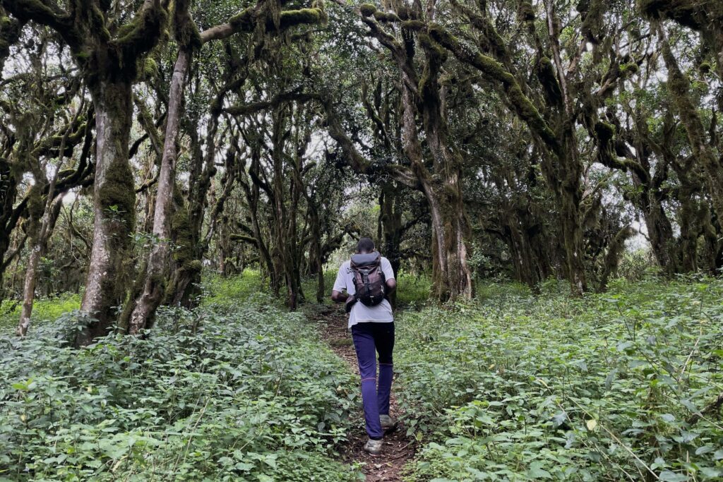
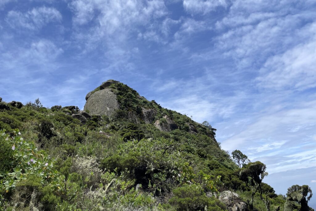
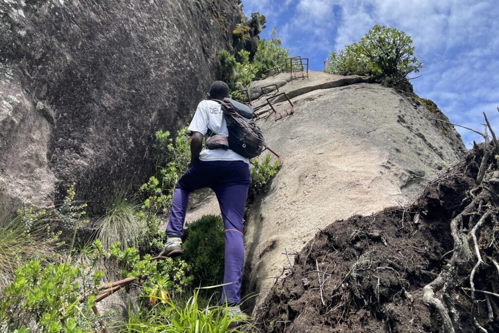
Once we left the forest, it was time for a longer break with a snack. We continued for a short time through the grassland, then entered the forest again. It was a bit similar to the one that I saw in Kilimanjaro with moss-covered trees. From the next plateau, we could already see the summit. I was a little bit anxious when I saw the metal footholds on the almost vertical rock leading to the summit. Luckily, climbing up wasn’t that bad, although the footholds were placed a bit too far from each other to put my feet comfortably.
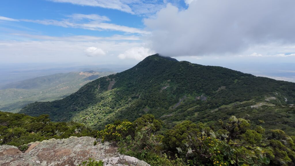
Finally, after ascending more than 1300 meters, we reached the summit from which we could admire an impressive view of Kenya and the plains on the Tanzanian side. Even Maasai bomas were visible! Look for the circular shapes.

The weather was much better than I expected. Although we could not see Kilimanjaro as it was a bit too hazy, the sky was mostly blue with some picturesque clouds. I didn’t have to make use of my rain jacket or any warmer layers, but don’t forget to pack yours. The weather in that place can be very changeable!
After snacks and a photo break, we started the descent and (unsurprisingly) going down was way more challenging on those metal footholds! They were way too far from each other, and I was struggling with where to put my feet, but my guide was very helpful, and soon I was at the bottom, wet from sweat. The rest of the way down was perfectly fine and we came back following the same trail as to the top.

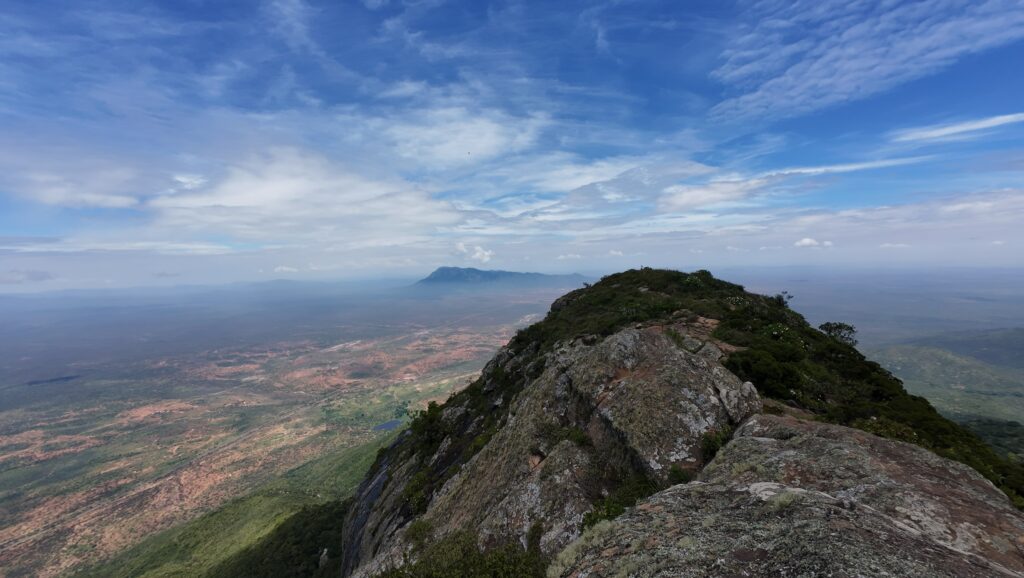
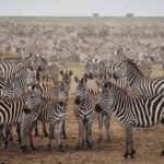
Overall, a very nice and memorable hike! We didn’t see any wildlife, but the guide told me that there were buffalo around, and there were even some sightings of leopards. It’s a pity we couldn’t see Kilimanjaro, but you need to be quite lucky with that, as it’s best viewed in the morning when it’s less likely to be cloudy. On the other hand, we saw Mount Meru as well as Ol Doinyo Lengai.
When we arrived back at the LCTP office, the guy was trying to organise transport for me back to Arusha, but it seemed that there were no dala-dalas as it was Sunday. He dropped me near the traffic police that was on the roadside, and when an officer stopped an upcoming Land Cruiser, I asked the driver if he was going to Arusha and could give me a lift. He agreed without any issues. I guess the policeman was trying to find a reason to fine him, as the driver got very emotional and they both started shouting at each other. Well, I’m not surprised, the policeman was surely an asshole looking for money to put in his pocket which is common in Tanzania.
The rest of the trip was very smooth, and I arrived at my hotel in Arusha just before sunset.
What else to do in Longido Town
The guy from the Longido Cultural Tourism Programme (LCTP) office can help you organise a visit to the Maasai Village, which includes traditional dance. It’s quite pricey (about 150.000 TZS), so it’s better to go in a group to split the costs.