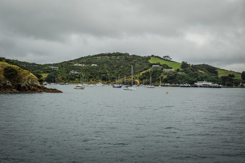
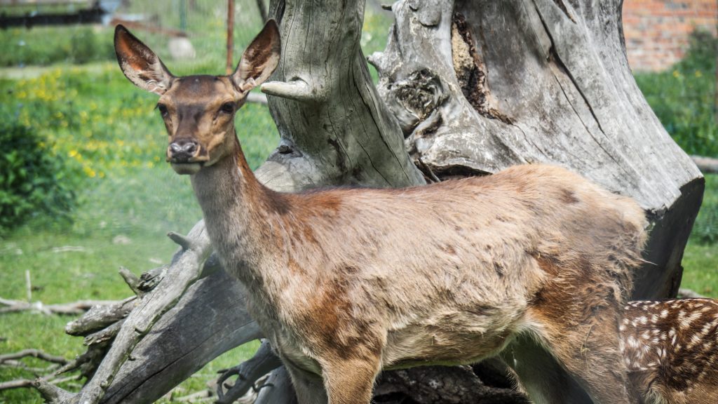
Waiheke was my second island escape from big city life in Auckland. Fantastic beaches, watersports, hiking, fishing, wineries. It seems that Waiheke has it all and it would be really difficult to be bored there. How lucky Aucklanders are to be surrounded by such places!
How to get to Waiheke?
The island can be easily accessed with the same operator that took me to Rangitoto and Motutapu Islands before – Fullers 360. The ferry ride from the Auckland City Centre takes around 40 minutes and costs 42 NZD for the return trip.
Approaching ferry terminal in Matatia Bay
How to get around?
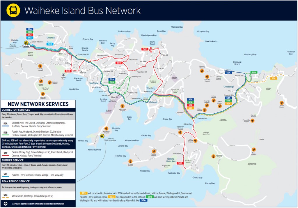
After arriving at the ferry terminal at Matatia Bay, I purchased one day ticket for public bus service. It costs around 10 NZD and takes people to various locations on the island with plenty of stops on the way.
There is also a more expensive alternative of HOP-ON HOP-OFF bus served by Fullers 360. It’s more like a tour bus that has set stops limited to the attractions and wineries. Combined ticket including return ferry ride plus the bus costs 68 NZD. Unless you want to reach a place that is beyond public bus service and on the other hand is included on the route of HOP-ON HOP-OFF, I don’t see the benefit of choosing that option.
Another means of transport include bicycles, scooters, rental cars or taxis.
One day itinerary
The first ferry from Auckland to Waiheke was scheduled at 8 AM and to have as much time as possible on the island, I was obviously on board. The morning seemed to be very cloudy but shortly after arrival at Matatia Bay, the sun was already burning my neck. I didn’t repeat the mistake from Rangitoto and that time I immediately put a sun cream all over my exposed skin.
I purchased a daily ticket for public bus service and boarded line 502 heading towards Rocky Bay. The driver seemed to be surprised that I’m going there and for a short moment it made me hesitate. Luckily, I didn’t change my mind. The less popular the place the better!
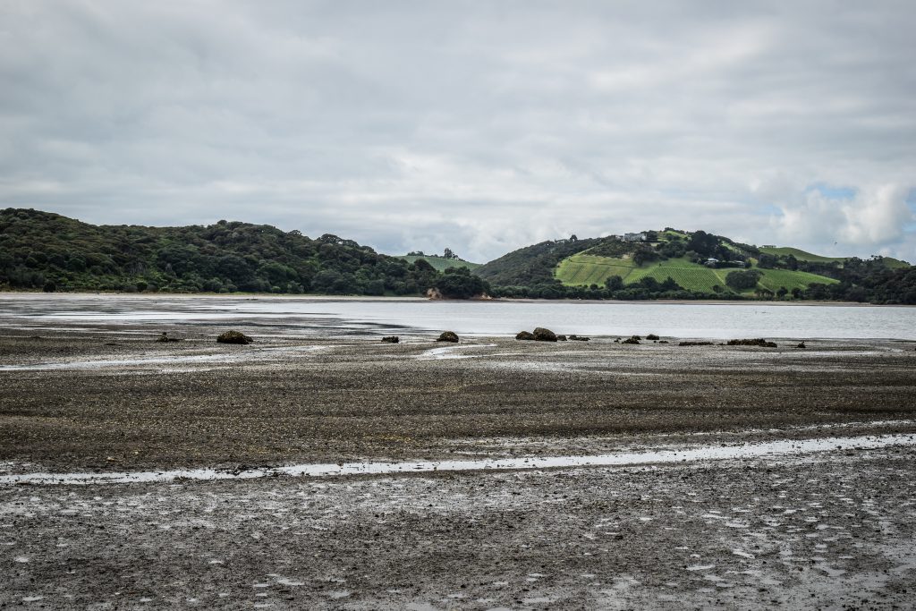
The reason why I wanted to go there was Whakanewha Regional Park. The place was absolutely awesome and probably I could spend the whole day just here, hiking all the tracks. It was still some time before high tide and the ocean looked like a bigger pool a few hundred meters from me.
Low tide at Rocky BayWhakanewha Regional Park has a lot of hiking tracks
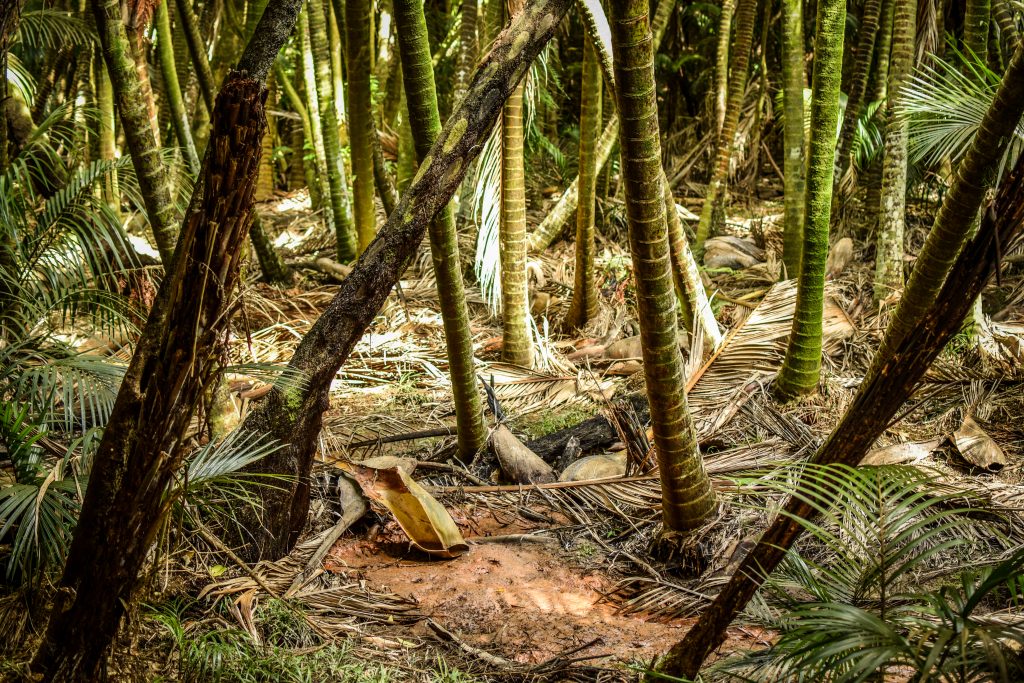
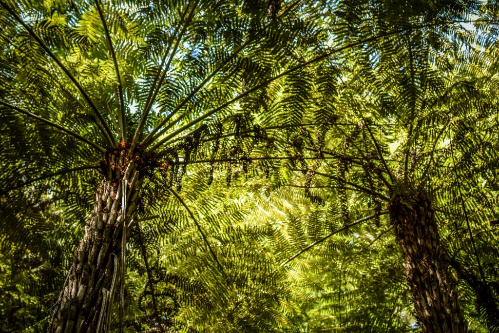
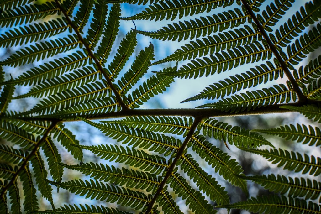
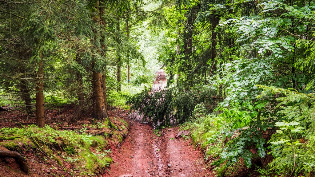
I followed Dotties Lane Track first, then completed two small loops: Rua Loop Track and Pa Look Track. In the end, I couldn’t resist going all the way to Cascades Stream with waterfalls, following Nikau Track that later joins Tarata Track. All of them were excellent hikes in a completely new type of forest for me. At least back then, because the next 3 months in New Zealand brought even more natural surprises. People don’t even call it a forest here. It’s a bush. Bush full of ferns, palms and birds singing all over the place.
Nature at its best!Feels like walking under huge umbrellasFern leaf in a symbol of New Zealand
The visit to Whakanewha Regional Park took me around 2-3 hours. You can check out the detailed map of the place published on the Auckland Council website.
My next destination was Onetangi Bay and due to peak hour, all buses seemed to be full of tourists. Google maps shown it was just around an hour walk to get there, with the chance to visit Waiheke Museum on the way, more or less following Waiheke Cross-Island Walkway. Why not? 🙂
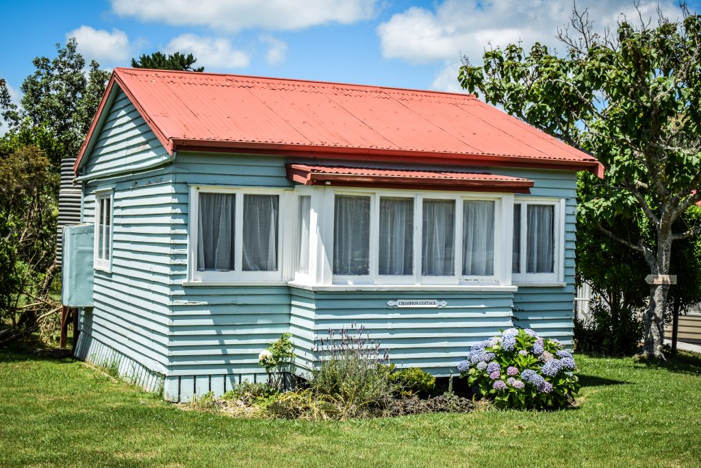
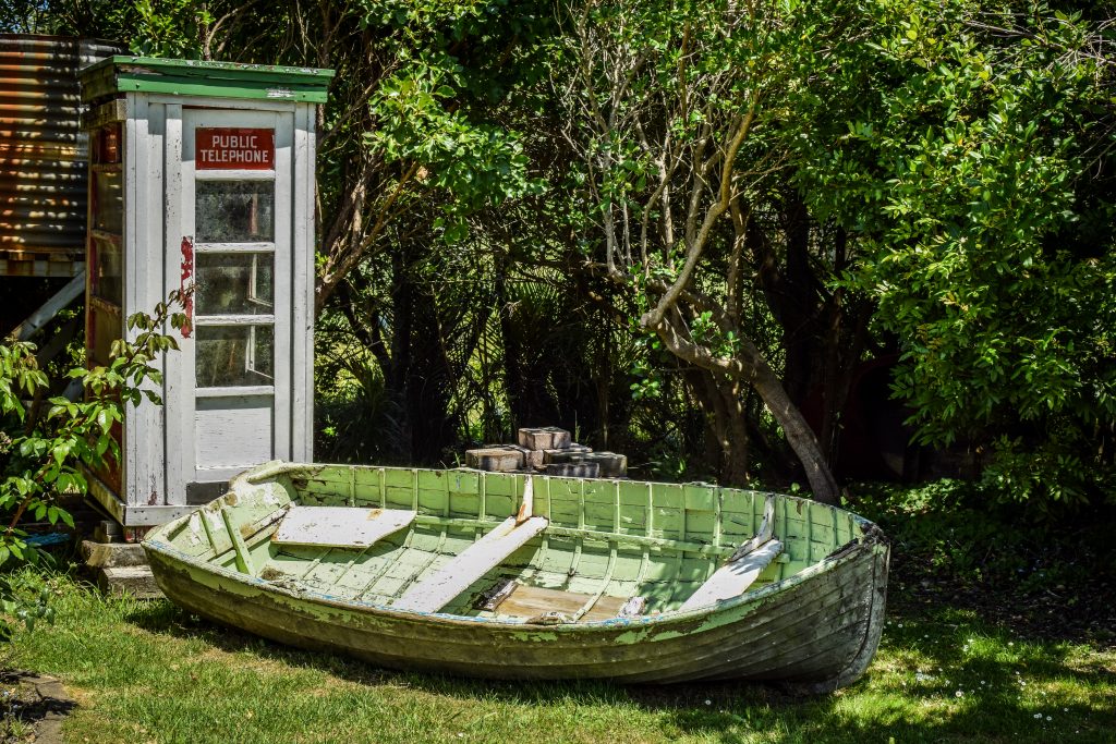
There is a reconstructed woolshed with exhibits, old cottage, three bach-style houses, telephone exchange and building of the jail. It’s a really nice place to understand the history of the island. Entry by donation.
Old cottage in Weiheke MuseumWeiheke Museum is a good short stop along the way
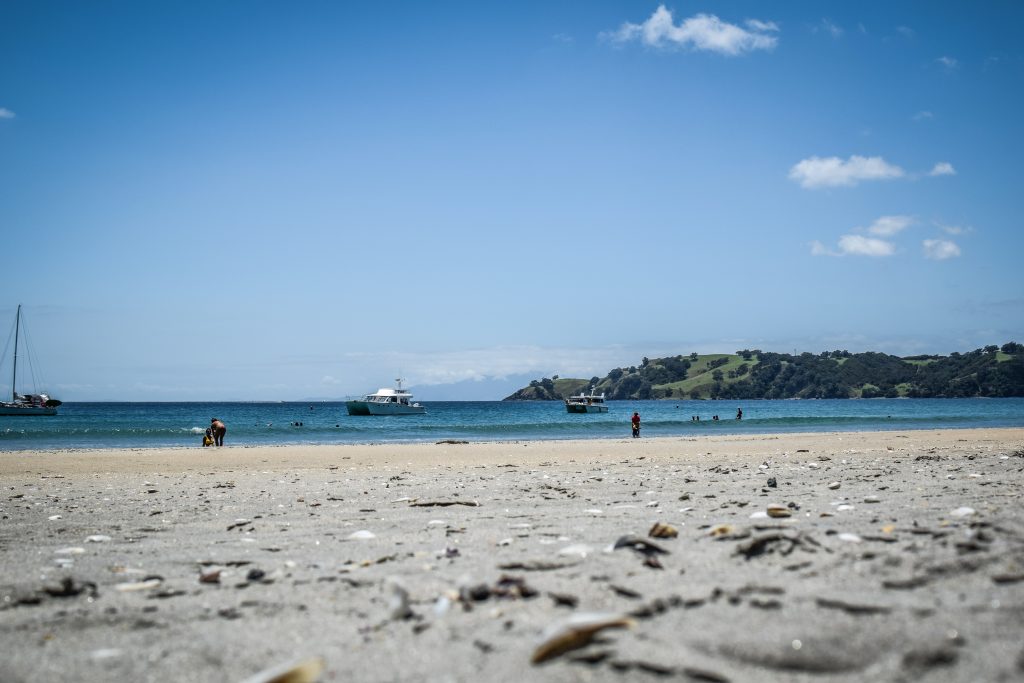
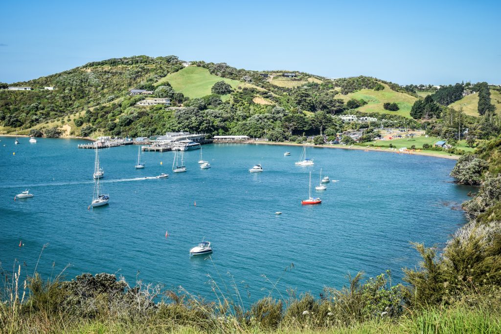
Onetangi Beach had nice sand and there were much fewer people than I expected. A pleasant place for quick swim and lunch.
Calm Onetangi BeachView on the yachts and hills Short swim is the best way to get new energy
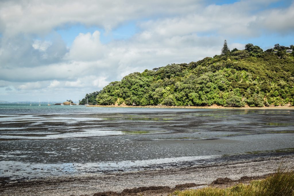
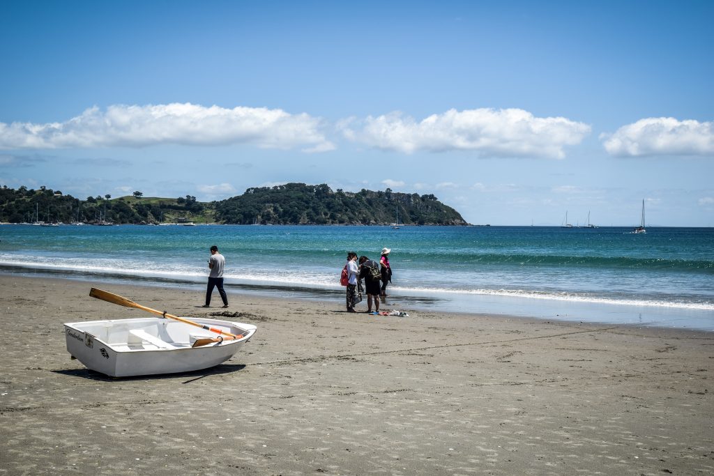
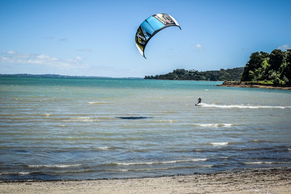
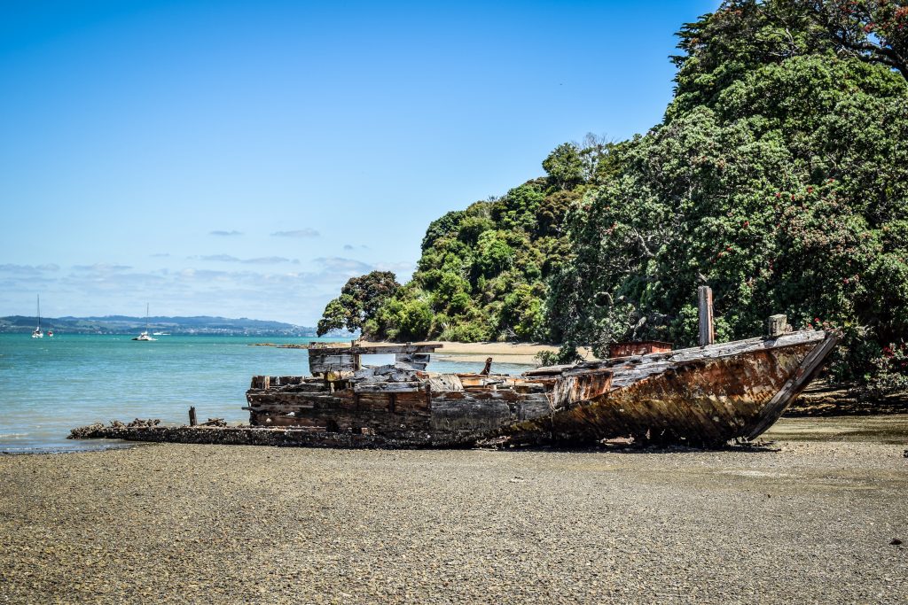
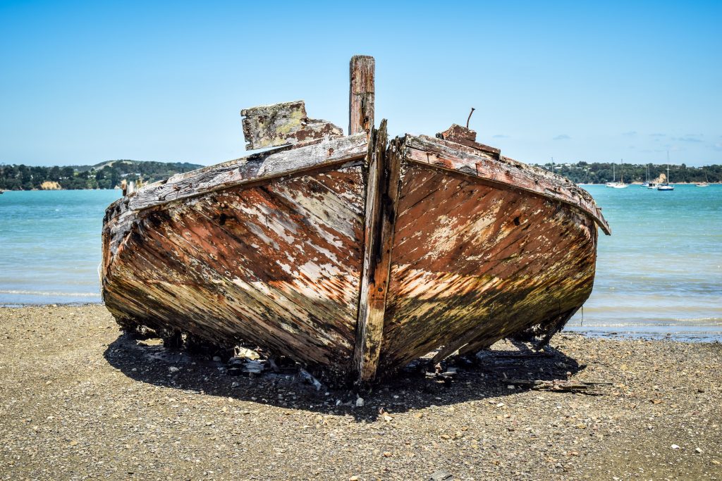
I caught the bus 502 again, that time going towards Blackpool Beach. Calm and quiet place only with a single kitesurfer and moored yachts. When I proceed along the Esplanade, unexpectedly I saw a picturesque wreck visible in full size due to low tide. It’s the hulk of the trading scow Rahir.
Kitesurfer making use of strong windUnexpected discovery on Blackpool BeachRahir shipwreck at low tide
As mentioned before, Waiheke is famous for two reasons: beaches and vineyards. Beaches checked. Time to have a break and do a wine tasting. At that moment the closest place was Mudbrick Vineyard and Restaurant and that was where I headed. For 10 NZD I had the chance to sample 3 different kind of liquid pleasure. It tasted even better on their lovely shaded terrace.
Hills full of vineyards
The last stop was Oneroa Beach, approximately half an hour walk but after some wine, I was fast as the wind. Oneroa was my least favourite beach on the island. Being so close to the ferry terminal, it’s very accessible and popular, somehow lacking the atmosphere.
One day on the island was just fine and fulfilled my expectations. On the other hand, I wouldn’t say that that 2 or 3 days would be too long either. With so many things to do, time can fly very fast and if you are tired enough, nothing is better than a glass of wine or chilling at the beach.
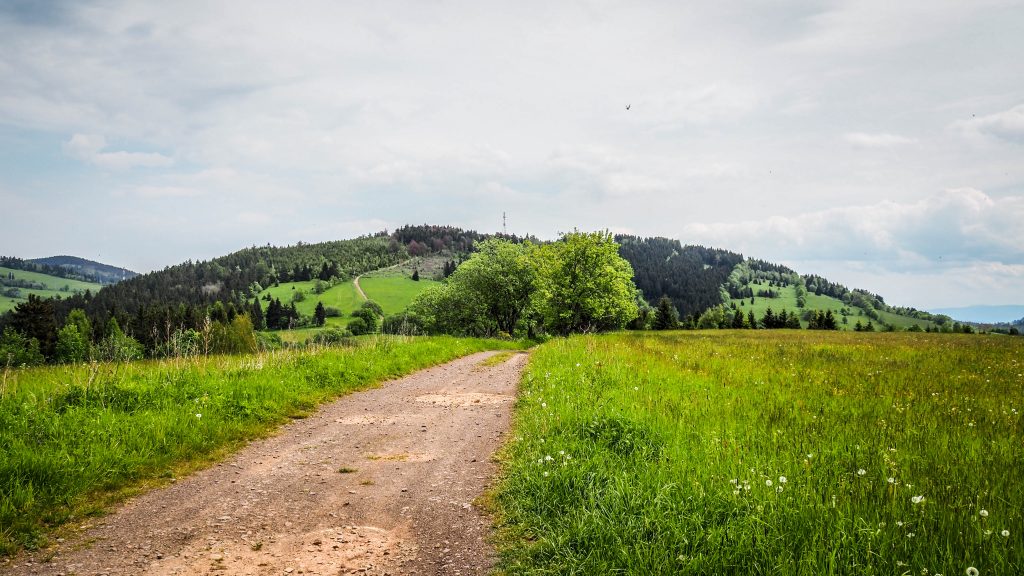
The plan for that stage was more ambitious at first, but weather conditions verified it quickly. Hitting the road in Kudowa Zdrój, I turned into Słoneczna Street passing Ecocentre of Table Mountains National Park, crossing the road leading to Dańczów and in the end, arriving at Lewińska Pass (535 m a.s.l.) about 6 kilometres from starting point.
Route: Kudowa Zdrój to Duszniki Zdrój Distance: ~ 15 km
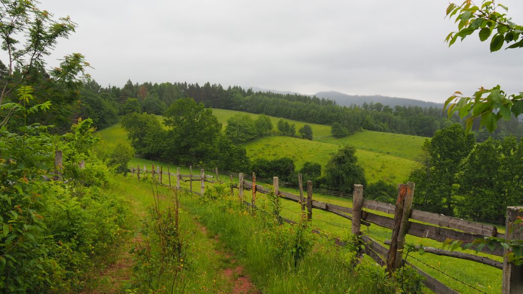
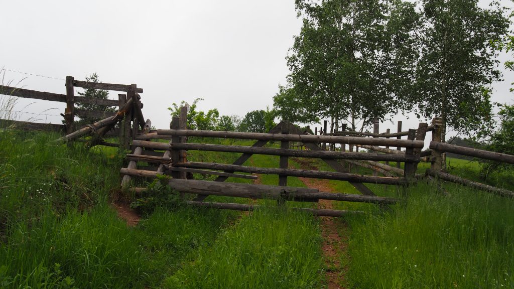
The views until now were quite nice, despite gloomy and foggy atmosphere. The track took me through the fields and in one place there was even the gate for cattle with little wooden steps allowing hikers to pass. Something similar to what I experienced before in the Alps or New Zealand.
Countryside views after leaving Kudowa ZdrójFollowing the road in the middle of grasslandsGate and wooden stairs on the left side
It’s another 3 kilometres of the gentle uphill walk towards Grodziec (803 m a.s.l.). Here I need to stop to wear rainjacket and put a rain cover on my backpack as what was initially a small shower, turned into heavy rain. There is not too much joy in such a walk and for the first time came through my mind the idea of shortening the walk for today and staying for the night in Duszniki Zdrój.
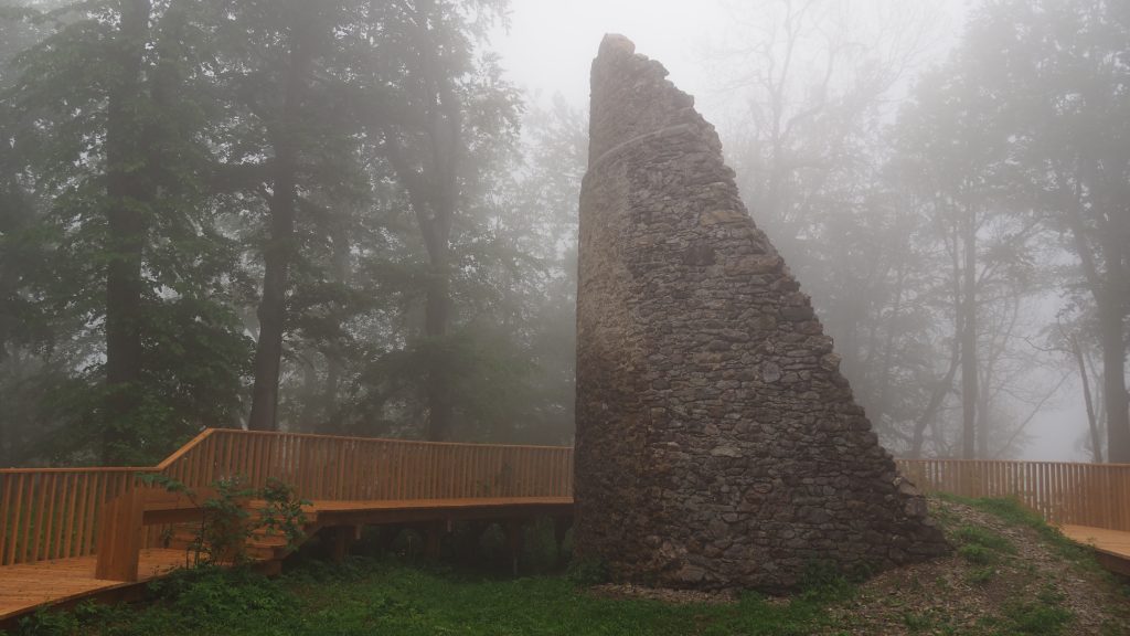
After 2 kilometres of descent from Grodziec, I arrived at the crossroad with the blue trail leading towards the ruins of Homole Castle from XIII-XIV century. As it’s only 10-15 minutes detour, I decided to check it out. The route was an easy one. First wooden boardwalk and then steps leading to the top of the castle hill. I was really happy to see the bench there as I could take off my backpack, make a sandwich and enjoy the moment without rain. I was the only person there and the fog made the atmosphere very unique.
When it comes to the ruins, there is not much left to explore and I simply walked around something that used to be the tower.
At the top of castle hillRuins of Homole Castle – not much left
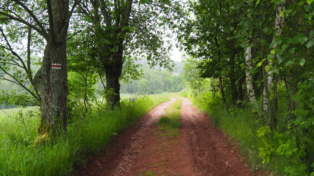
All the remaining way to Duszniki Zdrój is on a slightly downhill route, the only difficulty being mud. After around 4 kilometres, I was already in the office of tourist information, asking for their recommendation of an overnight stay. My preference was PTTK Hut Under the Muflon, however, they were fully booked. In COVID-19 times it’s better to always call and ask in advance for availability. I ended up in Agrotourism at Baltazar which happened to be quite far from the centre.
The track leading towards Duszniki Zdrój
It was only around noon, so having the rest of the day free, I decided to visit the Museum of Papermaking. The ticket costs 22 PLN and it’s an interesting place to kill an hour or two. Their permanent exhibition is about the history of paper and the way it is made in the world as well as more specifically in the Silesia region of Poland. The interesting part is that you can observe the whole process live and even take part in the workshops.
Museum of Papermaking in Duszniki Zdrój
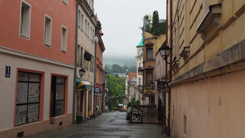
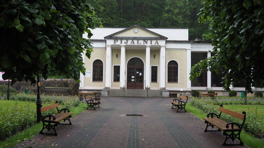
Other than that, Duszniki Zdrój is another spa town en route Main Sudetes Trail and according to me, one of the most charming ones. Spa treatments began in 1751 and in 1822 pump room with mineral waters was built. During next years, development continued and many famous people visited the town, such as Frederic Chopin, who gave two charity concerts in 1826 and Felix Mendelssohn-Bartholdy, German composer. Frederic Chopin Theatre, established in the place where Chopin gave his concerts, as well as market square are worth to have a look too.
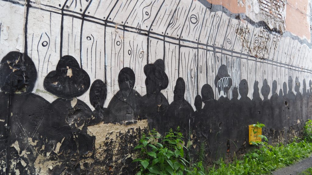
Murals nearby market squareMurals nearby market squareOne of the streets in the centre of Duszniki ZdrójPump room with mineral waters
That was it for that day. I walked all the way back to the accommodation where I stayed for the remaining part of day, simply resting and eating tons of fruits that I bought in local supermarket!
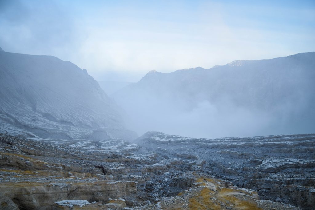
Kawah Ijen is an active but recently quiet volcano in East Java. Being home to the natural phenomenon of blue fire, it attracts thousands of tourists ready to set off in the middle in the night to witness the unique flames that can be seen only here and in Iceland!
How to get there?
Mount Ijen is located in East Java and the easiest way to get there is by ferry from Bali or from the nearest airport in Surabaya. Tour operators offer 1 day trip from Bali with pick up at your hotel and it is popular among tourists. Keep in mind that East Java has much more to offer so staying longer is definitely a better idea.
For independent travellers, the best is to base yourself at Banyuwangi and look for private transport (car/scooter) or organized tour there.
Javalindra Homestaywas a perfect base for exploring the area. The room, as well as a shared bathroom, were very clean, there was a spacious hall with a comfortable couch for chilling, they provide breakfast and rent scooters as well. Plus the owner is simply a friendly guy and he even dropped me to the bus station when I was about to leave to Semarang.
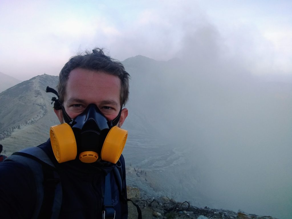
If you tell them about your plans to go to Ijen, they will also provide you with a breathing mask which is obligatory and at least partially helps to handle the intense smell of gases. You could also get one later from one of the guys hanging out at Ijen, but the quality may be questionable.
Adventure begins
The alarm went off at 11:30 PM. Time to start a new day before the previous ends! It was really hard to play it right as I usually don’t go to sleep very early so even though I tried to force myself to fall asleep at 9 PM, it turned out to be big failure.
Quickly packed some warm clothes and hat (the summit is at 2,799 metres a.s.l. so it can get chilly up there), headlight, camera, snacks, put on my hiking boots and it was a few minutes past midnight when I turned on the engine of my rented scooter.
Masks are a must when walking on Ijen
The night was cold and very dark as I was basically the only vehicle on the road. At some point, I was wondering if I am going the right way, but the closer I got, the more cars there were. After 1.5 hours (yes, it’s quite a long drive) I arrived the parking lot where first organized groups had their hot drinks before the hike to the crater.
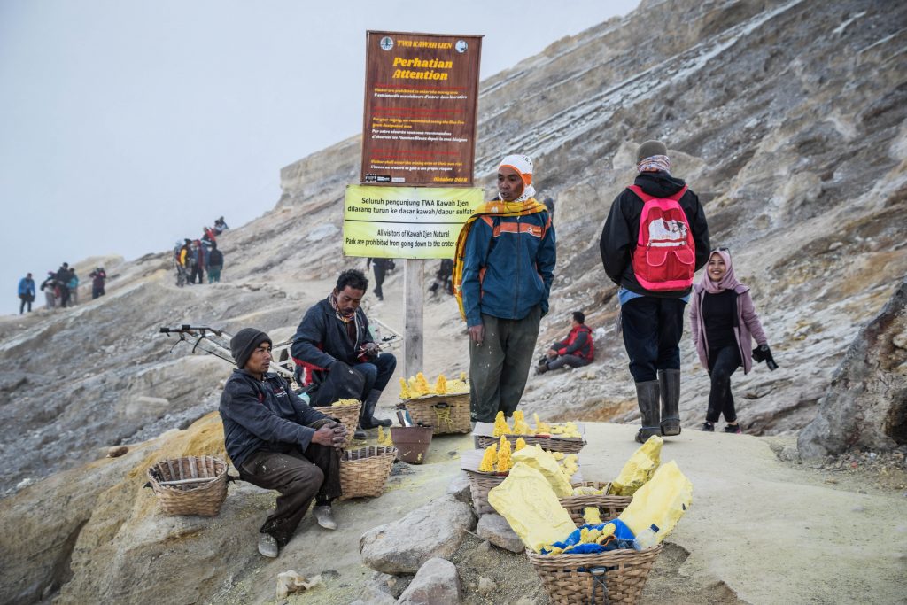
The entrance ticket costs 100.00O IDR on weekdays and 150.000 IDR on the weekends. From the ticket office, the path goes steeply uphill but it’s wide and well maintained. You certainly don’t need a guide and it’s impossible to lose the way. Having said that, be prepared to meet many guys who normally work in the crater getting the sulphur out of it and carrying in big baskets down to the village. They usually offer to take tourists down to the crater for another 150.000 or 200.000 IDR as it’s on their way anyway.
It’s not big money so if you find it more comforting than descending on your own, go for it. I was hesitating because I started the hike quite early and there weren’t too many people to follow. If this is the case, just have a snack and wait patiently for the first wave of tourists, then follow them. In the end, they all go to the same spot, so it’s easy to follow their headlights.
From the beginning of the hike, depending on your fitness, it takes roughly 1-1.5 hours to reach the caldera rim. Here you can decide to either continue hiking up to the sunrise spot or descent down to the crater and see the blue fire. Obviously, most of the people go down to the fire first and then come back all the way up for sunrise (usually around 5 -5:45 AM depending on the time of year).
Descent to the crater is on a rocky path but nothing too challenging. It just looks more difficult than it really is in the middle of the night. Here you should already put your gas mask on. After 20-30 minutes you should be already next to the largest highly acidic crater lake in the world waiting for the spectacle of blue fire. The pH of the water containing hydrochloric and sulphuric acids is less than 0.3, meaning it can dissolve metal. It has a unique turquoise-green colour which you won’t be able to see in the dark, but certainly later on after sunrise.
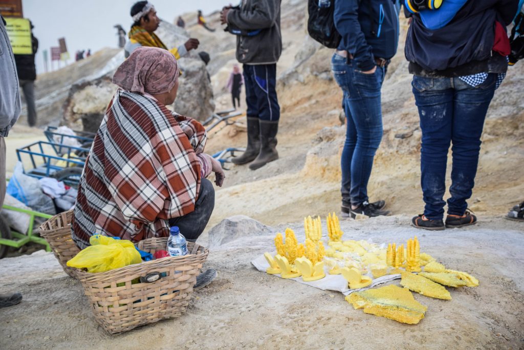
Being there, I had time to simply stand in silence and watch the work of sulphur miners. They are residents of nearby villages, working without masks, walking the same route as tourists do but 3-4 times a day and with the load up to 80 kg on their back. All of these for around 800-1,000 IDR per kilo of sulphur which sounds like a joke but unfortunately it’s true. That’s why they also offer to be your guide or sell small souvenirs made from sulphur.
Sulphur miner working just next to the blue fireMiners selling small figures made from sulphurMiners selling small figures made from sulphur
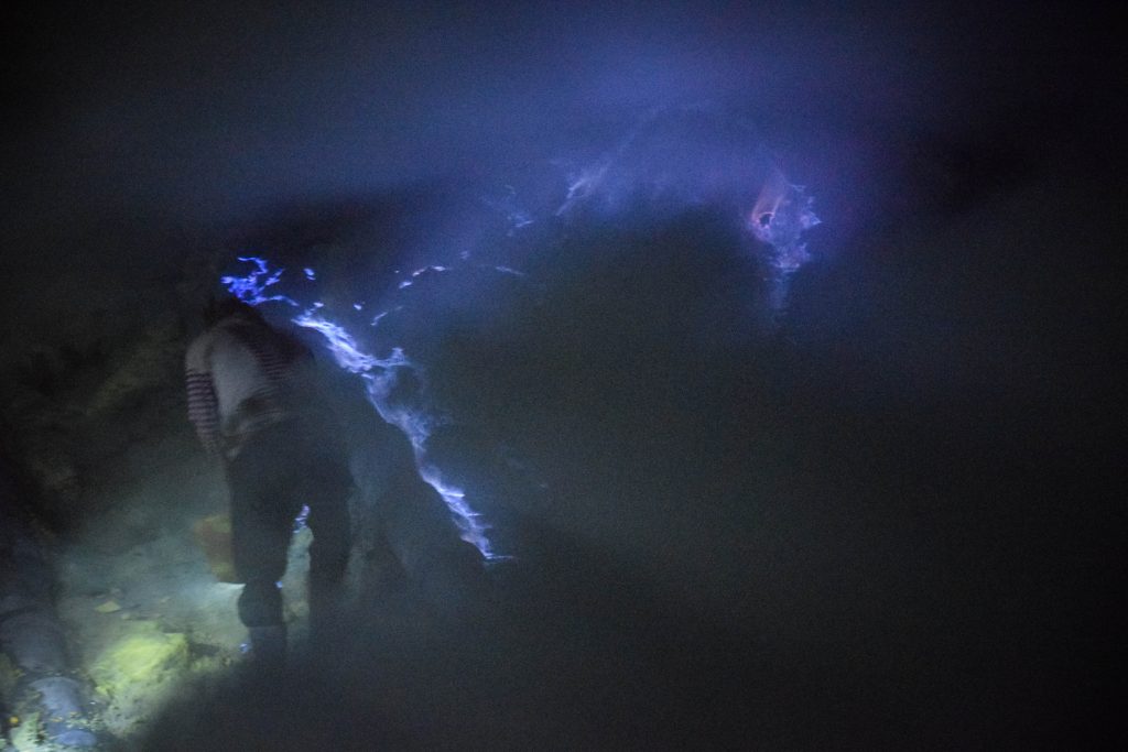
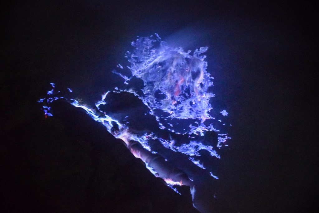
Finally, the blue fire went off and it was truly amazing to observe, even though I expected it to be a bit larger. I had the big luck to be in the crater way before all organized groups and I easily spent there over 45 minutes before it got crowded. From time to time the cloud of gases was blown by the wind into my direction but it wasn’t anything too disturbing. Just wear the mask, close your eyes and watch out for your electronics if you don’t want them to end up rusty.
The blue fire is a result of sulphuric gases combusting. They escape through the cracks in the volcano at high pressure and temperatures up to 600 C and igniting after reaction with air. The blue fire is often mistaken for lava, as some of the gases turn into liquid sulphur and keep burning on the slopes of Ijen.
Blue fire in the crater of Mount Ijen
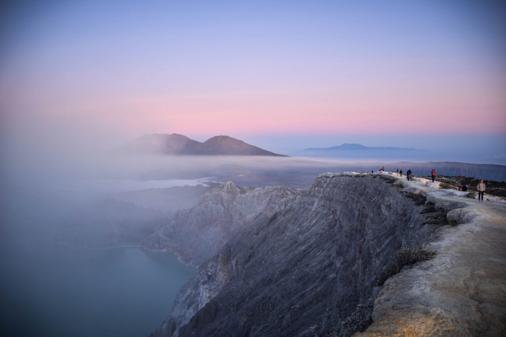
I started my way back to the crater rim and after passing the crowds going in the opposite direction, I was sooooo happy I got to the fire early enough to avoid them. It was like a long line of headlights on the path. From there, I continued up towards the sunrise viewpoint.
Sunrise at Mount IjenSunrise at Mount Ijen
The views and colours of the sky were really impressive. I saw the most sunrises in my life in Indonesia and it was certainly one of the most spectacular ones. Finally, after wandering in the darkness, I could admire the whole landscape of Mount Ijen around me.
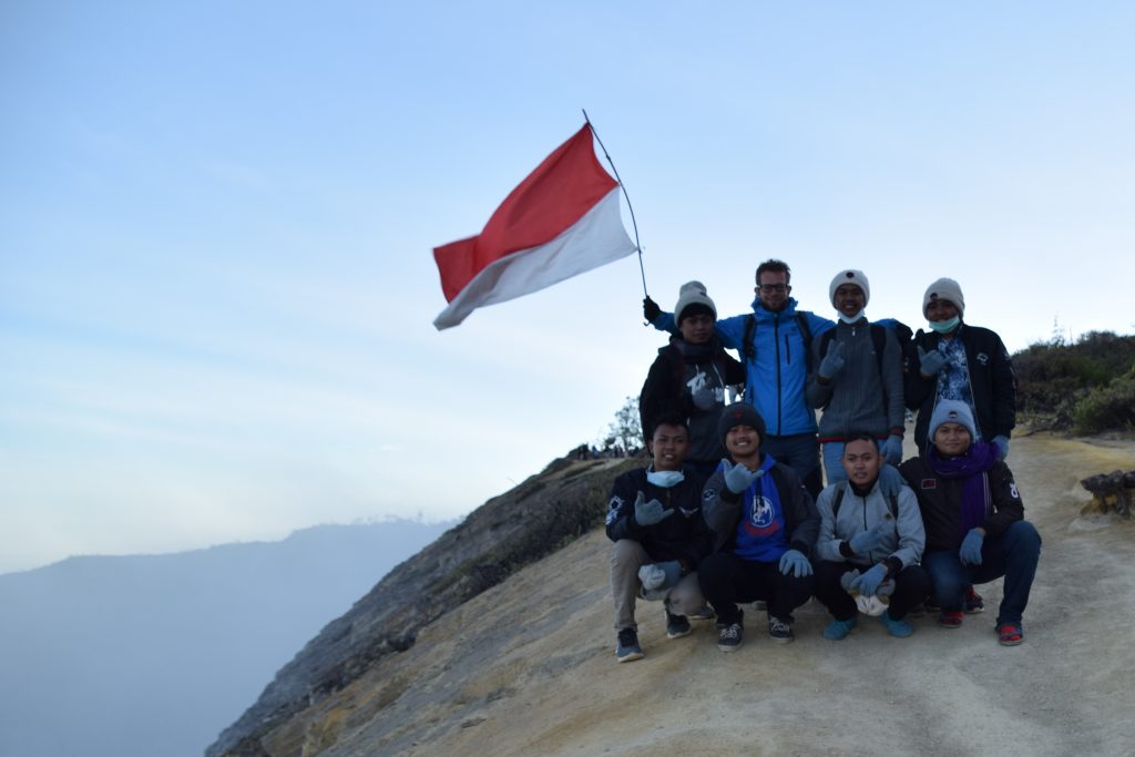
At the top, I met a group of friendly local folks that wanted to take a picture together. Why not, my pleasure! In fact, it happens in many places. Somehow I can’t imagine that someone stops another person on the street in Europe, just because of different skin colour and asks for pictures. But people in Indonesia don’t create stupid and unnecessary social borders as we do and they are extremely friendly.
With the group of locals at Mount Ijen
The way down took me a while, not because it was difficult but rather because I couldn’t stop taking pictures. The lake inside the crater and the place where I was just an hour ago next to the blue fire were clearly visible now.
Mount Ijen at sunriseMount Ijen at sunrise
If you don’t feel like walking, local guys will be happy to take you down in carts. It looks a bit ridiculous for me, but in the end, it’s another way to somehow support this hard-working community.
Once back at the parking, I had to wipe the seat of the scooter as it was all wet from morning dew. Put my helmet on, turned on the keys and… the engine didn’t start! I was sure I had enough fuel and I used the same scooter the day before without any problems. Luckily, some locals seeing me struggling hard, helped me to start the engine in an old-style way – with kick start. Indonesia was the first country where I drove scooter nearly every day so I didn’t have all the knowledge 🙂 This is something that I value a lot in this country. Even if you travel alone, far away and you need help – you can always count on it. It’s a totally different mindset than in Europe where everyone minds their own business.
Would I recommend the night trip to Mount Ijen?
Definitely. Night trip to the active volcano to admire spectacular nature is definitely something that I love and fits well into my travel character. I can easily put it next to ascents to Semeru, Inierie or Kerinci, also in the middle in the night, to see the sunrise from the summits.
Mount Ijen is much less demanding comparing to those, making it more accessible for moderate hikers. On the other hand accessibility make it crowded.
5 tips before your go
Go early and do it by yourself
Arrive at the crater before organized tours. It will give you enough time to enjoy the blue fire and take nice photos. To do this, start from Banyuwangi around midnight. I wouldn’t bother too much with joining tours unless you need it for psychical comfort. You certainly don’t need a guide to walk around and find your way. To go independently, hire a scooter or a car with driver (ask at your accommodation).
Take warm clothes and gas mask
The temperature certainly won’t be like in the middle of the night in Bali. It’s gonna be much colder so take enough layers to feel comfortable. Your clothes will need proper washing afterwards or everyone will know that you were at Ijen last night (intense smell of sulphur). A gas mask can be hired at your accommodation or from one of the guys on the way to the crater.
Take hiking shoes
It isn’t a hardcore hike but still a hike and proper shoes will make it much more enjoyable, especially when descending down to the crater.
Avoid the cloud of gases
Once next to the blue fire, try to get off the way of the cloud of gases occasionally being blown by the wind all over the place. If you can’t avoid it, close your eyes and hide your camera under the jacket.
Be friendly and support local community
Local guys can be a bit pushy and try to convince you to use their services as a guide. Take one if you wish or refuse politely and keep going. Small sulphur figures are great souvenirs from the place have small money and buy some for yourself or your friends.
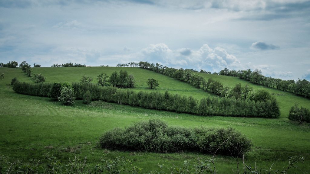
Wambierzyce town is located at around 204th kilometre of the Main Sudetes Trail and Kudowa Zdrój at 232nd. It means that somewhere between these two, I should celebrate half-way of my adventure! I was looking forward to that day also because of another reason. The track leads through the scenic Table Mountains and from what I saw online, I had all the reasons to believe that it’s gonna be awesome!
Route: Wambierzyce to Kudowa Zdrój Distance: ~28-30km
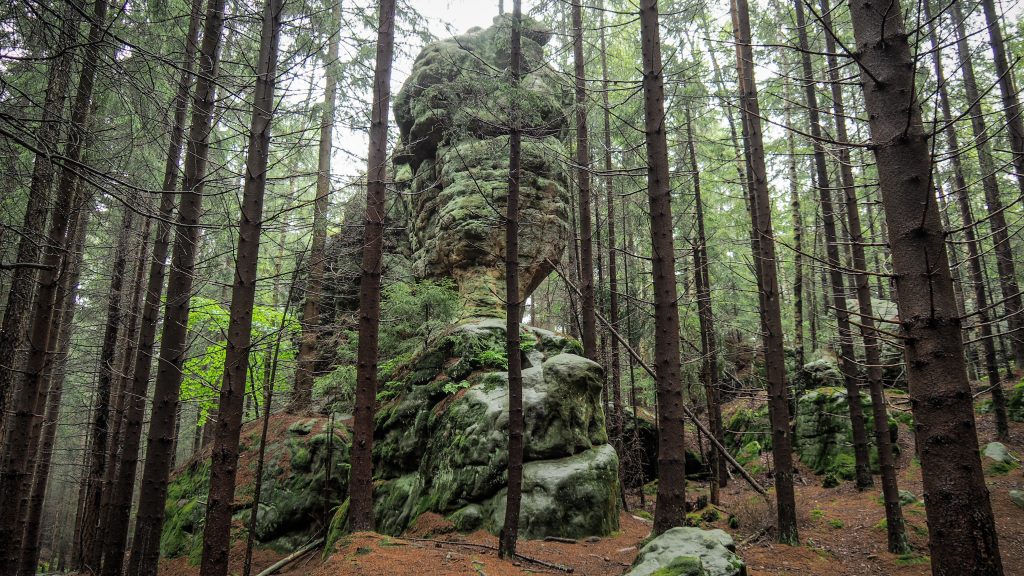
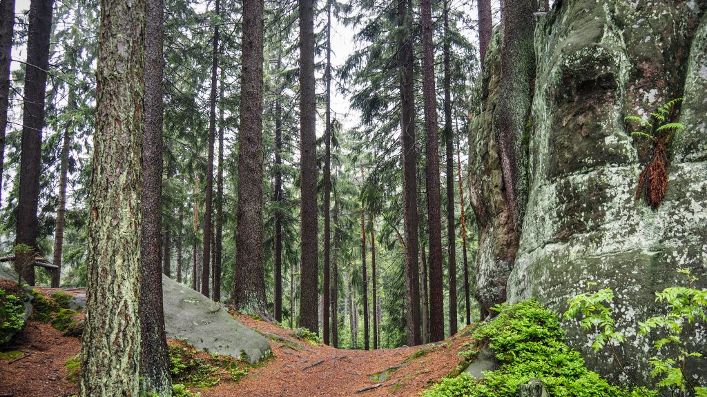
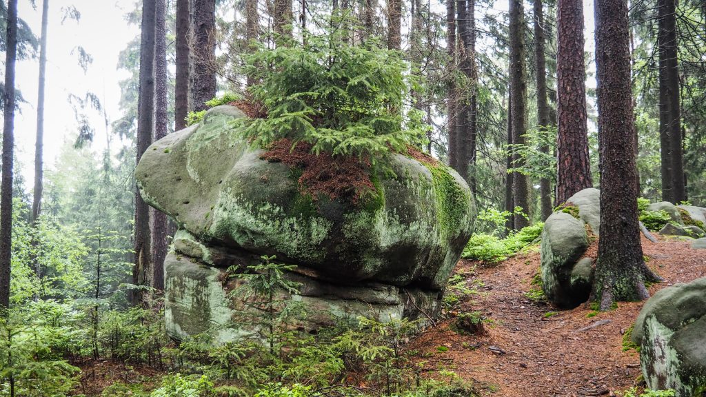
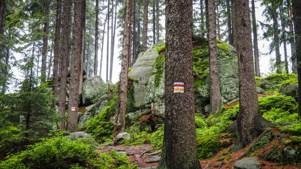
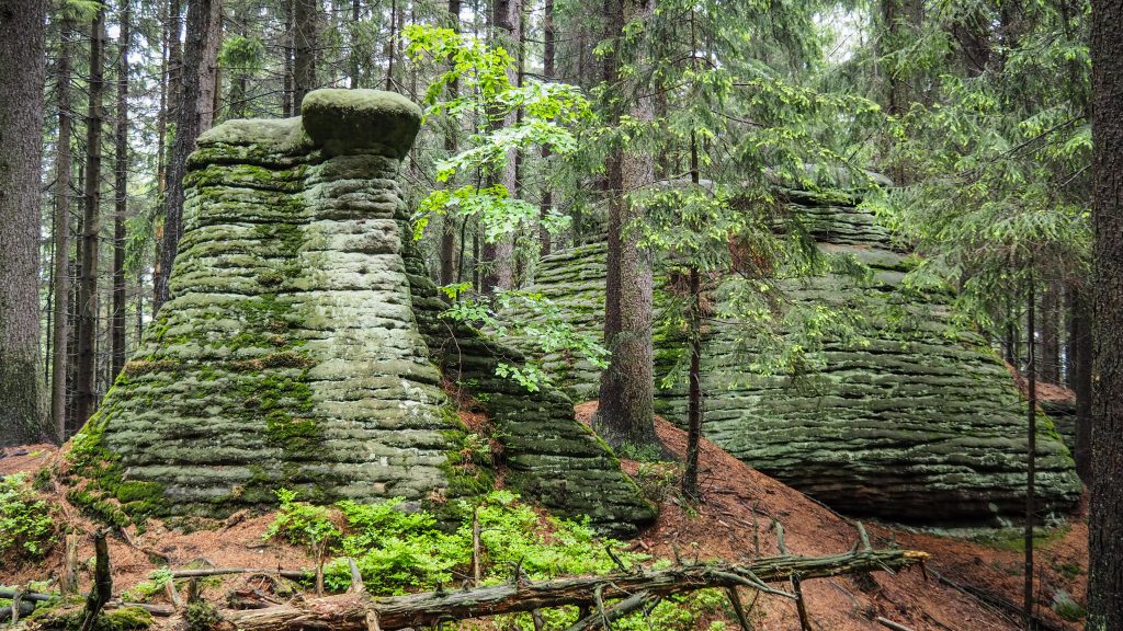
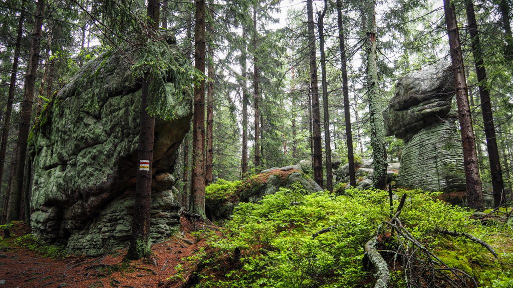
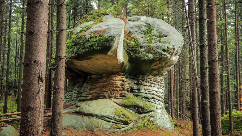
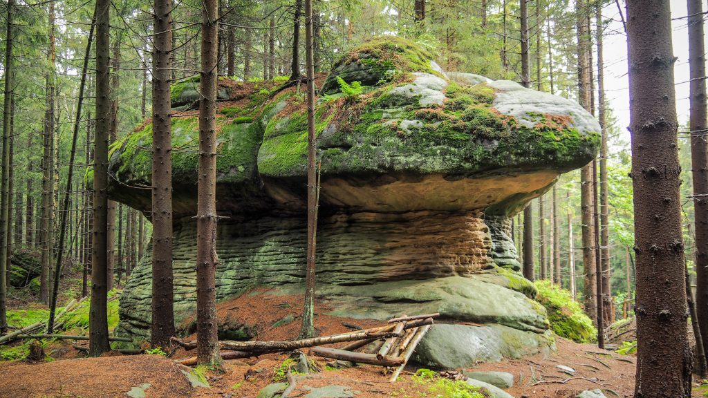
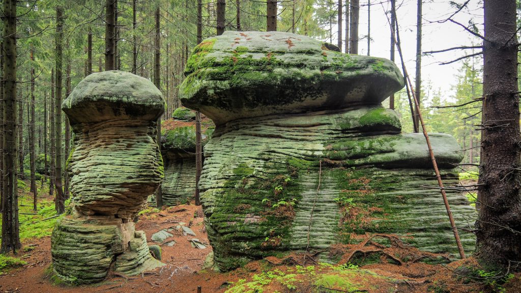
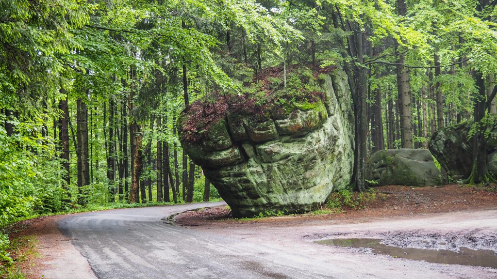
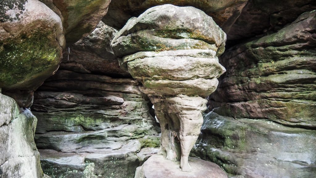
The beginning of the day was quite miserable due to boring terrain, asphalt roads and light rain. It started to look better after 4th kilometre when I passed Studzienno and entered the Table Mountains National Park. The path was going up towards Rogacz (707 m a.s.l.). More and more weird rock formations looked at me from behind the trees. Exactly what I had been waiting for!
The terrain here is totally unbelievable and it looked even more unbelievable in cloudy and a bit foggy weather conditions. The shapes of some rocks resemble huge mushrooms, hence its name – Mushroom Rocks (Skalne Grzyby). They owe it to erosion progress of sandstone, which is way faster in the lower parts of the rocks. I admit I spent a lot of time photographing everything but it’s always a learning process to become a better photographer. Honestly, it doesn’t matter how much time I take for my shots, I am never fully satisfied with the end result. Maybe it’s lack of talent or maybe endless pursuit for perfection.
Anyway, from Rogacz it’s around 5,5 kilometres to the parking lot at Stormy Meadow (Burzowa Łąka). As always, parking lots mean that there could be more people around and the rule proved to be right also that time. I mean more people for the Main Sudetes Trail standards because usually, it was rather no people at all. Even here it wasn’t as busy as one could expect. Tourism in COVID-19 times hasn’t come back to shape yet.
Crossing the road near Stormy Meadow parking lot
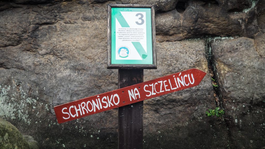
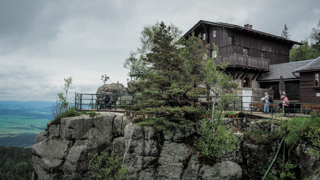
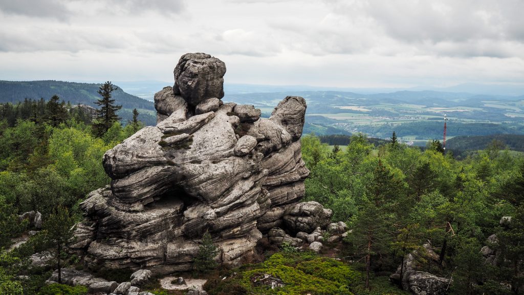
The track continues of the mostly flat path called The Road Over The Cliff for further 5 kilometres. At some point, there is a small path going right (5 minutes detour). Walk it till the end and you will understand the meaning of that name. Then, the next major landmark is the Great Szczeliniec (Szczeliniec Wielki, 919m a.s.l.).
Track leading to Szczeliniec WielkiPath and stony stairs enroute to Szczeliniec WielkiThe view from the top of Szczeliniec WielkiMountain hut at Szczeliniec Wielki
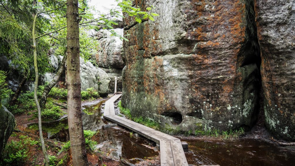
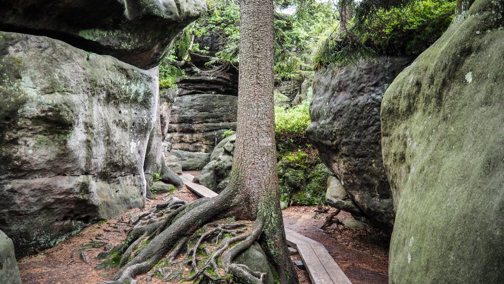
Even though the red track doesn’t lead to the top, it’s hard to resist a detour. It’s a tiring way up on the stony stairs but the place was definitely one of the biggest highlights of the day and should not be missed. There is a mountain hut at the top, in case you are in need of a hot meal or drink. The way down is even better and I recommend taking the paid alternative. It’s only 12 PLN and hiking through the amazing maze of rocks takes about 1 hour. The formations are incredible! Some parts may be very narrow and tricky with a big backpack, but it’s doable.
After the descent, I reached Karłów which is a midpoint of GSS. I felt big satisfaction of what I achieved so far and maybe it made me lose concentration and as a result, I took a wrong turn following red track but for ski runners, not hikers. Honestly, I find it very misleading to use the same colours and it took me a long time to realize that something is wrong. The signage could definitely be improved. Mapa-turystyczna.pl helped me to find my way but the whole situation cost me at least 1 hour and a few useless kilometres in my legs. Just pay attention here and don’t turn right too early. The track follows an asphalt road leading to the Errant Rocks (Błędne Skały) which is around 5 kilometres from Karłów. I had to speed up as the place was closing at 5 pm. The advantage of late arrival (4:10 pm) was that there were only a few other tourists.
The whole attraction is very similar to the Great Szczeliniec and doesn’t make such a big impression if you have already visited the other one. Crossing with the backpack was really difficult and I had to take it off in many places, struggling to push it through. I suggest to leave the luggage at the ticket office and simply come back to collect it afterwards. By doing that, your walkthrough should be much more enjoyable.
Unique rock formations in the Errant RocksWooden walking platform at the Errant RocksPassing through the Errant Rocks with backpack isn’t easy
Last part of the day was made by a long (~7km) descent to Kudowa Zdrój. I was really, really tired and still had to walk to the other side of the town as I didn’t pay too much attention to the localization of my guesthouse when booking it. Don’t get me wrong, the localization was awesome, but at that moment every 100 meters mattered. In the end, the day was finished with 38 kilometres on my Endomondo training.
I can fully recommend Guest Rooms Under Lions (Pokoje Gościnne pod Lwami). Super friendly owner and very close to the main attractions of the towns in case you want to do some sightseeing. And obviously, you should do that!
What to see in Kudowa Zdrój?
The history of the spa town dates back to the beginning of the 17th century when information about the positive effects on the health of the mineral waters from Kudowa springs appeared for the first time. Only a hundred years later, bottles filled with them were regularly sent to the royal court in Berlin.
Skull Chapel
In the small building located in Czermna (one of the districts of Kudowa Zdrój) there are about 23 thousands of human skulls all over the walls and ceiling. Father Tomaszek, collected human remains that remained in the surrounding fields after the Thirty Years ‘War in 1618-1648, the Seven Years’ War (1756-1763) and the great plague of 1680. As no one was able to provide the deceased with a proper burial, and the dogs were digging up bones from the ground, the priest decided to take care of them by moving to the chapel and crypt. It is believed that he got the idea during his trip to Rome, after visiting the local catacombs.
Skull Chapel in Kudowa Zdrój
Spa Park
It was established in the 18th century on the model of English parks and significantly expanded in the 19th century. Nice place to walk around! There is a small lake, fountains as well as a forested hill for those looking for a more challenging stroll. Mineral waters are available in drinking room.
Spa Park in Kudowa ZdrójSpa Park in Kudowa ZdrójSpa Park in Kudowa Zdrój
Trail of Vanishing Trades
A time spend here is like a journey back to the past, to learn about the jobs our ancestors did, such as blacksmithing, baking bread, pottery or knitting. There is also a mini ZOO which should entertain the children for a while. Overall it’s a pretty small open-air museum, so unless you have the time to kill or you are really interested in the topic, give it a miss.
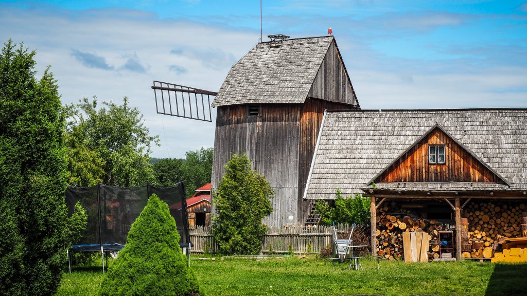
Following the Trail of Vanishing TrailsSmall kind of a ZOO also hereSleepy animals enjoying the dayWindmill at the Trail of Vanishing Trails
Other less impressive sights in town include: Museum of Minerals, Museum of Toys or Museum of Folk Culture of the Sudety Foothills.
I was quite optimistic about that day. The distance seemed to be just fine and there was not too much of the elevation difference. I set off from the accommodation at Silver Mountain as usual, at around 8 am and 20 minutes later I was at Silver Pass, joining the red track and heading to the Bardzkie Mountains.
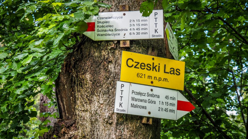
A gentle walk for 4 kilometres took me to Czech Forest (Czeski Las, 621 m a.s.l.) from where it was easy descent for another 3 kilometres to Czerwieńczyce. Nothing too spectacular here. Typical Polish countryside, which would seem to be totally dead if not some chickens running around.
Czeski Forest (621 m a.s.l.)
Route: Silver Mountain to Wambierzyce Distance: ~ 25-26 km
My next target was Słupiec. First, the path leads in the forest but in the end, I got out of it and continued on through farmlands with the blocks of flats in the town visible on the horizon.
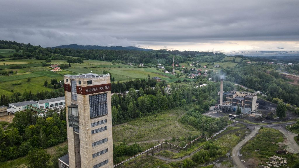
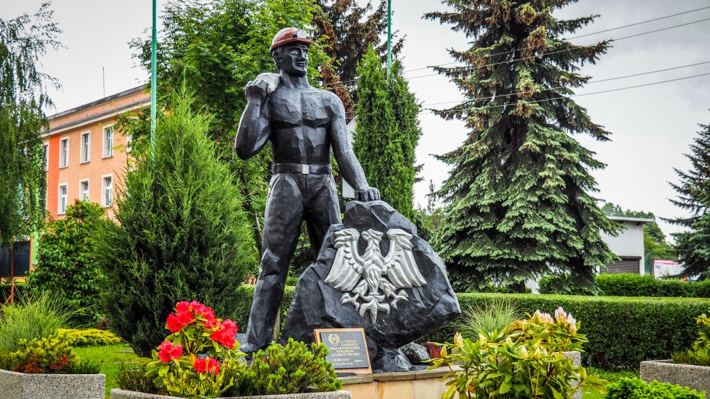
Słupiec was connected with Nowa Ruda in 1973. It’s an industrial city with a history strongly connected to mining, therefore from a touristic point of view it isn’t very attractive. However, I made a short break here, mainly to fly a drone around colourful blocks of flats built for miners and the mine itself.
View over the mine in SłupiecMiners’ monument in Słupiec
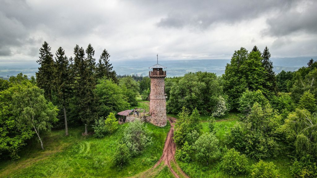
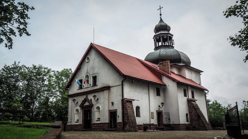
After Słupiec is the most challenging part of the day – 2 kilometres ascent to Kościelec (647 m a.s.l.) where you can find a viewing tower (really nice panorama) and a church a little bit further.
Viewing tower at KościelecChurch at Kościelec
It’s around 5 km from Kościelec to Ścinawka Średnia and here the track starts to get really muddy after last days of rain. Hiking poles are useful to navigate through the difficult terrain and no to fell down in the mud with a heavy backpack. Asphalt road starts around 2 kilometres before the village so my pace increases. Unfortunately, it also starts to rain.
Water on the track!Wet and muddy path through the forestRailroad in Ścinawka Średnia
The last section of the day (around 5.5 km) leads mostly through the meadows with the beautiful Table Mountains visible on my right side. I could only imagine how nice it would be to fly a drone here, but electronics and rains don’t like each other. Finally, I reached the Christian monument or something that looks like one and turned right, having huge Basilica of the Visitation of Our Lady in Wambierzyce in front of me.
Christian monuments are the sign that Wambierzyce town is closeLast section to WambierzyceFarmlands, red tulip and the Table Mountains
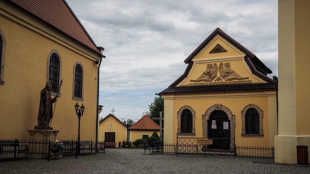
This town is soooo weird. I can understand the huge church in the centre, as it is in many cities, towns and villages. Poland is ultra catholic. But in Wambierzyce literally everything has a biblical name and is somehow put in a biblical context. On the other hand, there is a local grocery shop just in front of the basilica, with local old guys standing with beers in their hands the whole day doing nothing. That’s it about religiousness.
If that wasn’t enough, the cheapest option for the night happened to be at the Pilgrim’s House. It felt a little bit weird to stay there as non-catholic but who cares. They serve good schnitzel which let all my doubts go away 🙂
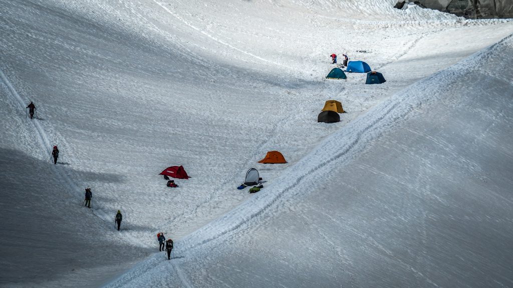
The Tour du Mont Blanc commonly knows as TMB is one of the most popular long-distance walks in Europe. Even though the track doesn’t go anywhere close to the summit, everyone knows Mont Blanc – the highest mountain of Western Europe (4.808 m a.s.l.) and its name attracts thousands of hikers every year. The first successful ascent by Jacques Balmat and Michael Paccard took place on August 8th 1786, causing a significant boom in mountaineering.
TMB goes around the massif, covering a distance of roughly 165 kilometres passing through parts of Switzerland, Italy and France. Depending on the path you take, it’s wise to prepare your legs for a little bit more. In my case it was over 180 kilometres, having completed several variants.
Following the classic route, the highest point is 2.537 m a.s.l. at the Grand Col Ferret which is also a border between Italy and Switzerland. However, some variants can get you higher than that. For example, Col des Fours or Fenetre d’Arpette rewards hikers with the panoramic views from 2.665 m a.s.l.
Fenetre d’Arpette, Switzerland
TMB was in my mind since I completed a few overnight hikes in New Zealand. Long-distance hiking totally got me and the plans for 2020 were modified several times. First, it was supposed to be Camino de Santiago (French Way), but in the end, it was the Main Sudetes Trail in Poland (440 km). After that, it was supposed to be Camino again but the number of COVID-19 infections increased in Spain once more (third time lucky?). Then, my eyes turned to theAlps.
Tour Monte Rosa, Tour Matterhorn and the Haute Route were all on the list of possible hikes to do. Having no previous experience in the region, I chose Tour du Mont Blanc as the most popular one and probably the easiest of those.
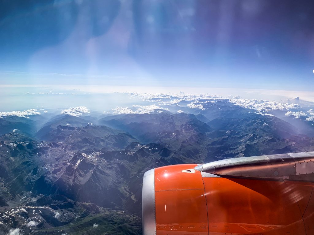
The Alps seen from the plane
It was time to book a one-way flight to Geneve. I didn’t know what to do after TMB, therefore it was better not to stick to a specific return date. I was sure there would enough time to think about the next steps while hiking or resting in a tent!
When to go
The best period (and the busiest) to hike TMB is definitely summer, more precisely July – August. June and September as shoulder months could be an option too, but the weather will definitely be more unpredictable and snow can be experienced at higher elevations.
Clockwise or Anti-clockwise
I chose to follow anti-clockwise direction, starting and finishing in Les Houches. It seems to be a way more popular option. However, after completing the track, I don’t think that going clockwise would make any significant difference.
First day on TMB
By going with the flow, it’s easier to make friends on the way as you see the same faces every day. On the other hand, if walking anti-clockwise, the track will be mostly empty in the morning hours, until you meet groups of hikers going from the opposite direction. It gives you the chance to enjoy a more secluded atmosphere. I don’t mind having other hikes around me but everyone has their own vision of encounter with nature.
If hiking clockwise, it is advised to start elsewhere than Les Houches to avoid 1500m killer ascent to Le Brevent on the first day when your body may still not be used to heavy backpack and increased physical effort. From that stage I clearly remember never ending descent and how sorry I felt for all the people going up. Consider starting in Argentiere, Champex or Courmayeur instead.
Where to stay
There is plenty of options to choose from if you have deep pockets. Private accommodations, hotels, refuges. I took my tent and camped every single night. Obviously it was the most cost efficient way, but to be honest I can’t imagine going for such a hike without a tent. This makes the whole experience complete.
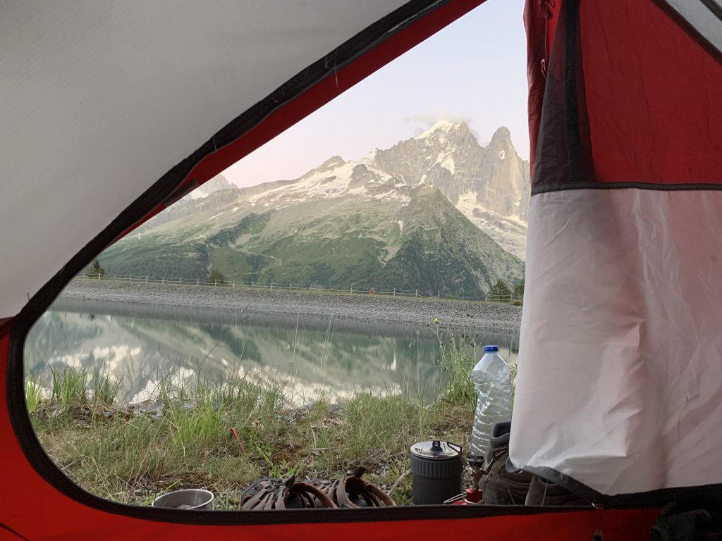
On the last day, I set my tent next to Refuge la Flegere and decided to treat myself with a proper dinner there. The food was nice, the chat with other hikers was nice but somehow I felt happy when I went back to my tent immediately after the meal. To find my own peace and rhythm.
Moreover, I didn’t have to bother at all about any bookings. I simply arrived at the campsite and had no issue with finding a spot. All the other options, especially refuges, require bookings well in advance, especially in COVID-19 times when the number of spots is even more limited.
Camping next to Refuge la Flegere
The website www.montourdumontblanc.com makes planning very handy. You can choose your departure point at the specific date and it shows you the list of accommodations on the way, including walking distance. Really cool!
There are plenty of alternatives and I will mention some of them in the separate articles dedicated to specific sections.
Wild camping is discouraged or forbidden, depending on the country. I didn’t do it so I have nothing to say in this topic. In Italy, wild camping is allowed above 2,500 m a.s.l. In Switzerland, it’s forbidden when in France no one really knows what the rules are and it’s usually tolerated. Some people set the tent at sunset and leave at dawn. Do it at your own responsibility and needless to say, leave no trace.
What to pack
As I was camping all the way, most of my backpack was filled with equipment that made the experience comfortable and hassle-free:
Sandals (I have the ones from KEEN and they were great to get around the camps)
Flip flops
Other:
Ultralight towel
Hiking poles (extremely useful!)
Painkillers
Toiletries
Wet tissues
Plasters for blisters (Compeed brand is great)
Sunglasses
Suncream
Optional:
Thermal underwear – it wasn’t really that cold to use it, but if your sleeping bag is not too thick, it could be a good option to wear for sleeping.
Buff – if it gets windy, you may put it on your head or neck. I used it also to wipe sweat from my forehead 🙂
Water filter – never used on TMB but good to have just in case.
I did laundry almost every day and on the next day my backpack looked like a Christmas tree with socks and undies as decorations. It was the only way to dry them though.
When it comes to food, you will be able to refill your stocks along the way so no need to add more weight into your backpack. I usually had food for 2 days, in case of an emergency stop due to bad weather or sickness.
Here are some examples of what I usually eat on the track:
Breakfast:
Bread with jam, honey or peanut butter
Instant cereal with fruits or porridge
Biscuits with jam
Powdered milk
Banana
Tea or coffee
Lunch:
Bread
Cheese
Salami
Humous
Ready to eat sausages
Instant soup
Tea or coffee
Dinner:
Instant rice or pasta
Tinned tuna or chicken
Instant soup
Freeze-dried meal
Tea or coffee
Snacks:
Chocolate
Muesli bars
Biscuits
Nuts
How to get there
Most hikers fly to Geneve and take a bus to Chamonix, so did I. Flying directly from the holidays in Spain, I didn’t have sufficient time to look for the most affordable option and I booked a shuttle bus from Mountain Drop-Offs. It cost me 40 EUR and I was the only passenger on board. It’s very easy to find their box at the airport and over an hour later I was already at the campsite in Chamonix.
On the way back, I used the service of BlaBlaBus which took a bit longer but was significantly cheaper (around 22-25 EUR).
Travel by train is possible as well but it’s more complicated and usually requires catching at least two connections.
Track markings
Budget
In total I spent 300 EUR, starting from day 0 after arrival to Chamonix when I bought a gas bottle, lighter, shoelaces and some food. Flight ticket and transportation from Geneve airport need to be added on top of that.
Campings were the most expensive in Switzerland: ~17-22 EUR per night. The exception was La Peuty for only 6 EUR, but the facilities were very basic. In France setting up a tent costs usually between 10-12 EUR and in Italy 12-15 EUR per night.
Everything else was mostly food. Spaghetti bolognese, pizza, panini, burger and even McDonald’s once back to Chamonix 🙂 Even though I mostly stocked in supermarkets and cook by myself, all of these meals are tempting and if you are tired, it isn’t easy to resist.
My itinerary:
Finishing the track took me 9 days, tackling a lot of variants which made the route a bit more difficult than the standard one. Some people do it faster, some people do it slower. It doesn’t really matter. Take your time, don’t rush and enjoy the views. I planned to take a day off in case of pouring rain, but it never came so every day I slept in different location 🙂 Being so lucky, there was no point in wasting such perfect weather conditions!
Day 1: Les Houches – Les Contamines (via Refuge de Miage) Day 2: Les Contamines – Les Chapieux Day 3: Les Chapieux – Courmayeur (via Refugio Maison Vieille) Day 4: Courmayeur – Arp Nouva (via Col Sapin) Day 5: Arp Nouva – La Fouly Day 6: La Fouly – Champex Day 7: Champex – Trient (via Fenettre d’Arpette) Day 8: Trient – La Flegere (via Lac Blanc) Day 9: La Flegere – Les Houches
Col de la Seigne – border between France and Italy
Final thoughts
Tour du Mont Blanc is absolutely amazing. In fact, it’s the first hike that I could imagine doing one more time straight away. Planning the stages, taking in all the sights and arriving at the campsite being filled with satisfaction. Setting up the tent, preparing dinner on a gas stove, far away from daily routine. Knowing that the next day will bring more good vibes.
It’s hard to describe the feeling on the last day. Being very tired, I was walking the final kilometres to Les Houches with a wide smile on my face, thinking of all the preparation, flight to Geneve, bus to Chamonix and completing all the stages. Adventure came to the end, but what an adventure it was!
If you are a hiking enthusiast and were thinking of doing a long-distance hike in the Alps, just do it. Do it now, not later. To be honest, I am always against postponing personal plans for later, as later can never come. The memories will enrich and stay with you forever.
The night at Zygmuntówka was nice and calm. It was almost completely empty and I had the room for myself. A group of 3 more hikers were staying in otherwise a very busy place. Seems that the early stage of COVID-19 pandemic locked at home most of the nature enthusiasts.
The plan for that day was to reach Silver Mountain (Srebrna Góra) and have a chill afternoon filled with sightseeing of historic strongholds. The weather was supposed to be bad and unfortunately, it was. From the walking perspective, it happened to be one of the most miserable days on the track. I walked simply to cover the distance, without any views whatsoever. Just clouds, fog, rain.
Route: Zygmuntówka Hut to Silver Mountain (Srebrna Góra) Distance: ~ 17 km
The track starts with proper ascent and after 15 minutes I had to stop to take off one layer of clothes. Hiking in this kind of weather is always weird. If you stop, you are instantly cold. If you walk, you are too warm and sweating. Well, it started to rain so I didn’t have to worry about sweating anymore.
After around 2.5 km from Zygmuntówka Hut, I reached the base of Kalenica viewing tower (964m a.s.l.). Going up was pointless, especially that I could hardly see the top of it in the fog. But I did go, maybe stupidly thinking that the clouds would magically disappear. They didn’t (surprise, surprise).
Next 5 km of descent towards Woliborska Pass (Przełęcz Woliborska, 711m a.s.l.) leads me through Popielak (856m a.s.l.) and Wigancicka Lea (Wigancicka Polanka, 794m a.s.l.).
It’s a crossroad with road 384 and there is parking for day walkers. However, for normal people, the day like that is usually a series or movie day, with hot tea and snacks on a comfortable couch, rather than hiking.
I warmed up again when going up towards Szeroka (826m a.s.l.), after which the track descents to Under the Szeroka Pass (Przełęcz pod Szeroką, 764m a.s.l.). It goes through the forest all the time and besides one lost opportunity to admire the views at Kalenica viewing tower, I probably didn’t miss a lot even with the fog around.
Ahh… and you may wonder why there are no pictures so far, but my camera was deep in the backpack, secured with a plastic bag.
It’s another ~1km to Malinowa (839m a.s.l.) from where it’s easy and gentle downhill walk all the way (~6km) to SIlver Pass (Przełęcz Srebrna, 568m a.s.l.). The famous fortress is just on my left side but being soaked isn’t nice, therefore my idea is to go to the hotel first, put on some dry clothes and go out for sightseeing. To do that, it’s time to leave red track and follow an asphalt road towards the town centre.
Houses at the centre of Silver MountainMuch better weather on the next day!Silver Mountain from a drone
Holiday House “Under Forts” (Pod Fortami) at Widokowa 1 street was reasonably priced and had quite good reviews. The owner was really nice too and she offered to take my wet shoes and put it next to the heating to dry faster. Nothing is worse than wet shoes, so I was sooo grateful!
What to see in Silver Mountain (Srebrna Góra)
After a ridiculously long hot shower, it was time to see what the town stretched along a steep valley has to offer. Its name comes from the silver deposits discovered in this area, which unfortunately were not very abundant.
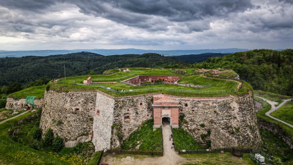
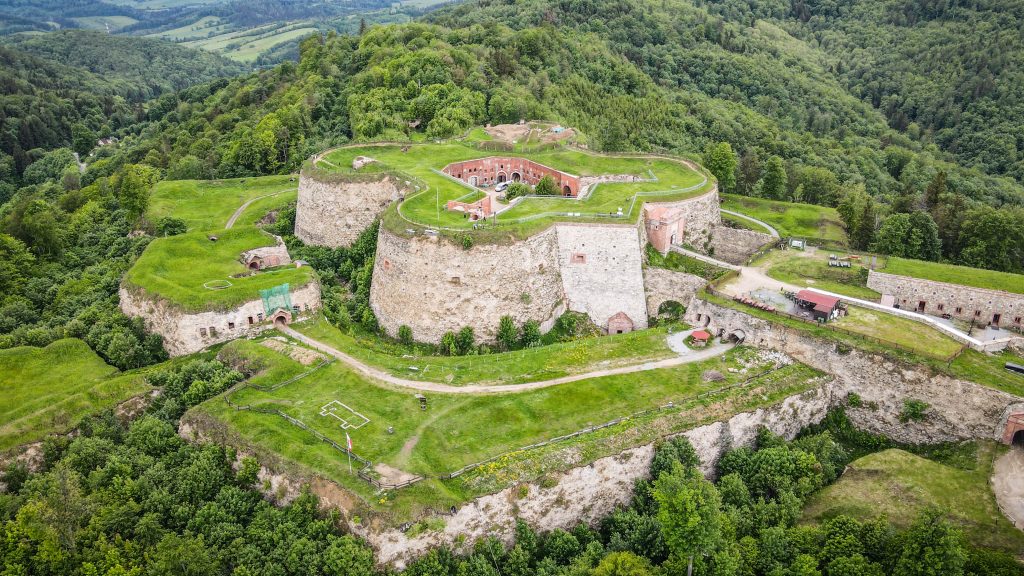
Fortresses complex is open for tourists and makes the town a very popular one on the itinerary around the Lower Silesia region in Poland. You can get combined ticked for 34 PLN to access two major forts (doesn’t have to be on the same day).
Fort Silver Mountain
A huge number of Prussian workers were employed for its construction (4,000 people supported by the local population) which took only 12 years (1765-1777). The attack of Napoleon’s army in 1807 was repulsed and Silver Mountain Fortress can boast the title of never conquered. Warehouses, wells, an armoury, a chapel, a prison, a hospital, a bakery, a brewery, a craft workshop, a powder magazine – all these were located inside the Donjon, ensuring it’s self-sufficient for many months. Up to this day, it’s the largest mountain fortress in Europe.
The guided tour was on top quality and was led by a guide dressed in the uniform of a historic regiment from the Napoleonic era. She shared a lot of information about the service and life in the fortress. In the end, she demonstrated a shot from a firearm. How loud it was! Hard to imagine being inside the fortress during the real battle.
Fort Silver MountainFort Silver MountainPanoramic views from Fort Silver Mountain
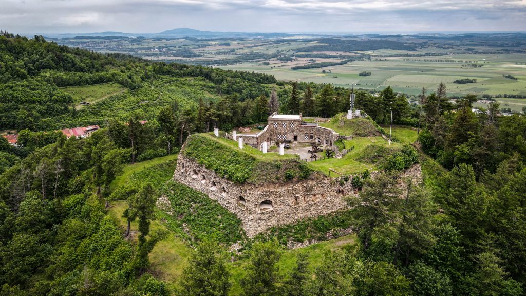
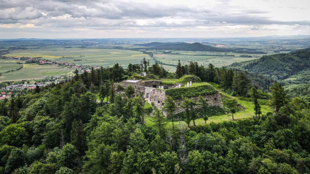
Fort Spitzberg-Ostróg
It was built in 1769-72 on the top of the Ostróg Mountain (627 m a.s.l.) with the main objective to block the Silver Pass and defend the southern flank of the main fort. Today it can be visited with a guide, who is quite a good actor and make the experience very enjoyable. In the 1930s the place was the training centre for Hitlerjugend while in the period of World War II there was a rigorous prison, and later a POW (prisoners of war) camp for high officers of the Polish Army.
Fort Spitzberg-OstrógFort Spitzberg-Ostróg
Fort High Rock
The least popular and impressive from all the forts in Silver Mountain. The purpose of it was to defend the approach the main fort and to control the town and the surrounding hills. It has been recently renovated and should be accessible for tourists, but I skipped it that time.
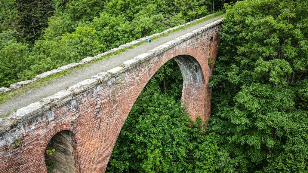
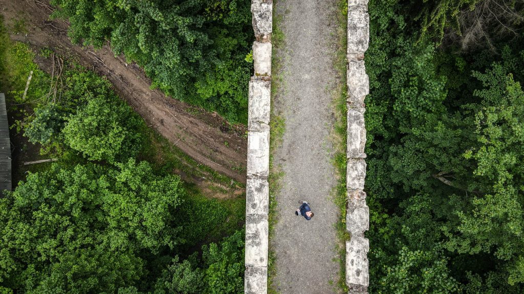
Viaducts of the Owl Mountains Railway
The Sowiogórska Railway was established in 1902, led from Dzierżoniów to Radków (55 km) through Srebrna Góra and the ridge of the Owl Mountains. It was to serve mainly as a tourist attraction, but also for the transport of coal from the mines in Słupiec and Nowa Ruda.
The section between Srebrna Góra and Woliborz required construction of two brick viaducts: Srebrnogórski and Żdanowski. The first one is easily accessible from Silver Pass and the second one is a bit further – follow the green track.
Srebrnogórski ViaductSrebrnogórski Viaduct
Walk around the town (church and around)
Silver Mountain is a really nice town to explore on foot, especially the area around the square with Apostles St. Peter and Paul Church.
For dinner, check out Stodoła – they have good pizzas but also salads and burgers.
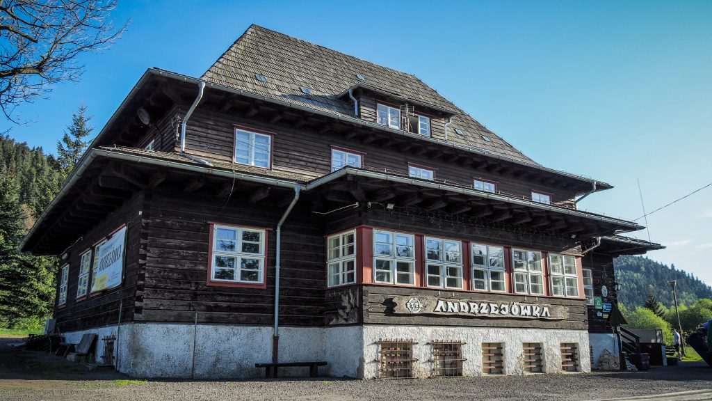
Nearly 30 km to go, no time to waste. Hiking or not, breakfast is always an important meal and somehow it just sets the mood for the rest of the day. I went for pancakes with cheese and red berries at Andrzejówka Hut. The portion is huge. Finished the first pancake and took the second to eat later, somewhere in nature.
Route: Andrzejówka Hut to Zygmuntówka Hut Distance: ~ 28-29 km
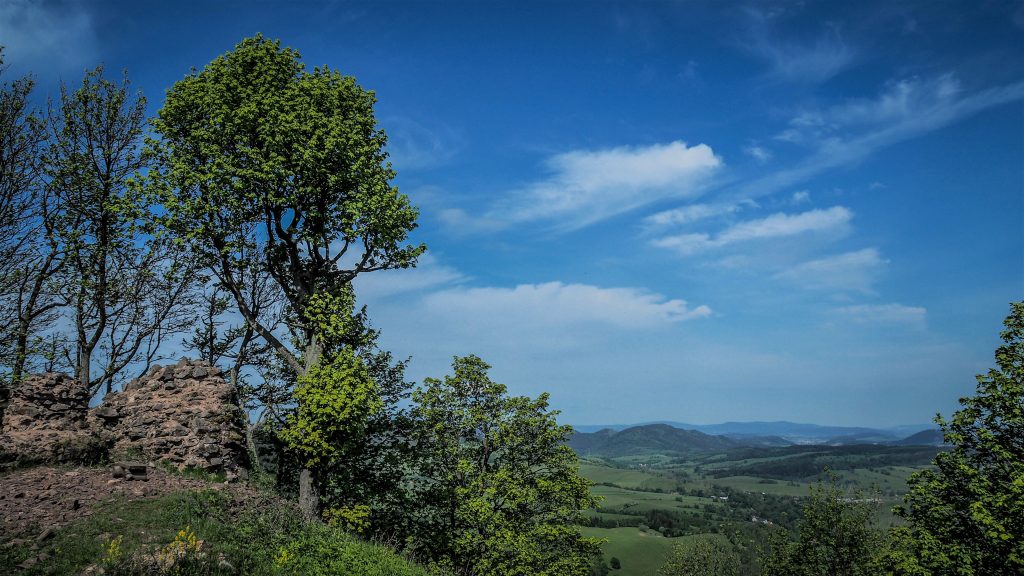
The track begins rather moderately and after less than a kilometre, I am at Turzyna (898m a.s.l.) from where it’s another 3 kilometres to the ruins of Rogowiec castle. For castle enthusiasts – nothing much to see here, but as a viewpoint, it’s totally worth a stop. To get to the ruins I have to leave the red track and follow the yellow one which later on merges with red again, making it a super easy detour.
Decent views from Rogowiec castle
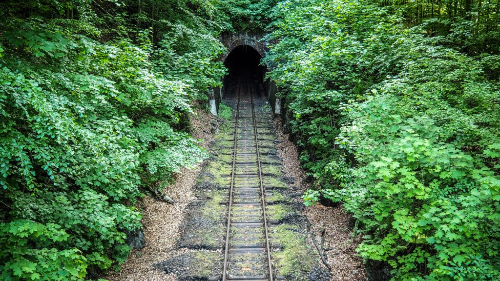
Now it’s time for 2 kilometres of easy descent through the forest towards Rybnica Mała. I am not far from Jedlina Zdrój but first I need to go up to Wawrzyniak Pass (568m a.s.l.) and cross the railway tracks before entering the town.
The track crosses the road 381 and leaves the town immediately, but it is worth to take a short detour and check out Jedlinka Palace. Unfortunately, due to COVID-19, the place was open for tourists only on the weekends, so I couldn’t go inside. Nevertheless, it’s a beautiful building to see from the outside and have a lunch break on the grass in front of it. The building was built at the beginning of the 17th century as a baroque manor house. In the years 1944–1945, it housed the design office of the Nazi Todt Organization and is closely connected to many other Nazi locations in the Owl Mountains and Włodarz Massif.
Railway tunnel near Jedlina Zdrój
After the lunch break, it’s time to sweat. The track climbs to Marcowa Pass. It’s already after 1 PM, so the temperature doesn’t make it easier. It’s a scenic fragment of the track though! After Marcowa Pass (Przełęcz Marcowa) it becomes flatter and here I met a couple following Main Sudetes Trail as well, but not in one push like me but they split over a couple of visits in the region. The guy seems to be a real hiker with huge experience in Polish mountains so it’s a pleasure to listen to his stories and the time (and distance) flies fast until we reach the Eagle’s Pass (Przełęcz Sokola).
First issues with the weather appeared when I saw dark clouds on the horizon, the sun was burning like crazy and I couldn’t stop the feeling that it had to end with a storm. 8 kilometres left to Zygmuntówka Hut but on the most difficult terrain of the day.
I started the ascent from Eagle’s Pass (754m a.s.l.) to the Great Owl (Wielka Sowa – 1015m a.s.l.). There was a lot of people on the track, going to the observation tower. Dark clouds were getting closer and I could already see the lighthouse-like construction at the top of the Great Owl when I heard the first thunder.
Viewing tower at the top of the Great Owl
I didn’t go up the viewing tower but rushed towards my final destination. Seems that not too many people venture beyond as the track became totally deserted. Luckily it’s mainly downhill so I was moving really fast. Unfortunately, the wind was getting stronger and stronger and I knew it’s only a matter of minutes to feel first drops of rain on my head. It started around Kozia Równia, so 2 kilometres before Zygmuntówka Hut. I put a rain jacket and rain cover on my backpack and continued walking for another 1 kilometre. Suddenly, the rain started to be simply insane and thunders were getting launder. Luckily, I noticed a wooden structure, full of rubbish and empty beer bottles inside, but good enough to spend next hour there waiting for the storm to calm down.
I knew I am very close to the hut, but it really didn’t make sense to push in such weather conditions. After a perfect sunny day with blue sky, a few hours later everything was covered in clouds and the temperature was dropping together with heavy rain. Quite common in the mountains, isn’t it?
Drone flight after the rain was entremely picturesqueClouds hanging above Zygmuntówka HutPanoramic views just in front of the hutZygmuntówka Hut
I reached the hut totally soaked, yet satisfied. It was a challenging day without the happy ending but damn, so enjoyable. After all, that storm will stay in my memories and I created my own happy ending – with the Owl’s beer (Sowie).
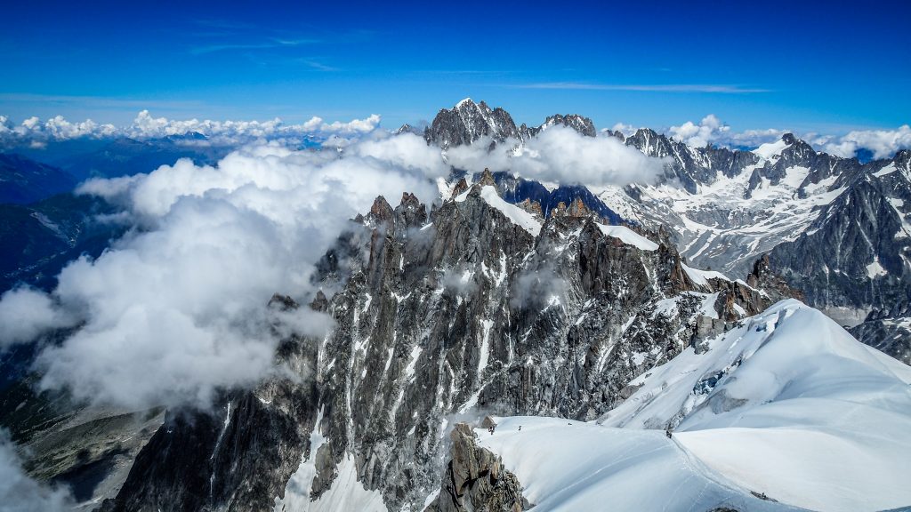
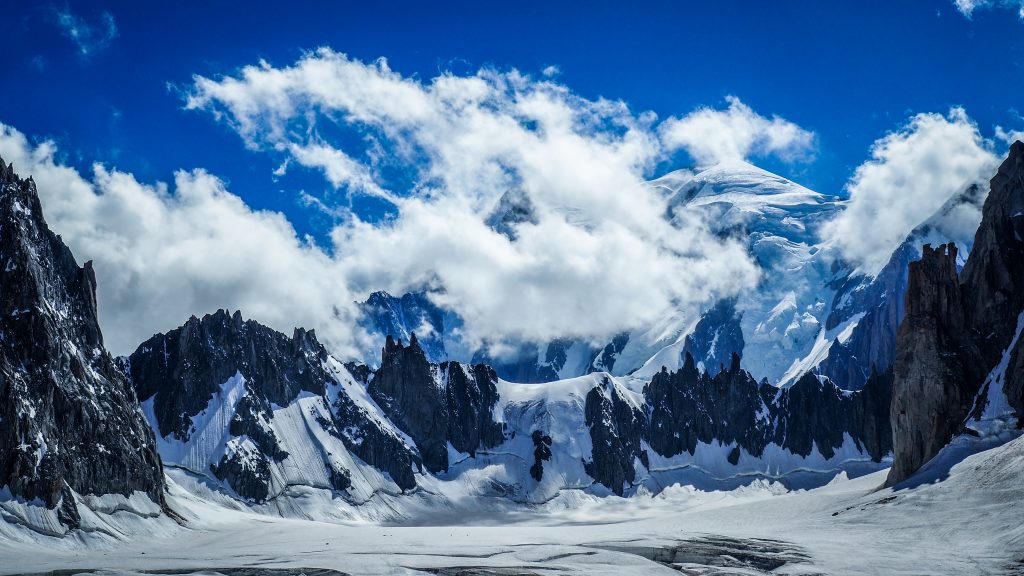
The main attraction bringing tourists to Chamonix-Mont-Blanc, commonly known as Chamonix, is Mont Blanc. The summit of the highest mountain in Western Europe is at 4810m a.s.l. and the first successful ascent by Jacques Balmat and Michael Paccard took place on August 8th 1786, causing a significant boom in mountaineering.
Winter sports were always popular in the region and it resulted in the first Winter Olympics organized here in 1924.
Mont Blanc MultiPass
Following below itinerary, you will save a lot of money by purchasing a 1-day version of Mont Blanc MultiPass. It costs 68 EUR, while return ticket for the cable car to Aiguille du Midi costs already 65 EUR. Totally worth it!
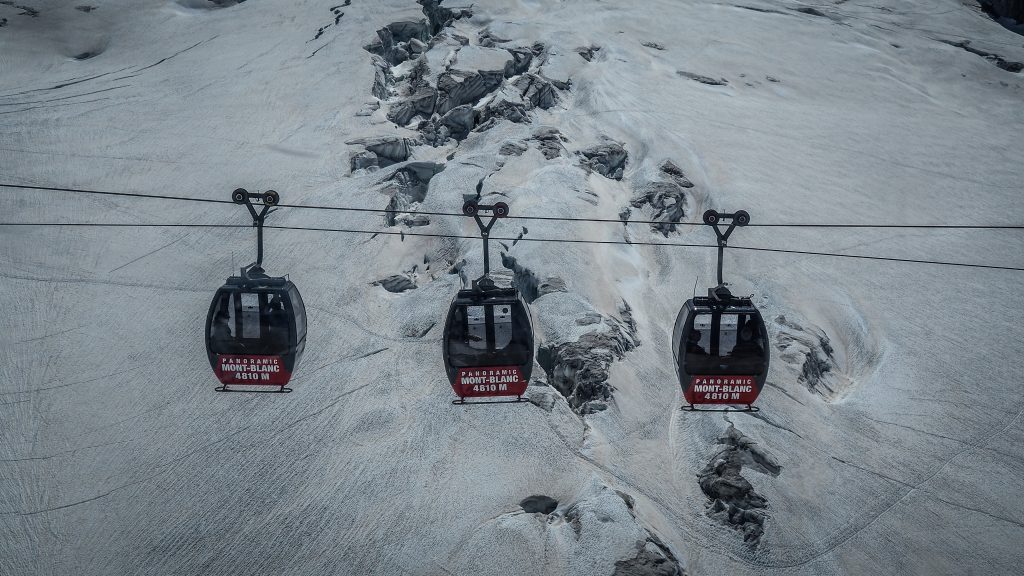
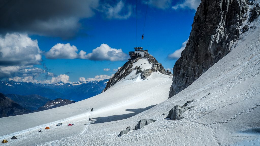
Aiguille du Midi
It’s impossible to miss a huge cable car station in the centre of Chamonix. Looking up, you can see the destination and the upper station at a height of 3,777m a.s.l. with o the summit terrace at 3,842m a.s.l. One can’t get closer to the summit of Mont-Blanc without hiking or climbing. It only takes around 20 minutes to get there, starting at the altitude of 1035 m a.s.l. It’s like a journey to a different world. Alpine world.
There is usually a lot of people but also a lot of space on the terraces to observe the panorama of the French, Swiss and Italian Alps, of course including the king – Month Blanc.
View to Aiguille du Midi from Chamonix centreUpper station of Aiguille du Midi cable car
At this altitude, it is usually much colder and windier than down in the valley, so take an extra layer but also sunglasses and suncream.
You may want to check out extra attractions such as small exhibition, cinema or something called Step Into the Void. It’s a 2.50 m glass cage out over a 1000 m precipice. Waiting lines are usually long here so I didn’t want to lose time just to take one picture.
Gondola ride to Aiguille du Midi is included in Mont Blanc MultiPass, otherwise, return trip costs 65 EUR.
Panoramic Mont Blanc Gondola (optional)
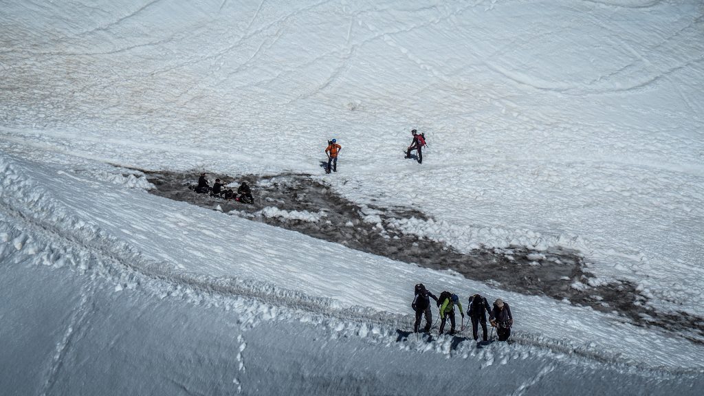
The Panoramic Mont-Blanc gondola is not included in Mont Blanc MultiPass but for me, it’s the most awesome ride in Chamonix region. For an extra 32 EUR, it takes you from Aiguille du Midi over the Glacier du Geant seracs and crevasses to the Pointe Helbronner in Italy. One way ride takes around 30 minutes.
There are a lot of hikers who challenged themselves to tackle the highest mountain in the Alps and their camps are like colourful pins on a white sea. I feel the strong atmosphere of this place. Will I ever be able to stand at the top of Mont Blanc? I have no experience in mountaineering whatsoever, but it’s never too late to learn.
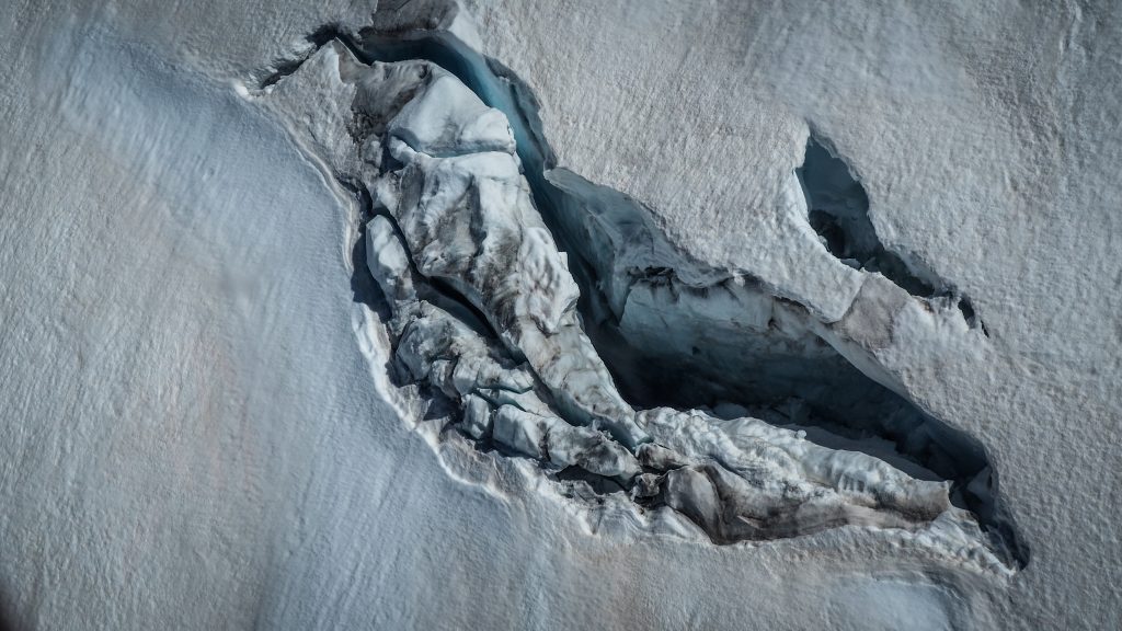
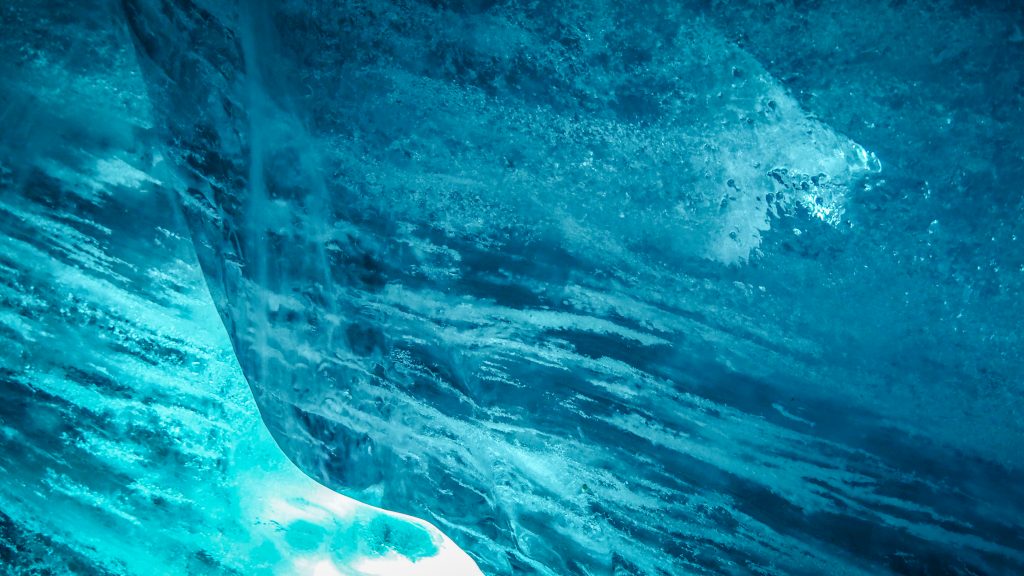
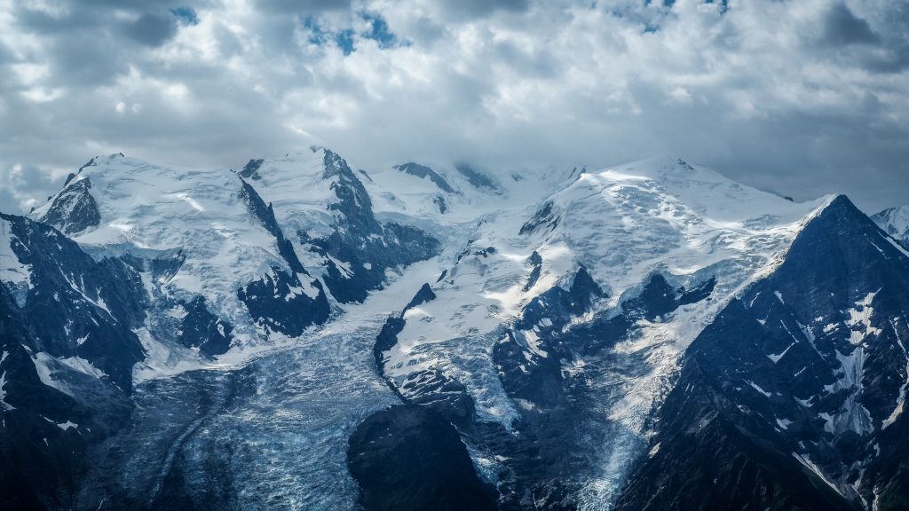
Mer de Glace
From Plan de l’Aiguille du Midi, which is the mid-station of Aiguille du Midi gondola, take a scenic track known as Grand Balcon Nord towards Mer de Glace. It takes 2 – 2.5 hours and it’s a wonderful alpine walk.
In English, Mer de Glace means the Sea of Ice. It’s the largest glacier in France, 7km long and 200m deep. Being heavily covered in debris, it doesn’t look like it at all. But take your time, use your zoom lens or binoculars and you will understand how impressive it is.
Panorama of glacier
Obviously, it was even more impressive some years ago. After reaching Montevers train station, check out small exhibition located dedicated to the history of glaciers in Glaciorium. Then, take a small cable car down to the ice cave. From the cable car lower station, there is still a long descent on metal platforms and steps. Every year new platforms are added and the way down is getting longer. Why? There are a lot of information boards along the track indicating the level of the glacier in the last years. It is really scary to see how fast it’s receding.
Ice cave itself was not very impressive but maybe it’s because I saw similar attractions in Switzerland before. When I was there, it was way too crowded to really enjoy the experience.
Inside the ice cave
The Montevers train, even though looking cute, was even more crowded with tourists and hikers with big backpacks and equipment. The ride is included in Mont Blanc MultiPass, otherwise, one-way ticket costs 28.50 EUR.
Le Brevent
Another popular gondola lift takes you from Chamonix to Plan Praz (2000 m a.s.l.), from where you continue by cable car to the top of Le Brevent (2525 m a.s.l.). Views to the south slope of Mont Blanc are terrific and there are nice walks in the area as well, such as Grand Balcon Sud or Lake Cornu.
The ride is included in Mont Blanc MultiPass, otherwise return ticket costs 34 EUR.
If you are about to hike Tour du Mont Blanc, you will conquer Le Brevent anyway by foot, so going there by cable car won’t make sense.
View to the south slope of Mont BlancView from Le Brevent
Chamonix
In such a case, spend the afternoon visiting the Alpine Museum in Chamonix. It’s quite cheap compared to other attractions in the area and for 6 EUR you can easily spend an hour here learning about the increasing popularity of mountain hikes, followed by the construction of cable cars and gondolas to meet the demand. All of that resulted in the development of the popular French mountain resort – Chamonix.
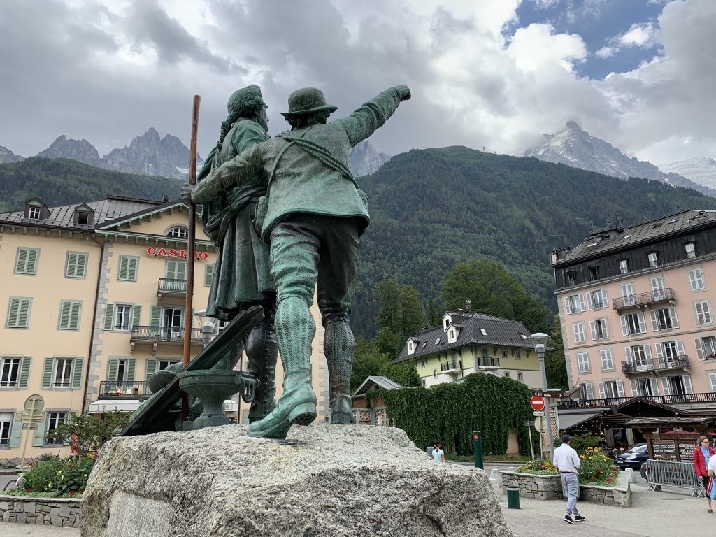
The town is extremely charming, despite the crowds of tourists. Spend your evening strolling on the streets. Don’t miss the statue of Balmat and Saussure. In 1760 Horace Bénédict de Saussure challenge climbers offering a financial prize to the first people setting foot on the top of Mont Blanc.
The statue of Balmat and Saussure in Chamonix
After several unsuccessful attempts, on August 8th 1786 two local Chamonix men finally made it happen. They were Jacques Balmat and Dr Michel Gabriel Paccard. As always, it’s all about money and a great story which in that case promoted Balmat, making him a local superstar. The role of his companion was consistently ignored and downgraded.
The second bronze statue to commemorate Dr Paccard was erected only in 1986. It stands only a few meters away and somehow nicely corresponds to the original story. Paccard calmly looks at the mountain when Balmat and Saussure stand in the spotlight, pointing at the summit in clearly visible excitement.
After most of the previous day spent in Krzeszów, when the weather was rainy, then sunny, then stormy again I was really happy to wake up and see perfectly blue sky. It always gives some extra boost of energy in the morning!
The plan for today was to reach Andrzejówka Hut and spend the night there. Due to COVID-19 and uncertainty what is open and what is still closed, I gave them the call to confirm availability. They said they are in the middle of renovation but still have some rooms available and I am welcomed. Great news! After the night spent in Odrodzenie Hut in Karkonosze Mountains, I had only good memories and was looking forward to staying again in a proper mountain hut rather than private accommodation in the village.
Route: Krzeszów to Andrzejówka Hut Distance: ~ 22 km
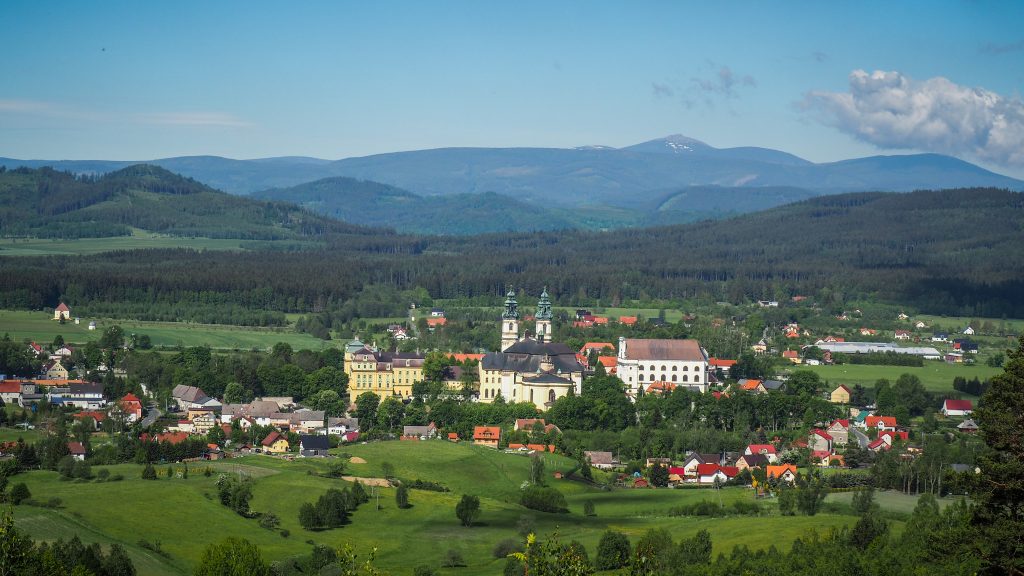
For the first 2 kilometres after leaving Krzeszów, the track takes me uphill towards Mount of Saint Anna (Góra Św. Anny), where I can have a closer look at the chapel seen the day before from a drone. From here, I look for a very last time to the panorama of Krzeszów.
Panorama of Krzeszów seen from Mount of Saint Anna
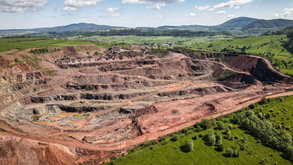
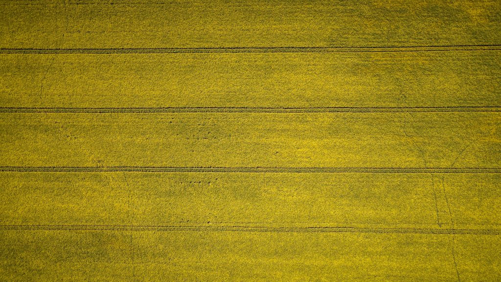
Then, it’s another 4 kilometres through the area called Hills of Krzeszów (Krzeszowskie Wzgórza) to the village Grzędy. Mostly in the forest, however as I get closer to the village, the forest is left behind and I see huge fields of yellow-blooming rape. It seems to be a great scenery for drone footage, therefore it’s time for a short break. With a drone, I discovered something that otherwise I only heard from the distance – melaphyre mine.
Melaphyre mine around GrzędyFields of yellow-blooming rape seen from the drone
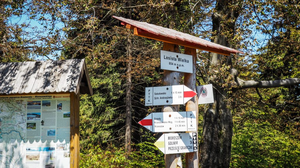
From Grzędy, the next destination is Sokołowsko, roughly 10 kilometres away but with significant ascent (~450m) and descent, passing through mountains, such as Mount Sucha (Sucha Góra – 767 m a.s.l.), Great Lesista (Lesista Wielka– 854 m a.s.l.) and Ostrosz (792 m a.s.l.).
But after walking through the Grzędy village, the most unpleasant section of the day begins. First, it’s over 2 kilometres walk on an asphalt road with cars passing by and then when it’s time to get back to the forest, the track is so poorly marked that I couldn’t find a way without double-checking it in the phone. It goes left into which seems to be a backyard of somebody’s house, but after you pass it, there is, in fact, a proper road. Moments like this give me a lot of frustration. Nowadays you can find detailed maps and descriptions online, but on the other hand, it would be so easy to mark it. Yet, no one cares. I would suggest to save yourself time as well as nerves and always have at hand mobile map, such as the one at www.mapa-turystyczna.pl
The steep descent from Great Lesista takes me all the way to the crossing with road 35 and then again the walk on asphalt road begins. Not pleasant at all, especially in full sun. In about half an hour I am at Sokołowsko and here I made short detours around the town to check out the sights.
The Great Lesista (854 m a.s.l.)
In 1849 countess von Colomb arrived at the village, which had a significant impact on its further development. She found the area so nice and relaxing that she went one step further and persuaded her brother-in-law, Doctor Hermann Brehmer, to open a health resort. In 1855, worlds first specialized tuberculosis sanatorium was ready and the village was named after Professor Alfred Sokołowski, Brehmer’s co-worker.
Shortly after entering the town, I find old Sanatorium Grunwald on the right side of the road. After the fire in 2005, today it’s still a ruin, however there are works going on at some day it may come back to the old glory.
Sanatorium Grunwald
Turning right into Parkowa Street, I reach Orthodox church of St. Michael the Archangel. It was built to meet the religious needs of patients who came in large numbers from Russia.
Orthodox church in Sokołowsko
Other than that, it’s just nice to walk around and admire old buildings and architecture, of once popular and today forgotten by the world spa town.
SokołowskoSokołowskoSokołowskoSokołowsko
From Sokołowsko, the fun begins as according to my resources, the ascent to Bukowiec and into Dry Mountains (Góry Suche) is one of the steepest on the track. I meet a group of people that just went down and I see big smiles on their faces when they see me walking the opposite way. Well, if I didn’t like to go up and down, then I wouldn’t go to the mountains 🙂 It was steep. It was tiring. It took me quite some time and around 3-4 breaks on the way up. I think the main problem was my heavy backpack and the fact that I already had some kilometres in my legs.
Views from the climb to Bukowiec
From here, only ~2.5 km left to Andrzejówka Hut and the section was mostly in the forest, having another melaphyre mine on the left side, which couldn’t be clearly seen but could be clearly heard.
Andrzejówka Hut was not as remote as mountain hut should be, at least to match my expectations. To be honest, it isn’t remote at all, there is an asphalt road leading to it from one side so there is a lot of day visitors walking around and enjoying food and drinks. By then I didn’t know yet that it’s rather normal in the Polish mountains. Mountain huts are like restaurants giving you an option to stay for the night, rather than remote shelters to which you have to carry your own food and fuel, as it was during my hikes in New Zealand. Well, now I know.
The room had 2 bunk beds but due to COVID-19 restrictions, I was the only one in the room. I enjoyed dumplings, apple cake and a coffee at a terrace and started planning the next day.


: Kudowa Zdrój – Duszniki Zdrój")


: Wambierzyce – Kudowa Zdrój")


: Silver Mountain – Wambierzyce")


: Zygmuntówka Hut – Silver Mountain")

: Andrzejówka Hut – Zygmuntówka Hut")


: Krzeszów – Andrzejówka Hut")