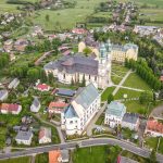
: Krzeszów – Andrzejówka Hut")
After most of the previous day spent in Krzeszów, when the weather was rainy, then sunny, then stormy again I was really happy to wake up and see perfectly blue sky. It always gives some extra boost of energy in the morning!
The plan for today was to reach Andrzejówka Hut and spend the night there. Due to COVID-19 and uncertainty what is open and what is still closed, I gave them the call to confirm availability. They said they are in the middle of renovation but still have some rooms available and I am welcomed. Great news! After the night spent in Odrodzenie Hut in Karkonosze Mountains, I had only good memories and was looking forward to staying again in a proper mountain hut rather than private accommodation in the village.
Route: Krzeszów to Andrzejówka Hut
Distance: ~ 22 km
For the first 2 kilometres after leaving Krzeszów, the track takes me uphill towards Mount of Saint Anna (Góra Św. Anny), where I can have a closer look at the chapel seen the day before from a drone. From here, I look for a very last time to the panorama of Krzeszów.
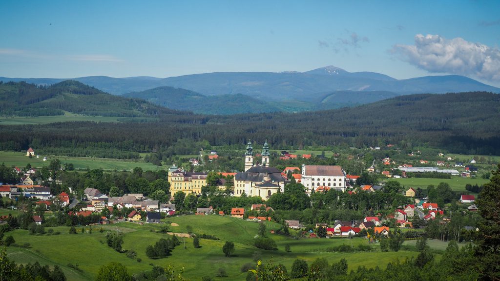
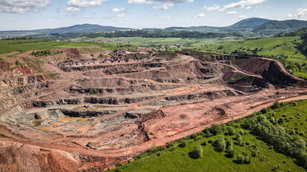
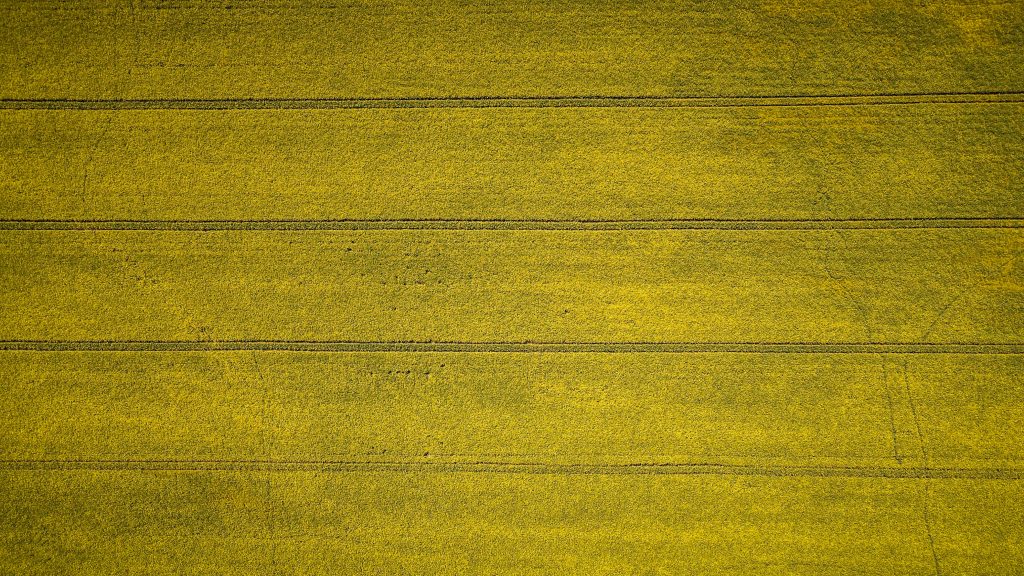
Then, it’s another 4 kilometres through the area called Hills of Krzeszów (Krzeszowskie Wzgórza) to the village Grzędy. Mostly in the forest, however as I get closer to the village, the forest is left behind and I see huge fields of yellow-blooming rape. It seems to be a great scenery for drone footage, therefore it’s time for a short break. With a drone, I discovered something that otherwise I only heard from the distance – melaphyre mine.
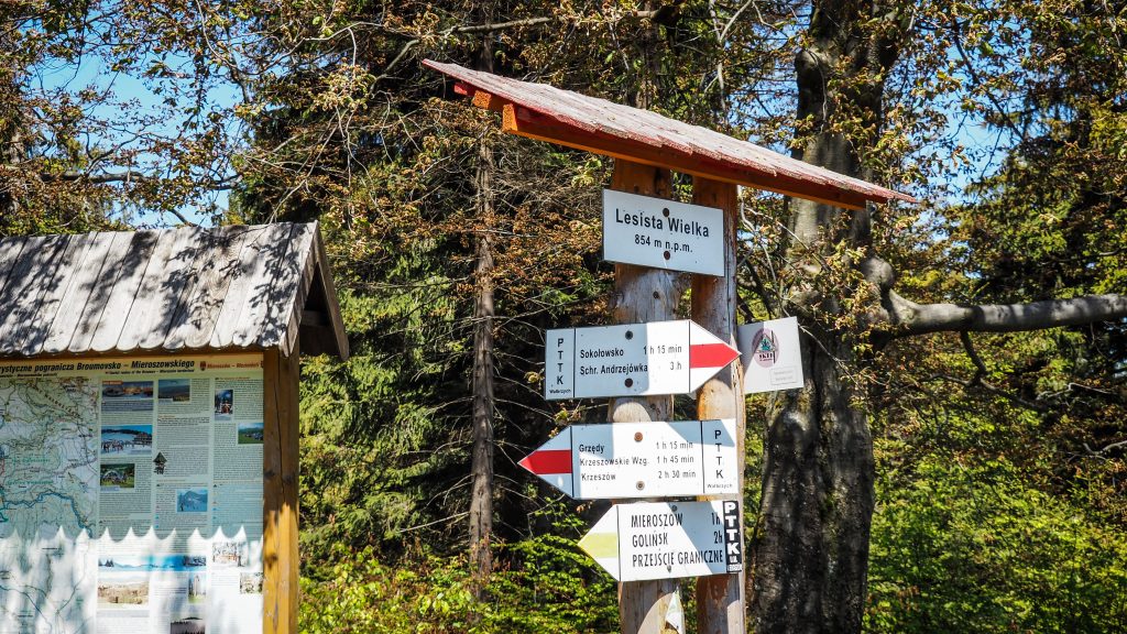
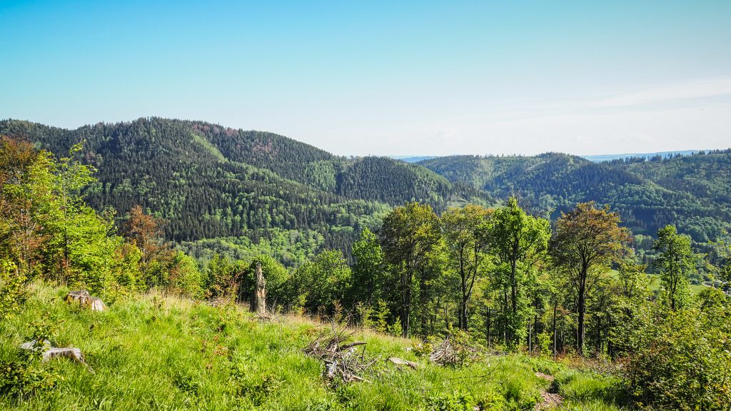
From Grzędy, the next destination is Sokołowsko, roughly 10 kilometres away but with significant ascent (~450m) and descent, passing through mountains, such as Mount Sucha (Sucha Góra – 767 m a.s.l.), Great Lesista (Lesista Wielka – 854 m a.s.l.) and Ostrosz (792 m a.s.l.).
But after walking through the Grzędy village, the most unpleasant section of the day begins. First, it’s over 2 kilometres walk on an asphalt road with cars passing by and then when it’s time to get back to the forest, the track is so poorly marked that I couldn’t find a way without double-checking it in the phone. It goes left into which seems to be a backyard of somebody’s house, but after you pass it, there is, in fact, a proper road. Moments like this give me a lot of frustration. Nowadays you can find detailed maps and descriptions online, but on the other hand, it would be so easy to mark it. Yet, no one cares. I would suggest to save yourself time as well as nerves and always have at hand mobile map, such as the one at www.mapa-turystyczna.pl
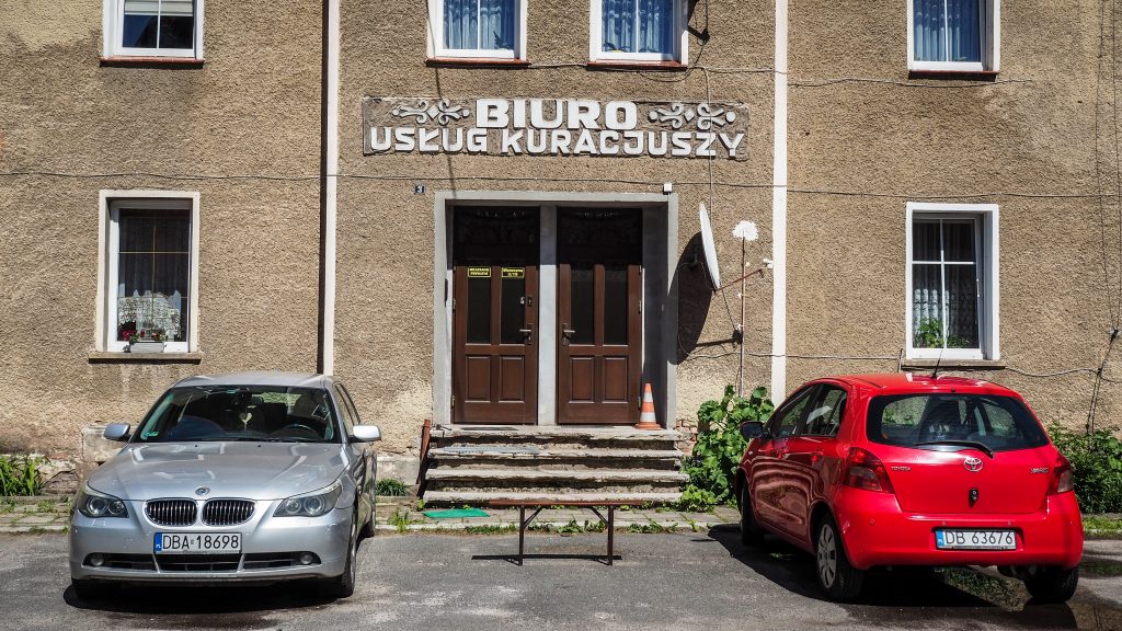
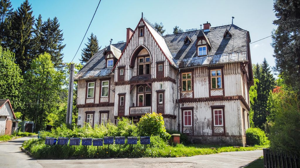
The steep descent from Great Lesista takes me all the way to the crossing with road 35 and then again the walk on asphalt road begins. Not pleasant at all, especially in full sun. In about half an hour I am at Sokołowsko and here I made short detours around the town to check out the sights.
In 1849 countess von Colomb arrived at the village, which had a significant impact on its further development. She found the area so nice and relaxing that she went one step further and persuaded her brother-in-law, Doctor Hermann Brehmer, to open a health resort. In 1855, worlds first specialized tuberculosis sanatorium was ready and the village was named after Professor Alfred Sokołowski, Brehmer’s co-worker.
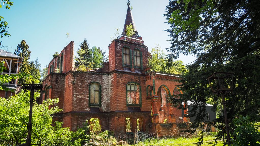
Shortly after entering the town, I find old Sanatorium Grunwald on the right side of the road. After the fire in 2005, today it’s still a ruin, however there are works going on at some day it may come back to the old glory.
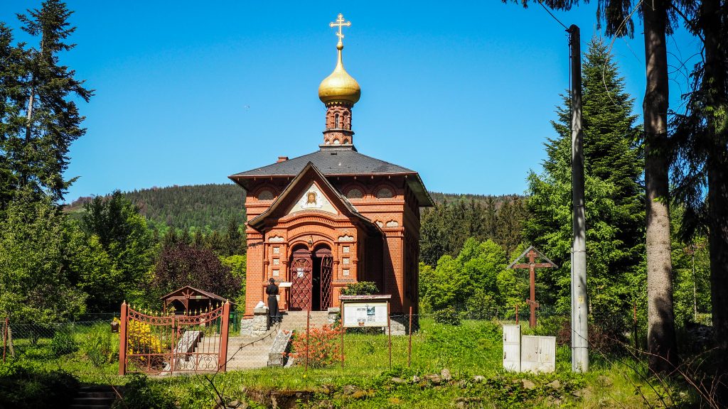
Turning right into Parkowa Street, I reach Orthodox church of St. Michael the Archangel. It was built to meet the religious needs of patients who came in large numbers from Russia.
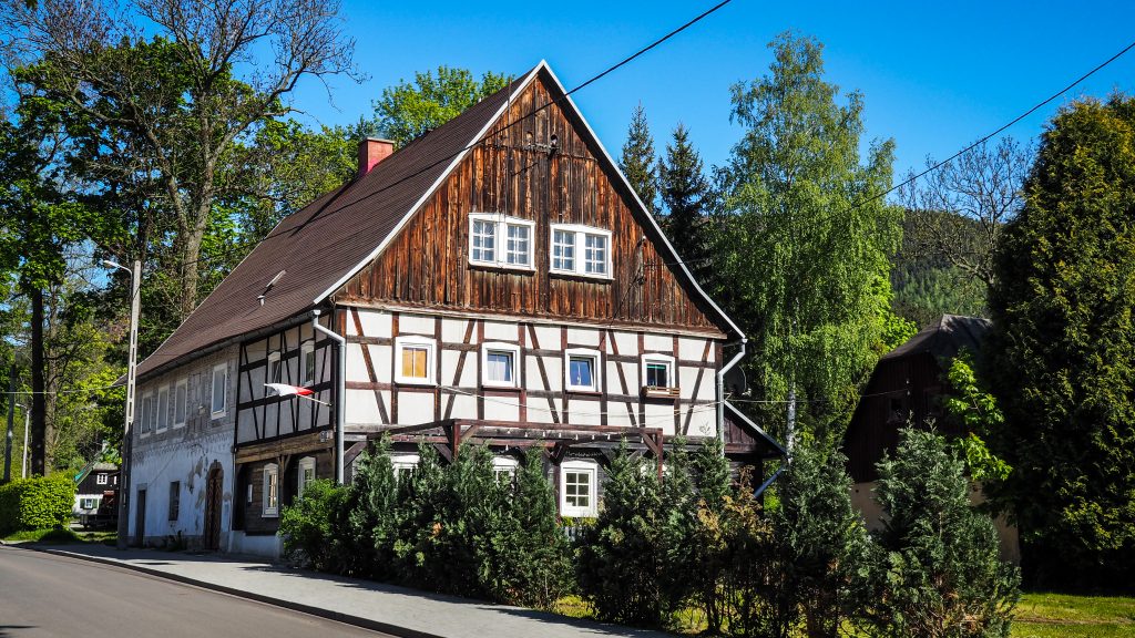
Other than that, it’s just nice to walk around and admire old buildings and architecture, of once popular and today forgotten by the world spa town.

From Sokołowsko, the fun begins as according to my resources, the ascent to Bukowiec and into Dry Mountains (Góry Suche) is one of the steepest on the track. I meet a group of people that just went down and I see big smiles on their faces when they see me walking the opposite way. Well, if I didn’t like to go up and down, then I wouldn’t go to the mountains 🙂 It was steep. It was tiring. It took me quite some time and around 3-4 breaks on the way up. I think the main problem was my heavy backpack and the fact that I already had some kilometres in my legs.
From here, only ~2.5 km left to Andrzejówka Hut and the section was mostly in the forest, having another melaphyre mine on the left side, which couldn’t be clearly seen but could be clearly heard.
Andrzejówka Hut was not as remote as mountain hut should be, at least to match my expectations. To be honest, it isn’t remote at all, there is an asphalt road leading to it from one side so there is a lot of day visitors walking around and enjoying food and drinks. By then I didn’t know yet that it’s rather normal in the Polish mountains. Mountain huts are like restaurants giving you an option to stay for the night, rather than remote shelters to which you have to carry your own food and fuel, as it was during my hikes in New Zealand. Well, now I know.
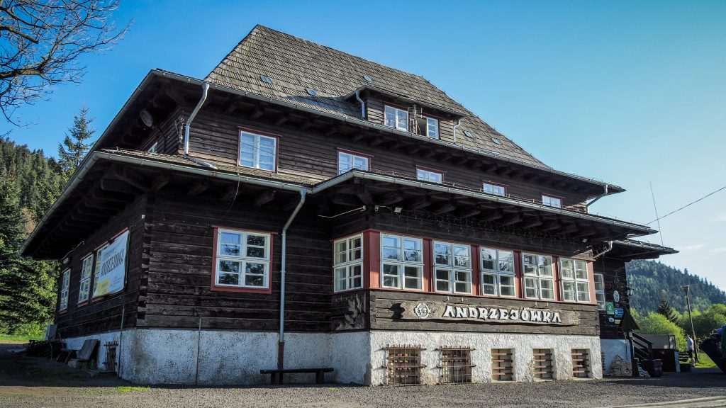
The room had 2 bunk beds but due to COVID-19 restrictions, I was the only one in the room. I enjoyed dumplings, apple cake and a coffee at a terrace and started planning the next day.