Tag

long-distance hikes

Browsing

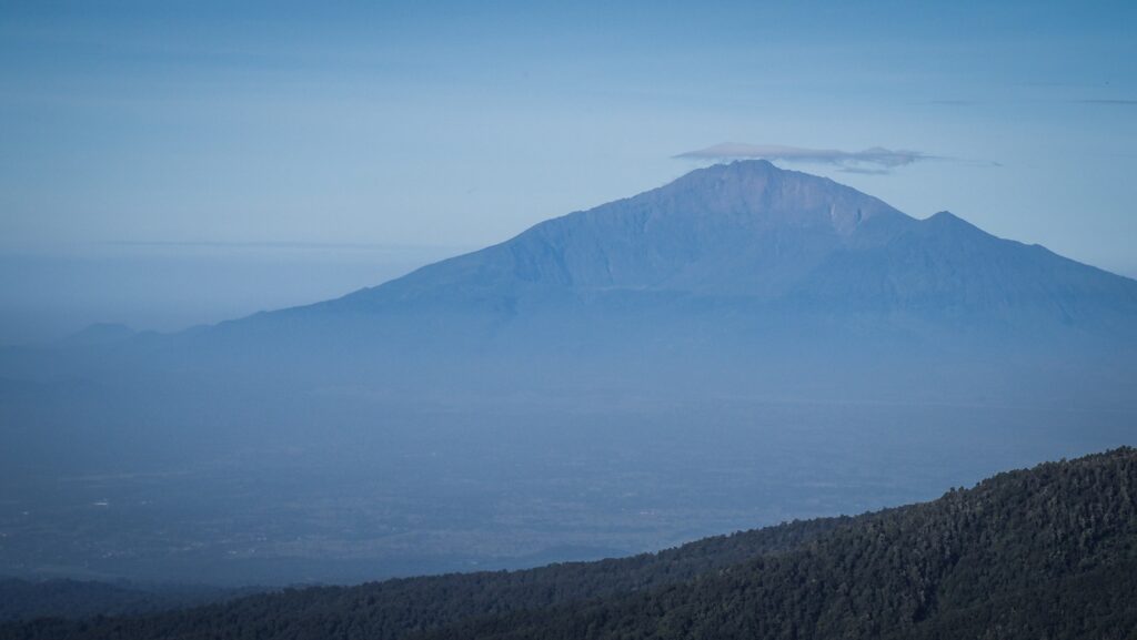
Rising proudly above the plains of Tanzania, Mount Kilimanjaro is the highest peak in Africa. This iconic mountain, crowned with snow despite its equatorial location, is a beacon for trekkers worldwide.

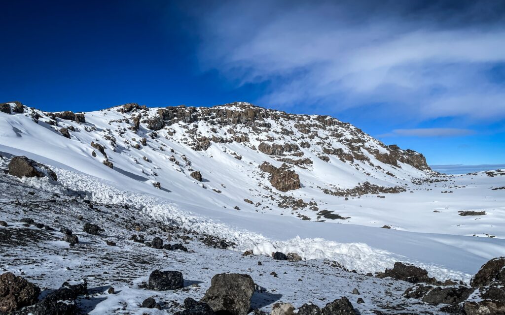
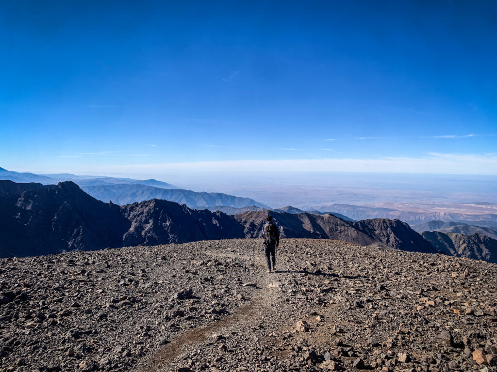
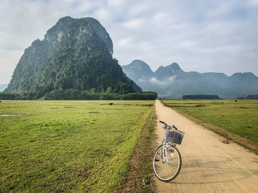
Kilimanjaro offers a journey through a kaleidoscope of landscapes: lush rainforests teeming with life, moorlands dotted with otherworldly plants, arid alpine deserts, and finally the icy summit at the Uhuru Peak. Unlike many high-altitude climbs, Kilimanjaro doesn’t require technical mountaineering skills, making it an accessible challenge for those with determination and a taste for adventure.

The history of Kilimanjaro

Mount Kilimanjaro was formed by powerful geological forces deep within the Earth, shaped over millions of years through volcanic activity. It sits in a region of East Africa known as the Great Rift Valley, where tectonic plates are slowly pulling apart. This shifting of the Earth’s crust created cracks and weaknesses, allowing magma to rise and build the towering mountain we see today.

Kilimanjaro is actually made up of three distinct volcanic cones: Kibo, Mawenzi, and Shira. Shira is the oldest and has mostly eroded, forming a plateau. Mawenzi, with its jagged peaks, is the second-highest and no longer active. Kibo, the central and tallest cone, is where Uhuru Peak is located. It’s the youngest of the three and still considered dormant, though it hasn’t erupted in thousands of years.

Over time, repeated eruptions built up layer upon layer of lava and ash, sculpting the massive stratovolcano. Glacial activity and erosion then helped carve the mountain’s current shape, leaving behind its iconic snow-capped summit and rugged terrain.

Long before it became a world-renowned trekking destination, it held deep cultural and spiritual significance for the indigenous Chagga people who live on its lower slopes. They regarded it with reverence, seeing it as a sacred place tied to myths, ancestral stories, and natural power.

The mountain remained largely a mystery to the outside world until the 19th century, when European explorers and missionaries began documenting its snow-capped peak, something that seemed impossible so close to the equator. One of the first widely noted accounts came from German missionary Johannes Rebmann in 1848, whose reports of snow were initially met with scepticism in Europe.

Kilimanjaro, Tanzania

During the colonial era, Kilimanjaro fell under German control as part of German East Africa, and later came under British rule after World War I. In the early 20th century, it became a symbol of exploration and imperial ambition, with the first recorded successful summit made by Hans Meyer and Ludwig Purtscheller in 1889. Their expedition opened the door for future climbers and sparked interest in the mountain worldwide.

In 1961, just before Tanzania gained independence, Kilimanjaro took on a new symbolic role. A torch was carried to the summit and lit there as a gesture of freedom and unity, representing a new dawn for the nation. Today, the mountain is not only a national treasure but also a UNESCO World Heritage Site, drawing trekkers, scientists, and conservationists who continue to study and protect its unique ecosystems.

Routes

Mount Kilimanjaro offers several routes to the summit, each with its own character, scenery, and level of difficulty. Choosing the right one depends on your fitness, experience, and how much time you can commit.

Marangu Route (5–6 days)

Often called the “Coca-Cola” route, this is the only path with hut accommodations instead of tents. It’s the shortest and has a steady, direct trail, but that also means less time to adjust to the altitude, making it one of the routes with a lower success rate.

  • Pros: Comfortable huts, easier logistics
  • Cons: More crowded, limited scenery variety (same trail up and down)

Machame Route (6–7 days)

Known as the “Whiskey” route, it’s one of the most popular choices. The trail is more scenic and diverse than Marangu, passing through rainforest, moorland, and alpine desert. It allows better acclimatisation with its “climb high, sleep low” profile.

That route was the one that I chose, and I decided on a 6-day itinerary. If I had to do it again, I would definitely go for a 7-day version to give myself more time for acclimatisation and avoid potential problems on the summit day. However, the ability to acclimatise is always individual.

  • Pros: Stunning views, good acclimatisation (I would choose the 7-day variant)
  • Cons: Steeper and more physically demanding

Lemosho Route (7–8 days)

This is considered one of the best all-around routes, offering a scenic, less crowded approach with a higher success rate due to its longer acclimatisation period. It begins on the western side of the mountain and merges with the Machame Route later on.

  • Pros: Excellent acclimatisation, remote and scenic start
  • Cons: Slightly more expensive due to longer duration

Rongai Route (6–7 days)

Approaching from the north near the Kenyan border, this trail is drier and offers a quieter, less-travelled path. It’s great during the rainy season since it’s on the mountain’s more sheltered side.

  • Pros: Less crowded, good for wet-season climbs
  • Cons: Less dramatic scenery compared to western routes

Northern Circuit (8–9 days)

This is the longest route, circling the mountain’s northern slopes. Its extended duration offers the best chance for acclimatisation and solitude.

  • Pros: Highest success rate, remote and uncrowded
  • Cons: Longest and often most expensive

Umbwe Route (5–6 days)

A steep and direct route is best suited for experienced trekkers. It’s not recommended for most climbers due to the fast ascent and poor acclimatisation profile.

  • Pros: Challenging and quiet
  • Cons: Low success rate due to rapid altitude gain
Kilimanjaro, Tanzania
The view of Mount Meru

Which agency to choose?

Climbing Mount Kilimanjaro requires you to go with a licensed tour operator, and you must be accompanied by a certified guide. This is a regulation enforced by the Tanzanian government to ensure climber safety and environmental protection. Solo, unguided treks are not allowed.

Guides are trained in altitude sickness recognition, emergency procedures, and route logistics. Along with guides, most treks include porters, who carry gear and supplies, and a cook, who prepares meals on the mountain. This team makes the climb more manageable and increases your chances of reaching the summit.

  • Choose a company that is officially registered with the Kilimanjaro National Park authorities and follows local labour and safety laws. Check if the porter will carry a portable oxygen cylinder in case you get into trouble.
  • Look for companies that employ certified guides with strong knowledge of first aid, altitude safety, and good reviews from past climbers.
  • Support companies that are part of or recognised by organisations like KPAP (Kilimanjaro Porters Assistance Project), which ensures fair wages and treatment for porters.
  • Beware of ultra-cheap tours as these often cut corners on safety, food, or porter welfare. A mid-range to premium tour might cost more, but it usually includes better equipment, safer practices, and better success rates.
  • Read recent reviews, paying attention to how the company handles altitude sickness, emergencies, and client care. Look for companies with a high summit success rate and clear emergency protocols.

After quite a long research, I decided to climb Kilimanjaro as well as do a 6-day safari with Kilinge Adventures, which is based in Moshi. The contact with Thomas (the owner) on WhatsApp was very easy, and once I arrived in Moshi, he, together with the guide, came over to my accommodation for a briefing.

I paid 1400 USD for a 6-day variant of the Machame Route. Overall, the service provided was good, and I reached the summit, although on the summit day, I suffered due to altitude sickness, and I had the feeling that more could have been done to monitor my health. For example, the guide was not equipped with a device to check my pulse rate and level of oxygen, which I saw that other guides were doing with their clients.

Costs of climbing Kilimanjaro

Climbing Mount Kilimanjaro is a serious adventure, and it comes with a price tag to match. The total cost can vary widely, depending on the route, tour operator, number of days, and the level of service you choose.

Typical price range (per person):

  • Budget climb: $1,500 – $2,000
  • Mid-range climb: $2,000 – $3,500
  • High-end climb: $3,500 – $6,000+

Here’s what you’re paying for:

  • Park fees (a big chunk—$800+ per person for a 6–7 day trek)
  • Guide, porter, and cook wages
  • Camping equipment or hut accommodation
  • Food, water, and logistics on the mountain
  • Transport to and from the trailhead

Cheaper trips often mean fewer meals, overloaded porters, or less experienced guides, so it’s smart to strike a balance between affordability and reliability.

Tipping culture

Tipping is expected and considered a standard part of the climb. Your guide and support crew work hard, often in tough conditions, to help you reach the summit safely and comfortably. Tips are a major part of their income. The best is the ask your agency and make it clear what is expected, but also don’t let it discourage you from climbing.

To be honest, I didn’t give as high tip as was expected from me, but I clearly stated that this is the maximum that I can calculate into my budget, so it was either that or nothing.

Typical tipping breakdown (per group, per day):

  • Lead guide: $20–30
  • Assistant guide: $15–25
  • Cook: $10–15
  • Porter: $5–10 each

For a 7-day trek, a group of 2–4 people might tip anywhere from 300 to 500 USD per climber in total.

Tips are usually pooled and distributed on the last day, often during a ceremony. In my case, I handed over the amount to my lead guide and sent him the message on WhatsApp on how to distribute it between team members. It doesn’t matter if you give dollars or simply withdraw local currency from an ATM.

Additional costs

When budgeting for Kilimanjaro, don’t forget to factor in:

  • Flights
  • Travel insurance (must include high-altitude trekking)
  • Gear rental or purchases
  • Medications
  • Visa fees and pre/post-climb accommodations

The experience is a big investment, but for many, it’s a once-in-a-lifetime journey that’s well worth the cost. From the perspective of time, I can definitely say that I don’t regret it!

The best time to climb

The best time to climb Mount Kilimanjaro is during its two dry seasons, when the weather is generally more stable and visibility is at its best. These periods fall between January to mid-March and June to October.

The January to March window tends to be a bit quieter on the trails, with fewer climbers and cooler temperatures at the summit. It’s a great time for those seeking solitude and crisp, clear mornings, though occasional afternoon snow can fall at higher elevations.

The June to October season is the most popular due to its dry conditions and warmer days, especially during the mid-year holidays. Skies are usually clear, offering spectacular views, but this also means more people on the mountain.

Avoid the long rainy season (March to May) and the short rainy season (November) if possible, as trails can become slippery, clouds may block the views, and summit attempts are more challenging in wet conditions.

What to pack?

Packing smartly for a Kilimanjaro climb is key to staying comfortable, safe, and successful on your journey. Since you’ll be trekking through several climate zones, from humid rainforest to arctic-like summit conditions, you’ll need to be prepared for a wide range of weather.

All necessary equipment can be rented in Moshi, although I would recommend taking your own sleeping bag, which you trust, as there is nothing worse than being cold in the night. The weather is very changeable, and most likely you will get wet. Always keep another set of dry clothes in a waterproof place. If your things get wet, it may not be easy to dry them along the way.

I rented a few things from Gilmans Outdoor Store, and the quality was excellent.

Clothing

Base layers:

  • Moisture-wicking thermal tops and bottoms (to keep sweat off your skin)
  • Breathable underwear and hiking socks

Mid layers:

  • Fleece or insulated jacket for warmth
  • Long-sleeve shirts and trekking pants

Outer layers:

  • Waterproof jacket and pants (Gore-Tex or similar)
  • Down or synthetic puffy jacket for summit night

Accessories:

  • Warm hat and sun hat
  • Gloves: one lightweight pair and one insulated, waterproof pair
  • Neck gaiter or buff for wind and dust
  • Sunglasses with UV protection

Footwear

  • Sturdy, broken-in hiking boots (waterproof)
  • Comfortable camp shoes or sandals

Gear

  • A durable backpack (30–40L) for your daily essentials
  • A large duffel bag or backpack (porters will carry this)
  • Sleeping bag (rated for cold temperatures, at least -10°C)
  • Trekking poles (helpful for balance and reducing strain)
  • Headlamp with extra batteries (essential for summit night)
  • Water bottles and/or hydration bladder (minimum 3L capacity)
  • Dry bags or plastic zip bags (to protect electronics and clothing from moisture)

Toiletries & Health

  • Sunscreen and lip balm with SPF
  • Wet wipes and hand sanitiser
  • Toothbrush, toothpaste, and biodegradable soap
  • Personal medications, altitude sickness meds (consult your doctor)
  • First aid essentials: blister pads, band-aids, painkillers, etc.
  • Fingertip pulse oximeter

Others

  • Power bank for charging devices
  • Snacks or energy bars for an extra boost
  • Lightweight towel
  • Travel journal or book for downtime
  • Small binoculars or a camera

How to get to Moshi?

By Air

The nearest airport is Kilimanjaro International Airport (JRO), located about 40 km from Moshi. It serves international and domestic flights.

Taxi/Private Transfer from the airport to town takes 45 minutes and costs about $30-$50. Alternatively, some hotels and tour companies offer shared transfers (~$10-$20) or just take a local tuk-tuk and negotiate the price.

You can also fly into Julius Nyerere International Airport (DAR) in Dar es Salaam or Abeid Amani Karume Airport (ZNZ) in Zanzibar and take a domestic flight to JRO or Arusha.

By Road

From Arusha (80 km, 1.5-2 hours) – Buses, shared taxis, and private transfers run frequently.

From Dar es Salaam (500 km, 8-10 hours) – Luxury buses like Kilimanjaro Express or Dar Express offer comfortable rides for 15-20 USD.

From Nairobi, Kenya (350 km, 6-7 hours) – Shuttle services run daily, costing about 30 USD. Border crossing at Namanga is required.

By Train

Tanzania’s rail network is limited, but there is a train from Dar es Salaam to Moshi (though infrequent and slow). Buses are a better option.

Where to stay in Moshi?

I recommend Karibu Africa House and The Better Inn. Both places offer good quality at an affordable price, and they also offer day trips to Lake Chala or Marangu, but Karibu Africa House is significantly cheaper in that aspect.

My experience on the 6-day Machame Route

Day 0: Briefing in Moshi

Organisational day. First, I stopped at Gilmans Outdoor Store to rent some stuff for the hike: fleece, rain jacket, hiking poles, gloves and a day backpack. The quality of the items was really good, although the price wasn’t. If you don’t mind paying, you can get everything you need in Moshi, but in general, I would recommend taking your own equipment.

Then, I went to the supermarket to buy some snacks, chocolate and energy bars. Not too many, as it was clearly communicated that all meals are included in the price of the hike and there will be a cook preparing them daily.

When I came back to my accommodation, the landlady knocked on my door and informed me that my guide had arrived. It was Thomas (the owner of the Kilinge Adventures) and my mountain guide, Tayson. He came into my room to check the equipment and recommended renting one more warm jacket (which later on proved to be a good decision, even though at first I was sceptical about it).

I finished packing my backpack and was waiting in excitement for the next day!

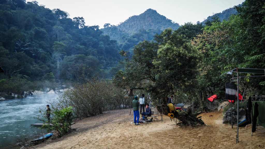
Day 1: Machame Gate to Machame Camp (10,3 km, 1218 m up)

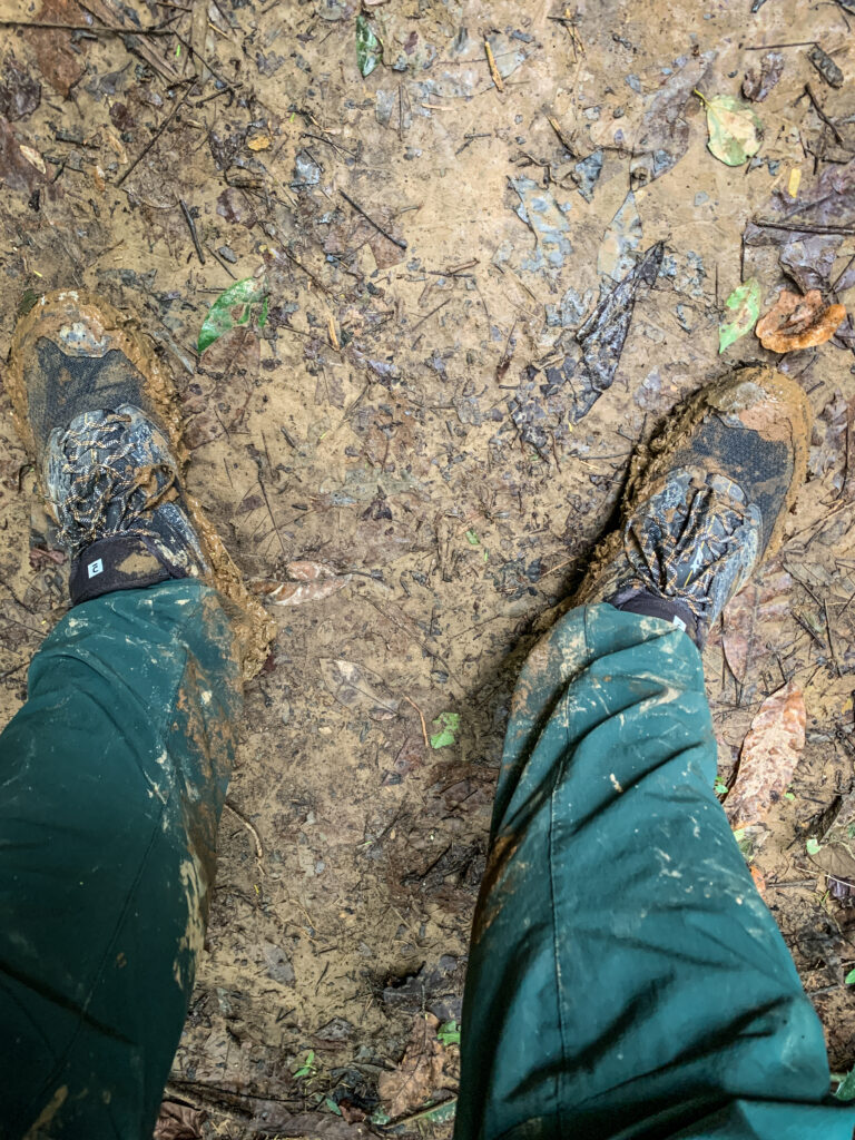
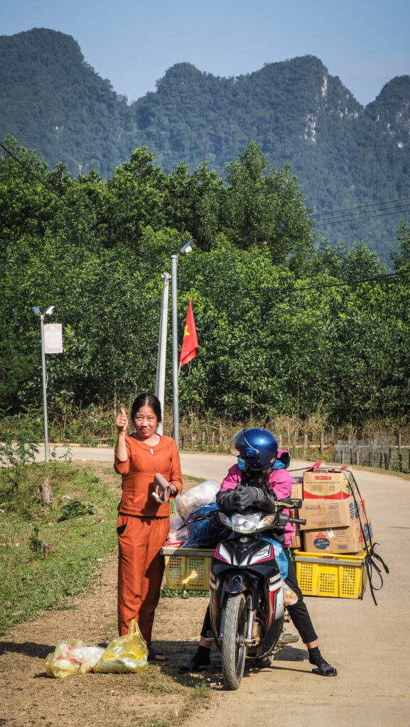
I had breakfast at my accommodation and was then picked up by the guide with only a small delay. Nice surprise considering that the services in Tanzania aren’t exactly punctual! We stopped at one more location to rent a rain poncho and two plastic bottles. The prices they have in Moshi are simply ridiculous. You can buy your own poncho and water bottles for the same price or even cheaper in Europe than renting them for a few days here. But well, they are taking all the advantage they can from having Kilimanjaro.

Then, we set off to Machame Gate. Once we arrived, it took forever to handle all the paperwork. I got my lunchbox even though I was not hungry at all, as it was too early. One of the monkeys stole my yoghurt, but maybe it was for the better… Better not to take any risks before such a long hike!

Finally, Tayson asked me to sign some papers, and it gave me the hope that we were about to start the real hike… but nope. I was slowly getting more and more annoyed, and probably after another 45 minutes of waiting, we went through the security gate and entered the forest. The security gate was a real deal, and they even asked me to open my backpack to see if I was carrying a drone or other prohibited items.

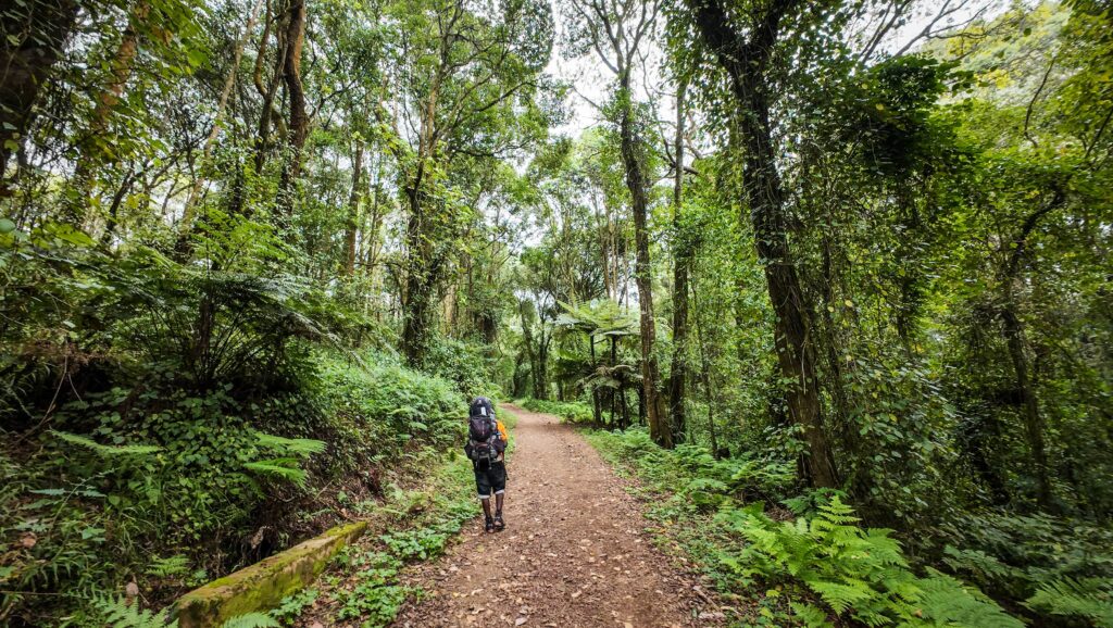
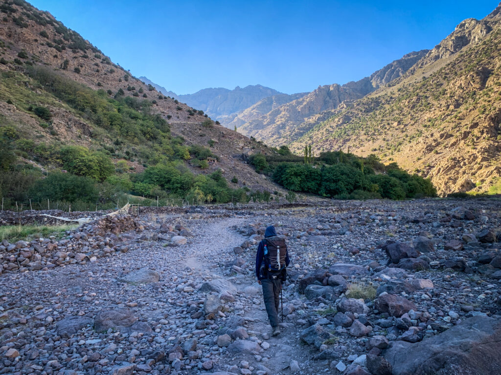
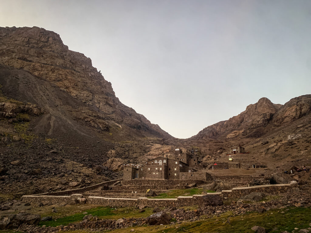
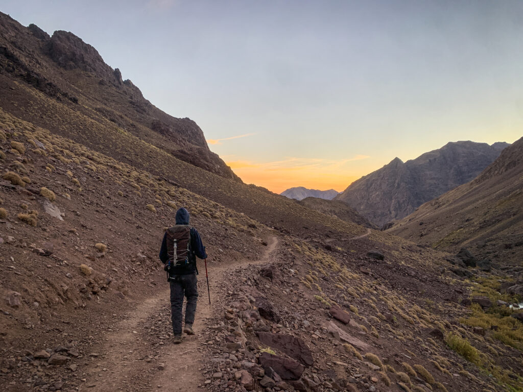
The first section to Machame camp was led through a scenic mossy forest, and it reminded me of the area at Mount Taranaki in New Zealand. Unfortunately, it started raining and I had to wear my poncho for the first time.

Kilimanjaro, Tanzania
The beginning of the hike

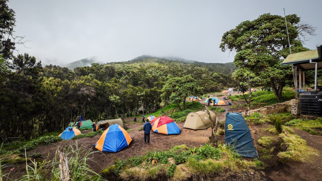
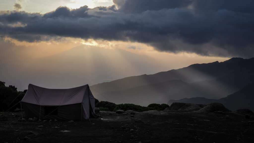
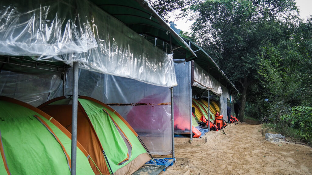
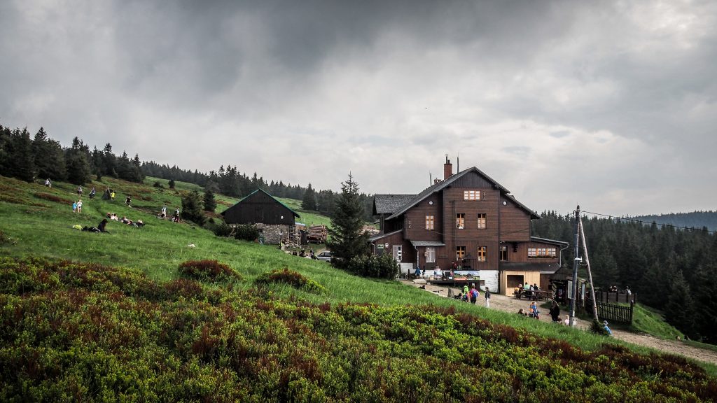
When we arrived at the camp, it was foggy, wet and cold. Not exactly how I was imagining the first 2-3 days of the hike. I thought it would be rather warm and pleasant, especially at lower elevations! I had to wait a bit for my tent to be ready, but then I was quite impressed. There was one section for sleeping and another one with a table and a chair for eating meals and relaxing. Pretty cool!

Kilimanjaro, Tanzania
Machame Camp
Kilimanjaro, Tanzania
The first meal

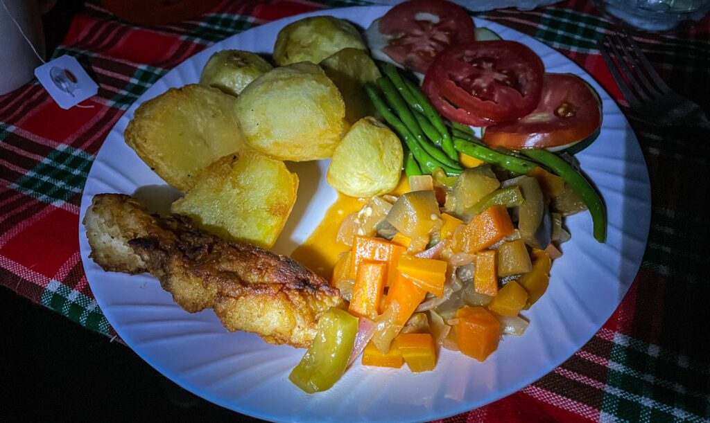
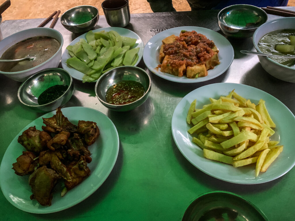
The first dinner was yummy, and our cook served fried potatoes with fried fish. I was also given a big bottle of hot water and could choose any drink I wanted: tea, cocoa, coffee, etc.

Apparently, I was added to the group of 10 other hikers, but it was only theoretical as I didn’t have any interaction with them for most of the time. I didn’t bother too much as I wanted to enjoy my experience in nature rather than forcing myself to socialise with much older folks who were probably from the UK or the US.

The first night was okayish, but I started taking preventive medication for the altitude sickness, so I had to get out of the sleeping bag to pee quite frequently.

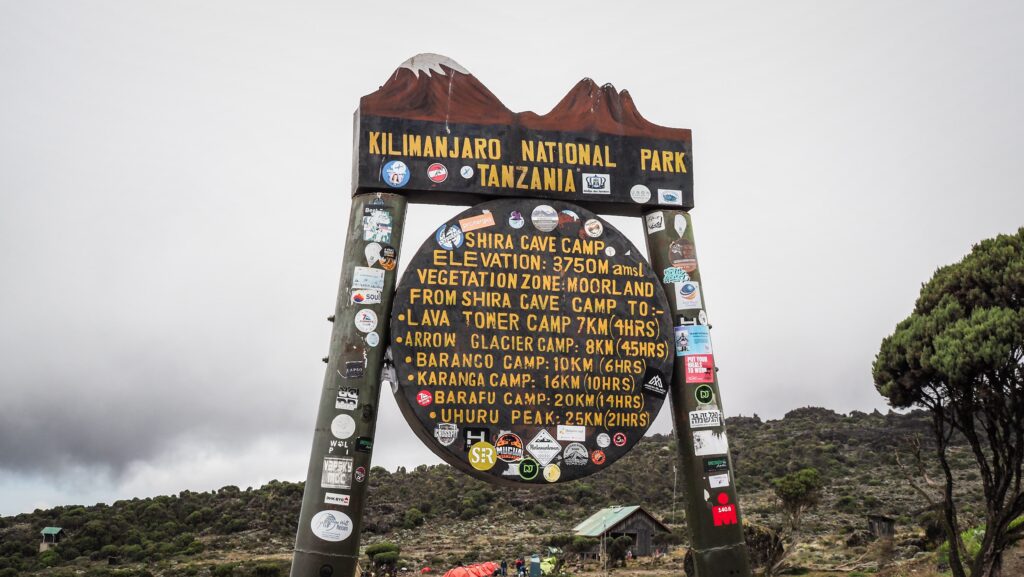
Day 2: Machame Camp to Shira Cave (4,8 km, 863 m up, 40 m down)

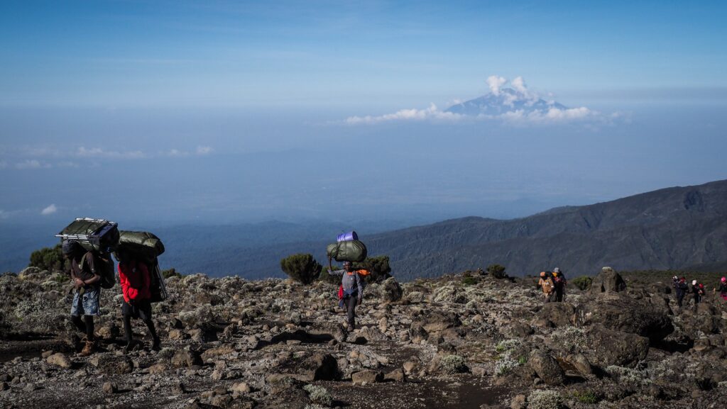
Easy day. The weather in the morning was good, and there were nice views of Mount Meru in the distance. The path was climbing up steadily, and it was not too challenging. The last section was more rocky, but still, nothing serious.

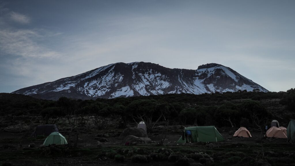
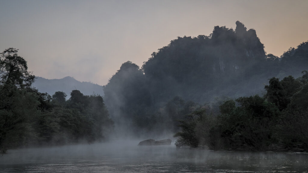
We arrived at the camp very early. I was walking around, but every now and then, the clouds were rolling in, so the conditions weren’t optimal for hanging out outside. At sunset, it improved a bit, and the clouds cleared. I could see the snowy summit of Kilimanjaro in the distance.

Today I realised that the portable toilets that were set near my tent were not for common use but for the rest of my group, as they paid extra for them. LOL. Good to know that I took a shit there twice the day before and oh damn, it was a smelly one. What do people have in their minds that they pay extra for portable toilets, and they actually hire an extra porter to carry one? The public ones are just fine. I mean, it is just a stinky hole in the ground, but what would you expect on the mountain?

Kilimanjaro, Tanzania
The way to Shira Cave Camp
Kilimanjaro, Tanzania
Shira Cave Camp
Kilimanjaro, Tanzania
Shira Cave Camp
Kilimanjaro, Tanzania
Sunset at the Shira Cave Camp

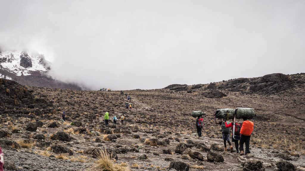
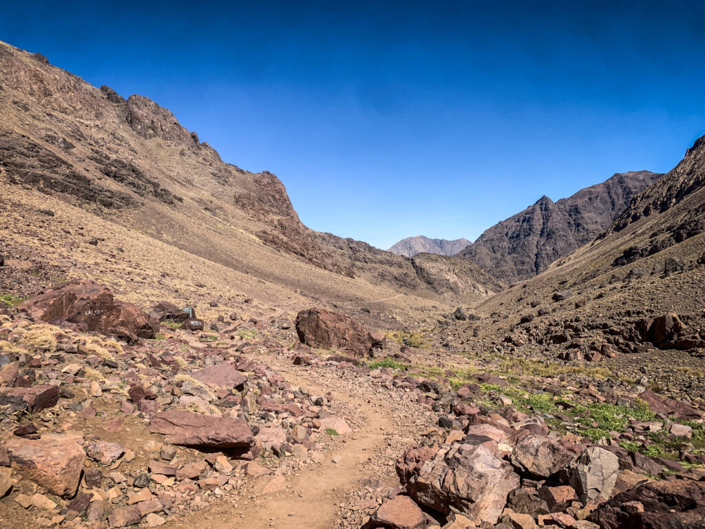
Day 3: Shira Cave to Barranco Camp (9,7 km, 806 m up, 667 m down)

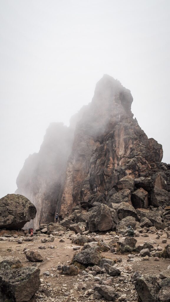
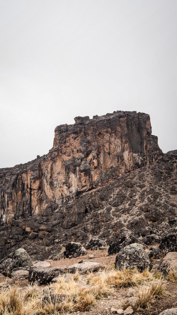
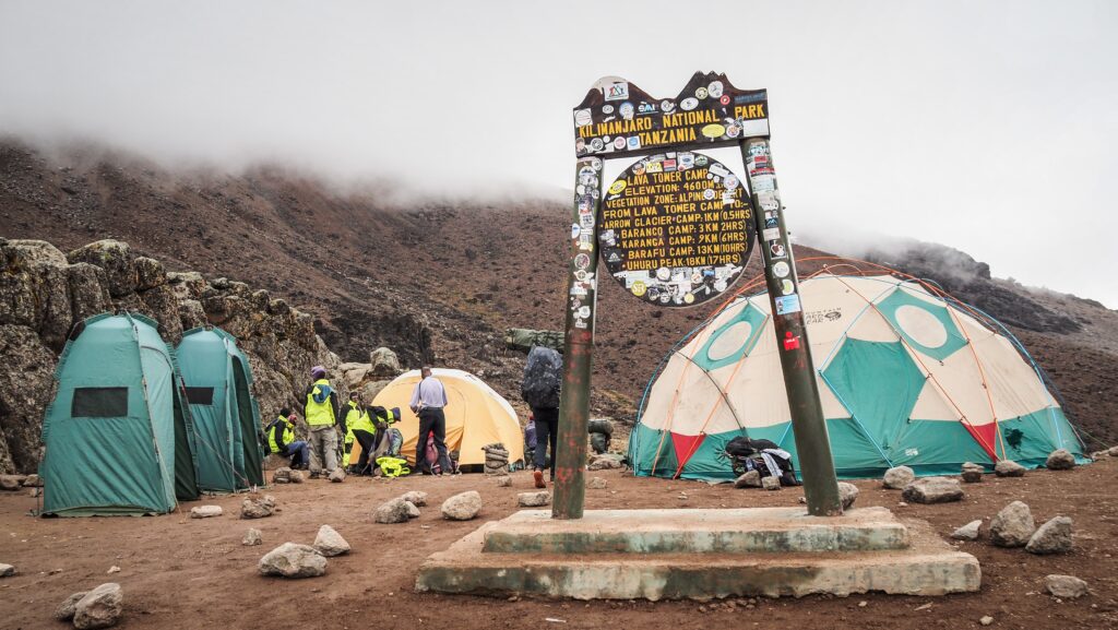
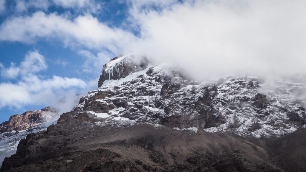
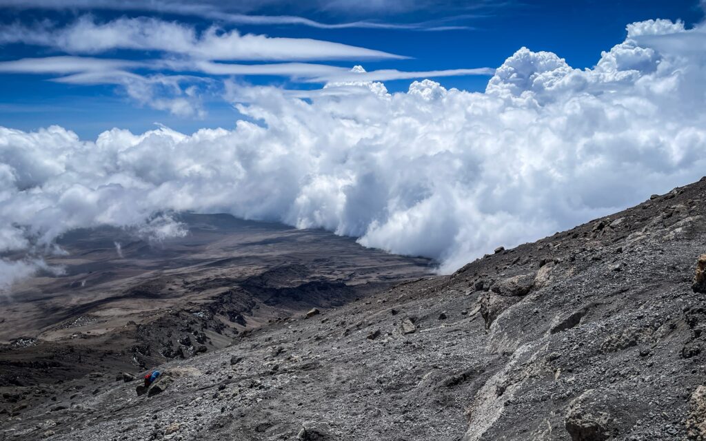
Beautiful hike, although again the weather was difficult. The first section to the Lava Tower had amazing views of the mountain at all times. Kilimanjaro looked pretty wide from that perspective, and there was a lot of snow near its top.

While we were approaching the Lava Tower, the weather was getting worse. It seems to be a standard on that mountain after noon. Luckily, instead of waiting for lunch, we just decided to make a short stop for snacks and then continued the way towards Barranco Camp.

Kilimanjaro, Tanzania
Kilimanjaro seen at sunrise

I had some stomach problems that started the previous night, and I suspected that the vegetables served for dinner were to blame. It made me feel uncomfortable, and I had to make unwanted stops. I decided to start taking antibiotics, even though I knew that they could harm my body during the upcoming summit push.

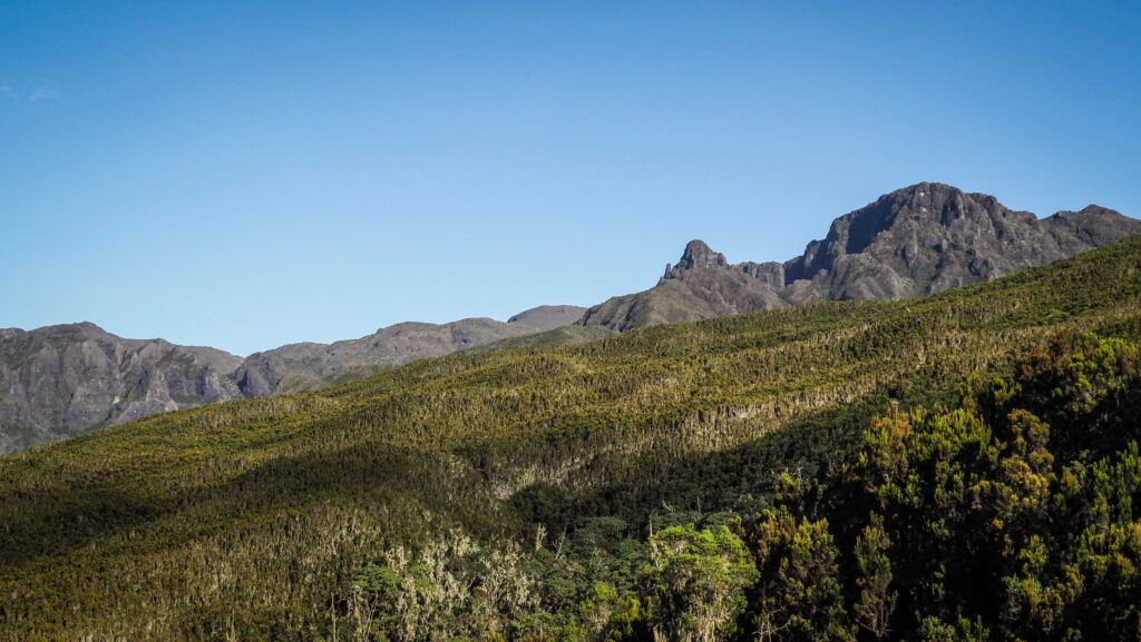
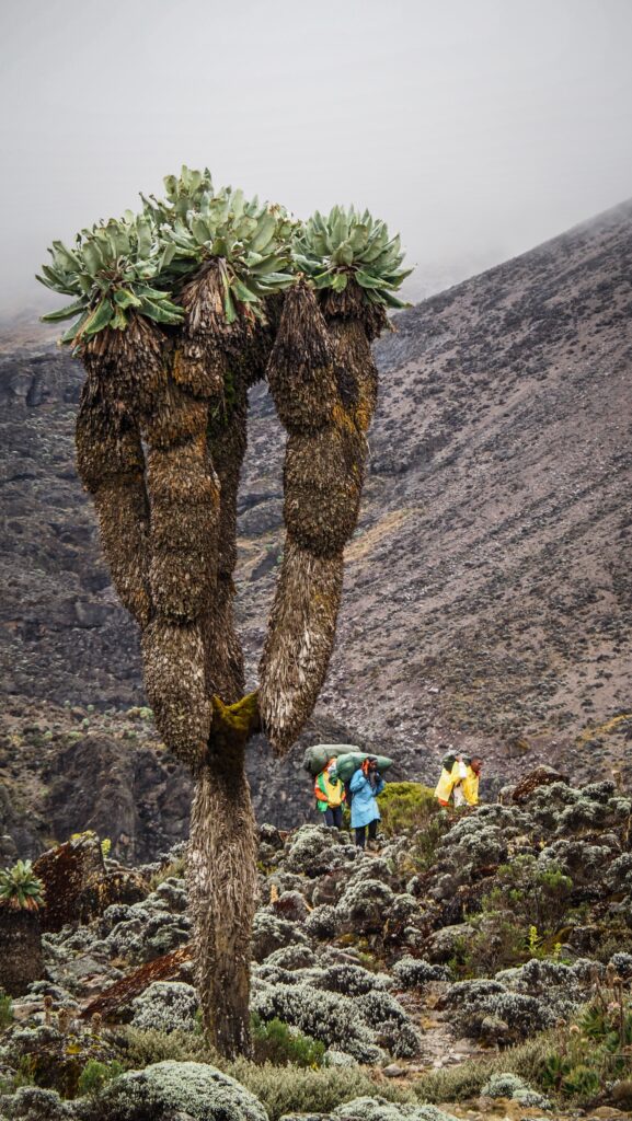
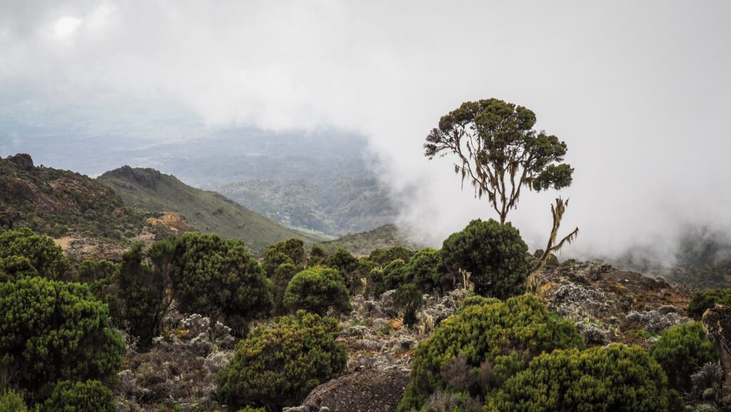
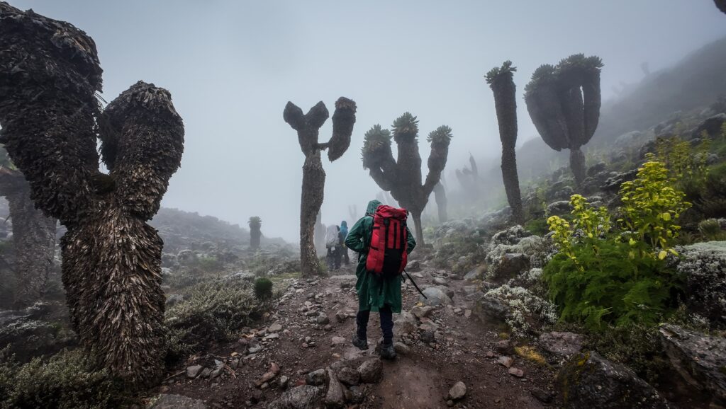
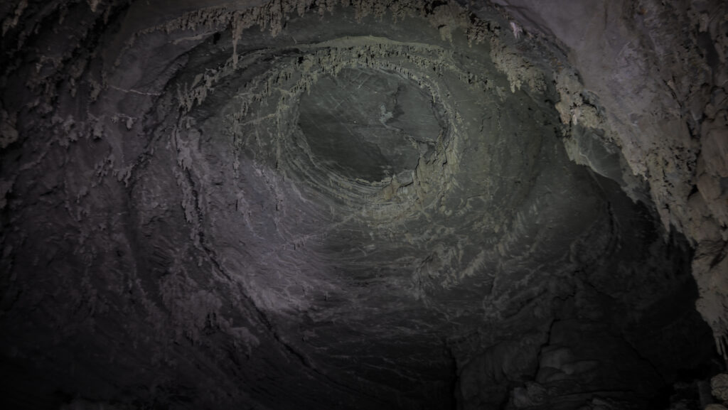
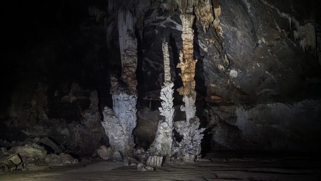
Then, it started raining, which was a pity as the way down to the camp was very scenic, full of unique trees that I could see so many times in the pictures and brochures about Kilimanjaro. Those are giant groundsel that are often mistaken for palm trees due to their unusual appearance. These plants, scientifically known as Dendrosenecio kilimanjari, have thick, weathered stems topped with large, succulent rosettes, resembling a cross between a Joshua tree and a pineapple.

Kilimanjaro, Tanzania
Porters carrying bags on their heads
Kilimanjaro, Tanzania
Heading to the Lava Tower Camp
Kilimanjaro, Tanzania
The Lava Tower Camp
Kilimanjaro, Tanzania
Walking among giant groundsel

Once we arrived at the camp, I registered in the book and waited for a while for the tent to be set up. Then, I jumped inside and changed all my clothes to dry ones. The cook surprised me with freshly made popcorn, which I enjoyed sitting on the chair in front of the tent with an American girl of Vietnamese origin whom I met the day before. This was also the place where we had our dinner. This time I decided not to touch the vegetables!

Day 4: Barranco Camp to Barafu Camp (7,8 km, 965 m up, 305 m down)

The day when the problems started.

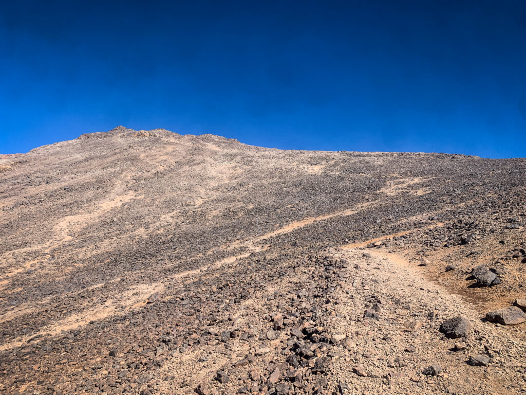
The first part of the hike was relatively good. We arrived at Karanga Camp after climbing the steep Barranco Wall. In Karanga, it was foggy, and I started feeling so-so, but I made a stop for snacks. Then, we started climbing higher and higher, and I was feeling worse and worse. The altitude sickness symptoms kicked in, and once I finally made it to Barafu Camp, I was completely exhausted.

I went inside the tent and waited there throughout very bad weather, while it was even snowing! Then, the cook served me dinner, but I didn’t have any appetite and I was forcing myself to eat anything. Even going out of the tent to pee seemed to be too tiring for me. I knew what was going on as I experienced altitude problems in Nepal a year ago. I reported the situation to Tyson, and he said that I had to try to sleep and we would evaluate the situation before leaving the camp for the summit push, so around 1 AM. Unfortunately, I wasn’t able to sleep at all.

If it had been my choice, instead of going to the summit, I would have gone back to Barranco Camp for one more acclimatisation day and only then pushed further to the summit. But if you climb Kilimanjaro, you have to decide how many days you want to do it; therefore, any flexibility is gone. You can either climb it in the given window or give up. No space for plan adjustments.

Mount Kilimanjaro, Tanzania
Hiking towards Barafu Camp

Day 5: Barafu Camp to Uhuru Peak to Mweka Camp (16,1 km, 1251 m up, 2802 m down)

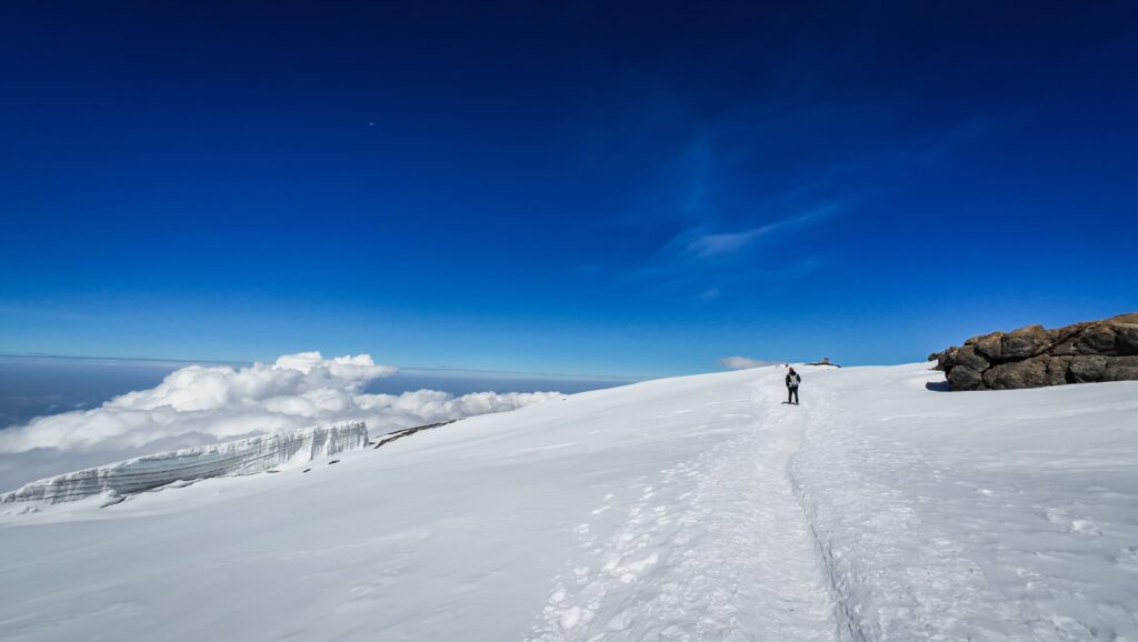
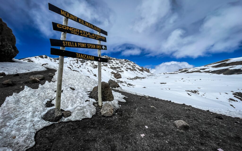
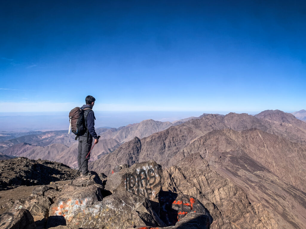
Besides drinking something warm in the morning, I didn’t eat anything more than some biscuits. We set off at 1 AM, and I was going slow. Ridiculously slow. I had to stop many times to catch my breath. It was pitch black, so I could only see the lights of people that are some meters ahead of me. Unfortunately, I also saw some people going back as they also couldn’t continue due to similar problems to mine. But I was fighting, even though I knew I was taking a risk. If it had been a solo trip, I would have certainly walked down a bit to acclimate better. Such an option isn’t really an option on a guided hike like that one, though. At sunrise, instead of being at the summit as it was planned, I was not even at Stella Point, which is a major milestone at 5,756 meters. The point was named after Estella Latham, the first woman to ever reach this mark in 1925.

Tyson was checking on me very often, and at some point, he suggested that it’s time to turn back. The mountain would still be there, and pushing myself to the limits was too risky. I knew he was right, but I am stubborn by nature and didn’t want to give up just yet. The oxygen level was very low, and we made a break at Stella Point to have snacks and drink glucose.

My guide was very strict, and he told me that I had to descend. But there we were, 20 minutes walk from the summit. I could see it. I had so many thoughts in my mind, and I really didn’t know what to do, but I told Tyson that I was taking all responsibility for my actions and I would continue walking to the summit. He wasn’t happy at all!

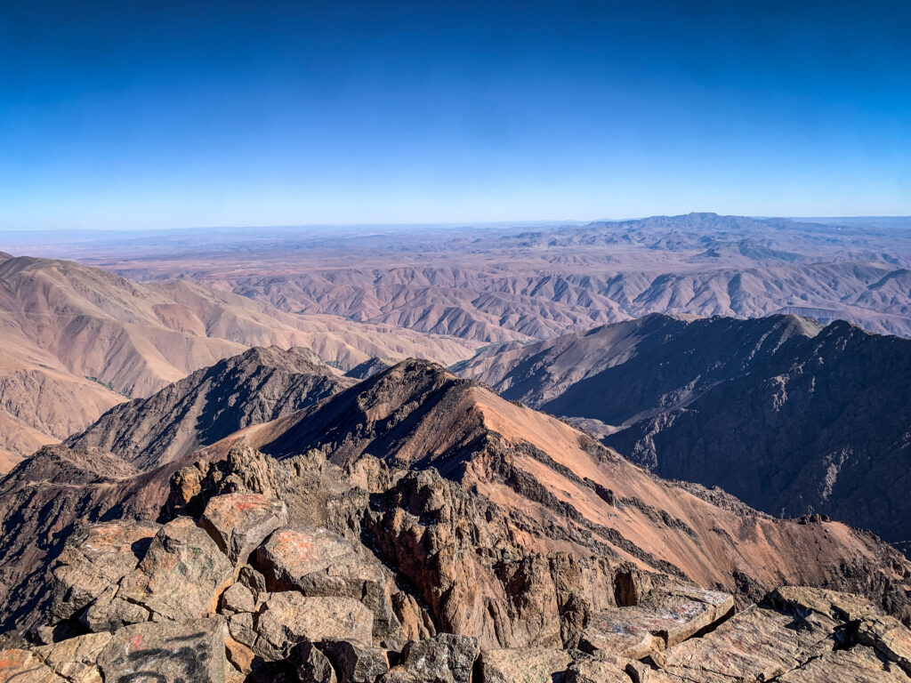
I was walking slowly, even though the elevation gain was very little compared to what we did the night before. The views all around were truly breathtaking, and I could see the crater on the right and the leftovers of the glacier on the left.

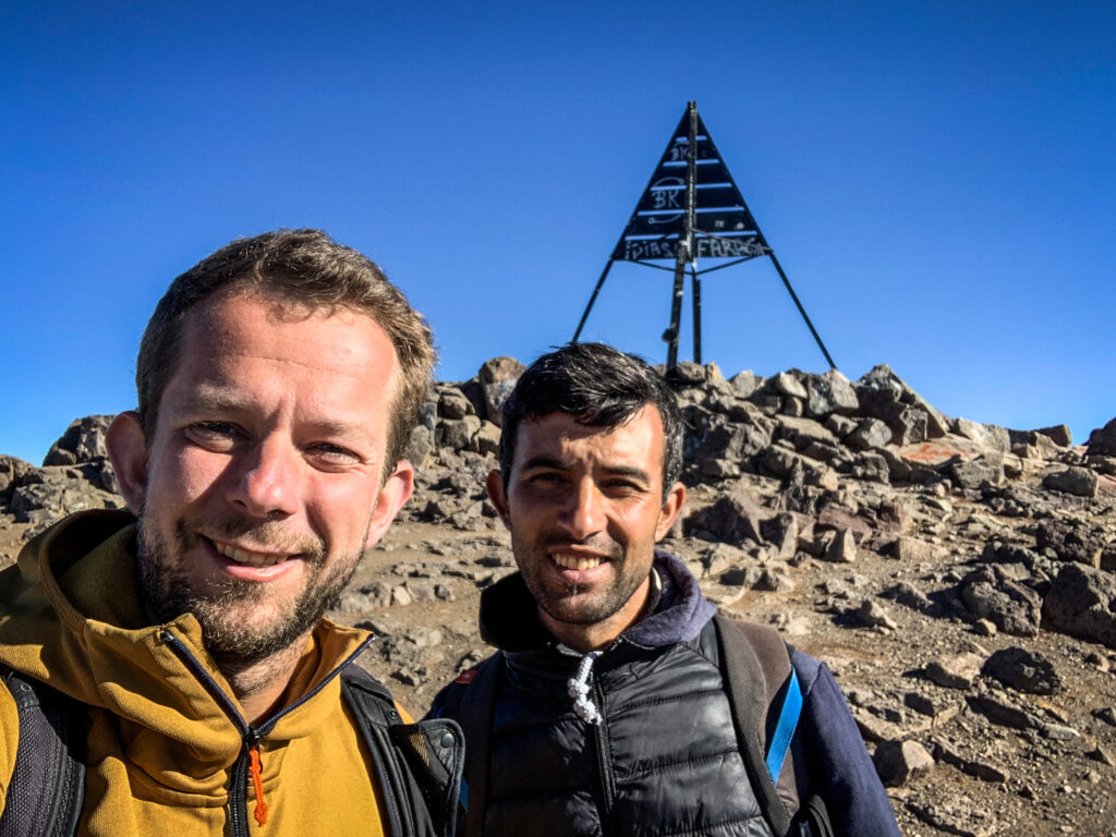
Finally, I reached the summit. I didn’t even have the energy to celebrate. After taking a few pictures, I started something that I should have done a long time ago – descent to Barafu Camp.

Mount Kilimanjaro, Tanzania
Sunrise neat Stella Point
Mount Kilimanjaro, Tanzania
Walking the last meters to the summit
Mount Kilimanjaro, Tanzania
Mount Kilimanjaro
Mount Kilimanjaro, Tanzania
Uhuru Peak
Mount Kilimanjaro, Tanzania
Mount Kilimanjaro
Mount Kilimanjaro, Tanzania
Stella Point
Mount Kilimanjaro, Tanzania
The slopes of Mount Kilimanjaro

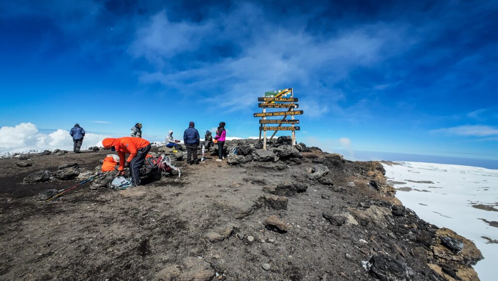
My legs were incredibly weak, and I almost fell down a few times. Due to a low level of oxygen in my body, I felt like I had been drinking a few beers, and I was dizzy. We passed Stella Point and then took a shortcut down, which was incredibly difficult as it was steep and full of loose stones. I fell down once or twice, and I was incredibly sleepy. During breaks, I had the feeling that I had to give up, and I would not be able to make more steps without some rest and sleep. Tayson kept motivating me, and luckily, it worked.

We made it to the camp and I immediately jumped into my tent, lay down and fell asleep. The cook brought me food, but I wasn’t able to eat anything. Apparently, I asked Tyson if I could get a moto-taxi down to another camp. LOL. It only proved how destroyed and delusional I was because I have no idea how I could ask this kind of stupid question. There was no common sense in my way of thinking. I had the feeling that I had a fever, but probably it was just a sunburn on my face, as in all that mess, I had forgotten to apply sun cream.

I found leftovers of strength, or maybe I just didn’t have another option, and left the tent for an over 2 hours of walk down to Mweka Camp. Luckily, I was feeling a bit better and the whole way the trail was descending. We arrived when it was already dark, and I only ate a little bit of dinner before I dropped off to sleep.

Damn, what a day it was.

Day 6: Mweka Camp to Mweka (9,5 km, 1549 m down)

From Mweka Camp, it was about 2-3 hours to the gate, and I made it quite quickly. I took a last picture with a goodbye sign, and I finally met with Ni, the American / Vietnamese girl whom I had hung out with in previous camps. She knew everything about my situation from other guides, as it seems the news spread fast on the Kilimanjaro slopes 🙂 She was fast and made it to the summit when it was still dark, without any problems.

She invited me to join her for the trip to the hot springs on the next day, and I probably would have gone, but Thomas signed me up for the safari starting on the next day, and it was not possible to delay it, as I was joining a group.

We stopped at Gilmans to return the rental equipment, and then I went to the hotel. I gave Tyson a tip with a detailed split of the amount per other members of our group, including porters and the cook.

Then I did my laundry as I had to quickly repack for the safari trip, and ate a delicious pizza in Blossoms Cafe. In the evening, I met up for dinner with Ni and we exchanged our experiences from the roof of Africa over Thai curries 🙂

Summary

Overall, it was a great hike, but also the most challenging one for me so far. I think there were several reasons why I suffered, and if I had had to do it again, I would have played it differently.

Firstly, I wasn’t in the best shape. Before coming to Moshi, I spent a few days in the Usambara Mountains, where I got some serious infections. On top of stomach problems and fever, I also had a cough which I could not get rid of, and I was struggling with it for the whole time on Kilimanjaro. I started the hike straight after taking medicine for a few days, including antibiotics. The symptoms of stomach issues came back on day 3, and I had to resume taking antibiotics as a precaution. My organism was surely not at 100%.

Secondly, I was taking Acetazolamide as a prevention for mountain sickness, but still got plenty of symptoms of it. Who knows what would have happened if I hadn’t taken that medicine? Quite likely, I would have been taken off the mountain by a helicopter. Hopefully not in a plastic bag. Acute altitude sickness should not be ignored; however, when people pay so much money, they want to make it to the summit no matter what. Flexibility is crucial here. If hiking solo, I would have done one more acclimatisation day before the summit push. So maybe it’s a smart idea to discuss this with the travel agency if such an option exists, in case you notice that you need it. If not, it’s worth considering taking longer Lemosho or Northern Circuit routes.

Regardless of all problems, I came back from Kilimanjaro with priceless memories and new experiences in high-altitude hiking. Many people say that it is once in a lifetime experience, but in fact, I would like to set foot on the roof of Africa once more in the future!
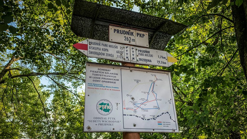
Jebel Toubkal is the highest mountain in North Africa, situated in the Atlas Mountains of Morocco. Standing at an impressive 4,167 meters above sea level, it attracts hikers from all over the world. Let me share with you my experience of going to the summit!

When to go?

The best time to hike Jebel Toubkal is typically during the late spring to early fall, so from late May to early October. During this period, the weather is usually mild, and the trails are not covered in snow. Winter requires more experience and equipment (crampons, winter clothing). I did my hike at the end of October and it was perfect. Sunny days with a temperature of about 20 – 25C and very cool at night.

How to get to Imlil?

Imlil is located only 60 km south of Marrakech and can be easily reached by grand taxi. You will need to pay about 300 DH for the private trip or 50 DH per seat and share the car with other passengers. Taxis are located close to Sidi Mimoun Garden. The trip will take about 1.5 – 2 hours but the views are very scenic!

Alternatively, you may take a local minibus to Asni and from there get a grand taxi to Imlil but it will take more time and you won’t save much.

If you want to have everything organized for you, including transportation, look for a reputable travel agent with a lot of positive reviews on Google Maps or check the offer of GetYourGuide.

Route

The distance from Imlil to the summit of Jebel Toubkal is about 15 km, starting at an altitude of about 1659 m a.s.l. and ending at 4167 m a.s.l. (2508 meters up).

It’s quite a lot and most people decide to conclude the first day with an overnight stay at Refugio du Toubkal, covering a distance of about 11,5 km (1501 meters up). On the second day, they continue to the summit and back to Imlil (18,5 km, 985 meters up, 1659 meters down). If you follow this scenario, there is no need to start in Imlil very early in the morning as you will have plenty of time to arrive at the shelter.

Jebel Toubkal, Morocco
Jebel Toubkal

Alternatively, you may do what I did, so go from Imlil to the summit and back to Refugio du Toubkal on the first day (18,5 km, 2493 meters up, 993 meters down), and then walk back to Imlil on the second day (11,5 km, 1501 meters down). If you decide to go for this option, keep in mind that an early start from Imlil is necessary and it will be a very difficult day, especially because of altitude difference.

The trail is well-marked and easy to follow but you can always get the Mapy.cz app on your phone to double-check your position. Of course, I’m talking about hiking season and not winter 🙂

What to take?

When hiking Jebel Toubkal, essentials include hiking boots or trail runners, weather-appropriate clothing (shorts, long pants, jumper, gloves, hat, spare T-shirt and underwear), a sleeping bag, suncream and a backpack with snacks and water. It gets really cold at night so don’t underestimate it. Hiking poles will be extremely useful too so if you don’t have ones, you may rent them in Imlil village. I regretted that I hadn’t done so!

Jebel Toubkal, Morocco
At the summit of Jebel Toubkal

Do you need a guide?

If you decide to start the hike from Imlil, then it is necessary to have a guide. There is a police checkpoint after Aroumd village where your passport as well as the ID of the guide will be checked. The requirement of having a guide was imposed in 2018 after the murder of two Scandinavian tourists. So it’s not that much related to trail difficulty but rather overall safety. I found the trail well-marked and easy to follow, especially with Mapy.CZ app on your phone where you can control your position.

I have seen some hikers walking without a guide but they were all coming from the direction of Ifni Lake, possibly doing longer traverses of this section of Atlas Mountains. I believe there is no police checkpoint in Imhilene village but getting there from Marrakech is much more difficult (over 4 hours by car).

Jebel Toubkal, Morocco

Anyway, remember that hiring a guide supports the local community and for them, it’s an important source of income. I paid 800 MAD for the overnight trip and I think it was a fair price.

Here is the contact number for my guide (Kamal): +212 659-076-717. He can be contacted on WhatsApp.

Where to stay?

Staying for the night in Imlil before the hike would be a good idea. It allows you to rest and get ready. Moreover, there are plenty of other shorter routes in the area which you could do as a warm-up. I recommend basing yourself in Dar Adouss in nearby Ait Souka village, but easily accessible on foot from Imlil (about 20-25 minutes). Aziz welcomed me with traditional mint tea, cooked a delicious tajine for dinner, recommended nearby hikes and organized a guide for the hike to Toubkal. It was also possible to do the laundry. The room was a bit cold in October but it’s normal in this region that houses don’t have heating. There were plenty of blankets to keep me warm at night.

Most people climb Toubkal as an overnight trip, spending the night in Refuge du Toubkal. It’s a typical mountain shelter, with dormitories and bunk beds. I was positively surprised by the possibility of taking a hot shower. The food wasn’t that good but it hardly ever is in places like that. It was still decent and no one was hungry! The price for the half board was slightly under 300 MAD. In high season, you may want to make a reservation by texting them at refugiotoubkal@gmail.com.

Jebel Toubkal, Morocco
Refugio du Toubkal

The hike

Day 1

My guide Kamal met me in Dar Adouss just after breakfast at around 8:30 AM. He seemed to be a nice guy, 33 years old so at my age but already with 3 kids. Well, different life priorities 🙂 His English was not too good but we were able to have some basic conversation. First, we went through Aroumd village and then continued towards the police checkpoint where my passport and Kamal’s ID were checked.

Jebel Toubkal, Morocco
The trail leading to Refugio du Toubkal

The weather was perfect. Sunny but still quite cool in the morning hours. We were progressing quite fast, passing by some places offering cold drinks and snacks. We made a break in one of them and Kamal came up with the idea of going all the way to the summit today. It seemed reasonable taking into consideration that it was still very early and we weren’t that far from the Refugio du Toubkal.

At the shelter, the break was longer so I had my improvised lunch with tuna and bread. Of course, I couldn’t miss some warm tea! It was about 2 PM when we made the final decision to continue to the summit. That was the moment when the hard part started. The terrain was significantly steeper and I guess I started having some issues with altitude as there were moments when I was really struggling to catch my breath and even got a bit dizzy. The path was going up and up and I was fighting my rising, being on the edge of giving up. Luckily, the presence of Kamal and his good attitude gave me more courage and motivation to slowly but slowly progress further.

Jebel Toubkal, Morocco
Frozen water, the proof of low temperatures at night

We reached the high point, from where we could clearly see the summit. It still seemed to be far away but in fact, we reached it much sooner than I expected. It’s a wide and flat area, with some ugly metal construction. The views were incredibly nice and we were the only hikers there.

Jebel Toubkal, Morocco
The summit is closer and closer…

We took a few selfies and started descending back to the shelter. It was obviously much easier but still took some time as my legs weren’t fresh at all. The shelter was really big and looked exactly like those kinds of places look like in Europe. There was a separate room for boots and several dormitories with bunk beds. When we arrived, it was packed with people planning to climb Toubkal early in the morning to catch the sunrise. I’m sure it’s a nice experience, but taking into consideration lower temperatures and the need for a really early wake-up, I felt really happy that we did it in the afternoon instead.

Jebel Toubkal, Morocco
At the summit with Kamal
Jebel Toubkal, Morocco
At the summit of Jebel Toubkal
Jebel Toubkal, Morocco
At the summit of Jebel Toubkal

At the dinner, I shared the table with a nice couple from Belgium, and I was surprised to hear that there was even a hot shower in the shelter! It was really great to refresh after the whole day outside. Unfortunately, because of altitude difference and tiredness, I got quite a strong headache so I took some painkillers and went to sleep very early.

Day 2

Most of the people disappeared from the dormitory in the very early morning and I was glad that I had a few extra hours of sleep in silence. We had breakfast at about 7:30 AM and then we set off for the way down to Imlil. Kamal was walking a good few hundred meters ahead of me, and I had the impression that he really wanted to get back home as soon as possible. Well, three kids were waiting 🙂 Once we arrived at Dar Adouss, Aziz prepared for us some mint tea and shortly after, it was time to say goodbye!

Jebel Toubkal, Morocco
The way down to Imlil

Other hikes around Imlil

I arrived at Imlil with one spare day before the start of the Jebel Toubkal hike, and I wanted to warm up my muscles before the big adventure. Therefore, I decided to make the following loop, which was an excellent choice:

Imlil – Tinerhourhine – Ikkiss Amssokrou – Aguersioual – Imlil (6.5h, 16 km, 863 meters up, 890 meters down)

Alternatively, you may also want to discover another area on a slightly more challenging route:

Imlil – Tizi n’ Mzik – Tizi Oussem – Imlil (8h, 18 km, 1480 meters up, 1480 meters down)

If you don’t have the whole day, it’s about a one-hour return walk to Cascade Imlil.

Phong Nha used to be just another sleepy village on the banks of the Son River in the countryside of Vietnam, but it all changed with the discovery of one of the world’s largest caves. Guesthouses, tour agencies and restaurants popped up feeling an opportunity and they were right. Today this area is considered to be an adventure tourism hotspot.

I had been looking forward to the visit to Phong Nha for quite some time, as I heard a lot of positive reviews claiming it to be one of the most beautiful nature places in Vietnam. As an enthusiast of multiday hiking trips, I was strongly tempted by the wide offer of tours including camping in the jungle or even inside the caves. In the end, I decided to go for it and selected Hang Tien Cave Exploration, one of the tours offered by Oxalis Adventure.

This is not a paid review. I simply decided to write it as I truly enjoyed the experience.

How to get to Phong Nha?

Phong Nha is one of the top tourist areas so it can be easily reached by bus from all the major cities around. There is an airport in Dong Hoi in case you want to save some time and energy when coming from Hanoi. The capital of Vietnam can be also reached by bus or by train but the travel time will be significantly longer (about 12 hours).

If you ride on a motorbike, the best would be to start at Dong Ha (~ 140 km) or Dong Hoi (~ 40 km) when approaching from the south or Vinh (~ 200 km) when coming from the north.

Where to stay before the tour?

I booked 2 nights at Phong Nha Friendly Home and also left my luggage and motorbike there for the duration of the tour. The room was spacious and clean and there was a nice view from the terrace. The only negative point was the hot water in the shower that didn’t last too long so I had to be quick 🙂

The owners are very friendly and breakfast is included in the price (about 400.000 VND per night).

Price and booking

The cost of the Hang Tien Exploration Tour is 9,900,000 VND (426 USD) per person and the tour has a limited annual number of visitors. Yeah, I know. It isn’t cheap. But let’s just think that for each group of 10 tourists, there are 1 tour guide, 2 safety assistants, 1 chef, 2 camp guards, and 4 porters. Oxalis provides all the meals, and camping and safety equipment such as helmets, harnesses, headlights, gloves and a waterproof box for your valuables. The final night is spent at Tu Lan Lodge which is of extremely good quality, much better than the hotels or guesthouses that I usually book. It’s a lifetime experience and I think it is worth the money.

When to go?

The tours are operated from November to September and the best would be to go around April – May. The days are getting warmer and dipping in the water is certainly more fun. I made a trip in late January and it was pretty cold, especially at night or when crossing rivers with icy water. Tours depart on a fixed schedule, on Tuesdays and Saturdays (as of January 2023).

There are no tours from September to October due to the rainy season and increased water levels.

How long to stay in the area?

Besides the amazing trip with Oxalis, it is still worth spending some time for further exploration of the region. It has so much to offer: Phong Nha Cave, Paradise Cave, Duck Stop and Botanic Garden, just to mention a few interesting places!

I spent there two extra days but I could easily imagine an additional one or two in summer when it’s warmer you can do more water activities.

The trip plan

Day 1

The big day has come! I was thinking for a long time about which tour to choose and nearly booked another one (Tu Lan Explorer) but luckily Oxalis consultant advised me to pick Hang Tien Exploration Tour which doesn’t involve too much swimming, which isn’t that nice in January. So, there I was, waiting at my guesthouse for minivan pickup.

They came right on time and about one hour later, we arrived at the Oxalis base camp in the countryside. We were given the equipment (protective helmet, gloves, backpack, bottle with water, and waterproof box for electronics). Then, we met our guide (Dai), who explained all the details of the tour and we had to repack: some things were taken by the porters, and some we carried ourselves. Unfortunately, I chose a backpack that was quite small and only later on I noticed that there were a few bigger ones but they were already taken by other. Well, too bad. Remember to pay attention and choose wisely! As always, my backpack was full to the limits.

We hit the trail walking first through the countryside and saw the daily activities of local people. Many of them were riding bikes with some plants attached to them. Looked quite funny as sometimes you couldn’t really even see the rider, just a motorbike and moving leaves. The road was getting muddier and muddier. In general, the first day was definitely the muddiest of all. We crossed a fast-flowing river with a strong current, some people did it with hiking shoes but it meant that they had to spend the rest of the day with completely wet feet. Luckily, I had my trekking sandals, which were excellent for that purpose so I quickly changed.

Then we continued through muddy terrain to the Secret Cave. The interior was small but really beautiful. Then we had lunch, mostly bread, rice paper and all the ingredients to prepare a sandwich or a spring roll by ourselves. Then we went to Hung Ton Cave which involved going down the steep ladder while wearing a safety harness. It was quite easy, even though it looked scary as I had never used that kind of equipment before. I felt perfectly safe as I was convinced that the guides were experienced and knew what they were doing. Then, as the water level was high and no one was interested in swimming in cold water, we took a short boat ride out of the cave.

From there, we hiked through more and more muddy terrain, but luckily there were barely any leeches. We crossed some more streams, one of them with a pretty strong current and water level up to the waist. I think it was the most dangerous section of the trip. If someone had fallen down, they would have gone with the river flow and for sure got hurt.

Finally, we reached our campsite. Some people took a swim in the river and jumped into the herbal steam bath. I didn’t do so as the water was way too cold for me. Instead, I drank a few cups of delicious ginger tea and warmed myself up next to the fireplace.

We started drying our clothes next to the fireplace, including shoes, which didn’t end up well for me. I left them there for the night and in the morning the right one was seriously burnt.

The dinner was very delicious and it felt really great to eat at the camp in the middle of the jungle. After dinner we were sitting around the fire, having a nice chat and at some point, roasted peanuts were served, which was a nice surprise.

The camp was nicely organized with tents under some kind of roof and on an elevated platform. There was also a thermal steam bath, a bathroom with water in the bucket and a properly-looking toilet.

In the end, everyone went to sleep quite early. The night was quiet and I slept well even though I was a bit cold. Everyone was given two sleeping bags but they were extremely thin, so it was necessary to use extra layers of clothes.

Day 2

We woke up at about 8 AM, got breakfast and then had some time to pack the things and get ready. On that day, the trail was supposed to be less muddy and without many river crossings. The total distance to go was about 8 km with roughly 350m of ascent. Unfortunately, I noticed that one of my shoes got burnt while lying too close to the fireplace. What can I say, I am a jungle genius.

I set off in my Keen sandals as there were small river crossings at the very beginning of the hike and I preferred to have dry feet.  I was glad to see that the trail was indeed less muddy than the day before. There were no caves en route today, just pure jungle. We had our first picnic at the beautiful spot at the lake. The meal was really delicious. Rice with papaya and some other veggies, peanuts and sauce. The weather was also much better than the day before, with the occasional sunny period but still cold, especially while resting. Luckily, there were still no leeches as well as no mosquitos.

After the lunch break, we had to cross the small lake walking on the fallen tree and the over the wooden mini-bridge but it was submerging under the weight of the person walking on it, so I again decided to change shoes to sandals and keep sports shoes dry.

Then we walked and walked until we reached our second campsite set in an amazingly scenic location at the riverbank. There was a kind of small beach and Oxalis guys even organized a stand-up paddleboard. This time I decided to take a short dip in the water but it was really so goddamn cold. Immediately after, I jumped inside the herbal steam bath. It was really cool experience.

Phong Nha, Vietnam
Phong Nha, Vietnam
Phong Nha, Vietnam

The evening was pleasant. I learned how to play a Vietnamese card game and we had delicious dinner again, followed by chitchat at the fireplace. The chef also prepared some hot sweet potatoes and corn. Awesome. The sky was clear so we could admire hundreds of stars.

There was another Oxalis camp for a different tour, on the other side of the lake, but we couldn’t hear them at all.

Day 3

The third day of the trip was the most exciting one as we visited the two biggest caves: Hang Tien 1 and Hang Tien 2. The morning on the campsite was cold but there was nice scenery with a morning mist over the river. Breakfast was delicious too, with nice banana pancakes and chocolate sauce.

We were also asked to decide if we want to take the longer route through the jungle which includes going up the mountains or rather a shortcut and coming back the same way through Hang Tien 1. We voted for the longer hike, which was also my preference.

It was a short trek to the entrance of Hang Tien 1, where we made a stop for a photo session. Then we went inside and it was really, really nice. Very big cave, exciting to walk through with some climbing and narrow passages but allowing to keep the feet dry. Inside, we could see calcite terraces and the circular ceiling dome. Further in we were given a safety harness and instructed to climb a 10 m ladder to reach the cave exit, opening out to a lush forest.

Phong Nha, Vietnam
Phong Nha, Vietnam
Phong Nha, Vietnam

From there we continued to Hang Tien 2, which was smaller but probably even more beautiful inside with crystal-like rock formations. We could leave our backpacks at the entrance because it was a one-way cave with the exit the same way. We took some cool group photos here, with shadows reflected on the rocks and also individual ones while standing between stalagmites and stalactites. The guides were equipped with special lights, which made the photos look really professional.

Phong Nha, Vietnam
Phong Nha, Vietnam
Phong Nha, Vietnam

After leaving the cave, we had a nice lunch and then continued the hike through the jungle. The weather was perfect and the hike was really pleasant, even though it was quite steep at some points. We rested for a while at the top and then started descent until we reached the road, where the minibus was already waiting for us.

It took about 1 hour to reach the Oxalis office and Tu Lan Lodge. We received keys to the rooms and had some time for taking a shower or riding a bike before going for dinner. The room was so amazing! Big panoramic window with a view of all the area and the mountains, even from the bathroom! Definitely the best room during my Vietnamese trip. But well, it wasn’t cheap 🙂 I did a short bike ride around the village but was definitely planning to wake up early the next day and explore some more.

Tu Lan Lodge, Vietnam

The dinner at the house of the local guide was delicious. A real feast with plenty of dishes but everyone was quite hungry! We also had some happy water (a local alcoholic beverage), obviously for better digestion 🙂

Day 4

The last day shouldn’t really be counted as an active one unless you grab a bike and go explore the village. That was exactly what I did! We had free time until 12:00 and the area is way too beautiful to just sit on the terrace. Bikes are available for free for anyone staying at Tu Lan Lodge.

Phong Nha, Vietnam
Phong Nha, Vietnam

It’s a real rural area with extremely friendly people always greeting you and smiling. Lots of great photo opportunities too, especially of people working in the ricefields.

Finally, it was time to set off back to Phong Nha and say goodbye to the group. What an amazing 4 days it was!

Other tours

Hang Tien Exploration is not the only tour in Oxalis Adventure offer. They have both longer and shorter hikes so simply visit their website and find the one that fits you best. It isn’t a sponsored recommendation as I truly liked my days in the Phong Nha area 🙂

Summary

All in all, it was an excellent trip. Logistics, guides, food, accommodation as well as communication with the consultant prior to the trip – everything was on a high level. It’s definitely not a cheap tour, but on the other hand, it’s an experience that you don’t have the chance to get very often. I wholeheartedly recommend Oxalis Adventure for all nature enthusiasts visiting Phong Nha.

Finally, the moment has come. The last day on the Main Sudetes Trail. I left Głuchołazy in the early morning and started ascent first to Przednia Kopa (495 m a.s.l.) and then to Średnia Kopa (543 m a.s.l.). Even though I already had over 400 km in my legs, I felt surprisingly well.

.

Next 7 kilometres through Podlesie to Jarnołtówek passed quickly due to easy and flat terrain. In the distance, I could already see the highest peak of Opawskie Mountains and the last mountain to tick off on the Main Sudetes Trail – Biskupia Kopa (890 m a.s.l.). It was also the last serious ascent, therefore I took a break for a second breakfast and to play with my drone.

Główny Szlak Sudecki
Landscape around Jarnołtówek
Biskupia Kopa seen from the distance

It’s about 4 kilometres from Jarnołtówek to the top of Biskupia Kopa with over 500m of elevation difference. That’s just enough to warm up for real! Unfortunately, I had to make another stop and put the rain cover on my backpack as the weather was getting worse. There is a mountain hut “Pod Biskupią Kopą” just 15-20 minutes from the summit, in case you are in a need of a hot drink or a meal.

Once on top, I was on the border between two countries – Poland and the Czech Republic. Views are limited by the trees but there is an option to climb an observation tower that stands on the Czech side. I skipped it that time due to clouds rolling in and continued descent towards Srebrna Kopa instead.

Biskupia Kopa, Główny Szlak Sudecki
Aerial view on Biskupia Kopa
Główny Szlak Sudecki
On top of Srebrna Kopa

Soon, I reached Pass Under the Castle Mountain (Przełęcz pod Zamkową Górą) and then Castle Mountain (Zamkowa Góra – 571m a.s.l.) itself. Pokrzywna village, which is famous for its fishery, was only half an hour away.

From there to Prudnik it was less than 15 km left. My plan was to catch the last train of the day heading to Wrocław and spend the night in a hostel there, before continuing back to Świeradów Zdrój to pick up my car. Ambitious plan and no time to waste!

The trail goes along Polish and Czech border
Główny Szlak Sudecki
Fallen trees around the trail
Główny Szlak Sudecki
Castle Mountain (Zamkowa Góra)
Spooky truck in the middle of nowhere

The trail continues through Wieszczyna and Dębowiec to Prudnicki Forest (Las Prudnicki) and a monastery where Cardinal Stefan Wyszyński was imprisoned, an important figure in Polish history. The Prudnik’s buildings are already visible on the horizon and I make the last stop to climb the observation tower on the Goat’s Mountain (Kozia Góra).

Monastery in Prudnicki Forest
View to Prudnik from the observation tower

If you have some time in Prudnik, you may want to see the market square with a nice fountain, local museum and the church of St. Michael the Archangel.

I walked quickly through the streets of the city towards the train station, where there is also a plate marking the end (or beginning) of the Main Sudetes Trail. It shows 112 hours to Świeradów Zdrój from where I started. How long did it take me? No clue. I wasn’t that ambitious to count hours 🙂

I finished walking the trail that most probably I would never walk if there wasn’t lockdown due to COVID-19. Was it worth doing? In such circumstances, for sure yes. I was really happy, satisfied and proud of myself that when most of the people locked themselves at homes, I could go out and spend several days close to nature.

Prudnik PKP – the end of the Main Sudetes Trail

Would I do it again if the borders are open and I can travel elsewhere? Probably not.

When I finished Tour du Mont Blanc a few months later, I couldn’t resist the feeling that I could walk it once again, even tomorrow. Because it was absolutely amazing. The Main Sudetes Trail, on the other hand, is just kind of a one-time experience. But still – a nice experience!

Stage 16 is complicated both logistically and physically. Between Paczków and Głuchołazy there are hardly any options for an overnight stay, not to mention long kilometres of walking on the asphalt roads.

Route planning

Total distance from Złoty Ztok to Głuchołazy is 58,5 km, which is clearly out of range for regular hikers. You may want to split it as follows:

Option 1: Złoty Stok – Paczków (13 km) and then Paczków – Głuchołazy (45,5 km)

Option 2: Złoty Stok – Piotrowice Nyskie (30.5 km) and then Piotrowice Nyskie – Głuchołazy (28 km)

.

Option 2 sounds more reasonable, though it involves overnight stay at Piotrowice Nyskie Palace, which isn’t particularly cheap. As it’s nearly the end of the hike, you can simply tell yourself that you deserve a little bit of a luxury 🙂

First kilometres towards Paczków

I hit the road in Złoty Stok following the main road passing through the town. Soon, on the right side, I noticed old lime kilns. If you want to learn more about their history, plan your first break here and have a look at the information board.

Finally the red track turn left leaving the main road and continues towards Błotnica and further to Kozielno and Paczków. Kozielno reservoir on your left is another nice place for a short break.

Zbiornik Kozielno, Główny Szlak Sudecki
Kozielno Reservoir

What to do in Paczków?

Paczków was founded in 1254 and shortly after defensive walls were erected. Remains of them can still be noticed today. Besides that, several other places are worth seeing: City Hall, Church of St. John the Evangelist, Gas Museum and city towers: Ząbkowicka, Wrocławska and Kłodzka.

City Hall

A beautiful building with the tower that retained its original renaissance character until today. It can be climbed and the panorama of the entire city fully rewards the effort.

Paczków, Główny Szlak Sudecki
City Hall in Paczków

Church of St. John the Evangelist

The temple is really huge and towers over the city so you can’t miss it. The construction began in 1350 and lasted about 30 years. The current shape of the building is the result of reconstructions in the Renaissance, Baroque and Neo-Gothic styles. An interesting fact is that in the 16th century, fearing the invasions of the Turks, the temple was rebuilt and fortified. A round stone well was set up in the southern aisle, the only one in Europe that was located inside the church.

Paczków, Główny Szlak Sudecki
Church of St. John the Evangelist in Paczków

Gas Museum

The gasworks in Paczków was built in the years 1898 – 1901 and shortly after started providing permanent gas supply. Over 90 years later, the place was turned into a museum, being the only facility in Poland where all the municipal gas production facilities have been preserved. You can see a huge collection of gas lamps, meters, cookers, heating stoves, irons but also more weird objects such as refrigerator or curling iron. Unfortunately, it was closed on the day of my visit in town due to COVID-19 pandemic, but it must be an interesting and unique place to visit.

City Gates: Ząbkowicka, Wrocławska, Nyska and Kłodzka

System of medieval town fortifications in Paczków is one of the best-preserved examples of its kind in Poland. Initially, three city gates led to the ring of defensive walls and in the 15th century, a fourth was built. Currently, Wrocławka Gate can be climbed for panoramic views and at the Nysa Gate, there is a wooden, roofed walking gallery with viewing platforms open to the public free of charge.

Paczków, Główny Szlak Sudecki
Kłodzka Gate in Paczków

The Main Sudetes Trail used to end in Paczków but a couple of years ago, it was extended to Prudnik. Therefore, I had to postpone celebration and continue my hiking adventure for a little bit longer. I turned left just after Nyska Gate and followed the main road all the way to the turn leading to Unikowice. Asphalt road passes through the village, goes further to Lisie Kąty and then to Ujeździec. It was only 8 kilometres from Paczków but the road seemed to be incredibly long and just boring with no mountains views at all.

Główny Szlak Sudecki
Small chapel with the indication of red track

There was still 10 kilometres between me and my bed for tonight. The boring path continued for 4 kilometres to Trzeboszowice. After passing it, the track turned right and took me to Ratnowice. Both are just another small villages en route without anything particularly interesting. For remaining distance, the landscape was quite monotonous. The only highlight was a young deer roaming the fields. Finally, I arrived at Piotrowice Nyskie and had the whole afternoon for relaxation after that difficult day. The distance was just fine, but walking on asphalt roads is usually much more tiring for the feet. Together with the monotonous landscape, it can be tiring for the mind too.

Główny Szlak Sudecki
The Main Sudetes Trail enters small village of Ratnowice

The following day started with 3 km to Kałków, unfortunately again on an asphalt road. I wondered if the trail would look like this until the end and if so, why was it extended. Luckily, after passing Łąka, it was finally the time to take a bit wilder path and cross the farmlands to reach Jarnołtów.

Główny Szlak Sudecki
Crossing the farmlands
Głuchołazy, Główny Szlak Sudecki
Storks are very common on a trail

Next targets were Sławniowice and Gierałcice, from where Polish-Czech border is a stone’s throw away. The track continues along on an asphalt road (yeah, again) until it finally separates and continues through the fields to Głuchołazy, passing Biała Głuchołaska river.

In Głuchołazy, I stayed in Guesthouse Iwona. Clean and spacious room with a nice yard in front of the house. There is not much to do in town but a short walk around the old market square and the Catholic Church of St. Lawrence is a good idea. And if you still have too much energy, wonderful Beech Forest Nature Reserve can be explored on foot.

Głuchołazy, Główny Szlak Sudecki
City centre of Głuchołazy
Głuchołazy, Główny Szlak Sudecki
In some places it seems like the time stopped

I was really happy to finally reach the town. Last two days were probably the worst ones during the entire hike. But I also had high hopes for the next day as I knew that mountains will be back for the last time. Biskupia Kopa (890m a.s.l.) is the highest peak in the Opawskie Mountains. So, the plan was easy. Climb it and then finish my adventure on the Main Sudetes Trail in Prudnik.

After the night near Stronie Village, I had to retreat my steps towards Biała Woda and join Main Sudetes Trail there. Luckily, the same as the day before, I managed to catch a ride quite quickly and save my legs from walking on a boring asphalt road.

The good news was that the distance to Lądek Zdrój (12 km) is rather easy and without significant elevation gains. A mostly downhill path through the forest is especially nice in hot weather and with sore muscles after getting to the top of Śnieżnik on the previous day.

I made a short break at Kąty Bystrzyckie. Next, the track goes gently uphill to the pass where you can see a small chapel. The legend says that it was built on the site of the death of 3 Swedish generals during the Thirty Years War.

The track follows the wide and comfortable road through the farmlands and forest until the first buildings of Lądek Zdrój pop up on the horizon. I could hear thunders becoming louder and louder, therefore I quickened my pace and shortly after arrived at the market square in the city centre.

The town is considered to be the oldest health resort in Poland, because according to historical sources, as early as 1241 there were bathing facilities here destroyed by Mongols returning from the battlefield near Legnica.

The area of old market square with the town hall, old tenement houses and restaurants is nice for a longer break and hot meal. Other than that, I recommend checking out the building of Wojciech Spa, Protestant church ruins as well as two picturesque bridges: the one of St. John of Nepomuk which is close to the old market square and the covered bridge which is more in the spa part of the city (still within walkable distance).

Wojciech Spa – a historic building from the 17th century, rebuilt two hundred years later. It houses a marble swimming pool designed in the style of a Turkish bath, stylish stone bathtubs for pearl baths and a pump room for waters from local springs.

Lądek Zdrój, Dolny Śląsk
Historic building of Wojciech Spa
Lądek Zdrój, Dolny Śląsk
Wojciech Spa seen from the sky

Bridge of St. John of Nepomuk – It was erected in 1565. The author of the sculpture took inspiration from the figure of the patron saint of Bohemia on the Charles Bridge in Prague.

Lądek Zdrój, Dolny Śląsk
Bridge of St. John of Nepomuk

Covered Bridge – one of the most original and beautiful monuments in Lądek. It was built in the 1930s in order to connect two spa facilities.

Lądek Zdrój, Dolny Śląsk
Covered bridge in Lądek Zdrój

Protestant church ruins – built in 1846, the temple was destroyed in the fire in 1999.

Lądek Zdrój, Dolny Śląsk
Ruins of Protestant church

The second part of the day from Lądek Zdrój to Złoty Stok is longer (16 km) and much more difficult due to elevation differences, especially ascent to the Great Jawornik (Jawornik Wielki, 872 m n.p.m.).

I left Lądek Zdrój crossing the bridge over Biała Lądecka and followed the red track towards Pass Under the Konik (Przełęcz Pod Konikiem) and further to Orłowiec village. There, it was time to take a turn from the main road and start tiring ascent to Jaworowa Pass (Przełęcz Jaworowa).

It’s over 3 kilometres to the top of the Great Jawornik. The views are limited because of the trees but there is a viewing platform within 150 metres of a detour from red track. Unfortunately, clouds were hanging very low and I could see absolutely nothing anyway.

There are 6 more kilometres to Złoty Stok but all the way downhill so it didn’t take long to reach historic villa Złoty Jar and shortly after I saw first tourists hanging around in rope park and gold mine museum. Sightseeing was on my list too but first I wanted to drop my heavy backpack at Gold Stok Hotel. The room was simple but comfortable. Moreover, a bed and a private bathroom was everything I needed at that time.

It was getting late and there is quite a lot to see in Złoty Stok, therefore I simply went out for the walk and dinner, leaving tourist attractions for the morning of the next day.

This medieval mining settlement was established in connection with the mining of gold (traces from as early as the 10th century were discovered). Złoty Stok is the oldest mining and metallurgical centre in Poland. The last mine (arsenic ores) was closed in 1961. Today, it’s a popular tourist destination with all attractions being related to its past.

Gold Mine Museum – A specially prepared tourist route with a museum exhibition covering two adits. The first one is called “Gertrude” (500 m) and presents a unique collection of geological maps, ancient mining instruments and rich collection of rocks, ores and minerals from around the world.

The second one, called “Czarna” (700 m), is located in the upper part. This adit leads visitors through the 16th-century, hand-forged workings. You can learn about mining techniques used over the centuries and admire the only underground waterfall in Poland. The tour ends with an underground tram ride in the direction of a daylight 🙂

Złoty Stok, Dolny Śląsk
Entrance to Gertrude adit
Złoty Stok, Dolny Śląsk
The only underground waterfall in Poland

Medieval Technology Park – A replica of a medieval settlement with a lot of real size devices. All of them still work and knowledgable guide presents their usage and let tourists try them themselves. 1-hour tour is concluded with the visit in Executioner Hut. He played an important role in punishing criminals and thieves.

Ochre Adit – It was opened in 2017 and the underground part includes 130 meters of the pavement that is opened for visitors. Sightseeing possible only with a guide.

Combined ticket for all three attractions costs 59 PLN per adult and you should count at least 3.5 hours for sightseeing.

The track leaves Długopole Zdrój climbing above railway tracks into the forest. Going at its edge, I could see a nice panorama with farmlands and mountains on the horizon. Shortly after, I left the forest and entered meadows. It seems that whoever planned Main Sudetes Trail, didn’t bother to mark in anyhow in case there were no trees to pain on. Therefore, it was a good couple of kilometres with barely any signs. Luckily, having access to free maps on mapa-turystyczna.pl on the phone, I was able to track my position very precisely and avoid getting lost. I suggest you to do the same!

Główny Szlak Sudecki
Farmlands seen from a drone
Główny Szlak Sudecki
Wide path leading through farmlands
Główny Szlak Sudecki
Scenic farmlands
Główny Szlak Sudecki
it’s worth looking at your feet
Główny Szlak Sudecki
Which way to go?
Główny Szlak Sudecki
From Wilkanów, the track heads towards mountains

After reaching and crossing road 33, I continued towards Wilkanów where I had my first rest break (around 7 km from the starting point). I knew that the next 6 km will be mostly uphill, so it was a good time to refill calories. First half was rather gentle but the second one leading to Sanctuary of Holy Mary slightly more challenging.

I had a quick look at the church and mountain hut nearby. Views all around the place were super nice! Next, I made a detour to the top of Igliczna (845 m a.s.l.) and came back the same way to rejoin the red track.

Igliczna, Główny Szlak Sudecki
Wonderful landscape around Igliczna
Igliczna, Główny Szlak Sudecki
Igliczna seen from a drone
Igliczna, Główny Szlak Sudecki
Sanctuary of Holy Mary

It was nice and quick downhill 3 kilometres bringing me to the second-highest waterfall in the entire Sudetes. Wilczki Falls was created on the line of a tectonic fault, where the Wilczka River falls from a height of 22 meters to the cauldron and continues along a narrow gorge known as the American canyon.

Wodospad Wilczki, Główny Szlak Sudecki
Wilczki Falls in Międzygórze

From there, the red track goes into Międzygórze. In 1840 the town and the vicinity of the Śnieżnik Massif were purchased by Princess Marianna Orańska, wife of the Prussian prince Albrecht Hohenzollern. She initiated the development project, transforming it into a popular summer resort. Walking through the town I could still admire unique 19th century Norwegian and Tyrolean guesthouse buildings.

Międzygórze, Główny Szlak Sudecki
Architecture of Międzygórze which was once a very popular resort

There is another 5-6 km to PTTK Hut on Śnieżnik (1218 m a.s.l.). Its nickname “Swiss” comes from both the style in which the facility was built and the Swiss administrator. Being a very popular destination for day walkers, the path leading to it through the forest is wide and easy to follow. This section is the most challenging part of the day with the highest elevation gain. Pay attention to the nice viewpoint called Goat Rocks (Kozie Skały) on the slope of Średniak.

Śnieżnik, Główny Szlak Sudecki
PTTK Hut on Śnieżnik
Śnieżnik, Główny Szlak Sudecki
Several tracks meet around PTTK Hut on Śnieżnik

The red track doesn’t go to the summit of Śnieżnik but come on – it’s only half an hour away. The decision couldn’t be different and even though I hesitated for a while due to louder and lauder thunders, shortly after I enjoyed spectacular views from the top.

Śnieżnik (1425 m a.s.l.) is the highest peak in the Eastern part of Polish Sudetes. Due to the significant height difference between Śnieżnik and the surrounding peaks, it can be clearly seen from the distance.

Śnieżnik, Główny Szlak Sudecki
Green track to the top of Śnieżnik
Śnieżnik, Główny Szlak Sudecki
Panorama from the peak

I descended the same way and rejoined the red track leading down Śnieżnicka Pass (Przełęcz Śnieżnicka) and further to Snake Glade (Żmijowa Polana) from where there is the last short ascent of the day to Black Mountain (Czarna Góra). Don’t forget to turn around from time to time to have a glimpse at Śnieżnik.

Śnieżnik, Główny Szlak Sudecki
Don’t forget to look behind your back
Śnieżnik, Główny Szlak Sudecki
Views from the ascent to Black Mountain

At the top, there is an observation tower but unfortunately closed for tourists. Remaining distance (2 km) to Puchaczówka Pass is quite a steep downhill walk. Best for you would be to find accommodation somewhere in Sienna village. I wasn’t so lucky and had to spend the night a bit further in Villa Diana near Stronie village. Luckily I managed to hitchhike and save my legs from walking on asphalt road. The villa was very nice, with a beautiful garden and breakfast included. It was also the most expensive accommodation during the entire hike, but well. I felt I deserved it 🙂

If you read the previous post, you know that my plans for stage 12 had to be adjusted due to the rain and I decided to stay overnight in Duszniki Zdrój. It didn’t seem to be a problem at first, but I totally forgot that on the next day the long weekend starts and it could be more difficult to book accommodation on the way, especially mountains huts. And this was exactly where I wanted to stay 🙂 When I called PTTK Jagodna Hut in the morning asking for bed, they only started to laugh as everything was booked out weeks before. Sleeping on the floor was also not an option due to COVID-19 restrictions.

Route: Duszniki Zdrój to Długopole Zdrój
Distance: ~ 39 km

At that point, it was clear that I have to hike all the way to Długopole Zdrój. I made a few phone calls trying to book a room and in the end, find one free at Aleksander Resort. Way overpriced, same as all the other places on that weekend. Seems like Polish people were so sick of spending time at home due to COVID-19 that once restrictions were loosened and bank holiday came, everyone set off for short city break.

Starting at Duszniki Zdrój market square, I passed the spa part of town and started the ascent towards Zieleniec, which is located 11 kilometres from the start point. The path goes very gently until Podgórze and from there it’s a bit more challenging but nothing extraordinary.

Duszniki Zdrój, Główny Szlak Sudecki
Panorama of Duszniki Zdrój
Duszniki Zdrój, Główny Szlak Sudecki
Hills surrounding Duszniki Zdrój

I heard the noise of cars coming from the top of the hill and unfortunately, shortly after I saw an asphalt road. It’s the Sudetes Highway. The only thing that road has in common with real highways is the name. Luckily, it’s an advantage for hikers as the red track follows it all the way to Zieleniec. Traffic is minimal so just keep to the left edge of the road and it should be fine.

Główny Szlak Sudecki
Track joining the Sudetes Highway
Zieleniec, Główny Szlak Sudecki
PTTK Orlica Hut

With all that ski lifts around, Zieleniec must be a busy place in winter. Without snow though, it was a rather dead place and I only made a short stop at PTTK Orlica Hut to have a drink and snack.

The tracks descents 4 kilometres towards Nature Reserve Pod Zieleńcem. It’s the area with peat bogs, not very visible from the main trail but you could easily make a short detour and get closer following one of the local paths.

Torfowisko pod Zieleńcem, Główny Szlak Sudecki
Nature Reserve pod Zieleńem
Torfowisko pod Zieleńcem, Główny Szlak Sudecki
Peat bogs seen from a drone

From here to Spalona and PTTK Jagodna Hut is around 15 kilometres without any significant elevation differences. I passed the village of Lasówka with a picturesque church. Great place for short picnic lunch. After that was a bit monotonous section through the forest until I popped out close to the ski lift at Spalona. Following it all the way to the top of the hill, I reached extremely busy at that time PTTK Jagodna Hut. Long weekend, lunchtime, mountain hut accessible by cars. All of these means one thing – crowds.

Główny Szlak Sudecki
Muddy forest trail
Główny Szlak Sudecki
Ski lift around PTTK Jagodna Hut

If you have time or you stay for the night in the hut, there is an easy trail blue going to the highest peak of Bystrzyckie Mountains – Jagodna (977 m n.p.m.). It’s around 4 kilometres, taking 1 hour one way. The views are particularly nice from the newly build viewing tower.

Main Sudetes Trail (red) continues from PTTK Jagodna Hut on the Sudetes Highway for 4 kilometres when it turns left and descents to Ponikwa. Be careful not to miss the sign. Before Ponikwa, it passes through the grasslands with the walking track being barely visible. The easiest is to just follow the grass crushed by other walkers and head in the direction of the buildings.

Główny Szlak Sudecki
Red track continues on The Sudetes Highway until it turns left…
Główny Szlak Sudecki
…and goes through the meadows…
Główny Szlak Sudecki
…all the way to Ponikwa

Shortly after leaving Ponikwa, the trail turns left and continues on the gravel road to my final destination. Luckily, that time I left the forest just in front of my hotel, so no more extra kilometres. It was a long day and sightseeing had to wait for the next day in the morning.

Długopole Zdrój is the smallest and probably least popular spa town along Main Sudetes Trail. The water flowing out of the excavation area of the old mine was taken for tests and proved to be healthy enough. The spa town was established in 1802 as Bad Langenau and therapeutic baths started shortly after. It’s worth to have a look at the pump house and try mineral waters. Other than that, there is nothing else to do.

Główny Szlak Sudecki
Panorama of Ponikwa and Długopole Zdrój
Długopole Zdrój
Pump house with mineral waters in Długopole Zdrój

The plan for that stage was more ambitious at first, but weather conditions verified it quickly. Hitting the road in Kudowa Zdrój, I turned into Słoneczna Street passing Ecocentre of Table Mountains National Park, crossing the road leading to Dańczów and in the end, arriving at Lewińska Pass (535 m a.s.l.) about 6 kilometres from starting point.

Route: Kudowa Zdrój to Duszniki Zdrój
Distance: ~ 15 km

The views until now were quite nice, despite gloomy and foggy atmosphere. The track took me through the fields and in one place there was even the gate for cattle with little wooden steps allowing hikers to pass. Something similar to what I experienced before in the Alps or New Zealand.

Główny Szlak Sudecki
Countryside views after leaving Kudowa Zdrój
Główny Szlak Sudecki
Following the road in the middle of grasslands
Główny Szlak Sudecki
Gate and wooden stairs on the left side

It’s another 3 kilometres of the gentle uphill walk towards Grodziec (803 m a.s.l.). Here I need to stop to wear rainjacket and put a rain cover on my backpack as what was initially a small shower, turned into heavy rain. There is not too much joy in such a walk and for the first time came through my mind the idea of shortening the walk for today and staying for the night in Duszniki Zdrój.

After 2 kilometres of descent from Grodziec, I arrived at the crossroad with the blue trail leading towards the ruins of Homole Castle from XIII-XIV century. As it’s only 10-15 minutes detour, I decided to check it out. The route was an easy one. First wooden boardwalk and then steps leading to the top of the castle hill. I was really happy to see the bench there as I could take off my backpack, make a sandwich and enjoy the moment without rain. I was the only person there and the fog made the atmosphere very unique.

When it comes to the ruins, there is not much left to explore and I simply walked around something that used to be the tower.

At the top of castle hill
Główny Szlak Sudecki
Ruins of Homole Castle – not much left

All the remaining way to Duszniki Zdrój is on a slightly downhill route, the only difficulty being mud. After around 4 kilometres, I was already in the office of tourist information, asking for their recommendation of an overnight stay. My preference was PTTK Hut Under the Muflon, however, they were fully booked. In COVID-19 times it’s better to always call and ask in advance for availability. I ended up in Agrotourism at Baltazar which happened to be quite far from the centre.

Główny Szlak Sudecki
The track leading towards Duszniki Zdrój

It was only around noon, so having the rest of the day free, I decided to visit the Museum of Papermaking. The ticket costs 22 PLN and it’s an interesting place to kill an hour or two. Their permanent exhibition is about the history of paper and the way it is made in the world as well as more specifically in the Silesia region of Poland. The interesting part is that you can observe the whole process live and even take part in the workshops.

Duszniki Zdrój
Museum of Papermaking in Duszniki Zdrój

Other than that, Duszniki Zdrój is another spa town en route Main Sudetes Trail and according to me, one of the most charming ones. Spa treatments began in 1751 and in 1822 pump room with mineral waters was built. During next years, development continued and many famous people visited the town, such as Frederic Chopin, who gave two charity concerts in 1826 and Felix Mendelssohn-Bartholdy, German composer. Frederic Chopin Theatre, established in the place where Chopin gave his concerts, as well as market square are worth to have a look too.

Murals nearby market square in Duszniki Zdrój
Murals nearby market square
Murals nearby market square in Duszniki Zdrój
Murals nearby market square
Duszniki Zdrój
One of the streets in the centre of Duszniki Zdrój
Duszniki Zdrój
Pump room with mineral waters

That was it for that day. I walked all the way back to the accommodation where I stayed for the remaining part of day, simply resting and eating tons of fruits that I bought in local supermarket!

Wambierzyce town is located at around 204th kilometre of the Main Sudetes Trail and Kudowa Zdrój at 232nd. It means that somewhere between these two, I should celebrate half-way of my adventure! I was looking forward to that day also because of another reason. The track leads through the scenic Table Mountains and from what I saw online, I had all the reasons to believe that it’s gonna be awesome!

Route: Wambierzyce to Kudowa Zdrój
Distance: ~28-30km

The beginning of the day was quite miserable due to boring terrain, asphalt roads and light rain. It started to look better after 4th kilometre when I passed Studzienno and entered the Table Mountains National Park. The path was going up towards Rogacz (707 m a.s.l.). More and more weird rock formations looked at me from behind the trees. Exactly what I had been waiting for!

The terrain here is totally unbelievable and it looked even more unbelievable in cloudy and a bit foggy weather conditions. The shapes of some rocks resemble huge mushrooms, hence its name – Mushroom Rocks (Skalne Grzyby). They owe it to erosion progress of sandstone, which is way faster in the lower parts of the rocks. I admit I spent a lot of time photographing everything but it’s always a learning process to become a better photographer. Honestly, it doesn’t matter how much time I take for my shots, I am never fully satisfied with the end result. Maybe it’s lack of talent or maybe endless pursuit for perfection.

Anyway, from Rogacz it’s around 5,5 kilometres to the parking lot at Stormy Meadow (Burzowa Łąka). As always, parking lots mean that there could be more people around and the rule proved to be right also that time. I mean more people for the Main Sudetes Trail standards because usually, it was rather no people at all. Even here it wasn’t as busy as one could expect. Tourism in COVID-19 times hasn’t come back to shape yet.

Park Narodowy Gór Stołowych
Crossing the road near Stormy Meadow parking lot

The track continues of the mostly flat path called The Road Over The Cliff for further 5 kilometres. At some point, there is a small path going right (5 minutes detour). Walk it till the end and you will understand the meaning of that name. Then, the next major landmark is the Great Szczeliniec (Szczeliniec Wielki, 919m a.s.l.).

Szczeliniec Wielki w Górach Stołowych
Track leading to Szczeliniec Wielki
Szczeliniec Wielki w Górach Stołowych
Path and stony stairs enroute to Szczeliniec Wielki
Szczeliniec Wielki w Górach Stołowych
The view from the top of Szczeliniec Wielki
Szczeliniec Wielki w Górach Stołowych
Mountain hut at Szczeliniec Wielki

Even though the red track doesn’t lead to the top, it’s hard to resist a detour. It’s a tiring way up on the stony stairs but the place was definitely one of the biggest highlights of the day and should not be missed. There is a mountain hut at the top, in case you are in need of a hot meal or drink. The way down is even better and I recommend taking the paid alternative. It’s only 12 PLN and hiking through the amazing maze of rocks takes about 1 hour. The formations are incredible! Some parts may be very narrow and tricky with a big backpack, but it’s doable.

After the descent, I reached Karłów which is a midpoint of GSS. I felt big satisfaction of what I achieved so far and maybe it made me lose concentration and as a result, I took a wrong turn following red track but for ski runners, not hikers. Honestly, I find it very misleading to use the same colours and it took me a long time to realize that something is wrong. The signage could definitely be improved. Mapa-turystyczna.pl helped me to find my way but the whole situation cost me at least 1 hour and a few useless kilometres in my legs. Just pay attention here and don’t turn right too early. The track follows an asphalt road leading to the Errant Rocks (Błędne Skały) which is around 5 kilometres from Karłów. I had to speed up as the place was closing at 5 pm. The advantage of late arrival (4:10 pm) was that there were only a few other tourists.

The whole attraction is very similar to the Great Szczeliniec and doesn’t make such a big impression if you have already visited the other one. Crossing with the backpack was really difficult and I had to take it off in many places, struggling to push it through. I suggest to leave the luggage at the ticket office and simply come back to collect it afterwards. By doing that, your walkthrough should be much more enjoyable.

Błędne Skały, Góry Stołowe
Unique rock formations in the Errant Rocks
Błędne Skały, Góry Stołowe
Wooden walking platform at the Errant Rocks
Passing through the Errant Rocks with backpack isn’t easy

Last part of the day was made by a long (~7km) descent to Kudowa Zdrój. I was really, really tired and still had to walk to the other side of the town as I didn’t pay too much attention to the localization of my guesthouse when booking it. Don’t get me wrong, the localization was awesome, but at that moment every 100 meters mattered. In the end, the day was finished with 38 kilometres on my Endomondo training.

I can fully recommend Guest Rooms Under Lions (Pokoje Gościnne pod Lwami). Super friendly owner and very close to the main attractions of the towns in case you want to do some sightseeing. And obviously, you should do that!

What to see in Kudowa Zdrój?

The history of the spa town dates back to the beginning of the 17th century when information about the positive effects on the health of the mineral waters from Kudowa springs appeared for the first time. Only a hundred years later, bottles filled with them were regularly sent to the royal court in Berlin.

Skull Chapel

In the small building located in Czermna (one of the districts of Kudowa Zdrój) there are about 23 thousands of human skulls all over the walls and ceiling. Father Tomaszek, collected human remains that remained in the surrounding fields after the Thirty Years ‘War in 1618-1648, the Seven Years’ War (1756-1763) and the great plague of 1680. As no one was able to provide the deceased with a proper burial, and the dogs were digging up bones from the ground, the priest decided to take care of them by moving to the chapel and crypt. It is believed that he got the idea during his trip to Rome, after visiting the local catacombs.

Kudowa Zdrój
Skull Chapel in Kudowa Zdrój

Spa Park

It was established in the 18th century on the model of English parks and significantly expanded in the 19th century. Nice place to walk around! There is a small lake, fountains as well as a forested hill for those looking for a more challenging stroll. Mineral waters are available in drinking room.

Kudowa Zdrój
Spa Park in Kudowa Zdrój
Kudowa Zdrój
Spa Park in Kudowa Zdrój
Kudowa Zdrój
Spa Park in Kudowa Zdrój

Trail of Vanishing Trades

A time spend here is like a journey back to the past, to learn about the jobs our ancestors did, such as blacksmithing, baking bread, pottery or knitting. There is also a mini ZOO which should entertain the children for a while. Overall it’s a pretty small open-air museum, so unless you have the time to kill or you are really interested in the topic, give it a miss.

Kudowa Zdrój
Following the Trail of Vanishing Trails
Kudowa Zdrój
Small kind of a ZOO also here
Sleepy animals enjoying the day
Kudowa Zdrój
Windmill at the Trail of Vanishing Trails

Other less impressive sights in town include: Museum of Minerals, Museum of Toys or Museum of Folk Culture of the Sudety Foothills.