Introduction
There are endless hiking possibilities in New Zealand and if you nature enthusiast, that’s the perfect country for you. I prefer camping, however, with the network of more than 950 backcountry huts operated by the Department of Conservation (DOC), carrying your own tent all the way is not always needed.
10 tracks with the status of the Great Walk are multiday adventures located in the most scenic landscapes in the country and providing hikers with good facilities. My story with them is rather simple. I went for one (Tongariro Northern Circuit) and I knew that I want to complete all of them.
North Island
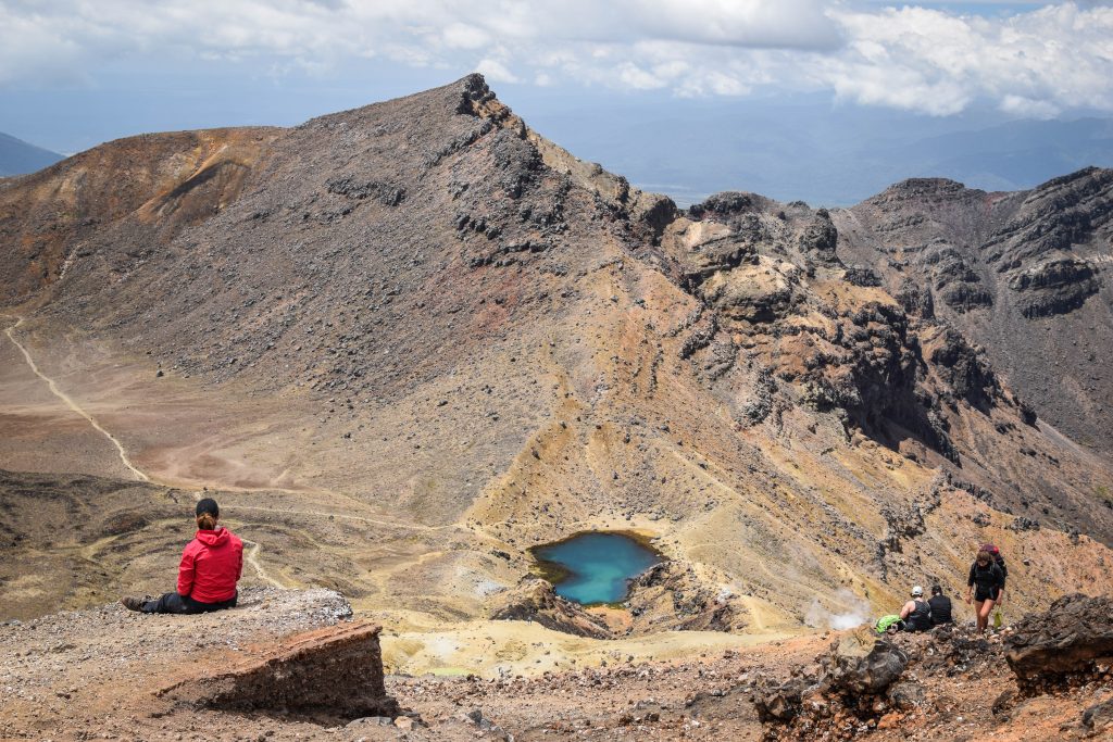
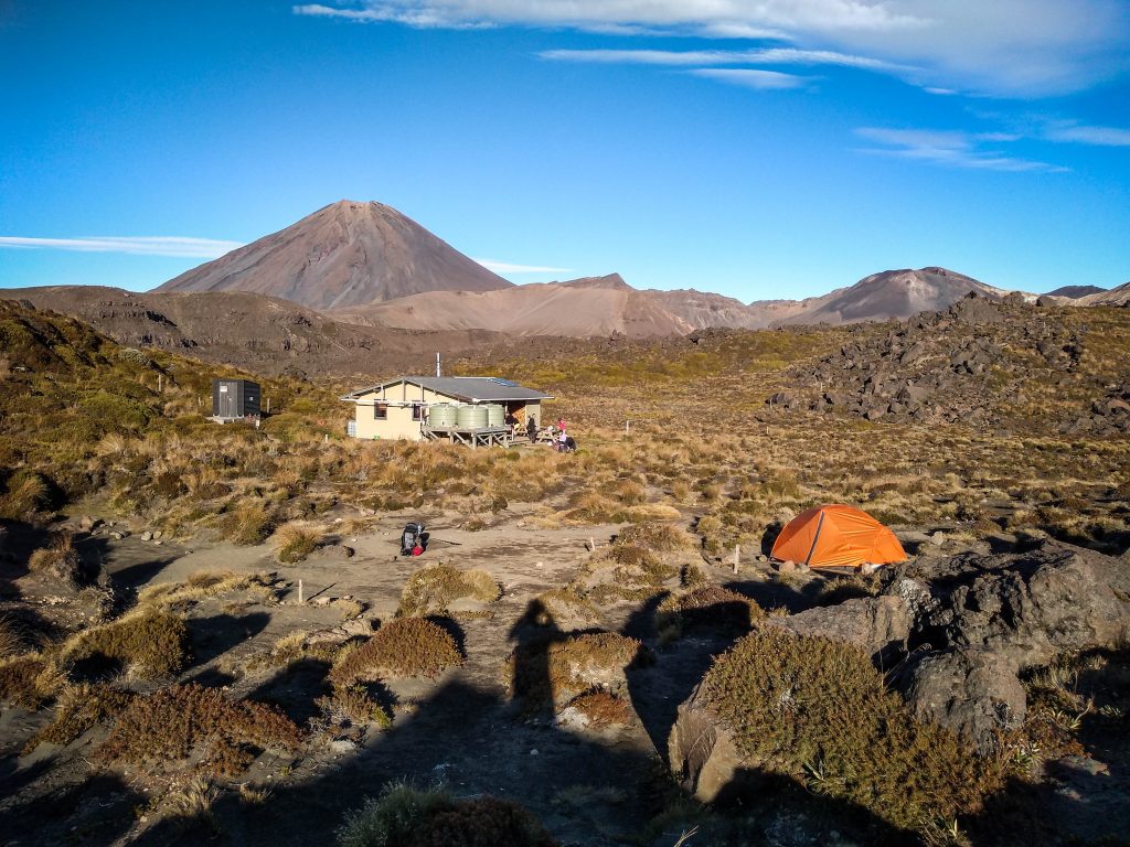
Tongariro Northern Circuit
Distance: 41 km
Time: 2-4 days
Definitely my favorite walk on the North Island. It was also my first Great Walk after arrival to New Zealand so I’m still sentimental about it. Being a loop, there is no hassle with extra transportation so it’s also budget-friendly.
I was extremely lucky with the weather and even though I initially planned the hike for 3 days, I finished it in 2 days which is perfectly doable but tiring. Do it in 3 days or 4 days if you like a more relaxed pace.
The track meanders through the rugged volcanic landscape with cones of Mt Tongariro, Mt Ruapehu and Mt Ngauruhoe around you. It includes most of Tongariro Crossing which is a day hike done by most of the tourists coming to Tongariro National Park and this section can get crowded.
Don’t miss Blue Lake, Tama Lakes and Taranaki Falls as side trips. They are all worth it!
Read the full description of the track.
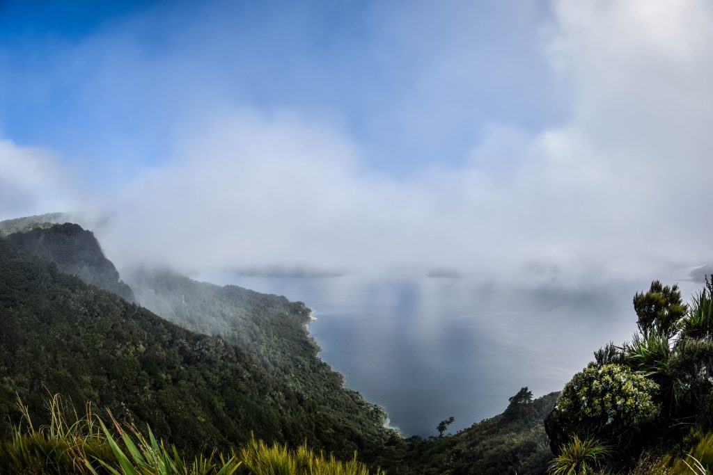
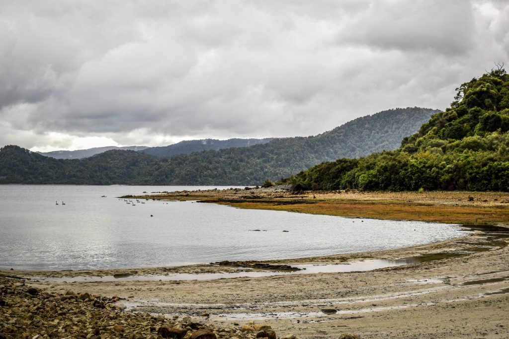
Lake Waikaremoana Track
Distance: 46 km
Time: 2-3 days
The track follows the shoreline of Lake Waikaremoana and if fairly easy except quite a steep uphill section between Onepoto and Panekire Hut (if walking from Onepoto) or Waiopaoa Hut and Panekire Hut (if walking from Hopuruahine Landing). Rainforest, waterfalls, beaches – you have it all here. Just don’t forget your swimwear!
I started the track at Onepoto and in this way covered the more difficult uphill section on the first day.
Whanganui Journey
Distance: 87 or 145 km
Time: 3-5 days
First of all, it’s not a walk. Unless you can walk on the water. If not, then grab a kayak or canoe, pack your things into waterproof containers and paddle your way down the Whanganui River.
The full version is 145 km long, starts at Taumarunui and finished in Pipiriki (5 days). If you are not such a big enthusiast of paddling, start at Whakahoro instead and cut the distance to 87 km (3 days).
It’s worth stopping at the Bridge to Nowhere, that was built in the times when soldiers coming back from World War I were granted land in the area. The land proved too difficult to cultivate and after building the bridge in the middle of the bush, the plans to continue with the road were abandoned. Therefore, today it’s quite a unique tourist attraction in the beautiful scenery.


South Island
Abel Tasman Coastal Track
Distance: 60 km
Time: 3-5 days
The trail goes along the coast and many hikers rate it as one of the easiest of Great Walks. There are several great campsites on the way where you can pitch your tent on the sand and even enjoy the shower. Jumping in the kayak and doing the whole route or only some fragments from the water perspective is a nice and popular alternative. It’s not a loop so at the end of the track, take a water taxi back to the starting point or if you have a couple of more days to spare, walk back via alternative inland track.
I did it over 3 days starting at Marahau and it seems to be an absolute minimum if you want to cover the whole distance. I camped at Onetahuti Bay and Totaranui. For more relaxed experience and longer breaks at the spectacular bays and beaches, plan 4 or 5 days.
There is one really critical tidal crossing at Aweroa that is passable 1.5 hours before and 2 hours after low tide under normal conditional. Therefore, plan your day accordingly and check tides hours online as there is no alternative way. For me, it was one of the most unique and breathtaking spots on the trail. Oystercatchers wandering around looking for food, a huge area with sand shaped by the water, hilly background and adventurous crossing on its own, sometimes with water above my knees.


Heaphy Track
Distance: 78.4 km
Time: 3-6 days
The longest and one of the most diverse of Great Walks. Being located in Kahurangi National Park, it takes not only good shape to tackle it, but you need extra cash to organize logistics. To come back from one trailhead to another, it’s a long bus trip that takes around 5 hours and costs over 100 NZD.
I hiked the track in 3 days. The first one was a mostly uphill walk in the mountainous area and forest. The second day was way flatter and the forest gave place to wide grasslands at the end arriving at the West Coast. On the last day, walking along the beach I got the chance to admire one of the most remote coasts that I have ever seen.
I spent the nights at Saxon and Heaphy campsites and both had superb location.
Outside of the Great Walks season (1 May – 30 November), it’s allowed to go on the track with a mountain bike.


Paparoa Track
Distance: 55 km
Time: 2-3 days
The only Great Walk that I didn’t experience but that’s because it’s a brand new one due to open in the second half of 2020. When I see its location on the West Coast, I have no doubts it’s on my bucket list for the second visit in New Zealand.
The track crosses the rainforest and the Paparoa Range. According to the Department of Conversation (DOC), mountain bikers are allowed as well.
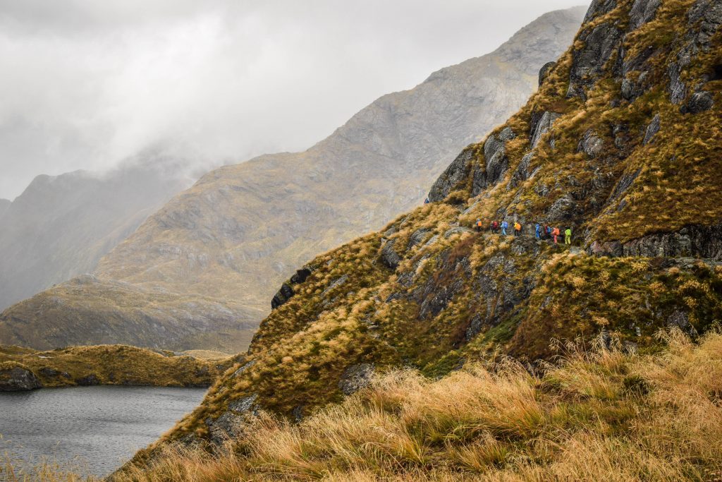
Routeburn Track
Distance: 32 km
Time: 2-3 days
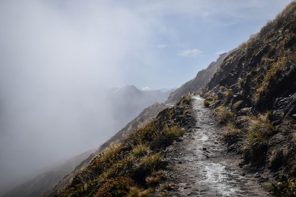
My favorite of 3 Great Walks in Fiordland National Park. It’s short but breathtaking and there are no boring sections. The weather on my first day was simply horrible with pouring rain and strong winds all the way. But if everything is booked…. gotta go 🙂 Luckily, it had a positive side too, as the passing dark clouds were extremely photogenic.
I spent the night at Lake MacKenzie campsite trying to dry my completely wet clothes at least a little bit. Of course, I failed.
The second day was much better and the sun welcomed me as soon as I opened the tent. After a full day of rain, the Earland Falls were so huge that I had to take a detour built for such situations.
It’s a great track for mountain enthusiasts. I recommend making a side trip to Key Summit which takes around 1.5-hour return. Leave your heavy backpack at the crossroad, there is no need to carry the things all the way up.
[update from DOC website as of 15.03.2020 – check regularly for further news]
The Routeburn Track partially reopens from 12 March 2020 as a new walking experience, named Routeburn Return. It’s a 4-day, 3-night hike beginning and ending at the Routeburn Shelter. This return journey starts and finishes near Glenorchy.
Routeburn Return replaces the Routeburn Great Walk, which is closed for the rest of the season due to storm damage.
The Routeburn Return route may be more challenging than the usual route because of changes in elevation and one of the days is longer than a usual Great Walks experience.

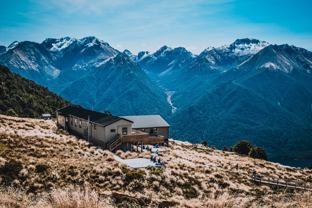
Kepler Track
Distance: 60 km
Time: 2-4 days
Being a circuit makes it easily accessible and budget-friendly. I did it over 2 days in a clockwise direction with overnight at Iris Burn but I must say it was pretty challenging and I finished completely exhausted.
The weather conditions in Fiordland National Park are pretty unpredictable which I experienced on the second day. The thin layer of snow was covering the ground and people coming from the other direction said that yesterday they were walking in a snowstorm. I was really lucky that DOC advised me to follow the clockwise direction!
There are limestone caves near the Luxmore Hut that make for a nice side trip. Take a torch!
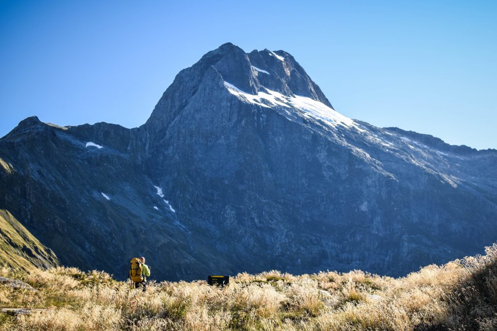
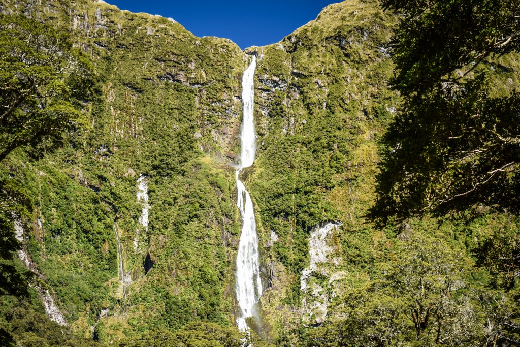
Milford Track
Distance: 53.5 km
Time: 4 days
Only 40 independent hikers can start the track each day which makes it extremely difficult to book. I did it 4 months in advance, refreshing the page several days hoping for someone to cancel. I got lucky, but it’s also easier for solo travelers.
This time I left the tent in the car as camping on Milford Track is not allowed. Even though it’s only 53.5 km long, you need to stay in all 3 huts on the way. It has pros and cons. I could easily walk such a distance in 3 or even in 2 days. On the other hand, I was ‘forced’ to take it slowly having more time to appreciate nature. Which was just fine. However, the popularity of the track, lack of campsites and additional transport from one end to another, demand quite a big budget as for the hike in the mountains.
And even though it’s my least favorite of Great Walks in Fiordland National Park, there is still a lot to appreciate. Spectacular views from MacKinnon Pass, the highest waterfall in New Zealand – Sutherland Falls (580m) and of course plenty of wildlife.
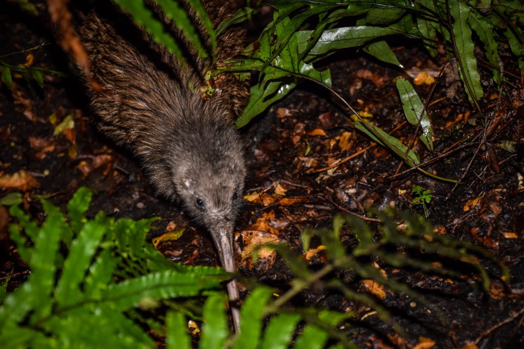
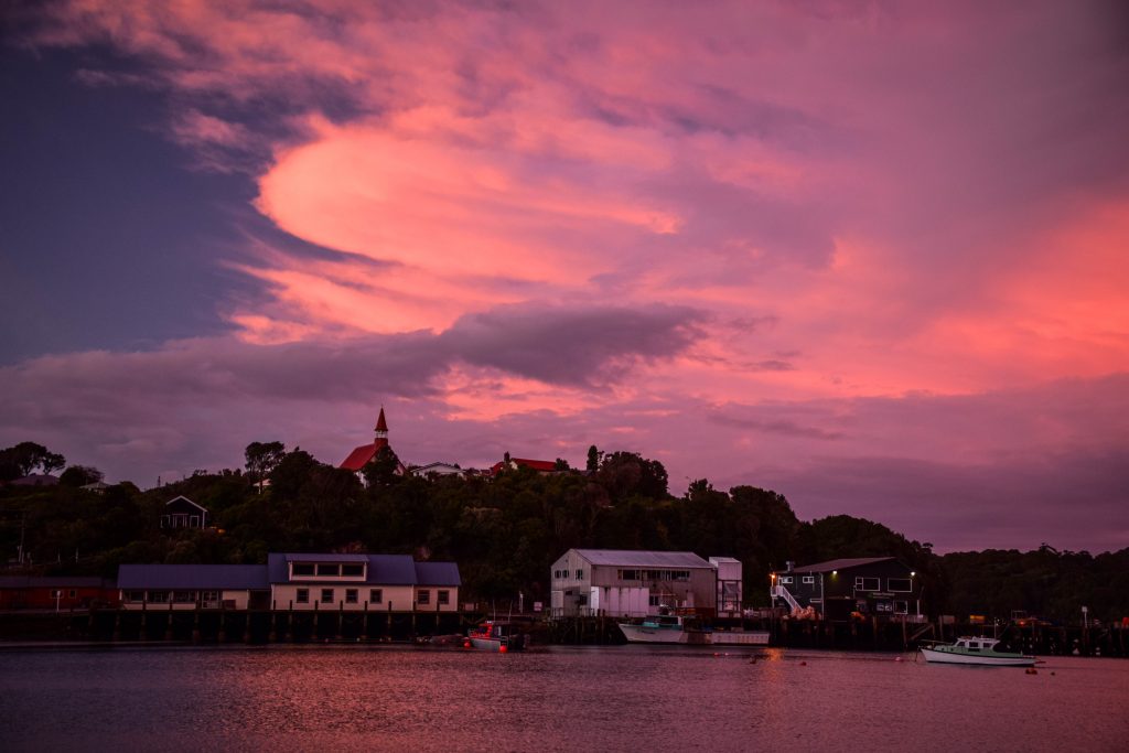
Rakiura / Stewart Island
Rakiura Track
Rakiura National Park covers around 80% of the island and is home to the least crowded of Great Walks. I booked my camping tickets only 2 days before departure which would rather not be possible on other tracks in the middle of the season.
You will hike along sandy beaches and through the forest but the most interesting part is the chance to see the kiwi. It’s the best place in the whole of New Zealand to see its symbolic bird. Apparently it’s possible even in the daylight! I suggest waking up around midnight, taking headlight (best with the red light mode that doesn’t scare kiwi off) and walking quietly around the camp.
Read the full description of the track.