Tag

featured

Browsing

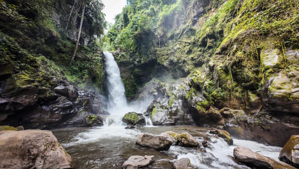
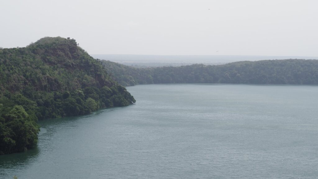
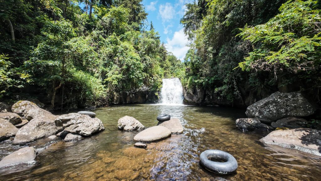
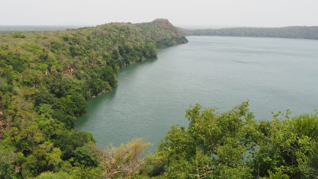
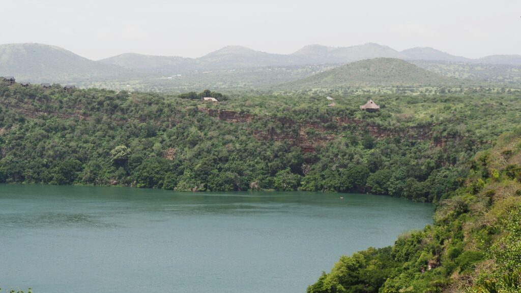
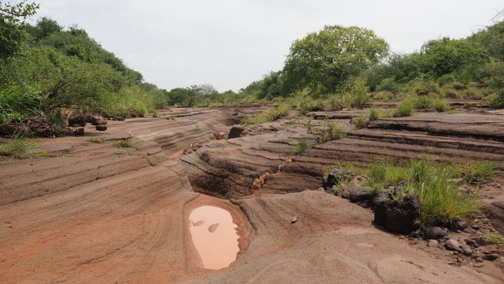
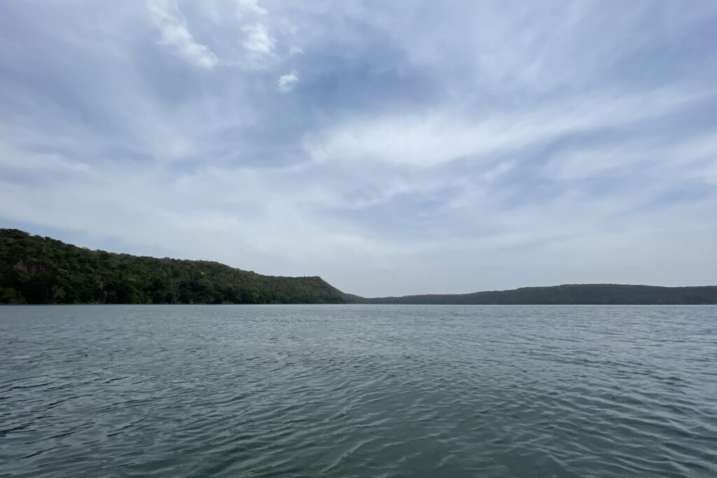
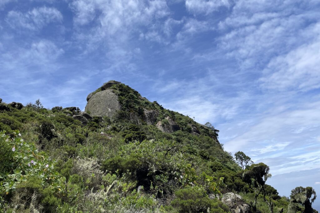
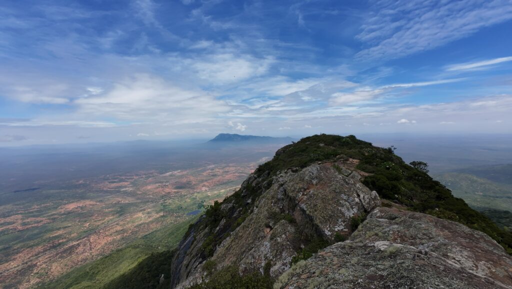
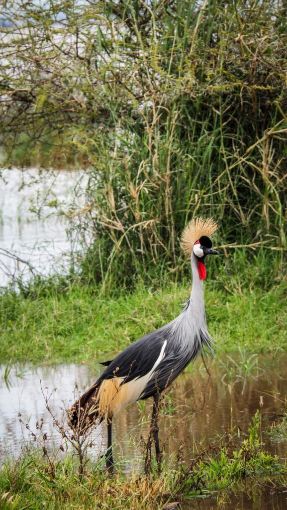
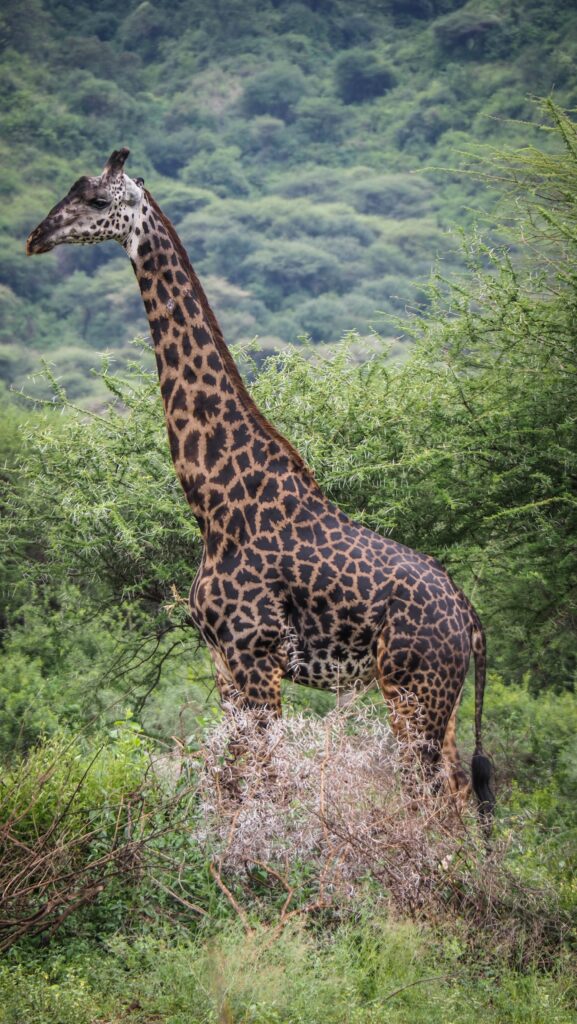
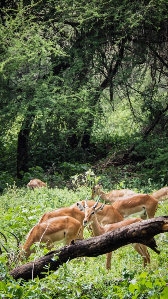
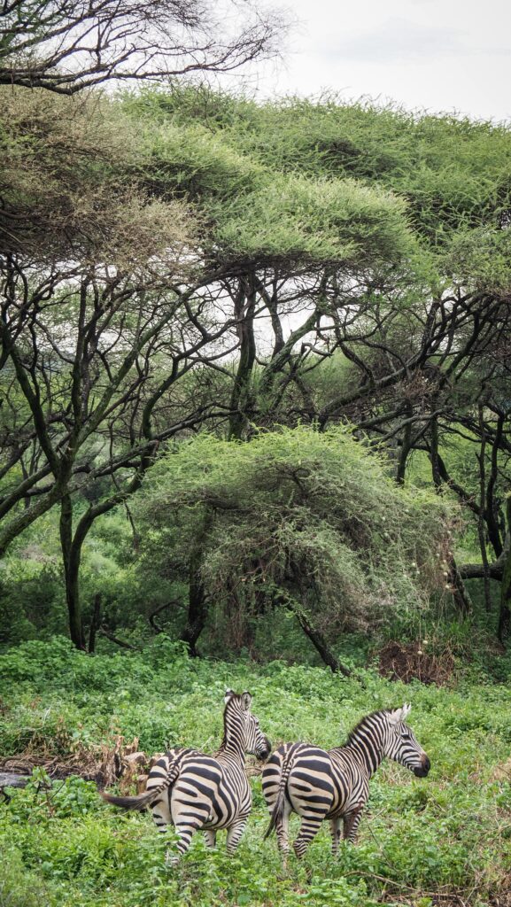
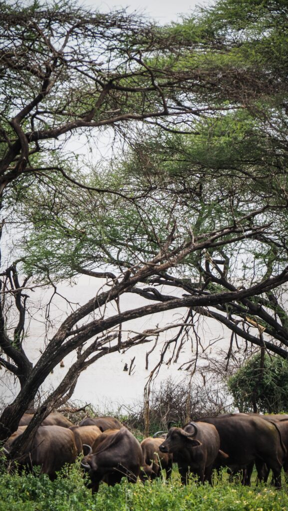
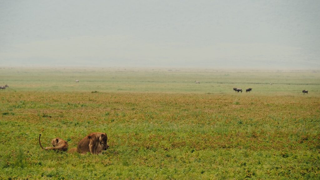
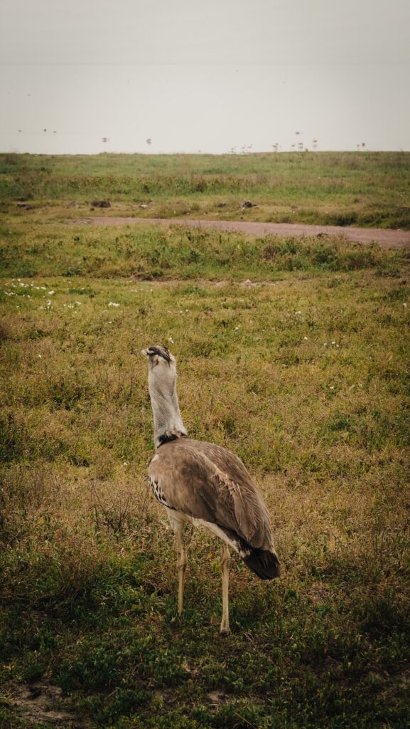
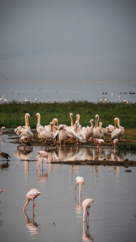
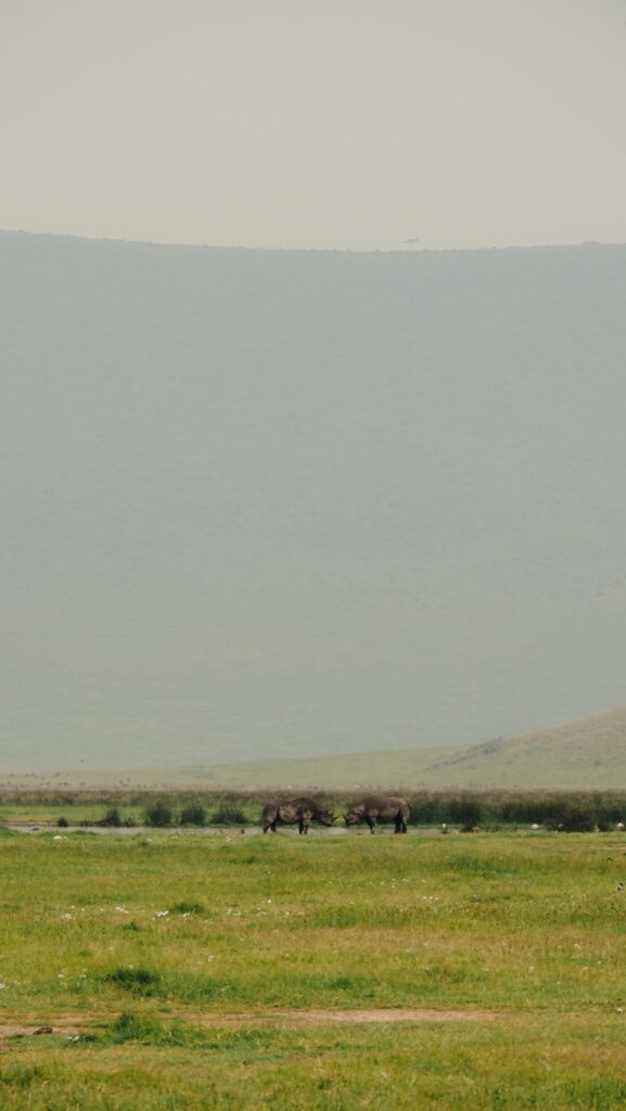
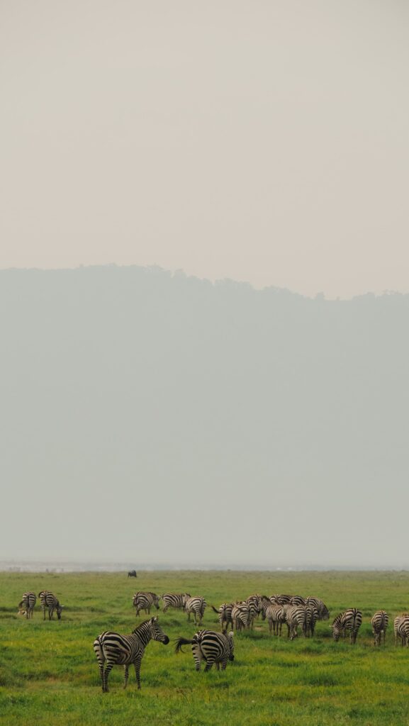
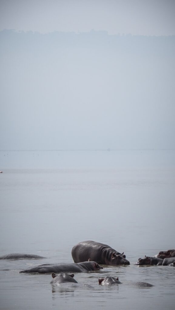
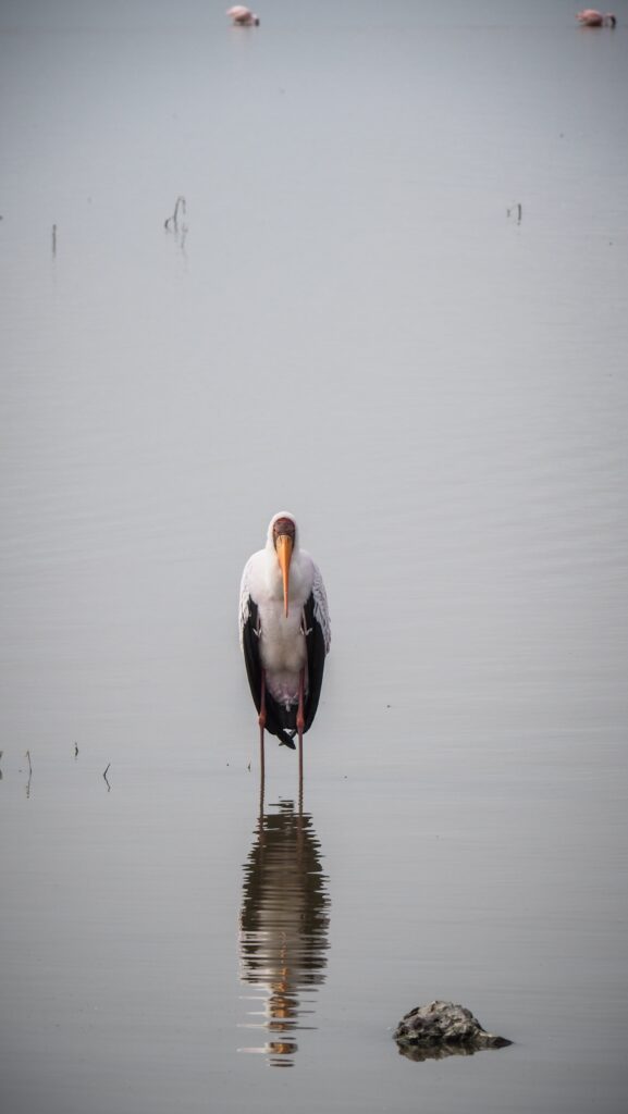
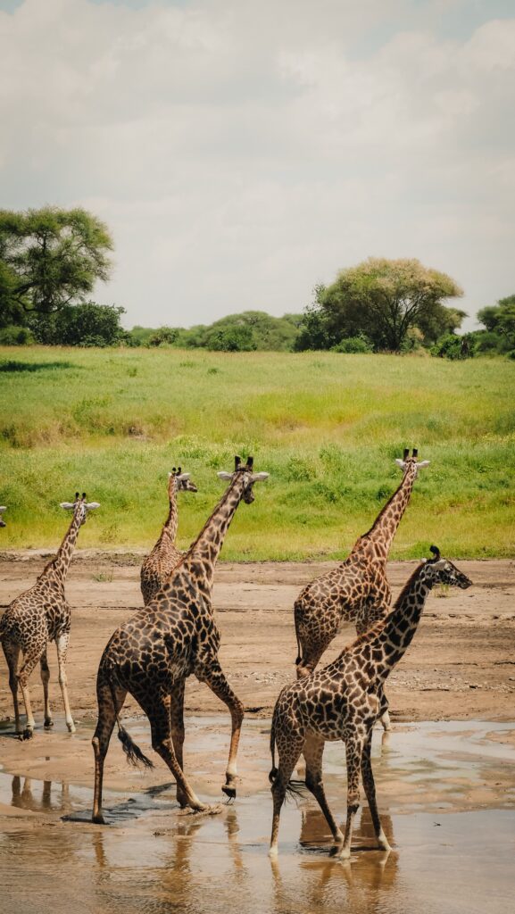
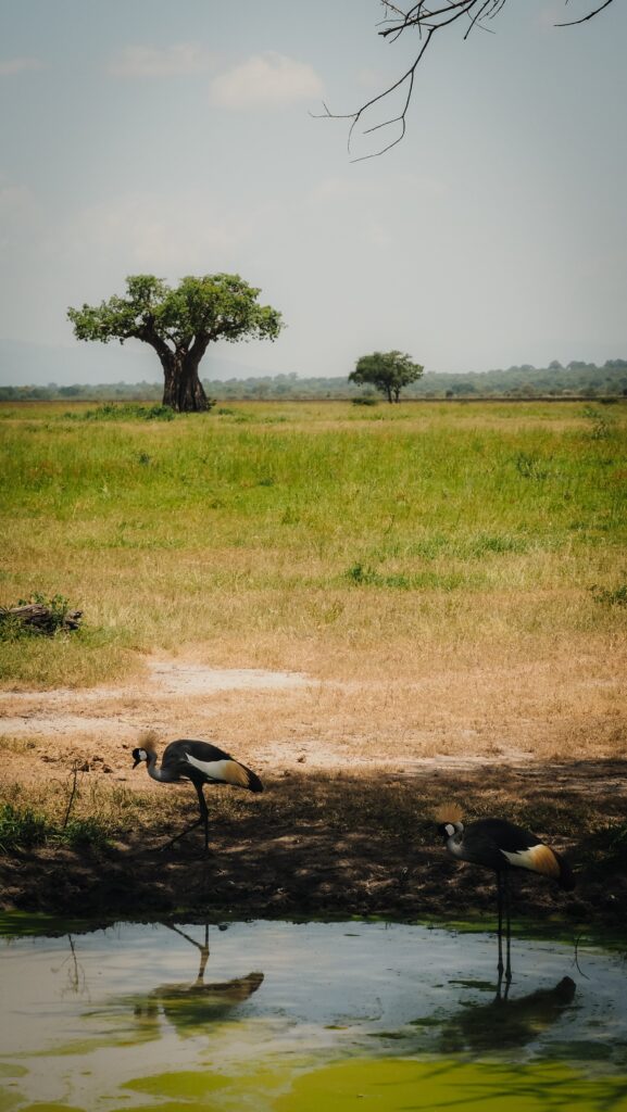
Lake Eyasi is a shallow salt lake in northern Tanzania, located at the base of the Rift Valley. It lies southwest of the famous Serengeti National Park and just south of the Ngorongoro Crater. The lake’s size and water levels fluctuate dramatically depending on rainfall, sometimes nearly drying up in the dry season. The area provides a unique ecosystem that supports a variety of bird species, including flamingos and pelicans, making it an interesting destination for both cultural and ecological tourism.

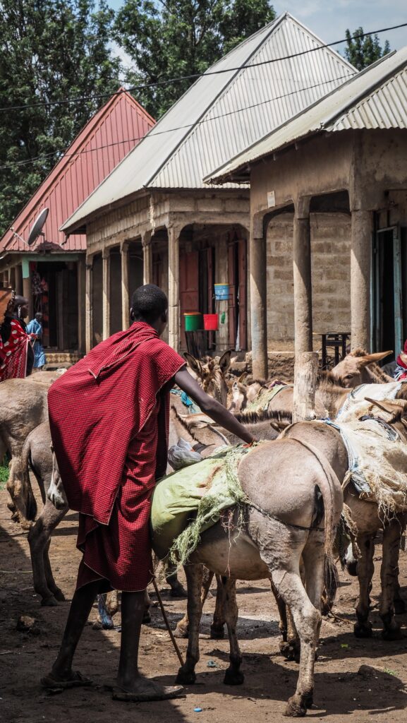
Besides all that, what attracts tourists to the region around Lake Eyasi is the presence of the Hadzabe as well as the Datonga people.

Hadzabe Tribe

An indigenous ethnic group in Tanzania, the Eyasi live primarily around Lake Eyasi. They are one of the last remaining hunter-gatherer societies in the world, relying on hunting wild animals and foraging for fruits, roots, and honey. Their way of life has remained largely unchanged for thousands of years, and they do not practice agriculture or animal husbandry.

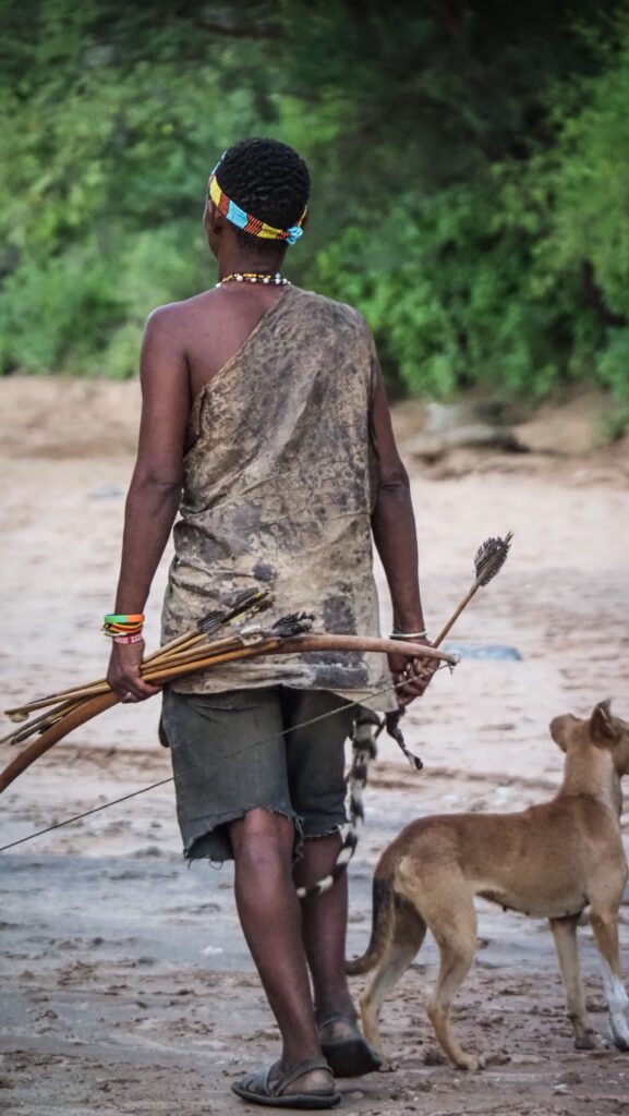
Men hunt wild animals such as antelopes, baboons, and birds using handmade bows and poison-tipped arrows, while women forage for fruits, tubers, berries, and honey. Their deep knowledge of the land allows them to precisely track animals and find food in harsh conditions.

Hadzabe society is egalitarian, meaning there are no formal leaders or social hierarchies. Decisions are made collectively, and resources are shared among the group. There is no concept of personal wealth, as everything from food to tools is distributed based on need.

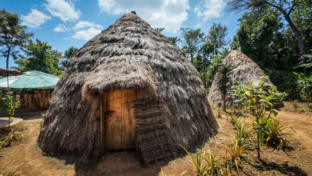
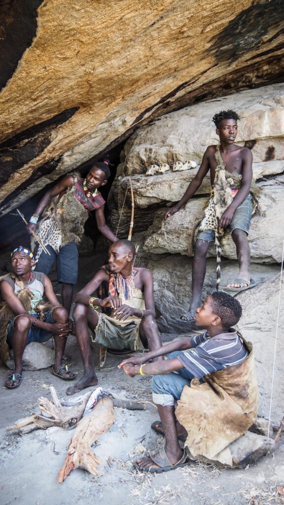
They live in small, mobile groups, often consisting of extended families. Their shelters are simple, temporary structures made of branches and leaves, reflecting their nomadic lifestyle. When resources become scarce in one area, they move to another.

The Hadzabe speak a unique click language, which is unrelated to the languages of their neighbouring tribes. Their language is part of the Khoisan language family, similar to the click languages spoken by indigenous groups in southern Africa. This linguistic uniqueness sets them apart from the surrounding Bantu and Nilotic-speaking populations.

The Hadzabe do not follow a structured religion, but they have spiritual beliefs connected to nature and ancestral spirits. They believe in the power of the sun and moon and practice rituals to ensure good hunting and well-being. Storytelling, music, and dance are central to their culture, serving as both entertainment and a way to pass down traditions.

Historically, the Hadzabe have had minimal interaction with neighbouring communities, such as the Datoga and Sukuma. However, they do trade with the Datoga, often exchanging honey and animal skins for metal arrowheads. Despite these interactions, the Hadzabe have largely resisted assimilation and continue to maintain their traditional way of life.

Despite the pressures of modernisation, the Hadzabe remain resilient. Some efforts are being made to protect their land rights and support their traditional lifestyle. Conservation groups and anthropologists have worked to document their culture and help them navigate the challenges of the modern world without losing their identity.

Datonga Tribe

A semi-nomadic pastoralist group known for its skills in cattle herding, blacksmithing, and craftsmanship. Traditionally, its wealth and social status are measured by the number of cattle it owns.

They are believed to have migrated to Tanzania from the Ethiopian highlands centuries ago, making them one of the oldest ethnic groups in the region. They are closely related to other Nilotic pastoralists, such as the Maasai, but have maintained a distinct identity through their customs, language, and social structure.

The Datoga society is organised into clans, with strong kinship ties and a patriarchal system where elders play a significant role in decision-making. Marriage is an important institution, often involving bride price payments in the form of cattle. Polygamy is common, especially among wealthy men who can afford multiple wives. Women have important roles in managing households, milking cattle, and crafting traditional clothing and ornaments.

One of the unique aspects of Datoga culture is their blacksmithing skills. While they are primarily herders, some subgroups specialise in metalwork, creating tools, knives, spears, and arrowheads, which they trade with neighbouring communities, including the Hadzabe. This trade has historically been essential for both groups – the Hadzabe provide honey and animal skins, while the Datoga supply metal tools.

The Datoga have a rich spiritual tradition that is deeply connected to nature and ancestor worship. They believe in a supreme deity, whom they associate with the sky, rain, and fertility. Rituals, sacrifices, and ceremonies are common, especially during important life events such as birth, initiation, marriage, and death.

Like many indigenous groups, the Datoga face increasing challenges due to modernisation, land encroachment, and government policies promoting settled lifestyles. Some have adapted by incorporating small-scale farming, but others resist change, striving to preserve their nomadic traditions. Education levels remain low among the Datoga, as formal schooling is not traditionally emphasised in their society.

How to get there?

By Air

The nearest major airport is Kilimanjaro International Airport (JRO), located near Arusha. From there, it’s 250 km (around 5-7 hours) to Lake Eyasi.

By Road

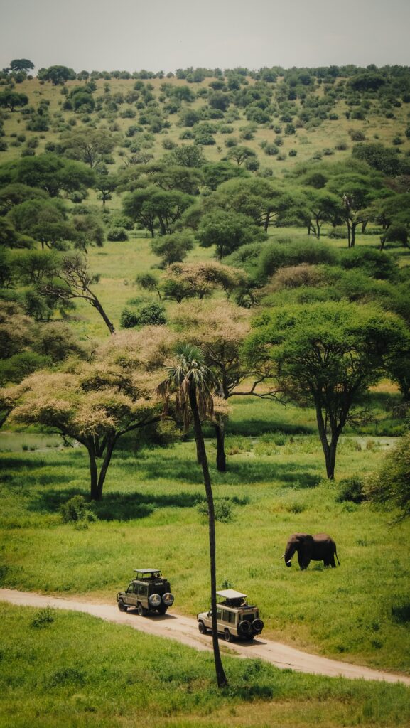
Most visitors travel to Lake Eyasi by road, usually as part of a safari tour, but reaching it by public transport is also possible.

From Arusha: The drive takes about 4 to 5 hours via Karatu. The road is well-paved until Karatu, but the final stretch to Lake Eyasi is a rough dirt road.

If travelling by public transport, take a local bus or shared taxi (dala-dala) from Arusha to Karatu, and then change to a shared 4×4 Land Cruiser, or hire a private car or motorcycle to reach the lake.

From Ngorongoro Crater: If you’re coming from Ngorongoro, it’s about a 2 to 3-hour drive.

From Serengeti: It takes about 5 to 6 hours, depending on your starting point in the park.

Lake Eyasi, Tanzania
Lake Eyasi

The best time to visit

The best time to visit Lake Eyasi is during the dry season, from June to October, when the weather is cooler, and wildlife is easier to spot. During this period, the lake’s water levels are lower, attracting a variety of bird species, including flamingos. It’s also an excellent time to interact with the Hadzabe and Datoga communities, as access to their villages is easier due to dry roads.

The wet season (November to May) brings lush landscapes and fuller water levels, making it a great time for birdwatching. However, travel can be more challenging due to muddy roads, and some areas may be inaccessible. If you’re interested in cultural experiences, both seasons offer opportunities to meet local tribes, but the dry season is generally more convenient for travel.

Where to stay?

I stayed in the Sarafina Guesthouse. The rooms were clean, but there were lots of mosquitoes inside. Luckily, a good-quality net above the bed was provided, but I could still hear them buzzing, which was disturbing.

You may also consider staying in Ziwani Lodge or Eyasi Safari Motel.

Going independently or with a guide?

Lake Eyasi can be reached independently, although most people come there as part of a safari trip, including national parks. If you decide to do it by yourself, use public transport from Arusha to reach Karatu and then Mang’ola.

Upon arrival, ask your guesthouse or motel to arrange a guide and motorbike taxi to the shore of Lake Eyasi or Hadzabe and Datonga villages.

If you prefer taking a guide from Arusha, I recommend getting in touch with Daudi (+255 621 146 836). He is a great guy who speaks English very well and will help you get around Arusha and its surroundings. The trip to Lake Eyasi (2 Days 1 Night), including public transport, accommodation and visits to tribes, will cost you about 150 – 170 USD, depending on your negotiation skills. I don’t recommend a one-day trip as you will spend most of the time on the bus, and you won’t get the chance to hunt together with the Hadzabe.

My experience

Day 1

I had an early morning breakfast and then went to the meeting with Daudi, who was again my guide. A few days before, we did a walking tour in Arusha, and that was when we decided to go to Lake Eyasi together. We found a shared car (locally called Noah) heading to Karatu, where we changed for the shared jeep (old Land Rover Defender) heading towards Mang’ola Village. Both vehicles were full to the limits, and even changing sitting position was difficult. Tanzanians have the unique ability to squeeze themselves, and even the driver shared his seat with another passenger!

The jeep dropped us in front of the guesthouse. The room was okay, and there was even hot water, but it was full of mosquitoes. Luckily, as usual in Tanzania, a mosquito net was provided.

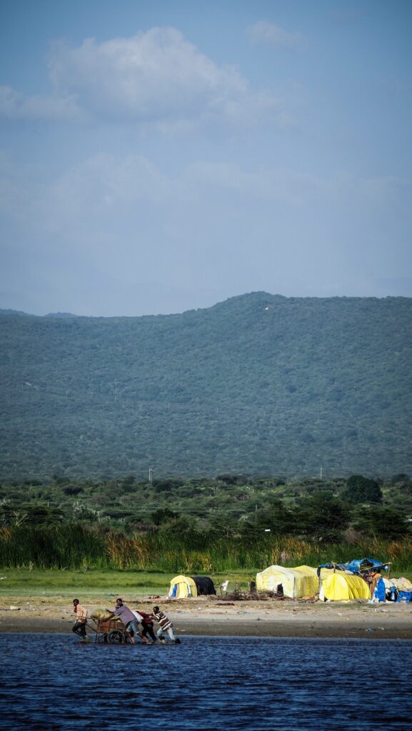
Soon, the local guide arrived on his motorcycle and we went to the lakeside. There were a lot of fishermen living in temporary tents made of some kind of plastic foil and wood. Apparently, they come from different parts of the country to spend a few months at the lake to fish and earn money.

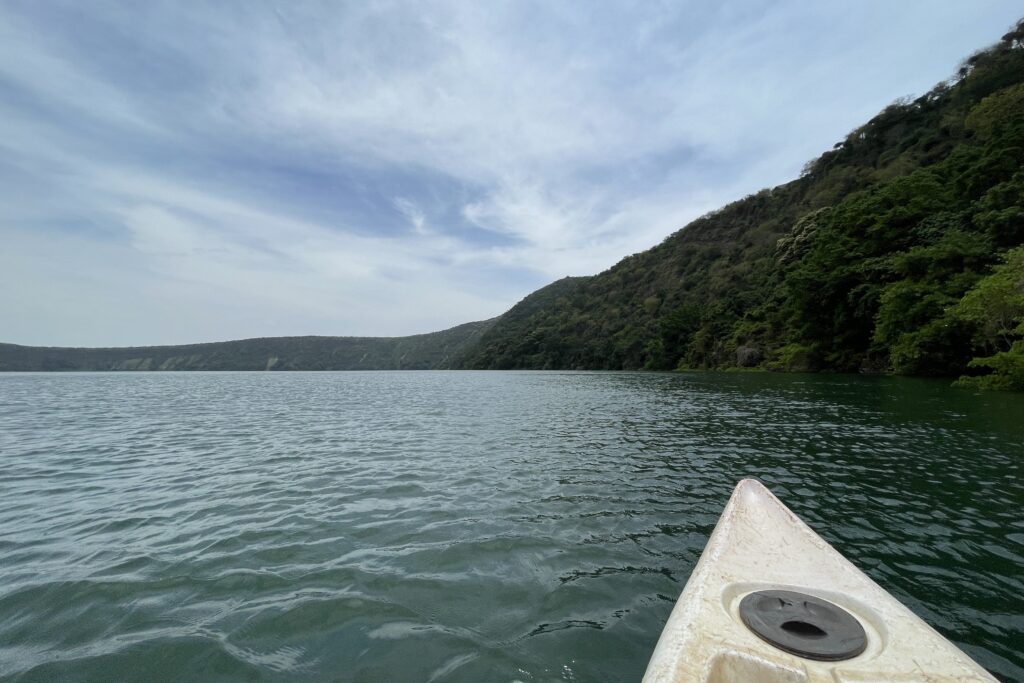
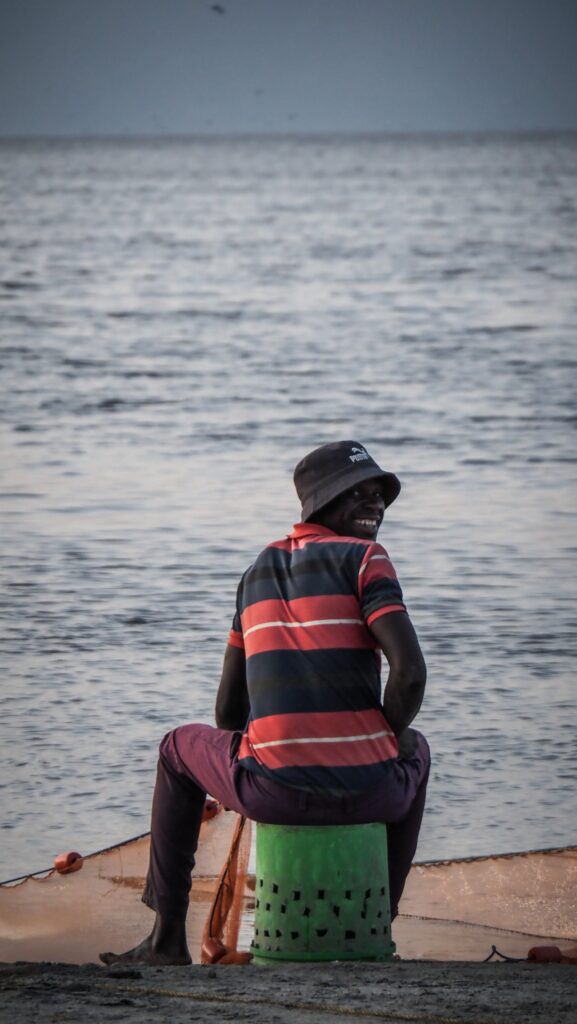
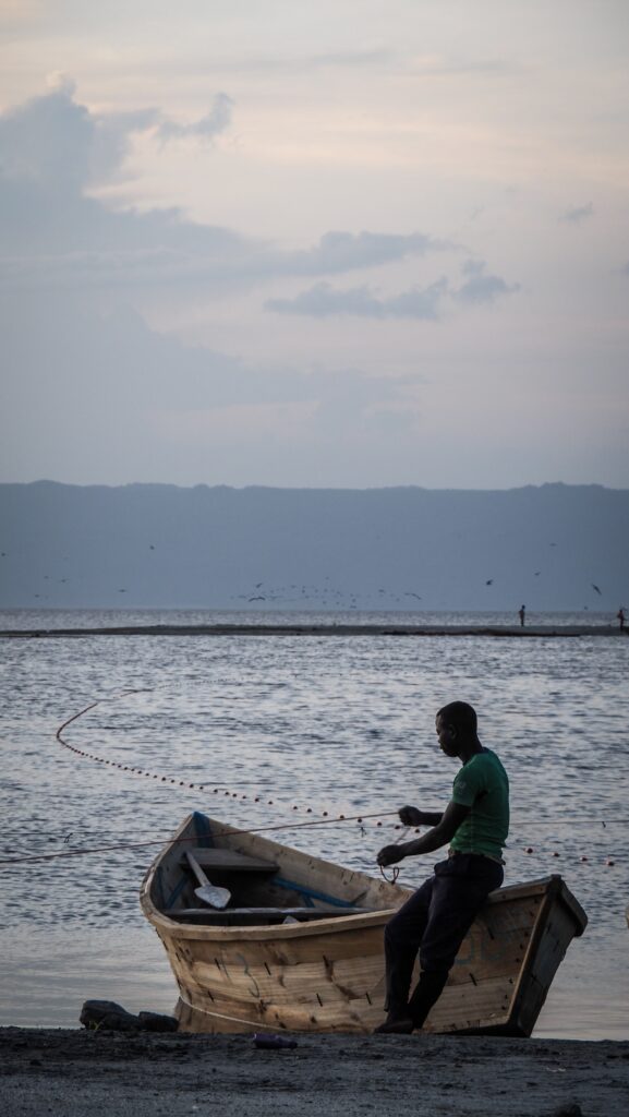
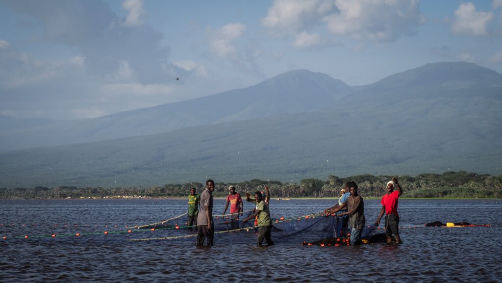
A group of local boys took us on a short boat trip. They paddled around and we got closer to fishing nets and made a stop on a small sand bank. There, we waited for the sunset. Fishermen were pulling the nets out of the lake, and it looked like really hard work. They had ropes attached to their waist and were making characteristic movements forward and backwards.

After sunset, we went to eat dinner in a local bar/restaurant. A very kitschy place with mediocre food, but there were no alternatives. Then, we went back to the accommodation, agreed on the plan for the next day, and Daudi explained to me a bit about what we could see in the sky. The conditions were great for stargazing as there was minimal light pollution in the village.

The night was quite bad as it was too hot to sleep, and the mosquitoes were buzzing outside the net like crazy. I think sleeping in that room without a mosquito net would be suicidal!

Day 2

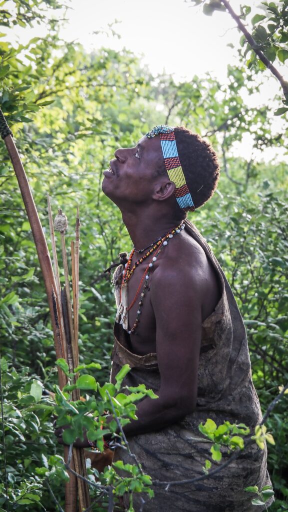
We woke up at 4:30 AM and left the guesthouse at 5 AM when it was still pitch black, but the night sky looked amazing as it was full of stars! The motorbike ride took nearly an hour, and when we arrived at the Hadzabe tribe, they were still sleeping. The fire smouldered in the fireplace, and after a moment, a figure emerged from the darkness to greet us.

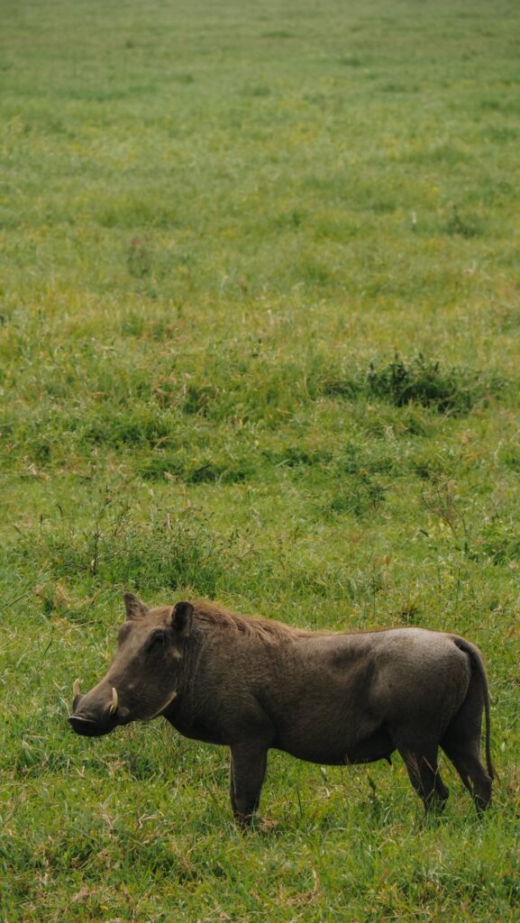
A father with his two children got ready for the hunt, and we joined them. We walked for quite a bit until we reached a dry river bed and started following the prints of animals on the sand. For a long time, the Hadzabe were trying to chase warthogs but unsuccessfully. Following them wasn’t easy as the vegetation was thick and full of thorns, and I had a backpack.

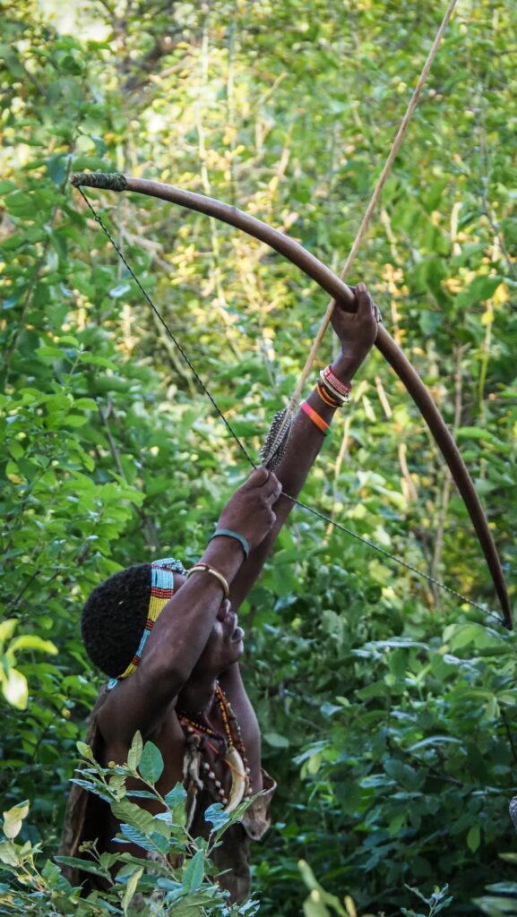
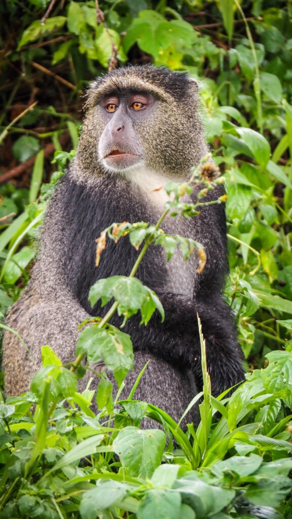
The warthog was lucky enough to get away, so Hadzabe started trying to get the monkey. It was sitting on a huge baobab tree, so they were throwing stones, hoping for the monkey to change position and get in the range of the arrows. After probably an hour of trying, climbing the tree and doing all the tricks, they had to give up. It wasn’t a lucky day for the Hadzabe, and it showed that hunting for wild animals isn’t easy at all!

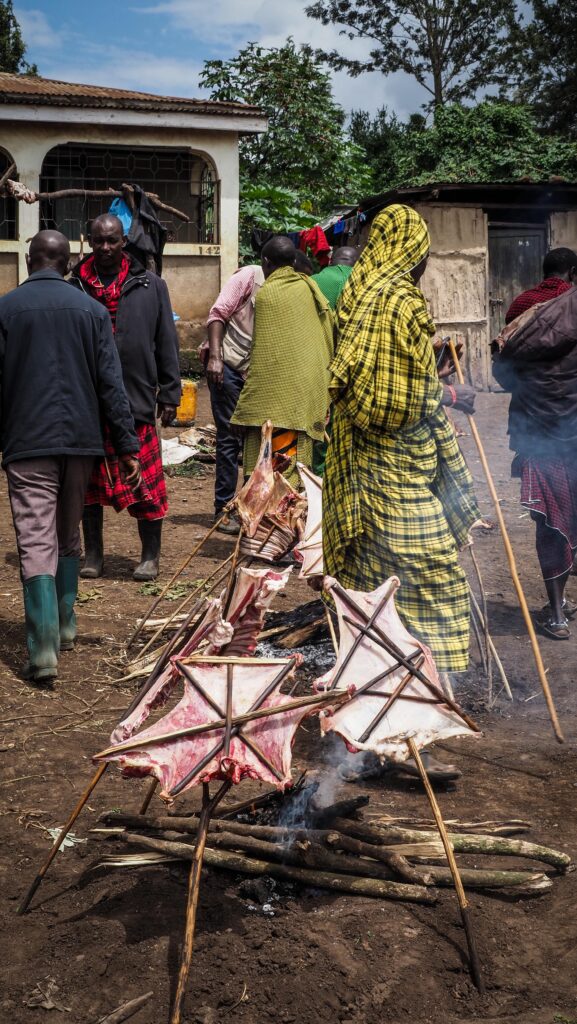
We made a small break, and the father with his two sons (10-14 years old) shared… a giant joint. Then, we walked deeper into the bush again, looking for the traces of animals, but in the end, we came back to camp with empty hands. I tried shooting from the bow, took some more pictures of people and the visit was concluded with a short dancing performance. That part felt a bit too touristy for me.

We jumped on motorbikes again and went to the Datonga tribe. We watched them make an arrowhead from start to finish: melting old iron, putting it into a long and thin form, and then using a hammer and other tools to shape it. Quite boring to be honest! I wanted to take some pictures of people, but they were very shy and not willing to look at the camera.

Then, we went for a quick lunch before we were dropped off at the lodge to pick up the things and wait for the jeep heading back to Karatu. There, we changed to the shared car heading to Arusha, and luckily, the driver offered us to pay for an extra seat so we could leave immediately without waiting for more passengers. We also had more space, which was so much more comfortable!

Monduli Juu is a scenic, highland area near Monduli town in northern Tanzania, known for its stunning landscapes, Maasai culture, and hiking opportunities. It is part of the Monduli Mountains, located about 50 km from Arusha.

The area is home to traditional Maasai communities, offering an authentic cultural experience, including visits to bomas (homesteads), learning about Maasai traditions, and experiencing their warrior training rituals.

I passed by many Maasai bomas in the Ngorongoro area, but all had rather negative reviews as not being very authentic. Therefore, I was looking for a better experience, and the Monduli Juu Bush Maasai Experience seemed to offer what I wanted. I contacted them on WhatsApp and was advised to come over on Saturday so we would have the chance to have a look at the traditional Maasai Market.

Maasai Tribe

The Maasai are one of the most well-known ethnic groups in Tanzania, recognised for their distinctive dress, semi-nomadic lifestyle, and deep-rooted traditions. They primarily live in northern Tanzania and southern Kenya, inhabiting areas like the Ngorongoro and Monduli. Their culture is built around livestock, community, and spiritual beliefs that have been passed down for generations.

Livelihood and Economy

The Maasai are traditionally pastoralists, relying on cattle, goats, and sheep for food, trade, and status. Cattle are central to their way of life, providing milk, blood, and meat, though in modern times, many Maasai also engage in small-scale farming and tourism-related activities.

Social Structure and Community Life

Maasai society is highly communal, with an emphasis on age-set systems that determine roles and responsibilities. Young boys begin as herders, while young men undergo initiation ceremonies to become warriors. Elders hold the most respected positions, guiding the community in decision-making and traditional knowledge.

Dress and Adornment

Maasai clothing is colourful and symbolic. Men often wear shúkàs (a red or blue cloth wrapped around the body), while women adorn themselves with intricate beadwork, earrings, and necklaces that indicate age, marital status, and social rank. Bead colours have different meanings – red symbolises bravery, blue represents the sky, and white signifies purity.

Language and Oral Traditions

The Maasai speak Maa, a Nilotic language, but many also speak Swahili and English due to interactions with other communities and tourism. Their history, values, and lessons are passed down through oral storytelling, songs, and proverbs rather than written records.

Spiritual Beliefs and Rituals

The Maasai believe in a supreme god, Enkai (or Engai), who controls rain and fertility. Rituals and ceremonies, such as Eunoto (warrior initiation) and Enkipaata (boyhood initiation), are essential in transitioning through life stages. The jumping dance (Adumu), performed during celebrations, is one of their most famous traditions.

Challenges and Modern Adaptations

While the Maasai have maintained their traditions, modernisation, land disputes, and climate change have influenced their way of life. Some Maasai have adapted by engaging in education, conservation work, and tourism while still preserving their cultural identity.

How to get there?

By Road

Take a dala dala (minibus) or shared car from Arusha to Monduli (about 1 hour). When you arrive at the bus stand, find a motorbike (boda boda) driver or another shared car that will take you further to Monduli Juu.

The best time to visit

Dry Season (June to October – Best for Safaris & Hiking)

Little to no rainfall, making it ideal for outdoor activities like hiking in the Monduli Mountains and visiting Arusha National Park. Wildlife is easier to spot due to the sparse vegetation. Cooler temperatures, especially in the mornings and evenings.

Short Rainy Season (November to December – Green Landscapes)

Short rains bring lush scenery, which is great for photography. Wildlife is still visible, but roads might be muddy.

Long Rainy Season (March to May – Least Recommended)

Heavy rains can make some roads difficult to navigate. Higher chances of cloud cover and reduced visibility.

Day trip to Monduli Juu

I took a morning dala dala to Monduli town, and I was squeezed to the limits with 4 people sitting on the seat for 3. I paid 2.000 TZS. Once I arrived in the town, I jumped on a boda boda heading towards Monduli Juu (10.000 TZS).

We were riding on an unpaved road, and at some point, a police patrol stopped us. Suddenly, out of nowhere, my guide, whom I was supposed to meet at the red market, appeared. His name was Nathaniel, and he said that we were going the wrong way. He brought his motorbike, and we continued the journey together. At this time of the day, the market was almost empty, so we just went for a short walk and then set off to the Maasai Boma.

We had a look inside a few houses, but women were cooking inside, and it was hard to breathe as the interiors were full of smoke. Anyway, I could see how they live and sleep, and I must say: WOW. No running water, just sleeping on the ground or some improvised wooden bed with a cow’s skin on top. Maasai can have several wives, so inside the boma, there are houses in a circular layout and inside each of them lives one wife. Sometimes, the man goes out for a few weeks to walk with livestock, and the women stay, taking care of the houses and kids.

There were lots of children, and they were very curious, following me and Nathaniel closely.

From the boma, we continued to the Monduli Juu Camp, where we started our walk to the viewpoint. On the way, we even managed to see some giraffes, so it felt like we were on a walking safari! A very nice experience! The view was cool, and we could see the impressive Rift Valley.

Then, we walked to the praying tree. According to local people, it has special powers, and they put stones on its branches, hoping for their dreams to come true. So did I.

Finally, we came back to the market, which was already in full swing. Plenty of perfect photo opportunities, although the people selling goats didn’t like the fact that I was walking around with a camera. My guide told me not to worry, as those were the Maasai from Dar es Salaam, who aren’t as friendly and open as the local people.

We went to the other side of the road to see other stalls, and the atmosphere was fantastic. People were selling fruits and veggies, shoes, food, and plenty of other things. I managed to take some shots, although I was observed by everyone. The guide helped me a bit by distracting people with conversation and drawing their attention.

In general, I didn’t get as many nice photos as I was hoping for, but still, it was a nice place to visit. We jumped on the motorbike and Nathaniel took me back to Monduli town. The weather was getting worse, and there was even a short drizzle on the way. In town, I caught a dala-dala heading back to Arusha.

Costs

According to the official brochure, a day trip to Monduli, including all activities (visit in a traditional boma, hike to the viewpoint and to the Lion Tree to make a wish, meeting a traditional healer, Maasai dance, picnic lunch and optional visit to the Saturday market), costs 120 USD for 1st person (without transport) and then 40 USD extra for every additional visitor. If you are not interested, you can resign from some activities and re-negotiate the price accordingly.

The market can be reached independently at minimal cost, but the presence of the guide helped a lot with taking pictures, and the visit to the traditional boma and the hike were worth it too. Here are some contact details:

Monduli Juu Bush Camp: +255 765 799 486

Nathaniel (guide): +255 713 758737

Moshi, a lively town in northern Tanzania, sits at the foot of Mount Kilimanjaro, making it the gateway for climbers heading to Africa’s highest peak. But beyond its role in tourism, Moshi has a fascinating history shaped by indigenous cultures, colonial rule, and economic growth.

Long before colonial influence, Moshi was part of the Chagga kingdom, an ethnic group known for their advanced agricultural practices, including the ingenious Irrigation Furrow System that still supplies water to farms today. The Chagga people lived in small chiefdoms, often competing for power and resources, until they were later unified under external influences.

When German explorers arrived in the late 19th century, they recognised Moshi’s potential due to its fertile land and strategic location. The Germans established Moshi as a colonial administrative centre and built roads, railways, and coffee plantations.

During World War I, British forces took over Moshi from the Germans, and it became part of British Tanganyika. The British continued coffee production and infrastructure development, further integrating Moshi into the regional economy.

After Tanzania gained independence (1961), Moshi flourished as a centre for coffee production. The Kilimanjaro Native Cooperative Union (KNCU), one of Africa’s oldest coffee cooperatives, played a major role in empowering local farmers.

Today, Moshi is a vibrant town known for its coffee culture and tourism industry and as a base for Kilimanjaro climbers. Despite modernisation, it retains its rich Chagga heritage and colonial-era influences.

How to get there?

By Air

The nearest airport is Kilimanjaro International Airport (JRO), located about 40 km from Moshi. It serves international and domestic flights.

Taxi/Private Transfer from the airport to town takes 45 minutes and costs about $30-$50. Alternatively, some hotels and tour companies offer shared transfers (~$10-$20) or just take a local tuk-tuk and negotiate the price.

You can also fly into Julius Nyerere International Airport (DAR) in Dar es Salaam or Abeid Amani Karume Airport (ZNZ) in Zanzibar and take a domestic flight to JRO or Arusha.

By Road

From Arusha (80 km, 1.5-2 hours) – Buses, shared taxis, and private transfers run frequently.

From Dar es Salaam (500 km, 8-10 hours) – Luxury buses like Kilimanjaro Express or Dar Express offer comfortable rides for 15-20 USD.

From Nairobi, Kenya (350 km, 6-7 hours) – Shuttle services run daily, costing about 30 USD. Border crossing at Namanga is required.

By Train

Tanzania’s rail network is limited, but there is a train from Dar es Salaam to Moshi (though infrequent and slow). Buses are a better option.

The best time to visit

June to October (Dry Season)

Clear skies, warm days, and cooler nights. Best time for Kilimanjaro climbing and outdoor activities. Ideal for coffee tours, cultural visits, and exploring waterfalls.

January to mid-March (Short Dry Season)

Great for trekking in warmer temperatures. Lush green landscapes after the short rains.

Months to avoid:

Mid-March to May (Long Rainy Season)

Heavy rains make trails slippery. Not ideal for Kilimanjaro trekking, but the waterfalls are at their fullest.

November to early December (Short Rains)

Unpredictable weather, but fewer tourists.

For coffee lovers:

If you’re visiting for a coffee tour, aim for September to December, when the coffee cherries are being harvested. It’s a great time to see the full process from picking to roasting, with the added bonus of lush green scenery.

Where to stay?

I recommend Karibu Africa House and The Better Inn. Both places offer good quality at an affordable price, and they also offer day trips to Lake Chala or Marangu, but Karibu Africa House is significantly cheaper in that aspect.

Places worth seeing in Moshi

You don’t need a lot of time to get around the town as most of the interesting places to see are located out of it. Luckily, the distances aren’t long!

Mbuyuni Market

It is one of the busiest and most vibrant local markets in town. You can find there a variety of locally grown fruits, vegetables, and spices, butcher stalls and fresh fish from nearby lakes, colourful kitenge and khanga fabrics, plus second-hand clothes, traditional Maasai jewellery, woven baskets, and souvenirs.

Places worth seeing outside of Moshi

Rau Forest Reserve

It is a lush, tropical forest located just a few kilometres from Moshi, offering a peaceful escape into nature. Home to colobus monkeys, blue monkeys, dik-diks, and a variety of bird species. The forest can be explored on guided nature walks or bike tours.

Materuni Waterfall and Coffee Tour

The road to the waterfalls was quite bumpy as it was going up the hills. I just got a boda boda driver on the street and asked him to take me there and back. Remember to negotiate the price before you jump on the motorbike, and make sure that waiting time is included.

Once we arrived, I was immediately offered an expensive package of waterfall and coffee plantation tours, but luckily, during the first weeks in Tanzania, I improved my negotiation skills and was able to get a much better deal.

We started with a coffee plantation. It wasn’t harvesting season, so we didn’t see many coffee beans on the trees, but after introduction, I was shown how to dry the beans, smash them into powder and separate them from the shells. At the end, there was a tasting session. Everything was accompanied by a group of villagers singing. Pretty cool!

Afterwards, I changed the guide, and we walked to the waterfall. He was a nice guy, and the route was pretty too, packed with white tourists. It’s rather an easy 30-40-minute slow walk through the community area and a forest rather than hiking. The guide is not necessary as the path is clear, but they try to earn money, which is understandable. It’s crazy that this trip is offered by tour agents for about 100 USD from Moshi, while by doing it yourself and coming on a motorbike, you can cut costs to 20-30 USD.

The waterfall was impressive! It’s about 80 meters tall, with lots of water and green surroundings but not suitable for swimming. It was worth coming here!

Marangu, Tanzania
Coffee tour
Marangu, Tanzania
Coffee tour

Kikuletwa Springs

Clean blue water with small fish that nibble you if you stay still in the water, but they are not harmful. You can rent rubber tubes for 5.000 TZS or swimming goggles for 10.000 TZS. There is also a swing. You can either decide to get a transfer there from Karibu Africa House for 50 USD or save yourself money and go independently by hiring a boda boda (motorbike) driver from Moshi and negotiating the price. It should be fair to pay between 30.000 – 40.000 TZS with waiting time as it is about 40 kilometres one way.

Marangu

Tucked away in the lush foothills of Mount Kilimanjaro, Marangu is a charming Tanzanian village that offers far more than just the most famous route to Africa’s highest peak. Verdant coffee farms, waterfalls cascading through dense rainforests, and hidden caves tell stories of both nature and history.

Read more about Marangu in a separate post HERE.

Marangu, Tanzania
One of the waterfalls in Marangu

Lake Chala

Lake Chala is a stunning crater lake on the border of Tanzania and Kenya. It was formed over 250,000 years ago due to volcanic activity associated with Mount Kilimanjaro. It sits in a deep caldera, which was created by a massive eruption that caused the land to cave in, forming the lake basin. Over time, underground springs fed by Kilimanjaro’s glaciers filled the crater, creating the lake we see today.

Lake Chala is about 55 km from Moshi. Many tour operators in Moshi and Arusha offer guided day trips, including transport, meals, and activities like hiking or kayaking. I found the best price at Karibu Africa House in Moshi – 80 USD, all-inclusive. Ignore other offers asking for 150 – 200 USD as this is a typical Tanzanian rip-off.

Read more about Lake Chala in a separate post HERE.

Lake Chala, Tanzania

Kilimanjaro

Suppose you’re in Moshi but don’t have time for a full Kilimanjaro climb. In that case, day hikes offer a perfect way to experience the mountain’s beauty, diverse landscapes, and rich culture without the intense commitment of a multi-day trek. Here are two popular variants:

1. Kilimanjaro Day Hike via Marangu Route

From Marangu Gate (1,870m) to Mandara Hut (2,700m). The distance is approximately 8 km round trip (4-6 hours). You will walk through the lush rainforest, hopefully spot colobus monkeys, and enjoy views of Maundi Crater.

Difficulty: Moderate

2. Kilimanjaro Day Hike via Machame Route

From Machame Gate (1,800m) to the First Campsite (~2,835m). The distance is approximately 11 km round trip (5-7 hours). You will walk through dense rainforests with very scenic trails, but this option is tougher than the Marangu variant.

Difficulty: Moderate to Hard

The view of Kilimanjaro

Tucked away in the lush foothills of Mount Kilimanjaro, Marangu is a charming Tanzanian village that offers far more than just the most famous route to Africa’s highest peak. The Marangu Route, often dubbed the “Coca-Cola Route” for its relative ease and comfort, is the most well-trodden path up Kilimanjaro. But many don’t realise that the mountain’s lower slopes around Marangu are just as mesmerising as the summit itself. Verdant coffee farms, waterfalls cascading through dense rainforest, and hidden caves tell stories of nature and history.

How to get there?

Marangu is about 40 km from Moshi and 120 km from Arusha.

From Moshi

Dala-Dala (Local Minibus) is the cheapest option, costing less than $2, but it can be slow and crowded.

A private taxi should cost around $20-$30, taking 45 minutes to an hour.

From Arusha

Regular minibuses and shared taxis run between Arusha and Moshi, taking 1.5 to 2 hours. From Moshi, you can continue by dala-dala or taxi.

Self-drive

If you prefer driving, you can rent a car in Arusha or Moshi. The road to Marangu is well-paved and easy to navigate, with scenic views of Kilimanjaro along the way. Just watch out for speed bumps!

By Tour Package

Many tour operators in Moshi and Arusha offer guided day trips, including transport, meals, and activities like hiking or coffee tours. However, they will quote you about 100 USD or more, and you will save a lot of money by doing it yourself and hiring a local guide near the Marangu Bus Stand. It’s really easy.

The best time to visit

The best time to visit Marangu depends on what you’re looking for – whether it’s trekking Kilimanjaro, exploring the waterfalls, or immersing yourself in the local culture. But generally, the dry seasons offer the best experience.

January to mid-March: Warm temperatures, clear skies, and fewer crowds. This is one of the best times for climbing Kilimanjaro or hiking around the waterfalls.

June to October – The peak season for Kilimanjaro climbs. The weather is stable, but the trails can get busy, especially around the Marangu Route. This is also the best time for exploring the lush landscapes without too much rain.

Months to avoid:

Mid-March to May – Heavy rains can make trails slippery and waterfalls harder to access. However, if you enjoy dramatic landscapes and don’t mind the rain, the greenery is at its most vibrant.

November to early December – A shorter rainy season, but it still brings unpredictable weather. If you visit during this time, be prepared for occasional downpours.

For coffee lovers:

If you’re visiting for a coffee tour, aim for September to December, when the coffee cherries are being harvested. It’s a great time to see the full process from picking to roasting, with the added bonus of lush green scenery.

Where to stay?

I recommend Karibu Africa House and The Better Inn. Both places offer good quality at an affordable price, and they also offer day trips to Lake Chala or Marangu, but Karibu Africa House is significantly cheaper in that aspect.

How much does it cost?

I don’t share the exact entrance fees here, as they can vary, but expect to pay between 10.000 – 20.000 TZS per attraction. Whatever price they want you to pay at the entrances to the waterfalls, always ask for the official receipt. If they can’t give you one, try to negotiate the price down by at least 50%. You may say that you are volunteering in Moshi or Arusha so as not to look like a typical tourist. I use this strict very often, but even though it’s a lie, I don’t feel bad about it, as even when I get to pay the resident price, it’s still much higher than the price for locals.

Also, don’t let them fool you into thinking that taking a guide down the falls is necessary. You can take one if you wish to, but you will be perfectly fine going solo. That’s how things work in Tanzania, and you need to be decisive and strong; otherwise, locals will take advantage of you.

My experience

It was quick to get into dala-dala heading to Marangu, however the travel was so damn slow. In one of the towns, Himo, we waited for a very long time for passengers to join, and an annoying boda-boda driver approached the bus and started annoyingly talking to me and asking for money.

When I finally reached Marangu, almost immediately, I was approached by a guy who asked to be my guide. I had a plan to explore the area independently, but it was really difficult to get rid of him, and at some point, I was like, why not? He made a very friendly impression on me, so we agreed on the price and proceeded to the first stop: Chagga Museum.

Just to make it clear: taking a guide in the Marangu area is absolutely not necessary, and it is easy enough to find the way using navigation or Mapy.CZ. If you decide to hire one, always discuss the costs upfront and make sure they know which places you want to visit.

Chagga Museum, Tunnels, Coffee Tour

Carved by the Chagga people centuries ago, these caves served as hideouts during conflicts with the Maasai. Walking through the narrow, dimly lit tunnels, you can almost feel the echoes of the past, imagining the resilience of those who once sought refuge here.

The Maasai are a pastoralist society that relies heavily on cattle. The Chagga, who were primarily agriculturalists, also kept livestock. Maasai warriors (Morans) would often raid Chagga villages for cattle, as wealth and social status in Maasai culture were closely tied to the number of cows a man owned.

Moreover, the Chagga lived on the fertile slopes of Mount Kilimanjaro, where there was a reliable water supply from the mountain streams. The Maasai, who lived in the drier plains below, frequently moved in search of pasture and water, leading to clashes over these resources.

To protect themselves from Maasai raids, the Chagga created an elaborate system of underground tunnels and caves, which served as hiding places and escape routes. These tunnels were dug beneath villages or near forests, making them hard to detect. Some tunnels had separate rooms for families, food storage, and even livestock, ensuring survival during prolonged attacks.

The Chagga huts, located at the same site, showed where they lived in peacetime. There was an actual cow’s calf and a goat tied in there, and I had very mixed feelings about it as it was probably a set-up just for tourists. The fire is lit every day, apparently to prevent the timber from getting insects.

They also do coffee tours, but I wasn’t interested in joining as I have already done one in Materuni.

The Chagga huts

Waterfalls

After the museum, we went for a hike to three waterfalls. The first one was Komteshane Moonjo Falls. Small and unimpressive, but with quite a big pool if you want to dip in. Anyway, definitely not worth the entrance fee or the time.

Marangu, Tanzania
Komteshane Moonjo Falls

The second one, Ndoro Falls, was much better. Be prepared for a short, winding hike to and from the cliff tops to the waterfall below. It’s a good idea to wear shoes with a grip! You can take a dip if you enjoy cold water.

The third and last was Kilasiya Falls. There is a trail with a wooden ramp leading down. The rocks leading to the falls are slippery, so I recommend wearing water shoes or sandals.

Marangu, Tanzania
Kilasiya Falls

Other waterfalls in the area that may be worth checking out are Paradise Falls, Kinukamori Falls, and Kilimanjaro Village Falls.

Lake Chala is a stunning crater lake on the border of Tanzania and Kenya. It was formed over 250,000 years ago as a result of volcanic activity associated with Mount Kilimanjaro. It sits in a deep caldera, which was created by a massive eruption that caused the land to cave in, forming the lake basin. Over time, underground springs fed by Kilimanjaro’s glaciers filled the crater, creating the lake we see today.

The depth is estimated to be over 90 meters, making it one of Tanzania’s deepest lakes. It is home to unique fish species, birds, and sometimes even elephants that come to drink from the lake.

Lake Chala is surrounded by mystery and folklore, with local legends passed down through generations. Many locals believe that Lake Chala is bottomless and that its depth is unknown. Some even say that objects or people disappearing into the lake are never seen again.

One legend tells of a battle between the Chaga and Pare tribes, where warriors were pushed into the lake, and their spirits are said to still haunt the waters. Some locals claim to hear whispers or strange sounds coming from the lake at night.

According to another one (created by Chaga people), cattle once mysteriously disappeared from nearby villages, only to reappear on the opposite side of the lake in Kenya. Some believe the lake has an underground tunnel that connects it to other bodies of water, allowing objects (or even animals) to vanish and reappear elsewhere.

Moreover, local stories speak of a water spirit or serpent-like creature that lives in Lake Chala, guarding its depths. Some believe this spirit punishes those who disrespect the lake, leading to unexplained drownings or disappearances. Fishermen and locals often perform small rituals or offerings before entering the lake to seek the spirit’s protection.

How to get there?

Lake Chala is about 55 km from Moshi and 140 km from Arusha.

From Moshi

It’s about a 1.5-hour drive. Take the Moshi–Taveta Road towards the Kenya border. About 7-8 kilometres past Himo, turn right onto a dirt road leading to Lake Chala.

From Arusha

It’s a 3 to 4-hour drive. Drive to Moshi via the Arusha-Moshi Highway and then follow the same route from Moshi to Lake Chala as described above.

By Public Transport

Take a bus or dala-dala from Moshi to Himo Town. From Himo, hire a motorbike (boda-boda) or taxi to the lake.

By Tour Package

Many tour operators in Moshi and Arusha offer guided day trips, including transport, meals, and activities like hiking or kayaking. I found the best price at Karibu Africa House in Moshi – 80 USD, all-inclusive. Ignore other offers asking for 150 – 200 USD as this is a typical Tanzanian rip-off.

Lake Chala, Tanzania
Lake Chala

The best time to visit

June to October (Cool and Dry Season): ideal for hiking and wildlife spotting, with less rain and pleasant temperatures.

December to February (Warm and Dry Season): great for swimming and kayaking, with warm temperatures and clear skies.

Months to avoid:

March to May (Long Rainy Season): Heavy rains can make trails muddy and access roads difficult.

November (Short Rainy Season): Occasional showers, but still possible to visit.

Where to stay?

If you want to stay in Moshi and just do a day trip to Lake Chala, I recommend Karibu Africa House and The Better Inn. Both places offer good quality at an affordable price, and they also offer day trips to Lake Chala, but Karibu Africa House is significantly cheaper.

If you decide to spend the night in nature, Lake Chala Safari Lodge and Campsite should be your choice. In February 2025, it was closed for renovation, so call them for more information before going.

Lake Chala, Tanzania
Lake Chala

How much does it cost?

If you go solo, you will probably be asked to pay a 30 USD entrance fee. It is a so-called “wildlife fee”, but unfortunately, no wildlife is around. I think it is way too much, and while the lake is pretty, it is not worth that amount of money. Unfortunately, Tanzania is heading in a weird direction as a travel destination for wealthy people, and the prices in many places are simply ridiculous. Result? Nobody is there, so maybe after al,l the strategy doesn’t work…

If you decide to book a trip with an agent, the entrance fee and lunch will be included in the price.

Lake Chala, Tanzania
Lake Chala

My experience

After a delicious breakfast at Karibu House Africa, I was picked up but their driver at 9:30 AM and we set off towards Lake Chala, picking up a packed lunch on the way.

We had some usual conversation about Tanzania and Poland, so the time passed quickly, and we approached the turn-off from the tarmac road towards Lake Chala. This section was way more bumpy, but the car wasn’t even 4×4, so it is perfectly doable in dry conditions.

First, the driver went to check in and pay the entrance fee. Then we continued towards Lake Chala Safari Lodge and Campsite, from where we walked to the viewpoint, partly following a dry riverbed and narrow paths in the bush. It was scorching hot, and I felt really lucky I didn’t forget my hat that time.

Lake Chala, Tanzania
River canyon near Lake Chala
Lake Chala, Tanzania
Kayaking on Lake Chala
Lake Chala, Tanzania
Kayaking on Lake Chala

The viewpoint was impressive. We could see a vast panorama of the crater lake, taking the same rest in the shadow of the trees.

Then, we hiked back and went down to the lakeside. I wore a lifejacket and jumped in the kayak as I got the chance to paddle freely around the lake. It was really nice, although the wind was strong, and when I was in the middle, I could feel it pushing me back. Some were monkeys hanging out in the trees, but besides that, I didn’t see any wildlife.

At the end, we had lunch at the shaded observation point near the lodge. We were the only people there, so it was quiet and peaceful.

Was it worth it?

Overall, I spent a nice day at Lake Chala, but taking into consideration how much it costs, it isn’t worth it. I had the feeling that it was just another attraction in Tanzania taking advantage of tourists, trying to rip them off as much as possible. The view of the lake is nice, but it definitely isn’t a “must-see” place.

Mount Longido is a mountain in northern Tanzania, located in the Longido District of the Arusha Region. It rises to about 2,637 meters above sea level and is part of the larger Longido Mountain Forest Reserve. The mountain is known for its lush forests, diverse wildlife, and hiking trails that attract nature enthusiasts and trekkers.

Situated near the Kenya-Tanzania border, Mount Longido provides stunning views of Mount Kilimanjaro, Mount Meru, and the surrounding plains. The area is home to the Maasai people, who graze their cattle on its lower slopes. The trek to the summit is a challenging but rewarding experience, passing through acacia woodlands, montane forests, and rocky outcrops.

It’s not a popular mountain, and very likely you will be the only tourist on the trail. However, if you are planning to climb Kilimanjaro anytime soon, going up to the summit of Mount Longido could be a perfect warm-up!

How to get there?

Getting to Arusha

Most travellers start their journey in Arusha, a major city in northern Tanzania. You can reach Arusha by:

Flight: Fly into Kilimanjaro International Airport (JRO) or Arusha Airport (ARK).

Bus: If coming from other Tanzanian cities like Moshi, there are regular bus services.

Arusha to Longido Town

Mount Longido is about 80 km north of Arusha, along the Arusha–Namanga highway (A104). Travel options include:

Private Car / Taxi: Takes about 1.5 to 2 hours.

Public Bus (Dalla-Dalla) or Shared Car (Noah): Buses run from Arusha to Longido town, but they may be crowded and slow. The best idea is to take a shared car, which is commonly called “Noah”. They leave when full and are packed to the limits, but they are faster. They are heading to the border with Kenya in Namanga, so make sure that the driver knows that he should drop you in Longido.

One place in a shared car (Noah) costs 7.000 TZS.

From Longido Town to the Mountain

The mountain is just a short distance from Longido town. First, you need to go to the office of the Longido Cultural Tourism Programme (LCTP), which offers guided treks and cultural experiences. There, you can organise a permit and a guide. LCTP is located near the Lutheran Church, and there is a sign on the main road going through the town indicating the turn-off to the right if coming from the direction of Arusha. If you can’t find it, just ask guys on motorbikes and they will take you there for a small fee.

Mount Longido, Tanzania
The view from the summit

How much does it cost?

After reaching the Longido Cultural Tourism Programme (LCTP) office, you will be asked to pay 60 USD for the guide and permit and 10 USD “village fee” (whatever that means). So, the total cost of the hike for me was 70 USD. I was climbing alone, so I am not sure if the cost is lower in the case of bigger groups but probably yes.

It’s a good idea to contact LCTP before your hike to ensure the guide’s availability. Here is their phone number: +255 787 855 185, and email address: touryman2017@yahoo.com. They are reachable on WhatsApp.

Mount Longido, Tanzania
The view of Longido Town

The best time to visit

June to October (Long Dry Season): Cool temperatures and clear skies.

December to February (Short Dry Season): Warmer temperatures, but still good for trekking. Great visibility with clear views of Mount Kilimanjaro and Mount Meru.

Months to avoid:

March to May (Long Rainy Season): Heavy rains can make the trails slippery and difficult.

November (Short Rainy Season): Unpredictable rain showers can make hiking less enjoyable.

How long does it take?

If you are reasonably fit, the hike up and down should take 6-8 hours. You may also opt for an overnight camping adventure, and I am sure it’s a great experience to witness sunrise with views of Kenya, Mount Meru, or even Kilimanjaro.

Mount Longido, Tanzania
Hiking trail through the forest

My experience

After I arranged the permit, the guide arrived within a few minutes and looked like he was running the whole way to the tourist office! He wasn’t too talkative, so most of the way, we were walking in silence, and just occasionally, I was asked how I was. Well, it was fine for me as I don’t like unnecessary conversations while going up the mountain or running.

First, we went through the village and then along the stream where children were bathing and washing their clothes. The trail was rocky, with small trees and quite exposed to the sun. Luckily, it was cloudy at that time. Then, we entered the forest, and the trail was getting steeper and steeper. Sometimes we had to speed up as there were plenty of ants all around the path.

Mount Longido, Tanzania
The way through a fairy tale forest
Mount Longido, Tanzania
Almost there!

Once we left the forest, it was time for a longer break with a snack. We continued for a short time through the grassland, then entered the forest again. It was a bit similar to the one that I saw in Kilimanjaro with moss-covered trees. From the next plateau, we could already see the summit. I was a little bit anxious when I saw the metal footholds on the almost vertical rock leading to the summit. Luckily, climbing up wasn’t that bad, although the footholds were placed a bit too far from each other to put my feet comfortably.

Finally, after ascending more than 1300 meters, we reached the summit from which we could admire an impressive view of Kenya and the plains on the Tanzanian side. Even Maasai bomas were visible! Look for the circular shapes.

Mount Longido, Tanzania
Panoramic view from the summit

The weather was much better than I expected. Although we could not see Kilimanjaro as it was a bit too hazy, the sky was mostly blue with some picturesque clouds. I didn’t have to make use of my rain jacket or any warmer layers, but don’t forget to pack yours. The weather in that place can be very changeable!

After snacks and a photo break, we started the descent and (unsurprisingly) going down was way more challenging on those metal footholds! They were way too far from each other, and I was struggling with where to put my feet, but my guide was very helpful, and soon I was at the bottom, wet from sweat. The rest of the way down was perfectly fine and we came back following the same trail as to the top.

Mount Longido, Tanzania
Approaching the summit
Mount Longido, Tanzania
On the summit of Mount Longido

Overall, a very nice and memorable hike! We didn’t see any wildlife, but the guide told me that there were buffalo around, and there were even some sightings of leopards. It’s a pity we couldn’t see Kilimanjaro, but you need to be quite lucky with that, as it’s best viewed in the morning when it’s less likely to be cloudy. On the other hand, we saw Mount Meru as well as Ol Doinyo Lengai.

When we arrived back at the LCTP office, the guy was trying to organise transport for me back to Arusha, but it seemed that there were no dala-dalas as it was Sunday. He dropped me near the traffic police that was on the roadside, and when an officer stopped an upcoming Land Cruiser, I asked the driver if he was going to Arusha and could give me a lift. He agreed without any issues. I guess the policeman was trying to find a reason to fine him, as the driver got very emotional and they both started shouting at each other. Well, I’m not surprised, the policeman was surely an asshole looking for money to put in his pocket which is common in Tanzania.

The rest of the trip was very smooth, and I arrived at my hotel in Arusha just before sunset.

Mount Longido, Tanzania
Metal footholds near the summit

What else to do in Longido Town

The guy from the Longido Cultural Tourism Programme (LCTP) office can help you organise a visit to the Maasai Village, which includes traditional dance. It’s quite pricey (about 150.000 TZS), so it’s better to go in a group to split the costs.

The Serengeti is one of Africa’s most iconic ecosystems, stretching across Tanzania and into Kenya. The name Serengeti comes from the Maasai word “Siringet,” meaning “endless plains.” This vast savanna is home to the Great Migration, where millions of wildebeest, zebras, and gazelles move across the land in search of fresh grazing, followed closely by predators like lions, cheetahs, and hyenas.

For centuries, the Maasai people, one of East Africa’s most famous indigenous tribes, have lived in and around the Serengeti. They are semi-nomadic pastoralists known for their colourful shúkàs (robes), intricate beadwork, and deep connection to cattle which they consider sacred.

The Maasai arrived in the region around the 17th and 18th centuries, migrating south from the Nile Valley. They thrived in the Serengeti due to their mastery of cattle herding, a practice central to their culture. To the Maasai, cattle are not just livestock – they are a source of wealth, social status, and spiritual significance.

For a long time, the Maasai coexisted with wildlife, practising a sustainable lifestyle that allowed animals to roam freely. Unlike some other tribes, they traditionally avoided hunting wild animals, relying instead on their cattle for food.

The Serengeti National Park was officially established in 1951 to protect its incredible wildlife, but this also led to challenges for the Maasai. Many were forced to relocate when the park boundaries were drawn, particularly from the Ngorongoro Conservation Area, where they had lived and grazed cattle for generations.

While they were excluded from Serengeti National Park itself, the Maasai were later allowed to live and graze their cattle in certain areas, such as Ngorongoro, which became a multi-use conservation zone. This led to ongoing discussions about land rights and conservation.

Today, the Serengeti remains one of the world’s greatest wildlife destinations.

How to get there?

The Serengeti is located in northern Tanzania, about 325 km from Arusha, the main gateway for safaris. You can reach the park by air or road, depending on your budget and preference.

By Air

If you want to save time, flying is the best option. Several small airlines operate flights to airstrips within the park.

Domestic flights to Serengeti depart from: Arusha, Kilimanjaro, Dar es Salaam, or Zanzibar and arrive at: Seronera, Kogatende, Grumeti, or other Serengeti airstrips. Cost: $200–$500 one way (varies by season and route)

By Road with Organised Safari

Driving to the Serengeti allows you to enjoy the stunning landscapes along the way, but it takes longer. Most visitors travel by 4×4 safari vehicles with a guide, either on a private or group tour.

Book a private or group safari tour from Arusha or other nearby locations for minimal hassle. I booked mine with Travel Africa Safari Agency as a part of a 6-day safari that included Tarangire, Ngorongoro, Serengeti, and Lake Manyara. Although some organisational aspects could be improved, it was a good quality-to-price ratio. They offer a so-called joining safari, which is a great way to save money and meet new people. 

The drive from Arusha to Serengeti takes about 5-7 hours. It’s the best option for travellers who want a full safari experience and don’t mind long drives.

The best time to visit

The Serengeti is a year-round destination, but the best time to visit depends on what you want to see, especially the Great Migration and wildlife viewing conditions.

Best Overall Time: Dry Season (June – October)

This is the prime safari season when wildlife is easiest to spot as animals gather around water sources. The weather is dry, and roads are in good condition. Cool mornings, warm afternoons, little to no rain.

Great Migration: July to October is when wildebeest cross the Mara River into Kenya’s Masai Mara, an epic sight.

Crowds: High – it’s peak season, so book early.

Best for the Great Migration: December – July

December – March: Calving season in the southern Serengeti (Ndutu area) – thousands of wildebeest give birth, attracting predators.

April – May: Herds start moving north; lush landscapes but occasional heavy rains.

June – July: Dramatic Grumeti River crossings as wildebeest head north.

Best for Fewer Crowds & Green Scenery: Wet Season (November – May)

The landscape is lush, fewer tourists, and fantastic birdwatching. Wildlife viewing is still good, but animals spread out more. Short rains (Nov-Dec) and long rains (March-May), but safari lodges stay open.

Great Migration: Calving season (Feb – March) is ideal for baby animals and predator action.

Serengeti, Tanzania

When to Avoid?

March-May: Heavy rains can make some roads muddy and harder to navigate, but the scenery is breathtaking.

My experience

I spent in Serengeti 48 hours at the end of January and damn, what an experience it was!

Day 1: The way to Serengeti

The day started with breakfast at Ngedere Lodge in Mto Wa Mbu. We arrived there the day before after doing a game drive in Tarangire National Park. The lodge is a kind of base for the safari operator that I used. Different jeeps were coming and leaving, taking people to their destinations. Even though I booked a camping safari, I got a private room in the lodge, which was really nice, and there was hot water under the shower. Dinner and breakfast were delicious, and there was even a short dancing and acrobatics show performed by a local group of enthusiasts.

After breakfast, we were introduced to our driver, Mayunga. Besides him, there were 6 of us in a Toyota Land Cruiser ,which is a typical safari car in Tanzania.

Serengeti, Tanzania

After an over 1-hour drive, we reached the entrance gate to the Ngorongoro Conservation Area. While Mayunga was getting the permit, we had time to use the restrooms and have a look at the baboons hanging around the parking lot. Then, we stopped at the Ngorongoro Crater Viewpoint, and it was simply breathtaking! Such an impressive, vast caldera, full of green colour contrasting with the blue sky. Thanks to binoculars, we could spot some bigger animals down there. We had a game drive in Ngorongoro Crater planned after visiting Serengeti, so it was just a first taste of it, from the viewpoint of the crater rim.

While we were taking pictures, Mayunga noticed that we had a flat tyre and he had to change it. I was thinking that it wasn’t a good sign that we had our first problems with a vehicle after such a short drive, but luckily it was the first and last time.

Once he fixed the wheel, we continued through the land of Maasai, with their villages and bomas visible in the distance. We also noticed the first animals: wildebeest and zebras. Soon, we reached the entrance sign of Serengeti National Park, so we stopped for a picture. The Maasai people and their houses disappeared from the landscape, as today they cannot live inside the park. We followed a wide dirt road, and soon we encountered one of the best experiences during the whole trip – the Great Migration. Thousands of zebras and wildebeests were on the road and around it. We also saw some elephants and buffalo.

Unfortunately, it started raining, so we had to close the roof of our Land Cruiser, but still, it was an epic ride. Once we were getting closer to our camp, Mayunga got some info on the radio and quickly turned around. We could only suspect that there was some animal that he wanted to show us, and we were not wrong. A lion was sleeping on the branch of a huge tree, in the middle of the savannah. The view is like straight from the National Geographic documentary film. I was so looking forward to the next day!

Serengeti, Tanzania

We arrived at the campsite. The tents were more than fine, so I put my stuff inside and went to the eating area to enjoy dinner and conversation with the rest of my group. Suddenly, someone screamed: LIONS! And indeed, a group of about 17 lions were passing by near the campsite. Imagine that! On the next day, someone noticed a paw print in the sand very close to the tents. They were around the whole night!

I imagined that the camps were somehow fenced and there were some armed guards, but it was just an open area in the middle of the savannah! For me, it was a really cool experience, although some people were afraid to go pee in the middle of the night 🙂

Day 2: Full-day game drive in Serengeti

We started the game drive without unnecessary delays, which I liked a lot. Soon after leaving the camp, we saw some giraffes and elephants. After that, we headed towards the “hippo pool”, and as the name suggests, there were plenty of them. They are quite bad with hygiene, so prepare yourself for intense and not necessarily pleasant smells. The weather was pretty crappy as it was rainy and quite cold!

Then, we started heading towards the border with Kenya, and it was quite a long drive without any significant wildlife, but scenic nevertheless. We stopped for a bush lunch on the hood of our Land Cruiser.

We made a few rounds around that area but didn’t spot anything significant, so we started heading back. Finally, we encountered some more elephants and hippos, and at the end of the day, lions. One of them, a female, was walking in the grass, and Mayunga took a right turn to meet it on the parallel road. Unfortunately, he drove a bit too close, so the car scared the animal off, but we were able to see as it climbed the tree and got itself comfortable on a branch.

Then, we saw some more lions, including males with impressive hair, but we couldn’t get any closer by car as leaving the main roads is not allowed. The lions were quite lazy, just lying in the grass! Anyway, it was an exciting end to the day!

During the dinner, someone forgot to close the door to the eating area, and a hyena came inside but then quickly escaped when one of the drivers screamed to scare it off. We could only see its eyes in the nearby bush, reflecting the light of the flashlights.

Day 3: Great Migration and leaving the park

The morning was pretty chilly again, and the plan for the day was a half-day game drive in Serengeti and then a drive to the campsite in Ngorongoro. The flat plains are broken in several places by isolated and much-eroded granite “islands” called kopjes, and we spent some time going around them looking for lions, but unfortunately, we weren’t lucky.

However, shortly after, all of a sudden, we encountered again the Great Migration. Hundreds of zebras and wildebeests were followed by predators resting just a few meters away in the grass. Breathtaking. I just couldn’t stop taking pictures and absorbing what I could see. Amazing spectacle of nature. For me, it was the best part of the safari. Zebras or wildebeests are not in the Big Five, but their number and presence all around were just mindblowing.

Then, we continued the drive, and we found some cheetahs. They were lying under the tree, chilling in the shade. Unfortunately, other cars were blocking the access, so I couldn’t take a decent picture, and it seemed that Mayunga was a bit in a hurry to head to the exit from the park, as he didn’t want to wait too long to get a better angle.

There was one more cheetah out there in the plains. It looked majestic. What a smooth and dynamic body!

Then, we started heading towards the exit of the Serengeti. We saw one more lion under the tree, consuming the leg of a zebra. That view couldn’t get any more authentic.

We stopped for lunch at the gate, and it was time to say goodbye to the magical Serengeti. I truly hope that one day I will come back to this place.

Nearby places worth visiting

Ngorongoro Conservation Area

The Ngorongoro Conservation Area is a unique protected region in northern Tanzania, known for its diverse wildlife, stunning landscapes, and rich history. It is home to the Ngorongoro Crater, the world’s largest inactive, intact volcanic caldera, which supports many animals, including the Big Five: lions, elephants, buffalo, leopards, and rhinos.

It’s about a 2-hour drive from Naabi Hill Gate to Ngorongoro Crater Viewpoint. You will find more information about this place in a separate post HERE.

Ngorongoro Crater, Tanzania
Ngorongoro Viewpoint

Tarangire National Park

It is home to one of the largest elephant populations in Tanzania. You may also spot lions, leopards, cheetahs, giraffes, zebras, buffalo, wildebeest, and over 500 bird species.

Tarangire River is the park’s lifeline and attracts wildlife year-round. In the dry season (June–October), animals from surrounding areas migrate here for water.

The park’s landscape is known for its iconic baobab trees, also known as the “Tree of Life.” Other than that, you will experience rolling savannas, wetlands, and acacia woodlands.

It’s about a 4-5 hour drive from Naabi Hill Gate to Tarangire National Park. You will find more information about this place in a separate post HERE.

Tarangire, Tanzania
Tarangire National Park

Lake Manyara National Park

Lake Manyara is a shallow, alkaline lake. It covers approximately 470 square kilometres and is part of Lake Manyara National Park, a UNESCO-designated biosphere reserve. The lake is known for its rich biodiversity, including large populations of flamingos, over 400 bird species, and a variety of wildlife such as elephants, hippos, giraffes, and the famous tree-climbing lions.

It’s about a 3-hour drive from Naabi Hill Gate to Lake Manuara National Park. You will find more information about this place in a separate post HERE.

Lake Manyara, Tanzania
Lake Manyara

Lake Manyara is a shallow, alkaline lake in northern Tanzania, located within the East African Rift Valley. It covers approximately 470 square kilometres and is part of Lake Manyara National Park, a UNESCO-designated biosphere reserve. The lake is known for its rich biodiversity, including large populations of flamingos, over 400 bird species, and a variety of wildlife such as elephants, hippos, giraffes, and the famous tree-climbing lions.

The lake’s name is believed to come from the Maasai word emanyara, referring to a spiky plant used to build protective enclosures around their homesteads. The surroundings of the park feature diverse landscapes, including groundwater forests, savannas, and wetlands.

Visitors to Lake Manyara can enjoy game drives, birdwatching, canoeing (seasonal), and cultural experiences in the nearby town of Mto wa Mbu. The lake is also home to fish species like tilapia and catfish, with the endangered Oreochromis amphimelas endemic to the area.

How to get there?

Getting to Lake Manyara depends on your starting point, but the most common routes are from Arusha, which is the main gateway to northern Tanzania’s safari circuit.

By Road

From Arusha: The drive to Lake Manyara National Park takes about 2 to 2.5 hours (approximately 126 km). The road is well-paved up to the park gate, making it an easy drive.

From Kilimanjaro International Airport (JRO): If you’re arriving by international flight, it’s about 3-4 hours (170 km) by road to the park.

From Ngorongoro Crater or Serengeti: If you’re coming from the Ngorongoro Conservation Area, it’s about 1.5 to 2 hours (80 km) to Lake Manyara. From the Serengeti, the drive can take 4-6 hours, depending on your exact location in the park.

Self-Drive vs. Tour Operator: While self-driving is possible, most visitors book a guided safari through a tour operator, which includes transport, park entry fees, and game drives.

By Air

Manyara Airstrip (Lake Manyara Airport): There are domestic flights from Arusha, Serengeti, or Kilimanjaro to the Manyara Airstrip, which is just outside the park. Airlines like Coastal Aviation, Air Excel, and Regional Air offer scheduled and chartered flights.

By Organised Safari

Book a private or group safari tour from Arusha or other nearby locations for minimal hassle. I booked mine with Travel Africa Safari Agency as part of a 6-day safari that included Tarangire, Ngorongoro, Serengeti, and Lake Manyara. Although some organisational aspects could be improved, it was a good quality-to-price ratio. They offer a so-called joining safari, which is a great way to save money and meet new people. 

Lake Manyara, Tanzania

The best time to visit

Best Overall Time: Dry Season (June – October)

Wildlife is easier to spot as animals gather around water sources, and the roads are in good condition. The weather is dry and sunny, with little to no rain. However, it is peak tourist season, so the park can be busier.

Best for Birdwatching & Lush Scenery: Wet Season (November – May)

Thousands of flamingos and migratory birds arrive, and the landscape is green and beautiful. Occasional rains, but mostly clear skies from January to February. Wildlife viewing is still good, though animals are more spread out. Fewer tourists, making for a quieter experience.

When to Avoid

March to May (Heavy rains): Roads can get muddy, and wildlife is harder to spot.

My experience

Lake Manyara was the last stop on my 6-day safari, and maybe that was why I wasn’t so excited about what I saw. Serengeti and Ngorongoro set the bar so high that doing a game drive at the lake was quite unmemorable.

The morning was super rainy, and a heavy thunderstorm delayed our departure from Ngedere Lodge quite a bit. Luckily, later during the day, the sky cleared up and the weather was beautiful.

Soon after we passed the entrance gate, we saw plenty of gibbons and even some blue monkeys. They were just hanging on the fallen trees, next to each other, as it was quite a cold morning, and it was still raining.

Blue monkeys are one of three primate species in the park, along with baboons and vervet monkeys. They are mainly olive or grey, with a dark face and a blackish cap, feet, and front legs. They have little hair on their face, which can sometimes make them appear blue.

Later on, we saw some giraffes, zebras and elephants, but compared to the scale of Serengeti or Ngorongoro, it was not that breathtaking. The park is quite overgrown, so it’s difficult to spot animals in the bush. Nevertheless, it was cool to see a group of elephants simply walking on the main road.

After lunch, we drove down to the shore looking for lions that climb the trees and very often can be spotted chilling there, but we weren’t lucky on the day and we didn’t see any.

Lake Manyara is huge (470 square kilometres), and you can’t even see the other side of it. It doesn’t look as impressive from the shore as it does from the viewpoint located en route to Ngorongoro. There are many dead trees in the water, the result of the lake overflowing.

All in all, out of the places that were included in my safari trip: Serengeti, Ngorongoro, Tarangire and Lake Manyara, the last one was the least interesting and I would even say that it could be completely skipped. We didn’t see too many animals, but on the other hand, maybe the perception would be different if it weren’t the last place to visit, but the first.

Nearby places worth visiting

Ngorongoro Conservation Area

The Ngorongoro Conservation Area is a unique protected region in northern Tanzania, known for its diverse wildlife, stunning landscapes, and rich history. It is home to the Ngorongoro Crater, the world’s largest inactive, intact volcanic caldera, which supports many animals, including the Big Five: lions, elephants, buffalo, leopards, and rhinos.

It’s about a 1-2 hour drive from Lake Manyara to the Ngorongoro Conservation Area. You will find more information about this place in a separate post HERE.

Ngorongoro Crater, Tanzania
Ngorongoro Viewpoint

Tarangire National Park

It is home to one of the largest elephant populations in Tanzania. You may also spot lions, leopards, cheetahs, giraffes, zebras, buffalo, wildebeest, and over 500 bird species.

Tarangire River is the park’s lifeline and attracts wildlife year-round. In the dry season (June–October), animals from surrounding areas migrate here for water.

The park’s landscape is known for its iconic baobab trees, also known as the “Tree of Life.” Other than that, you will experience rolling savannas, wetlands, and acacia woodlands.

It’s about a 1.5 – 2-hour drive from Lake Manyara to Tarangire National Park. You will find more information about this place in a separate post HERE.

Tarangire, Tanzania
Tarangire National Park

The Ngorongoro Conservation Area is a unique protected region in northern Tanzania, known for its diverse wildlife, stunning landscapes, and rich history. It is home to the Ngorongoro Crater, the world’s largest inactive, intact volcanic caldera, which supports many animals, including the Big Five: lions, elephants, buffalo, leopards, and rhinos.

The area is a UNESCO World Heritage Site and is distinct because it allows wildlife conservation and human habitation. The Maasai people live within the conservation area, continuing their traditional pastoral lifestyle while coexisting with the animals.

Ngorongoro is also significant for its archaeological sites, including Olduvai Gorge, where some of the oldest human fossils and tools have been discovered, offering insights into early human evolution. The region’s diverse ecosystems range from grasslands and forests to wetlands and highland plains, creating a haven for wildlife enthusiasts and researchers.

How to get there?

Getting to the Ngorongoro Conservation Area depends on your starting point, but most visitors arrive via Arusha, the main gateway to Tanzania’s northern safari circuit. Here are the main ways to reach Ngorongoro:

By Road

From Arusha: It’s about 160 km, taking 3 to 4 hours by car. Most visitors take a guided safari in a 4×4 vehicle. Self-driving inside the crater is allowed.

From Serengeti National Park: A drive from Serengeti to Ngorongoro takes about 3 to 5 hours, depending on the route and road conditions.

Lake Manyara is only about 1.5 to 2 hours away, making it a common stop before heading to Ngorongoro.

By Air

International Flights – Arrive at Kilimanjaro International Airport (JRO) near Arusha, or Julius Nyerere International Airport (DAR) in Dar es Salaam.

Domestic Flights – From Arusha or Dar es Salaam, take a domestic flight to Lake Manyara Airport or Seronera Airstrip in the Serengeti. From there, a safari vehicle can take you to Ngorongoro.

By Organized Safari

Book a private or group safari tour from Arusha or other nearby locations for minimal hassle. I booked mine with Travel Africa Safari Agency as part of a 6-day safari that included Tarangire, Ngorongoro, Serengeti, and Lake Manyara. Although some organisational aspects could be improved, it was a good quality-to-price ratio. They offer a so-called joining safari, which is a great way to save money and meet new people. 

Ngorongoro Crater, Tanzania

The best time to visit

The Best Time for wildlife viewing is June to October (Dry Season).

Animals are easier to spot as they gather around water sources. The weather is cooler and drier, making safaris more comfortable. Roads are in better condition compared to the rainy season. The crater offers great sightings year-round, but predators are more active in dry months.

Best Time for Green Landscapes and Fewer Crowds: November to May (Wet Season)

Lush green scenery with blooming flowers, great for photography. Fewer tourists, so you get a quieter and more intimate safari experience. The calving season (January to March) in the nearby Serengeti attracts predators, making it an exciting time to visit. Birdwatching is excellent, with migratory birds arriving.

When to Avoid

March to May is the peak of the long rains, which can make some roads muddy and harder to navigate. However, Ngorongoro Crater is still accessible year-round.

My experience

After the night at the campsite and filling breakfast, it was time to get into our Land Cruiser and descend into the crater. The only animal from the Big Five that we hadn’t seen was a rhino, so we had high hopes of seeing one down there!

First, we saw some wildebeests and zebras and then drove further to the lake to have a look at flamingos and hippos. The morning was quite cold and cloudy, but with every minute, the sky was clearing up. As we continued our game drive, we encountered elephants, buffalo, warthogs and quite a few lions, as always lying down without too much movement 🙂 Luckily, there was one which was more active, and it was walking along the road just next to safari cars and at one moment it decided to simply lie down near the wheel of a Land Cruiser. Pretty awesome!

Then, our driver heard on the radio that someone had spotted a rhino, so we rushed to the place. Indeed, two rhinos were standing in front of the small lake, however, the distance was significant, and we could see them clearly only through binoculars.

The lunch stop was near the pond with hippos, so we could hear them emerging from the water and heavy breathing. Very enjoyable place, although the sun was already out and it was getting very hot. Then, we slowly started heading towards the exit. The way out of the crater is different from the way in.

Overall, I would place Ngorongoro Crater in the second place of my favourite places during a 6-day safari, just after the Serengeti. There is something magical in observing the crater from the viewpoint at the rim and then descending to the bottom and seeing all the animals roaming around. A real theatre of life and death!

Nearby places worth visiting

Ngorongoro Crater Viewpoint

An obligatory stop before driving down into the crater! The panorama and vastness of the place are simply breathtaking.

Olduvai Gorge and the Museum

One of the world’s most important paleoanthropological sites, often called the “Cradle of Mankind”. It has provided crucial evidence of early human evolution. Archaeologists Louis and Mary Leakey made groundbreaking discoveries here, including fossils of Homo habilis (about 1.9 million years old) and Paranthropus boisei (about 1.8 million years old).

Some of the oldest known stone tools, dating back 1.7 to 2.1 million years, were found in the gorge, showing early human technological advancement. The gorge’s layers reveal a timeline of human evolution over nearly 2 million years, including shifts in climate and environment.

The Olduvai Museum displays fossils, tools, and exhibits about early human ancestors. In the area, there are also Shifting Sands, unique crescent-shaped dunes of volcanic ash that move slowly across the plains, as well as Laetoli Footprints, 3.6-million-year-old footprints of early hominins, proving bipedalism.

The museum is a short detour from the main road between Ngorongoro and Serengeti, however, you will need more time if you wish to discover Shifting Sands or Laetoli Footprints.

Olmoti Crater

Olmoti Crater is a shallow, grass-covered volcanic caldera north of the famous Ngorongoro Crater. It is less visited, making it a peaceful spot for those exploring nature on foot.

The crater is covered in lush grasslands and dotted with wildflowers, offering a different landscape from Ngorongoro’s rugged terrain. It has gentle slopes rather than steep crater walls. You may see buffalo, eland, bushbucks, zebras, and various bird species. There are fewer predators, making it safer for walking safaris. The Maasai people graze their cattle in the crater, offering visitors a chance to observe their traditional way of life.

Unlike Ngorongoro, Olmoti is explored on foot. A guided hike (about 30–45 minutes each way) takes you to the crater rim and the Munge Waterfall viewpoint. Visitors must be accompanied by an armed ranger for safety.

Lake Empakaai

Lake Empakaai is a crater lake located within the Ngorongoro Conservation Area. It sits inside the Empakaai Crater, a lesser-known but equally breathtaking volcanic caldera about 40 km northeast of the Ngorongoro Crater. The lake covers most of the crater floor, surrounded by steep, forested cliffs that rise to 300 meters, creating a dramatic and secluded landscape.

The lake has a striking deep blue-green colour, often reflecting the surrounding cliffs and sky. On clear days, you can see as far as Ol Doinyo Lengai, an active volcano, and even Lake Natron. Flamingos are often seen wading in the lake, along with other bird species. You might also spot buffalo, bushbucks, blue monkeys, and even leopards in the surrounding forest.

It is typically accessed via a guided walking safari, starting from the Nainokanoka ranger post. You must be accompanied by an armed ranger. The descent on foot into the crater takes about 30–45 minutes, and the hike back up can be challenging but rewarding.

Tarangire National Park is a wildlife reserve in northern Tanzania, known for its large elephant population, diverse landscapes, and rich biodiversity. It covers approximately 2,850 square kilometres and is part of Tanzania’s popular Northern Safari Circuit, which includes Serengeti National Park and Ngorongoro Crater.

It is home to one of the largest elephant populations in Tanzania. You may also spot lions, leopards, cheetahs, giraffes, zebras, buffalo, wildebeest, and over 500 bird species.

Tarangire River is the park’s lifeline and attracts wildlife year-round. In the dry season (June–October), animals from surrounding areas migrate here for water.

The park’s landscape is known for its iconic baobab trees, also known as the “Tree of Life.” Other than that, you will experience rolling savannas, wetlands, and acacia woodlands.

How to get there?

Getting to Tarangire National Park is relatively easy, especially if travelling from Arusha, which is northern Tanzania’s main safari gateway. Here are the main ways to reach the park:

By Road

Tarangire is about 120 km southwest of Arusha, and the drive takes 2 to 3 hours via the Great North Road (A104) and then a turnoff towards the park.

From Kilimanjaro International Airport (JRO): About 160 km, taking 3.5 to 4 hours by road.

From Serengeti or Ngorongoro: You can drive from the Ngorongoro Crater (about 4–5 hours) or the Serengeti (around 6–7 hours).

The roads leading to the park are mostly paved, except for the last section, which is a dirt road. A 4×4 vehicle is recommended, especially during the rainy season (March-May), when some roads may become muddy.

Tarangire, Tanzania
Tarangire, Tanzania

By Air

The closest airstrip is Kuro Airstrip, located inside the park. Charter or scheduled flights operate from Arusha Airport (ARK), Kilimanjaro International Airport (JRO), Dar es Salaam, Zanzibar, and Serengeti. Airlines like Coastal Aviation, Auric Air, and Regional Air offer flights. Once you land, lodges and safari operators arrange pickups from Kuro Airstrip. Needless to say, this option is very expensive.

Organized safari

Book a private or group safari tour from Arusha or other nearby locations for minimal hassle. I booked mine with Travel Africa Safari Agency as part of a 6-day safari that included Tarangire, Ngorongoro, Serengeti, and Lake Manyara. Although some organisational aspects could be improved, it was a good quality-to-price ratio. They offer a so-called joining safari, which is a great way to save money and meet new people. 

The best time to visit

The best time to visit Tarangire National Park depends on what you want to experience, but generally, the dry season (June–October) is the most popular for wildlife viewing.

Animals gather around the Tarangire River, making them easier to spot. It’s dry, sunny, and warm during the day (25–30°C). Cool nights. Best for observing elephants, big cats, and large herds of zebras, wildebeests, and buffalo.

Wet Season (November–May) comes with lush green landscapes, fewer tourists, and over 500 bird species (many migratory). The weather is warm and humid, with occasional rains (mostly short afternoon showers). The downside is that the wildlife is more spread out, and some roads may be muddy.

My experience

I visited Tarangire National Park at the end of January 2025, and the park itself was so-so. There were a lot of cars and all of them were going the same route, therefore sometimes you could have the feeling that you are stuck in a traffic jam. And the traffic jam got pretty serious when someone said on the radio that they saw a leopard. We made a really small loop in the park, and I had the feeling there was so much more to discover if only the drivers were more willing to spread out in the area.

The highlights were giraffes, elephants and the leopard, even though we could see them only from a far distance. Other than that, we saw a lot of birds, but I’m not too much fan of those.

Lunch was served at the rest point, which had a panoramic view of the river.

Was it worth it?

If Tarangire is the only park that you are going to visit, you may end up disappointed especially if you visit in the wrong season. It can get crowded and I had the feeling that all the cars we doing the same, relatively short loop. We were out of the park around 3 PM which was way too early for me.

If it’s just a stopover on the way to Ngorongoro and Serengeti, then it is a nice introduction to what awaits you in the next few days. If you are not planning to visit other parks, maybe it’s a good idea to spend the night in Tarangire and continue the safari the next day. It will significantly raise the costs of the safari, but you get the chance to experience the place in the early morning or late afternoon when day trippers are out.