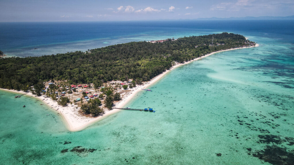
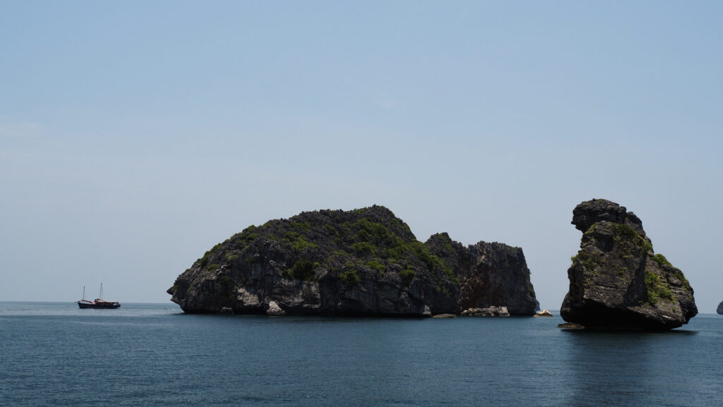
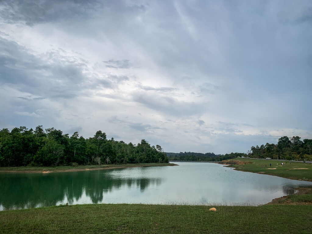
The three remote islands known as the Mantanani Islands are situated northwest of Kota Belud, a town roughly an hour and a half drive from Kota Kinabalu, the state capital of Sabah. Depending on the state of the sea, the speedboat voyage from the mainland to these islands takes about 60 minutes. The islands are a great place to go snorkelling, scuba diving, or island hopping because of their beautiful, white sand beaches surrounded by coconut palm trees, and their clear, blue waters that are home to a variety of marine life. The unique dugong, or sea cow, lives in the water there but sightings are not guaranteed as these mammals are very shy and will distance themselves, especially with the sight of crowds.
How to get to Mantanani Island?
The transfer to the island is included in the package for the day trip. If you decide to stay there longer than a day, your resort will organize a transfer for you as well.
The transfer includes the bus or minivan from your hotel in Kota Kinabalu to Kota Belud Jetty and then a speedboat further to Mentanani Island.
Several operators organize tours to the islands. I chose the offer of Borneo Calling as the price was attractive: 260 RM. Amazing Borneo is a bit more expensive and the tour costs about 340 RM. I didn’t see any differences in the itinerary.
When to go?
Tours to Mantanani Island are available the whole year, but the best time to visit is between February and April, during the dry season. The weather during these months is generally more favourable with less rainfall, making it easier to enjoy outdoor activities.
How long should you stay?
One day is enough to relax on the beach and do some snorkelling. However, during the day it is incredibly hot so most probably you will want to spend the time in the shade. Staying overnight is a great idea, as you can enjoy the magnificent sunset and sunrise and the calmness of the island once day trippers leave.
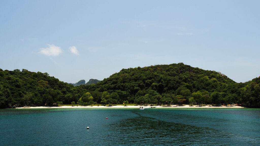
Mantanani Island
Where to stay?
I haven’t spent the night on the island itself, but based myself in Kota Kinabalu and did a day trip from there. I can recommend three places to stay there: ATAP Hotel, Hotel Tourist by HotSpot Essential and Akinabalu Youth Hostel. All of them were affordable and offered a nice and clean private room.
How to get around?
The island is small so you will need nothing else but your legs!
A day trip itinerary
I was met by a minibus driver punctually at 7:30 AM and then we made a loop around the town, picking up a few more tourists. The drive to the jetty in the Kota Belud district took approximately 1.5 hours with a short toilet break halfway. The further speedboat ride took about 60 minutes. The sea conditions were good so it wasn’t too bumpy.
Once we arrived at the island, we were taken to Lovely Mantanani Beach Club. We left our bags there, had a drink and went back to the speedboat to start our snorkelling adventure. The two spots were fine and we could see some colourful fish but definitely, it wasn’t as good as it was in Semporna.
The lunch was served at around 12:30 PM. The food was tasty and plentiful, even though I expected a buffet. After lunch, we were free to take a walk on the white sandy beach, enjoy the kayaks or simply relax in the shade. I used the opportunity to fly a drone, after previously asking the guide if it was allowed as I noticed a small police station nearby.
We departed back to Kota Belud Jetty at around 3 PM. There were dark clouds on the horizon and I was sure we would be caught by heavy rain. Miraculously, we weren’t. But as soon as we changed to the minivan and started driving back to Kota Kinabalu, the heavens got wild and it was pouring almost the whole way. I was back to my hotel at about 6 PM.
Overall, it was a well-organized tour of the beautiful island, but next time I would consider staying overnight to get the full experience. Waking up in such isolated places is always unique.
Included in the tour package are: transportation, lunch, water, and snorkeling equipment.
Tawau is situated on the southeast coast of Sabah, bordered by the Celebes Sea. It is close to the borders with Indonesia’s Kalimantan region and the Philippines.
The area was originally inhabited by indigenous groups and later became a part of the Sultanate of Sulu. In the late 19th and early 20th centuries, Tawau came under British control as part of North Borneo. It developed as a trading port, exporting agricultural products like rubber and tobacco.
During World War II, Tawau was occupied by Japanese forces. Post-war, it continued to grow as a key town in Sabah and a major agricultural hub, known for its palm oil plantations, cocoa, and rubber.
Tawau is a gateway to several natural attractions, including beautiful islands around Semporna where you can check out famous scuba diving destinations around Sipadan, Mabul and Pom PomIsland. It is also a nice idea to spend some time in Tawau Hills Park, known for its hot springs, waterfalls, and diverse flora and fauna. Especially that after diving, you need to wait 24 hours before taking your flight!
How to get to Tawau?
By Air
Several airlines operate flights to Tawau Airport (TAW), including Malaysia Airlines and AirAsia, with direct flights available from Kota Kinabalu (the capital of Sabah) and Kuala Lumpur (the capital of Malaysia).
By Land
Bus services are from Kota Kinabalu to Tawau but be prepared for a very long journey (most probably over 10 hours).
Some ferries connect Tawau with Nunukan and Tarakan in Indonesian Borneo. The ferry services are less frequent, so checking the schedule in advance is important.
When to go?
The best time to visit the Tawau is during the dry season, which typically falls between March and October. The weather during these months is generally more favourable with less rainfall, making it easier to explore the rainforest (the trails are less muddy) and enjoy outdoor activities.
Where to stay?
I can recommend staying at Kingston Executive Hotel. It is well-located, close to plenty of restaurants and shops. The room was clean and really spacious!
How long to stay?
Tawau doesn’t have much to offer but you can easily spend a day visiting Tawau Hills Park. It’s also possible to arrange a multiday trekking there.
What to do in Tawau?
Tawau Hills Park
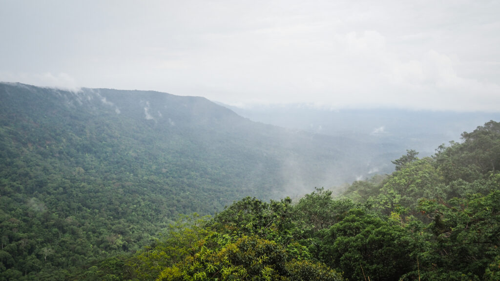
The third biggest city in Sabah doesn’t have much to offer and a walk at the waterfront at Traulsen Recreation Park is the best what you can do. Most people come here for Tawau Hills Park is a great and much cheaper alternative to Danum Valley or Maliau Basin. This 280 square kilometre natural reserve is made up of lowland rainforest, with hills covered with vegetation rising sharply from the plain below.
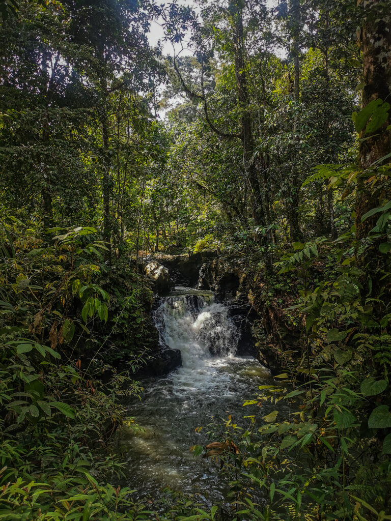
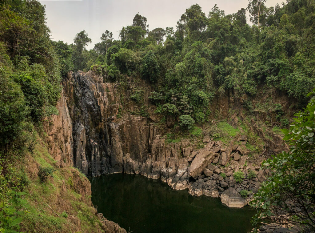
The park is great for day and night walks, and bird watching. Just a short walk from the reception, you will find a river with picnic tables and a scenic Table Waterfall a bit further. It isn’t accessible for swimming but you can get some nice shots from a viewing platform.
Bombalai Hill (530m) is just a short, thirty-minute trek through the jungle. Views of Tawau town, cocoa and palm oil farms, and the Sulawesi Sea stretching out in the distance may be seen from the top.
Follow clearly marked main trail which can bring you to several locations: Botanical Garden, The World’s Tallest Tropical Tree, Bukit Gelas Falls and Hot Springs.
The Botanical Garden is home to the variety of plant life found within the park, especially ferns, different species of orchids and begonia. The Elephant Ear Orchid is endemic only in Borneo and in Sabah it can be found only in Tawau Hills Park and Tenom.
Continue walking past the Botanical Garden and turn left on the crossroad. The path will take you to the World’s Tallest Tropical Tree. According to the description, it is 88 meters tall.
Come back the same way and turn left. A walk along the Sungai Tawau ends at Bukit Gelas Falls, which is lovely and worth a plunge. It is 2.4 km from the Park Reception. Enroute, you may also spot another trail, climbing steeply up but you should not proceed there without prior preparation.
It is the most challenging 14-kilometer trail in the park leading to Mount Magdalena, the highest peak in Tawau Hills Park (1280 meters). The stroll winds through lower montane and lowland forests. It is advised to take three days to complete the climb. There’s a hostel at km 10. Prior to your climb, you should get a climbing permit and a guide from the office of Sabah Parks. Mount Lucia (1240 meters) and Mount Maria (1020 meters) can be climbed during the same trip.
On the way back from Bukit Gelas Falls, you will certainly notice a bridge over the river. If you cross it and follow the trail, you will end up in a hot spring with sulfur.
Costs
The general entrance to the park costs 20 RM for international visitors and 6 RM for Malaysians.
If you decide to climb Mount Magdalena, Mount Lucia or Mount Maria, you will need to plan at least two days and get a permit and a guide. The permit costs 50 RM for one peak and 150 RM for multiple peaks per person for international hikers. Malaysians will pay 25 RM for one peak and 65 RM for multiple peaks.
Hiring a mountain guide costs 150 RM per day and you can share the cost among the group of 3 people. Additionally, you will need to pay 7 RM per person per day for insurance and something extra for the hostel.
Park opening hours are from 8 AM to 4 PM (Monday – Friday) and 7:30 AM to 3:30 PM (Saturday – Sunday and public holidays).
How to get there?
From the centre of Tawau, the easiest way is the get a ride using ride hailing app – Grab. Most likely drivers will ask for some extra payment in cash as the park is out of town. It also makes sense to note down the phone number of the driver, so you can text him to come over and pick you up in the afternoon. Tawau Hills Park is in the zone out of Grab coverage. Otherwise, you will need to try your luck hitchhiking as there is no public transport.
The Kinabatangan River, located in Sabah, Malaysian Borneo, is the second longest river in Malaysia, stretching approximately 560 kilometres from its headwaters in the mountains to its mouth at the Sulu Sea. This river is renowned for its incredible biodiversity and rich ecosystems, making it a prime destination for nature lovers and wildlife enthusiasts.
The river and its surrounding floodplain are home to a wide array of wildlife, including some of Borneo’s most iconic species such as orangutans, pygmy elephants, proboscis monkeys, and a diverse range of bird species. The region also supports various reptiles, amphibians, and plant species, contributing to its status as a biodiversity hotspot.
How to get to Kinabatangan River?
Getting to Kinabatangan typically involves travelling to Sandakan, a city in the Malaysian state of Sabah on the island of Borneo. From there, most people decide to join an organized tour including accommodation, food and activities around the river. The recommended duration is 3 days and 2 nights.
By Air
Several airlines operate flights to Sandakan, including Malaysia Airlines and AirAsia, with direct flights available from Kota Kinabalu (the capital of Sabah) and Kuala Lumpur (the capital of Malaysia).
By Land
There are bus services from Kota Kinabalu to Sandakan passing through Kundasang and Sepilok. The journey takes about 6-8 hours.
The best time to visit the Kinabatangan River is during the dry season, which typically falls between March and October. The weather during these months is generally more favourable with less rainfall, making it easier to explore the rainforest (the trails are less muddy) and enjoy outdoor activities. The animals are also more likely to come to the river to drink water. This increases the chances of seeing orangutans, pygmy elephants, proboscis monkeys, and a variety of bird species.
How long to stay?
Most tour operators recommend the package of 3 days and 2 nights and I also think it’s an optimal option. One day shorter would feel like not enough and you will be missing out on some activities such as jungle walks but I also didn’t feel like I would like to extend it for another night.
The tour with Uncle Tan Wildlife Adventures
There is a variety of operators offering similar packages and itineraries but what is different is the quality of accommodation and food. I selected the offer of Uncle Tan Wildlife Adventures (3D 2N) and will describe my experiences and impressions with them. It isn’t a resort with nice bungalows and all that, but this is exactly why I made my choice to stay there.
On the way to the camp
Prices
The price for the standard 3D/2N trip is 572.40 RM per person. Extended stay is possible at the price of 172.80 RM per person per extra day.
The price for the 2D/1N trip is 399.60 RM per person.
Children who are 7 years old and below are given discounted prices:
The 3D/2N trip children’s price is 286.20 RM.
The 2D/1N trip children’s price is 199.80 RM.
Children who are 2 years old and below stay for free.
The above-mentioned prices are from May 2024. Please always double-check them with Uncle Tan Wildlife Adventures directly.
A crocodile at the riverbank
Transport
The meeting point is at the Orangutan Centre in Sepilok and the price covers transportation by van to and from the Kinabatangan River, transportation by boat to and from the camp and all river Safaris.
You need to get on your own to Sepilok and pay extra in case you don’t come back there after the tour but continue your travel towards Semporna.
Accommodation
At Camp, lodging is provided in elevated huts. A lightweight mattress and mosquito net will be provided. Every hut is shared by a few people so don’t expect privacy.
Accommodation in wooden huts
Food
All meals are cooked on-site and included in the tour package. These are served as a buffet. Tea and coffee are available all day and bottled drinking water and fizzy drinks are sold by their staff co-operative.
Bathing and toilet
Water for bathing and washing is pumped from the river to the bathhouse. Swimming in the river is not possible due to the presence of crocodiles. There are two toilets provided in two different areas of the camp and you can get toilet paper from the reception. Don’t forget to bring it back afterwards as otherwise it will be stolen by monkeys.
Electricity and mobile signal
They use a small generator for lighting and charging of batteries from 7.00 PM till midnight. I had a Digi SIM card in my smartphone and the signal was very weak in the common hut and slightly better closer to the riverbank.
3 days 2 nights itinerary
Day One
I was met near the Orangutan Center by the representative of the tour operator at 1 PM. Soon, more participants arrived and we were briefed about the plan for the rest of the day.
We were taken in a minibus to the Bukit Garam jetty at the Kinabatangan River from where we continued the journey to the camp by boat. We could spot quite many crocodiles on the way. Upon arrival at about 5 PM, we were greeted with tea and coffee and then allocated the open-air huts, where we could find only mattresses and mosquito nets. Simple, but enough 🙂
The dinner was served in the form of a buffet at 8 PM but before that, we met the rest of the staff working at the camp. They explained to us the detailed plan for the remaining time at the camp.
On that day we had one more attraction left: a night river safari which started about 9 PM. We didn’t see much though, just some birds and owls.
The night was really hot and I was sweating even lying down in the open-air hut.
Day Two
The day started at 6:30 AM with an early morning safari. Tea and coffee were available in the common area. We boarded the boats and took the same route as the night before. Again we didn’t see that much. Mostly monkeys.
Then, we came back to have breakfast and shortly after we played some volleyball. It was really fun even though the humidity was insane!
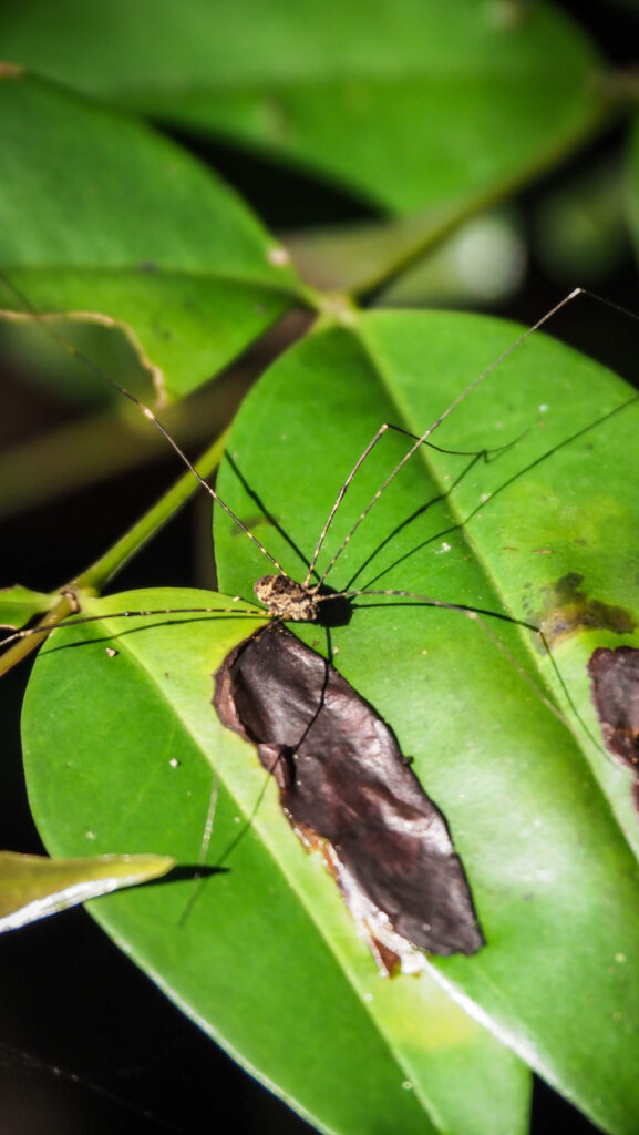
After that, it was a time for jungle walk. It was a really short one but luckily we were able to see one orangutan sitting high on the tree. Another cool thing to see was the spider which blended perfectly well with the color of the tree that it was sitting on.
The only orangutan that we saw during the tourWhat a camouflage!
Once the walk was finished, I flew a drone and discovered a very sad view. The area around the river is one huge palm oil plantation. I wasn’t surprised that we couldn’t see that much wildlife and that we always went on river safari to the same place. It was just the only relatively forested place left.
Flying over the Kinabatangan River
After lunch, we had a few hours of free time but we were also offered to join an extra activity: a fishing trip (paid extra: 60 RM per person). I decided to go for it as I don’t like sitting in one place doing nothing and I didn’t have much experience with fishing so wanted to learn something new. Unfortunately, we were caught by some rain but that is how it is in Borneo. You never know when you will get wet 🙂
I managed to catch 4 or 5 small catfish, but my fishing rod got stuck many times in shallow waters. Anyway, I was happy to join this activity and would recommend you to do the same. I will for sure repeat fishing one day!
In the afternoon we went to the third river safari and again it was to the same place. We mostly saw different kinds of monkeys and once it was already after sunset, then plenty of huge bats (flying foxes) could be spotted in the sky. Impressive and very memorable view!
Proboscis monkeyProboscis monkey
After dinner, we went for a night walk and saw some spiders, frogs and bugs. The guide was trying hard which was appreciated but unfortunately, we couldn’t find slow loris or tarsier.
Day three
We had breakfast and then it was time to pack our bags and board the boat back to the jetty. There, we split into two vans – one going back to Sandakan and another one heading towards Lahad Datu. Those heading to Lahad Datu, including me, had to pay extra for the transport (50 RM per person).
2 days 1 night itinerary
You will do a night boat ride on the day you arrive at the camp and a morning boat ride the next day. After breakfast, you will leave the camp at about 10 AM.
General impressions
I’m glad I decided to join the tour with Uncle Tan and I cannot say a bad word about the organization as everything went according to plan and the staff working at the camp were very friendly. However, I wouldn’t repeat it.
The reason is very simple. I was quite shocked to see the destruction of the area and deforestation in favour of palm oil plantations. Don’t expect to see some wonderful wild areas full of animals. There is a thin line of trees along the river but you can see through it. And everything beyond is nothing more than palm oil plantations. Some years ago it must have been a wonderful place, now it’s just the skeleton left…
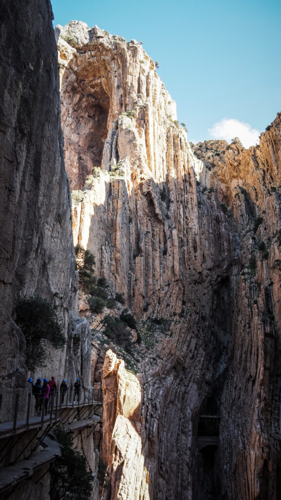
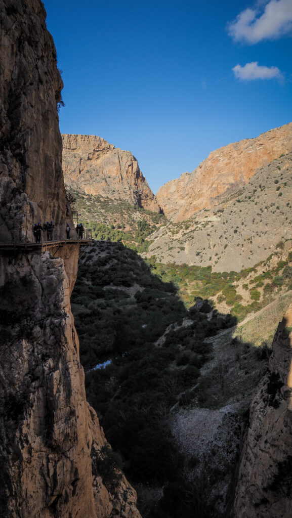
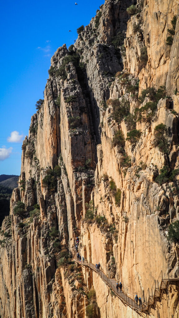
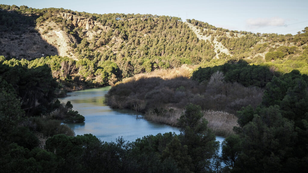
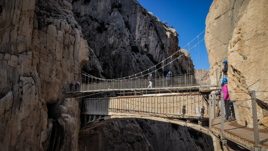
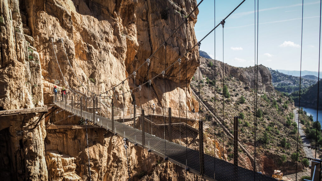
El Caminito del Rey, located in the province of Malaga, is a breathtaking and exhilarating footpath that winds its way through the stunning El Chorro Gorge. Known as the “King’s Little Pathway”, it offers an adrenaline-pumping adventure as it clings to the sheer cliffs, suspended high above the Guadalhorce River.
Originally it was constructed for workers to access a hydroelectric power plant. The construction began in 1901 and was finished in 1905. King Alfonso XIII crossed the walkway in 1921 for the inauguration of the dam Conde del Guadalhorce, and because of that the trail became known by its present name. The original path deteriorated over the years, and there were numerous sections where part or all of the concrete top had collapsed. Few of the original handrails remained, although a safety wire ran the length of the path. Several people died on the walkway and, after two fatal accidents in 1999 and 2000, the local government closed the entrance.
The regional government of Andalusia and the local government of Malaga agreed in June 2011 to share the restoration costs of €9 million. The project took approximately three years to complete.
Today, the scenic route provides awe-inspiring views of the dramatic landscape, featuring rugged rock formations and the turquoise waters below, making it a must-visit destination for those seeking both natural beauty and a memorable outdoor experience.
How to get there?
Car
Take the A–357 motorway and go towards the MA-5403, through the Towns of Cártama, Pizarra, Carratraca, and Ardales. This route is 59.1 km long, and it takes about 50 minutes to get there.
You can park in the Visitors’ Reception Centre Parking for 2 EUR per day. There you will find the shuttle bus stop. Once you finish the hike at the Southern Access (near El Chorro), the shuttle bus will take you back to the parking. The bus ticket costs 2.50 EUR.
Train and bus
First, take a train to El Chorro – El Caminito del Rey Station. Then, change to the shuttle bus going towards the northern access point. It takes about 2 hours to get there from Malaga.
Shuttle bus trips start at 08:30 from the Southern area and operate every 30 minutes until 16:30. For the train schedule, check at the official site of RENFE.
Organized tour
In this situation, you don’t have to worry about anything. Just come to the agreed meeting point and enjoy the bus ride. As I didn’t have a car and wanted to save some time, it was my chosen option. The tour started at 8:30 AM at the pick-up point near the train station and finished at 3 PM at the same spot. I signed up for the one advertised on Get Your Guide, and the link to it is below:
The best time to visit
The trail can be visited at any time of the year. The best is to avoid summer as then it gets crowded. I visited in December and it was really nice, although the temperature was about 15C and it was windy so better to have a warmer jacket.
Tickets
You can reserve and purchase your ticket through this website or directly at the northern access of the Caminito, at the ticket office. Booking in advance is highly recommended at any time of the year as the number of tickets is limited. Guided visits cost 18 EUR and general entry tickets cost 10 EUR.
The guided tours from Malaga cost about 50 EUR and include transportation, entrance tickets and a guide.
Beautiful panorama at the beginning of the trail
Opening hours
El Caminito del Rey is open from Tuesday to Sunday, except December 24th, 25th, 31st and January 1st.
Trail details
El Caminito del Rey is a one-way trail and you must start at the northern access point. According to me, the difficulty of the path is easy as it mainly descends although there are both uphill and downhill parts.
The full length of the path is 7.7 km, of which 4.9 km are accessways and 2.9 km is the boardwalk. Covering that distance can take between 2 to 4 hours, depending on your pace. Don’t rush though, as the views are worth taking it slowly.
Once you arrive at Bar Restaurante El Kiosko, you must decide which access trail you want. The first option is a 2.7 km long trail of Gaitanejo. The second option is 1.5 km long as it takes a shortcut through the pedestrian tunnel. Both trails arrive at the Northern Access Control Booth which is the official start of the Caminito del Rey.
The tour
As mentioned before, I opted for a guided tour starting from Malaga. The meeting point was near the train station and pick-up time was scheduled for 8:30 AM. We left on time and soon received a warm welcome from our two guides: Violetta and Christian.
After about an hour, we arrived at the parking where the bus stopped for a toilet break. From there, it was another a few minutes drive to the start of the hike. As we exited the bus, everyone got a small bottle of water.
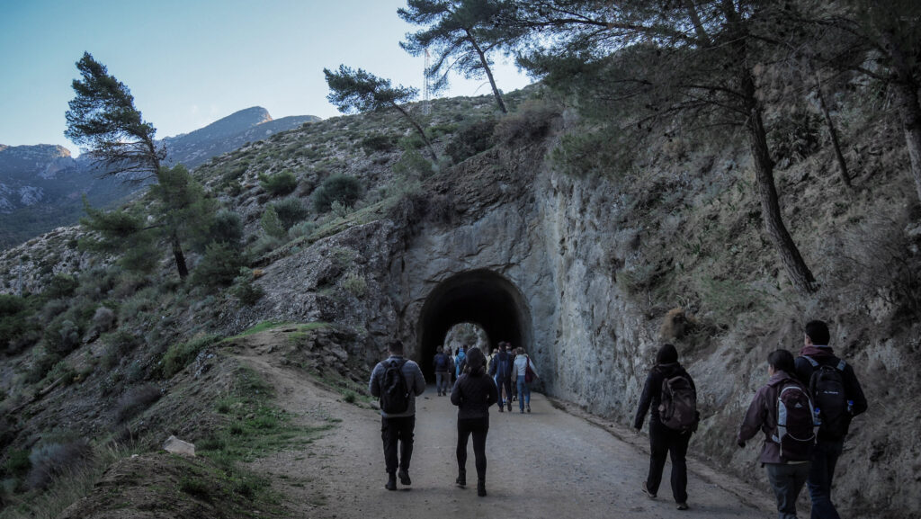
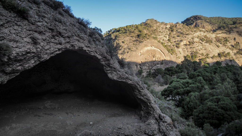
We took the access road that goes through the pedestrian tunnel. After the tunnel and the bridge, we turned around to watch the interesting rock formation consisting mainly of four huge hollows.
One of the first tunnelsHuge hollows in the rocks
Soon, we arrived at the reception booth, located near the Gaitanejo Hydroelectric Power Station, which is one of the oldest in Spain. There is where we got the helmets.
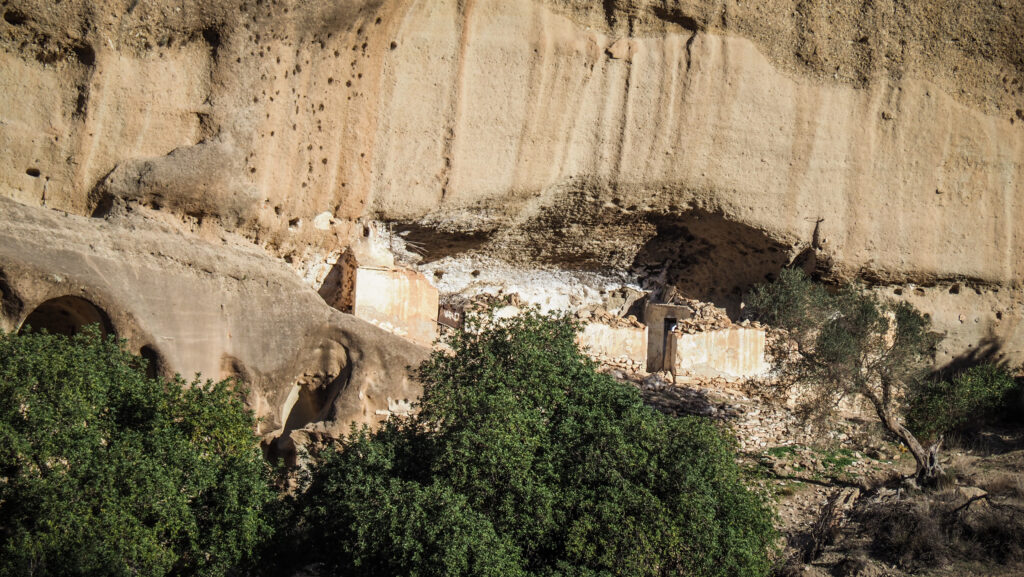
As we progressed, our guide pointed out another interesting sight – the remains of troglodytic houses which were made using the softness and hollowness of sandstone for their construction. They were living places for people involved in shepherding and agriculture, but also for dam construction workers and workers of El Caminito.
Remains of old housesWe continued the hike, already with helmets
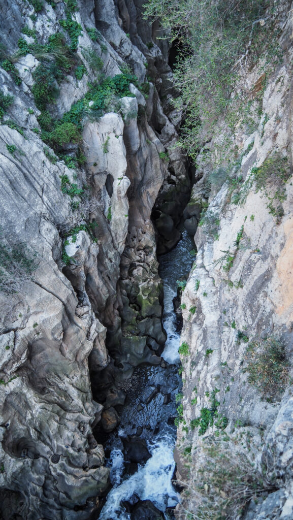
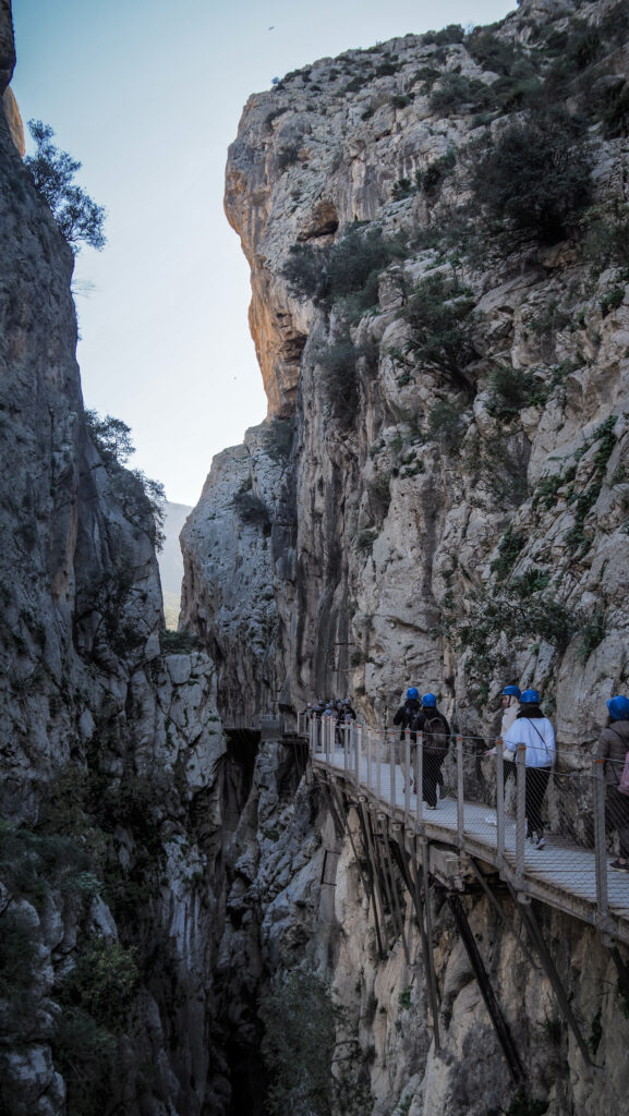
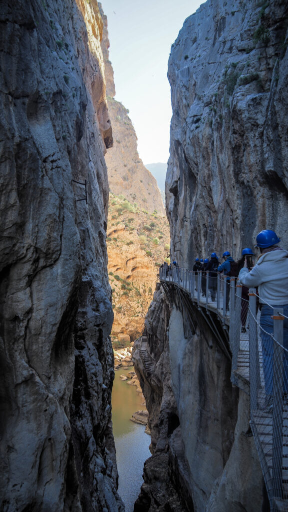
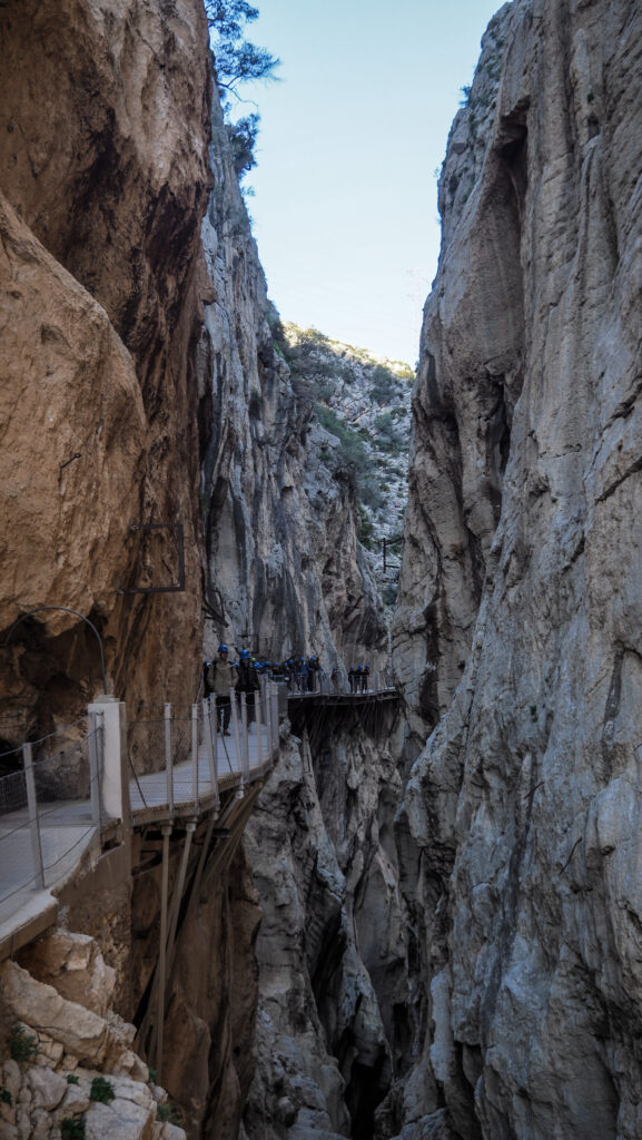
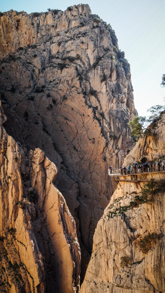
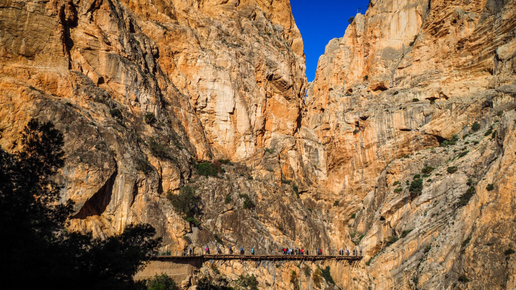
The rocky wall further ahead where commemorative plaques hang, marks the water level reached on different historical floods caused by strong storms. On the right-hand side, you will find an information panel about the history of El Caminito del Rey, after which you will enter the boardwalk leading into the Gaitanejo Gorge. The distance from wall to wall is less than 10 meters and it’s pretty deep too. Impressive!
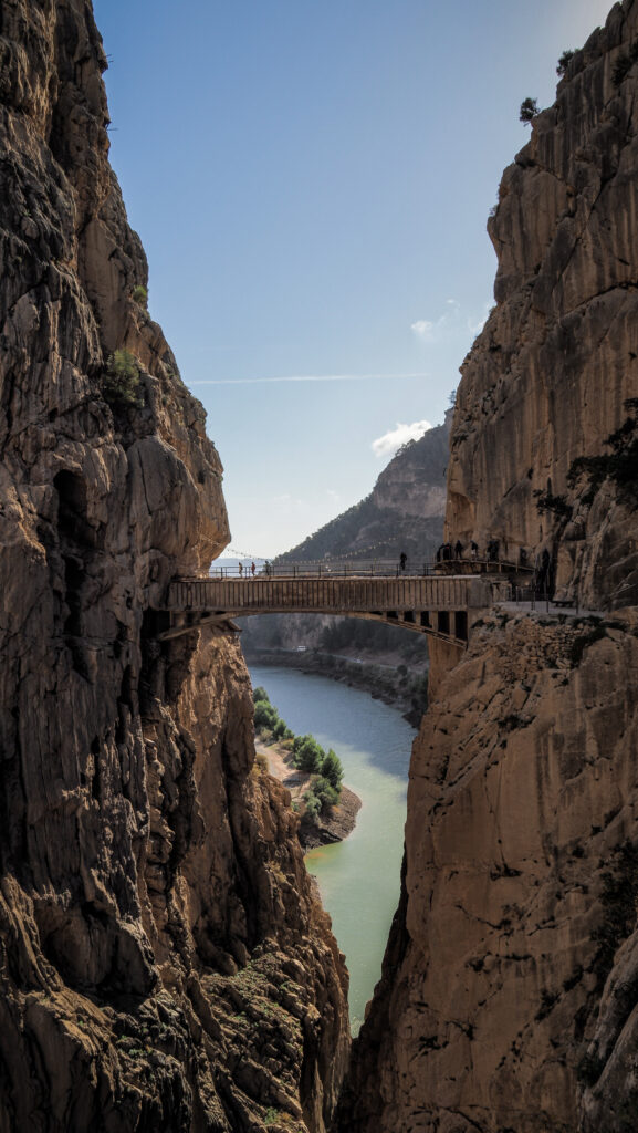
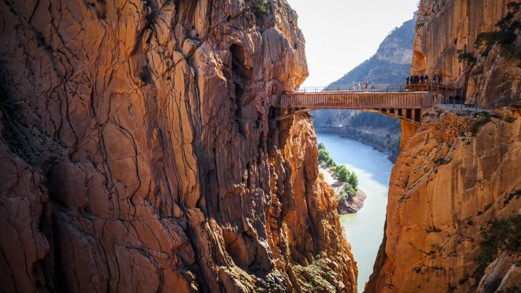
We continued strolling on the boardwalk passing through another small tunnel. Alternatively, you can go around it if you wish. A bit further on there is the bridge which was crossed by King Alfonso the 13th in 1921.
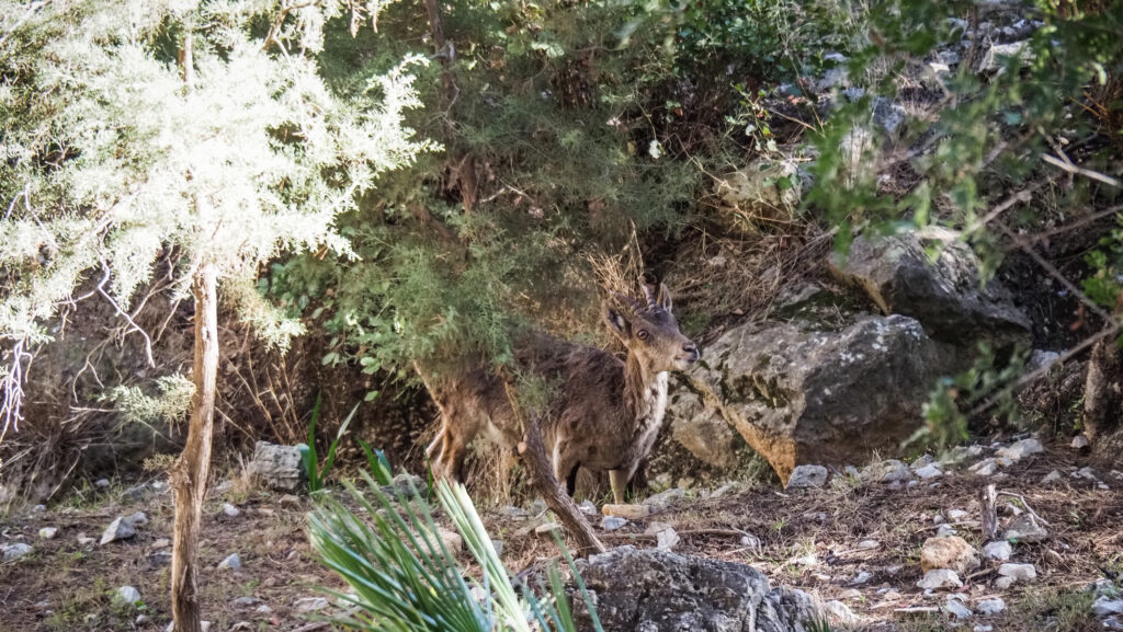
We were also able to spot some wildlife!
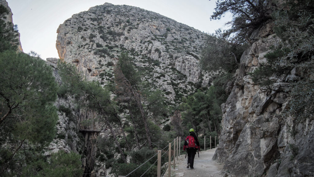
The most impressive parts of the trail were still ahead of us though. The tall rocky mass of San Cristobal’s Mountain towers above the boardwalk and is just breathtaking.
The Glass Balcony that stands on the rocky buttress is a vertigo test for many and it allows one to fully admire the vastness of the canyon. This was my favourite section of the hike. And there was another highlight just in front – the Hanging Bridge!
The last section of the boardwalk is just amazing!
The metallic boardwalk hangs 105 meters above the ground and is 35 meters long. Luckily, it isn’t too shaky even in strong winds so I was able to cross it comfortably, even though I am normally not so easygoing with heights.
The highlight of the hike – Hanging Bridge!Luckily the construction is very stable even in strong winds!Don’t look down 🙂
The last part of the trail goes down following the stairs and after you exit through the gate, it’s a wide path. We passed by the Chapel School also called ‘Ermita de la Medalla de la Milagrosa’. It was built by Rafael Benjumea, as well as other buildings in the village nearby for the children of technicians and workmen and later on for the workers of the Station Salto del Chorro.
Shortly after, we reached the place with chairs and tables as well as small boots serving food and drink. It was the end of El Caminito del Rey!
I was perfectly satisfied with the guided tour. The guides were amiable and explained everything in two languages: Spanish and English. There was no pressure to walk faster or slower so everyone had enough time to enjoy the place and take plenty of pictures.
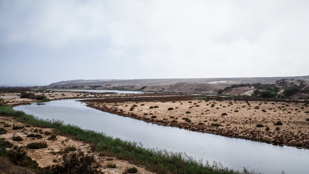
The Souss Massa National Park has been a natural reserve since 1991 and it covers an area of 33,800 hectares. It is located between Agadir to the north and Sidi Ifni to the south, including the landscape of the coastline, dunes, marshes and the steppes.
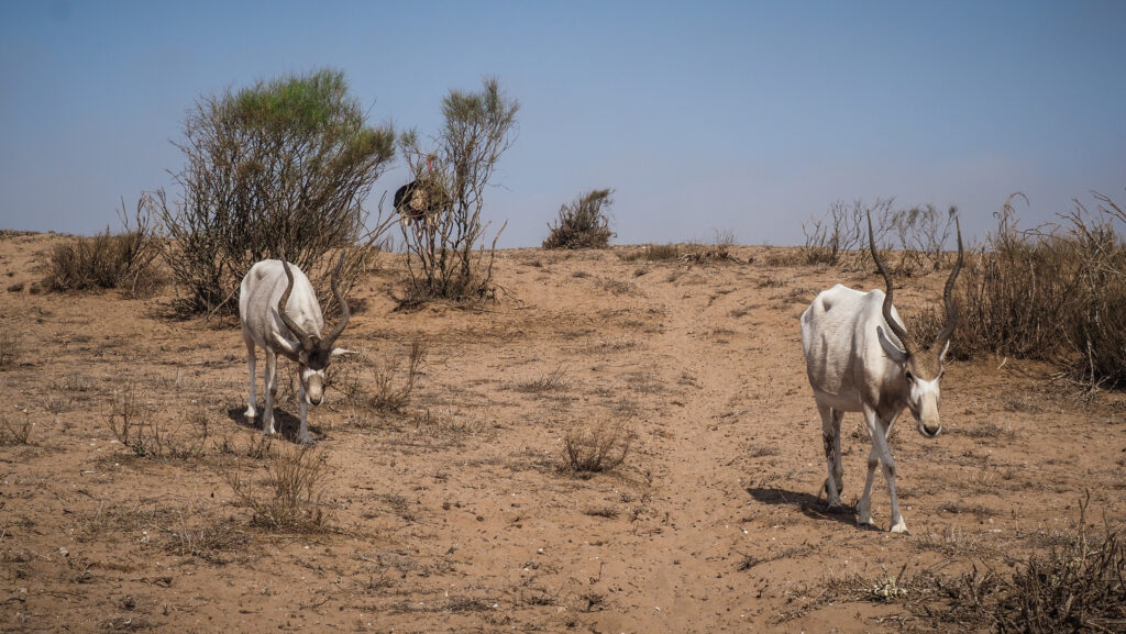
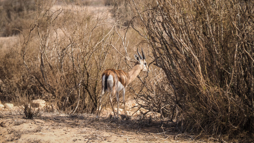
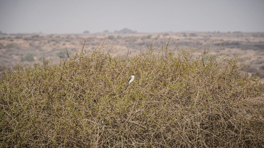
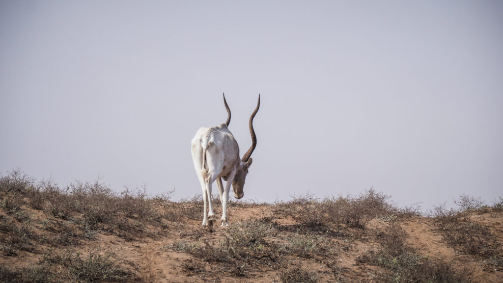
Over 300 plant species and over 30 fauna species can be found there, including the Oryx antelope and the Dorcas gazelle, as well as foxes and wild cats. Moreover, the Souss Massa Natural Park is home to the world’s largest colony of Bald Ibis and the wetlands act as a stopover for many other migratory birds.
When to go?
The climate on the Moroccan coast is enjoyable for most of the year. The best time to visit Souss-Massa National Park is spring (March to May) and fall (September to November) when the weather is ideal. In summer it can get extremely hot and December is the wettest month, although it doesn’t rain too much anyway. I visited the park at the beginning of October and it was simply perfect!
How to get there?
There are two entrances: one called Rokein Reserve, located near Takate and Ihchach, about 20 km from Agadir and the second one called Ourais Reserve, located near Sidi Binzarne, about 65 km from Agadir.
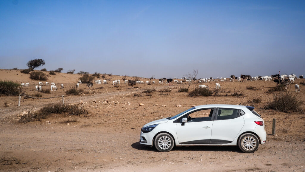
The easiest way to explore the park is with a rental car. It gives you full flexibility to organize the day as you like and it will also be the cheapest option. You can get a good vehicle for 25 – 40 EUR per day while an organized day trip costs about 70-80 EUR per person.
I recommend using the service of Click’n’Go Car Rental. Very friendly guys and easy to contact on WhatsApp. I ended up renting a Renault Clio for the whole month and got a nice price. For visiting Souss-Massa National Park any car is fine and you don’t need a 4×4 unless you really want to do some off-roading.
If you don’t want to drive, the only option is to join an organized tour. Most hotels will be able to get you in touch with travel agents or do your research online.
How much time should you plan?
Visiting all three major sites: Rokein Reserve, Tifnit and Ourais takes the whole day. After that, return to Agadir or spend the night in Tiznit, which is worth discovering too.
Where to stay?
In Agadir, I spent a few nights in Hotel Lynx. It’s not a resort but I wasn’t looking for one. The receptionist was very friendly, the room was spacious and comfortable and there was a small balcony too. Breakfast was not included but there are lots of restaurants all around so it wasn’t a big deal.
In Tiznit, I recommend Hotel Amoudou, located very close to the medina.
Rokein Reserve
Upon arrival, I was greeted by a staff member who explained two options for visiting a park. The first was a shorter loop dedicated to hikers (3 km), and the second was much longer and involved driving your car with a guide. Of course, I decided on the longer one as I had a car and I wanted to explore more remote sections of the part. The ticket cost me 150 MAD. The guide hopped inside the car and we started our mini safari in a Clio 🙂
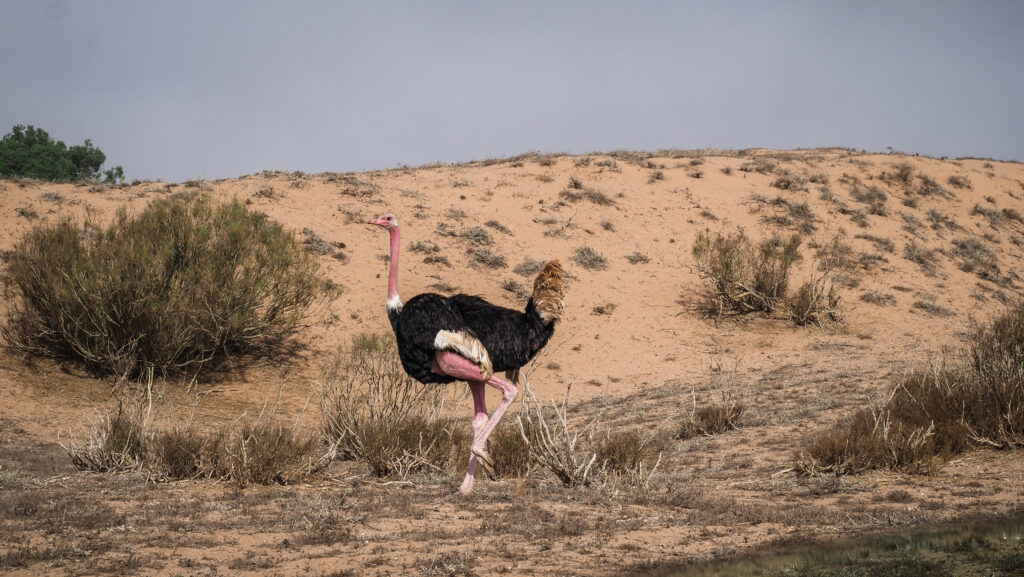
The guide spoke limited English so I couldn’t learn too much but we had some basic conversation and he was pointing out the animals that we were passing by. Mostly there were gazelles, ostriches, onyxes and some birds. It made me want to do some big safari in Africa soon! We left the car several times and walked to the observation points. One of them was particularly nice, with a large number of animals resting or grazing. According to my guide, they often gather there as it’s closer to the ocean and as a result, more windy and cooler.
Tifnit
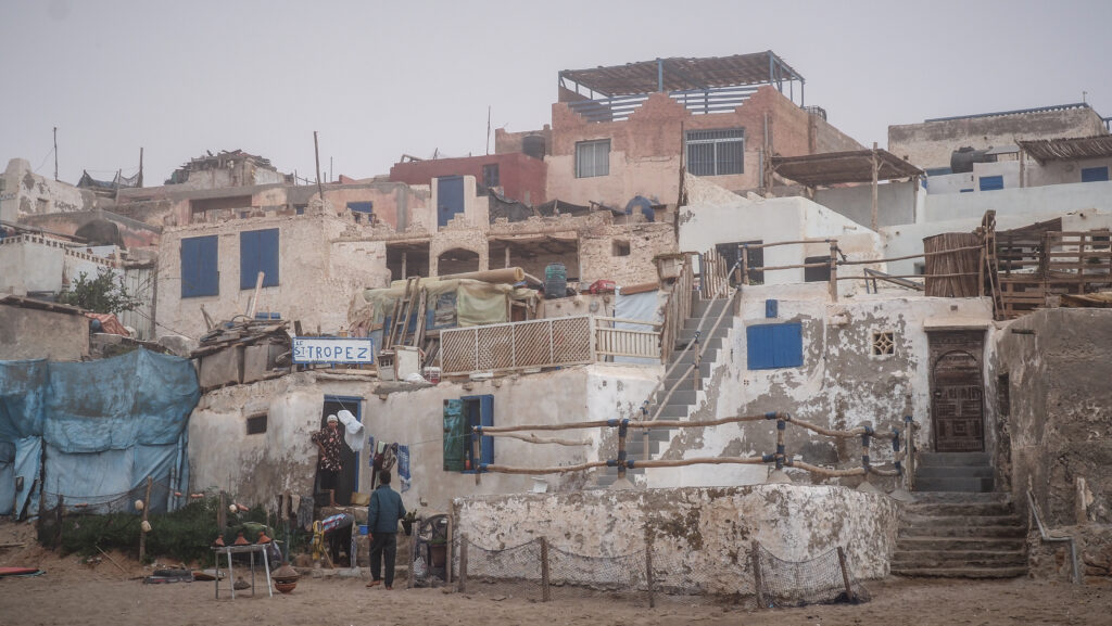
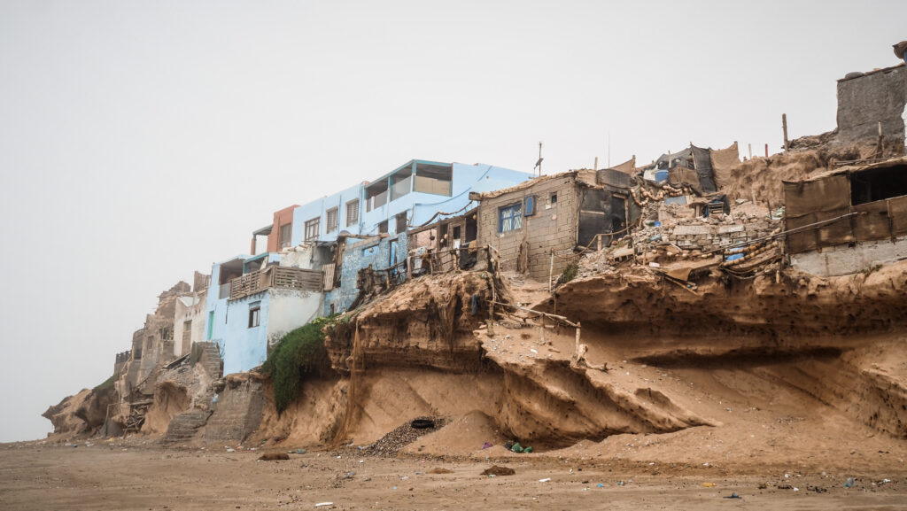
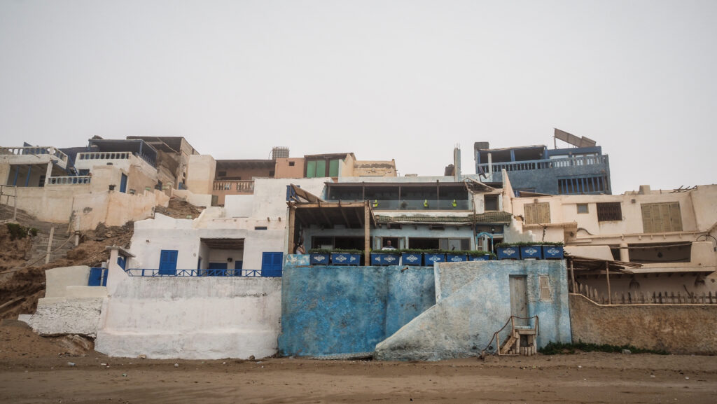
Next, I went to see Tifnit, a fishing village with houses packed between the beach and the cliff. I walked along the coast and saw some cave dwellings, that probably used to be occupied by fishermen but at that time they rather looked abandoned.
Ourais Reserve
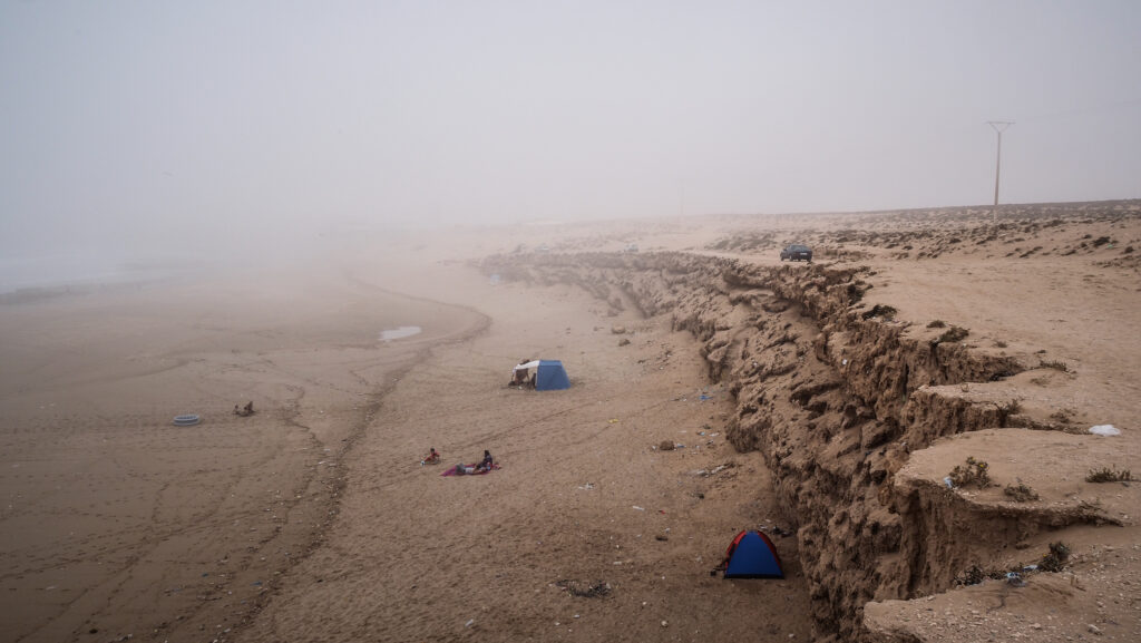
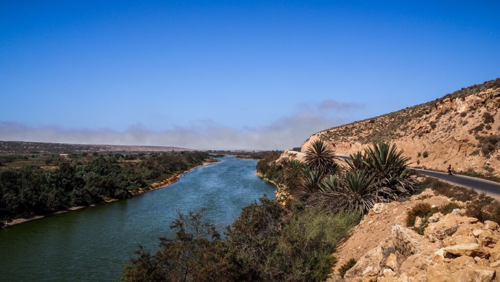
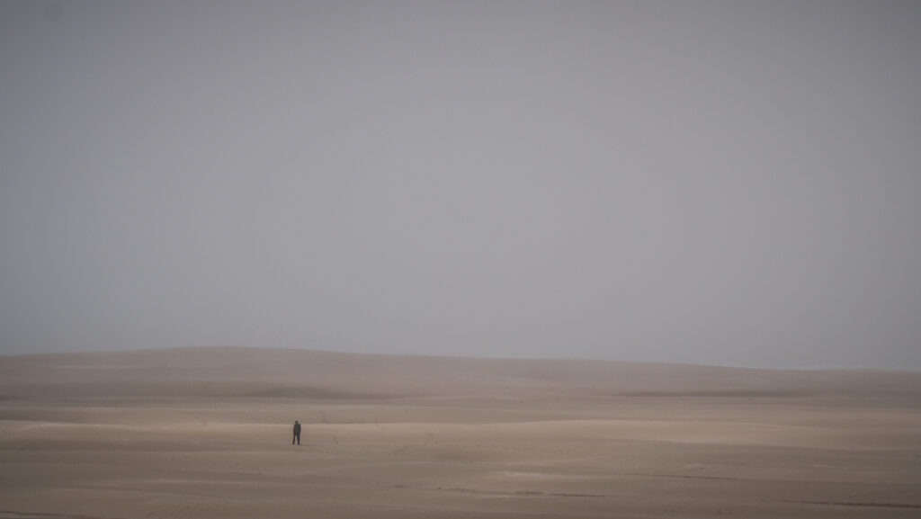
Another entrance to Souss-Massa National Park is located near Sidi Binzarne. The entrance doesn’t cost anything but I am sure you will be offered a service of a guide as soon as you park your car. There is no need for that as the way is very easy to follow, the question is if you can say no 🙂 If you decide to take one, it will cost you about 200 MAD but feel free to negotiate. The hiking trail goes along the river (Oued Massa) towards the beach with huge dunes and is about 10 kilometres long. Keep an eye out for some birds. On the day of my visit, the fog was hanging over the ocean, creating a mysterious atmosphere.
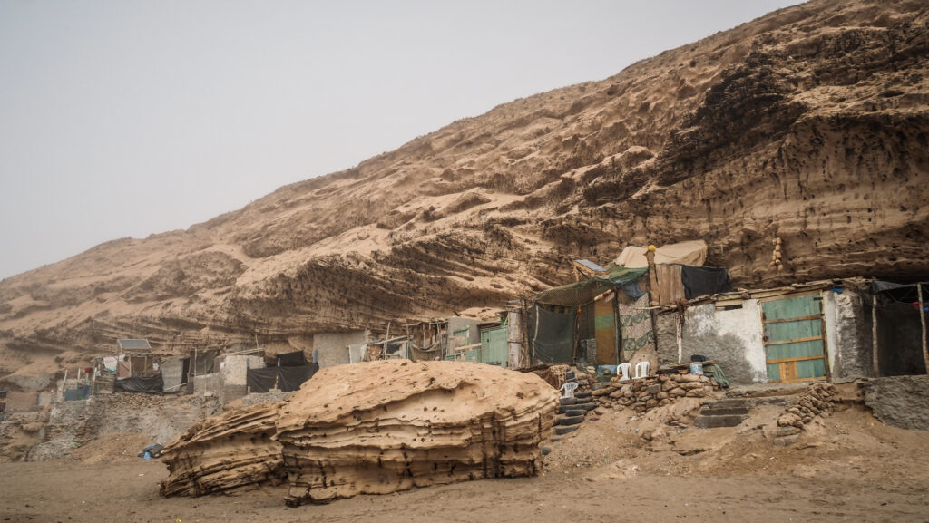
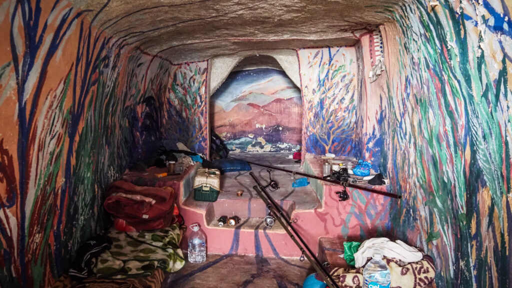
Once you reach the ocean, turn right and walk along the beach towards cave dwellings. On your rights, you will pass by a fancy hotel: Ksar Massa. If you want to check out the cave dwellings inside, approach one of the fishermen hanging out in front of it and I’m sure they will let you have a look for a few dirhams. I must say, observing how people live and how different those lifestyles are is one of the most memorable of my travel experiences.
Take the concrete pavement climbing up and start the way back, this time following the cliff edge. The wide sandy road will take you back to the trail along Oued Massa which you already walked before. Follow it again to return to the parking.
Summary
All in all, this was a day well spent and I truly enjoyed my time in the national park. It’s a great place to visit for those staying in Agadir, who want to escape the big city, see the magnificent Atlantic coast and hopefully spot some wild animals.
Jebel Toubkal is the highest mountain in North Africa, situated in the Atlas Mountains of Morocco. Standing at an impressive 4,167 meters above sea level, it attracts hikers from all over the world. Let me share with you my experience of going to the summit!
When to go?
The best time to hike Jebel Toubkal is typically during the late spring to early fall, so from late May to early October. During this period, the weather is usually mild, and the trails are not covered in snow. Winter requires more experience and equipment (crampons, winter clothing). I did my hike at the end of October and it was perfect. Sunny days with a temperature of about 20 – 25C and very cool at night.
How to get to Imlil?
Imlil is located only 60 km south of Marrakech and can be easily reached by grand taxi. You will need to pay about 300 DH for the private trip or 50 DH per seat and share the car with other passengers. Taxis are located close to Sidi Mimoun Garden. The trip will take about 1.5 – 2 hours but the views are very scenic!
Alternatively, you may take a local minibus to Asni and from there get a grand taxi to Imlil but it will take more time and you won’t save much.
If you want to have everything organized for you, including transportation, look for a reputable travel agent with a lot of positive reviews on Google Maps or check the offer of GetYourGuide.
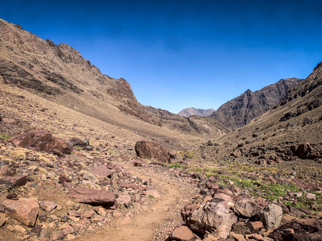
Route
The distance from Imlil to the summit of Jebel Toubkal is about 15 km, starting at an altitude of about 1659 m a.s.l. and ending at 4167 m a.s.l. (2508 meters up).
It’s quite a lot and most people decide to conclude the first day with an overnight stay at Refugio du Toubkal, covering a distance of about 11,5 km (1501 meters up). On the second day, they continue to the summit and back to Imlil (18,5 km, 985 meters up, 1659 meters down). If you follow this scenario, there is no need to start in Imlil very early in the morning as you will have plenty of time to arrive at the shelter.
Jebel Toubkal
Alternatively, you may do what I did, so go from Imlil to the summit and back to Refugio du Toubkal on the first day (18,5 km, 2493 meters up, 993 meters down), and then walk back to Imlil on the second day (11,5 km, 1501 meters down). If you decide to go for this option, keep in mind that an early start from Imlil is necessary and it will be a very difficult day, especially because of altitude difference.
The trail is well-marked and easy to follow but you can always get the Mapy.cz app on your phone to double-check your position. Of course, I’m talking about hiking season and not winter 🙂
What to take?
When hiking Jebel Toubkal, essentials include hiking boots or trail runners, weather-appropriate clothing (shorts, long pants, jumper, gloves, hat, spare T-shirt and underwear), a sleeping bag, suncream and a backpack with snacks and water. It gets really cold at night so don’t underestimate it. Hiking poles will be extremely useful too so if you don’t have ones, you may rent them in Imlil village. I regretted that I hadn’t done so!
At the summit of Jebel Toubkal
Do you need a guide?
If you decide to start the hike from Imlil, then it is necessary to have a guide. There is a police checkpoint after Aroumd village where your passport as well as the ID of the guide will be checked. The requirement of having a guide was imposed in 2018 after the murder of two Scandinavian tourists. So it’s not that much related to trail difficulty but rather overall safety. I found the trail well-marked and easy to follow, especially with Mapy.CZ app on your phone where you can control your position.
I have seen some hikers walking without a guide but they were all coming from the direction of Ifni Lake, possibly doing longer traverses of this section of Atlas Mountains. I believe there is no police checkpoint in Imhilene village but getting there from Marrakech is much more difficult (over 4 hours by car).
Anyway, remember that hiring a guide supports the local community and for them, it’s an important source of income. I paid 800 MAD for the overnight trip and I think it was a fair price.
Here is the contact number for my guide (Kamal): +212 659-076-717. He can be contacted on WhatsApp.
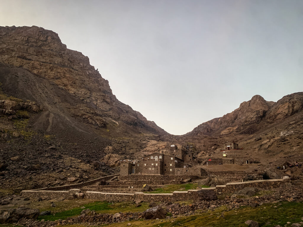
Where to stay?
Staying for the night in Imlil before the hike would be a good idea. It allows you to rest and get ready. Moreover, there are plenty of other shorter routes in the area which you could do as a warm-up. I recommend basing yourself in Dar Adoussin nearby Ait Souka village, but easily accessible on foot from Imlil (about 20-25 minutes). Aziz welcomed me with traditional mint tea, cooked a delicious tajine for dinner, recommended nearby hikes and organized a guide for the hike to Toubkal. It was also possible to do the laundry. The room was a bit cold in October but it’s normal in this region that houses don’t have heating. There were plenty of blankets to keep me warm at night.
Most people climb Toubkal as an overnight trip, spending the night in Refuge du Toubkal. It’s a typical mountain shelter, with dormitories and bunk beds. I was positively surprised by the possibility of taking a hot shower. The food wasn’t that good but it hardly ever is in places like that. It was still decent and no one was hungry! The price for the half board was slightly under 300 MAD. In high season, you may want to make a reservation by texting them at refugiotoubkal@gmail.com.
Refugio du Toubkal
The hike
Day 1
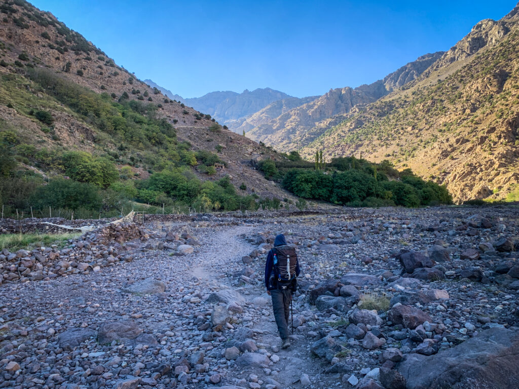
My guide Kamal met me in Dar Adouss just after breakfast at around 8:30 AM. He seemed to be a nice guy, 33 years old so at my age but already with 3 kids. Well, different life priorities 🙂 His English was not too good but we were able to have some basic conversation. First, we went through Aroumd village and then continued towards the police checkpoint where my passport and Kamal’s ID were checked.
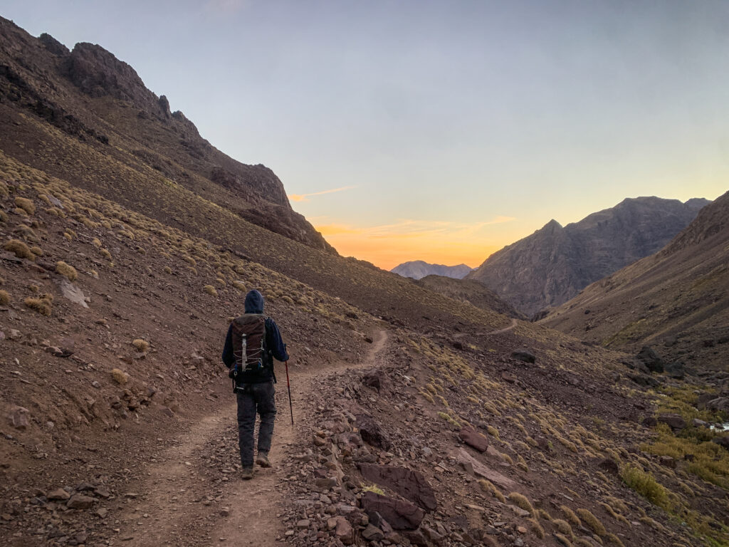
The trail leading to Refugio du Toubkal
The weather was perfect. Sunny but still quite cool in the morning hours. We were progressing quite fast, passing by some places offering cold drinks and snacks. We made a break in one of them and Kamal came up with the idea of going all the way to the summit today. It seemed reasonable taking into consideration that it was still very early and we weren’t that far from the Refugio du Toubkal.
At the shelter, the break was longer so I had my improvised lunch with tuna and bread. Of course, I couldn’t miss some warm tea! It was about 2 PM when we made the final decision to continue to the summit. That was the moment when the hard part started. The terrain was significantly steeper and I guess I started having some issues with altitude as there were moments when I was really struggling to catch my breath and even got a bit dizzy. The path was going up and up and I was fighting my rising, being on the edge of giving up. Luckily, the presence of Kamal and his good attitude gave me more courage and motivation to slowly but slowly progress further.
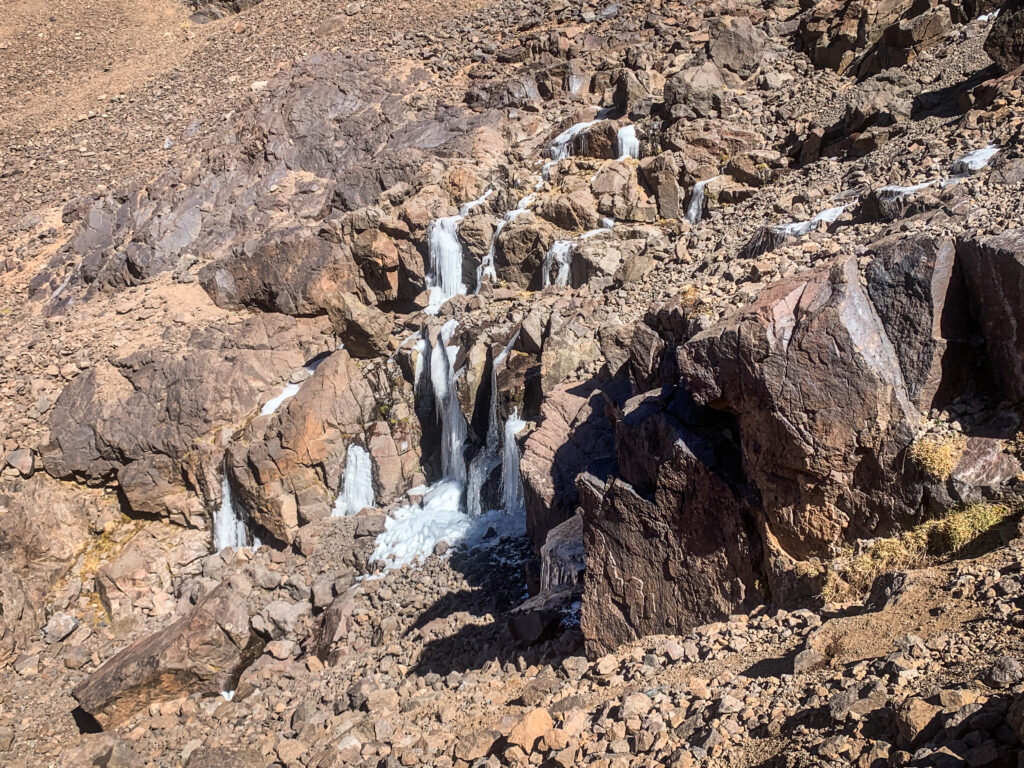
Frozen water, the proof of low temperatures at night
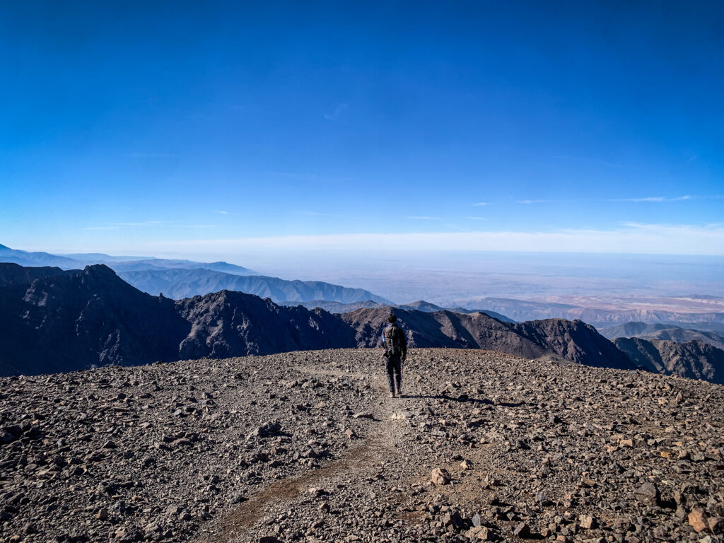
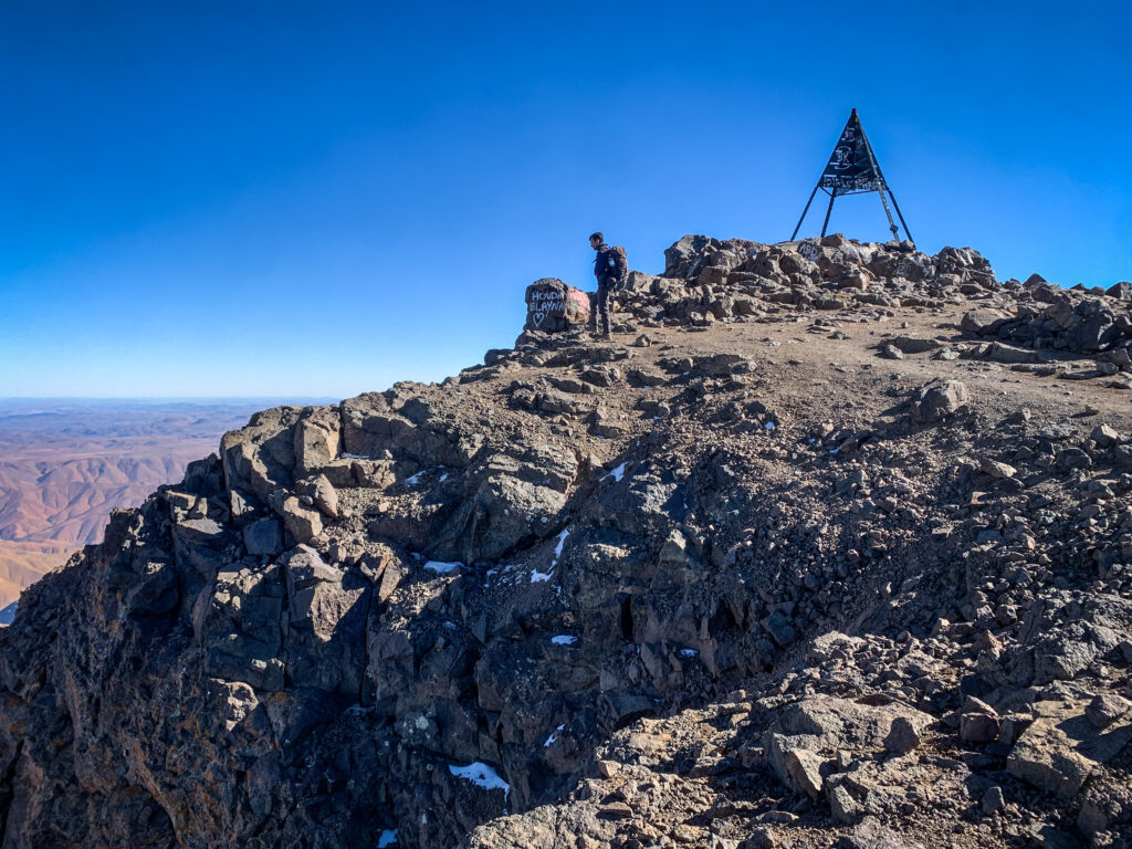
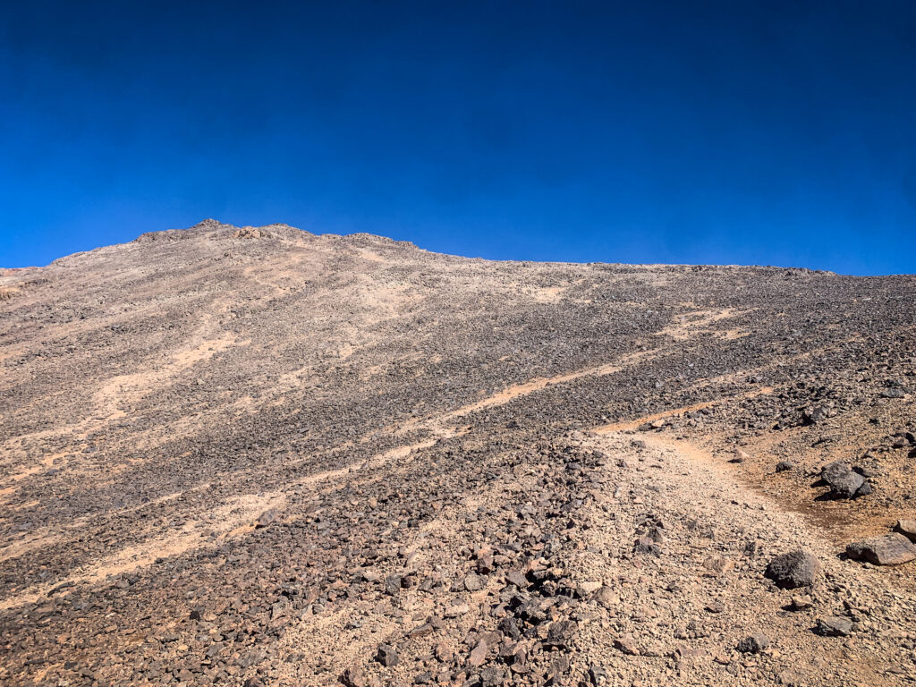
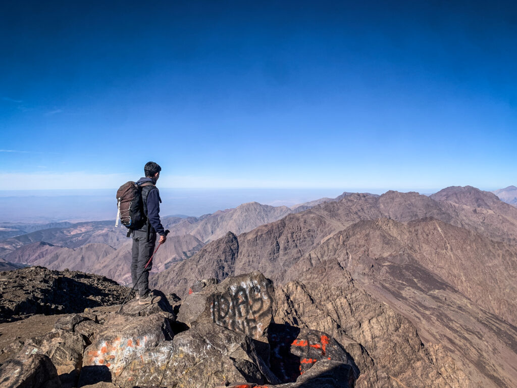
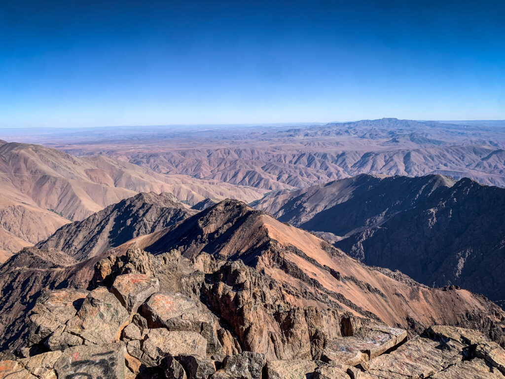
We reached the high point, from where we could clearly see the summit. It still seemed to be far away but in fact, we reached it much sooner than I expected. It’s a wide and flat area, with some ugly metal construction. The views were incredibly nice and we were the only hikers there.
The summit is closer and closer…
We took a few selfies and started descending back to the shelter. It was obviously much easier but still took some time as my legs weren’t fresh at all. The shelter was really big and looked exactly like those kinds of places look like in Europe. There was a separate room for boots and several dormitories with bunk beds. When we arrived, it was packed with people planning to climb Toubkal early in the morning to catch the sunrise. I’m sure it’s a nice experience, but taking into consideration lower temperatures and the need for a really early wake-up, I felt really happy that we did it in the afternoon instead.
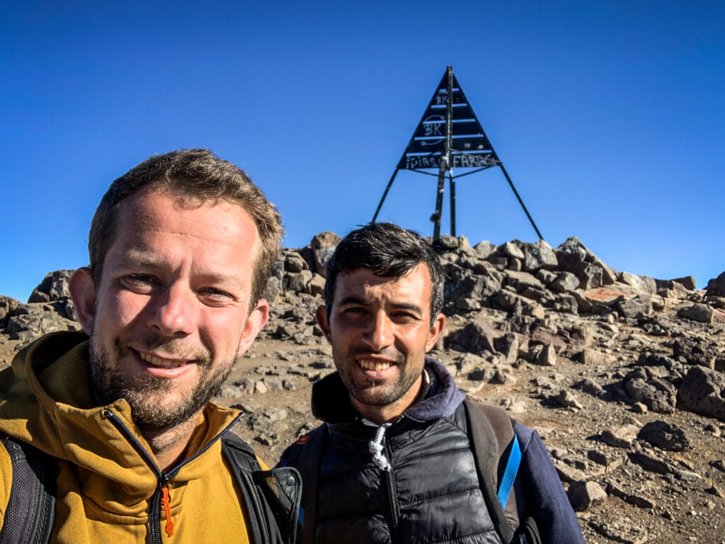
At the summit with KamalAt the summit of Jebel ToubkalAt the summit of Jebel Toubkal
At the dinner, I shared the table with a nice couple from Belgium, and I was surprised to hear that there was even a hot shower in the shelter! It was really great to refresh after the whole day outside. Unfortunately, because of altitude difference and tiredness, I got quite a strong headache so I took some painkillers and went to sleep very early.
Day 2
Most of the people disappeared from the dormitory in the very early morning and I was glad that I had a few extra hours of sleep in silence. We had breakfast at about 7:30 AM and then we set off for the way down to Imlil. Kamal was walking a good few hundred meters ahead of me, and I had the impression that he really wanted to get back home as soon as possible. Well, three kids were waiting 🙂 Once we arrived at Dar Adouss, Aziz prepared for us some mint tea and shortly after, it was time to say goodbye!
The way down to Imlil
Other hikes around Imlil
I arrived at Imlil with one spare day before the start of the Jebel Toubkal hike, and I wanted to warm up my muscles before the big adventure. Therefore, I decided to make the following loop, which was an excellent choice:
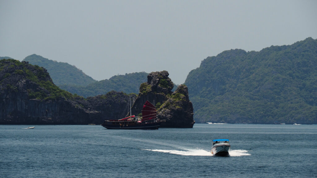
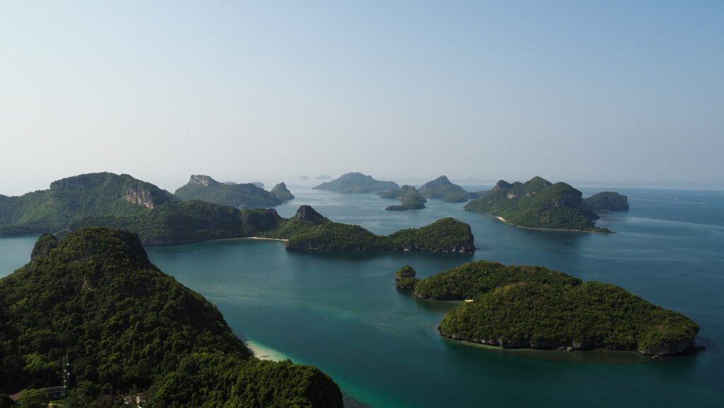
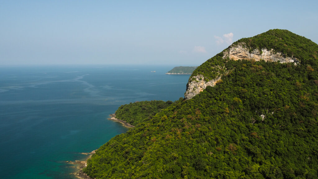
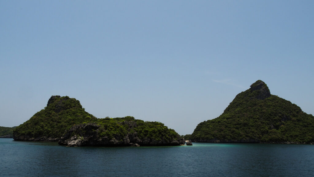
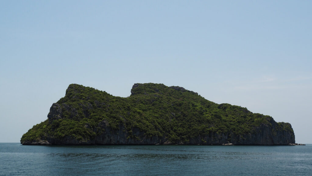
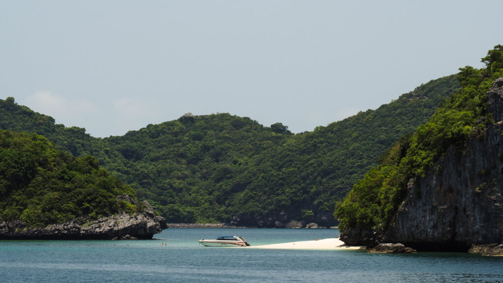
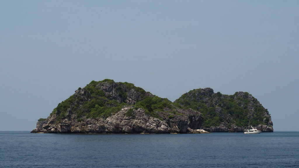
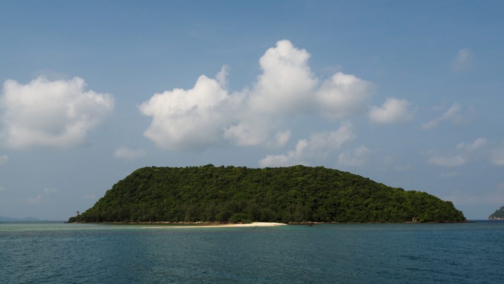
Ang Thong National Marine Park is a stunning archipelago located in the Gulf of Thailand, not far from the popular tourist destinations of Koh Samui and Koh Phangan. The park was established on 12th November 1980. and consists of 42 small, limestone islands, characterized by lush greenery, towering cliffs, and hidden coves. All of the islands are uninhabited and undeveloped except for one: Koh Wua Talap, where the visitor centre, campsite, and bungalows are located.
How to get there?
To get to Ang Thong National Marine Park, you need to travel to the nearby islands of Koh Samui or Koh Phangan, as it serves as a starting point for visiting the park. In both places, you will easily find tour agents offering day trips to the park. There are no boat tours from Surathani or Koh Tao.
Koh Samui and Koh Phangan can be reached on a ferry from Donsak Pier near Surat Thani. Raja Ferry is slow, cheap, uncomfortable, and takes about 1,5 hours to Koh Samui and 2,5 hours to Koh Phangan while Lomprayah is exactly the opposite but about twice the price and takes 45 minutes to Koh Samui and 1,5 hours to Koh Phangan. Time is money, they say. The choice is yours 🙂
Another option would be to fly to Koh Samui. There are regular flights from Bangkok and other major cities in Thailand, as well as some foreign destinations. Check your connections at 12Go.Asia.
How long to stay?
Typically people sign up for a one-day tour. However, camping is possible so if you wish to do so, you will need to make arrangements individually with the tour agent and the boat will pick you up on the next day. The rent of a tent for 2 people is 250 THB per person per night including a torch, clean sleeping bag, and mosquito net.
When to go?
The best period to visit Ang Thong National Marine Park is between December and August.
The dry season lasts from December to February and it’s the peak tourist season. Pleasant weather with lower humidity and cooler temperatures. Accommodation and flights can be more expensive, and popular tourist spots can be crowded.
From March to August, there is a hot season with higher temperatures and humidity. Occasional rain showers are possible but they are usually brief. May and June can be particularly hot.
Rainy season months, from September to November, are better to avoid. The prices are more budget-friendly but you may expect frequent rainfall and boat tours will most likely be closed.
Ang Thong National Marine Park
Entrance fee to the park
When signing up for a tour, clarify if the entrance fee is included in the tour price. Normally it isn’t and extra cash is collected by tour companies before the trip starts or while you are on board.
The fees as of August 2023 are as follows: 300 THB for foreign adults and 150 THB for foreign kids. Thai citizens will pay 50 THB for adults and 25 THB for kids.
*all prices are from April 2022.
Where to stay?
Koh Phangan
The night in Mae Haad Garden Inn cost me about 12 EUR per night and I chose that location only because other options were not available because of the Full Moon Festival. I ended up very satisfied with it and the area was super calm. With a scooter, it was easy to reach any part of the island anyway. Chaloklum Beach was only a 10-minute ride away.
Later, I moved to the Shanti Boutique Hotel which was a bit more expensive but absolutely brilliant. The rooms are simple but very cozy and clean, and it’s nice that they come with a balcony. The location is great as well, near Srithanu Beach and Zen Beach. There are also many cafés and restaurants that offer super tasty food with a lot of variety.
Koh Samui
I stayed for three nights at the Pamoni Hotel in Chaweng for about 19 EUR per night. It was basically a small apartment, with a living room and a kitchen, a bedroom, and a private bathroom and there was a swimming pool for guests too. A very good price-to-quality ratio and the location was very good too.
Ko Wua Talap
If you decide to extend your tour for the overnight stay, there are camping and bungalows to rent at the park headquarters on Ko Wua Talap Island. Facilities are basic: cold water shower and electricity from a generator that shuts down at 11 PM, but isn’t it a beauty of this place? You may also rent a kayak to explore the area from the water perspective independently.
The tour
There are numerous companies running daily trips from Koh Phangan and Koh Samui and first, you will need to decide if you prefer to take a speedboat or a slow boat. It takes about an hour to reach the islands by speedboat and about 2-3 hours by slow boat. You can save a lot of time choosing the first option but the ride can be bumpy and less enjoyable. The slow boat usually has a nice deck where you can sunbathe and take a lot of nice pictures.
I decided to choose a tour operated by the Orion Cruise, starting from Koh Phangan. It was a bigger and slower boat. As of April 2022, the cost was about 2.000 THB. Included in the price is pick-up from the hotel, lunch, snacks, soft drinks, and snorkelling equipment. You may pay an extra 200 THB if you go for an option with a kayak. The price included the Ang Thong National Marine Park entrance fee.
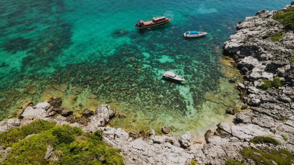
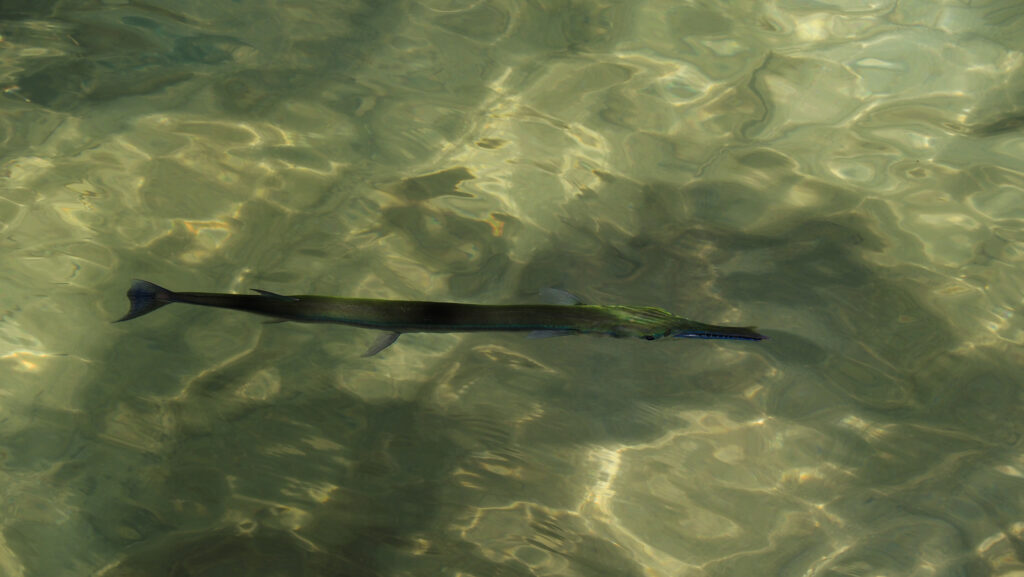
The day started with a slightly delayed pick up in the accommodation by a minivan and delivery to the pier. Coffee or tea and snacks were already waiting. The boat departed a few minutes after 9 AM and was going slowly so there was plenty of time to relax on the deck. The first stop was around Koh Wao, where we got our snorkeling equipment and jumped into the water to see some colourful fish and coral. It wasn’t bad but the water wasn’t perfectly clear and during my travels in South East Asia, I have visited much better snorkeling locations.
Snorkelling spot near Koh WaoSnorkeling spot near Koh WaoSnorkeling spot near Koh Wao
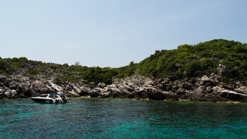
From there, the boat went deeper into the national park and at this point, it is better to be on the upper deck to have an unobstructed panoramic view of the small rocky islands all around. The boat stopped near Ao Ka Beach, which was a drop-off point for those who decided to choose the option of a kayak. To get to the beach itself, we had to switch to a long-tail boat first, as the slow boat was too big to get so close. The whole kayaking experience wasn’t too long and took about 30-40 minutes.
A scenic beach in Ang Thong National Marine ParkPicturesque rock formations
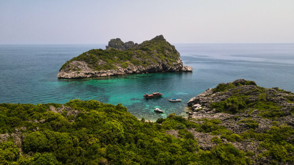
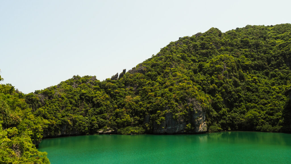
If you haven’t decided to have a kayak trip, you will stay on board and meet up with other participants later at Koh Mae Koh. It’s a wonderful island with a Blue Lagoon surrounded by steep limestone cliffs in the middle. Follow some steep stairs to get to the viewing platform and you won’t be disappointed. The color of the water is bizarre yet very beautiful.
The Blue LagoonThe waters are full of fish
The last stop was at the biggest island in the archipelago: Koh Wua Talap. Here are the national park headquarters and this is the place where you can stay overnight if you wish to. What you certainly have to do is hike up to Pha Chan Charat Viewpoint. It provides a sensational view of the islands with blue waters and green forests all around. The hike up is very steep and sweaty, especially under the hot sun but it’s totally doable for most people. Take your time and stop at other viewpoints along the way. The return trip should take about 1 hour.
Absolutely amazing views from Pha Chan Charat ViewpointAbsolutely amazing views from Pha Chan Charat Viewpoint
Once I got down, I still had some time to enjoy the wonderful beach and chill in the hammock. At the agreed time, the captain called me to return to the boat and we started our return journey to Koh Phangan with the sun slowly setting. We arrived shortly after 6 PM and were dropped off at our hotels.
Overall, it was a great day and the whole trip was organized nicely. The food was good, the crew was incredibly friendly and the views in the national park impressed me a lot. The only negative side was the speed of the boat, which was really slow and we spent plenty of time travelling to and from Ang Thong National Marine Park. If the boat had been faster, we would have had more time to spend in the park.
Ang Thong National Marine ParkAng Thong National Marine ParkAng Thong National Marine ParkAng Thong National Marine ParkAng Thong National Marine ParkAng Thong National Marine Park
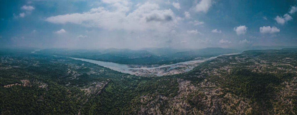
One of my favourite national parks in Thailand is located just next to the impressive Mekong River. Pha Taem is named after a large cliff where besides the panoramic views, you can also admire ancient rock paintings. There are excellent hiking trails and well-maintained campsites.
How much is the entrance fee?
The ticket for one day costs 400 THB for foreigners, so it’s quite expensive compared to other national parks. To fully enjoy it, I suggest spending two days in the park, including camping on one of the cliffs.
Panorama of the Mekong River
How to get there?
Ubon Ratchathani can be reached by air, train, or bus from Bangkok. There are daily flights from Bangkok to Ubon which take less than an hour. Train and buses are significantly cheaper but the travel time takes between 9 – 11 hours. My preference is the sleeping train which has the best comfort-to-price ratio but the arrival is very early in the morning, so you will need to hang around the city a few hours before checking in to the hotel.
From Ubon Ratchathani, you will need to get a bus or minibus further to Khong Chiam.
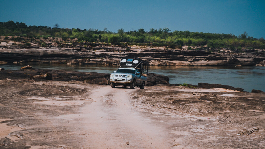
You can travel comfortably through the park by car or motorbike. If you are in Khong Chiam, ask around at your accommodation or Baan SteakRestaurant.
If you plan a long road trip in Isan, I recommend renting a car in Ubon Ratchathani. In bigger cities, there is always more competition and better prices. I used the services of Smile Rent a Car and got a well-maintained and cheap Toyota Yaris.
Nice and well maintained rental car
When to go?
The park has a monsoon climate with three seasons: the rainy season (June to October), the cool season (October to February), and the dry and hot season (February to June). The waterfalls will look the best in the middle or at the end of the rainy season. Other periods are nice as well but be aware that in May, the road to Pha Chana Dai Cliff is closed and there is very little or no water in the falls.
The Mekong River seen from the cliffsThe views are fantastic and next time I will definitely camp on the cliffs!
Where to stay?
I recommend the Khong Chiam 2 Hotel in the small town of the same name. It’s conveniently located close to the main road and the night market. The room was clean and very spacious, with fast internet.
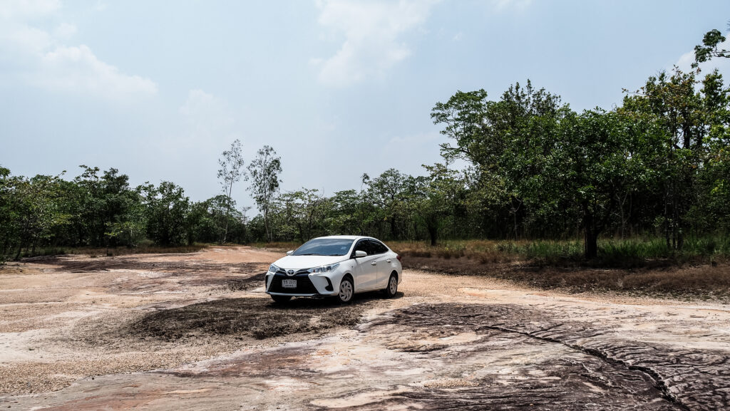
Itinerary
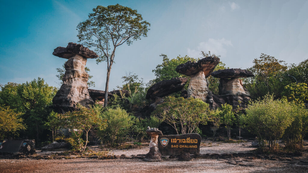
The first turn-off when driving from Khong Chiam takes you to Sao Chaliang. It is a natural monolith formed by water and wind erosion that resembles mushrooms. There are visible remains of shells, gravel, and sand in the rock, therefore, it is assumed that about a million years ago, this area used to be the sea. The Meak Mai Sai Than Hin Taek Nature Trail is comprised of 3 pathways. The first trail is 350 meters long, the second one has 1 kilometer and the third one is 2.7 kilometers. I highly recommend doing the longest loop as the views are really beautiful.
Impressive Sao Chaliang rock formationsI highly recommend hiking around that area
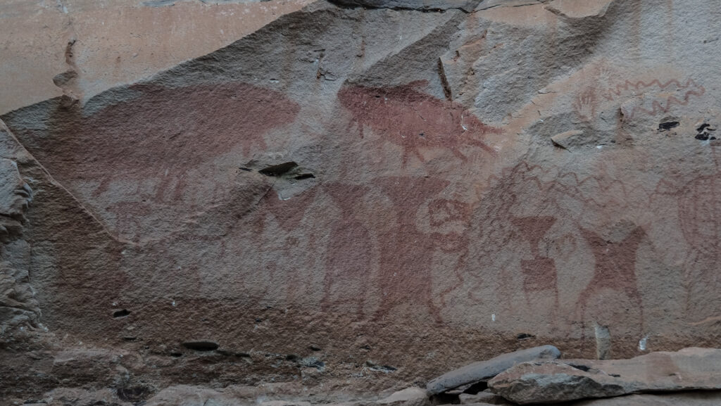
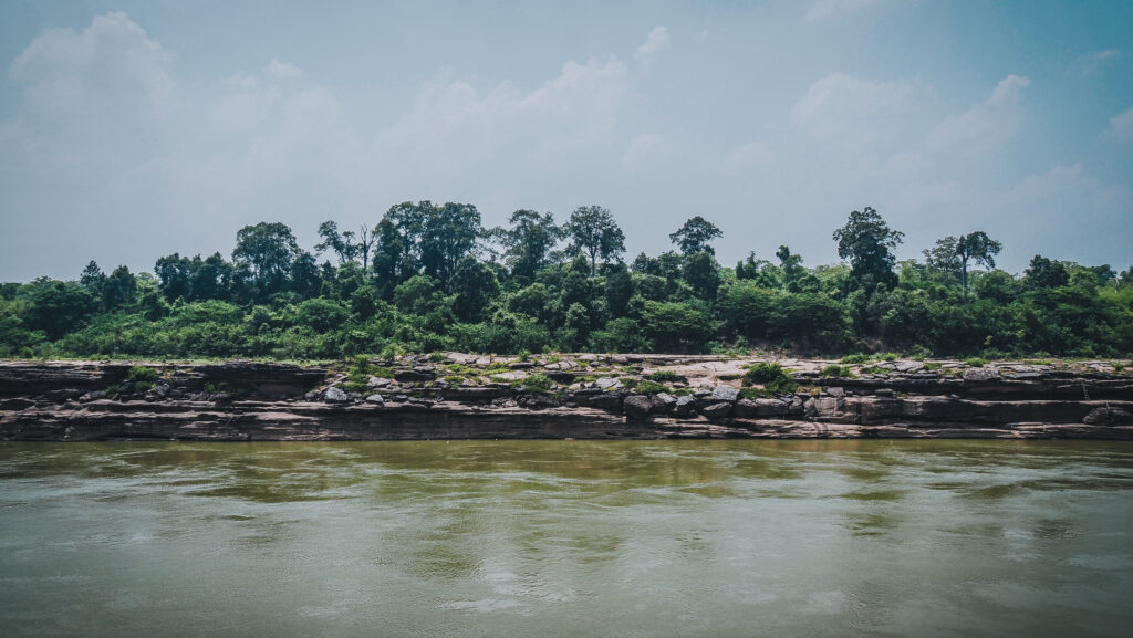
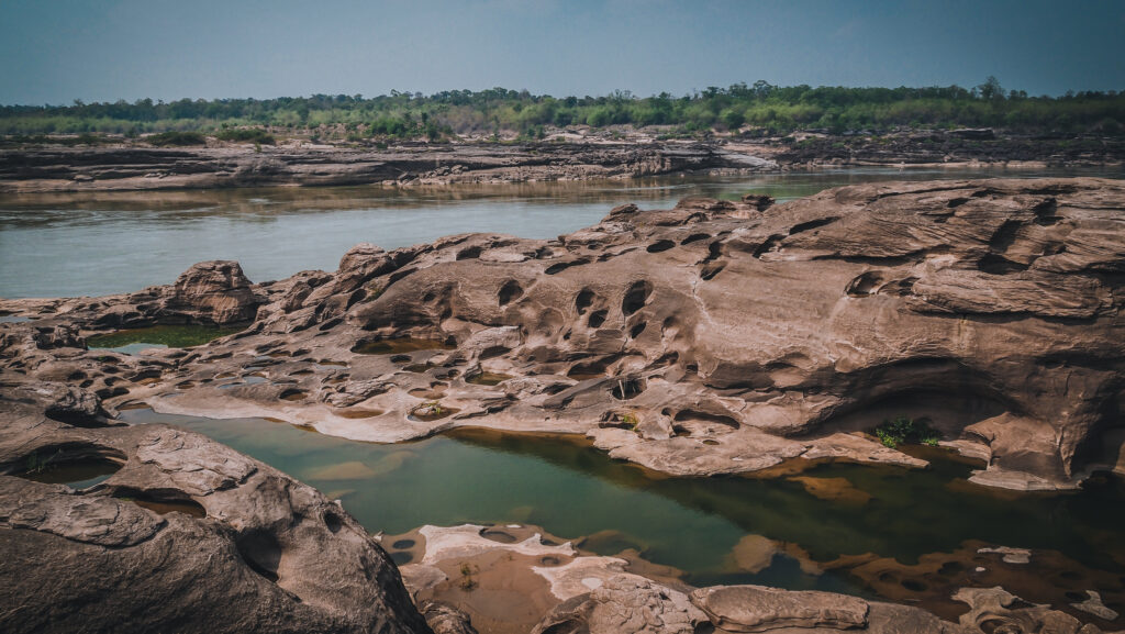
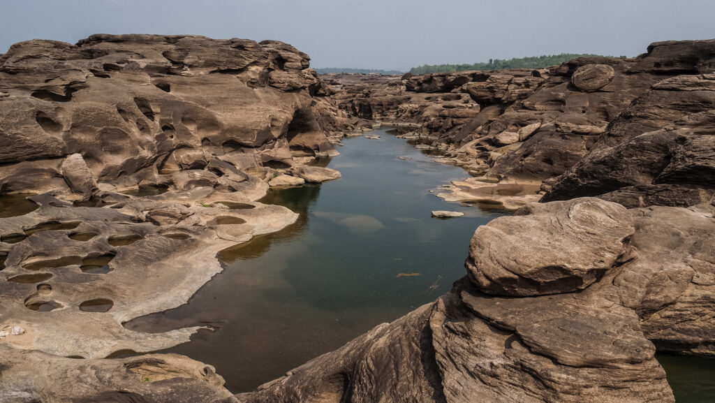
Further down the road is Pha Taem Cliff with incredible views over the Mekong River, a natural border between Thailand and Laos. Due to its geographical location to the east, the area is also known as the best place to experience the first rays of the sun in the country.
The hiking trail takes you first down the cliff to see ancient prehistoric paintings that were first discovered in 1981. They were made in various styles and techniques and present people, animals (elephant, turtle, catfish, and freshwater stingray), utensils, symbols, and human palms. The paintings are dated to be approximately 3,000 – 2,500 years old. Then you will climb up and return to the parking lot following the path at the top of the cliff. The total distance is nearly 5 kilometres but it is worth it!
The hiking path leads at the bottom of the cliff Rock paintings can be seen in several placesThey present people, animals, utensils, symbols……and human palmsThe way back to the parking is at the top of the cliff
Another turn-off from Road 2112 takes you to Soi Sawan Waterfall. From the parking, there is a short walk down to the falls. It was a beautiful sight even though there was very little water in May. From the parking area, you can also take a longer hike to Pha Chek Cliff and Pha Moei Cliff. The panorama of the Mekong River from there is simply breathtaking. The distance is about 4.5 km one way which should take 1.5-2h to complete.
Not too much water flowing at the end of MayNevertheless, the rock formations are worth seeing
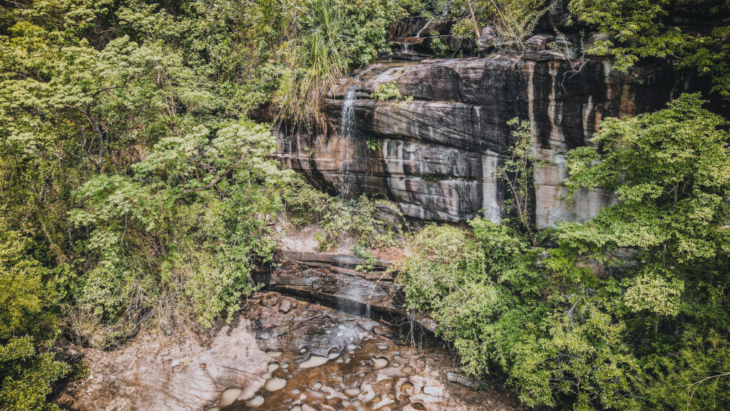
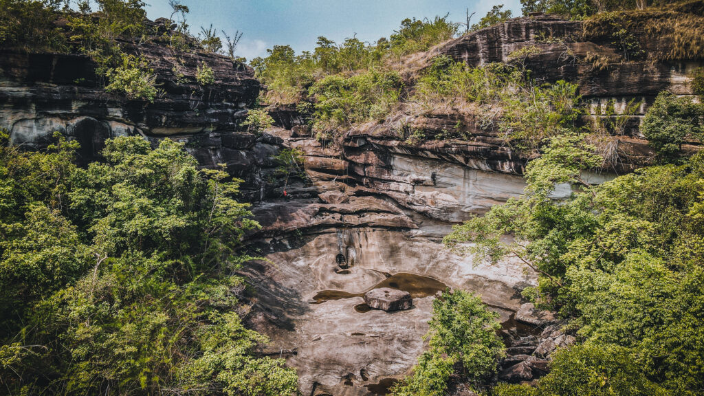
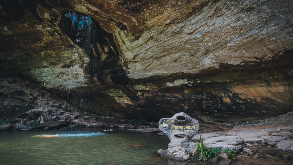
Come back to the main road and continue further north. Saeng Chan Waterfall is another exciting place to stop by and quite unusual because the water runs through the hole in the sandstone rock. Take your time to absorb the atmosphere of this place!
Saeng Chang Waterfall
Nearby, there is Thung Na Mueang Waterfall and if you continue following the road along the Mekong River, you will reach its end and the easternmost point of Thailand.
The next two attractions are a bit more difficult to reach. The road up to Pha Chana Dai Cliff is narrow and there are specific times when you can go up and down. The schedule as of April 2023 looked as follows:
Time of going up: 04:30 – 06:30, 10:30 – 13:00, 16:00 – 18:00
Time of going down: 07:30 – 09:30, 14:00 -15:00, 19:00 – 19:30
The road seems to be closed during the month of May. Check their website for the most recent information.
The road to Pha Chana Dai Cliff
The cliff is an easy 10 minutes walk from the car park and provides great views over the Mekong and into the mountains of Laos. Consider camping overnight to see the magnificent sunrise! Huai Phok Waterfall is nearby.
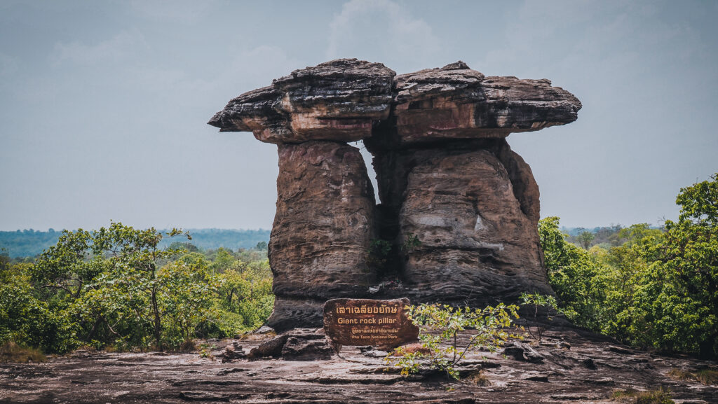
On the way to Pha Chana Dai, don’t forget to stop at Twin Pillars which is another sandstone formation shaped like a mushroom. Very photogenic!
Further north, you may visit Pha Chang, another scenic area with lower cliffs on the Mekong riverbank. It’s free to visit and you can park your car just at the end of the road and walk down the remaining distance. In the same area, you will find Sao Chaliang Yai, which is another rock formation resembling a giant mushroom.
Sao Chaliang YaiSao Chaliang YaiMekong riverbank at Pha ChangLess impressive but still scenic cliffs
Nearby
Sam Phan Bok
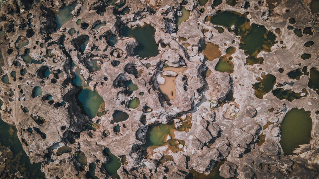
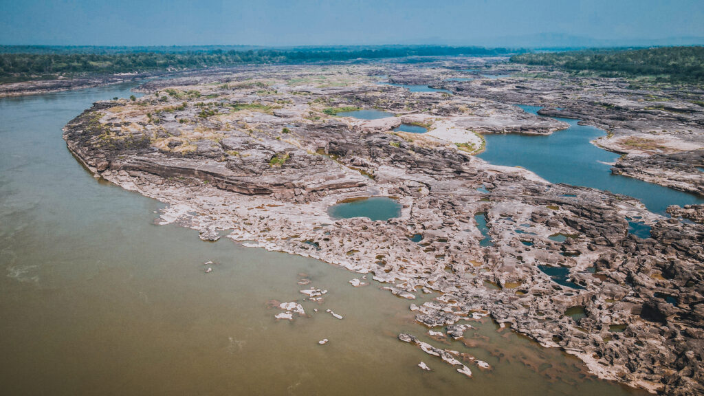
This place doesn’t belong to Pha Taem National Park but it’s pretty close to it and in my opinion, you can’t miss it. Sam Phan Bok means 3000 holes and as soon as you see the landscape, you will understand why it is called like that. The waters of the Mekong River eroded sandstone rocks into unique shapes. You may walk down there by yourself or hire a pickup truck for 150 THB to give you a lift. The distance isn’t long but it’s exposed terrain and on a sunny day it can be incredibly hot. There are people selling drinks and you may also accept the service of a young local guide showing you around, pointing at some unique rock formations such as Mickey Mouse, and taking photos of you.
Pick-up trucks take tourists to the riverbankTop-down view of eroded rocksAerial views of Sam Phan BokMickey Mouse 🙂You can wander around freely or hire a young guide to show you aroundThe place is best seen in the dry season when the water level is low
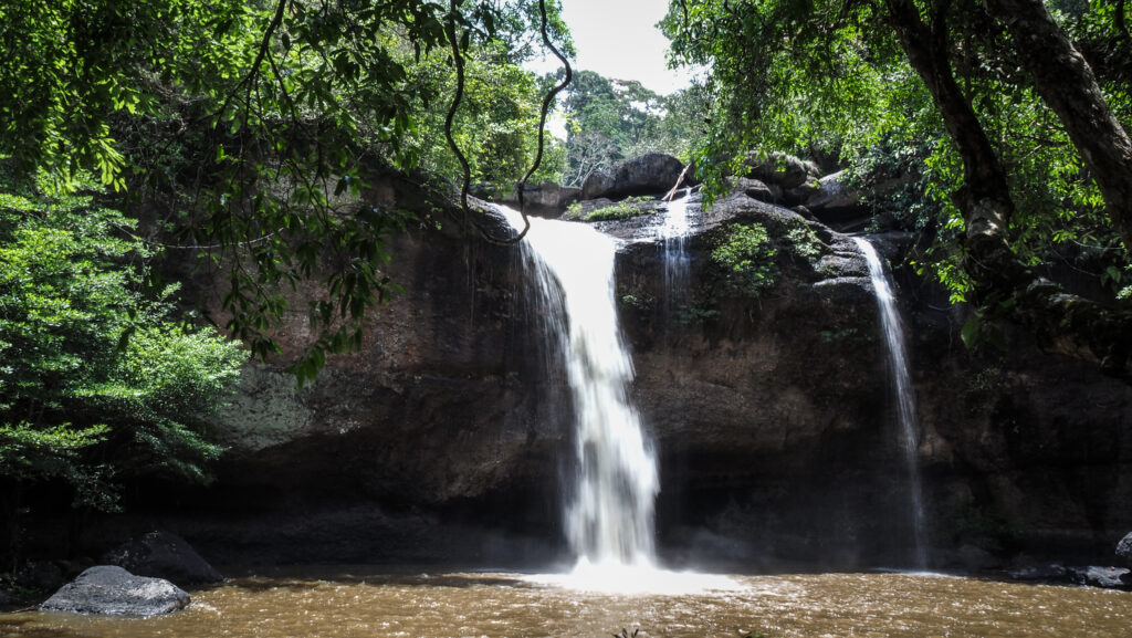
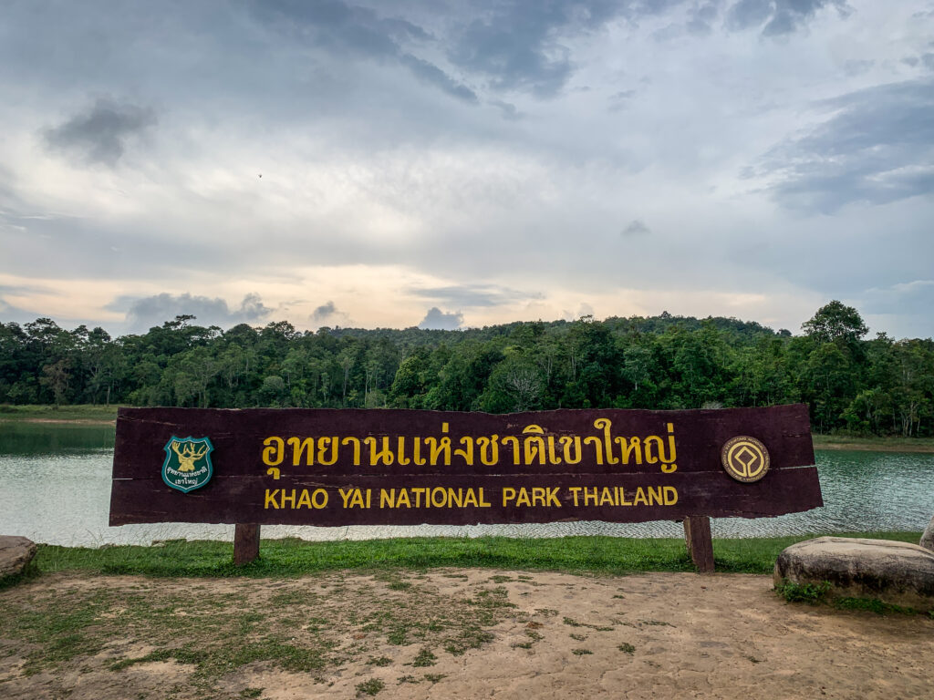
Located in Thailand’s Nakhon Ratchasima Province, Khao Yai National Park has a long and fascinating history. It was established as the country’s first national park in 1962 and is now one of the most popular tourist destinations not far from Bangkok. The area is home to stunning waterfalls, rainforests, mountains, as well as elephants, and other incredible wildlife. Read on to discover the amazing attractions that await you inside and outside of the park!
How to get there?
Khao Yai National Park is located about 180 kilometres northeast of Bangkok and about 3-4 hours’ drive from the capital. If travelling by public transport, the best option would be to take a train or bus from Bangkok to Pak Chong and then hail a taxi, take a songthaew or rent a motorbike for a one-hour drive to the Khao Yai.
The park can be visited during the whole year, however, the chances of animal encounters or the size of waterfalls will vary significantly.
The hot seasons last from March to May. While it isn’t as hot as it is in the cities, the rainfall is very low and waterfalls aren’t too impressive, or some may even dry up completely. The advantage is a minimal number of leeches.
The rainy season lasts from June to September. Waterfalls are and their best and you can hear a loud noise of flowing water even from a distance. The vegetation is green and dense. Unfortunately, there are plenty of leeches so you will need to be extra careful.
The cool season lasts from October to February and the average temperatures are the lowest during the year. It can get especially cold in the mountains during the night. The skies are blue and the visibility is excellent. As this period is just after the end of the rainy season, the waterfalls are still nice to see, especially in October.
Where to stay?
I decided to stay in Pak Chong, which is a bigger town not far from the national park. I recommend this option for people working online, as it may be hard to find reliable WIFI in nature. The place I stayed in was called Pak Chong Hostel & Wildlife Tours and it was excellent. The room is simple and only with a fan, but it was just enough for me. The owner is incredibly friendly. He picked me out from the train station, took me for lunch, rented a motorbike, explained the best things to do in the park and even provided me with leech socks. He also organizes tours, which may be a good option in case you are travelling in a bigger group. The only disadvantage of staying in Pak Chong is the distance to the national park entrance gate. It’s about 30 km and 40 minutes of riding a motorbike.
For those without the need of being connected to the Internet, the best would be to stay at a campsite or in a bungalow inside the park. It would give you much higher chances for encounters with wildlife at dawn and dusk.
What to take?
It’s a tropical environment and there are a few items that you definitely should take with you, to make your trip enjoyable and safe.
1. Sunscreen
2. Insect Repellent
3. Leech socks
4. Hat
5. Sunglasses
6. Lightweight and comfortable clothing
7. Trekking shoes
8. Water bottle
9. Snacks
10. Raincoat or poncho
11. First aid kit
12. Camera
13. Binoculars
14. Map of the park
Entrance fee
The ticket is quite pricey compared to other national parks in Thailand, but taking into consideration its size, it’s understandable. As of May 2023, foreign adults will pay 400 THB and children 200 THB. Thai citizens of course will pay much less, 40 THB for adults and 20 THB for children. Unfortunately, the double price policy is quite standard in this country. There is a small additional fee if you are entering the park with a motorbike or car.
What to do inside the park
Chao Phor Khao Yai Shrine
It is the first sight that you will see when entering the national park from the Pak Chong side. The shrine was erected in memory of Mr Jang Nisaisat, the individual who had protected the animals and forest of Khao Yai and was widely respected by local villagers.
Km. 30 Viewpoint
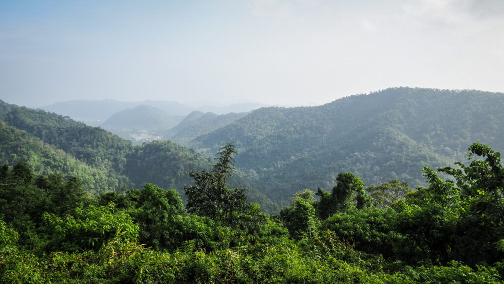
Shortly after passing the shrine, you will encounter this beautiful viewpoint. It faces the north and in the morning there is often a sea of mist below the mountain range.
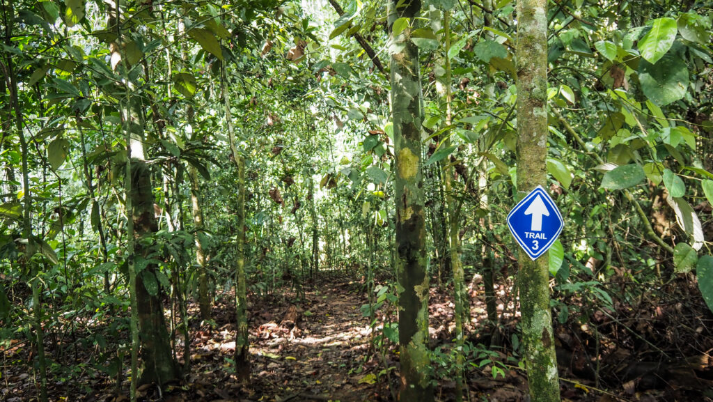
Trail #3: Km. 33 – Nong Phak Chi
Distance: 4.2 km one-way
Time: 2.5 – 3 hours
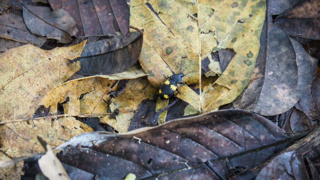
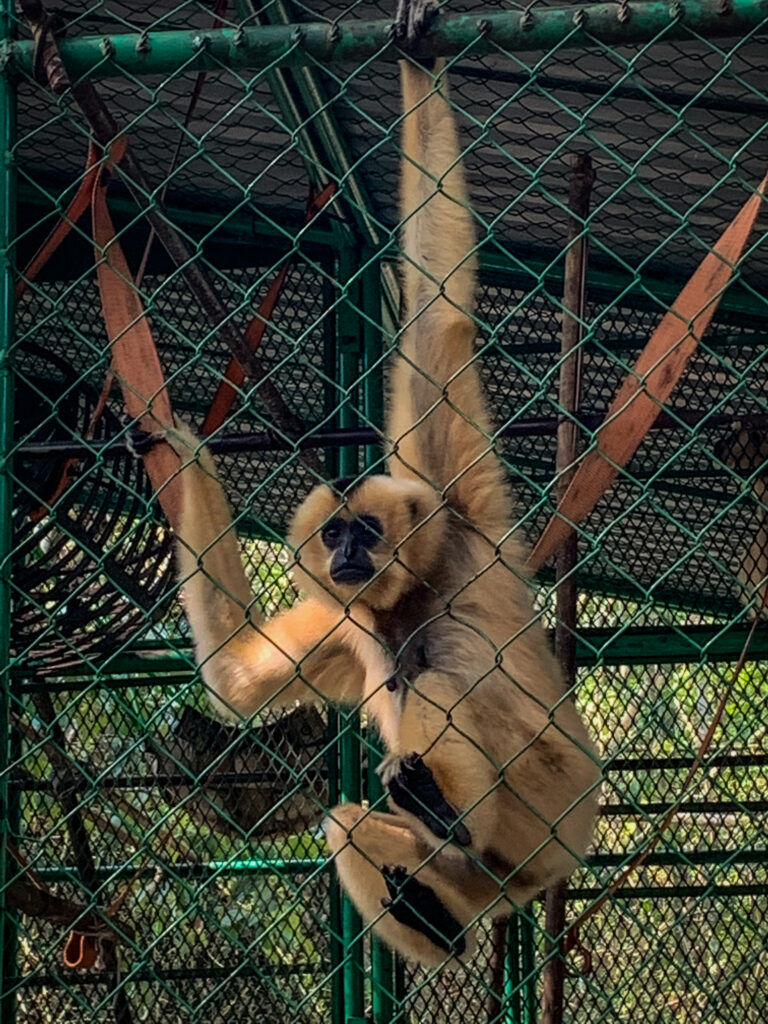
The trail starts at the roadside by the Km. 33 milestone. It was highly recommended by my host in Pak Chong to hike it first and preferably do it in the early morning. He was right! It was definitely the highlight of my visit. You will see different types of vegetation: mature dry forest, secondary forest and grassland. I saw hornbills, gibbons and some other insects. The sound made by gibbons was amazing! Closer to Nong Phak Chi Observation Tower, you can see some traces of elephants as they come near the water sources and salt licks. Unfortunately, I didn’t see any at that time.
From the observation tower, you may either hike back the same way or continue to the asphalt road and hitchhike back to your car or motorbike. The trail can be started between 8 AM and 2 PM.
Trail #5: Dong Tiw – Nong Phak Chi
Distance: 5.5 km one-way
Time: 3 hours
The trail can be combined with #3 in one big loop. It starts at the side of Thanarat Road about 200m from the Visitor Center at Sai Sorn Reservoir and finishes around Nong Phak Chi Observation Tower. The highlight of this trail is a giant Baing tree which is centuries old.
The trail can be started between 8 AM and 2 PM.
Trail #4: Dong Tiw – Sai Sorn Reservoir
Distance: 2.7 km one-way
Time: 1.5 – 2 hours
This one-way trail leads to Sai Sorn Reservoir, a beautiful spot to watch the sunset. It is just a much shorter version of trail #5. In the rainy season, you may see a beautiful array of flowers such as balloon plants, begonia and mossiata. The trail also connects with #5 and #7.
Trail #7: Thai-American Friendship Trail
Distance: 2 km loop
Time: 1.5 hours
It starts and ends at the Ridge of Sai Sorn Reservoir. The trail celebrates the long and friendly relations between Thailand and the USA. You will walk through dry forest, secondary forest and grassland. Frequently encountered wildlife include the Siamese Fireback, silver pheasant, gibbons and hornbills.
Trail #1: Visitor Center – Kong Kaew Waterfall
Distance: 1.2 km loop
Time: 45 mins – 1 hour
The trail begins at the hanging bridge behind the Visitor Center. This is the shortest and the easiest trail in the national park. Animals encountered might include the Lar gibbon, pileated gibbon and various birds. At the end of the trail is a small Kong Kaew Waterfall. Nothing too impressive but a pleasant place to rest next to the stream with volcanic rocks.
Trail #6: Visitor Center – Haew Suwat Waterfall
Distance: 8 km one-way
Time: 6 hours
The longest and the most challenging trail in the national park. You will walk through both rainforest and dry forests interspersed with bamboo groves. Animals encounters may include elephants, gibbons, Asian black bears and hornbills. There are many twists and turns, so the route may be confusing, and this is why you should consider arranging an experienced trail guide. The reward at the end is one of the two most beautiful waterfalls in the park.
The hikes should be started before 10.00. It is closed between July 1st – August 31st.
Trail #2: Pha Kluai Mai Campground – Haew Suwat Waterfall
Distance: 3 km one-way
Time: 2 hours
This nature trail links two waterfalls, following the Lam Ta Khong stream. Along the trail, you will hear the thundering sound of Pha Kluay Mai Waterfall during the rainy season. Unfortunately, in May the water level was very low so the trail wasn’t that impressive to me. On the other hand, when water levels drop, you can see the traces of lava flow from a volcano hundreds of millions of years ago.
Haew Suwat Waterfall
One of the two most impressive waterfalls in the Khao Yai National Park. Lam Ta Khong stream falls 25 metres down the volcanic rock. There is a nice viewpoint where the falls can be seen through vegetation but for a much better experience, you should go down quite steep steps to the basin. In the dry season, you may check out the cave just behind the water curtain.
Sai Sorn Reservoir
A picturesque place with plains for picnics and sufficient parking along the road. A popular place for event photography too. Hiking trails #4, #5 and #7 pass nearby.
Pha Diaw Dai Viewpoint
The wooden boardwalk is approximately 450 meters long and leads you through a pristine forest, which is extremely atmospheric in the wet weather. The views from the stony edge of the cliff over the Rom Khwang mountain range are truly breathtaking.
While driving up here, you will pass by Viewpoint 3 at Yod Khao Khieo Mountain. The panorama is great as well but there is no place to stop and park a car or motorbike.
Pha Trom Jai Cliff
It is located 600 metres from the Pha Diaw Dai, just next to the entrance to the Royal Thai Air Force radar station. At an elevation of 1,290 meters above sea level, this is the highest viewpoint in the central region of Thailand. The view, however, isn’t the best.
Haew Narok Waterfall
Haew Narok is located to the south of Khao Yai National Park on Highway 3077, about 23 km from the Visitor Center. It’s an excellent road through the dense forest with a high chance of seeing wild elephants, especially in the later afternoon. Drive slowly!
The waterfalls are the largest and tallest in the park (150 metres). From the parking, there is a 1-kilometre trail going over Huay Samor Poon Stream and then down the steep staircase to the best viewpoint.
According to the national park website, the area of the waterfall is a permanent part of wild elephants’ foraging range, which has been the cause of tragedy with elephants falling down the waterfall. The first time was on 2 August 1992, when a family of 8 elephants was lost as they were crossing the stream in the forest at the top of Haew Narok Waterfall, making it known as an “elephant graveyard”. On 5 October 2019, another 11 elephants were lost.
Night Safari
When joining the tour, you may see nocturnal animals, such as sambar deer, Malayan porcupine, large Indian civet, Asian palm civet, wild elephant, owls and nightjars. Inquire and reserve a time slot at Khao Yai Visitor Center, at the service desk before 6 p.m. The guided journey on a pick-up truck is 10 km long and takes about one hour. The price is 600 THB per vehicle fitting up to 10 people.
Whitewater Rafting
The rainy season from July to October is the best for this activity as the water current is strong and turbulent, and suitable for rafters wanting to be challenged. Hin Phoeng Rapids is used as a starting point and then a trip continues on a 2.5 km stretch with 6 rapids called Kaeng Hin Phoeng, Kaeng Phak Nam Lom, Kaeng Wang Bon, Kaeng Luk Seua, Kaeng Wang Sai and Kaeng Ngu Hao.
What to do outside of the park
Ban Tha Chang Spring
A popular place for locals to come for a dip. Very clear water with plenty of space to enjoy. You may also rent a kayak and check out the small river. Free entrance and free parking
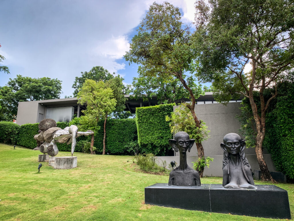
Khao Yai Art Museum
Surprisingly good place with paintings and sculptures of local artists. Don’t miss a walk in the garden which is full of art installations. Free entrance.
Wat Tham Sila Thong
Ask the monk to give you a key to a cave. It has a hole in the ceiling, but the cave is quite dark so it’s good to have your own flashlight.
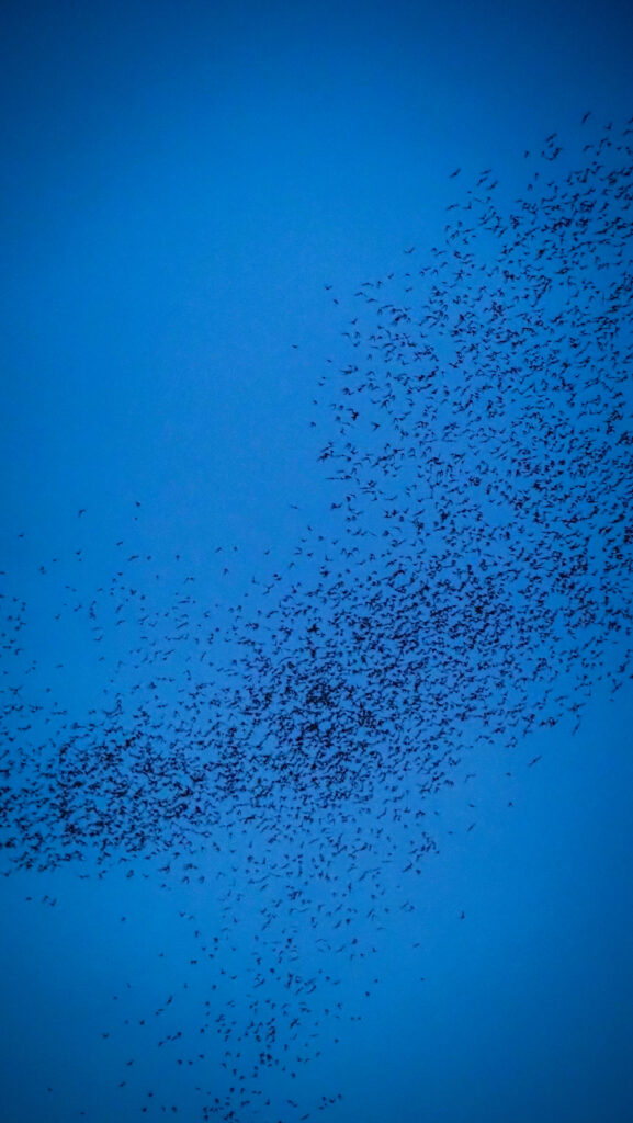
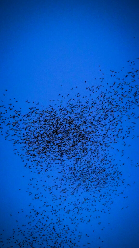
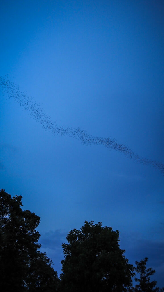
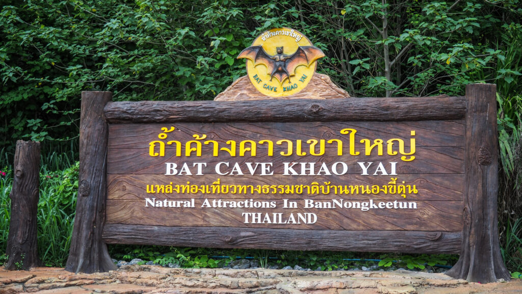
Bat Cave
It’s not really a cave to explore, but rather an observation point for a spectacle straight from National Geographic documentaries. At dusk, thousands of bats fly out of the cave in a continuous stream. Unique and amazing experience! The show of nature usually happens between 5:45 PM – 7 PM and lasts for a surprisingly long time. Over 20 minutes once I was there!
Sarika Waterfall
Another nice waterfall with a beautiful winding road up the mountains to get there. Entrance ticket for foreigners costs 200 THB and for Thais 40 THB. As in all the other waterfalls in this region, it’s best to visit in the rainy season.
Nang Rong Waterfall
Small and free waterfall but unfortunately not very well maintained. A popular picnic place for local people.
Khun Dan Prakarn Chon Dam
The longest and largest dam in Thailand. You can either walk or rent an electric golf cart to get to the other side. Obviously, I recommend walking. There’s also an option to go on a boat trip further down the lake and to the nearby waterfall.
Cat Tien is one of the most famous National Parks in Vietnam. Located in the southern part of the country, it is home to a unique and diverse ecosystem that includes tropical forests, wetlands, and even a dry evergreen forest. Here, visitors will discover a wide variety of wildlife, including rare species of birds, primates, and reptiles. Not only is this park a haven for nature lovers, but it also offers some activities for those looking for a bit of adventure. From day hikes to overnight camping, there’s something for everyone. I spent 2 full days in the park and left with mixed impressions. Let me show you what the part has to offer and what disappointed me.
How to get there?
From Ho Chi Minh City, you can take a bus from the Mien Dong (Eastern) Bus Station to the town of Dai Ninh, located just outside of Cat Tien National Park. From there, you can take a taxi or motorbike to the park. Alternatively, if you are travelling from other cities in Vietnam, you can take a bus or train to either Bao Loc or Dalat and arrange transport from there.
You may also check your connections at 123Go.Asia.
When to go?
The best time to visit Cat Tien National Park is during the dry season, which runs from December to May. During this time, the weather is more pleasant, making it ideal for trekking and exploring the park.
River panorama and one of the gibbons at Bear and Gibbon Rescue Center
Where to stay?
My stay atThuy Tien Eco Lodgewas definitely one of the most pleasant experiences in that area. I was upgraded to the bigger room which was clean, with air-conditioning and a hot water shower. The internet was fast and I could work online without any issues. The owner was really sweet and she helped me organize my time in the park and gave me some tips.
What to take?
It’s a tropical environment and there are a few items that you definitely should take with you, to make your trip enjoyable and safe.
1. Sunscreen
2. Insect Repellent
3. Leech socks
4. Hat
5. Sunglasses
6. Lightweight and comfortable clothing
7. Trekking shoes
8. Water bottle
9. Snacks
10. Raincoat or poncho
11. First aid kit
12. Camera
13. Binoculars
14. Map of the park
Entrance fee
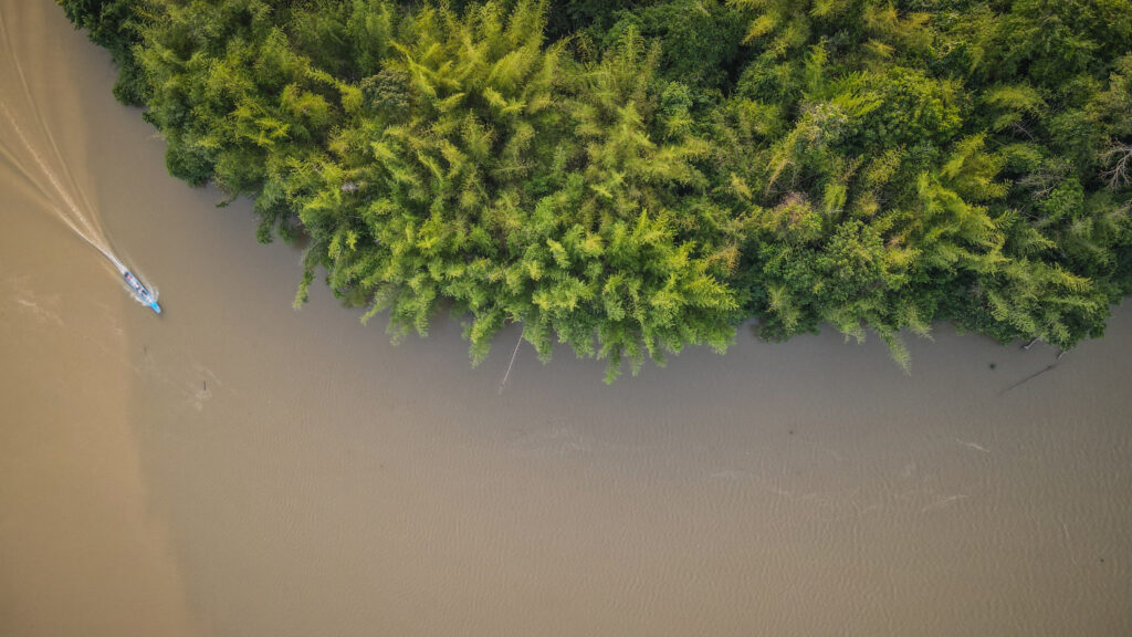
The ticket for a boat that takes you across the Dong Nai River costs 60.000 VND. There is no other way to get inside, so you must take it. The crossing literally takes one minute or even less.
Renting a bicycle
There are several options to rent a bike: 30.000 VND for 1 hour, 100.000 VND for 4 hours or 150.000 VND for 8 hours. Unfortunately, the bicycles are total rubbish so take your time and choose wisely. The rental place is just to the left of the Visitor Center.
Very bad quality rental bicycle
Do-it-yourself activities
Tung Tree
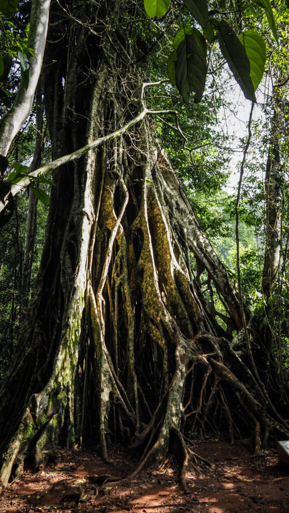
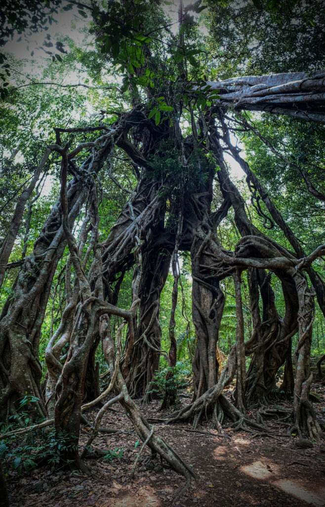
In the park, there are many tall trees which are hundreds of years old and Tung Tree is one of them, with a height of 20 meters and a width of 10 meters. The roots of the trees sit on the ground and are absolutely breathtaking. When walking through the jungle and approaching this tree, you can feel like Tomb Raider!
Ben Cu Rapids
Nothing too spectacular, at least in the dry season. You can walk around the stones to get closer to the river but unfortunately, the area was full of rubbish. Very sad view, especially inside the National Park. It seems like rangers are too busy doing nothing instead of moving their asses to clean a bit!
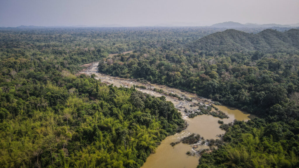
Rapids on Dong Nai RiverThe whole area looks impressive from the sky
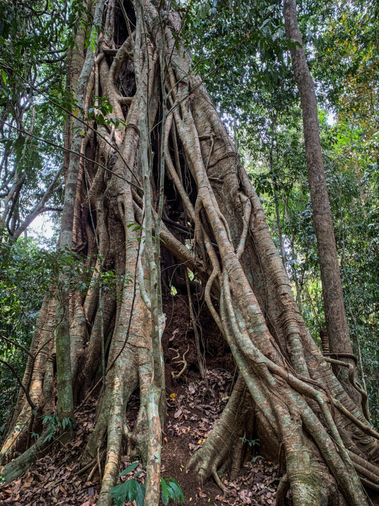
Uncle Dong Tree
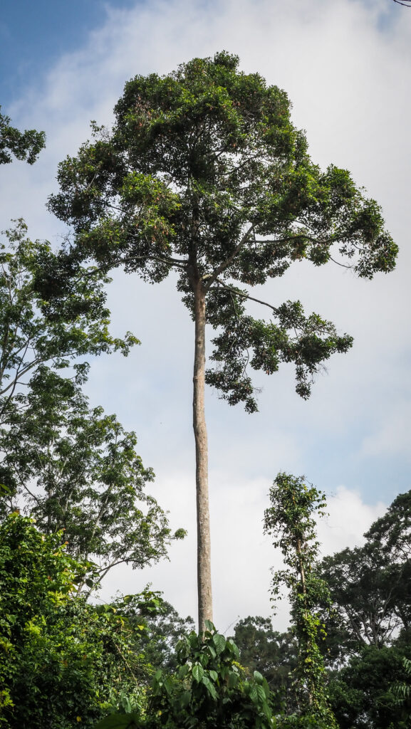
Another impressive tree. This time it is a genus of redwood tree with 2 meters diameter.
Botanical Garden
It’s a series of paths through the jungle, very close to the riverside. The names of plants and trees are included on the boards. Very pleasant walk!
Heaven’s Rapids
The series of rapids is located about 12 km away from the Visitor Center. The road to get there is a bit bumpy, especially on low-quality rental bicycles. You can easily do it together with other sights on the way: Tung Tree, Ben Cu Rapids, Botanical Garden, and Uncle Dong Tree (small detour needed). Unfortunately, similar to Ben Cu Rapids, there were lots of plastic bottles in the water. It isn’t my definition of heaven!
Crocodile Lake
This is the classic trekking route in Cat Tien and is not to be missed. Take a bicycle for about 9 km on the main park road to the beginning of the trail. Then hike 5 km to reach the lake. You might see giant trees, rare peafowl, water birds, monkeys and of course Siamese crocodiles. And if you don’t see, for sure you will hear a lot of wildlife around you. This was certainly the best hike in the park, even though the entrance fee of 250.000 VND at the lake seemed to be too high. You can stay overnight at the Ranger Station with advance reservations which of course will give you priceless opportunities to watch wildlife in the night and at dusk.
Crocodile Lake
Garlic-Shaped Lagerstroemia Tree
From Crocodile Lake, the unpaved road continues for another 3 km to these unique trees. At the end of April, the forest here was full of butterflies making the whole ride even more amazing!
Amazing trees in Cat Tien National Park
6 Rooted Intersecting Ficus
On the way to or from Crocodile Lake, do not forget to stop to see this wonder of nature. I felt like inside the Lord of the Rings movie, only waiting for that tree to move and grab me with its roots.
Amazing trees!
Bear and Gibbon Rescue Center
It is located just next to the visitor centre and is free to visit. However, it looks a bit creepy. The gate was open but I couldn’t see any staff member around so I just walked around. I couldn’t see any moon bears or sun bears inside but there were a few gibbons in the cages. I hope they are treated well!
Ta Lai Village
The place is located 12 km from the Visitor Center and is populated by Ma, Stieng, and Tay people. The Ma and Stieng people are the original inhabitants of the Park’s Core Zone. Here you can experience daily life in a rural community. You can come here on a bicycle following the western bank of the Dong Nai River or on a motorbike following the eastern bank.
Activities
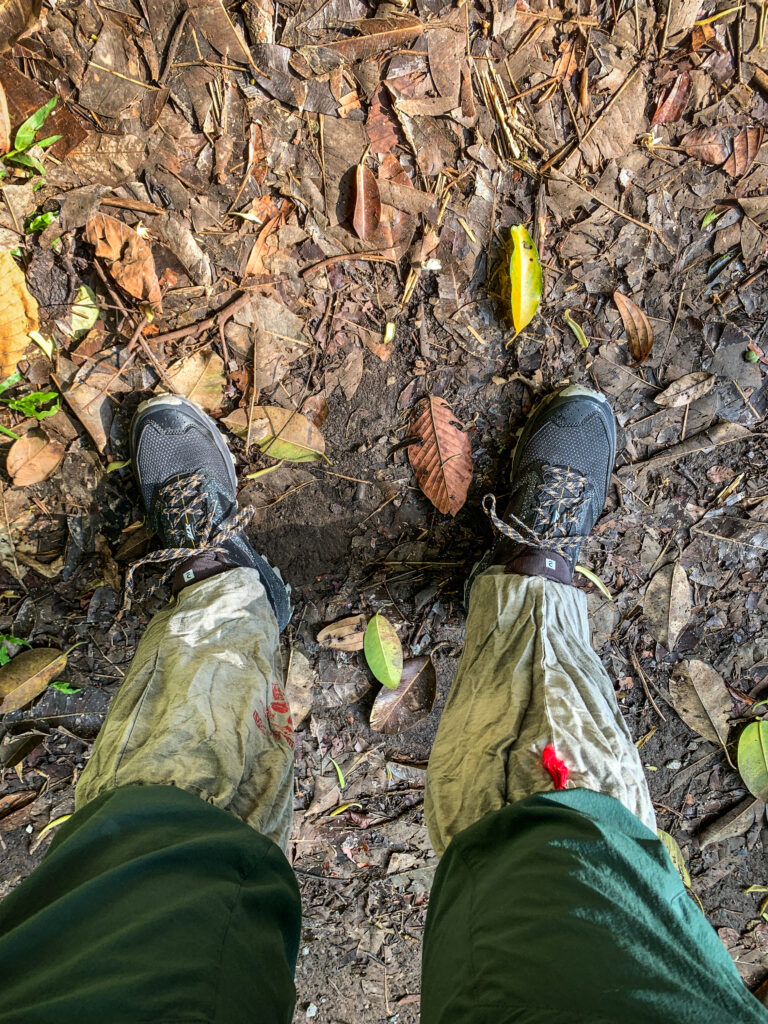
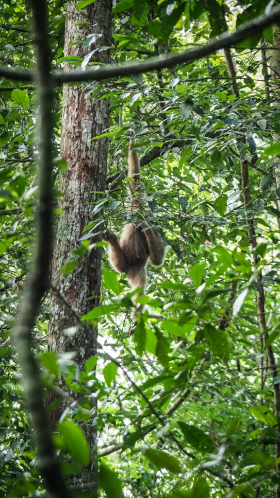
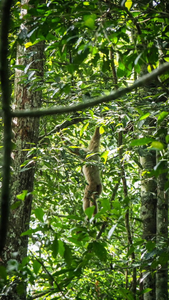
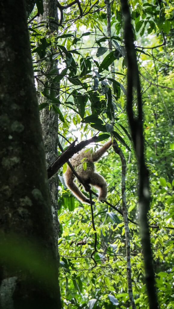
Wild Gibbon Trek
The most famous activity in the park brought me a lot of mixed feelings. The tours are limited to 4 people per day and we started at 5 AM in the morning when a boat took us to the visitor centre where we were greeted by our guide. Then we walked to the area next to Tung Tree, where we made a short stop and then continued deeper into the jungle. Soon, we were able to hear incredibly loud sounds made by the gibbons so we followed in this direction. The whole singing spectacle lasted about 10-15 minutes and then it got quiet. We could see some gibbons eating high in the trees. After a while, we came back to the visitor centre and the tour finished. Overall, it was great to hear and see gibbons in the wild. The tour took about 2 hours and cost 1.150.000 VND. Was it worth the time? Definitely yes. Was it worth the money? Definitely not. I found the tour highly overpriced and the guides also weren’t too eager to share some information about gibbons and wildlife in general.
Gibbons were seen high in the trees
Boat ride to Ta Lai
If you like water and birds, it is recommended to take a boat trip on the Dong Nai River. The trip downstream to Tai Lai Village is a great way to see the park from the waterfront. There is not much to do in the village itself so the whole activity is rather about sightseeing from the water and not about the final destination. The round trip takes about 3 hours.
Boat on the Dong Nai RiverDong Nai River
Night Safari
Night spotting is the easiest way to see mammals. Ride in an open-air truck through the jungle to observe wild animals such as deer, wild pigs, snakes, porcupines, gaur and weasels as they forage for food on the grasslands or in bushes during the night.
Dao Tien Engangered Primate Species Center
Dao Tien Island is just 5 minutes upstream from the boat landing. The centre specializes in the rescue, rehabilitation and release of endangered primates naturally found in the area of the park: golden-cheeked gibbons, black-shanked douc, silvered langur and pygmy loris. Most of the animals who are helped at this centre were victims of the illegal wildlife trade. The local guide will explain more about their stories and the job that the centre does. At the time of my visit (April 2023), there was only one tour per day and it was at 8 AM, so you need to be at the visitor centre at around 7.45 AM.
Final thoughts
Even though the time in nature is always great, I left Cat Tien National Park with mixed feelings. In my opinion, the number one attraction called Wild Gibbon Trek is highly overpriced. Moreover, I saw rubbish all over Ben Cu Rapids and Heaven’s Rapids. I also saw many park rangers who didn’t do anything besides chilling in the hammock. Then, where does all the money earned from park attractions goes? They could just walk around ONCE A WEEK to collect the trash if there is any. But yeah, what’s the point? It’s Vietnam and no one cares anyway.