Tag

featured

Browsing

Introduction

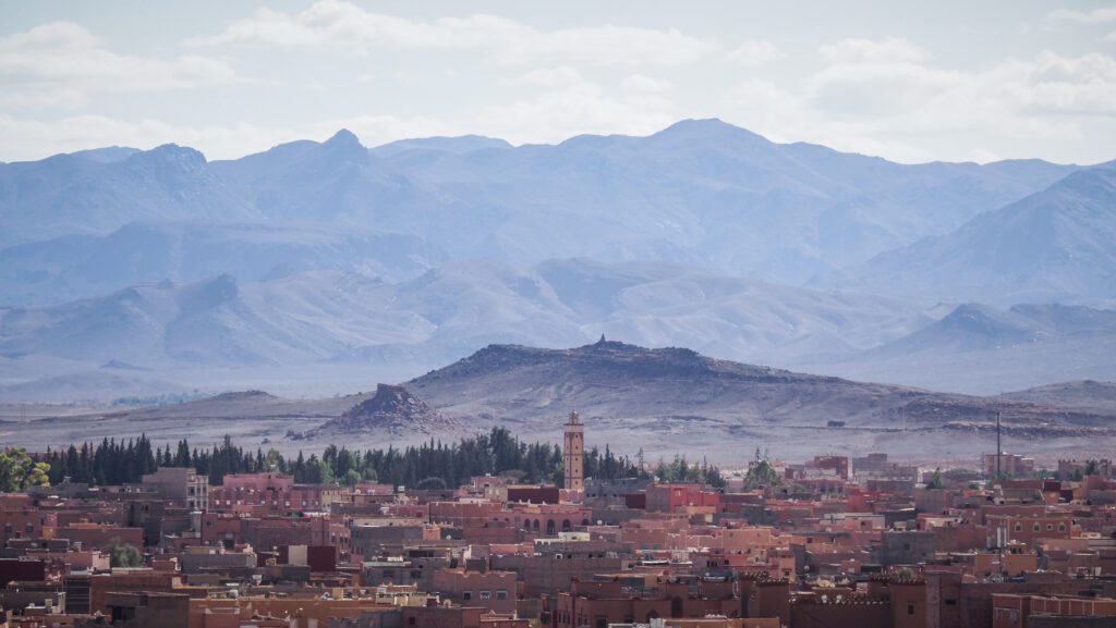
Larache is a coastal city in northern Morocco known for its rich history, vibrant culture, and picturesque location along the Atlantic Ocean. It has historical ties to Moorish and Spanish influences, reflected in its architecture and cultural heritage. Founded during the Islamic period, it later became an important port city under Spanish rule before returning to Moroccan sovereignty.

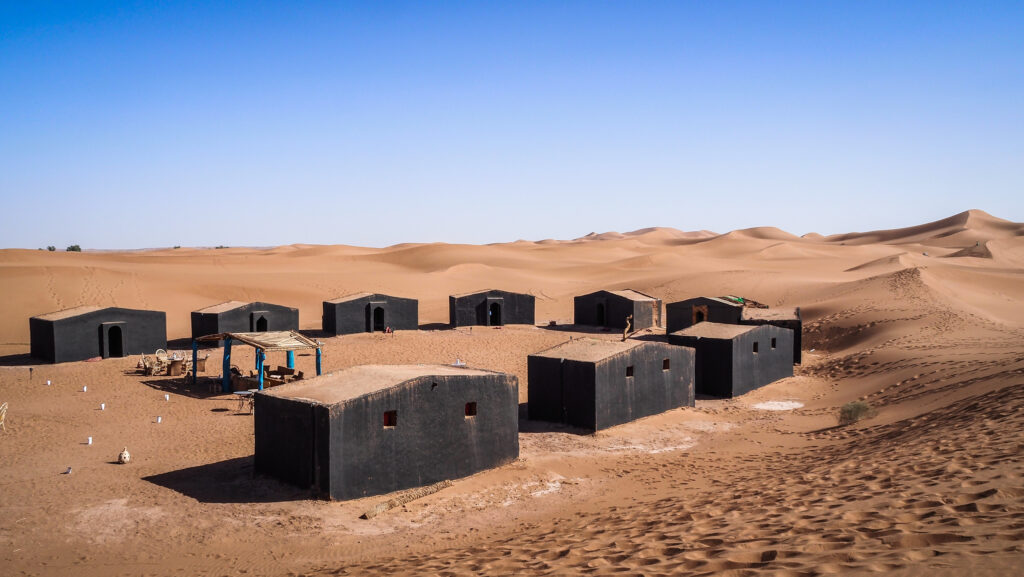
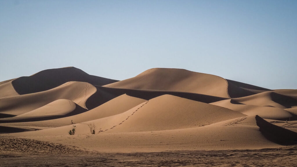
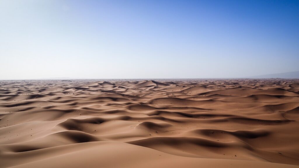
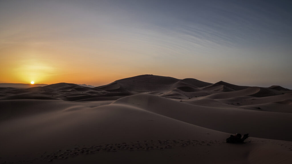
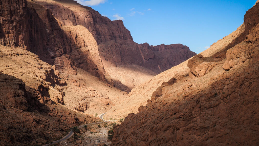
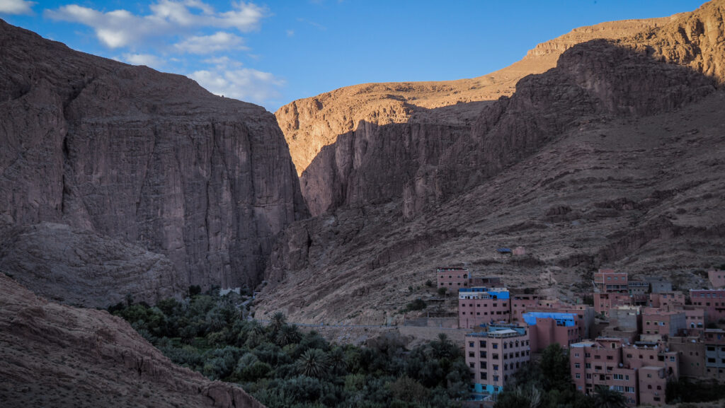
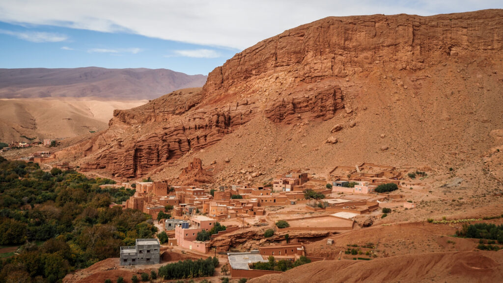
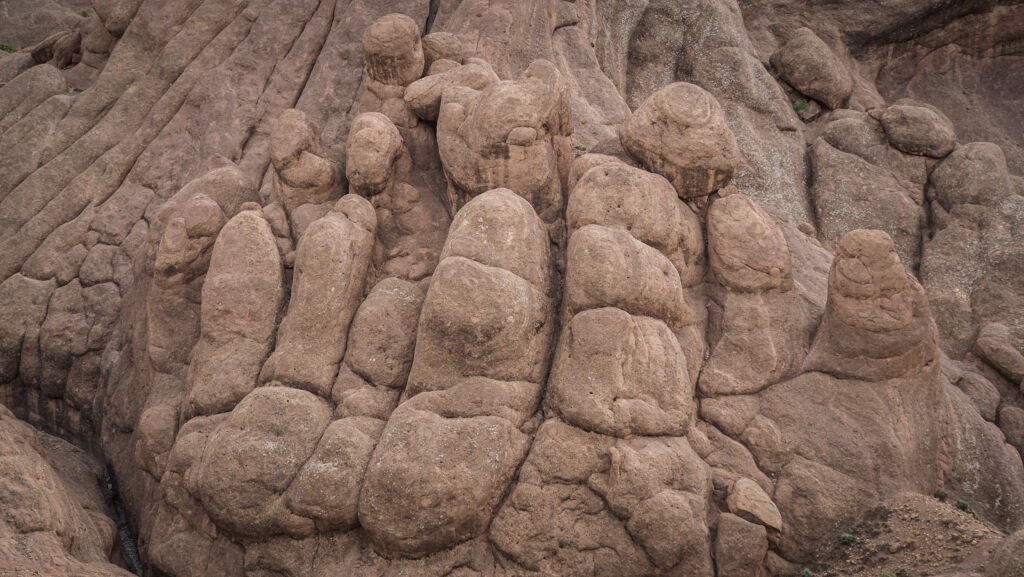
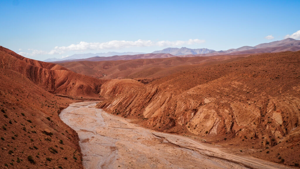
The city is particularly famous for its laid-back atmosphere and stunning landscapes, including sandy beaches and the nearby Loukkos River. One of the most notable sites near Larache is Lixus, an ancient archaeological site with Phoenician, Carthaginian, and Roman ruins. Lixus is believed to have been one of the oldest continuously inhabited settlements in the region and is often associated with myths, including the story of the Labours of Hercules.

The medina (old town) of Larache offers a blend of traditional Moroccan life with Spanish colonial-era influences. Its streets are lined with whitewashed buildings, colourful markets, and small cafes. The city’s vibrant port and fishing industry play a key role in its local economy, contributing to its culinary traditions, which heavily feature fresh seafood.

How to get there?

By Air

The nearest international airports to Larache are:

Tangier Ibn Battuta Airport (TNG): About 85 km north of Larache. From here, you can take a taxi, train or bus.

Rabat-Salé Airport (RBA): Around 150 km south of Larache, also accessible by road or train.

By Train

Larache is not directly served by a train station, but the nearest station is in Ksar El-Kebir, about 30 km away. From Ksar El-Kebir, you can take a shared taxi or local transport to reach Larache.

The ONCF (Moroccan National Railway) network connects major cities like Tangier, Rabat, Casablanca, and Fez to Ksar El-Kebir.

By Bus

Several bus companies operate routes to Larache from major cities in Morocco:

CTM: Known for comfort and reliability, offers services from cities like Tangier, Casablanca, Rabat, and Fez.

Private buses: Less expensive but may be less punctual or comfortable.

By Grand Taxi

Shared taxis (Grand Taxis) are a popular way to travel between cities in Morocco. You can take a Grand Taxi to Larache from nearby cities like Tangier, Ksar El-Kebir, or Asilah.
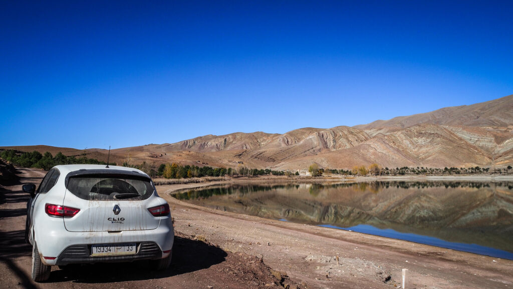
By Car

Larache is easily accessible by car:

From Tangier: Take the A1 highway (approximately 1 hour).

From Rabat or Casablanca: Use the A1 highway heading north.

From Fez: Take the N4 and N1 roads via Ksar El-Kebir.

Powered by 12Go system

How to get around Larache?

Once in Larache, small taxis and buses are the most common ways to get around. Walking is also an excellent way to explore the city, especially the medina and the port area.

Where to stay?

I selected La Maison Haute for its great location inside the medina and good quality-to-price ratio. I wasn’t disappointed. There was everything that I needed for my short, one-night stay, and the hosts were friendly, even though communication in English was limited. A good breakfast was included in the price.

The best time to visit

Spring (March to May)

Temperatures are moderate, ranging from 18°C to 25°C. The landscapes are lush and green due to the previous winter rains. It’s a perfect time for outdoor activities like visiting Lixus, strolling through the medina, or enjoying the beaches. It’s less crowded than summer.

Autumn (September to November)

Similar to spring, with temperatures between 20°C and 27°C. The sea is still warm enough for swimming after the summer heat. Quieter than in summer, with fewer tourists, and the weather is comfortable for sightseeing.

Summer (June to August)

Hot and sunny, with temperatures often reaching 30°C to 35°C. Coastal breezes help keep the heat manageable. Best time for beachgoers, as the beaches are lively and the water is warm. However, it can be crowded, especially with local and international tourists.

Winter (December to February)

Cooler but mild, with temperatures between 10°C and 18°C. Occasional rain is possible. Ideal period for a peaceful visit, as the city is less busy. While beach activities may be limited, it’s a great time to explore cultural and historical attractions.

For the best balance of pleasant weather and fewer crowds, spring or autumn is highly recommended.

Larache, Morocco
The view of Fort Kebibab

What to see in Larache?

I started my exploration from Liberation Square (Spanish Square). A very lively spot where local residents gather to catch up with friends and unwind over coffee or tea. This circular plaza was constructed by the Spanish and is located just next to Larache’s historic medina. It is surrounded by exquisite Hispano-Moorish buildings, most of which are now terrace cafes. There are lots of palm trees and a fountain, which makes it an ideal spot to relax and observe people.

While walking around the square, you can’t miss the huge Bab al-Khemis, which is the entrance to the medina. Over the past century, not much has changed in the blue-and-white area. It is mostly residential and centred on the expansive covered market where household products and fresh food are offered for sale.

Larache, Morocco
Fort Kebibab
Larache, Morocco
Fort Kebibab

Fort Kebibat at the northern end of the medina is a 16th-century fort, built by the Portuguese. Unfortunately, today it lies in ruins with lots of trash around and cannot be visited. From there, it’s a good idea to have a walk along the corniche, or even have a glass of tea at the terraces to enjoy panoramic views over the Loukos River and the port.

There is not much to see in the port itself unless you want to buy fresh fish at the pier. You may have it grilled for you at one of the restaurants nearby.

Larache, Morocco
Medina seen from the Corniche’s side

On the other side of the Loukos River, you may find the best beach in town, known as Peligrosa. It’s reachable by small boats from the port and the corniche area, or you can drive there by car, taking the less direct way passing by the Lixus Archaeological Site.

Worth mentioning is also the Church of Our Lady of the Pilar, which dates back to 1931 and is located near Liberation Square. Very pretty from the outside, but unfortunately, it was closed to visitors on the day of my visit. Today, it is the centre of a local community that organises cultural activities.

Larache, Morocco
The Church of Our Lady of the Pilar

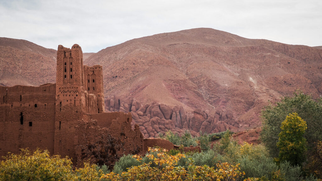
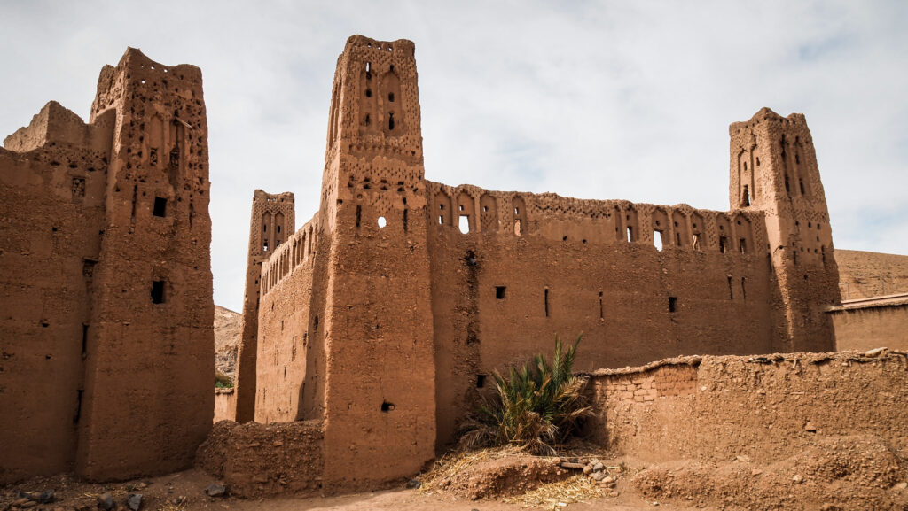
A short walking distance from the church stands the Laqaliq Castle (Stork’s Castle). This is another stunning example of Renaissance military architecture. Originally having imposing bastions at each angle until one was lost, the castle takes the shape of an equilateral triangle. Up until the sixteenth century, it served as the medina’s institutional and representative hub and protected the road leading to Fez.

Nearby, you will notice the Jewish Tower. Oral histories state that the incorrect name resulted from the widespread rumour that a Jewish doctor who lived in that tower treated Sultan Alsaadi during the well-known Wadi Almakhain Battle in the sixteenth century.

Larache, Morocco
The Jewish Tower

There is a large Muslim Cemetery on the other side of the road.

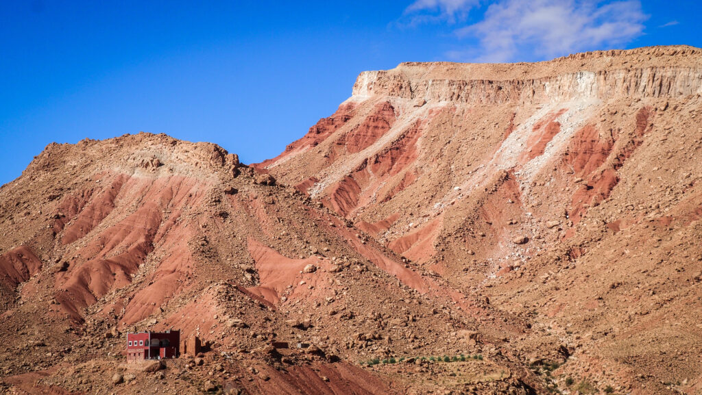
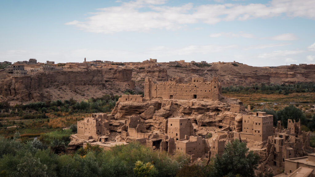
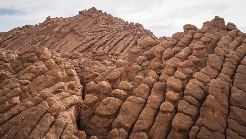
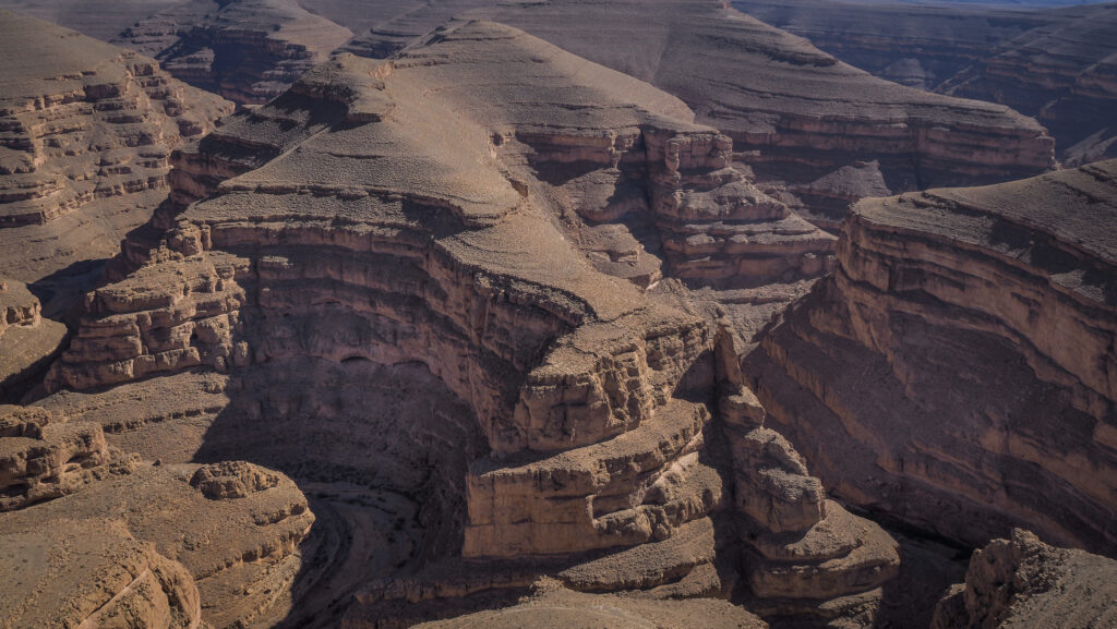
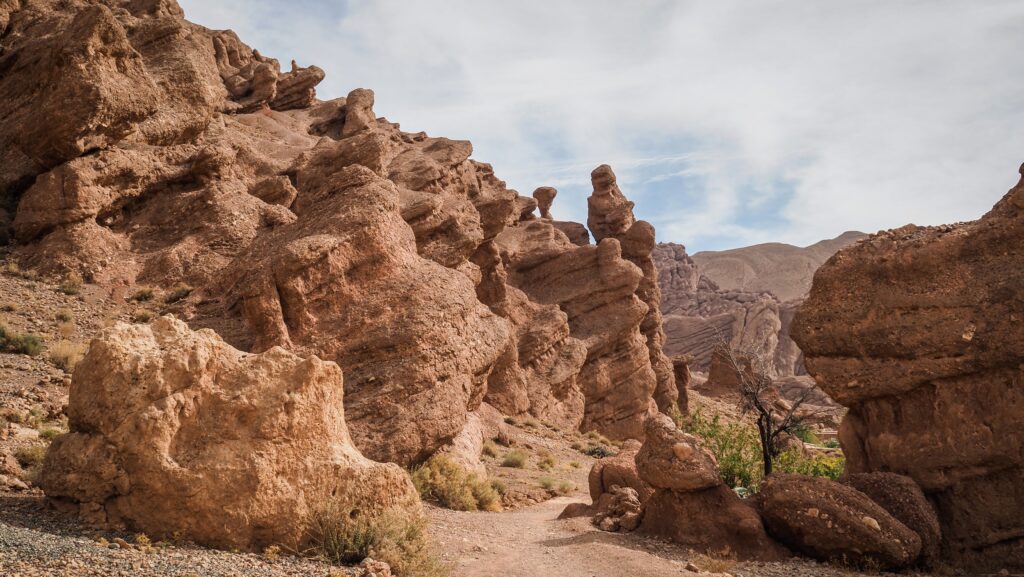
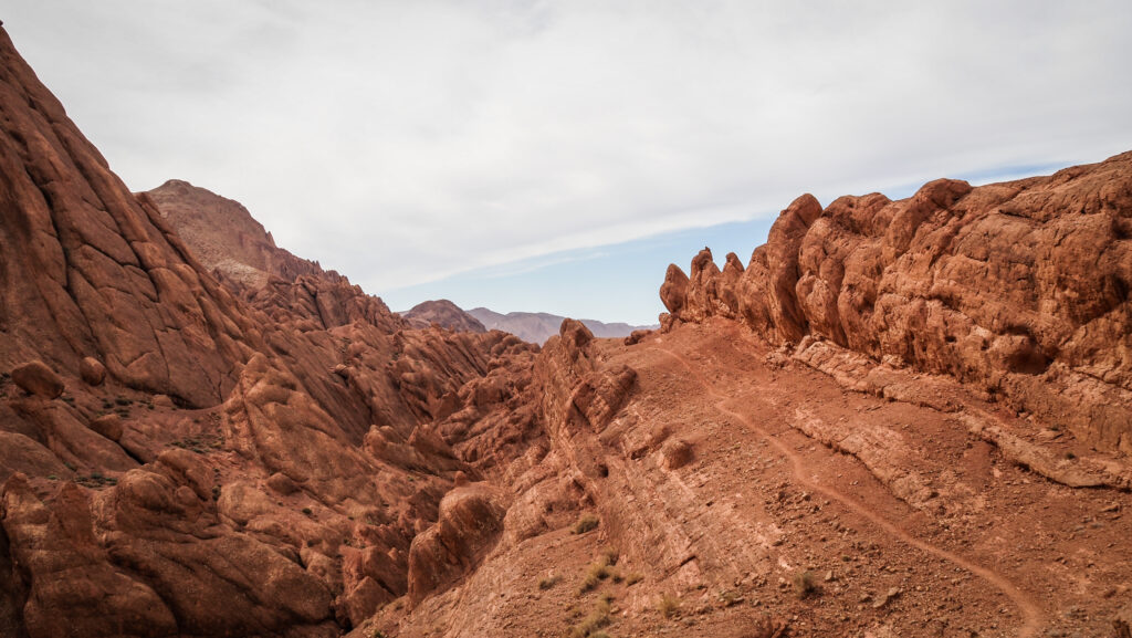
I left the best for the end, and after finishing sightseeing around the city centre, I took a taxi to the Lixus Archaeological Site. I was the only tourist there, which added to the experience and made the experience more intimate. The atmosphere was amazing, and I especially liked the part of the ruins located on top of the hill with wide-open panoramic views. But let me share the historical background of Lixus with you!

Lixus was founded by the Phoenicians around the 7th or 8th century BCE as a trading post. Its location near the Loukkos River made it an important centre for trade and maritime activity. The fertile land and access to water helped it thrive as a hub for agriculture, fishing, and trade with other Mediterranean civilisations.

After the Phoenicians, the Carthaginians took control of Lixus, continuing its development as a key part of their trading network. In 146 BCE, after the fall of Carthage, it came under Roman control, becoming part of the province of Mauretania Tingitana.

Larache, Morocco
Lixus Archaeological Site
Larache, Morocco
Lixus Archaeological Site

Lixus is famously associated with Greek mythology, particularly the Labours of Hercules. According to legend, it was in Lixus that Hercules completed his eleventh labour by retrieving the Golden Apples of the Hesperides, which granted immortality. The Hesperides were said to live in a lush garden near Lixus, guarded by the dragon Ladon. This myth gave Lixus a sense of mystery and divine importance, drawing interest from ancient storytellers and travellers.

During the Roman era, Lixus reached its peak. It became a flourishing city with amphitheatres, temples, baths, and residential areas. The Romans built elaborate salt factories and fish-salting facilities to produce garum, a prized fermented fish sauce exported across the empire. Lixus was known for its wealth and cultural significance during this time, serving as a bridge between the Mediterranean world and Africa.

Larache, Morocco
Lixus Archaeological Site
Larache, Morocco
Lixus Archaeological Site

After the fall of the Roman Empire, Lixus began to decline. The rise of other trade centres and political shifts contributed to its gradual abandonment. By the Islamic period, it was largely deserted, with its remaining population moving to nearby Larache.

Today, Lixus is an important archaeological site, showcasing ruins from the Phoenician, Carthaginian, and Roman periods. Visitors can explore its amphitheatre, temples, baths, and the remains of its industrial fish-salting complexes. The site’s hilltop location offers stunning views of the Loukkos River and the surrounding countryside.

Introduction

Erg Chigaga is one of the largest and most impressive sand dune areas in the Sahara Desert, located in the southeastern part of Morocco near the Algerian border. It is known for its remote and pristine beauty.

The dunes can reach heights of up to 300 meters and extend for over 40 kilometres, creating a breathtaking landscape. Unlike the more popular Erg Chebbi near Merzouga, Erg Chigaga is more secluded and less developed for tourism, offering a more authentic desert experience.

Visitors can explore traditional Berber (Amazigh) culture, stay in desert camps, and enjoy activities like sandboarding, camel riding, and stargazing under the desert’s clear night sky.

How to get to Erg Chigaga?

Reaching Erg Chigaga typically involves a journey through the desert, often by 4×4 vehicles or camel treks, starting from towns like M’Hamid or Zagora.

From Marrakech

Take a bus (e.g., CTM or Supratours) or drive to Zagora. The journey by road takes about 7–9 hours, passing through the scenic High Atlas Mountains and the Draa Valley.

From Ouarzazate

Ouarzazate is another popular starting point. From here, it’s a 4–5-hour drive to Zagora and then onward to M’Hamid.

Continue to M’Hamid

M’Hamid, a small desert outpost, is about 1.5 hours south of Zagora. Regular buses and taxis are available. Alternatively, many organized tours start from Ouarzazate or Marrakech and include transport to M’Hamid.

Off-Road to Erg Chigaga

From M’Hamid, the journey to Erg Chigaga involves traversing 60 kilometres of desert terrain. This requires a 4×4 vehicle or a camel trek.

4×4 jeeps (usually Toyota Land Cruiser) are driven by experienced drivers who navigate the challenging desert trails. The drive takes about 1.5 – 2 hours.

Camel Trek

slower but more traditional option is travelling by camel, which can take 2–3 days, depending on your starting point.

Powered by 12Go system

Where to stay?

Accommodation comes together in a package with transportation by 4X4 and food. Camp quality can vary and some offer more traditional Berber tents and some offer luxury settings among the dunes. There are also plenty of hotels and desert camps in M’Hamid if you need to spend the night before setting off to Erg Chigaga.

For adventurers travelling in their private vehicles, there will be no problems with self-sufficient camping.

Erg Chigaga, Morocco
A desert camp around Erg Chigaga

The best time to visit

Spring (March to May): temperatures are warm but comfortable, typically ranging from 20°C to 30°C during the day and cooler in the evenings. This is a beautiful time for desert landscapes, as the sand and skies are vivid, and occasional spring rains may create rare blooms in the desert. Spring is popular with tourists, especially in April, so booking accommodations or desert tours in advance is recommended.

Autumn (September to November): similar to spring, temperatures are mild, with daytime highs around 25°C to 30°C and cooler evenings. October is especially pleasant. Clear skies and beautiful sunsets make autumn a favourite for photographers and those looking to experience the desert at its most vibrant. Autumn also sees a fair number of tourists, but generally fewer than spring. It’s still wise to book ahead, especially in October.

Winter (December to February): days are mild, with temperatures between 15°C to 20°C, but nights can be cold, dropping close to freezing in the desert. The winter sky is often crisp and clear, perfect for stargazing. If you’re prepared for the cold nights, winter can be a magical time to experience the desert’s tranquillity. Winter is less crowded, though the holiday period around late December can be busy.

Summer (June to August): daytime temperatures soar, often reaching 40°C to 50°C, making outdoor activities challenging. Most tours run early in the morning or late in the afternoon to avoid the midday heat, and many desert camps close or operate with limited services. Fewer tourists visit in summer due to the heat, making it an option for those who want to avoid crowds, but only if you’re comfortable with intense temperatures.

Erg Chigaga, Morocco
Sand dunes

Overnight trip

I organized my Erg Chigaga trip at short notice, one day before arrival to M’Hamid. After contacting several camps and tour providers, the best offer was given by Hamza Laghfiri. The prices aren’t very encouraging for a solo traveller, so it’s always better to travel in a group and share the cost of jeep transportation. Erg Chigaga isn’t that close to M’Hamid, so your driver will stay there overnight as well. Taking into consideration that the food and accommodation are included, the price seems to be justified.

After negotiations, I agreed to pay 120 EUR for the complete tour. It was the best price I could get as other operators wanted from 150 EUR to even 220 EUR.

Here are the Hamza’s contact details:

hamza.laghfiri@gmail.com

+00 212 (0) 676 380 671 / + 00 212 (0) 656 950 249

The trip to Erg Chegaga was supposed to start at 2 PM so I still had quite a lot of time to kill in the morning. After checking out from my accommodation in M’Hamid, I had a short walk around the town and I bought a Berber-style head scarf. However, it didn’t prove to be very practical while walking on the dunes as I was sweating like a pig because of that synthetic material.

As soon as I texted Hamza that I was ready, he appeared in front of the meeting spot literally in 30 seconds. I guess he really didn’t want me to get in contact with any other drivers hanging out on the streets as potentially he could lose the customer. He introduced me to the driver who didn’t speak much English but seemed to be a nice and sensible guy. His driving style was very careful which I appreciated a lot, especially after my previous experiences with taxi drivers in Morocco. We could make a stop for the pictures any time I wanted and he also showed me a water well built next to a nomadic camp. The car was a Toyota Land Cruiser and the only negative was that the window on the passenger side couldn’t open.

Erg Chigaga, Morocco
Independent overlanders heading to Erg Chigaga
Erg Chigaga, Morocco
A single tree on the way to Erg Chigaga
Erg Chigaga, Morocco
A sandy road
Erg Chigaga, Morocco
The landscape was changing really fast!

The views and types of the desert were changing surprisingly fast. First, the landscape was more sandy with some occasional vegetation, then stony and wide open spaces and finally, we saw massive sand dunes. We passed by some folks travelling in pretty old cars, doing the route through Mauretania to Senegal, following the classic Dakar route. What a dream!

As we arrived at the camp, I was greeted with tea and snacks. At this time of the day, I was the only guest there but they said that 9-10 more people would come later on. The camp was much bigger than the one I stayed in Merzouga and there were even bathrooms with showers. I was very surprised that they brought water in huge containers for such a long distance.

I got a private room with two single beds and carpets on the floor. Very cosy and atmospheric! Actually, it wasn’t a tent but some other light construction.

After tea, I set off for something that was supposed to be a short walk to the dunes, and instead, it lasted until sunset. I climbed the highest dune, from where the views were simply amazing. I felt like the desert belongs to me. Absolutely no other people nearby. It was hot, and quiet and only flies were a pain in the ass. I spot a small camp at the bottom of the dune but it rather looked like the one belonging to nomads. Incredible that people live like that. I am always impressed by how different human lives and stories can be, depending on the culture, history and geographical location. Not a bit different… but absolutely different.

Erg Chigaga, Morocco
Nomads living on the desert
Erg Chigaga, Morocco
A water well in the middle of the desert
Erg Chigaga, Morocco
Sand dunes
Erg Chigaga, Morocco
Sunset at one of the highest dunes
Erg Chigaga, Morocco
Erg Chigaga

Then, I made a stupid decision to go down and head back to the camp. On the way, I noticed plenty of other tourists who probably just arrived and were heading to the same place where I was a few minutes ago. It was pretty logical as the sunset time was coming and the top of the highest dune sounds like a good place to be, doesn’t it? Instead of continuing to the camp, I turned around and climbed that bloody dune again 🙂 The sunset was indeed magical!

It was getting dark really quickly so I was rushing back not to be surprised by darkness and not to get lost among the dunes. When I entered my room, I instantly drank one litre of water, as I didn’t take any (it was supposed to be a quick walk to the dunes.) Never underestimate the desert!

Erg Chigaga, Morocco
Erg Chigaga
Erg Chigaga, Morocco
Erg Chigaga

Just before the dinner, the staff working in the camp lit plenty of candles so the atmosphere was unique. The food was quite standard for Morocco – lentil soup and chicken tajine. Once dinner was over, we moved to the fireplace and it was time for singing and playing traditional instruments.

I slept well and started the day with the sunrise on the dune. Surprisingly, other guests were just sleeping and it seemed that I was the only one out there. The spectacle was good but not as impressive as the sunset the day before. Then I had breakfast and it was time to leave back to M’Hamid!

We took the same way and when we arrived in town, Hamza was already waiting. We shook hands and said goodbye. A very nice guy and the trip was organized exactly as expected, therefore I highly recommend his services!

Introduction

Merzouga is a small village on the edge of the Sahara Desert in southeastern Morocco, known for its towering sand dunes, stunning landscapes, and as a gateway to the vast, golden stretches of the Erg Chebbi. These dunes can reach heights of up to 150 meters and extend over an area of approximately 28 kilometres, creating a surreal, otherworldly landscape that feels remote and ancient.

Merzouga has a unique atmosphere shaped by its desert setting and is celebrated for its vibrant yet tranquil ambience. The village itself is modest and rooted in Berber (Amazigh) culture, with people speaking a mix of Tamazight, Arabic, and French.

The region has become a popular destination for adventurers and cultural travellers who want to experience the Sahara up close. Camel treks at sunrise or sunset are popular, giving visitors the chance to ride through the dunes and witness the landscape’s constantly shifting colours in the warm desert light. Many opt to stay in desert camps under the stars, where traditional Berber meals like tagine are served, often accompanied by live drumming around a campfire.

The ecosystem around Merzouga, despite the arid conditions, is surprisingly rich. During certain times of the year, especially after rain, Merzouga sees migratory birds like flamingos visit its seasonal salt lake, Dayet Srji. The desert’s flora and fauna are specialized to endure extreme conditions, showcasing the adaptability of life in one of Earth’s most challenging climates. Nearby, you’ll find fascinating geological sites and fossil deposits dating back millions of years, along with old kasbahs and ksars (fortified villages) that provide insight into Morocco’s history and the Saharan trade routes that once passed through the area.

How to get to Merzouga?

Getting to Merzouga can be an adventure in itself, as it’s in a remote part of Morocco near the Algerian border. Here are the main ways to get there, depending on your starting point, time, and budget.

Merzouga, Morocco
Merzouga

By Car

From Marrakech

The drive is around 9–10 hours (560 km) and passes through the High Atlas Mountains, the Tizi n’Tichka Pass, Ouarzazate, and the Draa Valley. Many people split the trip over two days, often stopping overnight in places like Ait Benhaddou or Dades Valley.

From Fes

The drive takes about 7–8 hours (470 km). You’ll pass through scenic towns like Ifrane, Midelt, and Erfoud, a fossil-rich area that’s also a gateway to the desert.

By Bus

Supratours has a direct, overnight bus from Marrakech and Fes to Merzouga. The journey from Marrakech takes around 12 hours and the one from Fes about 10 hours. The bus arrives in Merzouga early in the morning, allowing you to start desert tours the same day. The buses are typically comfortable and air-conditioned, though the ride is long. It’s recommended to book tickets in advance, especially during peak travel seasons.

By Plane

While Merzouga doesn’t have an airport, the closest ones are in Errachidia and Ouarzazate. Royal Air Maroc operates limited flights from Casablanca to Errachidia. From Errachidia, Merzouga is a two-hour drive by taxi or private transfer. Ouarzazate Airport (OZZ) is another option, but it’s farther away (about 5–6 hours by car).

Powered by 12Go system
Merzouga, Morocco
At the dunes

By Private Transfer or Organized Tour

If you prefer a hassle-free journey, many companies offer multi-day tours that include transport to and from Merzouga, typically starting from Marrakech or Fes. These often include stops at scenic and cultural sites along the way, such as Ait Benhaddou, the Todra Gorge, and the Valley of the Roses. You’ll travel in a comfortable 4×4 or minivan with a guide. Shared group tours are more budget-friendly and include similar stops but may be less flexible.

Where to stay?

I stayed in Auberge Kasbah Des Dunes which was a great choice. The room was very atmospheric, there was a lot of parking space plus a delicious breakfast was included. The owner also helped me to organize an overnight desert experience at Erg Chebbi.

The best time to visit

Spring (March to May): temperatures are warm but comfortable, typically ranging from 20°C to 30°C during the day and cooler in the evenings. This is a beautiful time for desert landscapes, as the sand and skies are vivid, and occasional spring rains may create rare blooms in the desert. Spring is popular with tourists, especially in April, so booking accommodations or desert tours in advance is recommended.

Autumn (September to November): similar to spring, temperatures are mild, with daytime highs around 25°C to 30°C and cooler evenings. October is especially pleasant. Clear skies and beautiful sunsets make autumn a favourite for photographers and those looking to experience the desert at its most vibrant. Autumn also sees a fair number of tourists, but generally fewer than spring. It’s still wise to book ahead, especially in October.

Merzouga, Morocco

Winter (December to February): days are mild, with temperatures between 15°C to 20°C, but nights can be cold, dropping close to freezing in the desert. The winter sky is often crisp and clear, which is perfect for stargazing. If you’re prepared for the cold nights, winter can be a magical time to experience the desert’s tranquillity. Winter is less crowded, though the holiday period around late December can be busy.

Summer (June to August): daytime temperatures soar, often reaching 40°C to 50°C, making it challenging for outdoor activities. Most tours run early in the morning or late in the afternoon to avoid the midday heat, and many desert camps close or operate with limited services. Fewer tourists visit in summer due to the heat, making it an option for those who want to avoid crowds, but only if you’re comfortable with intense temperatures.

Merzouga, Morocco

Erg Chebbi

The most famous sand dune region in Morocco spans about 28 kilometres in length and 5–7 kilometres in width, creating a vast sea of reddish-orange sand that stretches to the horizon. Erg Chebbi is often called Morocco’s “gateway” to the Sahara because it offers one of the most accessible ways to experience the true Sahara Desert. While not as vast as the Sahara further east, the experience of walking, riding camels, or camping among these dunes provides an authentic taste of the desert’s allure.

Popular activities include camel trekking, sandboarding, 4×4 off-road excursions, and quad biking. These activities allow visitors to explore the dunes from different perspectives and provide a mix of adventure and relaxation.

Merzouga, Morocco
Panorama of Erg Chebbi dunes

I went to Erg Chebbi three times: twice independently and once while heading to the desert camp. If you go independently, the dunes can be accessed from many points. Once, I parked near the National 4X4 Auto Museum and set off from there, and at another time I simply walked towards the dunes from my accommodation Auberge Kasbah Des Dunes. Climbing the highest one was huge fun! Not an easy job as my feet sank into the sand but very scenic views from the top! I could hear quads in the distance as the dunes were also a playground for such activities.

Be careful as sometimes strong winds can blow sand straight into your face. It’s good to have some kind of face cover.

Merzouga, Morocco
Erg Chebbi at sunset

Overnight at the desert camp

Camel trekking is one of the most popular ways to explore Erg Chebbi. Many visitors take a camel ride into the heart of the dunes, often timed for sunrise or sunset to capture the changing colours of the sands. Overnight stays in traditional Berber desert camps are also popular, with accommodations ranging from basic tents to luxurious setups, allowing for an immersive experience under the stars. I arranged my trip through the accommodation upon arrival to Merzouga and I advise you to do the same for the best price.

The start of the trip was planned at 4 PM but it was slightly delayed as we were waiting for 3 more people to join but seemed that they were still on their way. Finally, I set off alone with the guide as they were not even sure if the other guests would come or not. The ride on the camel was a surprisingly long and super nice experience, even though as always the ass hurt and in general I never feel good riding on any type of animal.

We made a short stop to admire the sunset and then continued to the camp. The camp was really small, basically 3 tents for guests, one for the kitchen and one for dining.

Merzouga, Morocco
Camp in the desert

I was sure I was going to be the only guest which would be quite a boring and miserable experience but then my guide came with dinner and said that the other 3 guests were on their way. It was an American girl and two guys from New Zealand. I didn’t get along with them as I could hardly understand their accent and what the hell they were talking to me 🙂 Plus they were young teenagers and some of their behaviours proved that.

After dinner, we went out a bit deeper into the desert to go sandboarding and look for the desert fox. Unfortunately, none of us had a proper headlamp so we could see shadows of foxes moving around but not very clearly. Sandboarding was cool but in the total darkness, I couldn’t even see where I was going and it was so tiring to climb back to the dune! So a great tip: take a strong headlamp! For me, sitting in the desert looking at the night sky full of stars was an absolute highlight. In moments like that, I could feel that I was halfway between space and Earth. We even saw some shooting stars!

In the morning we woke up for sunrise. It was pretty cold so I was glad that I took some extra layers! After that, we went back to the village riding the camels. I had breakfast in the accommodation and then took a shower. It was very nice that they gave me this opportunity even after checkout time, as my skin was full of sand!

Merzouga, Morocco
Sunset around the camp

National 4×4 Auto Museum

According to the reviews, the museum features a wide variety of antique 4×4 cars from different eras, all in excellent condition. It’s free but a donation to the guard is welcome. Unfortunately, at the time of my visit, it was closed even though opening hours said it should have been open.

Ouzina

Ouzina is a small village about 60 kilometres south of Merzouga. The local people live in a way that reflects their deep connection to the desert environment, often in adobe houses, and maintain traditional practices, including crafting and agriculture adapted to arid conditions. It is less visited than Merzouga, making it ideal for travellers seeking a more off-the-beaten-path desert experience.

Reaching Ouzina is a bit challenging due to its remote location. Travelers usually take a 4×4 vehicle from Merzouga or Rissani, navigating unpaved desert roads. Many organized tours include Ouzina as part of a multi-day Sahara excursion.

I followed the N13 road to the south, to check how far I could go with Renault Clio. The landscape changed and the terrain was more rocky, without high dunes. Soon, roadworks started and the surface turned into a combination of sand and small stones so I decided to turn back. If you have a 4X4, you can drive all the way to Zagora. It must be an amazing off-road experience!

Merzouga, Morocco
Desert landscape en route to Ouzina

Sijilmassa Archeological Site and Rissani

From the 14th to 18th century, Sijilmassa was the desert capital and a hub for trading gold and slaves across the Sahel.

Caravans of camels left Sijilmassa for the remote desert salt mines of Taodeni and Tagahaza (modern-day Mali), then travelled to Niger and Ghana, where a pound of Saharan salt was sold for one ounce of African gold. By the 12th century, Sudanese gold purified in Sijilmassa had reached Europe and was coined into European coins.

The city collapsed in the 14th century due to internal conflict. Alawite Sultan Moulay Ismail rebuilt it in the 18th century, but it was eventually destroyed by nomadic fighters from AĂŻt Atta.

Today, the town’s name is Rissani and it is no longer the vibrant place it once was. The 17th-century ksar houses only a fraction of the population, while the modern town consists of just one street and plaza. Few ruins of Sijilmassa remain, but you can wander around freely and use your imagination to feel the grandeur of the ancient city.

If you have some extra time, it’s worth driving about 20-kilometre loop along P7107 road through Ksar Guighlane, Ksar Tazegzout and Ksar Jdid El Ghorfa. A lot of great architecture with crumbling kasbahs, but unfortunately as soon as you leave the car, you are surrounded by “guides” who simply don’t want to leave you alone and explore in peace.

Gara Medouar

A striking rock structure that resembles a circus and serves as a natural stronghold, located at 850 meters above sea level. Although the formation appears to be a volcano or a crater, it is an eroded rock from millions of years ago.

In the eleventh century, Gara Medouar was transformed into a castle with a garrison. It probably safeguarded the trade routes from the south as well as the surrounding trading city of Sijilmasa, which produced gold coins. In the seventeenth century, the stronghold was abandoned. Portuguese prisoners of war were housed in Gara Medouar throughout the 1800s. This is how the “Portuguese Prison” gained its moniker. The inmates were made to labour in the quarries and mines in the area. Many of them passed away from illness or fatigue.

Gara Medouar is located 7 km west of the town of Rissani. Look for the turn-off from well-maintained N12 and follow the last 3 km on a gravel route to reach the slope. In optimal weather conditions, it’s possible to reach the place in a 2WD car. Just drive carefully!

Merzouga, Morocco
Gara Medouar
Merzouga, Morocco
Gara Medouar

Introduction

Todra Gorge is a stunning natural canyon located in the eastern part of the High Atlas Mountains near Tinghir in Morocco. It is renowned for its dramatic limestone cliffs that rise vertically up to 400 meters on either side of the Todra River. The canyon creates a narrow passage that is particularly breathtaking at its narrowest point, where it is just 10 meters wide.

The gorge, shaped by the erosive power of the Todra River over thousands of years, showcases vibrant shades of red, pink, and orange rock that change in hue with the shifting light throughout the day. The gorge is a popular destination for both tourists and adventurers, especially climbers drawn by the sheer cliffs that offer some of the best rock-climbing routes in Morocco.

Trekkers and hikers also frequent the area to experience the raw beauty of the landscape, while casual visitors can enjoy the scenic walk through the canyon’s lower reaches. At sunrise and sunset, the lighting on the cliff faces is particularly photogenic, creating a mesmerizing effect against the rugged terrain. In addition to its natural beauty, Todra Gorge is a culturally rich area. Surrounding villages are inhabited by Berber communities, where visitors can experience local traditions, crafts, and warm hospitality. The gorge itself is easily accessible from nearby towns, making it a must-visit for anyone travelling in Morocco.

How to get to Todra Gorge?

To reach Todra Gorge, travellers typically go through the town of Tinerhir, which is the closest major town.

By Car

The roads to Todra Gorge are generally paved and well-maintained, though some areas can be winding, especially through the mountain passes.

From Marrakech

The drive from Marrakech to Todra Gorge takes about 6–7 hours. You’ll head east via the N9 highway, cross the scenic Tizi n’Tichka pass, and then join the N10 highway towards Ouarzazate and Tinghir.

From Fes

A drive from Fes takes about 8–9 hours. You’ll drive south through the Middle Atlas, passing Ifrane and Midelt, before reaching Errachidia and then Tinerhir.

From Merzouga

If you’re visiting the Sahara first, you can drive from Merzouga to Todra Gorge in about 3–4 hours. Head west via the N12 highway, then join the N10 to Tinghir.

Todra Gorge, Morocco
Panorama from the hike near Todra Gorge

By Bus

Tinerhir’s bus station is centrally located, and taxis are available to take you from Tinghir to the gorge itself.

From Marrakech

CTM and Supratours are the main bus companies offering routes from Marrakech to Tinghir. The journey takes around 8–9 hours and typically requires a transfer in Ouarzazate.

From Fes

Direct buses to Tinghir are less common, but you can often find routes that connect through Errachidia or Merzouga. The trip can take 10+ hours depending on the route.

From Merzouga

Supratours and local buses connect Merzouga to Tinghir, with the journey taking about 4–5 hours.

By Taxi

Once in Tinghir, you can easily hire a “grand taxi” to take you directly to Todra Gorge. The distance is about 15 kilometres, and the trip takes 20–30 minutes. Taxis can be shared or hired privately, depending on your preference.

By Tour

Many travellers opt for guided tours from major cities like Marrakech, which often include transport, local guides, and stops at other attractions like Ouarzazate and the Dades Valley. These tours range from one-day excursions to multi-day trips and are a convenient option for those who prefer organized travel.

Where to stay?

I didn’t have any reservations so simply asked for a room at Auberge Restaurant Tizgui and got one without any problems (November). Very well located near the gorge and with great views from the upper terrace. Breakfast was included.

The best time to visit

Spring (March to May): This is one of the most popular times to visit, as temperatures are warm (but not hot), and the landscape is often lush and green from recent rains. Daytime temperatures are generally around 20–25°C, making it ideal for exploring.

Autumn (September to November): Similar to spring, autumn offers pleasant temperatures and fewer crowds. The summer heat has typically subsided by September, making it a great time for hiking, climbing, and enjoying the scenery. Daytime temperatures range from 20–28°C.

Summer (June to August): Summers in Todra Gorge can be extremely hot, with daytime temperatures often exceeding 35°C, especially in July and August. While mornings and late afternoons can still be pleasant, midday heat can make outdoor activities uncomfortable. However, some visitors still come in the summer to enjoy cooler canyon breezes and early-morning hikes.

Winter (December to February): Winters are generally mild in Todra Gorge, with daytime temperatures around 10–15°C. However, nights can be very cold, sometimes dropping close to freezing, especially in January. If you don’t mind the chill, winter can offer a peaceful experience with few crowds.

Plan your trip in spring or autumn for the best weather conditions.  While winter is generally mild, it can get quite cold at night and in the mornings, with temperatures occasionally dropping close to freezing, especially at higher elevations. Summer can be hot, but temperatures are milder in the mountains.

You should always have some warmer layers, regardless of the season. In the end, it’s mountains there!

Todra Gorge, Morocco
Todra Gorge

Tinghir

Most tourists just drive through Tinghir without stopping but it’s worth a stop for an hour or two. Check out the historic Kasbah, for a nice view of the city and mountains in the background. Other than that, it’s a ruin and there’s not much to see. Walking around is free of charge.

Another sight worth mentioning is Ikalalne Mosque, a beautiful building with an interesting history and unique architecture. There is a guardian, a Berber man who is renovating it by himself and maintaining it. Very kind and enthusiastic person who will certainly show you around for a donation.

The road R703 which goes towards Todra Gorga, passes by Palmeraie de Tinghir, a stunning haven of greenery in the middle of the arid south of Morocco. The oasis is maintained by a traditional irrigation system called khattara, which dates back centuries. The technique is a marvel of traditional engineering, where underground canals bring water from distant mountains to irrigate fields.

You can admire the panorama from a lookout point along the road or drive down to one of the villages and get closer.

Todra Gorge, Morocco
Panorama seen from the Kasbah
Todra Gorge, Morocco
Palmeraie de Tinghir
Todra Gorge, Morocco
Palmeraie de Tinghir

Todra Gorge

The gorge was formed by the Todra and Dades rivers, which have carved out massive red limestone cliffs over thousands of years. Some of these cliff walls rise up to 400 meters on either side of the canyon, creating a narrow, awe-inspiring passageway. The narrowest point is just 10 meters in width at its most constricted point, emphasizing the height and majesty of the cliffs surrounding it. The best time to visit is early morning or late afternoon. Other than that, expect a lot of bus tours stopping here on the way to Merzouga.

Loop hike

A popular and extremely scenic hike. The distance is 9 kilometres with an elevation gain of ~ 610 meters. It should take about about 3,5 – 4 hours to complete. I started with the ascent from the parking area in Todra Gorge and then descended to Ait Tizgui village and followed the road back to the parking where I left the car. The views of the mountains are breathtaking and about halfway you will come across Berbers living in tents in a nomadic style. They will most likely offer you tea, and it’s hard to imagine a better setting to get one and enjoy it.  

The trail is not really marked but with an offline map on Mapy.cz I didn’t have any issues following it and monitoring my current position.

Todra Gorge, Morocco
A view from the loop hike
Todra Gorge, Morocco
A view from the loop hike
Todra Gorge, Morocco
Berbers’ settlement
Todra Gorge, Morocco
A view from the loop hike
Todra Gorge, Morocco
A view from the loop hike

Drive further

It definitely pays off to continue driving R703 further towards Tamtetoucht. The landscape is still incredible and all bus tours turn around to take another road to Merzouga, so most likely there will be minimal traffic. If you are adventurous and have some extra time, I recommend driving all the way to Er-Rich and then turning towards Merzouga from there, passing by Ziz Canyon on the way. You won’t regret it as the views are breathtaking!

Todra Gorge, Morocco
Driving towards Tamtetoucht
Todra Gorge, Morocco
Less popular section of Todra Gorge
Todra Gorge, Morocco
Ziz Gorge

Introduction

The Valley of Roses, located in the Dades Valley in Morocco, is a picturesque and fertile area renowned for cultivating a special type of rose, Rosa Damascena (Damask rose), particularly in and around the town of Kelaat M’Gouna. It is part of the greater Draa-Tafilalet region in the foothills of the Atlas Mountains, close to Boumalne Dadès.

Roses are harvested to produce a variety of products, including rosewater, essential oils, and perfumes. Moreover, every year in May, the valley celebrates the Festival of Roses, a vibrant and colourful event that marks the end of the rose harvest season. The festival includes music, traditional dancing, parades, and the crowning of a “Miss Rose.” It attracts both locals and tourists who come to enjoy the festivities and purchase rose-based products.

The roses grown in the valley are an important source of income for the local community. Rosewater and rose oil are highly sought after for their use in cosmetics, perfumes, and culinary products. Small cooperatives in Kelaat M’Gouna and surrounding areas produce these items and export them across Morocco and internationally.

Rose Valley, Morocco
Rocky landscape

How to get to Rose Valley?

From Marrakech or Ouarzazate

You can start your journey from Marrakech, about 285 km from Kalaat M’Gouna. Most people combine a visit to Rose Valley with a trip to the Dadès Gorge, Todra Gorge, or the Sahara Desert.

Ouarzazate is closer to the Kalaat M’Gouna (about 95 km).

By Car

Renting a car is the most flexible way to travel. Take the N9 road from Marrakech towards Ouarzazate, passing through the scenic Tizi n’Tichka Pass in the Atlas Mountains. From Ouarzazate, continue on the N10 road towards Kalaat M’Gouna and Boumalne Dadès. It’s about 285 kilometres and 5 hours drive.

By Bus

You can take a bus from Marrakech or Ouarzazate to Boumalne Dadès. The journey from Marrakech takes about 7–8 hours, while it’s roughly 2–3 hours from Ouarzazate. Popular operators include CTM or Supratours.

Once you arrive in Boumalne Dadès, ask around at your accommodation or travel agents on the streets for further sightseeing options and day tours.

The best time to visit

The best time to visit Rose Valley is during the spring, from late April to mid-May. This period is when the valley’s famous rose fields are in full bloom, creating a stunning landscape of fragrant pink roses. The highlight of the season is the Festival of Roses, typically held in May, which celebrates the annual rose harvest with music, dancing, and cultural events.

Rose Valley, Morocco
The landscape of the Rose Valley
Rose Valley, Morocco
Rocky landscape near the Rose Valley

What to see and do in the Rose Valley?

Visit a shop or cooperative

There are plenty of shops and cooperatives where you can get a short tour with an explanation of how they make the oil. They are mostly located along the main road, so you can’t miss them. According to one of the salesmen, 4 tons of roses are needed to make 1 litre of rose oil! If you like the products, it could be a great gift idea for your friends and family.

Walk amond roses

A short stroll through the green oasis is a good idea to see the plants closer. There isn’t any specific trail to follow, just improvise 🙂 Hdida or Taberkhachte are two villages that give quite easy access to the fields.

Kasbah ruins

Large kasbah ruins stand only 3 kilometres from the turn-off from the road N10. The site can be reached easily on foot from the main road.

Rose Valley, Morocco
Kasbah ruins

Gorges Izelmaden

Another beautiful gorge where locals like to chill next to the stream.

Rose Valley, Morocco
Gorges Izelmaden

Further away

Gorges d’Amejgag

A spectacular drive through the gorge takes you sometimes at river level and other times on the road excavated in the rock wall. It attracts offroad fans and can be explored by motorcycle or 4X4.

Drive through Tizi n’ AĂŻt Hamad to AĂŻt Bouguemez

If you are adventurous enough, you can drive through the highest mountains pass in Morocco – Tizi n’ AĂŻt Hamad – to AĂŻt Bouguemez. The road is not an easy one, it has many crazy bends and in some sections, the surface is really bad. Drive slowly and carefully!

The distance from Kalaat M’Gouna to AĂŻt Bouguemez is 122 km but you should budget at least 4 hours to drive it.

You can see more about AĂŻt Bouguemez in a separate post HERE.

Introduction

The Dades Gorges is a stunning natural formation located in the High Atlas Mountains of Morocco, carved by the Dades River over thousands of years. This dramatic series of gorges and canyons offers some of the most spectacular scenery in the country. It lies between the towns of Boumalne Dades and Agoudal but most of the tourists don’t go further than M’semrir.

The Dades Gorges is famous for its jagged cliffs, red and orange-hued rocks, and unusual geological formations, including the well-known “Monkey Fingers” rock formations near the village of Tamellalt.

The gorges are also renowned for their scenic, hairpin-turn roads, particularly the stretch that climbs up the mountainside, providing breathtaking views of the valley below. This road is often a highlight for road trips and attracts photographers for its dramatic curves.

The Dades Valley is home to several small Berber villages that maintain a traditional way of life. The architecture includes ancient kasbahs (fortified homes) and ksars (fortified villages), built from mud and straw, blending into the landscape.

The Dades Gorges are close to other notable sites, such as the Todra Gorge, another impressive canyon. Many travellers visit both in one trip, often as part of a broader route that includes the Sahara Desert (Merzouga) and AĂŻt Benhaddou, a UNESCO World Heritage site.

Dades Gorges, Morocco
Dades Gorge

How to get to Dades Gorges?

From Marrakech or Ouarzazate

You can start your journey from Marrakech, about 300 km from the Dadès Valley. Most people combine a trip to the Dadès Valley with a tour of the Sahara Desert.

Ouarzazate is closer to the Dadès Valley (about 140 km) and is often a stopover point. Many travellers visit Ouarzazate for its proximity to the Dadès and Todra Gorges.

By Car

Renting a car is the most flexible way to travel. Take the N9 road from Marrakech towards Ouarzazate, passing through the scenic Tizi n’Tichka Pass in the Atlas Mountains. From Ouarzazate, continue on the N10 road towards Boumalne Dadès.

Approach from Boumalne Dades or Agoudal?

Most tourists drive in Dades Gorges from Boumalne Dades. In such case, you will have a tarmac road more or less until Bouljam which is roughly 70 kilometres away. After that, it’s a dirt road which climbs up to Agoudal. It is doable but stressful in rental sedan cars. It will be your choice to continue or turn around and come back the same way.

If you really want to cover the whole distance of Dades Gorges, probably it’s better to start in Agoudal and drive down towards Boumalne Dades. I did it this way in Renault Clio and damn, it was certainly the most difficult road that I have taken in Morocco! On the other hand, the views were magnificent, with an impressive gorge on the left side wriggling like a snake. Make sure you go slowly!

Dades Gorges, Morocco
Dades Gorge

By Bus

You can take a bus from Marrakech or Ouarzazate to Boumalne Dadès. The journey from Marrakech takes about 7–8 hours, while from Ouarzazate, it’s roughly 2–3 hours. Popular operators include CTM or Supratours.

Once you arrive in Boumalne Dadès, ask around at your accommodation or travel agents on the streets for further sightseeing options and day tours.

Powered by 12Go system

By Tour

Many tour operators offer guided trips to the Dadès Valley from Marrakech or Ouarzazate, often as part of multi-day desert tours that include the Sahara, Ait Benhaddou, and Todra Gorge. These tours will handle all transportation and logistics, making it a more convenient but less flexible option if you want to explore at your own pace.  

The best time to visit

Plan your trip in spring or autumn for the best weather conditions.  While winter is generally mild, it can get quite cold at night and in the mornings, with temperatures occasionally dropping close to freezing, especially at higher elevations. Summer can be hot, but temperatures are milder in the mountains.

You should always have some warmer layers, regardless of the season. In the end, it’s mountains there!

Dades Gorges, Morocco
Dades Gorge

Where to stay?

There are several nice riads and homestays in the villages or along the road R704. I stayed in Hotel Babylon Dades and was perfectly satisfied. The room was cosy and the tajine for dinner was one of the best I have had in Morocco. It’s also located very close to another beautiful and narrow gorge. Ideal for a morning walk!

Boumalne Dades

A small town located at the entrance to the Dadès Gorge. It is a popular stop for travellers exploring the High Atlas, as well as those heading towards the Sahara Desert. If you travel by bus, this is most likely where you will arrive. Walk around the town and do your research at travel agents about the tours exploring Dades and Todra gorges.

Sidi Boubker Gorge

Just 15 kilometres from Boumalne Dades in this harder accessible gorge – Sidi Boubker. You can park the car near Hotel Atlas Gorge Dades and walk down. On my visit in November, there was a lot of water in the gorge so I was not able to explore it deeper.

Monkey Fingers

The Monkey Fingers is a scenic trek, specifically in an area known for its unique rock formations that resemble the fingers of a monkey’s hand. These formations are located near the village of Tamellalt.

The hike offers an exciting combination of dramatic landscapes, towering red rock canyons, and narrow gorges, making it a popular destination for adventurous travellers and nature lovers. Hikers can explore the rock formations and the surrounding valleys, discovering small Berber villages, and beautiful viewpoints over the gorge. The area is also dotted with kasbahs (traditional mud-brick fortresses), adding a cultural dimension to the experience.

More about it HERE.

Monkey Fingers, Morocco
Monkey Fingers

Little canyon near Hotel Babylon Dades

If you turn left from Hotel Babylon Dades, in a few meters you will see the path on the right side, crossing over a creek. It will take you to a beautiful narrow gorge. Explore as far as you can! I had to turn back after around 1.5 – 2 kilometers as there was quite a bit of water and climbing over the rocks was getting more and more difficult. Great adventure though!

Bends and viewpoint

The bends are a series of sharp, switchback turns that snake their way up the steep canyon walls. These hairpin turns are dramatic and provide some of the most breathtaking views of the gorge and surrounding mountains.

For the best view of famous bends on the road going through Dades Gorge, stop for a drink at the Cafe and Restaurant Timzzillite Chez Mohamed.

Dades Gorges, Morocco
Famous bends
Dades Gorges, Morocco
Dades Gorge

Narrow section

One of the most scenic parts of the gorge, with a road on one side and a stream on the other, surrounded by towering rocky walls. Unbelievable!

Dades Gorges, Morocco
A narrow section of Dades Gorge

Aweddim

The ruins of a watchtower which was built during the French colonial era.

Amouguer

Here you can drive down to the village and then walk towards the bottom of Dades Gorge.

Kefroun (turtle’s back)

Spectacular landscape and the rock formation which resembles a turtle shell. Park on the roadside and enjoy.

Dades Gorges, Morocco

Between Bouljam and Agoudal

The road linking these two towns is unpaved and bumpy. It’s doable in a normal 2WD car but it will take a long time and you must be extra careful. The scenery is amazing though and traffic is minimal. There are rumours that soon this section will be paved, so let us know in the comments if you have driven it recently!

Dades Gorges, Morocco
Narrow and unpaved road near Agoudal
Dades Gorges, Morocco
A view of Dades Gorge
Dades Gorges, Morocco
A view of Dades Gorge
Dades Gorges, Morocco
Unpaved road among amazing scenery

Worth a detour

Rose Valley

The Valley of Roses is a picturesque and fertile area renowned for its cultivation of fragrant roses, particularly in and around the town of Kelaat M’Gouna. It is part of the greater Draa-Tafilalet region in the foothills of the Atlas Mountains, close to Boumalne Dadès.

The valley is known for growing a special type of rose, Rosa Damascena (Damask rose), which has been cultivated in the region for centuries. These roses are harvested to produce a variety of products, including rosewater, essential oils, and perfumes.

The valley itself is stunning, with terraced fields of roses stretching across the landscape, interspersed with orchards of fruit trees, especially almonds and figs. The contrast between the lush green valley and the rugged mountains of the High Atlas makes it a scenic destination for nature lovers.

Rose Valley, Morocco
Rose Valley
Rose Valley, Morocco
Rose Valley

Introduction

The Monkey Fingers is a scenic trek through the Dadès Gorge region, specifically in an area known for its unique rock formations that resemble the fingers of a monkey’s hand. These formations are located near the village of Tamellalt in the High Atlas Mountains.

The hike offers an exciting combination of dramatic landscapes, towering red rock canyons, and narrow gorges, making it a popular destination for adventurous travellers and nature lovers. Hikers can explore the rock formations and the surrounding valleys, discovering small Berber villages, and beautiful viewpoints over the gorge. The area is also dotted with kasbahs (traditional mud-brick fortresses), adding a cultural dimension to the experience.

How to get there?

From Marrakech or Ouarzazate

You can start your journey from Marrakech, which is about 300 km from the Dadès Valley. Most people combine a trip to the Dadès Valley with a tour of the Sahara Desert.

Ouarzazate is closer to the Dadès Valley (about 140 km) and is often a stopover point. Many travellers visit Ouarzazate for its proximity to both the Dadès and Todra Gorges.

By Car

Renting a car is the most flexible way to travel. From Marrakech, take the N9 road towards Ouarzazate, passing through the scenic Tizi n’Tichka Pass in the Atlas Mountains. From Ouarzazate, continue on the N10 road towards Boumalne Dadès (the town nearest to the Monkey Fingers).

From Boumalne Dadès, you’ll drive a further 25 km into the Dadès Gorge until you reach the village of Tamellalt, the starting point for the Monkey Fingers hike.

Monkey Fingers, Morocco
Panorama of the village

By Bus

You can take a bus from Marrakech or Ouarzazate to Boumalne Dadès. The journey from Marrakech takes about 7–8 hours, while from Ouarzazate, it’s roughly 2–3 hours. Popular operators include CTM or Supratours.

Once you arrive in Boumalne Dadès, you can hire a taxi or arrange for local transport to Tamellalt and the entrance to the Monkey Fingers trail.

By Tour

Many tour operators offer guided trips to the Dadès Valley from Marrakech or Ouarzazate, often as part of multi-day desert tours that include the Sahara, Ait Benhaddou, and Todra Gorge. These tours will handle all transportation and logistics, making it a more convenient but less flexible option if you want to explore at your own pace.  

The best time to visit

Plan your trip in spring or autumn for the best weather conditions.  While winter is generally mild, it can get quite cold at night and in the mornings, with temperatures occasionally dropping close to freezing, especially at higher elevations. Summer can be hot, but temperatures are milder in the mountains.

You should always have some warmer layers, regardless of the season. In the end, it’s mountains there!

Where to stay?

If you decide to spend a night in the area, you won’t have problems finding a place to stay. A good choice might be Monkey Fingers House by Fatima Mellal.

Monkey Fingers, Morocco
Kasbah

How long is the hike?

The distance of the loop is about 8 kilometers and you should plan at least 3 hours to walk it comfortably.

Do you need a guide?

You may want to hire a local guide from the village to lead the hike, especially if you’re unfamiliar with this kind of activity. A guide can also help you up in case you choose to follow the trail that goes to the top of the rocks and involves some scrambling. Ask about one at your accommodation.

For hiking enthusiasts, there is absolutely no need to hire a guide. Just get yourself a good offline map such as Mapy.CZ to check your position on the trail in case of doubts.

The hike around Monkey Fingers

I parked the car at the roadside near Imzzoudar and walked through Ait Arbi village. Very atmospheric place but it looked like abandoned, without any inhabitants visible around it. I was following the trail anti-clockwise in the direction of the rocks.

Monkey Fingers, Morocco
Remains of Kasbah in the village
Monkey Fingers, Morocco
The first interesting rock formations

Once you get to the bottom of the rocks, you will need to make a decision. There are 3 routes to choose from. The first leads along the base of the rocks, with interesting formations on your right side. The second one goes in the middle of the gorge, while the third one climbs up the rocks for better panoramic views. Eventually, they all merge.

I chose the trail that goes higher and includes climbing on top of the rock mass. There were sections where I had to think where to put my feet but if you are reasonably fit and you don’t mind pulling yourself up, then it will be alright. The views from up there were simply incredible!

Monkey Fingers, Morocco
The upper path on Monkey Fingers
Monkey Fingers, Morocco
Monkey Fingers
Monkey Fingers, Morocco
Monkey Fingers
Monkey Fingers, Morocco
Monkey Fingers

At some point, I met a group walking in the opposite direction with a guide and he gave me some advice on how to descend to rejoin the track going at the base of the rocks. BTW, he was doing the track in flip flops. People never stop amusing me.

After merging with another track, the rest was a piece of cake. At the crossroads of trails, I turned left and then left again into a beautiful valley with a dried riverbed. Soon, I returned to the car. Very glad and satisfied that I decided to go for that hike! Well worth it.

Monkey Fingers, Morocco
Dried riverbed in the valley

Sidi Boubker

A bit further down the road towards Boumalne Dades in another gorge – Sidi Boubker. You can park the car near Hotel Atlas Gorge Dades and walk down. On my visit in November, there was a lot of water in the gorge so I was not able to explore it deeper.

Introduction

Imilchil is a small village located in the Atlas Mountains of Morocco, specifically in the High Atlas range. It is best known for its remote beauty, the annual Imilchil Marriage Festival and two beautiful lakes nearby: Tislit and Isli. The town sits at a high altitude, around 2,200 meters (7,200 feet) above sea level, making it a cold, rugged, and mountainous region. Winters can be harsh with snow, while summers are more temperate.

The village is most famous for its marriage festival, an annual event held in September. Historically, it was a time when young men and women from Berber tribes in the region could meet and choose partners, with their families’ approval. Today, visitors can witness traditional Berber customs, music and dancing. It’s a great opportunity to immerse yourself in local culture!

The festival has its roots in the story of two star-crossed lovers from opposing tribes, Isli and Tislit, who were forbidden from marrying. Their grief was so deep that they cried themselves to death, forming the two lakes near the village. As a result, the festival was established to celebrate love and marriage.

How to get there?

From Major Cities

Marrakech to Imilchil (around 300 km / 7-8 hours):

The most common route is by car or bus. You would first drive towards Beni Mellal (about 3-4 hours from Marrakech) and then continue towards Ait M’hamed and Tilmi before arriving in Imilchil. This route will take you through beautiful valleys and mountain roads.

Alternatively, you can take a bus or shared taxi from Marrakech to Azilal, and from there, you may need to arrange private transport to Imilchil.

Fes to Imilchil (around 270 km / 6-7 hours):

You can travel via Midelt, a town located on the national road between Fes and Imilchil. From Midelt, you drive through the High Atlas Mountains via Ait Hani to reach Imilchil. The road is scenic but winding and steep, so be prepared for a rugged but rewarding journey.

 Shared taxis and buses can take you as far as Midelt or Rich, but a private taxi or car hire is needed for the final leg.

Ouarzazate to Imilchil (around 240 km / 6-7 hours):

From Ouarzazate, you would drive towards the town of Skoura and continue via Boumalne Dades and Tamtatoucht before reaching Imilchil. This route involves crossing mountain passes and offers beautiful views of gorges and valleys.

Some buses may travel this route to nearby towns, but again, private transportation is often required to complete the trip.

Transportation Options

By Car

Renting a car is the most flexible and comfortable option. It allows you to stop along the way to enjoy the scenery and small Berber villages. The roads are generally good but can be narrow and winding, especially as you climb into the mountains.

By Bus

CTM and other bus companies offer services to nearby towns such as Beni Mellal, Midelt, or Rich. From these points, you will likely need to hire a private taxi or take a shared taxi (called “grand taxis”) to reach Imilchil. Bus travel is the cheapest option, but it can be slower and less flexible than driving yourself.

By Shared Taxi (Grand Taxi)

 Shared taxis are common in Morocco and can be a more affordable alternative to renting a private car. They usually operate between major towns like Azilal, Beni Mellal, Midelt, and smaller villages. These taxis can be crowded and may not always offer the most comfortable ride, but they are a good way to travel if you don’t want to drive.

The best time to visit

The best time to visit Imilchil and the surrounding lakes Tislit and Isli is typically from late spring to early autumn, especially from May to September.

May to September offers the most comfortable weather, as temperatures are mild, and the risk of snow in the High Atlas Mountains is lower.

Summer (June to August) can be ideal because of warmer temperatures in the region, though it remains cooler compared to lower elevations in Morocco due to the altitude.

Autumn (September to October) is also pleasant, especially during the famous Imilchil Marriage Festival in late September.

Winters (November to March) are very cold in Imilchil, with heavy snowfall and harsh conditions, making travel and outdoor activities more difficult.

Lake Tislit, Morocco
Lake Tislit

How long to stay there?

Half a day is enough to comfortably explore the area of the lakes. There is nothing much to do in the town itself other than having a cup of tea and observing local life going on.

Visiting Lakes Tislit and Isli

Lake Tislit and Lake Isli are situated near the village of Imilchil, at an altitude of over 2,000 meters. The lakes are relatively close to each other (8 kilometres) but are in separate basins, surrounded by rugged mountain terrain. Their high-altitude setting makes the area cold in winter, with snow often covering the surrounding peaks.

Lake Tislit, Morocco
The road to Lake Isli

Lake Tislit (often referred to as the “Bride’s Lake”) is smaller and more rounded, while Lake Isli (the “Groom’s Lake”) is larger and more elongated. The lakes are fed by rain and snowmelt from the surrounding mountains, and the area around them is relatively dry, with limited vegetation apart from seasonal grasses and small shrubs.

In the beginning, I had no idea that there were actually two lakes. When I reached Lake Tislit, I immediately saw some other dirt road and quickly checked on the map where it was going. Then, I discovered Lake Isli. I wasn’t very sure about road conditions and I was hesitating if driving in Renault Clio was a good idea but I’m happy I took that risk. In dry conditions, the road is quite easy and doable in 2WD. If you are adventurous and looking for a calm place in nature, these are the spots for you!

Lake Tislit, Morocco
Lake Tislit
Lake Tislit, Morocco
Lake Isli

Introduction

Imsfrane Cathedral has nothing to do with a religious building but it is a striking natural rock formation that rises to 1872 meters above sea level. The term “Cathedral” in this context is used metaphorically to describe the towering and majestic appearance of this rock, which resembles the shape of a cathedral with its steep, vertical cliffs. The rock formation is a popular destination for hikers and nature enthusiasts due to its dramatic geological features.

How to get to Imsfrane?

By Car

From Marrakech, take R210 heading northeast toward Demnate and then continue to Ouaouizeght on R304. It’s going to be about 4 hours drive (216 km). From Ouaouizeght, it’s another 57 km, which takes about 1.5 hours due to the bad condition of the road (doable in a normal car like a Renault Clio).

From Zaouiat Ahansal, take R302 for 43 km. It’s a dirt road so you should count about 1,5 hours to cover that distance.

By Bus/Taxi

You can take a bus from Marrakech to Demnate. Bus companies like CTM operate this route, and the journey takes 2.5 to 3 hours. For further connections, you must ask locals or negotiate the ride with taxi drivers. Be prepared for a long and tiring day.     

The best time to visit

Plan your trip in spring or autumn for the best weather conditions. Winter can bring snow and ice to the higher mountain roads, making them difficult to navigate. Summer can be hot, but temperatures are milder in the mountains.

You should always have some warmer layers, regardless of the season. In the end, it’s mountains there!

How long to stay there?

Half a day is enough to get to the top of Imsfrane Cathedral or even do a longer loop. If you want to explore a bit more or at a slower pace, plan one full day.

Imsfrane Cathedral, Morocco

Where to stay?

If you decide to spend a night in the area, there are some basic options such as Auberge Ă  la Cathedrale Imsfrane or GĂ®te D’Ă©tape La CathĂ©drale.

The hike to Imsfrane Cathedral

I left early from Zaouiat Ahansal and had a first good look at the rock from the viewpoint “Vue panoramique sur la cathĂ©drale” just on the roadside. You may find it on Google Maps. It looked truly impressive and I was looking forward to standing on top!

I parked the car just next to Gite La Cathedrale, packed water and hit the trail. I recommend using Mapy.CZ as the trailhead isn’t clearly marked. The plan for that day was to do a loop, including the summit of Imsfrane Cathedral, and returning through Ahansal Gorge. The total distance of 15.2 kilometers.

The mornings in this region can be cold but as soon as I started the ascent, I had to remove some of my layers. It was already getting quite hot, therefore I took off my thermal underwear and continued going up. The trail was obvious and there were also some other people around, so I felt perfectly safe.

Imsfrane Cathedral, Morocco
First views while going up

The views were nice and soon I passed a group of goats. It’s crazy how they climb these steep rocks. At some point, there was a short small section which was a bit steeper and I thought it was the beginning of a more difficult climb but it wasn’t. The path flattened again and it was steadily climbing on the side of the rock.

Finally, I reached the summit and there was only me and a local vendor. The views were breathtaking! I also felt that I wanted to appreciate the fact that the guy came up all the way to sell hot tea, drinks and snacks so I bought a juice and a pack of walnuts.

Imsfrane Cathedral, Morocco
At the top of Imsfrane Cathedral

On the way down, I took a different path, on the other side of the mountain. I was descending quickly and this path seemed to be less popular as I met only two other people going in the opposite direction. Once I reached the crossroads, I decided to turn right and head towards the Ahansal Gorge. Unfortunately, it was not exactly what I expected as instead of going down to the canyon, the trail took me to a viewpoint. Well, the view wasn’t bad at all.

Imsfrane Cathedral, Morocco
The view to Ahansal Gorge

I returned the same way and took another trail heading down to the canyon. Unfortunately, there was another obstacle – a fast fast-flowing stream to cross! I didn’t want to get my shoes wet, nor did I want to cross it barefoot. I somehow managed to move forward on the edge of the rocks but when I thought the worst was behind me, then again I reached the point where crossing the stream was the only solution. I just did it without taking off my shoes. Better safe than sorry!

Imsfrane Cathedral, Morocco
Imsfrane Cathedral

Soon I joined the main road that I was driving on in the morning. The last meters to the car were quite boring and felt really long. There was absolutely no traffic so I couldn’t catch a ride. I passed by a popular photo spot that I have seen many times on Instagram, with a ruined car.

Finally, I reached my car, bought some chips and tonic in the nearby shop and started driving towards Ouaouizeght. The hike to Imsfrane Cathedral was beautiful and it was a time well spent in nature!

Introduction

Zaouiat Ahansal is a small, remote village in Morocco’s High Atlas Mountains. It gets its name from the local “zaouia” (religious school or monastery) founded by Sidi Said Ahansal, a revered Islamic scholar and saint.

The village’s religious roots date back to the 16th century when it became a spiritual hub for the surrounding Berber tribes. Sidi Said Ahansal, the founder of the zaouia, established a religious order that drew followers from the High Atlas region. The influence of the Ahansal family extended over centuries, and the local zaouia was both a centre of learning and a point of unity for the local Amazigh (Berber) communities. Today, the religious significance of the village remains a key part of its identity.

Zaouiat Ahansal is set in a dramatic mountainous landscape, surrounded by towering peaks, rugged valleys, and winding rivers, including the Assif Ahansal River. The area is part of Morocco’s central High Atlas range and is known for its pristine nature, making it a popular destination for adventure tourists, climbers, and hikers.

The population of Zaouiat Ahansal is predominantly Amazigh, and the local culture is deeply rooted in traditional Berber customs, language, and ways of life. The Berber people have preserved their unique customs, dialects, and cultural practices for generations in the face of modern challenges. Traditional festivals, clothing, and crafts remain vital parts of everyday life, though they slowly adapt to the contemporary world.

Taghia Gorge, Morocco
Zaouiat Ahansal
Taghia Gorge, Morocco
Zaouiat Ahansal

In recent years, Zaouiat Ahansal has become an emerging destination for eco-tourism and adventure travel. Visitors come to explore the untouched natural beauty of the High Atlas, engage in trekking, mountain biking, and rock climbing, or experience the quiet, traditional life of the Amazigh people. Due to its relative isolation, the village has managed to retain much of its authenticity, making it attractive to tourists seeking less commercialized experiences.

When it comes to rock climbing, nearby Taghia Gorge has gained a reputation as one of the premier destinations in the country. The steep limestone walls offer a variety of climbing routes, ranging from technical sport climbs to long, multi-pitch trad routes. Due to the complexity and difficulty of many of the climbs, Taghia attracts serious climbers, including professionals from around the world. The routes vary in difficulty, but many are highly challenging, with climbs often exceeding 300 meters. The gorge is often compared to renowned climbing locations in Europe and has been described as a “paradise” for big-wall climbers. The area was relatively unknown in the global climbing community until the late 20th century when international climbers began exploring the region. The remoteness means that amenities and modern conveniences are limited, adding to the appeal for those looking for an immersive adventure in a natural, undeveloped setting.

How to get there?

Getting to Zaouiat Ahansal, a remote village in the High Atlas Mountains of Morocco, requires some planning due to its isolated location and lack of direct transportation options. However, the journey offers a rewarding experience through Morocco’s rugged mountain landscapes. The most common starting point for travellers heading to Zaouiat Ahansal is Marrakech, the nearest major city with an international airport and well-developed infrastructure. From Marrakech, you have two main options: renting a car or using public transport, though the latter will involve multiple steps.

By Car

Renting a car is the most flexible and efficient way to reach Zaouiat Ahansal, as it gives you control over the journey and allows you to explore the surrounding area at your own pace. The drive from Marrakech takes around 5-7 hours, depending on road conditions and stops.

From Marrakech, head northeast toward the town of Azilal. You’ll follow the R210 road toward Demnate, then take the R304 road, which passes through stunning mountainous terrain. After reaching Azilal, continue toward Ait M’Hamed and head to Zaouiat Ahansal via the rural R302 road. This road becomes narrower and more challenging as you ascend into the High Atlas.

By Public Transport

While public transport options are limited, combining buses and taxis to reach Zaouiat Ahansal is possible, though this will take longer and may require flexibility.

Firstly, take a bus from Marrakech to Azilal. Several bus companies operate this route, and the journey takes about 4-5 hours. Buses to Azilal leave from the main bus station in Marrakech (Gare Routière).

Secondly, find a shared taxi from Azilal to Ait M’Hamed. The grand taxis are often crowded and less comfortable than buses but are commonly used for travel in rural Morocco.

From Ait M’Hamed, there may be local taxis or 4×4 vehicles available to take you to Zaouiat Ahansal, though this can depend on demand. Alternatively, you can hire a guide and arrange a multi-day trek from Ait M’Hamed or another nearby village to reach Zaouiat Ahansal, which can be an adventurous option.

The best time to visit

Plan your trip in spring or autumn for the best weather conditions. Winter can bring snow and ice to the higher mountain roads, making them difficult to navigate. Summer can be hot, but temperatures are milder in the mountains.

You should always have some warmer layers, regardless of the season. In the end, it’s mountains there!

How long to stay there?

One day is enough if you just plan to drive to Taghia Gorge and do some hiking there. You should plan some extra time if you are a climbing enthusiast.

Where to stay?

There are some basic guesthouses in Zaouiat Ahansal, and staying with local families is also an option. I spent the night in AUBERGE Kasbah Ouad Ahanssal. The location is magnificent and so are the views around the property. The shower always had hot water and the dinner was delicious.

What to do in Taghia Gorge?

Passage Berbere

A wonderful place to discover but not for people who are quickly affected by dizziness or are afraid of exposition. It is better to start the adventure in the morning if the weather is mild and the path is dry. Good shoes and a warm layer of clothing are a must. Avoid going there solo in case something goes wrong. Taking a guide might be a smart idea. Otherwise, follow the trail which is visible on Mapy.cz, as shown below. The first section is of medium difficulty and involves some easy scrambling. Then, the proper Passage Berbere is something that I didn’t care to cross. It was made with sticks and stones during the colonization of Morocco so that the Moroccan soldiers could escape the enemy army.

Taghia Gorge, Morocco
The views around Passage Berbere
Taghia Gorge, Morocco
Passage Berbere
Taghia Gorge, Morocco
The views around Passage Berbere

Drive from Zaouiat Ahansal to Taghia

The dirt road linking these two villages is very narrow so you may have some problems if there is a car coming from the opposite direction. The distance is about 9 kilometers and the views are simply breathtaking with you being surrounded on both sides by the high walls of rock. In good weather conditions, the road is passable in a standard 2WD car (I did it in a Renault Clio). When I was passing through some village en route, there were quite aggressive kids, wanting money and hitting the car windows with their hands. Moments like this make me sceptic about travelling to Morocco but luckily soon happy feelings take over when I see the landscapes. If that happens to you, just keep the door of the car locked and slowly move forward. Do not give those kids any money!

Taghia Gorge, Morocco
The road between Zaouiat Ahansal and Taghia
Taghia Gorge, Morocco
The road between Zaouiat Ahansal and Taghia

Canyon Tazart

On the way back from Taghia, look for some small village with a few houses on your left. It’s a good idea to make a stop there and check out Canyon Tazart. Just follow the dried river bed and double-check your position on Mapy.CZ.

The gorge is completely different from the one around Passage Berbere and walking felt was much safer. At some point, as it was getting late, I decided to turn around and return taking the same path. You should definitely avoid this place in case of rainy weather due to the risk of flash floods.

Taghia Gorge, Morocco
Canyon Tazart
Taghia Gorge, Morocco
Canyon Tazart

Other hikes

There are other hiking opportunities in the area, for one or multiday adventures involving peaks over 3.000 meters above sea level. However, the trails are not marked and it’s highly recommended to hire a guide or at least consult one before setting off.

Taghia Gorge, Morocco
The panoramic view of Taghia Village