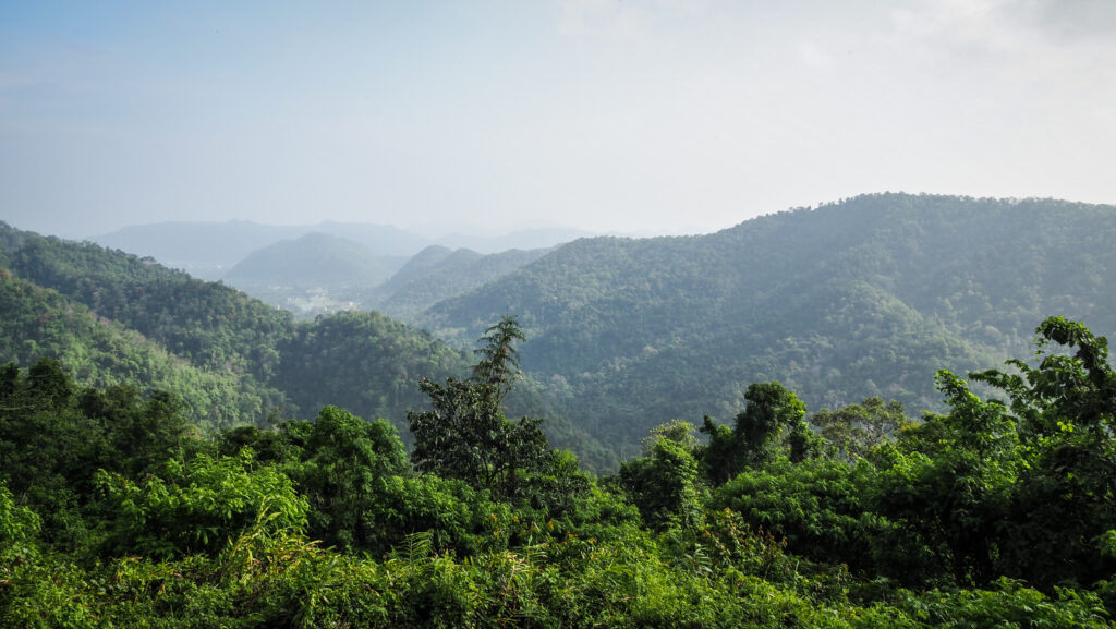
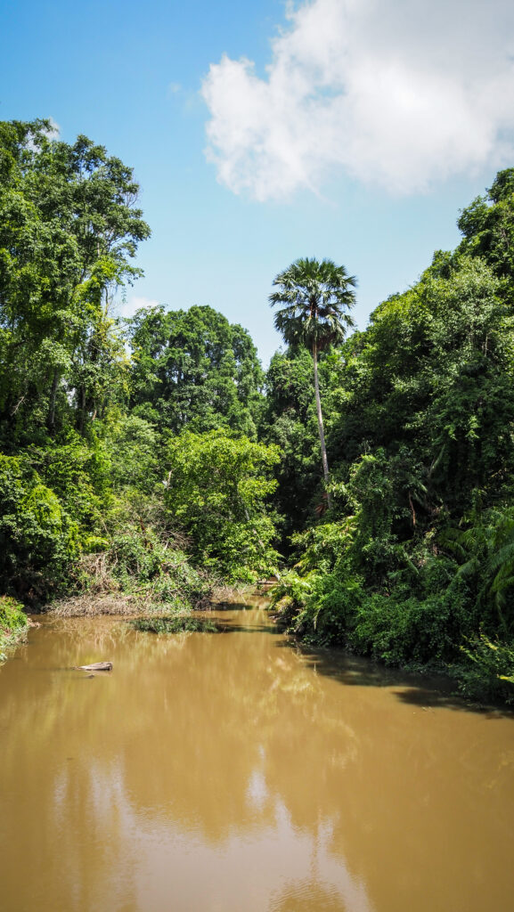
Traveling through the Isan region of Thailand was a wonderful experience, mainly because of the amazing landscape filled with national parks and the breathtaking Mekong River. I haven’t visited too many temples there, mainly because I felt a bit bored with them after seeing so many in the last few years. But Wat Phu Tok was completely different and I was so happy to explore it!
How to get there?
The temple can be reached from Nakhon Phanom, Udon Thani, or Nong Khai, and from all these places the driving time will take about 2.5 – 3 hours. Alternatively, get a bus to Bueng Kan and organize your further transport there, by renting a car/motorbike or hiring a driver. The best would be to consult the options at your accommodation.
The temple can be visited at any time of the year. The dry season runs from November to March. During this time, the weather is generally mild, sunny, relatively dry, and with less humidity.
I visited this region in May and unfortunately, it wasn’t the best experience as it was scorching hot, and walking around the rock wasn’t easy.
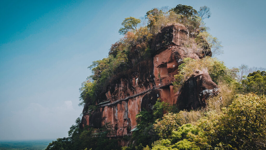
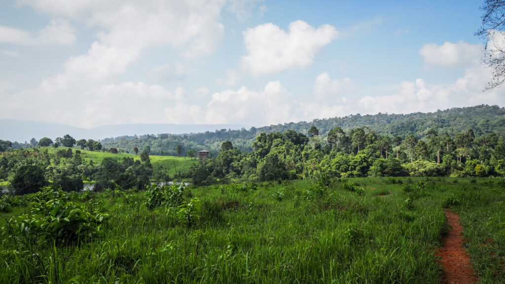
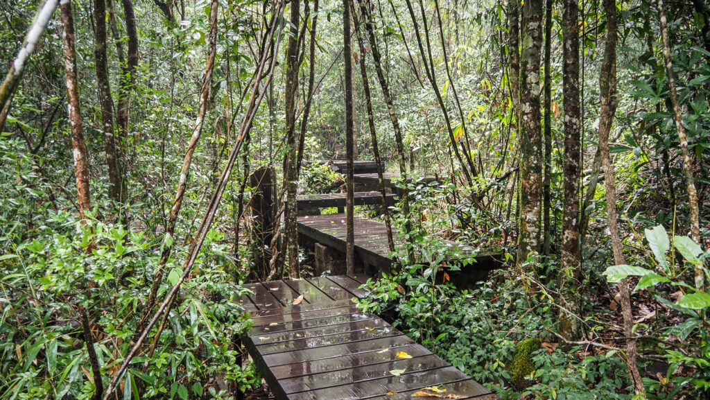
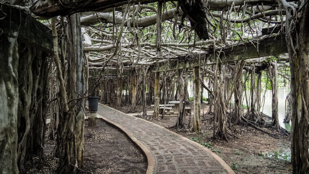
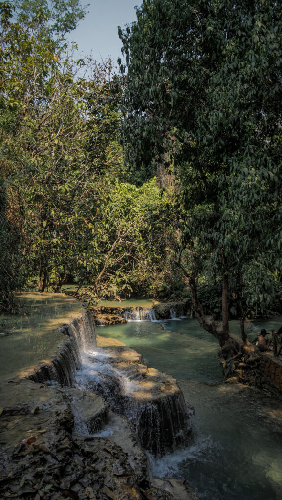
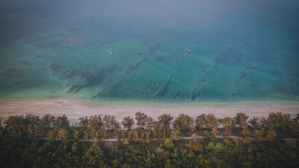
Impressive walkways around the mountain
Sightseeing
I didn’t have any problems with finding a parking space inside the temple grounds. Understandably, there weren’t too many people willing to expose themselves to the sun in a massive heatwave that was over Thailand at that time with over 45 C every day. It would be smart to plan your visit in the early morning or later afternoon.
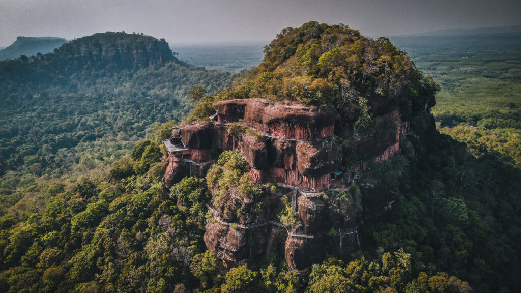
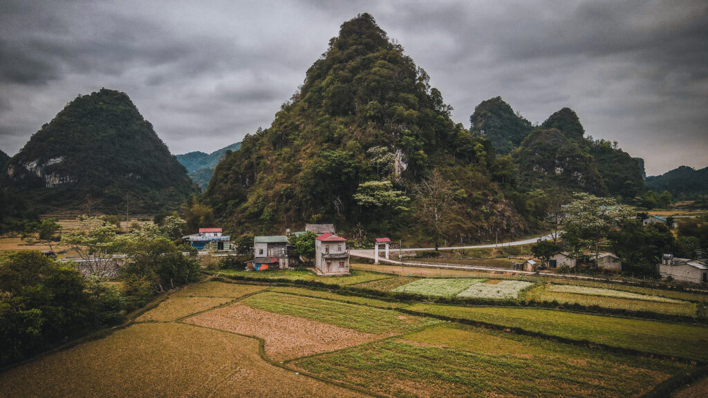
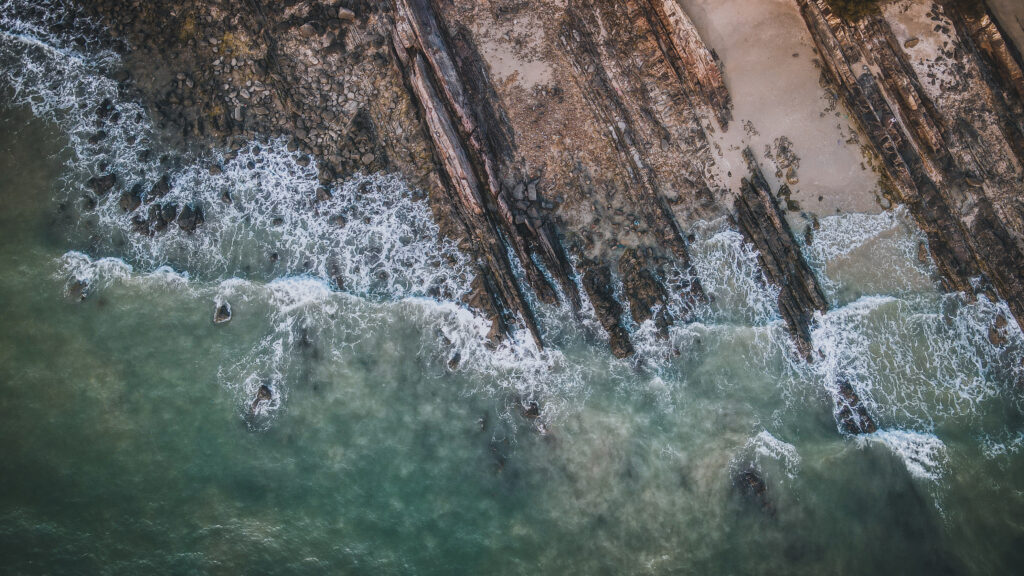
Wat Phu Tok
Around the parking, there is another big temple with a beautiful lake as well as Atthaborikhan Museum Chedi Phra Ajarn Juan Kulchetto,dedicated to the founder of the entire place.
The area near the parking
I grabbed my water bottle and started climbing the wooden stairs and ladders up the rocky mountain of Phu Thok. Even though there was some shadow created by the trees, I stopped frequently to wipe the sweat off my forehead.
Wat Phu Tok is certainly one of the most unique and exciting temples I’ve visited in Thailand. The whole experience of climbing and the panoramic view from the top reminded me of the visit to Wat Chalermprakiat Mountain Temple in Lampang Province in 2022.
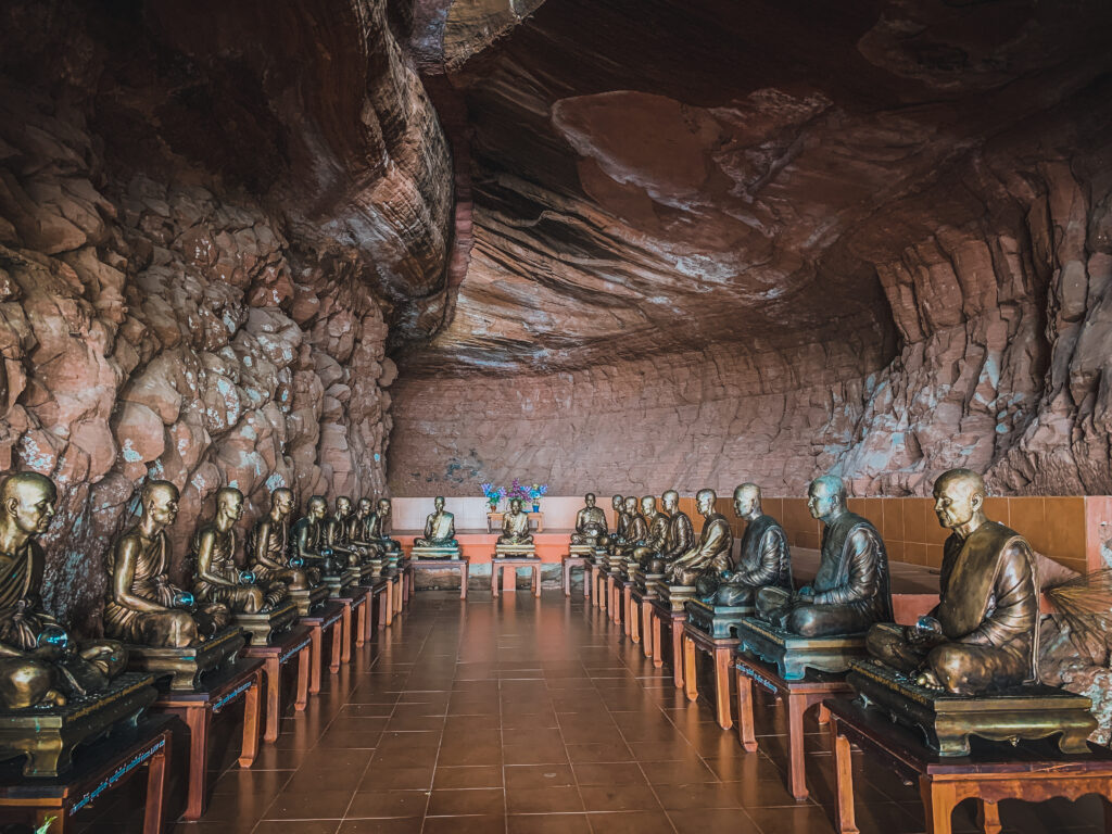
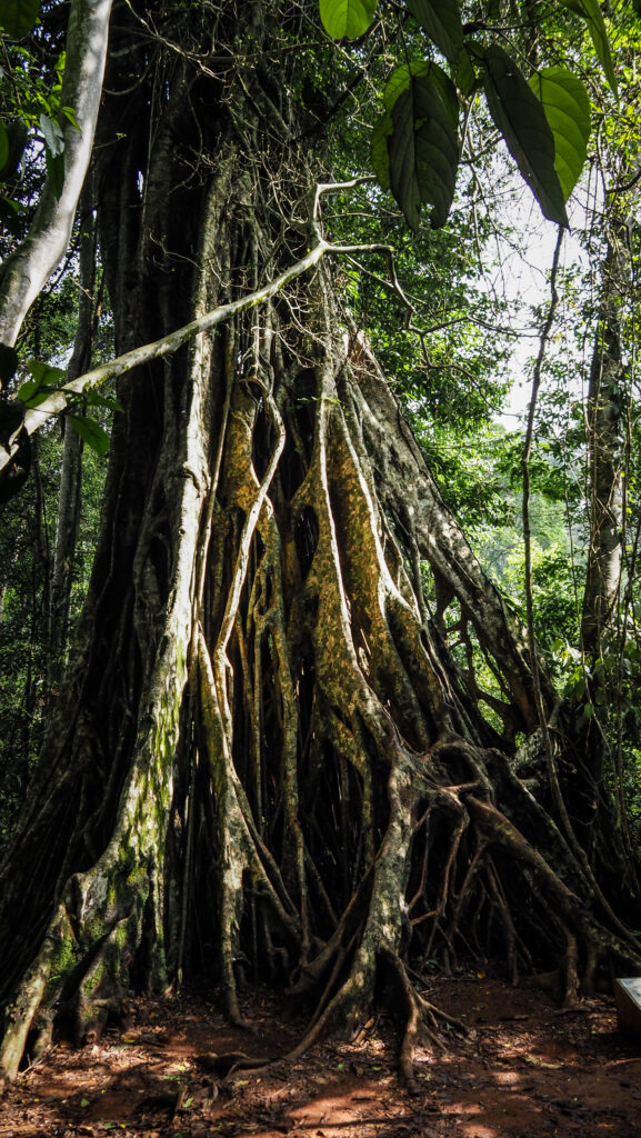
One of the caves with plenty of statues
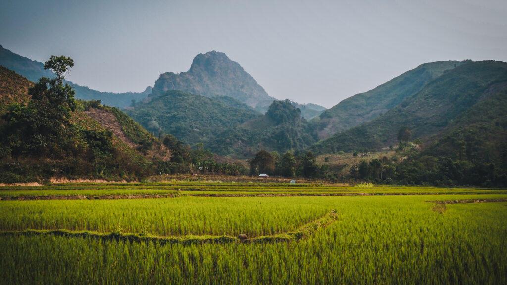
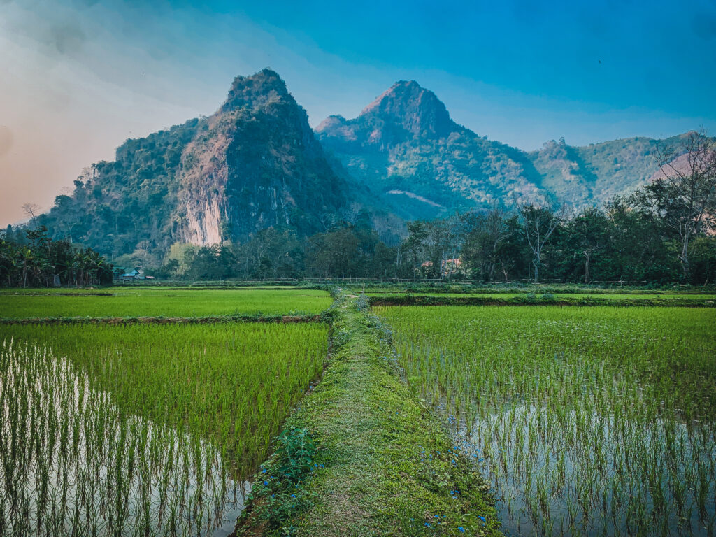
Phu Tok Mountain is 359 meters high, and the name literally means “a lonely mountain”. Indeed, there aren’t any other significant peaks in that area. Due to its isolation from the outside world, it seemed to be the perfect place for meditation, and the construction was initiated by Phra Ajarn Juan Kulchetto, one of Thailand’s most venerated monks. Several wooden staircases, ladders, and walkways were created on seven levels to connect meditation places, shrines, and Buddha statues. Number seven is not a coincidence as it relates to the seven stages of awakening that lead to Nirvana. The construction was finished by 1980, including the walkways into the sides of the cliff, providing a 360-degree panoramic view of Bueng Kan District.
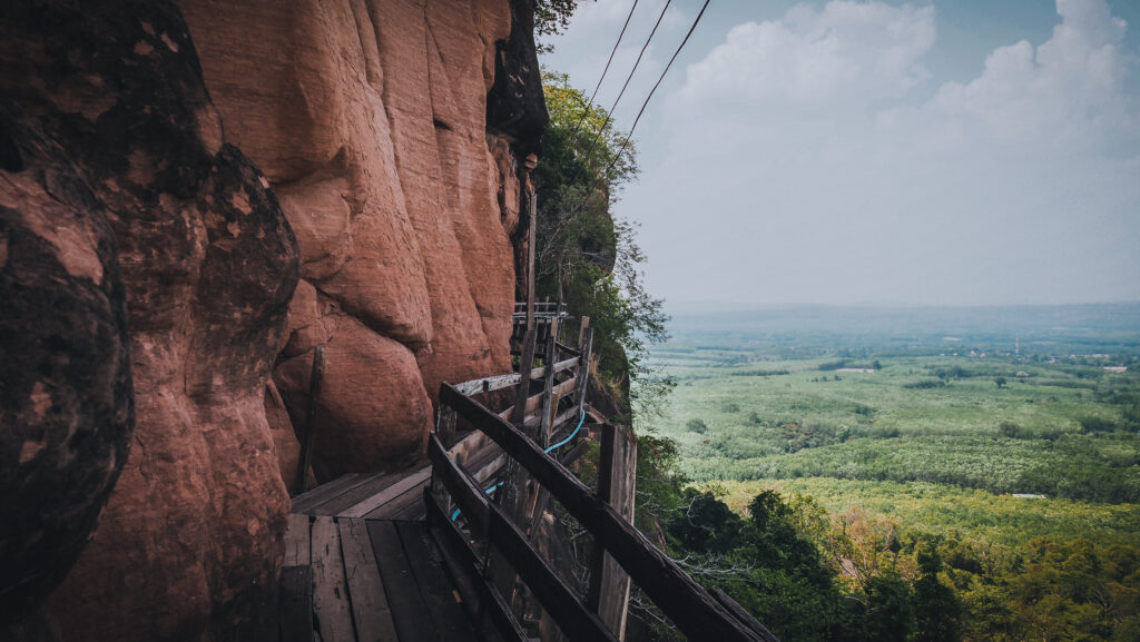
The navigation is rather simple and even though sometimes you will have to decide to turn left or right, the best is to just follow your intuition and immerse yourself into this place. Sooner or later you will reach the top level anyway. Keep in mind that following wooden walkways hanging at the edge of the cliff is not something for people afraid of heights. The construction is stable, but still, it’s hard to get rid of the thought that you are several hundred meters from the ground.
The impressive walkway around the rockIt’s definitely not for those afraid of heights
On level 5, you will see an impressive boulder and a small pavilion with the relics of the Buddha and a statue of Ajarn Juan. The views are breathtaking and it’s a good photo spot to capture the walkways installed on the rocky wall.
Pavilion with the relics of the BuddhaPavilion and nearby landscape
The summit of Wat Phu Tok is on the 7th level, but it’s mostly covered with vegetation. There will be two nice spots for taking photos if you decide to make a loop walk around that area. I strongly recommend doing so!
When going down, I was trying to take different walkways and staircases than I did on the way up. The whole sightseeing experience took me about 2 hours, at a rather relaxing pace. It was a good and sweaty exercise but worth it! Some of the walkways may look a bit terrifying but in the end, I felt only positive thrill and excitement.
Other places to visit
As already mentioned, visiting Wat Phu Tok should take you between 2-3 hours. If you have your transport, you may want to fill up your day with some of the attractions mentioned below.
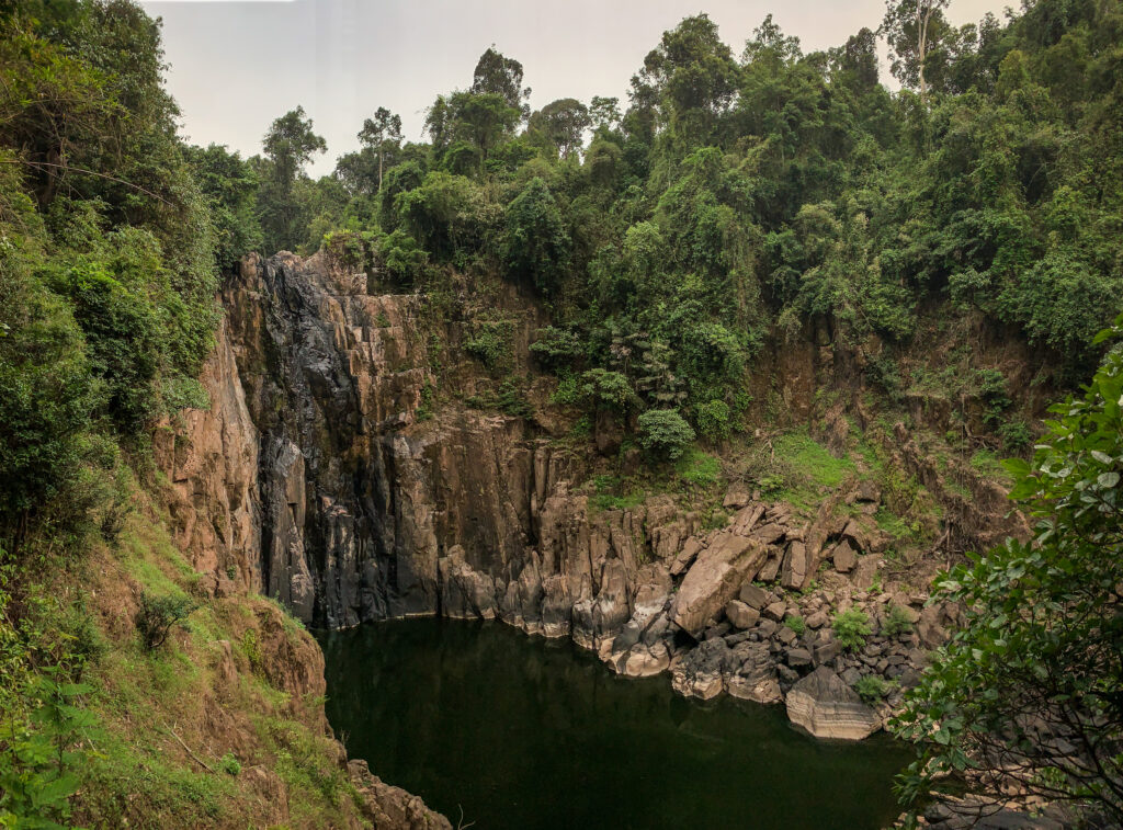
Chet Si Waterfall
It takes about 1 kilometer of walking to get to the waterfall from the parking area. There are several levels to explore but be careful as the rocks may be slippery. Best to visit in the rainy season, otherwise there might be no water and no fun 🙂
Unfortunately dry Chet Si Waterfall
Tham Phra Waterfall
On my visit in May, the waterfall has run mostly out of water but I still enjoyed the visit to this place. The sandstone cliffs are beautiful and the eroded pools filled with water are good for cooling down. It’s an excellent place to take some pictures and enjoy nature. You need to get a short boat ride from the pier to get there, which usually cost 50 THB per person for a round trip but you might be charged more if you are a solo traveler.
Three Whale Rock
Another stunning rock formation in the region with incredible views of the Isan countryside and the Mekong River in the distance. The bus to the top together with a guide will take you to five stops including Three Whale Rock. It costs 500 THB per vehicle which can fit up to 8 people. Yellow tape lets you know how far you can go toward the edge of the rock.
Phu Langka National Park
A great park with well-maintained trails. The most popular one to Nakee Cave takes about 3 hours for a round trip and a moderate level of fitness is required. When going up, you need to take at least one guide per group of no more than 10 people. No need to book in advance but it’s recommended to go early in the morning to avoid heat. During the rainy season, there is a beautiful waterfall along the trail. The park seems to be closed in May. The entrance fee is 200 THB for foreigners.
Naka Cave
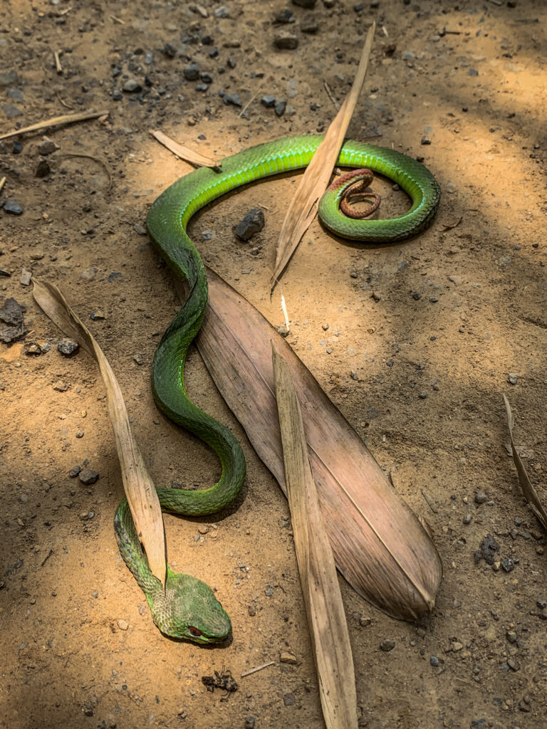
The round trip takes about 4 hours and you should be moderately fit. There are lots of stairs to climb so carry plenty of water and something to eat. The mountain has rocks with the texture of snakeskin and also some rocks that look like snake heads. During the weekends, it’s recommended to book your hiking trip with the QueQ application. You will be assigned a guide who will accompany you and tell you more about the cave and the mountains around.
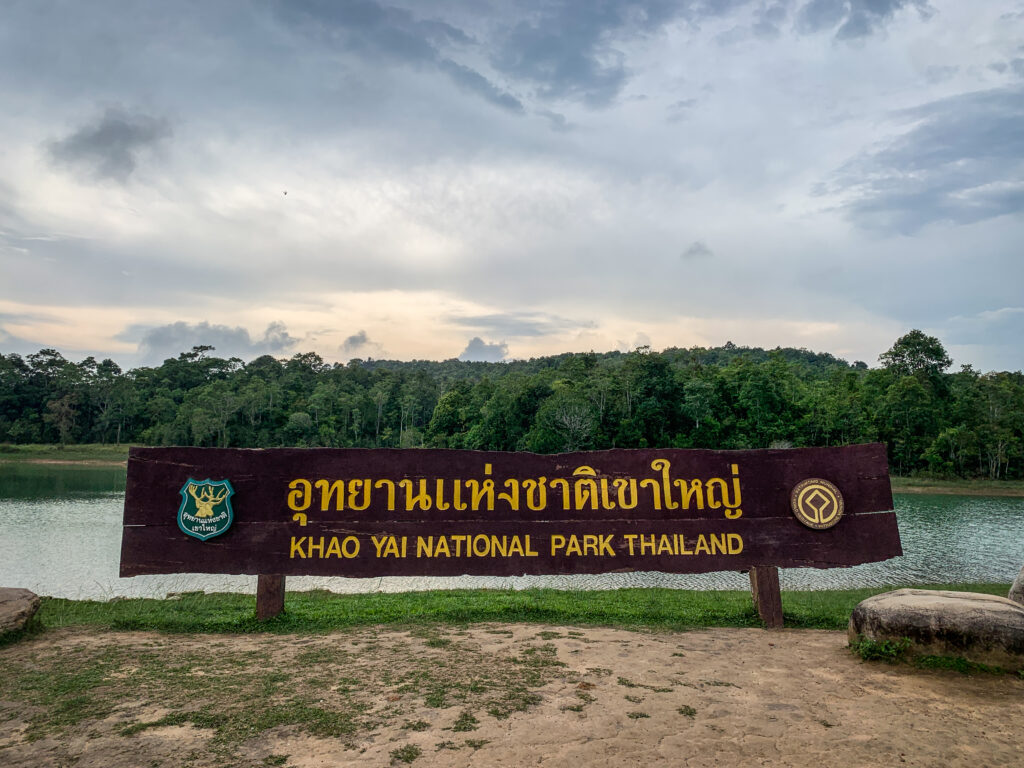
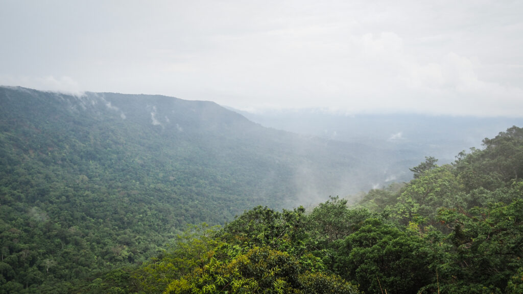
Located in Thailand’s Nakhon Ratchasima Province, Khao Yai National Park has a long and fascinating history. It was established as the country’s first national park in 1962 and is now one of the most popular tourist destinations not far from Bangkok. The area is home to stunning waterfalls, rainforests, mountains, as well as elephants, and other incredible wildlife. Read on to discover the amazing attractions that await you inside and outside of the park!
How to get there?
Khao Yai National Park is located about 180 kilometres northeast of Bangkok and about 3-4 hours’ drive from the capital. If travelling by public transport, the best option would be to take a train or bus from Bangkok to Pak Chong and then hail a taxi, take a songthaew or rent a motorbike for a one-hour drive to the Khao Yai.
The park can be visited during the whole year, however, the chances of animal encounters or the size of waterfalls will vary significantly.
The hot seasons last from March to May. While it isn’t as hot as it is in the cities, the rainfall is very low and waterfalls aren’t too impressive, or some may even dry up completely. The advantage is a minimal number of leeches.
The rainy season lasts from June to September. Waterfalls are and their best and you can hear a loud noise of flowing water even from a distance. The vegetation is green and dense. Unfortunately, there are plenty of leeches so you will need to be extra careful.
The cool season lasts from October to February and the average temperatures are the lowest during the year. It can get especially cold in the mountains during the night. The skies are blue and the visibility is excellent. As this period is just after the end of the rainy season, the waterfalls are still nice to see, especially in October.
Where to stay?
I decided to stay in Pak Chong, which is a bigger town not far from the national park. I recommend this option for people working online, as it may be hard to find reliable WIFI in nature. The place I stayed in was called Pak Chong Hostel & Wildlife Tours and it was excellent. The room is simple and only with a fan, but it was just enough for me. The owner is incredibly friendly. He picked me out from the train station, took me for lunch, rented a motorbike, explained the best things to do in the park and even provided me with leech socks. He also organizes tours, which may be a good option in case you are travelling in a bigger group. The only disadvantage of staying in Pak Chong is the distance to the national park entrance gate. It’s about 30 km and 40 minutes of riding a motorbike.
For those without the need of being connected to the Internet, the best would be to stay at a campsite or in a bungalow inside the park. It would give you much higher chances for encounters with wildlife at dawn and dusk.
What to take?
It’s a tropical environment and there are a few items that you definitely should take with you, to make your trip enjoyable and safe.
1. Sunscreen
2. Insect Repellent
3. Leech socks
4. Hat
5. Sunglasses
6. Lightweight and comfortable clothing
7. Trekking shoes
8. Water bottle
9. Snacks
10. Raincoat or poncho
11. First aid kit
12. Camera
13. Binoculars
14. Map of the park
Entrance fee
The ticket is quite pricey compared to other national parks in Thailand, but taking into consideration its size, it’s understandable. As of May 2023, foreign adults will pay 400 THB and children 200 THB. Thai citizens of course will pay much less, 40 THB for adults and 20 THB for children. Unfortunately, the double price policy is quite standard in this country. There is a small additional fee if you are entering the park with a motorbike or car.
What to do inside the park
Chao Phor Khao Yai Shrine
It is the first sight that you will see when entering the national park from the Pak Chong side. The shrine was erected in memory of Mr Jang Nisaisat, the individual who had protected the animals and forest of Khao Yai and was widely respected by local villagers.
Km. 30 Viewpoint
Shortly after passing the shrine, you will encounter this beautiful viewpoint. It faces the north and in the morning there is often a sea of mist below the mountain range.
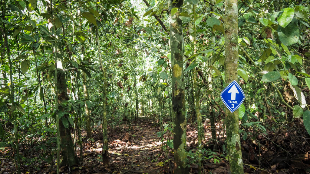
Trail #3: Km. 33 – Nong Phak Chi
Distance: 4.2 km one-way
Time: 2.5 – 3 hours
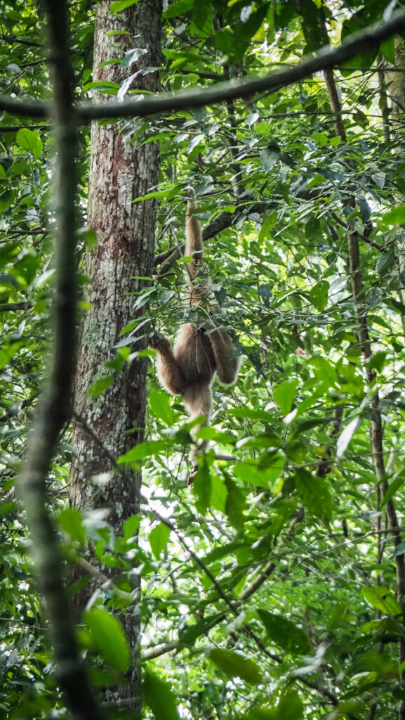
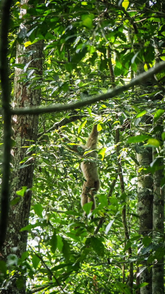
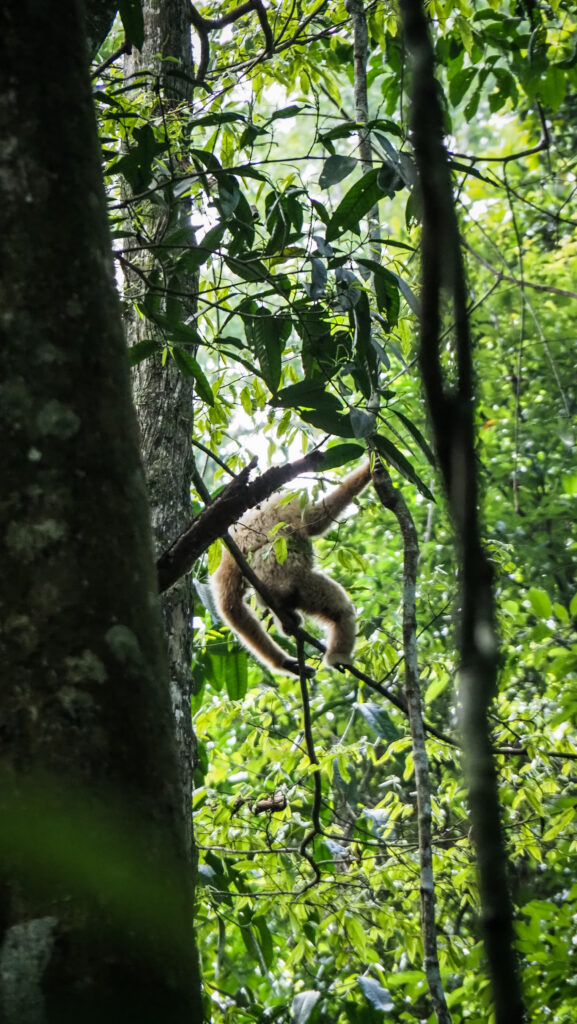
The trail starts at the roadside by the Km. 33 milestone. It was highly recommended by my host in Pak Chong to hike it first and preferably do it in the early morning. He was right! It was definitely the highlight of my visit. You will see different types of vegetation: mature dry forest, secondary forest and grassland. I saw hornbills, gibbons and some other insects. The sound made by gibbons was amazing! Closer to Nong Phak Chi Observation Tower, you can see some traces of elephants as they come near the water sources and salt licks. Unfortunately, I didn’t see any at that time.
From the observation tower, you may either hike back the same way or continue to the asphalt road and hitchhike back to your car or motorbike. The trail can be started between 8 AM and 2 PM.
Trail #5: Dong Tiw – Nong Phak Chi
Distance: 5.5 km one-way
Time: 3 hours
The trail can be combined with #3 in one big loop. It starts at the side of Thanarat Road about 200m from the Visitor Center at Sai Sorn Reservoir and finishes around Nong Phak Chi Observation Tower. The highlight of this trail is a giant Baing tree which is centuries old.
The trail can be started between 8 AM and 2 PM.
Trail #4: Dong Tiw – Sai Sorn Reservoir
Distance: 2.7 km one-way
Time: 1.5 – 2 hours
This one-way trail leads to Sai Sorn Reservoir, a beautiful spot to watch the sunset. It is just a much shorter version of trail #5. In the rainy season, you may see a beautiful array of flowers such as balloon plants, begonia and mossiata. The trail also connects with #5 and #7.
Trail #7: Thai-American Friendship Trail
Distance: 2 km loop
Time: 1.5 hours
It starts and ends at the Ridge of Sai Sorn Reservoir. The trail celebrates the long and friendly relations between Thailand and the USA. You will walk through dry forest, secondary forest and grassland. Frequently encountered wildlife include the Siamese Fireback, silver pheasant, gibbons and hornbills.
Trail #1: Visitor Center – Kong Kaew Waterfall
Distance: 1.2 km loop
Time: 45 mins – 1 hour
The trail begins at the hanging bridge behind the Visitor Center. This is the shortest and the easiest trail in the national park. Animals encountered might include the Lar gibbon, pileated gibbon and various birds. At the end of the trail is a small Kong Kaew Waterfall. Nothing too impressive but a pleasant place to rest next to the stream with volcanic rocks.
Trail #6: Visitor Center – Haew Suwat Waterfall
Distance: 8 km one-way
Time: 6 hours
The longest and the most challenging trail in the national park. You will walk through both rainforest and dry forests interspersed with bamboo groves. Animals encounters may include elephants, gibbons, Asian black bears and hornbills. There are many twists and turns, so the route may be confusing, and this is why you should consider arranging an experienced trail guide. The reward at the end is one of the two most beautiful waterfalls in the park.
The hikes should be started before 10.00. It is closed between July 1st – August 31st.
Trail #2: Pha Kluai Mai Campground – Haew Suwat Waterfall
Distance: 3 km one-way
Time: 2 hours
This nature trail links two waterfalls, following the Lam Ta Khong stream. Along the trail, you will hear the thundering sound of Pha Kluay Mai Waterfall during the rainy season. Unfortunately, in May the water level was very low so the trail wasn’t that impressive to me. On the other hand, when water levels drop, you can see the traces of lava flow from a volcano hundreds of millions of years ago.
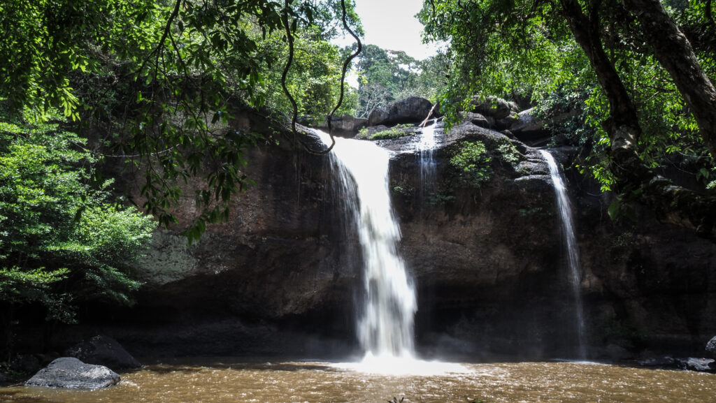
Haew Suwat Waterfall
One of the two most impressive waterfalls in the Khao Yai National Park. Lam Ta Khong stream falls 25 metres down the volcanic rock. There is a nice viewpoint where the falls can be seen through vegetation but for a much better experience, you should go down quite steep steps to the basin. In the dry season, you may check out the cave just behind the water curtain.
Sai Sorn Reservoir
A picturesque place with plains for picnics and sufficient parking along the road. A popular place for event photography too. Hiking trails #4, #5 and #7 pass nearby.
Pha Diaw Dai Viewpoint
The wooden boardwalk is approximately 450 meters long and leads you through a pristine forest, which is extremely atmospheric in the wet weather. The views from the stony edge of the cliff over the Rom Khwang mountain range are truly breathtaking.
While driving up here, you will pass by Viewpoint 3 at Yod Khao Khieo Mountain. The panorama is great as well but there is no place to stop and park a car or motorbike.
Pha Trom Jai Cliff
It is located 600 metres from the Pha Diaw Dai, just next to the entrance to the Royal Thai Air Force radar station. At an elevation of 1,290 meters above sea level, this is the highest viewpoint in the central region of Thailand. The view, however, isn’t the best.
Haew Narok Waterfall
Haew Narok is located to the south of Khao Yai National Park on Highway 3077, about 23 km from the Visitor Center. It’s an excellent road through the dense forest with a high chance of seeing wild elephants, especially in the later afternoon. Drive slowly!
The waterfalls are the largest and tallest in the park (150 metres). From the parking, there is a 1-kilometre trail going over Huay Samor Poon Stream and then down the steep staircase to the best viewpoint.
According to the national park website, the area of the waterfall is a permanent part of wild elephants’ foraging range, which has been the cause of tragedy with elephants falling down the waterfall. The first time was on 2 August 1992, when a family of 8 elephants was lost as they were crossing the stream in the forest at the top of Haew Narok Waterfall, making it known as an “elephant graveyard”. On 5 October 2019, another 11 elephants were lost.
Night Safari
When joining the tour, you may see nocturnal animals, such as sambar deer, Malayan porcupine, large Indian civet, Asian palm civet, wild elephant, owls and nightjars. Inquire and reserve a time slot at Khao Yai Visitor Center, at the service desk before 6 p.m. The guided journey on a pick-up truck is 10 km long and takes about one hour. The price is 600 THB per vehicle fitting up to 10 people.
Whitewater Rafting
The rainy season from July to October is the best for this activity as the water current is strong and turbulent, and suitable for rafters wanting to be challenged. Hin Phoeng Rapids is used as a starting point and then a trip continues on a 2.5 km stretch with 6 rapids called Kaeng Hin Phoeng, Kaeng Phak Nam Lom, Kaeng Wang Bon, Kaeng Luk Seua, Kaeng Wang Sai and Kaeng Ngu Hao.
What to do outside of the park
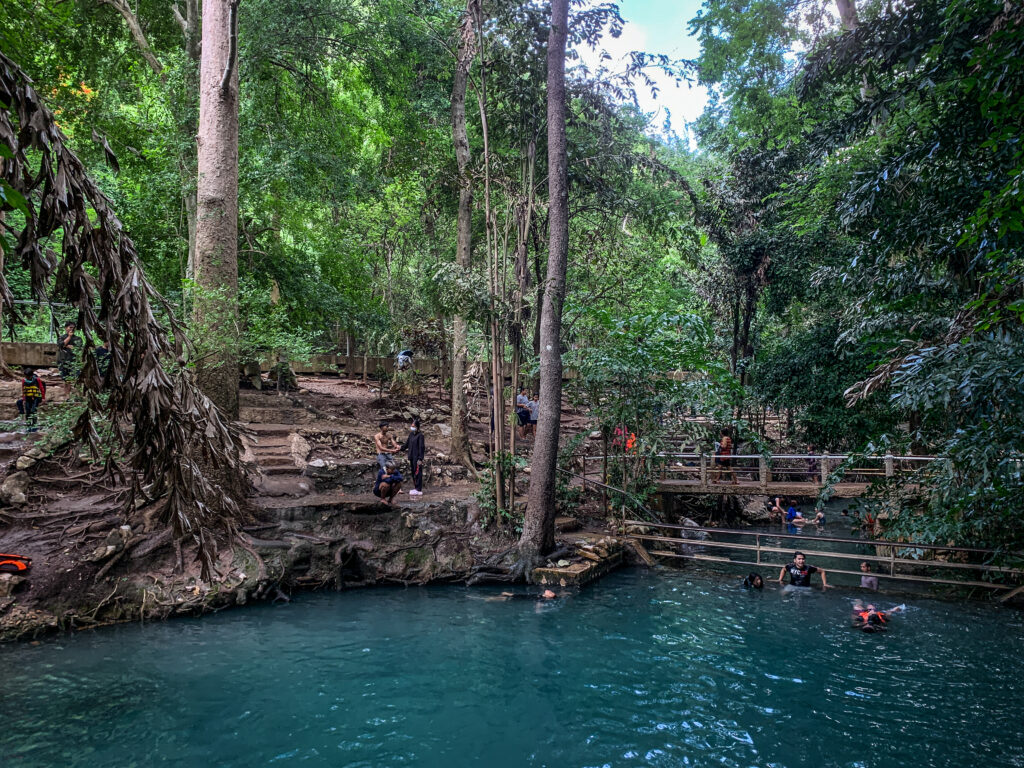
Ban Tha Chang Spring
A popular place for locals to come for a dip. Very clear water with plenty of space to enjoy. You may also rent a kayak and check out the small river. Free entrance and free parking
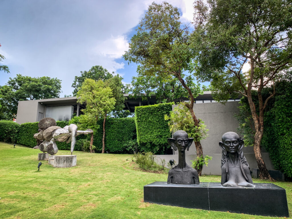
Khao Yai Art Museum
Surprisingly good place with paintings and sculptures of local artists. Don’t miss a walk in the garden which is full of art installations. Free entrance.
Wat Tham Sila Thong
Ask the monk to give you a key to a cave. It has a hole in the ceiling, but the cave is quite dark so it’s good to have your own flashlight.
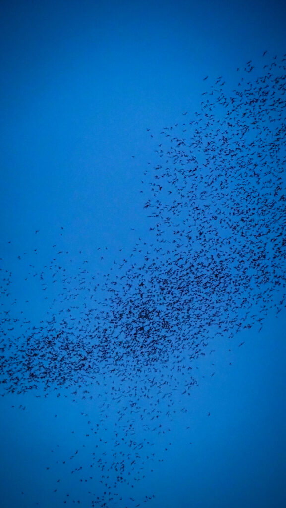
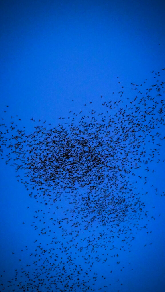
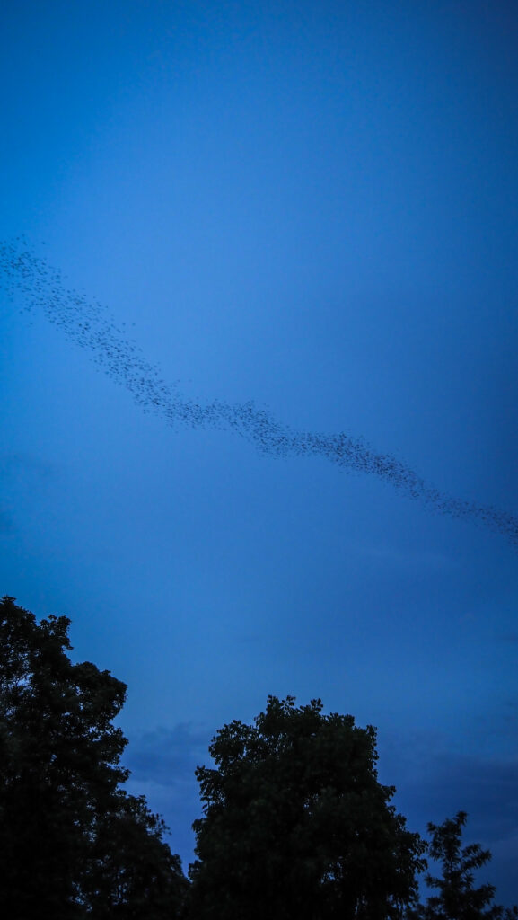
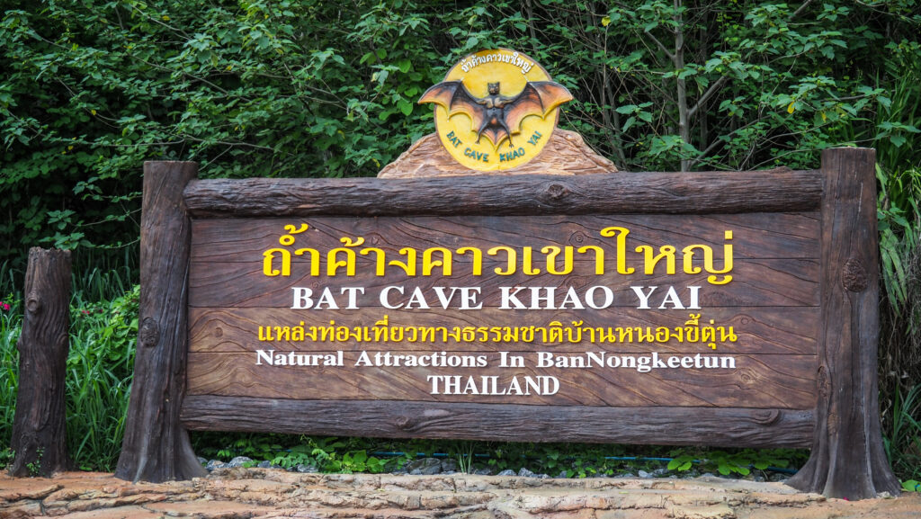
Bat Cave
It’s not really a cave to explore, but rather an observation point for a spectacle straight from National Geographic documentaries. At dusk, thousands of bats fly out of the cave in a continuous stream. Unique and amazing experience! The show of nature usually happens between 5:45 PM – 7 PM and lasts for a surprisingly long time. Over 20 minutes once I was there!
Sarika Waterfall
Another nice waterfall with a beautiful winding road up the mountains to get there. Entrance ticket for foreigners costs 200 THB and for Thais 40 THB. As in all the other waterfalls in this region, it’s best to visit in the rainy season.
Nang Rong Waterfall
Small and free waterfall but unfortunately not very well maintained. A popular picnic place for local people.
Khun Dan Prakarn Chon Dam
The longest and largest dam in Thailand. You can either walk or rent an electric golf cart to get to the other side. Obviously, I recommend walking. There’s also an option to go on a boat trip further down the lake and to the nearby waterfall.
Nakhon Ratchasima, or “Khorat” as it is more commonly called, is the largest city in the Isaan province of northeastern Thailand. Located close to the famous ancient Khmer ruins of Phimai, and with a booming city center, Nakhon Ratchasima has become a popular tourist destination.
How to get there?
From Bangkok, there are several ways of getting to Nakhon Ratchasima, also known as Khorat.
By bus: There are numerous bus services from Bangkok which run every day. The journey takes around 4 hours and tickets can be purchased from several major bus terminals in Bangkok, but probably the easiest is to start at Mochit Bus Terminal.
By train: The State Railway of Thailand operates several services from Krung Thep Aphiwat Central Terminal Station or Don Mueang to Nakhon Ratchasima. The journey takes around 4-5 hours.
By car: The journey takes around four hours by highway.
By air: Nakhon Ratchasima has an airport, Khorat Airport (KKC), with direct flights from Bangkok. Flight time takes around 1 hour.
The city can be visited at any time of the year. The dry season runs from November to March. During this time, the weather is generally mild, sunny, relatively dry, and with less humidity.
Where to stay?
I spent two nights inMoonlight House and can’t say anything bad about it. It’s nicely located within walking distance of most of the sights, there is parking and an opportunity to rent motorbikes. The staff at the reception is very friendly too.
What to see?
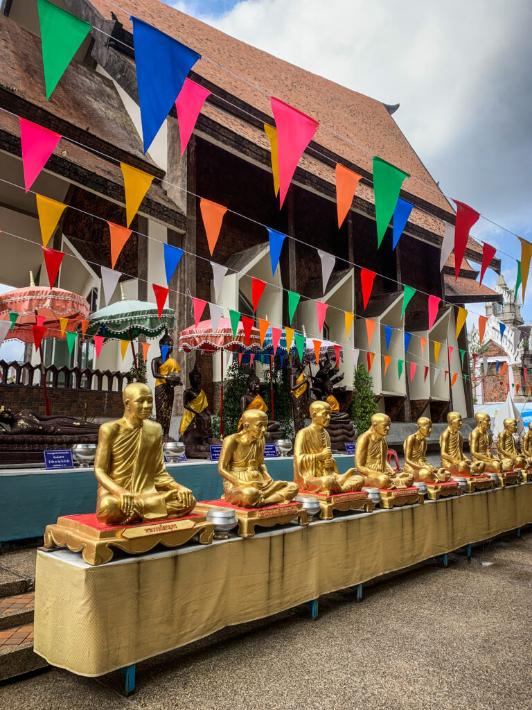
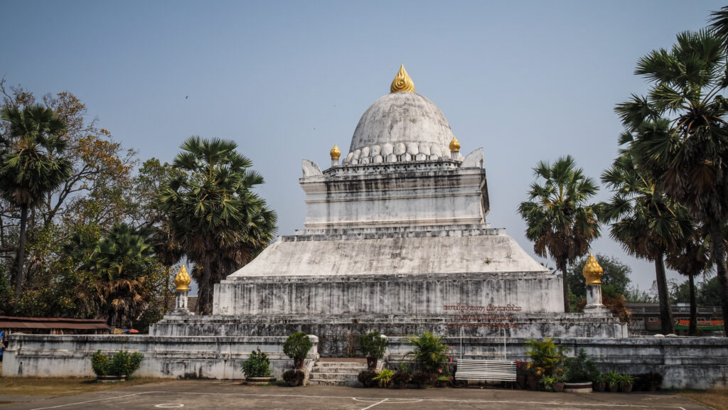
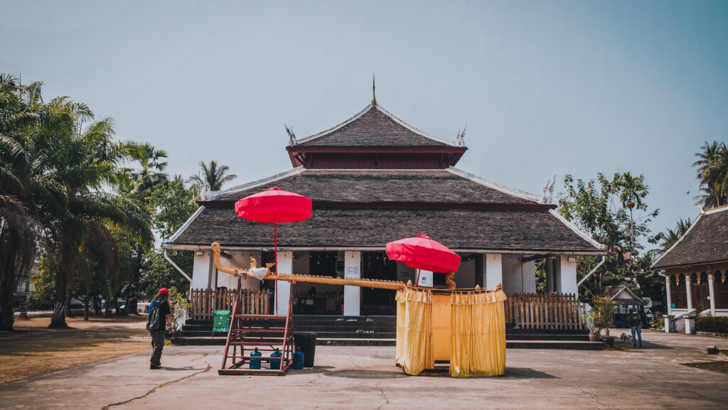
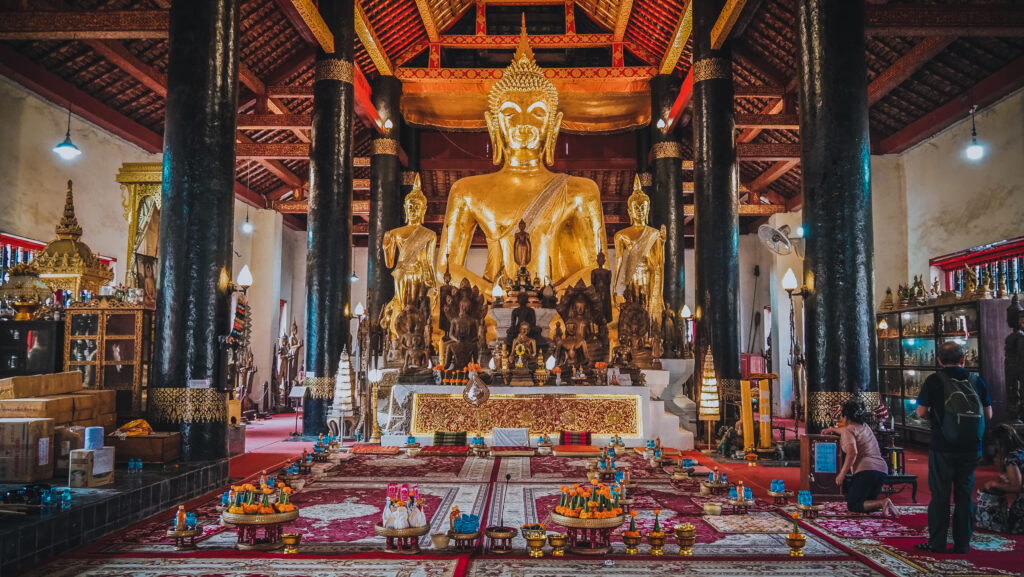
Wat Sala Loi
Located in the northeast of the city, about 500 meters from Rob Mueng Road. The temple was built by the Khorat heroine Thao Suranari and her husband in 1827. Wat Sala Loi’s highlight is the meeting hall which is the applied Thai art in the shape of a ship riding the waves. The outdoor is also made of metal. Inside the hall, there is a giant statue of Buddha. Outside there is a plaster sculpture of Thao Suranari sitting and praying in the middle of a pong, plus a small pagoda containing her ashes. There are even small waterfalls if you need to slow down and relax.
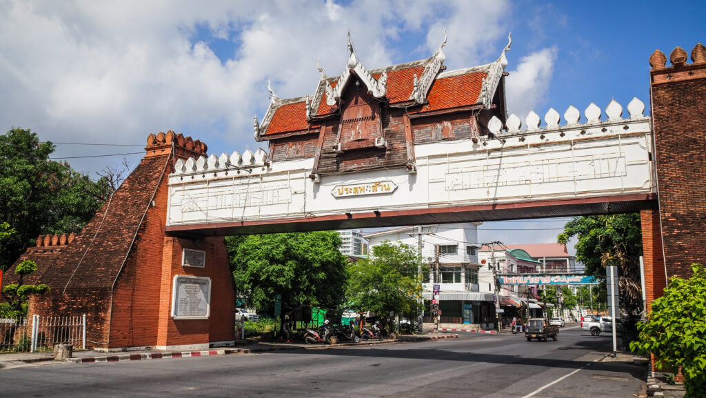
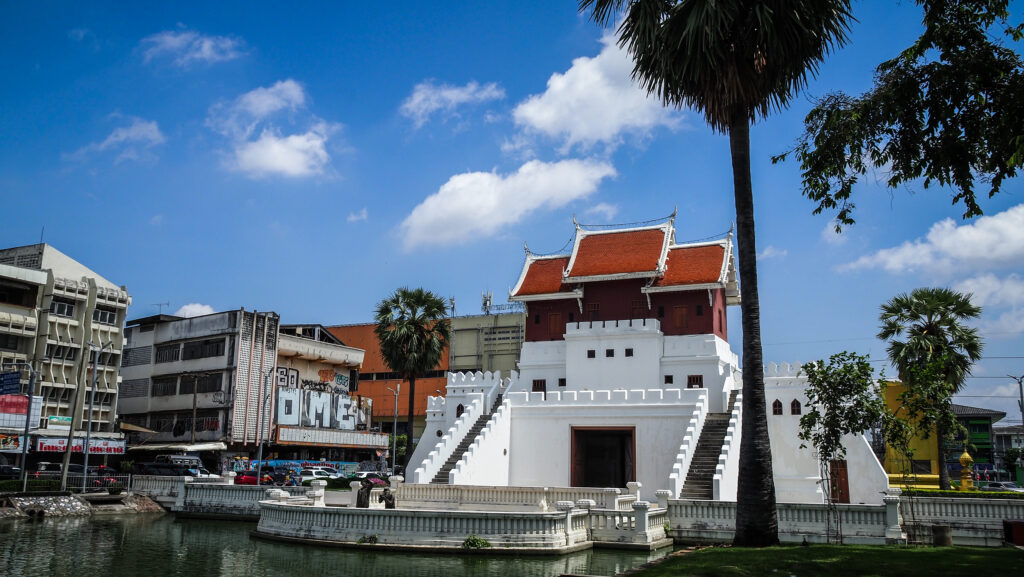
City gates
Nakhon Ratchasima has been the important gateway to the northeastern region since the Ayutthaya period, preventing Khmer invasions. Therefore, the city wall and gates were built. Chumphon Gate is the only original one still standing. The other ones: Phon Saen Gate, Phon Lan Gate, Chainarong Gate or Yamo Gate have been recently rebuilt.
Phon Lan GateYamo Gate
Wat Phayap
Definitely an extraordinary site with an interesting history. When the abbot of Wat Phayap learned that blasting for a quarry in Saraburi Province was destroying a beautiful cave, he decided to rescue some pieces of it and create a room full of stalactites, stalagmites and Buddha statues just next to his residence.
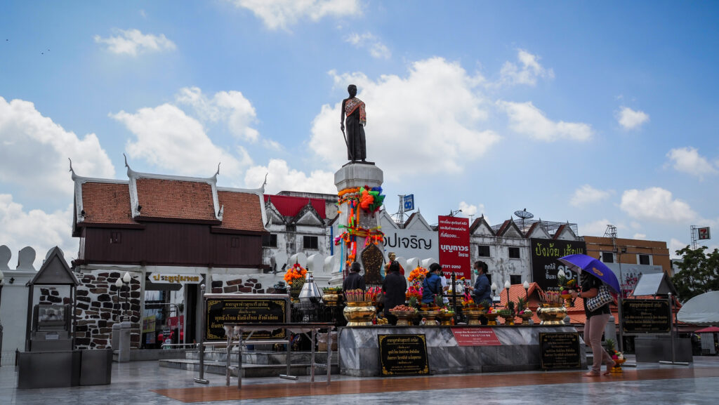
Thao Suranari (Ya Mo) Monument
A statue of Thao Suranari stands in the center of Nakhon Ratchasima and is a popular object of devotion. LadyMo, also known as Ya Mo (Grandma Mo) was the wife of the deputy governor of Nakhon Ratchasima (Korat), the stronghold of Siamese control over its Laotian vassals.
In 1826, the King of Vientiane invaded Siam, seeking complete independence. His forces seized the city, and evacuated the inhabitants, intending to resettle them in Laos. This is when Lady Mo comes into the stage. She became a hero by organizing a successful prisoner revolt. There are several versions of the legend. One of them says that she convinced the women to seduce the Lao soldiers. According to another one, she simply got them drunk. One more says that she requested knives from the invaders so that food could be prepared and then she gave the knives to the imprisoned men. The result was, however, the same in all stories. Thai men launched a surprise attack, saving the city.
Thao Suranari MonumentAnd one more monument!
Maha Weerawong National Museum
A very small museum in a one-story building behind the library. There are interesting antiques to see but you will be done with sightseeing in half an hour.
Wat Pha Narai Maha Rat
The temple takes its name from the Vishnu statue which is housed in a shrine there. The statue is Khmer in origin and made of sandstone. There are three of these sandstone statues in the temple. It is nicely located on an island in the center of a small lake, but somehow the area seems to be neglected.
Impressive Naga at the entranceTemple is located at the artificial lake
Wat Sa Kaeo
Small and calm temple next to an artificial pond alongside a road.
Art Gallery and Exhibition
A pair of two-story pavilions have a variety of art and exhibits of Thai kings. Located in a little park beside a section of moat. Most of the information is in the Thai language only. Free to enter.
City Pillar Shrine
More than the altar it is the large pottery wall telling the battle against Lao invaders (the one Thao Suranaree presumably led).
People praying next to City Pillar Shrine
Around Nakhon Ratchasima
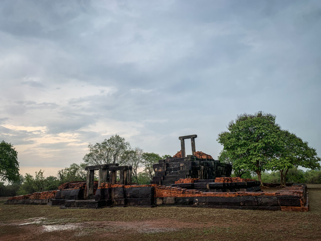
Prasat Hin Phanom Wan
A must-visit Khmer sanctuary, which is believed to be built in the 15th century and renovated during the 18th and 19th centuries. Initially dedicated to the Hindu religion but later became a Buddhist ritual site. The main pagoda and a tiered pagoda are still remaining and make the site incredibly beautiful and atmospheric. Not many tourists come here so you won’t find guides or shops. Just a peaceful place with ancient structures.
Prasat Hin Phanom Wan
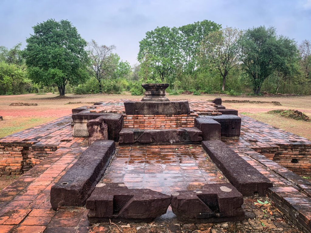
Prasat Non Ku
It is a small cluster constructed of bricks and sandstone. The plan is rectangular facing east. From the archaeological evidence, it is assumed that it used to be a Hindu religious building cluster in the ancient Khmer style in the 10th century.
Prasat Non Ku
Prasat Muangkhaek
This large ancient ruin is 600 meters from Prasat Non Ku, made of bricks and sandstone with a rectangular plan facing towards the north. It is assumed that this building might have possibly been another Hindu shrine in this region. It was built around the 10th century.
Prasat MuangkhaekPrasat Muangkhaek
Mueang Sema Historical Site
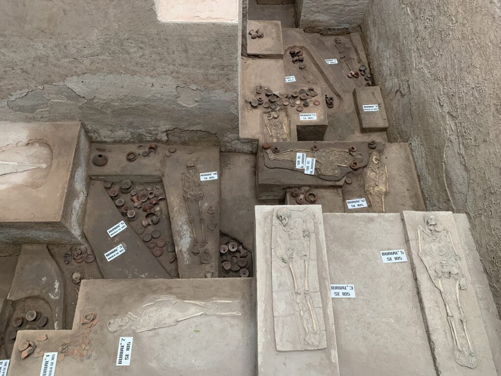
Mueang Sema is a large ancient city that was surrounded by an earthen moat and divided into outer city and inner city. The outer city was larger on the north side, where three ancient monuments were found. In the center of the city, a square moat or pond was dug. Monuments of the inner city are found at 6 sites. Some sites are religious centers of the Brahman religion, such as Prasat Prathan, constructed in Khmer style with bricks. Additionally, within the Muean Sema were found skeletons buried ritually in the prostrate position, wearing bronze rings, along with pottery, iron tools, and glass beads.
Mueang Sema has developed since the late prehistoric age around the 13th – 14th centuries Buddhist Era. During this period, under the influence of Dvaravati culture Buddhist religious sites were constructed. Later, around the 15th – 16th centuries of the Buddhist Era, the influence of Khmer culture brought about the appearance of Hindu buildings.
Mueang Sema Historical Site
Wat Thammachak Semaram
This reclining Buddha image made of sandstone is the oldest and largest in Thailand. It was built approximately in the 15th-century Buddhist era about the same time as the ancient city of Mueang Sema. It is in the area just outside of the moat of Mueang Sema. The image is built from large blocks of red sandstone placed in layers and carved into the shape of a reclining Buddha oriented north to south. It has been hypothesized that this area was an important Buddhist religious center for the ancient Mueang Sema.
The reclining Buddha imageWat Thammachak Semaram
Wat Ban Rai and Luang Phor Koon Museum
Wat Ban Rai is one of the famous Temples in Nakhon Ratchasima. It required some effort to get there as it’s over one hour drive from the city center.
Originally, Wat Ban Rai was a small monastery, but then the monk Luang Pho Khun developed it into the big and well-known temple that we can see today. An interesting building on the grounds is definitely an elephant-liked ceramic shrine in the center of the water. On the rooftop are the statue of the walking Buddha and the statue of Luang Pho Khun. The Museum of Luang Pho Khun presents some more details about the life of a famous monk.
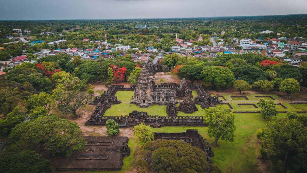
Phimai
It is a charming town famous for the 11th-century Khmer ruins of Phimai Historical Park. It’s one of Thailand’s most impressive and well-preserved archaeological sites. Long before it was a tourist attraction, the site served as an important religious and political hub for the Khmer Empire. Today, visitors to Phimai are treated to an incredible display of ancient architecture and intricate carvings, as well as a glimpse into the region’s rich cultural heritage. You can read more about it in a separate post HERE.
Jim Thompson Farm
Beautiful place to spend some time among flowers and relax. It only opens for a specific period during the year, which is usually around December. Check the info in advance on their Facebook to avoid disappointment.
Phimai, located in Thailand’s Nakhon Ratchasima Province, is a charming town famous for the 11th-century Khmer ruins of Phimai Historical Park. It’s one of Thailand’s most impressive and well-preserved archaeological sites. Long before it was a tourist attraction, the site served as an important religious and political hub for the Khmer Empire. Today, visitors to Phimai are treated to an incredible display of ancient architecture and intricate carvings, as well as a glimpse into the region’s rich cultural heritage.
How to get there?
The fastest way to get to Phimai from Nakhon Ratchasima would be to take a bus from Terminal 2 Station. The journey takes over an hour and tickets can be purchased inside the bus.
When to go?
The site can be visited at any time of the year. The dry season runs from November to March. During this time, the weather is generally mild, sunny, relatively dry, and with less humidity.
Where to stay?
Phimai can be easily reached from Nakhon Ratchasima as a day trip. That’s exactly what I did so I haven’t stayed there for the night. I am not going to recommend anything from my own experience, but if you want to take your time in the town, look for your options at booking.com or agoda.com. BenyaGuest House looks like something that I could potentially choose.
What to see?
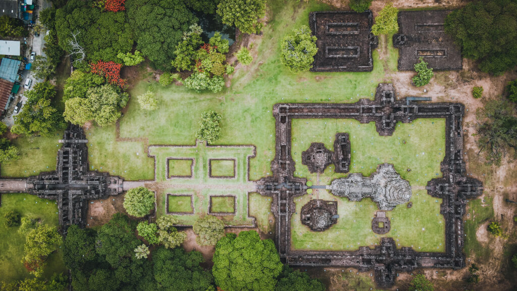
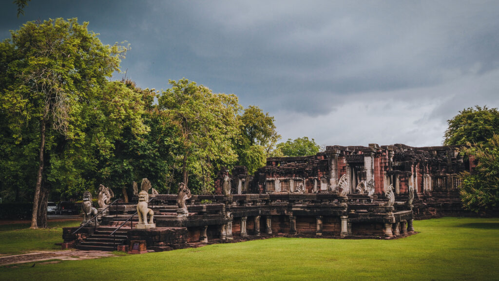
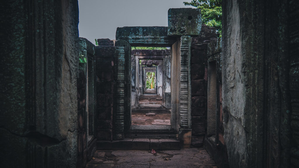
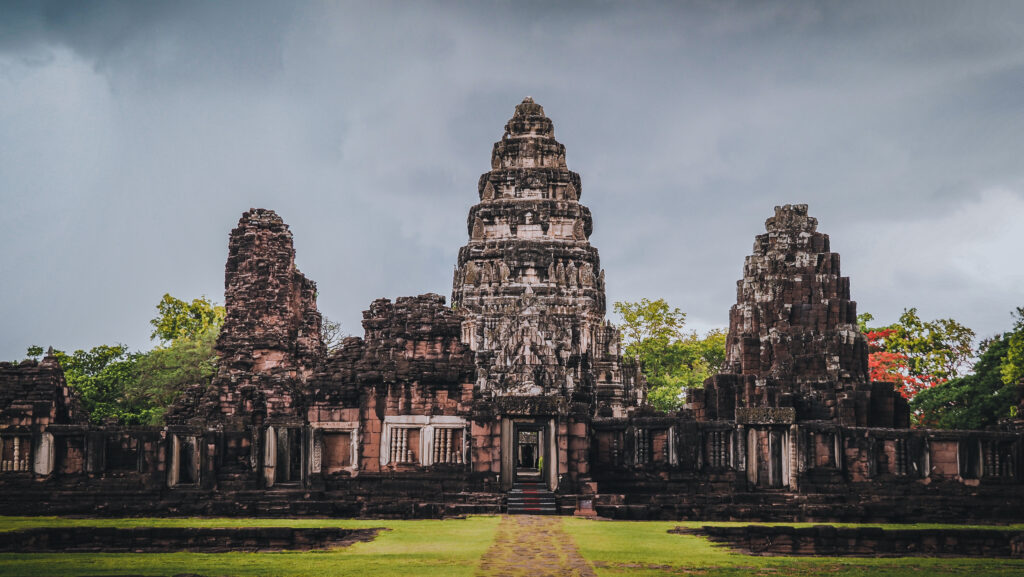
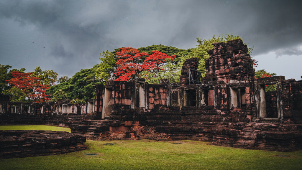
Prasat Hin Phimai
The temple is located at one end of the Ancient Khmer Highway from Angkor and it is believed to have been an important city in the Khmer Empire. Most buildings are from the late 11th to the late 12th century, built in the Baphuon, Bayon, and Khmer temple style. As the inhabitants of the Khorat area had been Buddhists as far back as the 7th century, the temple was dedicated to the Vajrayana sect of Mahayana Buddhism.
In front of the main temple, there were Prang Hin Daeng and Prang Bhramadatta which were also in the rectangular gallery with four-sided entrances. These two buildings were linked together by the walkway. In front of the southern entrance, there was a cross passageway which was called Naga Bridge. The frontmost building was presumably used as a robing pavilion for the king and nobles before performing religious ceremonies.
After the fall of the Ayutthaya Kingdom in 1767, attempts were made to set up five separate states, with Prince Teppipit, establishing Phimai as one, ruling over eastern provinces including Nakhon Ratchasima. As the weakest of the five, Prince Teppipit was the first to be defeated and was executed in 1768.
Phimai National Museum
The museum contains artefacts from the Phimai Historic Site and other temples in the region. It is best to visit before entering the historical park to understand the full context. The entry fee is 100 THB for foreigners and 20 THB for Thais. Unfortunately, as of May 2023, the museum was closed for renovation and I’m not sure how long it is going to take. There are some artefacts located outdoors so you can still walk around and see them for free. The remains of the North Gate are located near the museum, on the other side of Tha Songkran Road.
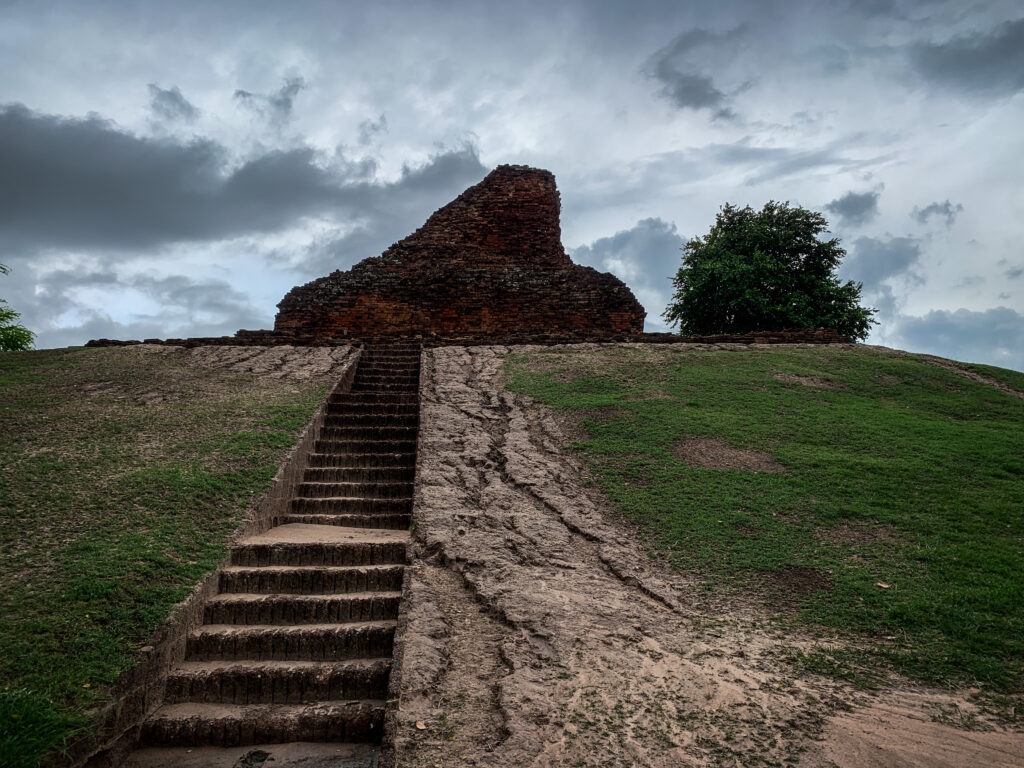
Meru Brahmathat
Just a short walk from the entrance to Prasat Phimai is the ruin of Meru Brahmathat. It is unrelated to the Khmer Empire in any way and origins from the 18th century which was the late Ayutthaya era. It sits atop a man-made hill and unfortunately isn’t in particularly good condition. It looks much better from the square further away than up close.
Pratu Chai
The south gate is the most intact and noteworthy of Phimai’s three surviving 13th-century city gates. It was built by King Jayavarman VII and served the road to Angkor.
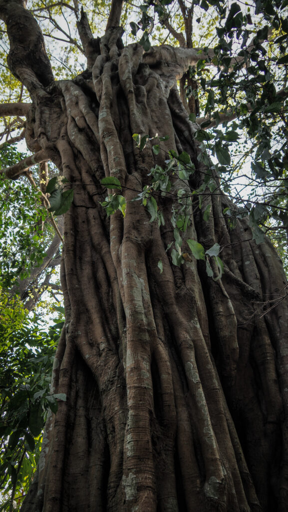
Sai Ngam
It must be the biggest banyan tree I have ever seen! it’s a very significant symbol in Buddhism as it is believed that the Buddha enlightened while sitting in the shade of a banyan tree. A banyan reproduces by sending tendrils down from its branches which can take root and form a new tree. It’s a pleasant walking area and there are plenty of food stalls available.
Banprasat Archaeological Site
Excavation sites include some pottery and burial places of a farming community dating back some 3000 years. There is also a small museum, with explanations in English. The village is located about 15 km from Phimai. Free entrance.
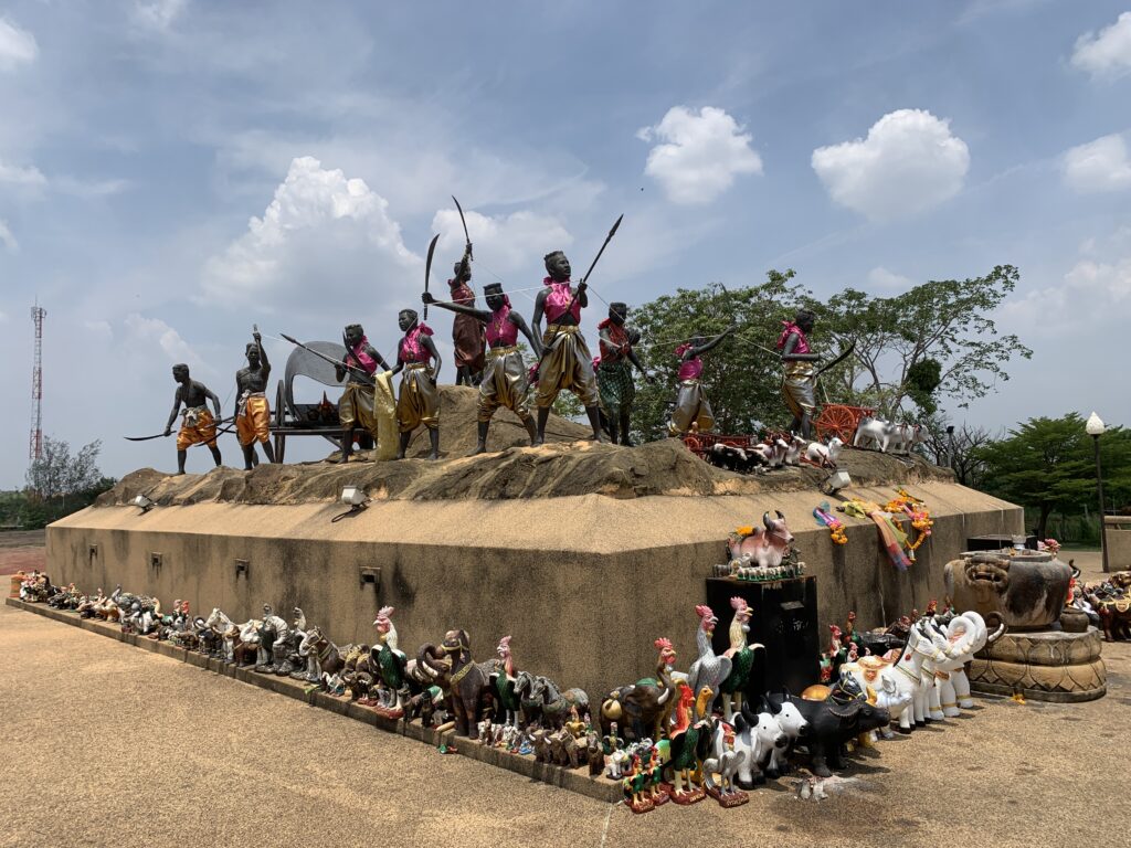
Thung Samrit Memorial
The place was a battleground between the Khorat people and Lao soldiers during the reign of King Rama III. A shrine was constructed by villagers in 1988 to pay homage to the fighters.
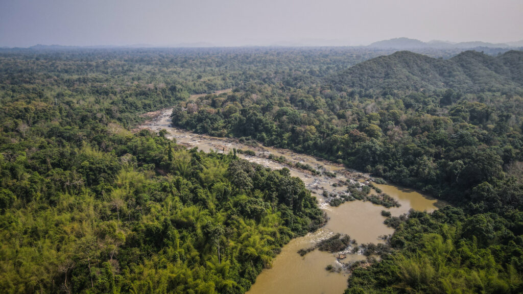
Cat Tien is one of the most famous National Parks in Vietnam. Located in the southern part of the country, it is home to a unique and diverse ecosystem that includes tropical forests, wetlands, and even a dry evergreen forest. Here, visitors will discover a wide variety of wildlife, including rare species of birds, primates, and reptiles. Not only is this park a haven for nature lovers, but it also offers some activities for those looking for a bit of adventure. From day hikes to overnight camping, there’s something for everyone. I spent 2 full days in the park and left with mixed impressions. Let me show you what the part has to offer and what disappointed me.
How to get there?
From Ho Chi Minh City, you can take a bus from the Mien Dong (Eastern) Bus Station to the town of Dai Ninh, located just outside of Cat Tien National Park. From there, you can take a taxi or motorbike to the park. Alternatively, if you are travelling from other cities in Vietnam, you can take a bus or train to either Bao Loc or Dalat and arrange transport from there.
You may also check your connections at 123Go.Asia.
When to go?
The best time to visit Cat Tien National Park is during the dry season, which runs from December to May. During this time, the weather is more pleasant, making it ideal for trekking and exploring the park.
River panorama and one of the gibbons at Bear and Gibbon Rescue Center
Where to stay?
My stay atThuy Tien Eco Lodgewas definitely one of the most pleasant experiences in that area. I was upgraded to the bigger room which was clean, with air-conditioning and a hot water shower. The internet was fast and I could work online without any issues. The owner was really sweet and she helped me organize my time in the park and gave me some tips.
What to take?
It’s a tropical environment and there are a few items that you definitely should take with you, to make your trip enjoyable and safe.
1. Sunscreen
2. Insect Repellent
3. Leech socks
4. Hat
5. Sunglasses
6. Lightweight and comfortable clothing
7. Trekking shoes
8. Water bottle
9. Snacks
10. Raincoat or poncho
11. First aid kit
12. Camera
13. Binoculars
14. Map of the park
Entrance fee
The ticket for a boat that takes you across the Dong Nai River costs 60.000 VND. There is no other way to get inside, so you must take it. The crossing literally takes one minute or even less.
Renting a bicycle
There are several options to rent a bike: 30.000 VND for 1 hour, 100.000 VND for 4 hours or 150.000 VND for 8 hours. Unfortunately, the bicycles are total rubbish so take your time and choose wisely. The rental place is just to the left of the Visitor Center.
Very bad quality rental bicycle
Do-it-yourself activities
Tung Tree
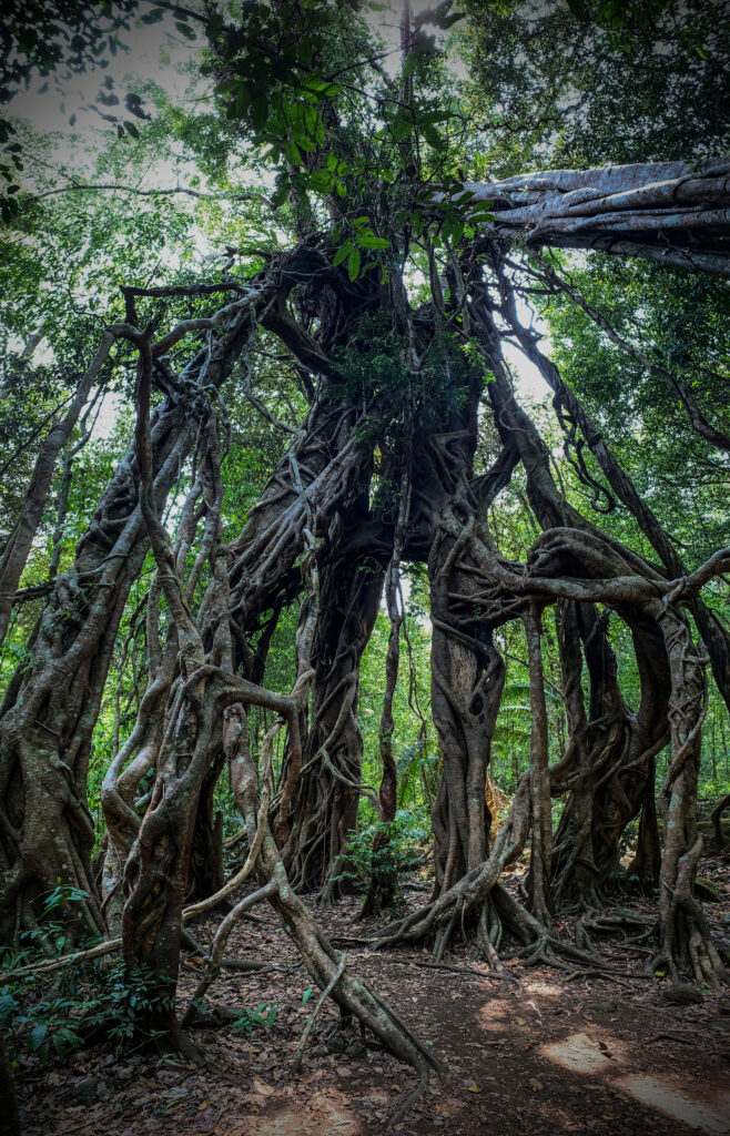
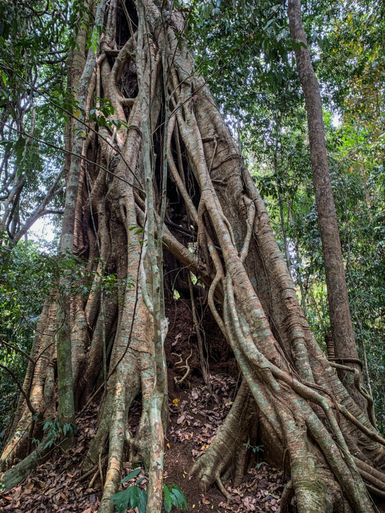
In the park, there are many tall trees which are hundreds of years old and Tung Tree is one of them, with a height of 20 meters and a width of 10 meters. The roots of the trees sit on the ground and are absolutely breathtaking. When walking through the jungle and approaching this tree, you can feel like Tomb Raider!
Ben Cu Rapids
Nothing too spectacular, at least in the dry season. You can walk around the stones to get closer to the river but unfortunately, the area was full of rubbish. Very sad view, especially inside the National Park. It seems like rangers are too busy doing nothing instead of moving their asses to clean a bit!
Rapids on Dong Nai RiverThe whole area looks impressive from the sky
Uncle Dong Tree
Another impressive tree. This time it is a genus of redwood tree with 2 meters diameter.
Botanical Garden
It’s a series of paths through the jungle, very close to the riverside. The names of plants and trees are included on the boards. Very pleasant walk!
Heaven’s Rapids
The series of rapids is located about 12 km away from the Visitor Center. The road to get there is a bit bumpy, especially on low-quality rental bicycles. You can easily do it together with other sights on the way: Tung Tree, Ben Cu Rapids, Botanical Garden, and Uncle Dong Tree (small detour needed). Unfortunately, similar to Ben Cu Rapids, there were lots of plastic bottles in the water. It isn’t my definition of heaven!
Crocodile Lake
This is the classic trekking route in Cat Tien and is not to be missed. Take a bicycle for about 9 km on the main park road to the beginning of the trail. Then hike 5 km to reach the lake. You might see giant trees, rare peafowl, water birds, monkeys and of course Siamese crocodiles. And if you don’t see, for sure you will hear a lot of wildlife around you. This was certainly the best hike in the park, even though the entrance fee of 250.000 VND at the lake seemed to be too high. You can stay overnight at the Ranger Station with advance reservations which of course will give you priceless opportunities to watch wildlife in the night and at dusk.
Crocodile Lake
Garlic-Shaped Lagerstroemia Tree
From Crocodile Lake, the unpaved road continues for another 3 km to these unique trees. At the end of April, the forest here was full of butterflies making the whole ride even more amazing!
Amazing trees in Cat Tien National Park
6 Rooted Intersecting Ficus
On the way to or from Crocodile Lake, do not forget to stop to see this wonder of nature. I felt like inside the Lord of the Rings movie, only waiting for that tree to move and grab me with its roots.
Amazing trees!
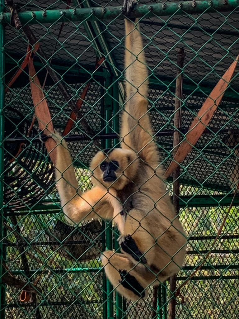
Bear and Gibbon Rescue Center
It is located just next to the visitor centre and is free to visit. However, it looks a bit creepy. The gate was open but I couldn’t see any staff member around so I just walked around. I couldn’t see any moon bears or sun bears inside but there were a few gibbons in the cages. I hope they are treated well!
Ta Lai Village
The place is located 12 km from the Visitor Center and is populated by Ma, Stieng, and Tay people. The Ma and Stieng people are the original inhabitants of the Park’s Core Zone. Here you can experience daily life in a rural community. You can come here on a bicycle following the western bank of the Dong Nai River or on a motorbike following the eastern bank.
Activities
Wild Gibbon Trek
The most famous activity in the park brought me a lot of mixed feelings. The tours are limited to 4 people per day and we started at 5 AM in the morning when a boat took us to the visitor centre where we were greeted by our guide. Then we walked to the area next to Tung Tree, where we made a short stop and then continued deeper into the jungle. Soon, we were able to hear incredibly loud sounds made by the gibbons so we followed in this direction. The whole singing spectacle lasted about 10-15 minutes and then it got quiet. We could see some gibbons eating high in the trees. After a while, we came back to the visitor centre and the tour finished. Overall, it was great to hear and see gibbons in the wild. The tour took about 2 hours and cost 1.150.000 VND. Was it worth the time? Definitely yes. Was it worth the money? Definitely not. I found the tour highly overpriced and the guides also weren’t too eager to share some information about gibbons and wildlife in general.
Gibbons were seen high in the trees
Boat ride to Ta Lai
If you like water and birds, it is recommended to take a boat trip on the Dong Nai River. The trip downstream to Tai Lai Village is a great way to see the park from the waterfront. There is not much to do in the village itself so the whole activity is rather about sightseeing from the water and not about the final destination. The round trip takes about 3 hours.
Boat on the Dong Nai RiverDong Nai River
Night Safari
Night spotting is the easiest way to see mammals. Ride in an open-air truck through the jungle to observe wild animals such as deer, wild pigs, snakes, porcupines, gaur and weasels as they forage for food on the grasslands or in bushes during the night.
Dao Tien Engangered Primate Species Center
Dao Tien Island is just 5 minutes upstream from the boat landing. The centre specializes in the rescue, rehabilitation and release of endangered primates naturally found in the area of the park: golden-cheeked gibbons, black-shanked douc, silvered langur and pygmy loris. Most of the animals who are helped at this centre were victims of the illegal wildlife trade. The local guide will explain more about their stories and the job that the centre does. At the time of my visit (April 2023), there was only one tour per day and it was at 8 AM, so you need to be at the visitor centre at around 7.45 AM.
Final thoughts
Even though the time in nature is always great, I left Cat Tien National Park with mixed feelings. In my opinion, the number one attraction called Wild Gibbon Trek is highly overpriced. Moreover, I saw rubbish all over Ben Cu Rapids and Heaven’s Rapids. I also saw many park rangers who didn’t do anything besides chilling in the hammock. Then, where does all the money earned from park attractions goes? They could just walk around ONCE A WEEK to collect the trash if there is any. But yeah, what’s the point? It’s Vietnam and no one cares anyway.
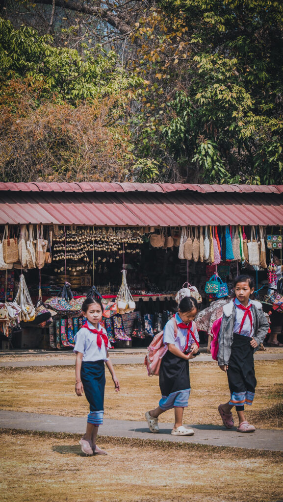
Welcome to Luang Prabang, the heart of Laos! I was visiting the city for over the week in March 2023 and at the beginning I was quite surprised that the tourist hotspot was there, and not in the capital city of Vientiane. After the first day of sightseeing, it became clear why.
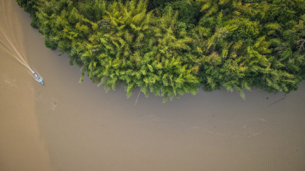
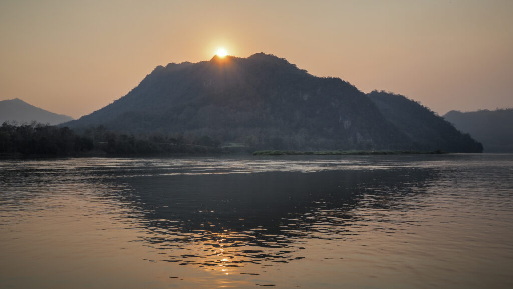
Located in the northern part of the country, at the confluence of the Mekong River and the Nam Khan River, this charming city is a vibrant mix of culture, history, and natural beauty. From its ancient temples and breathtaking mountains to its delicious cuisine and hospitable locals, Luang Prabang has a lot to offer. The city was inscribed on the UNESCO World Heritage List in 1995.
In this blog post, we’ll explore the must-see attractions and activities, as well as tips on where to stay and eat. Let’s go!
When to go?
The most popular time to visit Laos is between November and April, at least if you don’t like rain as it’s the dry season. However, nothing is as easy as it seems. You won’t get wet, but it’s the time of intense agricultural burnouts with dense haze hanging over the mountains and the air quality is regularly rated as unhealthy.
I traveled to Laos in March but next time I would go at the very beginning or at the end of the rainy season, so in October or May. Getting a bit wet is certainly better than breathing in all that air pollution!
How to get there?
Luang Prabang is probably the easiest city in the country to get to. Buses, trains, flights, or even boats, all of those are possible.
Buses
You will have no problems finding buses or mini buses going from all the other major cities to Luang Prabang. Check the latest schedule with your guesthouse or local travel agent. You may also book your ticket at 123Go.Asia.
Train
Laos-China Railway offers ticket booking for 6 stations in Laos, including Vientiane, Vang Vieng, Luang Prabang, Muang Xay, Luang Namtha, and Boten.
Flights
The airport is very very small but it operates domestic flights to Vientiane and Pakse and a few international ones to Bangkok, Chiang Mai, Hanoi, and Siem Reap.
Slow boat from Thailand
The 2-day journey costs 210.000 LAK and takes you from the Laos border town of Huay Xai all the way down to Luang Prabang. The boat stops for the night in Pakbeng so you need to book accommodation there.
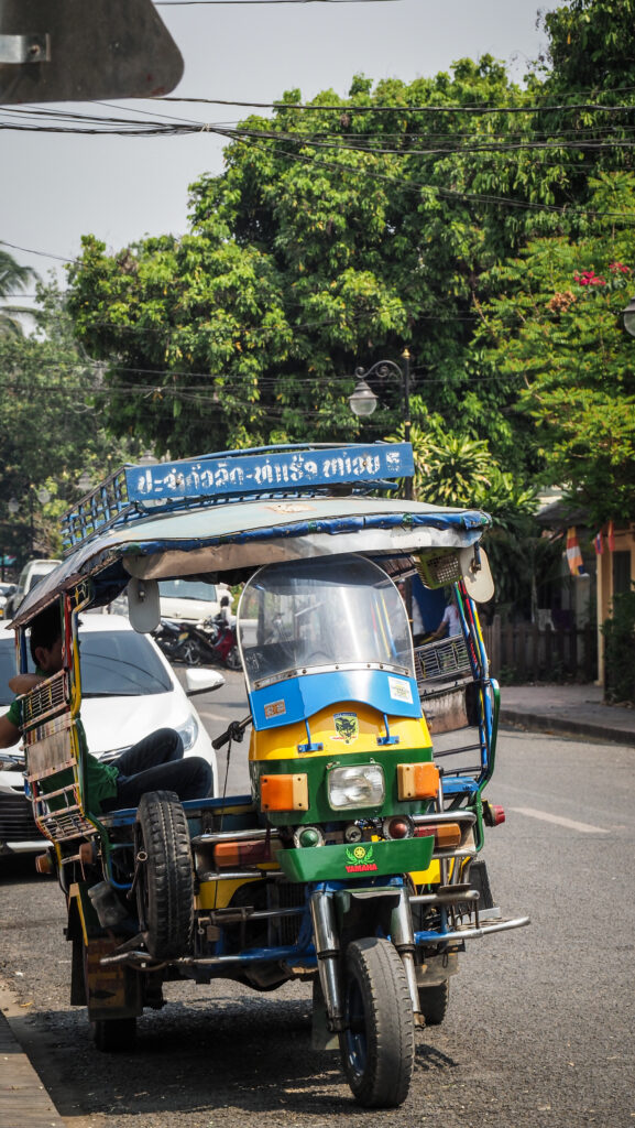
The streets of Luang Prabang
Where to stay?
I spent in Luang Prabang quite a bit of time as it was the starting and finishing point of my North East motorbike loop. During this time, I stayed in three different guesthouses.
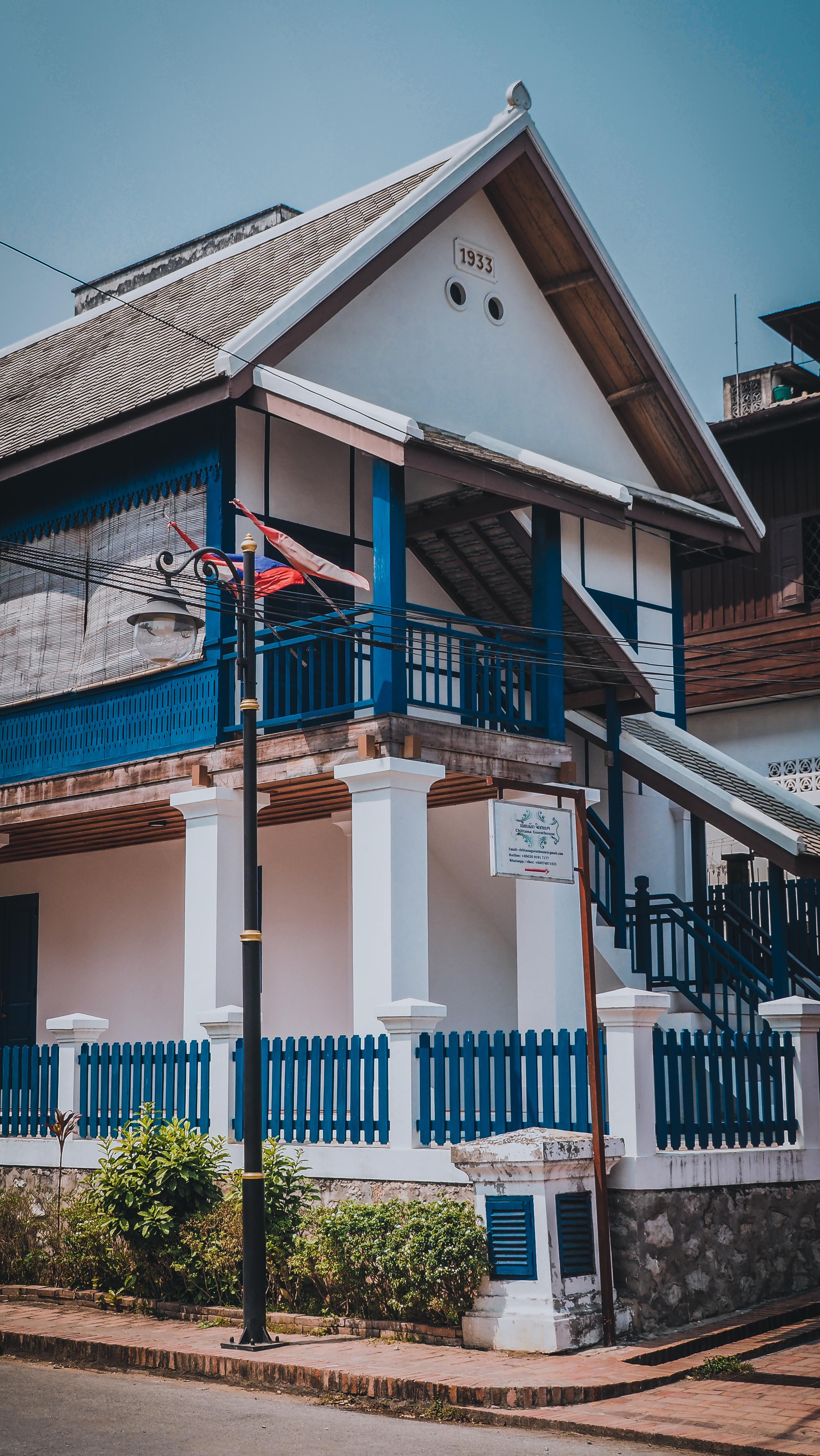
The first one was Beauty Season 1935 Hotel. Nothing too fancy but a pleasant stay. I didn’t like the entrance door to the room with a kind of wooden shutter so you can hear everything from the outside and probably people outside could hear you talking inside the room until late hours at night. Not ideal for digital nomads to have Skype calls.
The second and best one was Chaliya Boutique Garden. Comfortable room with fast internet and free bikes available for exploration of the city. The only problem was the price (25 – 30 USD per night) and I also didn’t like the fact that everything was quoted in USD and not in local currency.
The last one was PP Guesthousewhere are arrived without booking. You should get a double room for around 12 USD, including a decent breakfast. Unfortunately, during 5 days of staying there, the room was never cleaned and I had to empty the rubbish bin myself as the teenage staff was too busy with their mobile phones.
How long to stay?
There are a lot of nice things to do in and around town. I would suggest a minimum of 2 full days not only to check many temples in the historical center but also to visit Kuangsi Waterfall or even the very calm villages on the other side of the Mekong River. It’s so beautiful that there’s no point in rushing!
Where to rent a motorbike?
Most hotels and guesthouses rent themselves or can organize a motorbike for you. If you want to do it yourself, try Anousay Motorbike Rental. They are a little bit pricier but have a decent selection of bikes. This should be also your place for renting bikes for longer trips to other provinces, as not all rental companies allow doing that.
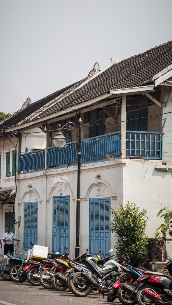
Beautiful architecture in the historic center
Temples
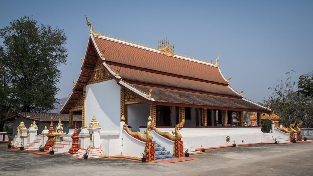
Luang Prabang is a major center of Buddhism in Southeast Asia and home to over 30 Buddhist temples and monasteries, many of which have played an important role in the spiritual and cultural development of the region. Spending a day visiting them all is a must-do experience and it really is enjoyable. One small tip from my side: wear flip-flops or sandals as you will need to take off your shoes very often!
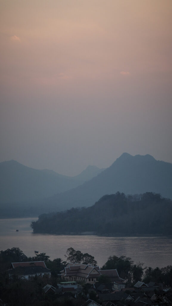
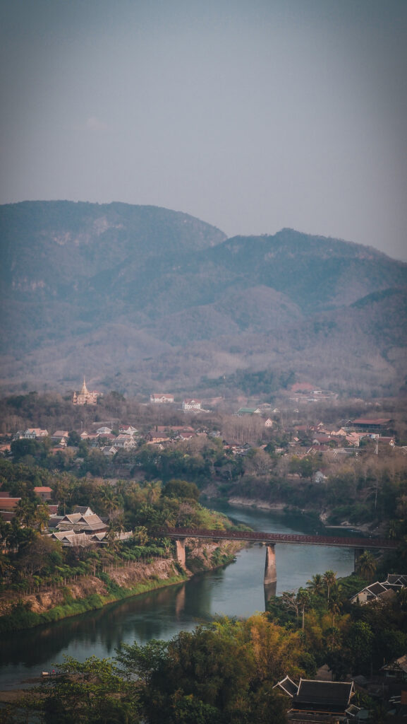
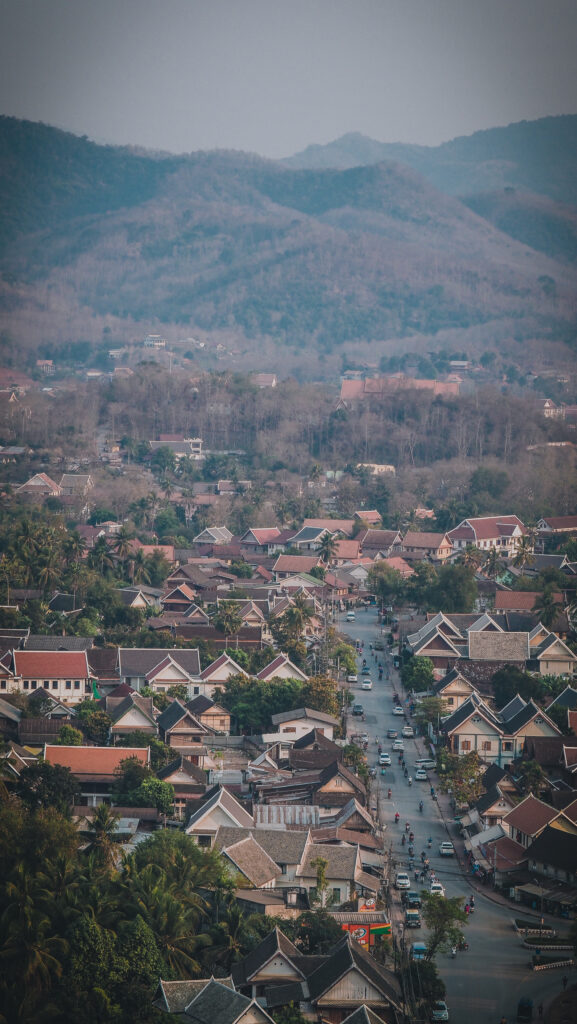
Phousi Hill
The top of the hill is a sacred site for Buddhists and contains a number of temples and shrines, including Wat Phousi, a temple dedicated to the guardian spirit of Luang Prabang. From the summit of the hill, visitors can enjoy panoramic views of the city with rivers and the surrounding mountains. If you want to take pice photos, arrive early as the place gets ridiculously busy at sunset time.
Panoramas from Phousi Hill
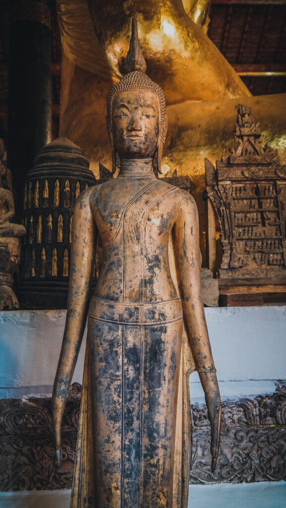
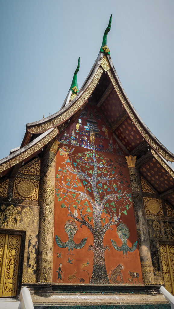
Wat Xieng Thong
This best-known temple in the town dates back to the 16th century and is renowned for its exquisite murals and architecture. There’s a stunning ‘tree of life’ mosaic set on its western exterior wall.
Other temples worth visiting
Wat Mai Suwannaphumaham
Wat Xieng Mouane
Wat Pakkhan
Wat Souvannakhili
Wat Manorom
Wat Ho Pha Bang
Wat Pa Huak
Wat Siphoutthabath
Wat Wisunarat
A temple run day in Luang Prabang is a must!Wat WisunaratInside Wat Wisunarat
Almsgiving
Almsgiving, or Tak Bat, is an important daily ritual in the city of Luang Prabang, Laos. Every morning before dawn, hundreds of orange-clad Buddhist monks descend the streets of the old city to receive alms from local people. Alms are typically given in the form of food, such as sticky rice and other offerings, which are then shared among the monks. The ritual has its roots in the Buddhist tradition of dana, or generosity, which is believed to bring merit to the giver. It is also a way for communities to show their respect and reverence for the monks.
Sakkaline Road is the most popular place for observing the activity. Just walk past the temples at around 6 AM. Many tourists want to participate in a ritual so sometimes it all turns into a circus of photographing everything and everyone. Be mindful and respectful.
Sights
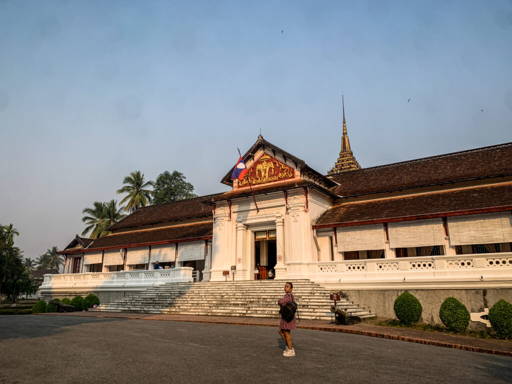
Royal Palace
It was built in 1904 by King Sisavang Vong and was the residence of the royal family for many years. Today, the palace is a national museum where visitors can explore a variety of exhibits including royal artefacts, photographs, and sculptures. The palace also contains a library with a vast collection of traditional Lao manuscripts, as well as a throne room with a magnificent throne made of carved ivory.
Royal Palace
UXO Information Center
UXO (Unexploded Ordnance) Lao is a non-profit organization in Laos that works to clear landmines, cluster munitions, and other explosive remnants of war from the country. They are also actively educating the public about the dangers of UXO, providing assistance to victims of UXO accidents, and advocating for increased international support for UXO clearance and victim assistance in Laos.
In the information centre, you can see examples of UXO but the most interesting and shocking are probably short videos shown in a small multimedia room. Similar centres can be found in Vientiane and Phonsavan.
Traditional Arts and Ethnology Centre
The museum showcases a wide variety of artefacts (musical instruments, outfits, etc.) from traditional Lao culture, with a particular focus on the ethnic minorities of the country.
Night Market
It’s a perfect place to buy beautiful souvenirs as well as get dinner. Foreign and local food is sold on the main square while purely local and delicious food can be enjoyed in the small alley just on the other side of the road. Try grilled fish, papaya salad, and a wide selection of sausages, of course together with sticky rice!
Ock Pop Tok Living Crafts Centre
Founded in 2001, it is a social enterprise that works with local Lao artisans to produce quality handmade textiles, crafts, and home décor items and by that build sustainable livelihoods. You can join hands-on workshops to learn about traditional weaving and dyeing techniques or simply visit a souvenir shop and buy something beautiful there.
Heuan Chan Heritage House
An authentic traditional longhouse on tree-trunk stilts that acts as a small museum on the lifestyle of Luang Prabang, a cafe, and a handicraft centre.
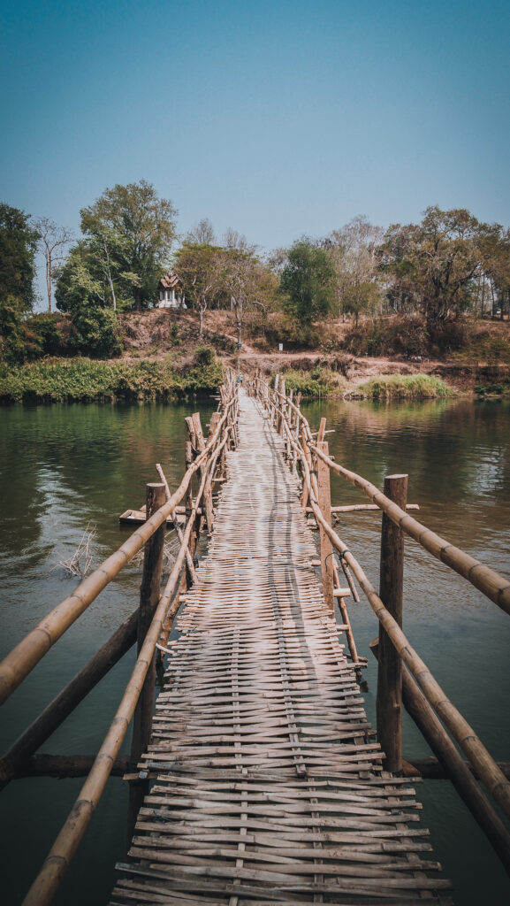
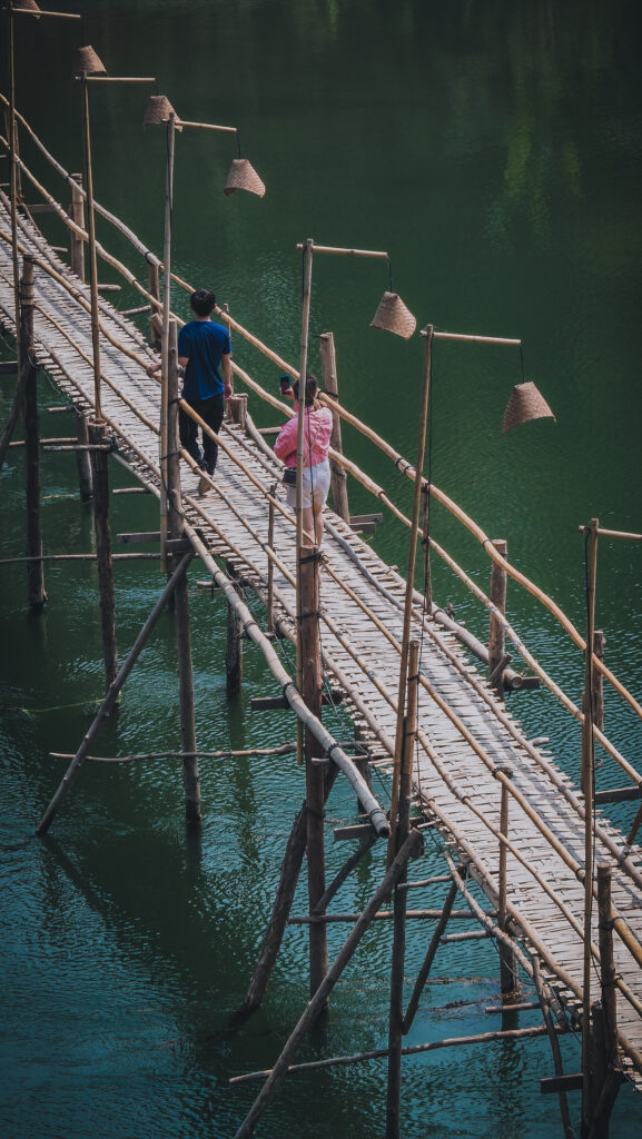
Across the Nam Khan River
When the water level is low in the dry season, the Nam Khan River can be crossed over a bamboo bridge. It is an experience in itself. It’s best to do it in the late afternoon, around sunset time. On the other bank, check out Wat Xiengleck and relax at the Sunset Viewpoint.
Rivers and bamboo bridgesWat XiengleckWat Xiengleck
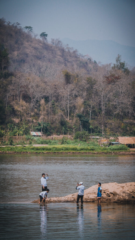
Across the Mekong River
The public ferry can be found behind the Royal Palace. On the other side of the river, there is a series of nice and quiet monasteries: Wat Xiang Maen, Wat Chomphet, Wat Long Koon, Wat Tham Sakkalin, Wat Had Siaw, Wat Nong Sa Keo, Wat Khokphap. Bicycles and motorbikes can be taken to the ferry but the area is perfectly walkable too.
Activities
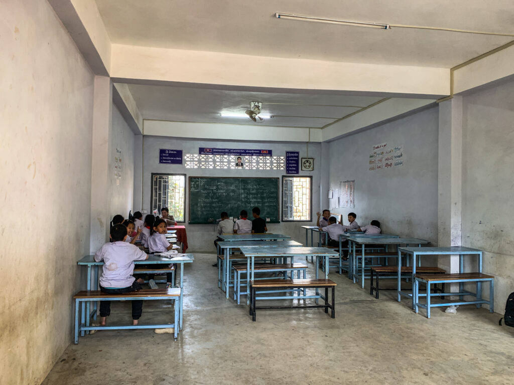
Big Brother Mouse
Big Brother Mouse is a non-profit organization in Luang Prabang, Laos that provides children in rural villages with access to books, education, and literacy programs. You can join one of their 2 hours conversation session with local students to help them learn English and familiarize yourself with Lao culture in the best possible way. There is also an option of full-day volunteering at school from Monday to Friday.
Inside the school in Luang Prabang
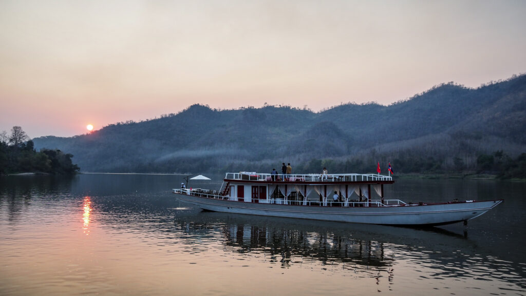
Mekong Sunset Cruise
One afternoon I decided to go on Khopfa Mekong Cruise. A very nice and relaxing cruise on a two-floor boat with sitting areas, resting chairs, hammocks, good relaxing music, a bar, and an option to order food. The trip lasts for 2 hours and starts between 4.15 PM and 5.30 PM depending on the season and the sunset time. The ticket costs 15 USD (~260.000 LAK).
One of many boats on the Mekong RiverGreat to see the sunset from the water perspective
Cooking classes
Bamboo Tree RestaurantandTamarind Restaurant are just next door and both offer hands-on lessons in preparing traditional Lao dishes. Learn everything from how to buy ingredients in the local markets to the basics of Lao cuisine.
Trekking
A trekking itinerary in Luang Prabang may include a visit to the Kuang Si Waterfall, a visit to the hill tribe villages in the mountains, and a trip to some of the local caves. Trekking can be done either on foot or by bike and there are many different routes to choose from. Get in touch with Tiger Trail Travel or Discover Laos Todayand ask for details.
Outside of town
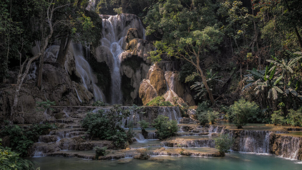
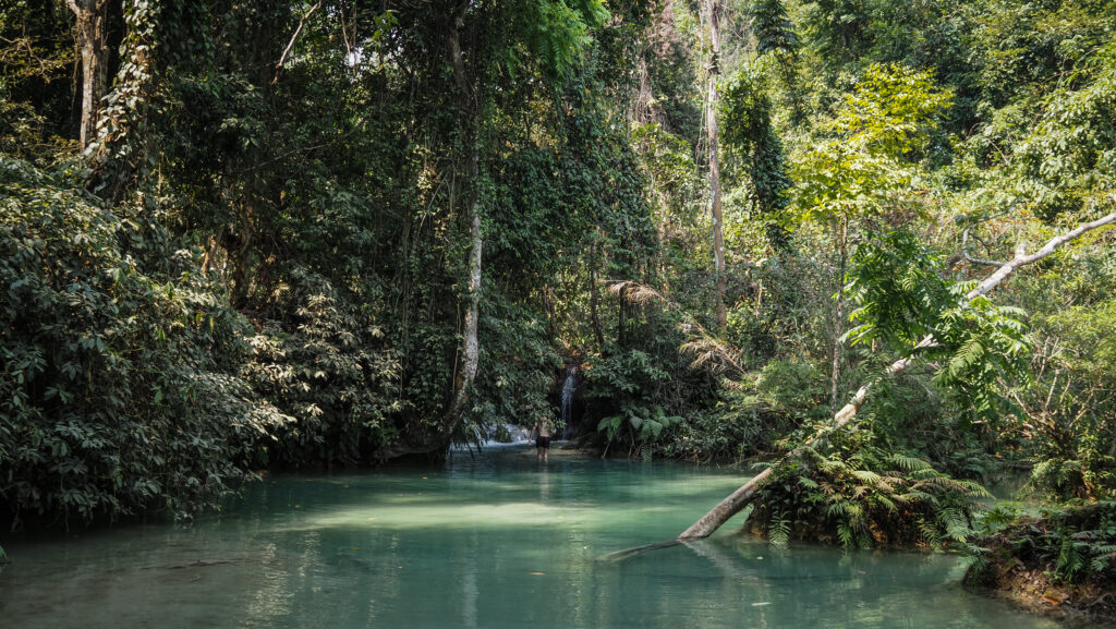
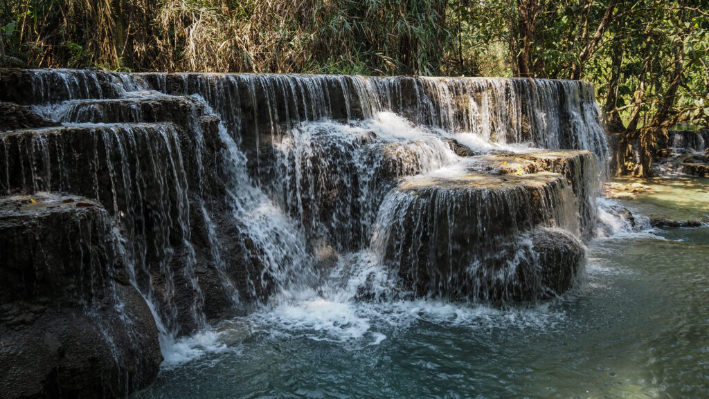
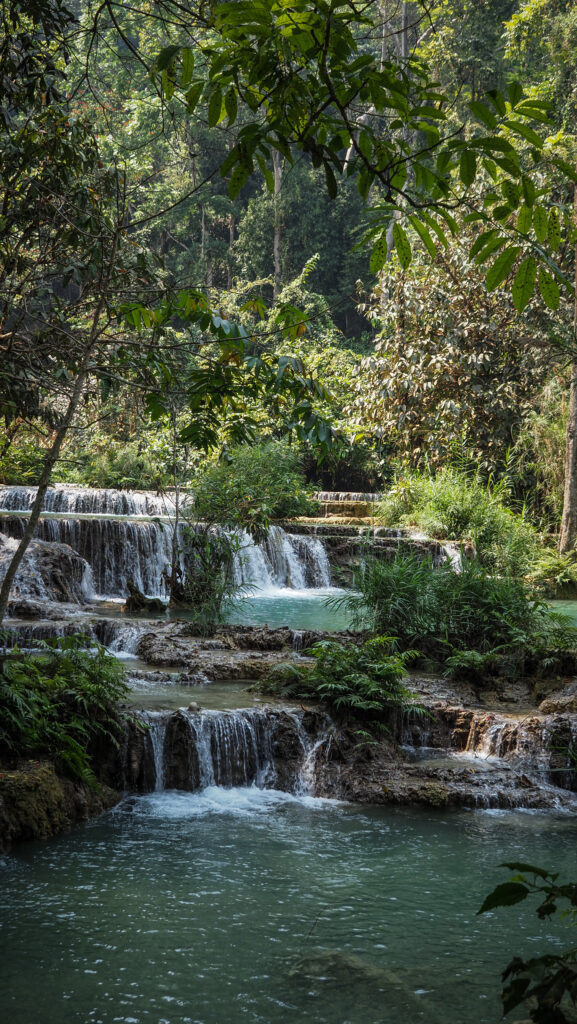
Kuang Si Waterfalls
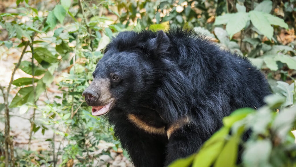
One of the most beautiful waterfalls in South East Asia. The water cascades down a series of limestone tiers and creates stunning pools of turquoise-blue water. You can’t swim in the main pool but at the other ones down the stream. The 1.5km trail leads to the top of the falls where you can take a wooden raft to the water source. It’s a nice hike but the raft experience was a slight waste of time though :)The area is also home to Asian Black Bear Rescue Centre and Butterfly Park. The ticket costs 25.000 LAK and the electric car takes you to the entrance to the nature area.
Spectacular Kuang Si WaterfallPlenty of great swimming optionsAnd another falls down the stream Asian Black Bear in the nearby rescue centre The nature around Kuang Si Waterfall
Tat Sae Waterfall
Absolutely don’t come here in the dry season as there is nothing to see. From the parking area, you need to take a boat to the waterfall but the guys sell tickets not even mentioning that there is no water. Total waste of time!
The Living Land Company
Definitely one of the most memorable experienceson my trip to Laos. You will learn the traditional method of growing, harvesting, and preparing rice from end to end. It involves getting dirty and I loved it! The staff is very friendly, speaks good English and will be happy to take photos of you.
The tour without lunch costs 30 USD and with lunch 40 USD. It’s well worth it! They can pick you up at your hotel or provide a discount if you decide to come by yourself.
Now I know everything about rice!
Nahm Dong Park
They offer activities like zip-lining and tree-top guided walks. Moreover, there’s a large area with options for hiking through the forest and swimming in secluded waterfall pools. The road leading towards the park is in quite bad condition so be careful.
Laos Buffalo Dairy
You can join quite a pricey guided tour (about 8 USD) to be able to pet and learn about pigs, rabbits, buffalo, and goats as well as try buffalo dairy products. If you don’t want to join the tour, they sell ice cream by the roadside, but the taste was nothing special.
Pak Ou Caves
The Pak Ou Caves are located along the Mekong River about 25 km upstream of Luang Prabang. You can reach them by a scenic two-hour boat trip or by road and then take a short boat ride to the other bank. The caves are filled with thousands of gold lacquered Buddha statues of various shapes and sizes that have been placed there over the centuries. I would say that the area and the way to the caves are more interesting than the caves themselves.
The small town near the Laos border was a scene of the famous Battle of Dien Bien Phu fought between the French and the Viet Minh. It began in March 1954 and ended almost two months later in May, with the French losing their final battle and Vietnam becoming a free country. It also turned out to be the beginning of the end of French colonialism.
The French began an operation to place their soldiers at Dien Bien Phu, up in the hills northwest of Tonkin, close to the border with Laos. The purpose was to cut off Viet Minh supply lines into that country and draw the Viet Minh into a major confrontation in order to defeat them. However, it was not Viet Minh who ended up defeated.
Under the leadership of General Vo Nguyen Giap, Viet Minh surrounded and besieged the French. The key to success seemed to be the ability to move bulky weapons through difficult terrain by individual men and women up the rear slopes of the mountains. They dug tunnels through the mountains and arranged the guns to target the French position. It all surprised their opponents and the French garrison was overrun in May after a two-month siege. Most of the foreign forces surrendered.
In 1954 the Geneva Accords were signed. France agreed to withdraw its forces from all its colonies in French Indochina and Vietnam was divided at the 17th parallel, with control of the north given to the Viet Minh as the Democratic Republic of Vietnam under the leadership of Ho Chi Minh, and the south becoming the State of Vietnam, under Emperor Bao Dai. It was to prevent Ho Chi Minh from gaining control of the entire country.
When to go?
In theory, the best time to visit Dien Bien Phu is in spring or early summer so from April to June. I visited at the beginning of April and even though the temperature was pleasant, the air pollution from agriculture burnouts made the whole experience horrible. The visibility was extremely low. I don’t know if every year is the same, but you may consider doing your health a favour and coming in May or June instead.
Keep in mind that there is Victory Day on May 7th and there will certainly be a lot of visitors coming over. Book your accommodation well ahead if you plan to visit on that occasion.
How to get there?
Dien Bien Phu is located in the northwest of Vietnam, near the border with Laos. There is an airport with infrequent flights from Hanoi. For bus connection check 12Go.Asia.
Where to stay?
I spent a night at Guesthouse 51.It’s an okayish place for one night but for 7 EUR (180.000 VND) don’t expect too much luxury. Definitely, some more cleaning could have been done.
How long to stay?
You can walk around the town in half a day. I arrived in the afternoon and left in the late morning on the next day. If you want to visit some sights outside of the town (such as Dien Bien Phu Campaign Command Headquarters), rent a motorbike and stay a full day.
What to see
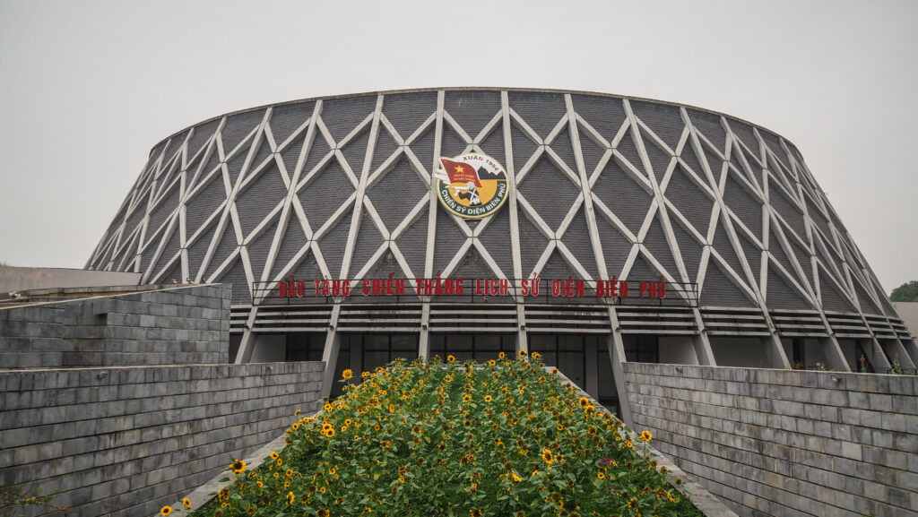
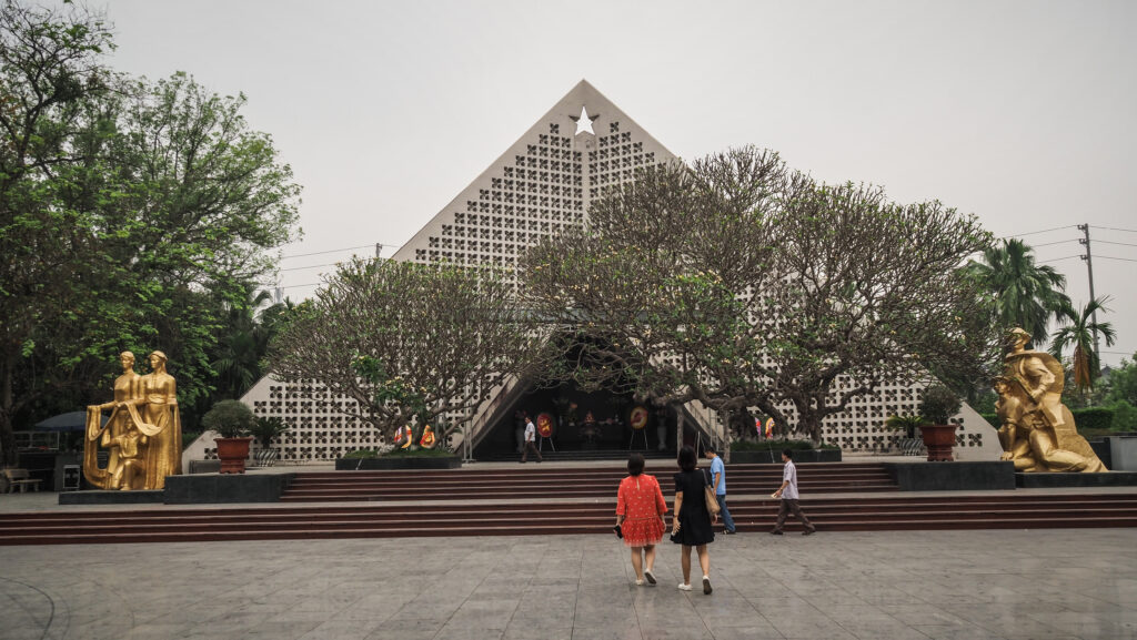
Dien Bien Phu Museum
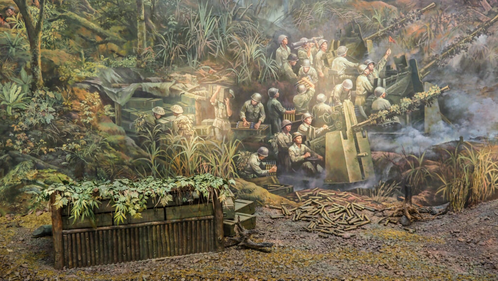
It was opened in 1984 to celebrate the 30th anniversary of the battle of Dien Bien Phu. The exhibition is quite big but most of the information is in Vietnamese. You may only find short English descriptions under the photographs. There is an interesting panorama painting on the top floor, which is 132m long, 20.5m high, and 42m in diameter. 4,500 characters are included in the painting which was done by nearly 100 painters. The process took nearly 3 years, from November 2019 to May 2022.
Museum building from the outsideA part of panorama painting……and one more
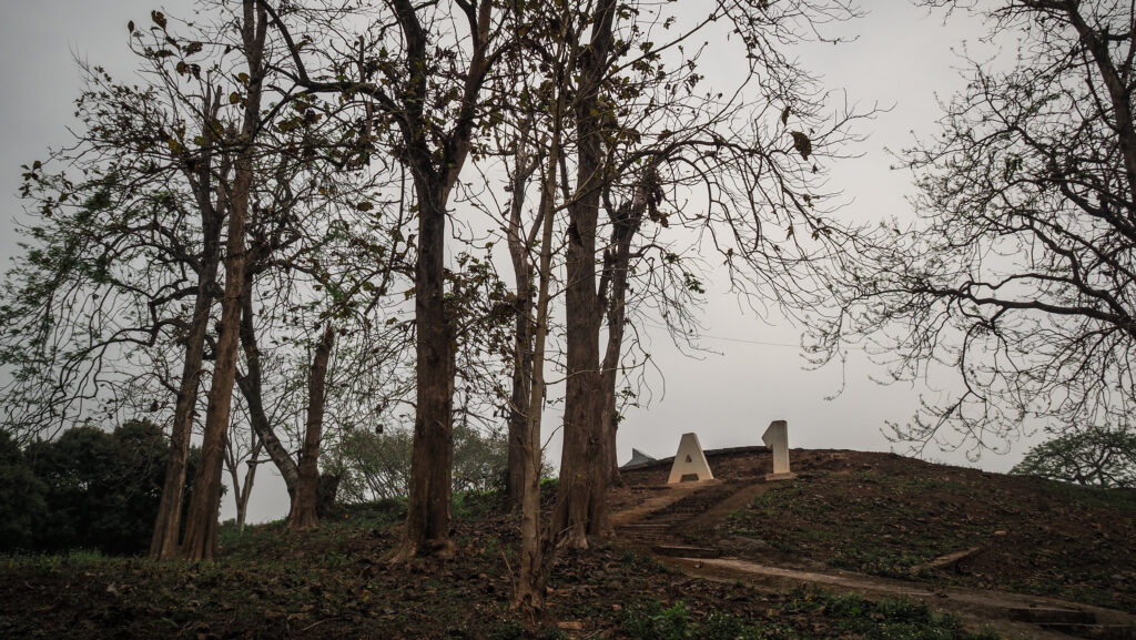
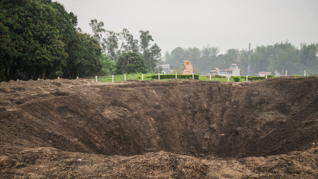
A1 Hill
It was the last of the French strong points, also known as Eliane, to fall to Viet Minh. I found this place to be the most interesting. You can see some trenches, bunkers, tanks, bomb craters, and pillboxes but there is no English explanation. Entry ticket: 20.000 VND.
On the way to the top of A1 hillBomb crater at A1 hill
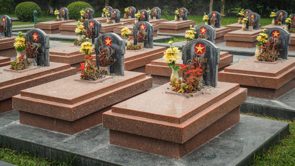
Cemetery
Located just opposite the museum, this small cemetery is the final resting place of the Vietnamese soldiers, who died in the battle of Dien Bien Phu. The identities of most of them are unknown.
The memorial site at the cemeteryGraves of soldiers who died in the Battle of Dien Bien Phu
Victory Monument
A huge bronze sculpture honours those who fought and lost their lives in the Battle of Dien Bien Phu. It sits at the top of the hill and can be accessed by road from the back or on foot by climbing the high staircase with nice views over the city. Entry ticket: 20.000 VND.
Bunker of Colonel de Castries
Colonel de Castries was in charge of the seven French posts at Dien Bien Phu and was captured at this bunker on 7th May 1954. Entry ticket: 20.000 VND and the visit won’t take longer than a few minutes.
Bunker of Colonel de CastriesInside the bunker
French War Memorial
A nearly unnoticeable French War Memorial was erected on the 30th anniversary of the battle and commemorates the 3000 French troops buried under the rice paddies. It is just south of the de Castries bunker but the entrance gate was closed on the day of my visit.
Muong Thanh Bridge
The old Muong Thanh Bridge across the Nam Ron River was erected by the French. It is 40 meters long and 5 meters wide. Today it is closed to cars but motorbikes can still go over it.
Market
The busiest area of the town is located just nearby Moung Thanh Bridge, on the east bank of the Rom River. Great spot for photography and observing local minority groups. You may notice a lot of women with buns on top of their heads. Those are representatives of the Black Thai ethnic group who mainly live in the provinces of Hoa Binh, Lai Chau, Dien Bien, Son La, Lao Cai, Yen Bai, Thanh Hoa, and Nghe An. Married women do their hair in a bun style while unmarried ones do not tie their hair into a bun but wear an elaborately embroidered scarf.
OLYMPUS DIGITAL CAMERABusy Saturday morning at the local market
Other interesting places in the area
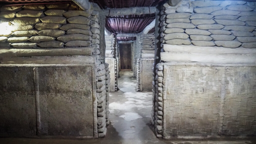
Dien Bien Phu Campaign Command Headquarters
The site hosts a series of underground rooms hidden in the forest where General Vo Nguyen Giap had his headquarters, made a plan, and commanded the attacks against the French. Very interesting site and it’s fun to walk inside the tunnels. The drive from Dien Bien Phu takes about 40 minutes. Entry is free of charge.
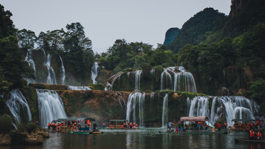
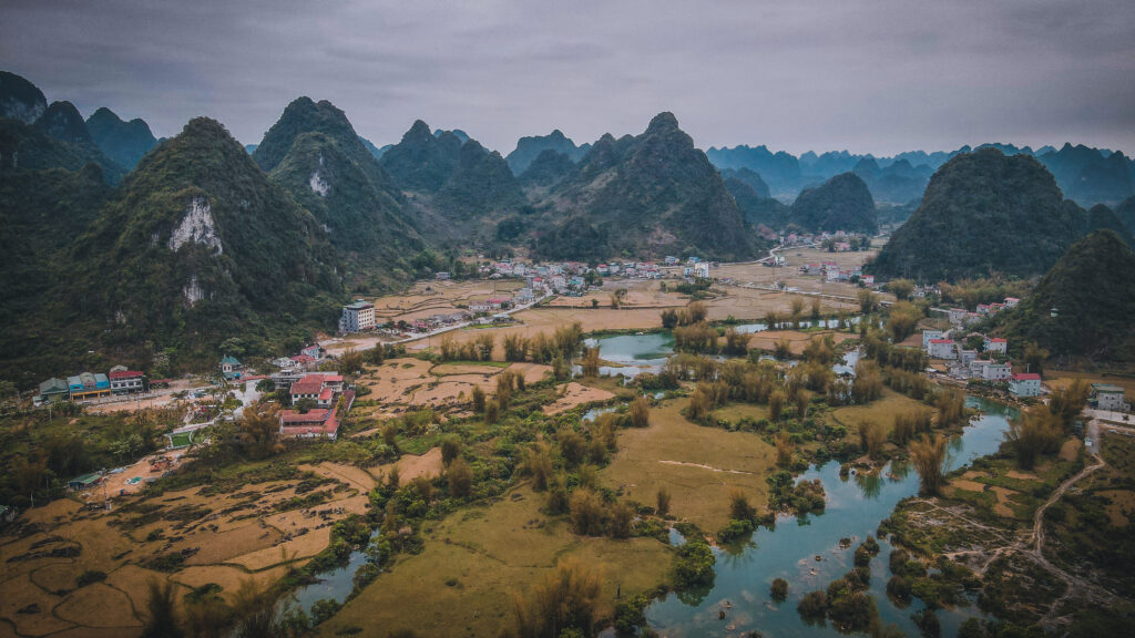
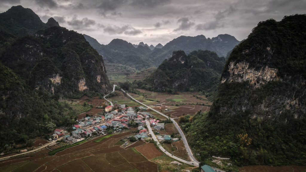
The Ban Gioc is undoubtedly the largest and most beautiful waterfall in Vietnam. It is 30 meters high and 300 meters wide with the water flowing from 3 levels. It is fed by the Quay Son River and is part of the Cao Bang Non-Nuoc Geopark, a UNESCO World Heritage Site.
The location is directly on the border of Vietnam and China, so you can see Vietnamese tourists on one side of the falls, and Chinese on the other. They both take rafts to get closer to the massive main falls of Bang Gioc. On the Vietnamese side, some other small waterfalls can be admired to the left of their big brother.
I visited Ban Gioc in March 2023, approaching on a motorbike from the town of Cao Bang, which is on the Vietnamese side and the post describes that experience.
The visit to Ban Gioc is another example when the destination itself wasn’t the only beautiful thing to see. The whole ride there, through the countryside filled with karsts, observing local minorities doing their daily work, was simply mindblowing.
The people of the Cao Bang region
Costs
At the moment of writing this article, the ticket to Ban Gioc Waterfall costs 40,000 VND per person. Motorbike parking is an additional 10,000 VND and going on a raft is 50,000 VND.
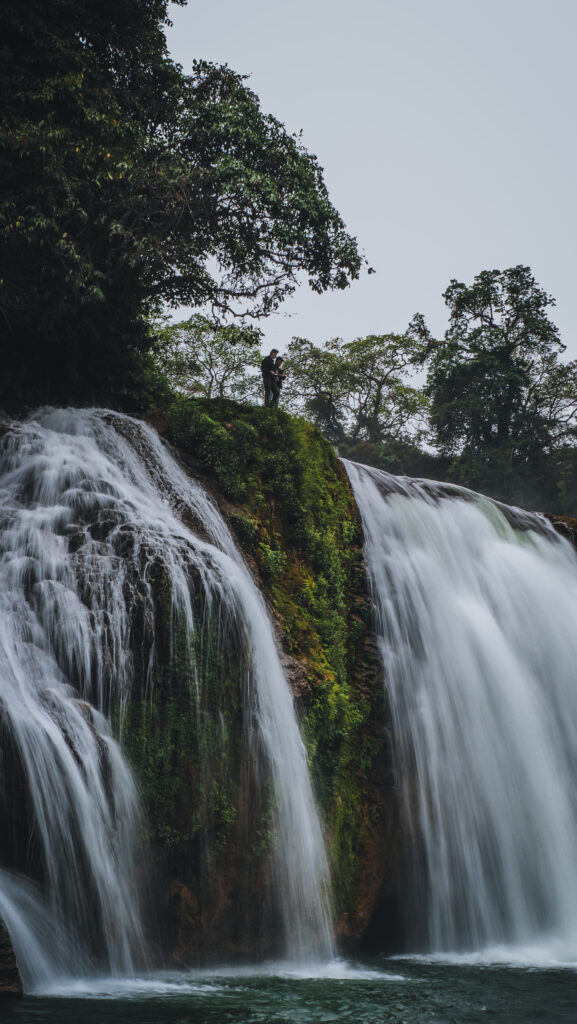
Rafts
If you want to get closer to the falls, it can be done on the raft. The journey takes around 10-15 minutes and costs 50,000 VND. You will get the chance to take nice photos from different angles than those on the land plus you will feel the power of the falling water even more.
Rafts everywhere!
When to go?
The waterfall can be visited at any time of the year, but depending on the season, it can be more or less impressive. The good point is that it never dries up.
The wet season in the Cao Bang region lasts from June to September and the dry season from October to May. The wet season obviously means more water and more breathtaking views. However, the water gets a dark brown colour and you won’t be able to get too close on the rafts, at least if you plan to stay dry.
I visited at the end of March and Ban Gioc looked wonderful, even though the weather was cloudy and quite cold. The additional benefit was that it wasn’t as busy as it usually gets in high season. I was perfectly satisfied with my visit.
To sum up, don’t be discouraged to visit Ban Gioc in the dry season. It is a magnificent place and you will certainly like it. If you want to see the falls at their best, plan your trip at the end of the rainy season, around August and September.
Top-down shot of Ban Gioc
How to get there?
Most people use Cao Bang as a base for a trip to Bang Gioc, and so did I. From there, you have three options: renting a motorbike, taking a public bus, or arranging a taxi. You may also think of joining an organized tour from Hanoi, which usually covers Ba Be Lake and other interesting sights en route.
The pure beauty of the waterfalls
Motorbike
It has always been my preferable way of travelling in Asia. There are a few decent rental places such as Green Riders House. Alternatively, you can ask for a bike in your hotel or homestay and certainly, they will help you to arrange one. Motorbike will give you the possibility to visit not only Ban Gioc Waterfall but also other attractions in the region, such as Núi Mắt Thần Mountain.
Bus
The minibus goes directly to the falls and costs 70,000 VND for the two-hour trip. It leaves frequently but I suggest asking about the current schedule at your accommodation.
Taxi
It only makes sense if you travel in a bigger group. Always negotiate with the driver and ask at your accommodation what’s the appropriate price.
Where to stay?
I spent a night at GiaBinh Homestay in Cao Bang and it was easily one of the best homestays during my 5-month Vietnamese road trip. The room was clean, spacious, and nicely decorated. The host immediately made me feel at home and shared some useful tips about my next destination.
If you don’t want to stay in Cao Bang, there are also nice homestays in stone houses in the village not far from Ban Gioc Waterfall.
Locals hanging out around the waterfall
How long to stay?
Ban Gioc Waterfall and other attractions in that area can be easily discovered during a 1-day trip, especially if you travel on a motorbike. It’s also doable by bus but probably you need to limit the trip to the waterfall and nearby cave only.
Other interesting places in the area
I recommend making use of your day and doing a loop in that area. Start in Cao Bang and follow the road QL3 and then DT206 all the way to Ban Gioc. Then visit Truc Lam Phat Tich Pagoda and the Tiger Cave. After that head back on the road DT206 until Trung Khanh, where you take a turn off to the road DT211 leading towards Nui Mat Than Mountain and Thang Hen Lake. In the end, join back the road DT205 and then QL3 bringing you back to Cao Bang.
The itinerary can be easily done on a motorbike but you need to start early. If you travel by bus, probably you need to limit yourself to Ban Gioc, Truc Lam Phat Tich Pagoda, and the Tiger Cave which are all in the same region.
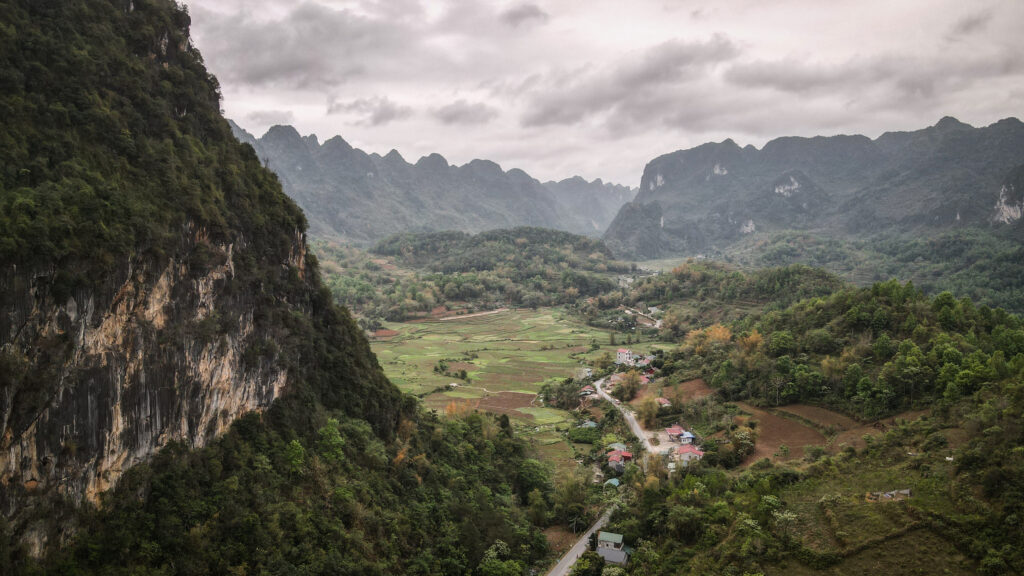
Landscapes of Cao Bang region
Truc Lam Phat Tich Pagoda
The temple was built on the top of the mountain opposite the waterfall, from where you can admire the beautiful panoramic view of Ban Gioc. It’s about15 minutes uphill walk.
Tiger Cave / Nguom Ngao Cave
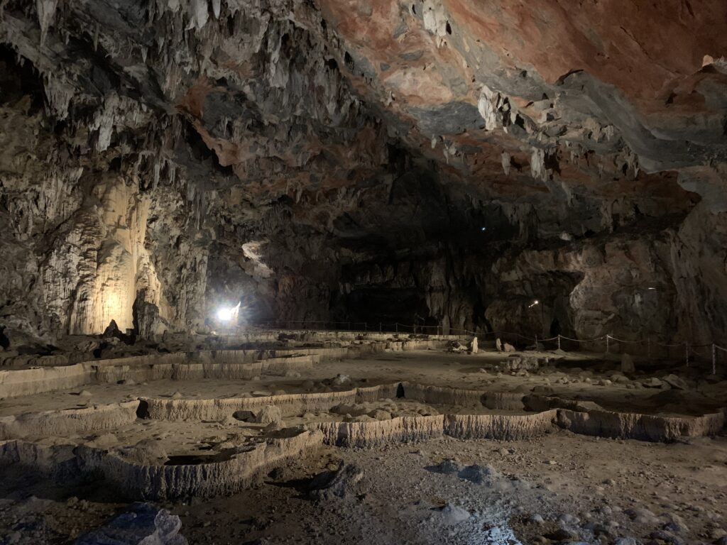
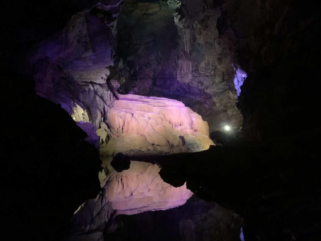
The cave is located about 4km from Ban Gioc Waterfall, so can be easily visited even without a motorbike. It was created by an underground river and was previously used as shelter during the war with China in 1979. Today visitors have two options for the visit: a shorter one which takes about half an hour and costs 45.000 VND and a longer one, which takes about 1,5 hours and costs 195.000 VND. If you choose the longer one, the guide will accompany you and you will be provided with a headlamp, water shoes, and a reflective vest. The cave is wonderfully lit and after visiting the caves in Phong Nha, Tiger Cave or Nguom Ngao Cave was my second favourite in Vietnam.
Inside the TIger Cave
Nui Mat Than / Angel Eye Mountain
The mountain is truly a hidden paradise. To get there, put Cao Bang Camping in your navigation. The narrow road through the village becomes a dirt road, leading down into an amazing valley. This mountain is also called the Angel Eye mountain, due to the huge hole near its top. There is a small waterfall to the right of the plain and camping is available. Must be an amazing experience, especially with the sky full of stars! In the rainy season, the lake is created in the central area of the valley, probably making it even more photogenic.
Thang Hen Lake
Located right next to Nui Mat Than Mountain. You can take a boat trip or simply sit down and relax by the water’s edge observing nearby mountains that are being reflected in the lake.
Cao Bang
Small and calm city, without major tourist attractions but pleasant to walk around. It’s mostly an overnight stopover for most of the people heading to Ban Gioc Waterfall.
Pho Kim Dong Street is the place where locals hang out in the evenings and where you will find tasty street food. It’s also nice to stroll around the riverside of Song Bang.
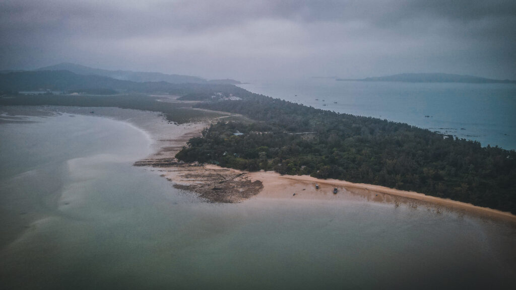
Northern Vietnam is famous for its capital Hanoi, mountainous areas, and incredible Ha Long Bay. However, if you are looking for a place with sandy beaches and relatively clean seawater to relax far away from tourism madness, Co To Island in Quang Ninh province could be a smart choice. You can be sure, that there won’t be many other foreigners besides you, if any!
When to go?
Even though the island is reachable for the whole year, I strongly recommend going during the summer and autumn months, meaning from April to August. The temperature is about 30oC and the visibility should be fine. It’s also the best time to enjoy beaches and swim in the sea.
I was on Co To Island in late March. The temperature was pleasant but the sky was constantly cloudy so even nearby islands weren’t perfectly visible.
Morning hours are the best for photography!
How to get there?
Slow boats and speed boats depart from Cai Rong Port. The slow boat costs 100.000 VND and takes between 3 – 4 hours. Speed boat costs 250.000 VND and takes between 1,5 – 2 hours. The schedule may vary depending on the month that you will be traveling.
I arrived at Cai Rong Port around 11:30 AM and was lucky to get into the slow boat at 12:00 PM. The boat was packed with people and packages and wooden benches were super uncomfortable to sit on but it was still quite doable. I mean, it’s 100.000 VND, so don’t expect luxury. At least I had the possibility to stand at the back of the boat, taking in the magnificent scenery en route. The trip was mostly smooth but the waves got bigger in the open sea section between Quan Lan Island and Co To Island. The ticket fee is collected when arriving at Co To Island.
Flying over Co To Island
I took the speed boat back to the mainland and it involved some drama. There were two boats on that day: 8:00 AM and 4:00 PM. I really wanted to get the morning one to have enough time to ride the bike to Lang Son. I thought that similar to a slow boat, the tickets can be purchased on board. Instead, I was told to go to the ticket office which was at the entrance to the pier. I had only 15 minutes left before the departure and then it came up that all the tickets were sold out. The sales lady was really fighting hard with the captain to push me in the boat but she failed, and I had to stay on the island for a few more hours, leaving at 4:00 PM.
The speed boat was comfortable but it didn’t give the chance to get out on the deck and the scenery could be enjoyed only through the window.
Unfortunately, the skies weren’t clearRocks around Van Chai Beach
Where to stay?
I arrived without a reservation at Hung Phoung Hoteland took a private room for 350.000 VND after some negotiating. They also organized a motorbike for another 150.000 VND. The room was clean, WiFi was good and the view from the window was pleasant, but the bed was one of the hardest I experienced during the trip to Vietnam.
How long to stay?
One full day should be enough to ride a bike around the island and chill here and there. You may want to stay one more night in summer when the weather is perfect and the skies are clear. Then, you will get the chance to discover nearby islands too.
Tinh Yeu Beach
How to get around?
The best is to rent a motorbike from your hotel. It cost me 150.000 VND per day. If you travel in a bigger group, most of the hotels have or can arrange electric vehicles with a driver.
Interesting sights
Cau May Cliffs
Definitely the most beautiful place on the island, especially during sunrise or sunset hours. There are small paths around the edges of the cliffs. Very photogenic place and a lot of people come here dressed nicely for photo sessions.
What a cliffs!The most beautiful place on Co To Island
Beaches
There are 3 main beaches: Tinh Yeu Beach, Hong Van Beach, and Van Chai Beach. Unfortunately, all of them have problems with rubbish, especially plastic. Van Chai Beach seemed to be the cleanest one, while Hong Ban Beach provides nice views of the opposite islands.
Hong Van BeachAerial view to Van Chai BeachVan Chai Beach
Lighthouse
The lighthouse was built in the late 19th century and is located on top of a mountain, 100 m above sea level. It can be reached on a motorbike, following a narrow road that climbs through dense forest. The lighthouse tower itself can’t be climbed, but there is an observation deck on the top of the nearby building. The panorama is magnificent! Entrance fee: 10.00 VND.
Truong Xuan Lagoon
It’s not easy to get a proper look at the lagoon but if you follow the road along Hong Van Beach until the end, there will be a small resort. It was empty when I arrived, so I could freely walk around to enjoy the view. Alternatively, you may check out the view from Thanh Lan Pier or the Lighthouse Viewpoint.
Truong Xuan Lagoon
Nearby Islands
You can also arrange a boat at your hotel and go for a trip to other islands around, such as Co To Con Island or Thanh Lan Island. There is not much more to do than relax on the beach and swim but that’s the point.
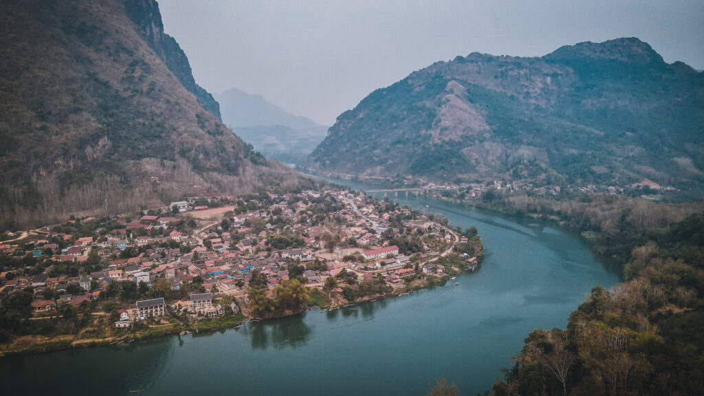
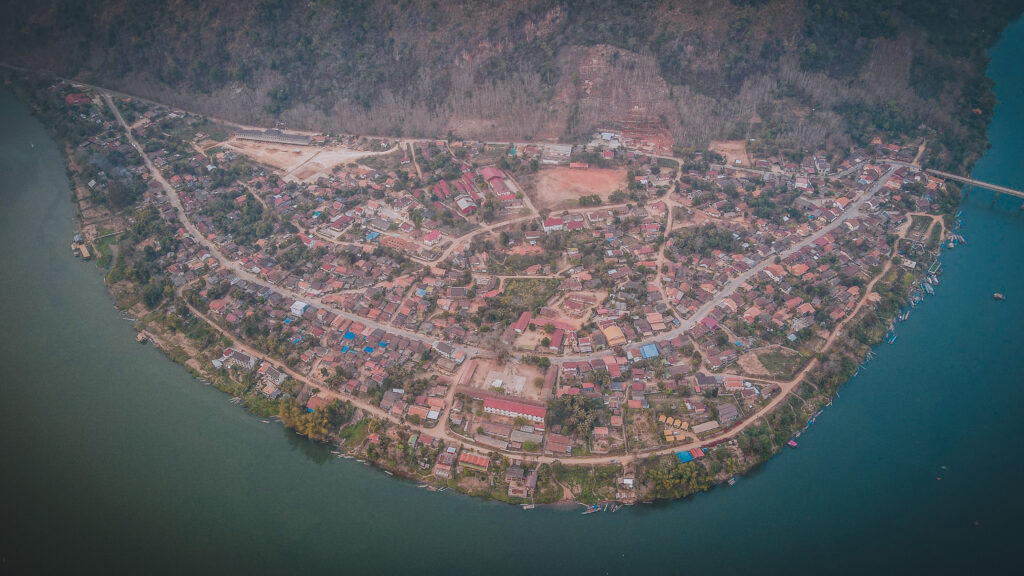
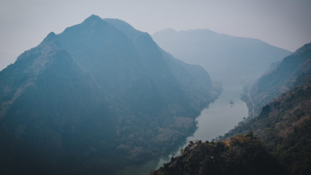
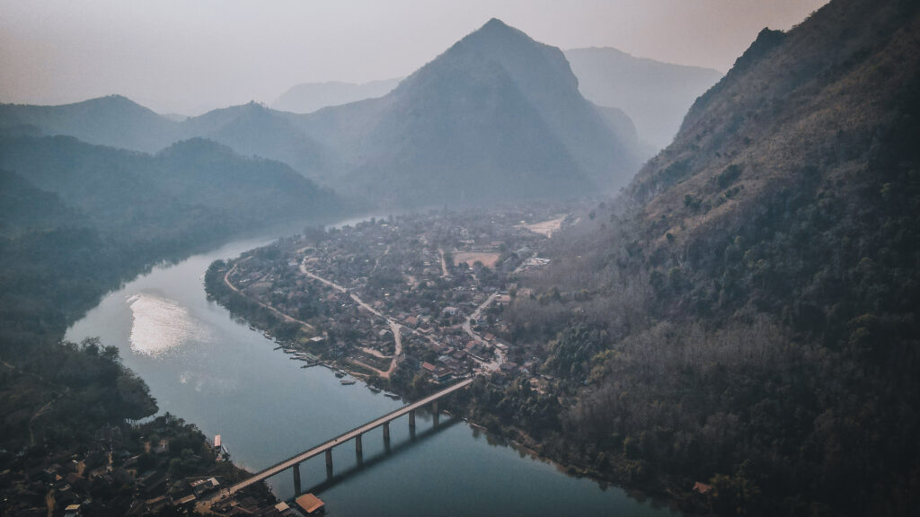
A small village located on the west bank of the Nam Ou River attracts more and more tourists who want to experience rural life. Narrow footpaths ascend steep limestone cliffs to provide you with panoramic views. There are also caves and fantastic multiple-day hiking opportunities to even smaller villages, with an overnight at the atmospheric homestay.
When to go?
The best time to visit Laos is between November and April, as it’s the dry season. However, try to avoid February and March if possible. It doesn’t rain, but it’s the time of intense agricultural burnouts with dense haze hanging over the mountains and the air quality is regularly rated as unhealthy.
How to get there?
From Luang Prabang to Nong Khiaw it’s a bit over 140 km and you will need to get a bus to get there. There are many travel agents on the streets of Luang Prabang or simply ask in your hotel and they will set you up. Expect a travel time of about 3.5 – 4 hours and an approximate cost of 200,000 LAK. For bus connections, you may also check 12Go.Asia.
You can also get there by boat from Muang Khua, which must be a memorable experience. A shared boat with other passengers should cost about 150.000 LAK.
Nong Khiaw can be reached by boat from Muang Khua
Where to stay?
I stayed two first nights at Nam Ou Riverlodge, which is nicely located just at the riverside. The bed was comfortable and there was a mosquito net which I always appreciate 🙂 The hot shower was fine, though the pressure was quite weak. The room costs about 220.000 LAK per night. The owner also organizes all kinds of tours, so if you want to do a hike, you won’t have to look any further.
Once I was passing by Nong Khiaw for the second time, they didn’t have an available room so I stayed at Arthith Guesthouse. The views from the terrace were even better, and the room was clean and cozy. It was slightly more expensive than Nam Ou Riverlodge (300.000 LAK) but a delicious breakfast was included in the price.
You may notice that there are not many accommodation options available on booking.com or agoda.com. It’s pretty normal in Laos and it’s not because all the rooms are booked out. The owners simply don’t care about advertising in this way. To get the best deal, check the reviews of guesthouses or hotels on Google Maps, choose a few that you like, and then visit them asking about the room and the price.
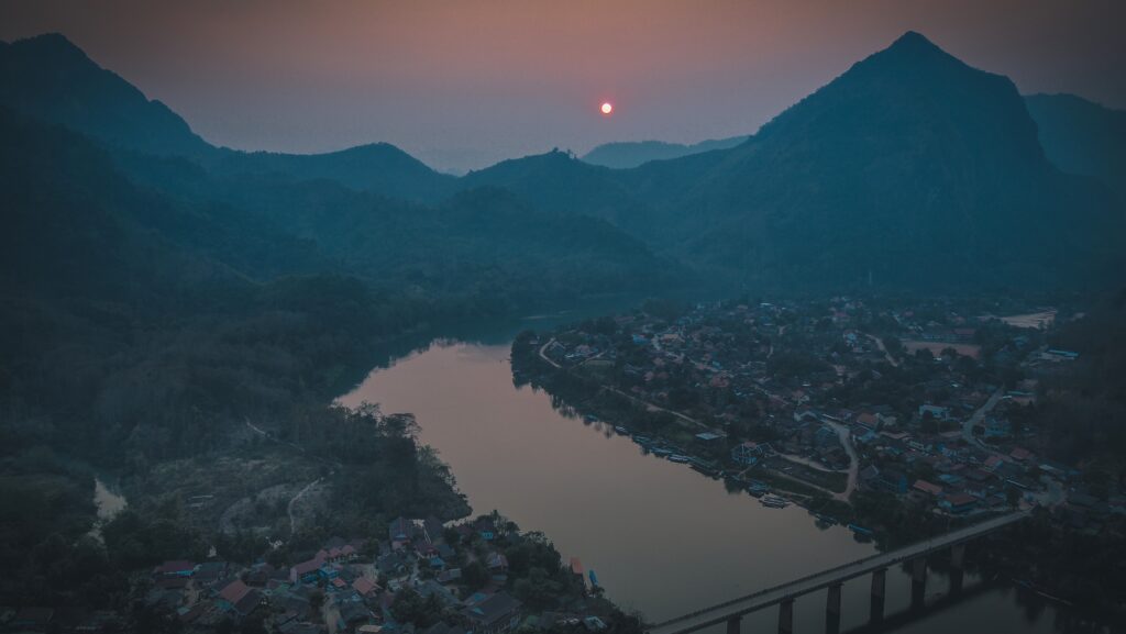
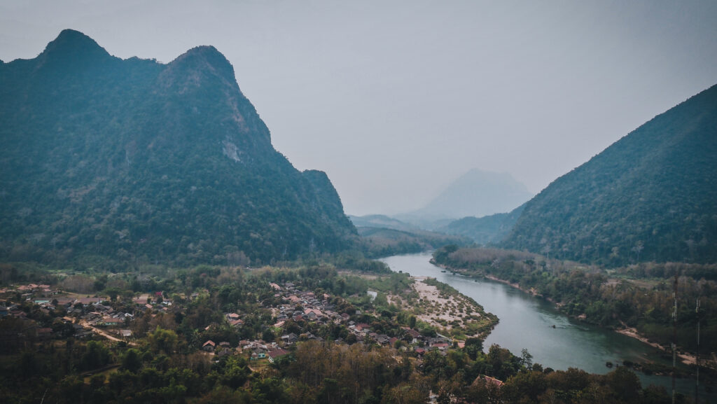
Nam Ou river slowly flows past Nong Khiaw
How long to stay?
It depends if you are a hiking enthusiast or not. I am, so it took me two full days to visit all the viewpoints and one of the caves in Nong Khiaw. I spent additional two days on the hiking trip with an overnight stay in the small village and a visit to Muang Ngoy and Tad Mook Waterfall on the way back. But longer treks are available too. I would say that you should plan a minimum of 3-4 days to fully discover the area. It’s so beautiful that there’s no point in rushing!
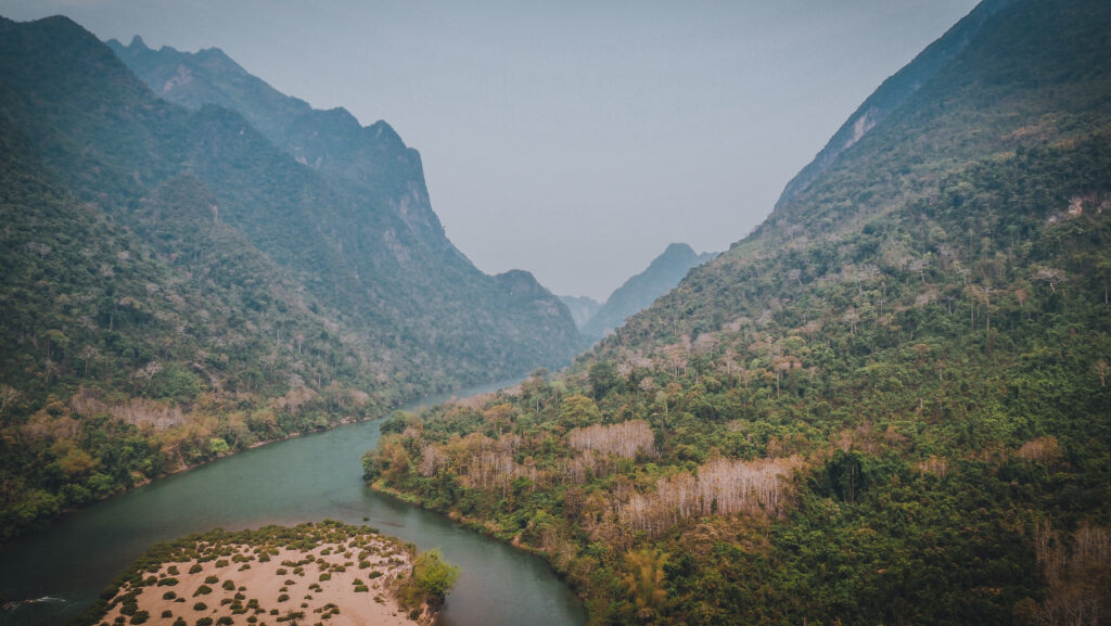
Aerial view of Nong Khiaw
Viewpoints
Sleeping Lady Viewpoint
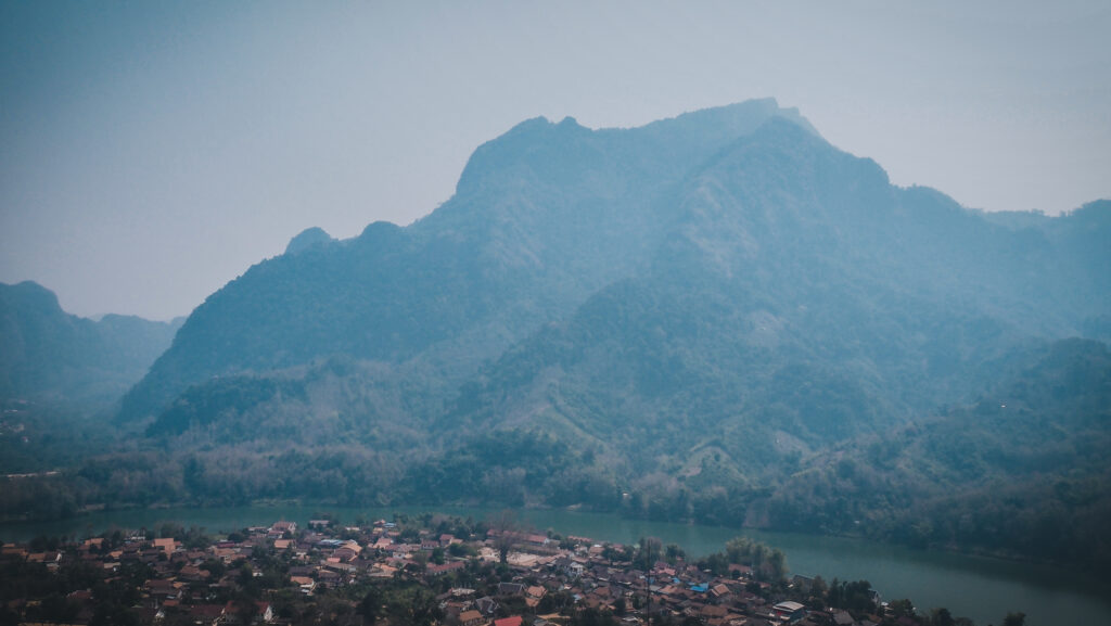
The first spot that I visited upon arrival. The way up at midday was challenging and very sweaty, but totally worth about one hour climb. The first viewpoint is halfway so it’s a good place to rest for a while. Don’t forget to stay hydrated! From the second viewpoint, the wide panorama of surging karsts and mountains, with the river flowing far below is simply amazing! I had the whole place for myself but probably more people came up for sunset.
Panorama from on side of the Sleeping Lady Viewpoint……and from the other one
Som Nang Viewpoint
On the same day, I still had the energy for one more climb and made it for sunset here. It was much easier than going up to the Sleeping Lady Viewpoint. In fact, it was the easiest of all viewpoints in the Nong Khiaw area. The start point is just past the bridge’s eastern end and there’s an entry fee of 20,000 LAK. It should take around 30 minutes to reach the lookout and the trail is well-developed with stairs and handrails in place. There’s a large viewing platform at the top, with benches for a comfortable sunset experience. If you want some drinks, get them before you start an ascent 🙂
Waiting for sunset at Som Nang ViewpointUnfortunately, there was dense haze from agricultural burnouts
Nong Khiaw Viewpoint / Pha Daeng Peak
This viewpoint is positioned above the Som Nang Viewpoint so provides an even better panorama but it’s a more challenging hike, taking about 1-1,5 hours to reach. There is an entry fee of 20,000 LAK. There is also an option of camping at the top.
Phar Kew Lom Viewpoint
Without a doubt, the most challenging viewpoint to get to. Even though I was climbing early in the morning when it was still cloudy and cool, my T-shirt was totally soaked with sweat. At the top, I was rewarded with an incredible view. At the summit is a small platform where you can even camp for the night. It must be really amazing experience which I will certainly do next time! You should count at least 3 hours for comfortable ascent and descent. Entry fee 20,000 LAK.
Trekking
Nong Khiaw is a very popular starting point for 2-3 day hikes with overnight in the homestay in small villages. If you are short on time, 1-day activities are available too. I booked my experience at my accommodation, but you may also to it in the Nong Khiaw Adventure Tours office, on the corner just before the bridge.
Day 1
Once the group was complete (8 people), we got big bottles of water and took a tuk-tuk for a short ride to the beginning of a trail at Ban Ving Kham village. The first section was rather easy, but we were walking on mainly open terrain on a sunny day, so it was pretty hot. We arrived at the village where we took a rest and had lunch. It was also a good opportunity to take some nice photos of the wonderful local people.
Nong Khiaw, Laos
After the break. we continued uphill, which was probably the most difficult part of the entire trek. It was really hot and sweaty and probably the fact that we did the ascent just after lunch didn’t help either. At the top of the hill, we made another extended break to take photos and simply enjoy a super scenic viewpoint.
The last stretch was down and then along the river, finally ending in the village. Our mattresses were on the floor, one by one, and over them was a mosquito net. We went to the river to swim a bit and above all, to clean ourselves as it was the only opportunity to do so on that day. The water was cold but after a tiring day, it felt good. Plus the smell of sweat was at least partially gone 🙂 I smell really bad after the whole day hiking in hot weather. The dinner was fine too, with rice and some traditional dishes to share, including pumpkin soup, laap, or tofu. After dinner, we tried some rice whiskey and spent time sitting around a fireplace and learning how to make bamboo baskets.
The village was very much alive so walking around provided a lot of cool photo opportunities and brought many smiles. The children were especially excited! I felt really grateful to have my online work and to be able to visit such places where time seems to have stopped.
Overall, it was a pretty long and challenging hike on that day. To be honest, more difficult than I expected, but of course, it was fully satisfactory! The village was just at the riverside and the homestay had a nice vibe.
Day 2
We started the day with delicious rice porridge with papaya. Luckily, extra portions were available! While others were packing, I still had some time to walk around the village and take extra photos. So friendly people living there! Then, we went down to the riverbank and boarded the boat that took us to Muang Ngoy.
Inside the homestay
We started sightseeing with a climb to the Phanoi Viewpoint. Nothing too difficult but it’s pretty steep and hot so don’t forget your water. The panorama of the Nam OuRiver was unbelievably beautiful and totally worth the effort. On the way back, we visited Phanoi Cave. After seeing the caves in Central Vietnam, others don’t make a super big impression on me.
Panorama from Phanoi Viewpoint from one side……and from another side
From there, we walked to the center of the village, bought some snacks there, and boarded the boat again to get to Tad Mook Waterfall near Sop Keng Village. It was about time to eat lunch, so we stopped at Yensabai Organic Farm and got some fried noodles packed inside a banana leaf. The organic farm seemed to be a nice place too and there were some people volunteering in a bar and/or staying for the night in tents. The remaining hike to the waterfall was very pleasant. First walking along beautifully green ricefields and then through the forest. Unfortunately, it seemed that all the groups arrived at a similar time, so the place got way too crowded. Despite that, it is a beautiful waterfall.
Ricefields on the way to the waterfallGrowing rice and Tad Mook Waterfall
We hiked back to the boat, which took us a bit further down the river, and then we changed to kayaks. The paddling time to Nong Khiaw was probably around 30 – 40 minutes. Not too long but just enough as I could feel already a bit tired from two intensive days. The sun was getting lower and lower so it was a very scenic time to be on the river, quietly paddling and enjoying the sounds of nature.
Overall, the trip was really fantastic and I can wholeheartedly recommend hiking in Nong Khiaw and staying in a village homestay. I will definitely do more hikes in Phongsaly or Luang Namtha in the future!
Caves
Phathok Caves
Follow the road 1C past Phar Kew Lom Viewpoint until you reach the turn-off to the caves. They were used as shelters by the Pathet Lao during their fight with the US-backed national forces, in the 1970s. The first cave is the biggest one, around 30m high and accessed by a stairway. The second one is quite narrow and definitely not for people with claustrophobia. The third one is the smallest and least impressive of all. You will most likely be accompanied by local kids with flashlights, asking you for a tip at the end. You can say you don’t want them to follow you but I don’t think they will listen 🙂 Bright your own decent torch for safety and just to see more. On the way back you will cross paddy fields which were very green and looked gorgeous in the afternoon light. The entry fee is 20.000 LAK.
Ricefields near Phathok Caves
Pha Kuang Cave
Similar to Phathok Cave, this one was also used as a hiding place during the Indochina war. It’s a place for people who are ready to get dirty and are not claustrophobic. It involves some serious crawling and going through narrow passages. I don’t really like places like that so decided not to go. The entry fee is 10.000 LAK.