Tag

islands

Browsing

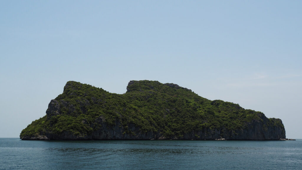
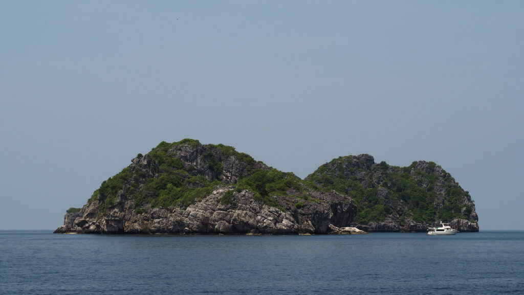
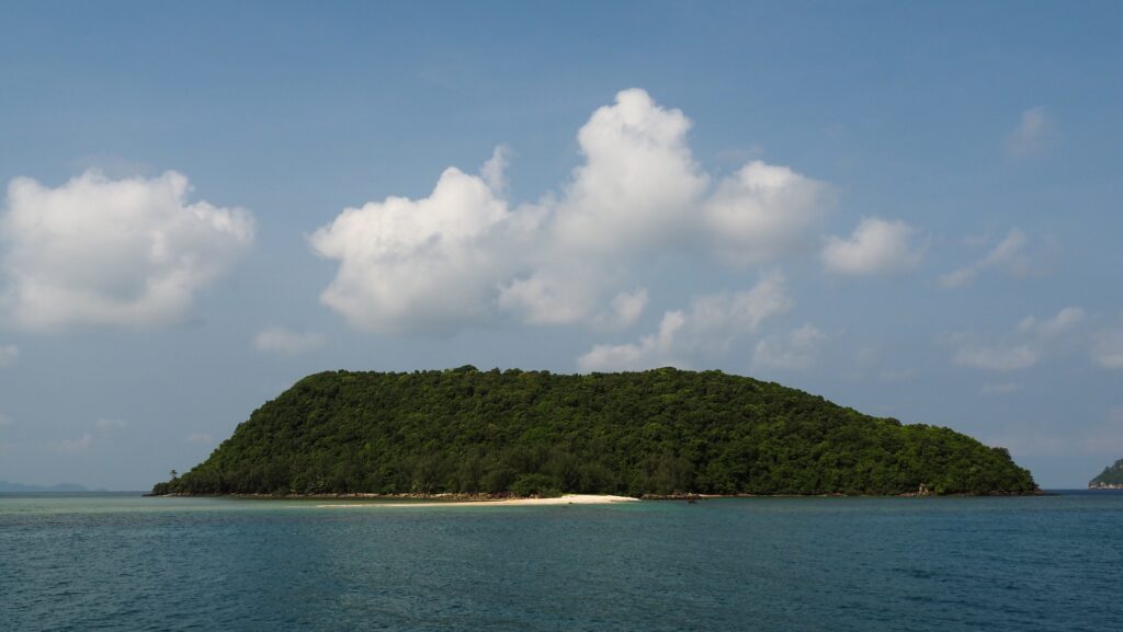
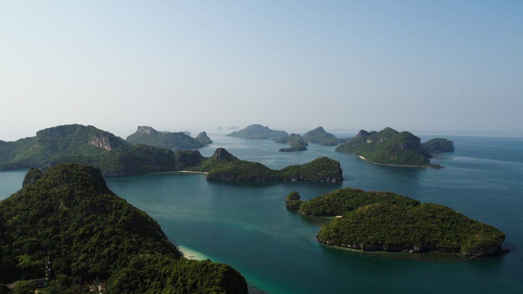
Ang Thong National Marine Park is a stunning archipelago located in the Gulf of Thailand, not far from the popular tourist destinations of Koh Samui and Koh Phangan. The park was established on 12th November 1980. and consists of 42 small, limestone islands, characterized by lush greenery, towering cliffs, and hidden coves. All of the islands are uninhabited and undeveloped except for one: Koh Wua Talap, where the visitor centre, campsite, and bungalows are located.

How to get there?

To get to Ang Thong National Marine Park, you need to travel to the nearby islands of Koh Samui or Koh Phangan, as it serves as a starting point for visiting the park. In both places, you will easily find tour agents offering day trips to the park. There are no boat tours from Surathani or Koh Tao. 

Koh Samui and Koh Phangan can be reached on a ferry from Donsak Pier near Surat Thani. Raja Ferry is slow, cheap, uncomfortable, and takes about 1,5 hours to Koh Samui and 2,5 hours to Koh Phangan while Lomprayah is exactly the opposite but about twice the price and takes 45 minutes to Koh Samui and 1,5 hours to Koh Phangan. Time is money, they say. The choice is yours đŸ™‚

Another option would be to fly to Koh Samui. There are regular flights from Bangkok and other major cities in Thailand, as well as some foreign destinations. Check your connections at 12Go.Asia.

How long to stay?

Typically people sign up for a one-day tour. However, camping is possible so if you wish to do so, you will need to make arrangements individually with the tour agent and the boat will pick you up on the next day. The rent of a tent for 2 people is 250 THB per person per night including a torch, clean sleeping bag, and mosquito net.

When to go?

The best period to visit Ang Thong National Marine Park is between December and August.

The dry season lasts from December to February and it’s the peak tourist season. Pleasant weather with lower humidity and cooler temperatures. Accommodation and flights can be more expensive, and popular tourist spots can be crowded.

From March to August, there is a hot season with higher temperatures and humidity. Occasional rain showers are possible but they are usually brief. May and June can be particularly hot.

Rainy season months, from September to November, are better to avoid. The prices are more budget-friendly but you may expect frequent rainfall and boat tours will most likely be closed.

Ang Thong National Marine Park in Thailand
Ang Thong National Marine Park

Entrance fee to the park

When signing up for a tour, clarify if the entrance fee is included in the tour price. Normally it isn’t and extra cash is collected by tour companies before the trip starts or while you are on board.

The fees as of August 2023 are as follows: 300 THB for foreign adults and 150 THB for foreign kids. Thai citizens will pay 50 THB for adults and 25 THB for kids.

*all prices are from April 2022.

Where to stay?

Koh Phangan

The night in Mae Haad Garden Inn cost me about 12 EUR per night and I chose that location only because other options were not available because of the Full Moon Festival. I ended up very satisfied with it and the area was super calm. With a scooter, it was easy to reach any part of the island anyway. Chaloklum Beach was only a 10-minute ride away.

Later, I moved to the Shanti Boutique Hotel which was a bit more expensive but absolutely brilliant. The rooms are simple but very cozy and clean, and it’s nice that they come with a balcony. The location is great as well, near Srithanu Beach and Zen Beach. There are also many cafĂ©s and restaurants that offer super tasty food with a lot of variety.

Koh Samui

I stayed for three nights at the Pamoni Hotel in Chaweng for about 19 EUR per night. It was basically a small apartment, with a living room and a kitchen, a bedroom, and a private bathroom and there was a swimming pool for guests too. A very good price-to-quality ratio and the location was very good too.

Ko Wua Talap

If you decide to extend your tour for the overnight stay, there are camping and bungalows to rent at the park headquarters on Ko Wua Talap Island. Facilities are basic: cold water shower and electricity from a generator that shuts down at 11 PM, but isn’t it a beauty of this place? You may also rent a kayak to explore the area from the water perspective independently.

The tour

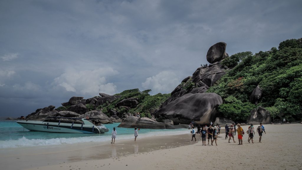
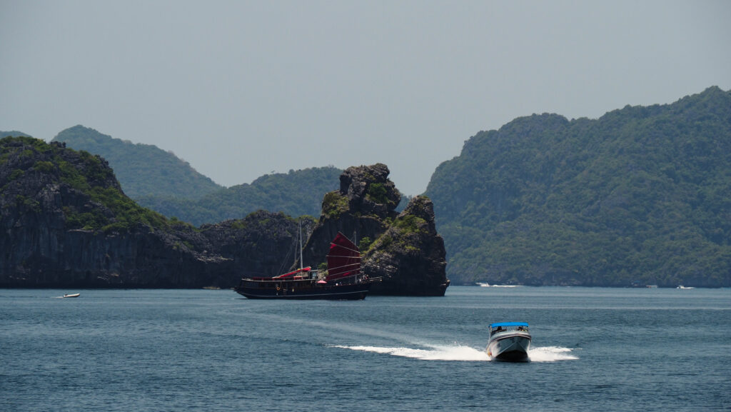
There are numerous companies running daily trips from Koh Phangan and Koh Samui and first, you will need to decide if you prefer to take a speedboat or a slow boat. It takes about an hour to reach the islands by speedboat and about 2-3 hours by slow boat. You can save a lot of time choosing the first option but the ride can be bumpy and less enjoyable. The slow boat usually has a nice deck where you can sunbathe and take a lot of nice pictures.

I decided to choose a tour operated by the Orion Cruise, starting from Koh Phangan. It was a bigger and slower boat. As of April 2022, the cost was about 2.000 THB. Included in the price is pick-up from the hotel, lunch, snacks, soft drinks, and snorkelling equipment. You may pay an extra 200 THB if you go for an option with a kayak. The price included the Ang Thong National Marine Park entrance fee.

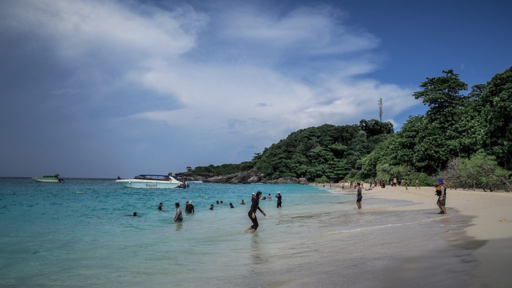
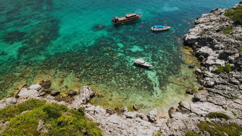
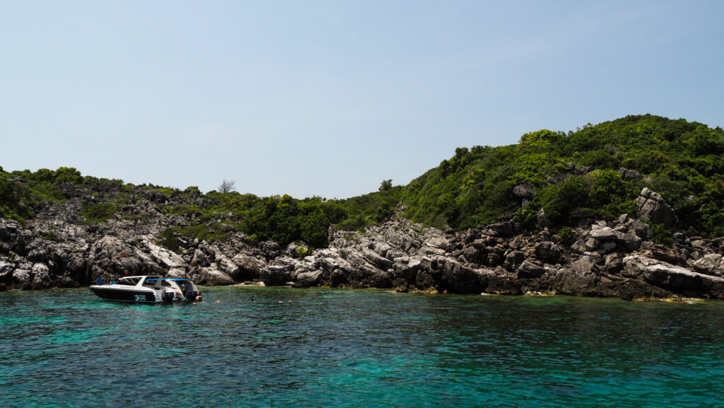
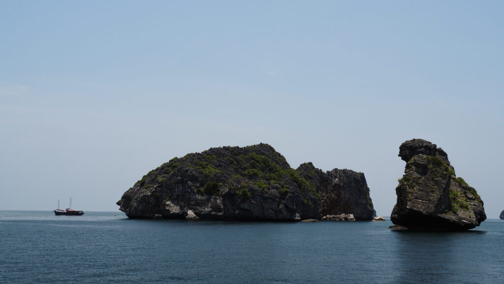
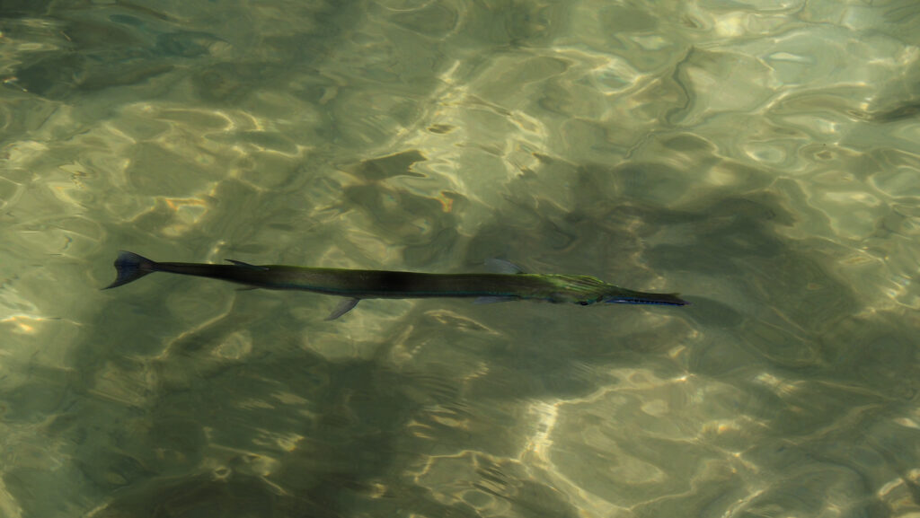
The day started with a slightly delayed pick up in the accommodation by a minivan and delivery to the pier. Coffee or tea and snacks were already waiting. The boat departed a few minutes after 9 AM and was going slowly so there was plenty of time to relax on the deck. The first stop was around Koh Wao, where we got our snorkeling equipment and jumped into the water to see some colourful fish and coral. It wasn’t bad but the water wasn’t perfectly clear and during my travels in South East Asia, I have visited much better snorkeling locations.

Ang Thong National Marine Park in Thailand
Snorkelling spot near Koh Wao
Ang Thong National Marine Park in Thailand
Snorkeling spot near Koh Wao
Ang Thong National Marine Park in Thailand
Snorkeling spot near Koh Wao

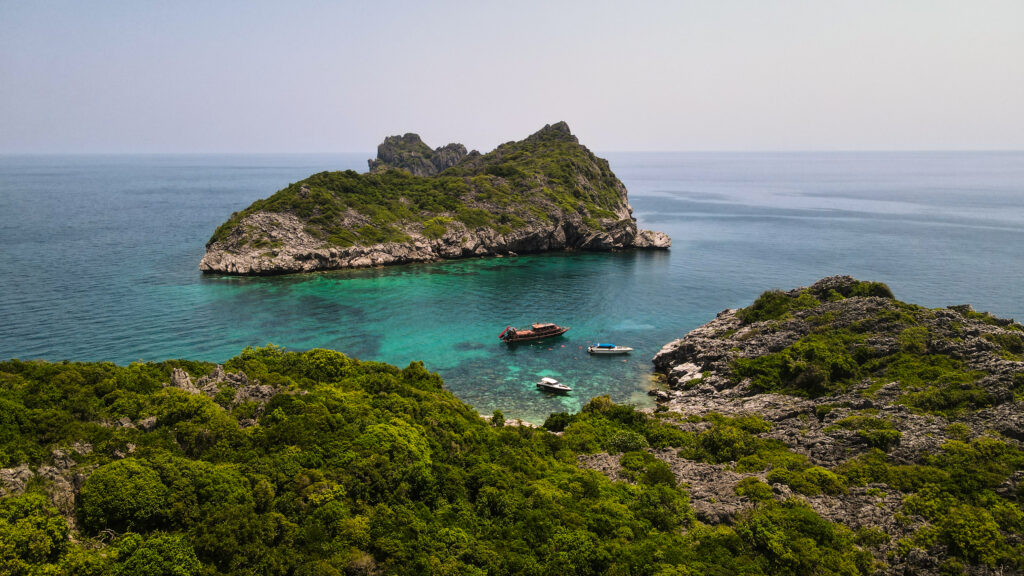
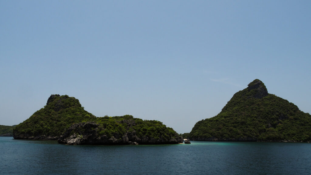
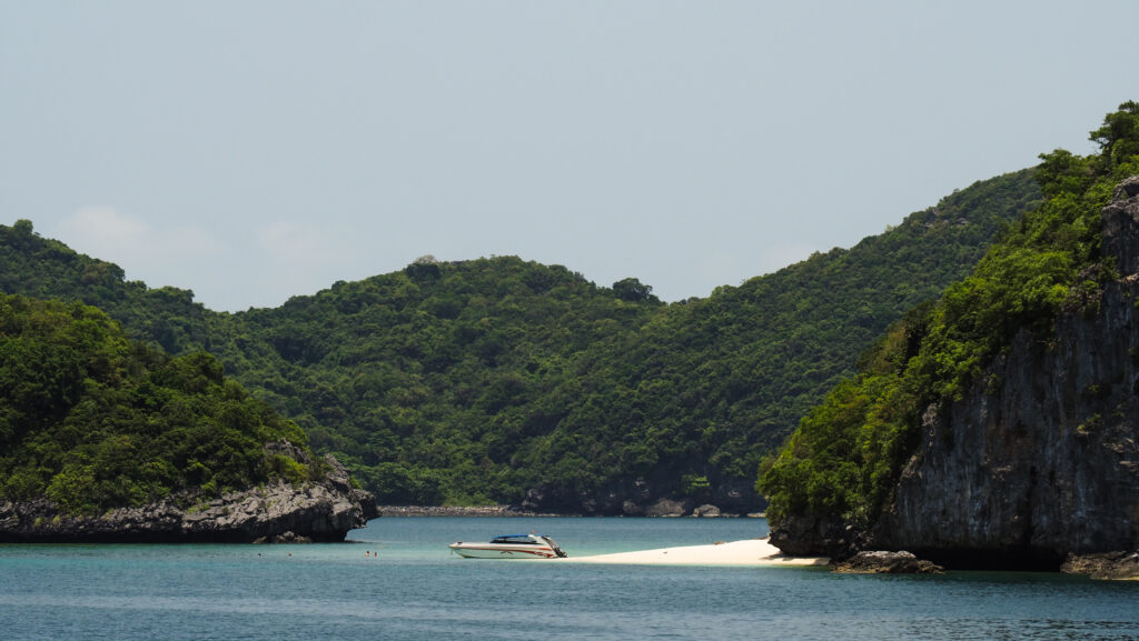
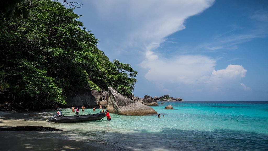
From there, the boat went deeper into the national park and at this point, it is better to be on the upper deck to have an unobstructed panoramic view of the small rocky islands all around. The boat stopped near Ao Ka Beach, which was a drop-off point for those who decided to choose the option of a kayak. To get to the beach itself, we had to switch to a long-tail boat first, as the slow boat was too big to get so close. The whole kayaking experience wasn’t too long and took about 30-40 minutes.

Ang Thong National Marine Park in Thailand
A scenic beach in Ang Thong National Marine Park
Ang Thong National Marine Park in Thailand
Picturesque rock formations

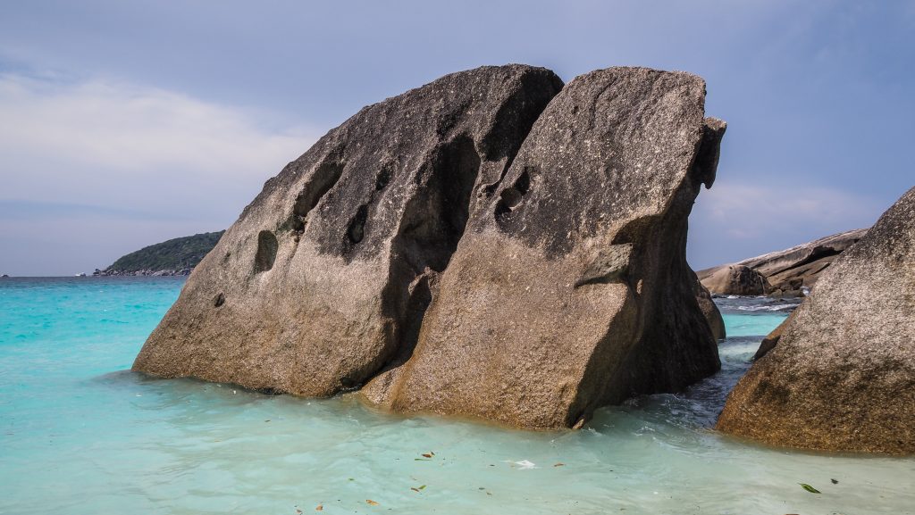
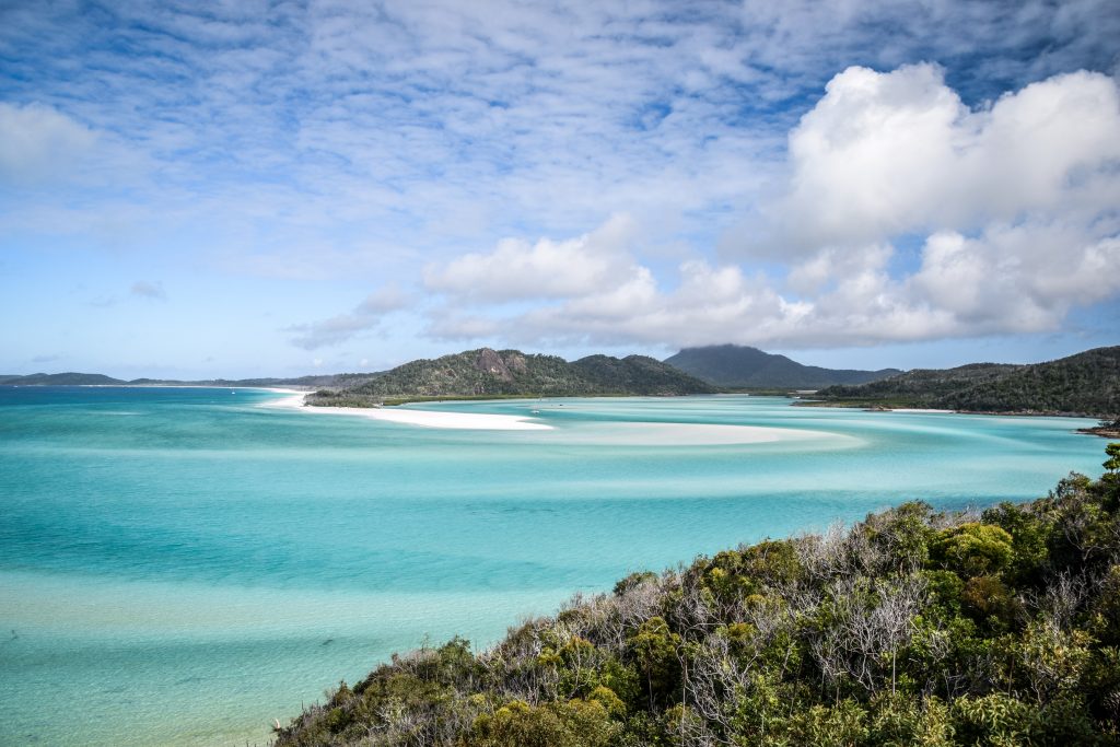
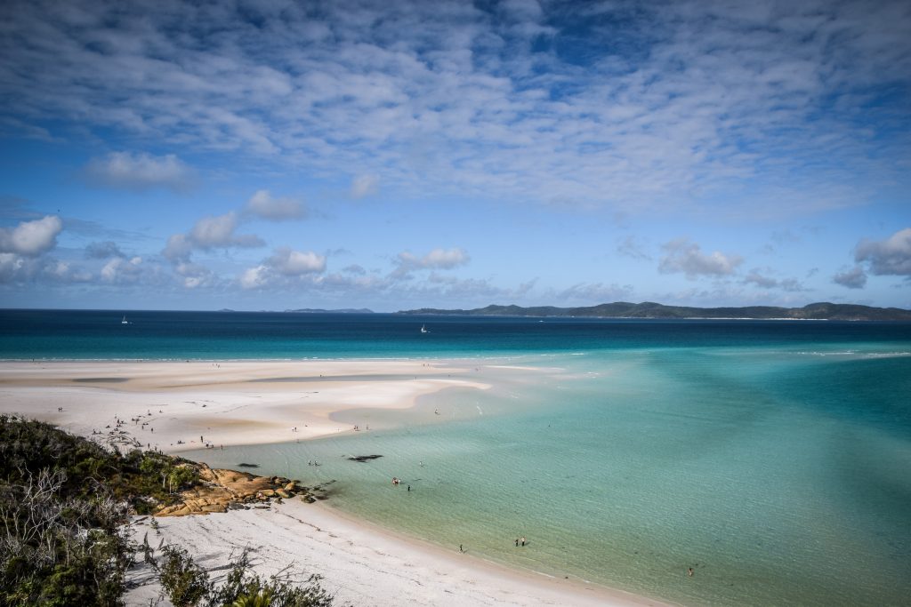
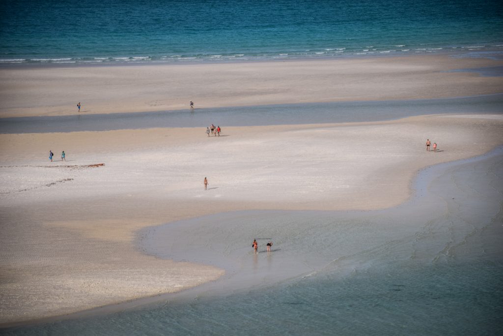
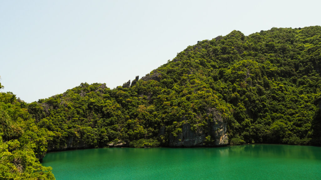
If you haven’t decided to have a kayak trip, you will stay on board and meet up with other participants later at Koh Mae Koh. It’s a wonderful island with a Blue Lagoon surrounded by steep limestone cliffs in the middle. Follow some steep stairs to get to the viewing platform and you won’t be disappointed. The color of the water is bizarre yet very beautiful.

Ang Thong National Marine Park in Thailand
The Blue Lagoon
Ang Thong National Marine Park in Thailand
The waters are full of fish

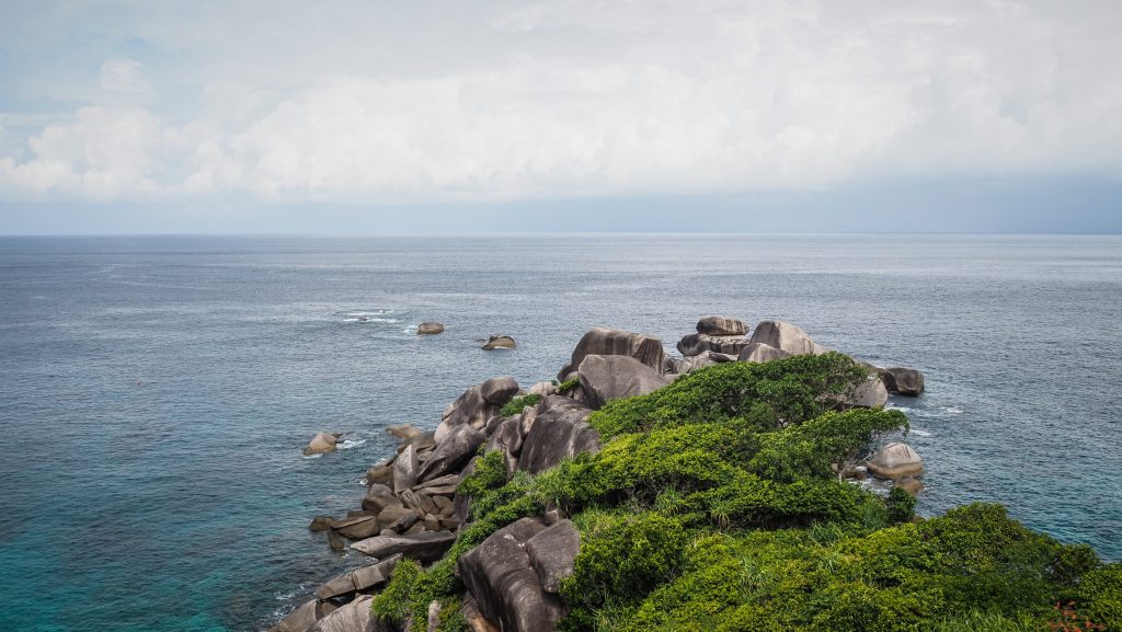
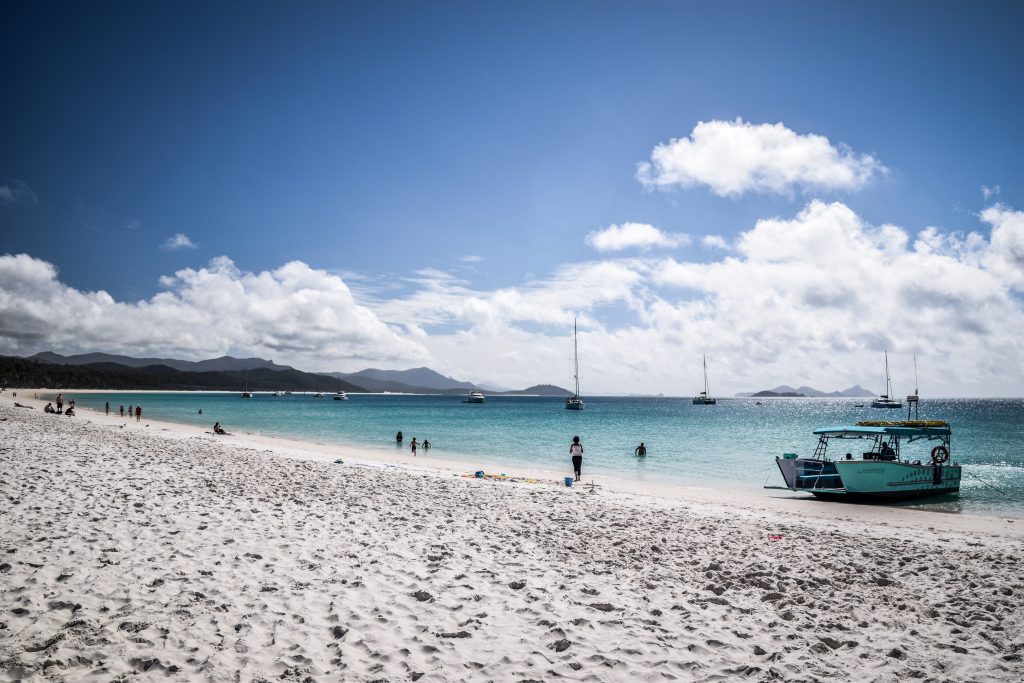
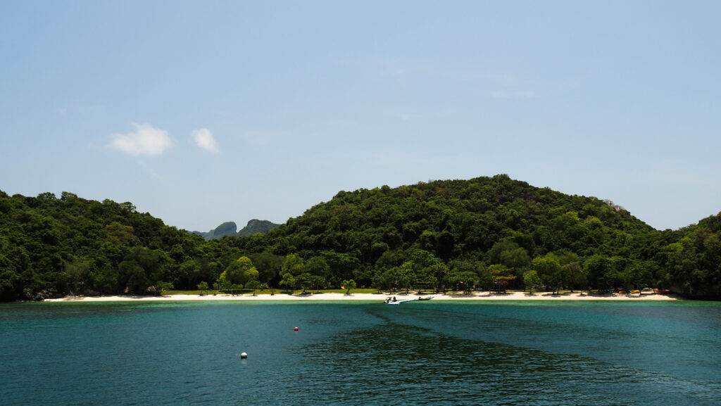
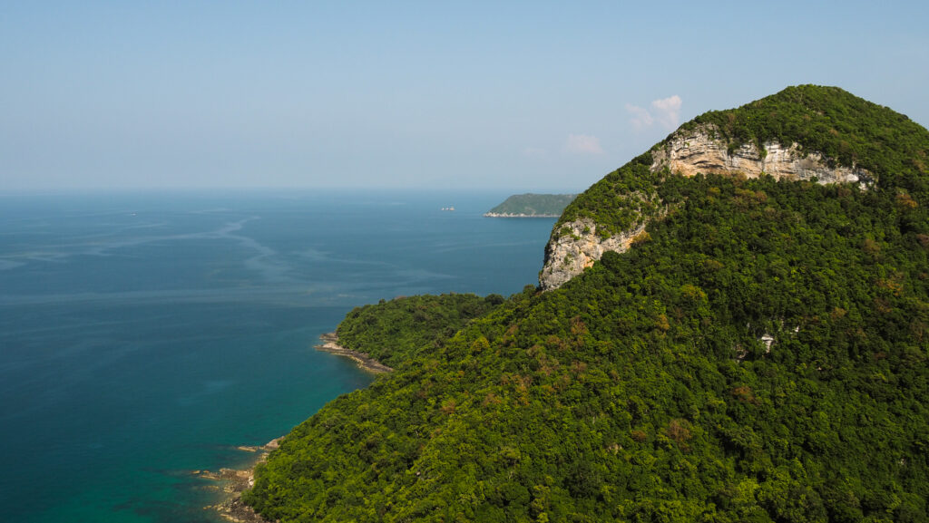
The last stop was at the biggest island in the archipelago: Koh Wua Talap. Here are the national park headquarters and this is the place where you can stay overnight if you wish to. What you certainly have to do is hike up to Pha Chan Charat Viewpoint. It provides a sensational view of the islands with blue waters and green forests all around. The hike up is very steep and sweaty, especially under the hot sun but it’s totally doable for most people. Take your time and stop at other viewpoints along the way. The return trip should take about 1 hour.

Ang Thong National Marine Park in Thailand
Absolutely amazing views from Pha Chan Charat Viewpoint
Ang Thong National Marine Park in Thailand
Absolutely amazing views from Pha Chan Charat Viewpoint

Once I got down, I still had some time to enjoy the wonderful beach and chill in the hammock. At the agreed time, the captain called me to return to the boat and we started our return journey to Koh Phangan with the sun slowly setting. We arrived shortly after 6 PM and were dropped off at our hotels.

Overall, it was a great day and the whole trip was organized nicely. The food was good, the crew was incredibly friendly and the views in the national park impressed me a lot. The only negative side was the speed of the boat, which was really slow and we spent plenty of time travelling to and from Ang Thong National Marine Park. If the boat had been faster, we would have had more time to spend in the park.

Ang Thong National Marine Park in Thailand
Ang Thong National Marine Park
Ang Thong National Marine Park in Thailand
Ang Thong National Marine Park
Ang Thong National Marine Park in Thailand
Ang Thong National Marine Park
Ang Thong National Marine Park in Thailand
Ang Thong National Marine Park
Ang Thong National Marine Park in Thailand
Ang Thong National Marine Park
Ang Thong National Marine Park in Thailand
Ang Thong National Marine Park

Introduction

“Similan” is a Yawi (a Malayan dialect) word which means nine. The park had originally nine islands numbered 1 to 9 but expanded to include two more remote islands back in 1998: Ko Tachai and Ko Bon.

Crystal clear waters filled with marine life, white sand beaches and tropical forest. All of these made Similan Islands incredibly popular and unfortunately, overcrowded. National Park authorities have been constantly reducing the number of tourists allowed to visit the islands and as of today, it’s not possible anymore to stay overnight at any of the islands in the archipelago.

Similan Islands in Thailand
Similan Islands have rocky shores

The islands are located about 70 km off the coast in Phang Nga Province and the nearest popular towns on the mainland are Khao Lak and Phuket.

How to get to Similan Islands?

The Similans can be reached only by tour company-operated speedboats. The best is to base yourself in Khao Lak and ask around at travel agents or your accommodation.

If you are into diving, you may want to check out the offers of liveaboard dive boats which are ideal for multiple days adventures.

Thap Lamu Pier is the main pier for boats operating to the islands but there are several others in the area, used by various tour operators so make sure you check where to check in for the tour if pick-up from the hotel isn’t included.

You can also book your tour in Phuket but that will significantly extend the duration of the trip as you have to add a few hours in a minibus, which means super early departure and late arrival back to the hotel. I wouldn’t recommend that, as you will also miss the chance to explore Khao Lak, which is a nice place itself.

After doing my research, I decided to book the tour online via Klook.com. The price was significantly cheaper compared to the official one on the website of Love Andaman.

Similan Islands in Thailand
Sailboat Rock on Koh Similan

Price and entrance fees

The prices of one day trip should vary between 2,000 – 3,500 THB, depending on what is included. Back in March 2022, the trip cost me 2.200 THB and the National Park entrance fee was included. Always make sure that it’s the same in your case, to avoid any surprises at the pier or upon arrival to the islands. Especially as this is one of the most expensive national parks in Thailand.

As of June 2022, the entrance fees for Similan Islands are 500 THB for adults and 250 THB for children 3-14 years old. These are the prices for foreign tourists. As usual in Thailand, local citizens will pay significantly less: 100 THB for adults and 50 THB for children.

Similan Islands in Thailand
One of the views from Sailboat Rock on Koh Similan

When to go?

The best time to visit Similan Islands is from December to April, outside of the rainy season. The waters are clear, making it the best time for scuba diving and snorkelling. The weather is stable and showers are rather occasional.

The park is usually closed for visitors from the 15th of May until the 15th of October but it may close even earlier if the weather is terrible. The daily opening hours are from 8 AM to 4 PM.

Similan Islands in Thailand
The beach on Koh Miang An Island
Similan Islands in Thailand
The beach on Koh Miang An Island

How long to stay?

Camping or any other kind of accommodation is not available on the islands. Therefore, if you don’t join liveaboard diving boats, one day trip will be your only choice to discover that area.

The trip plan

The boat operated by Love Andaman is leaving Thap Lamu Pier at about 8:30 AM but you certainly should arrive earlier to check in and to have enough time to enjoy the breakfast! Yes, breakfast is included in the price and it’s actually a really good one, with a wide selection of snacks and drinks. After checking in, you will receive a colourful wristband corresponding to the group that you have been assigned to. The guide will call your number and give you safety instructions as well as general talk about the plan for the day.

The first stop is at Island No. 8, also called Koh Similan. That’s the most popular spot with iconic Sail Boat Rock and the viewpoint up there. The panorama over the turquoise-blue shallow waters of Donald Duck Bay is indeed spectacular. A path through the rocks leads to the top but isn’t too difficult. You will also get enough time to have a walk, swim or just sit on the beach.

Next, the boat stops around Island No. 9, also called Koh Ba Ngu for snorkelling. Of course, it’s an optional activity but highly recommended as you will see plenty of fish or even a turtle if you are lucky.

At about 12:00, there it’s time for Thai buffet lunch. After a nice surprise in the morning with a quality breakfast, the lunch was delicious too. I have done several boat trips during my 5-month stay in Thailand and the food delivered by Love Andaman was definitely the best.

After lunch, there is another stop for snorkelling at Island No. 7, also called Bayu Island. Some people spot a turtle here but unfortunately, I wasn’t so lucky.

The last stop is at Island No. 4, also called Koh Miang An Island. There is a nice path through the forest connecting two beautiful beaches where you can enjoy water activities or simply chill on the sand. Don’t forget to look up as you might be able to see a lot of bats, hanging on the branches and resting before an evening meal.

Similan Islands in Thailand
Plenty of bats up in the trees!

The boat leaves Similan Islands at about 15:15 and arrives back at the pier at about 16:30. Needless to say, above mentioned program is the general one and it can be changed depending on the weather and sea conditions.

Summary

All in all, it was a day well spent. Everything was on an excellent level: food quality, attention of guides, snorkelling spots, and comfort on the boat. And if you get a good promo on Klook.com, the value is amazing. I would definitely go again!

Introduction

Santa Maria is the island of the firsts. It was the first island to be formed in the archipelago, the first to be discovered by the Portuguese explorers and Vila do Porto, the capital town, was also the first to be founded (in the 1430s).

Together with Sao Miguel, it forms the Eastern Group of the Azores archipelago. Dryer and warmer weather than on the neighbouring islands and the possibility to make use of it on the white sand beaches are the main advantages that attract tourists.

I visited Santa Maria on my long term trip in pandemic times, when I took the advantage of remote work and had been living “on the road”. I stayed in the archipelago for two months, between April and May, which isn’t a high season. Graciosa is the only island I haven’t visited yet, but isn’t it a good reason to be back one day?

How long to stay?

I would say that 2-3 full days should be enough to visit all the interesting places on the island and do a couple of hikes. Of course, it depends on the weather which is very unpredictable in this region. Even though Santa Maria is located only a 20-30 minutes flight from Sao Miguel, I was really surprised by how different the landscape is, especially in its western part. You will immediately notice that the grass is much more yellowish in comparison to luscious and intense green on the other islands in the archipelago. In fact, Santa Maria receives less than half the precipitation of the islands in the Western Group: Flores and Corvo.

Nevertheless, you should still check the weather frequently and always have a backup plan. The mobile app SpotAzores is a great tool for monitoring weather situations in the Azores archipelago. I used it every day when I was there and seriously can’t imagine travelling without it!

Where to stay?

Due to my remote work, I always look for a private room with a fast internet connection. The best quality to price ratio offered Azores Youth Hostel located in the centre of Vila do Porto. The room was simple but nice and had a private bathroom, however, there was no internet signal inside it. I don’t know if I was unlucky, or all the rooms are like that. WiFi seemed to be only available in the common area. It is a really big space with tables and comfortable sofas, but with other guests hanging around, could be not optimal enough for the ones who need silence to work remotely. Free parking is available on the streets nearby.

Getting around Santa Maria

As on all the other Azores islands, renting a car is essential to reach all places. I used the services of Autatlantis several times and I can fully recommend that company. The price was always around 16-20 EUR per day (without any extra insurance) and the cars I had were Toyota Yaris, Citroen C1 or Smart. Bigger ones are available too, of course for the higher price. Pick up and return were smooth and quite fast.

Another popular rental company in the Azores region is Ilha Verde, however, customers’ opinions are mixed and I have never used them.

If you don’t have a driving licence, you can try hitchhiking but you need to be patient and quite lucky as in some areas traffic is really minimal.

Tips

  • The weather is unpredictable and you have to be prepared for anything. Always have with you a waterproof jacket and umbrella. Install mobile app SpotAzores and don’t go to places that are totally covered in clouds. You will lose time and won’t see anything anyway.
  • Book your car in advance in the high season. I was travelling in the Azores between April – May so it wasn’t a problem to get a car from one day to another, however, I can imagine that in high season it could be a problem, especially on the smaller islands.
  • Drive carefully, especially in the fog. It’s pretty normal that cows, sheep or goats stand very close to the road or simply walk on it.
  • If you go hiking, download GPS files and maps from the official website Visit Azores and have them on your phone just in case. In general, trails are well marked but in a dense fog, it’s not that difficult to get lost.
  • Don’t be afraid of hitchhiking. Many trails are linear, which means that you need to get back to the starting point. You can walk the same way or try to save your legs. On some islands, the traffic is minimal but once the car comes, it is almost certain that the driver will stop and help you out.

Vila do Porto

The name simply means ‘town of the port’ and even though there isn’t much to do, it’s a good place to base yourself, mainly because of easy access to restaurants, bars and shops. There is basically one main street, perfect for an evening walk starting from the port and Fort de SĂ£o BrĂ¡s, all the way to Church of Santo AntĂ£o.

Santa Maria, the Azores
Vila do Porto
Santa Maria, the Azores
Vila do Porto

Other sights on Santa Maria

Ribeira de MaloĂ¡s – a short walk leads to the unique formation that occurred due to the contact of the sea with a basaltic lava flow of the Pico Alto Volcanic Complex. it resembles a similar place in Iceland, which is very popular among tourists and can be seen on many photographs online.

Santa Maria in the Azores
Ribeira de MaloĂ¡s

Barreiro da Faneca – A semi-desert with a red landscape and even eucalyptus trees around. If Ribeira de MaloĂ¡s looks like Iceland, then Barreiro da Faneca definitely awakes the memories from Australia. Breathtaking place!

Poço da Pedreira – the shape isn’t really natural as back then it was a quarry where a red stone was extracted and later on used in various constructions around the island. Currently, it’s a nice place for a picnic next to the pond or could be a starting point for the PRC03 hiking trail (loop).

Santa Maria, the Azores
Poço da Pedreira

Aveiro Cascade – the most beautiful waterfall on the island, surrounded by stunning vineyard terraces. It is 110 meters high.

Gonçalo Velho Lighthouse – good viewpoint to Maia and the cliffs.

santa maria azores
Gonçalo Velho Lighthouse

Praia Formosa – white sand beach in the Azores? Yes, and it’s quite big!

Anjos – Christopher Columbus disembarked in the village on his way back from the discovery of America what is commemorated by the statue. You, on the other hand, can start or finish PR01 SMA – Costa Norte hiking trail here.

Museu de Santa Maria in Santo Espirito – a great place to learn about the history of the island! It’s set in rural house from the 20th century. A knowledgeable guide explaining the exhibition is an additional benefit.

Viewpoints (Miradouro) on Santa Maria

As on every island in the Azores archipelago, there are plenty of viewpoints and usually, they are easily accessible by car. Just look for the sign ‘Miradouro’ which in the Portuguese language means viewpoint. Here is the list of the most popular ones but of course nice views are nearly everywhere and it’s easy to find a stunning ‘no-name’ spot.

  • Miradouro de SĂ£o Lourenço
  • Miradouro do Barreiro
  • Miradouro das Lagoinhas
  • Miradouro da Macela
  • Miradouro da Pedra Rija
  • Miradouro das Fontinhas
  • Farolim da Ponta do Malmerendo

Hiking trails on Santa Maria

PR01 SMA – Costa Norte

The route starts in Bananeiras and soon turns right to descent all the way to Baia do Raposo. A magnificent place with a stream flowing into the ocean and waterfalls in the distance. It’s a kind of a detour to get there, so after a while, you have to climb back to the point where you left the main trail and then continue west until you reach Barreiro da Faneca. It’s a place of the last volcanic activity on the island and the combination of red clay and eucalyptus trees brought up my memories of Australia. From here, it’s really worth taking a detour to Ponta do Pinheiro, about 10-15 minutes each way. After rejoining the main trail, continue straight until another short detour option, this time to Monte Gordo. It’s about 10 minutes ascent, well worth it as well. From there the trail continues towards Ponta dos Frades and then finally ends in Anjos village, right next to the statue of Christopher Columbus.

Santa Maria, the Azores
Baia do Raposo
Santa Maria, the Azores
Barreiro da Faneca
Santa Maria, the Azores
Barreiro da Faneca
Santa Maria, the Azores
Barreiro da Faneca
Santa Maria, the Azores
Barreiro da Faneca
Santa Maria, the Azores
Barreiro da Faneca

PRC02 SMA – Pico Alto

The trail begins just next to the parking at Pico Alto. There, you may notice the memorial dedicated to Independent Air Flight 1851 that crashed into the mountain in 1989. Follow the steps going up to the highest point of the island. The view from there isn’t so impressive though, especially with all the antennas around. Return down and go into the forest where the trail stays for most of the remaining distance, but there are also good lookouts to the coast and caldeira.

PRC03 SMA – Entre a Serra e o Mar

Officially, the trails start near the church of Santa Barbara, but you may also begin at Poco da Pedreira, as did I. Cross through the centre of Santa Barbara, head towards Lagos, then in the direction of Norte and finally you will see the Chapel of Nossa Senhora de Lurdes. You definitely should take a detour to a viewpoint over the bay of SĂ£o Lourenço, which is the highlight of that trail. Return to the main path and continue along the bay until you are back to the starting point.

Santa Maria, the Azores
Poco da Pedreira
Viewpoint over the bay of SĂ£o Lourenço

PR04 SMA – Santo Espirito – Maia

Very pleasant and picturesque trail. It’s a linear one, so I would recommend leaving the car at Maia and hitchhiking to Santo Espirito. Traffic is minimal, but be patient and sooner or later someone will go that way. Start near the church and if you have some extra time, drop by to the Ethnographic Museum of Santa Maria. A very informative place with an awesome guide presenting the history of the island. Next, follow the road passing by the ruin of old windmills and pastures. Continue towards the coast following the stream. Aveiro waterfall is just on the edge of the cliff, but it’s simply too close to be visible well. Follow the trail and after a while look back to admire that 80 meters high miracle of nature. Soon, the descent through vineyards starts to be quite steep so be careful. In Maia, it’s worth taking a detour to the base of Aveiro waterfall, just to see it again from a different (and according to me the best) angle. Lastly, turn back and continue along the asphalt road to the place where you parked your car.

Santa Maria Island in the Azores
Aveiro waterfall
Santa Maria Island in the Azores
Aveiro waterfall
Santa Maria Island in the Azores
The landscape around Aveiro waterfall

PR05 SMA – Costa Sul

At the moment of writing this text, the trail was officially closed. I did walk it, having in mind that I would simply go back if there was something dangerous. In the end, I arrived at its end as it was perfectly fine all the way. The trail starts in Vila do Porto, next to the Fortress of Sao Brass, then it crosses the stream and continues through dried land to Padreira do Campo. It’s a geological site where marine fossils were found. Shortly after, your will pass by Figueiral Cave, which was created artificially to extract clay for the construction of local houses. Now, ahead of you, there is a steep descent towards Praiha, which is a good place for a break and swimming. The trail passes by the Fortress of Sao Jao Baptisa to finally end at Praia Formosa. Long and wide white sand beach in the Azores? Highly unique but yes, it really exists here so make use of it! Hitchhiking back to Vila do Porto should be relatively easy from here. If it’s not, walk up to the road EN1-2A which is much busier.

Santa Maria Island in the Azores
Praiha – perfect place for a break
Santa Maria Island in the Azores
Doesn’t it look like feet?
Santa Maria Island in the Azores
Beach around Prainha
Santa Maria Island in the Azores
Beach around Prainha

PR06 SMA – Areia Branca

This is a great and varied hike connecting Praia Formosa with BaĂ­a of SĂ£o Lourenço. As it’s a linear way and I didn’t feel like doubling the distance, I left the car in Santa Barbara and hitchhiked from there to the turnoff to Praia Formosa. People in Santa Maria are really nice and usually, the first car stops and they try to help you out.

From Praia Formosa, the 6 kilometres ascent towards Pico Alto begins, which can be quite tough in places. After checking out the panorama from there, descent through the farmlands to Santa Barbara. Go through the town and then descent even more on a very steep path leading all the way to BaĂ­a of SĂ£o Lourenço. The views here with all that vineyards in terraces looking like a chessboard are truly amazing. The trail ends next to the beach. After some chilling and drone flight, I hiked back to Santa Barbara (which unfortunately was quite a tiring way up) to pick up my car.

Santa Maria Island in the Azores
BaĂ­a of SĂ£o Lourenço
Santa Maria Island in the Azores
Aerial view of the vineyards around BaĂ­a of SĂ£o Lourenço

Great Route of Santa Maria

The mother of all the hiking trails on Santa Maria. The distance of 78 km is suggested to be covered in four stages, but honestly, I believe it could be done in three if you don’t mind walking more than 20 km a day. It starts in Vila do Porto and then goes basically around the whole island: Vila do Porto – Cordal – Norte – Bananeiras – Vila do Porto. Certainly, a great adventure which is on my list if I ever come back to this region of the world đŸ™‚

Introduction

There are 74 islands in the Whitsunday archipelago which lies between the northeast coast of Queensland and the Great Barrier Reef. Most of the islands are uninhabited while the most popular among tourists is definitely Whitsunday Island. Airlie Beach is the major gateway, where you can book lots of tours and activities. For me, it wasn’t any different. I arrived in the early morning and made my way directly to the meeting point of my tour.

I spent a lot of time browsing different boat tours and looking for the best quality to price ratio. Overnight yachts tours sound to be an amazing experience, however, it’s Australia and such attractions aren’t cheap. That’s why I chose 1-day tour on an open-air speedboat operated by Big Fury. The standard price is 170 AUD but you can usually find a slightly better price on BookMe.

What to bring?

You definitely don’t need much. Pack your swimwear, towel, sunscreen, sunglasses and some warmer hoodie or jacket just in case. There isn’t too much walking involved so don’t worry about your shoes either.

1-day itinerary

The departure time of the tour was at 10 AM and a few minutes before we were greeted by the staff. They checked passengers list and gave us kind of swimsuits that we were supposed to wear while snorkelling. Fins and goggles were available on the deck as well.

We quickly gained speed and soon reached the first spot for snorkelling. Not the best though! Corals and fish were nice but nothing extraordinary. The worst was the temperature of the water was really cold and after a few minutes, I wasn’t interested in swimming but simply wanted to warm up on the deck. The swimsuits were rather designed to protect from the stingers (which wasn’t a problem anyway at this time of the year) rather than keep me warm.

The next stop was on the famous Whitehaven Beach which stretches for 7 kilometres. It is considered to be one of the best in the world, mainly due to its bright white sands, which consist of 98% pure silica. The sand on Whitehaven Beach does not retain heat making it comfortable to walk barefoot on a hot day.

Whitsunday Islands in Australia
Not too bad colours, right?
Whitsunday Islands in Australia
Let’s get ready to explore the island!
Whitsunday Islands in Australia
Seagulls like the island too
The whole area is protected as a national park
Whitehaven beach is 7 km long

After some chillout time here, it was time for lunch. It came in the form of a buffet in a shaded spot and was really delicious! The smell and noise attracted goannas that came out of the bush to look for an easy meal. Goannas are some species of lizards of the genus Varanus found in Australia and Southeast Asia.

Goanna at Whitesunday Islands
There are plenty of goannas around the shaded lunch spot
Looking for food leftovers that was dropped by humans

There was still some time left until the departure so I went for a short walk towards South Whitehaven Beach Lookout. The view is really good and there were almost no other people!
The last stop was on the other side of Whitehaven Island to see the panorama from the famous Hill Inlet Lookout. It’s one of the best known, postcard style views from Australia with breathtaking swirling sands and unique colour of the water. The distance to walk is 1.3 km (return). Definitely worth seeing, even though the place is usually very crowded as every tour stops here.

Hill Inlet on Whitsunday Islands
Classic view from the Hill Inlet Lookout…
…and the other side with amazing white sands
Hill Inlet on Whitsunday Islands

On the way back to the port, the captain reduced the speed couple of times, looking around for humpback whales. There wasn’t any sign of one at first but then one of the passengers spotted one in the distance. Unfortunately, it was quite far away from the boat and I was able to take a picture with maximum zoom, but the quality is far from perfect. Still, better than nothing!

Humpback whale around Whitsunday Islands
Humpback whale making a splash

We were back in the marina about 5 PM and I was really full of positive emotions after a lovely day. Sure, I could easily imagine cruising around the islands for additional days, exploring them more in detail and sleeping on a campsite or on the deck. However, considering the costs, a 1-day trip with Big Fury is a great deal for backpackers and budget travellers.