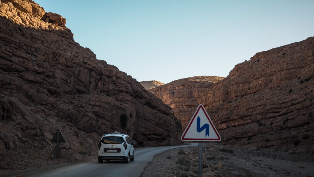
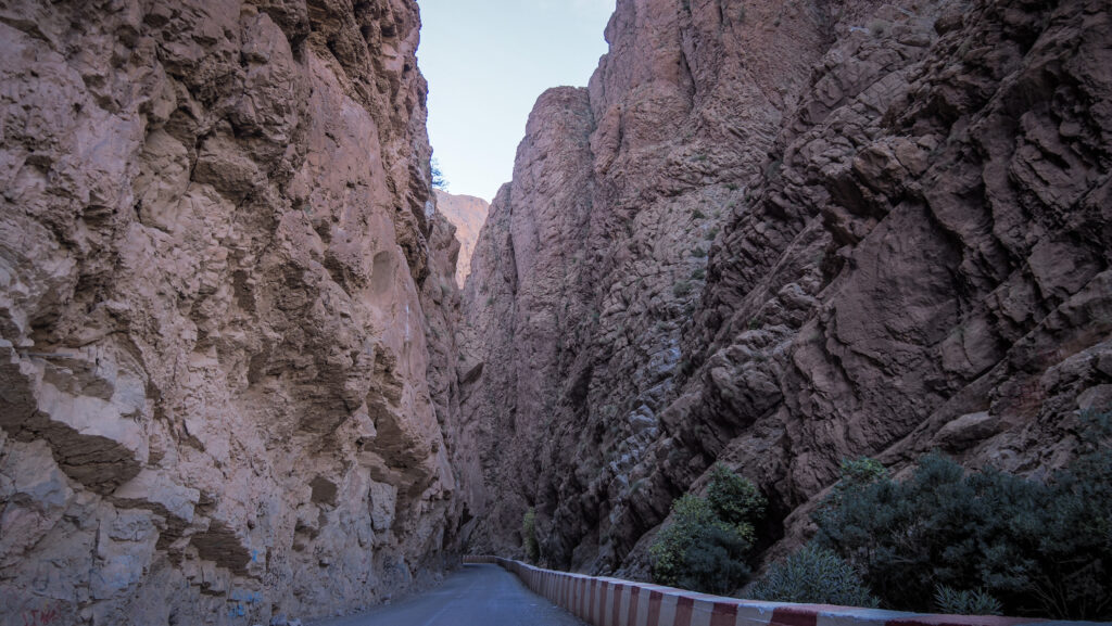
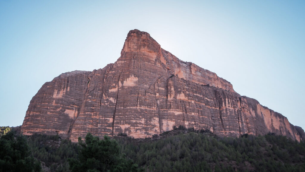
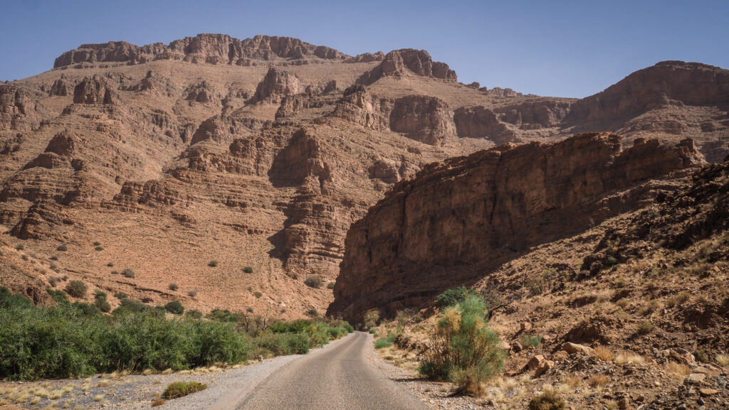
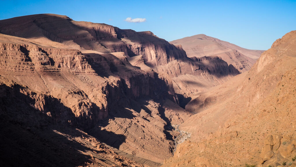
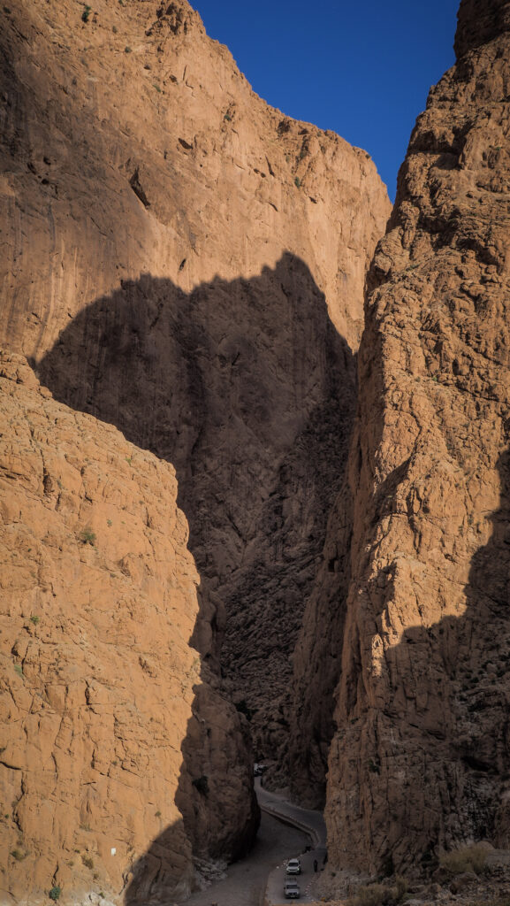
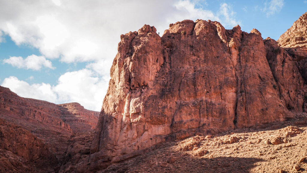
Todra Gorge is a stunning natural canyon located in the eastern part of the High Atlas Mountains near Tinghir in Morocco. It is renowned for its dramatic limestone cliffs that rise vertically up to 400 meters on either side of the Todra River. The canyon creates a narrow passage that is particularly breathtaking at its narrowest point, where it is just 10 meters wide.
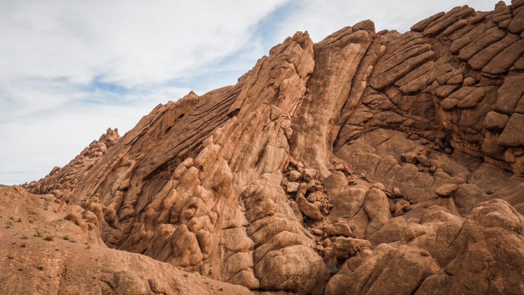
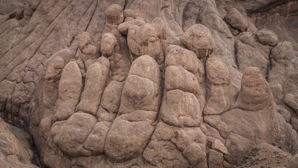
The gorge, shaped by the erosive power of the Todra River over thousands of years, showcases vibrant shades of red, pink, and orange rock that change in hue with the shifting light throughout the day. The gorge is a popular destination for both tourists and adventurers, especially climbers drawn by the sheer cliffs that offer some of the best rock-climbing routes in Morocco.
Trekkers and hikers also frequent the area to experience the raw beauty of the landscape, while casual visitors can enjoy the scenic walk through the canyon’s lower reaches. At sunrise and sunset, the lighting on the cliff faces is particularly photogenic, creating a mesmerizing effect against the rugged terrain. In addition to its natural beauty, Todra Gorge is a culturally rich area. Surrounding villages are inhabited by Berber communities, where visitors can experience local traditions, crafts, and warm hospitality. The gorge itself is easily accessible from nearby towns, making it a must-visit for anyone travelling in Morocco.
How to get there?
To reach Todra Gorge, travellers typically go through the town of Tinerhir, which is the closest major town.
By Car
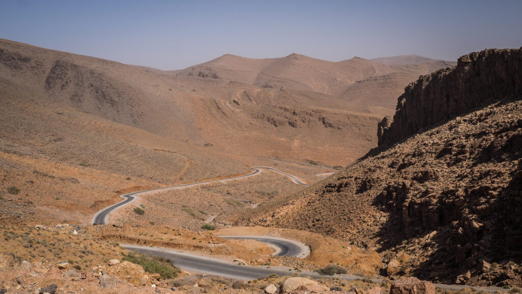
The roads to Todra Gorge are generally paved and well-maintained, though some areas can be winding, especially through the mountain passes.
From Marrakech
The drive from Marrakech to Todra Gorge takes about 6–7 hours. You’ll head east via the N9 highway, cross the scenic Tizi n’Tichka pass, and then join the N10 highway towards Ouarzazate and Tinghir.
From Fes
A drive from Fes takes about 8–9 hours. You’ll drive south through the Middle Atlas, passing Ifrane and Midelt, before reaching Errachidia and then Tinerhir.
From Merzouga
If you’re visiting the Sahara first, you can drive from Merzouga to Todra Gorge in about 3–4 hours. Head west via the N12 highway, then join the N10 to Tinghir.
By Bus
Tinerhir’s bus station is centrally located, and taxis are available to take you from Tinghir to the gorge itself.
From Marrakech
CTM and Supratours are the main bus companies offering routes from Marrakech to Tinghir. The journey takes around 8–9 hours and typically requires a transfer in Ouarzazate.
From Fes
Direct buses to Tinghir are less common, but you can often find routes that connect through Errachidia or Merzouga. The trip can take 10+ hours depending on the route.
From Merzouga
Supratours and local buses connect Merzouga to Tinghir, with the journey taking about 4–5 hours.
By Taxi
Once in Tinghir, you can easily hire a “grand taxi” to take you directly to Todra Gorge. The distance is about 15 kilometres, and the trip takes 20–30 minutes. Taxis can be shared or hired privately, depending on your preference.
By Tour
Many travellers opt for guided tours from major cities like Marrakech, which often include transport, local guides, and stops at other attractions like Ouarzazate and the Dades Valley. These tours range from one-day excursions to multi-day trips and are a convenient option for those who prefer organized travel.
Where to stay?
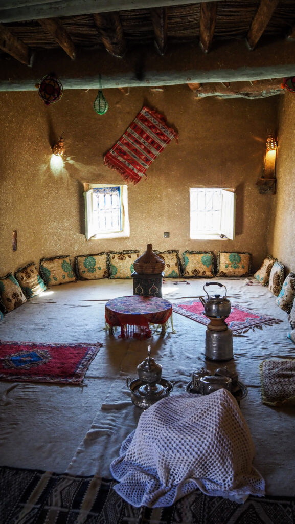
I didn’t have any reservations so simply asked for a room at Auberge Restaurant Tizgui and got one without any problems (November). Very well located near the gorge and with great views from the upper terrace. Breakfast was included.
The best time to visit
Spring (March to May): This is one of the most popular times to visit, as temperatures are warm (but not hot), and the landscape is often lush and green from recent rains. Daytime temperatures are generally around 20–25°C, making it ideal for exploring.
Autumn (September to November): Similar to spring, autumn offers pleasant temperatures and fewer crowds. The summer heat has typically subsided by September, making it a great time for hiking, climbing, and enjoying the scenery. Daytime temperatures range from 20–28°C.
Summer (June to August): Summers in Todra Gorge can be extremely hot, with daytime temperatures often exceeding 35°C, especially in July and August. While mornings and late afternoons can still be pleasant, midday heat can make outdoor activities uncomfortable. However, some visitors still come in the summer to enjoy cooler canyon breezes and early-morning hikes.
Winter (December to February): Winters are generally mild in Todra Gorge, with daytime temperatures around 10–15°C. However, nights can be very cold, sometimes dropping close to freezing, especially in January. If you don’t mind the chill, winter can offer a peaceful experience with few crowds.
Plan your trip in spring or autumn for the best weather conditions. While winter is generally mild, it can get quite cold at night and in the mornings, with temperatures occasionally dropping close to freezing, especially at higher elevations. Summer can be hot, but temperatures are milder in the mountains.
You should always have some warmer layers, regardless of the season. In the end, it’s mountains there!
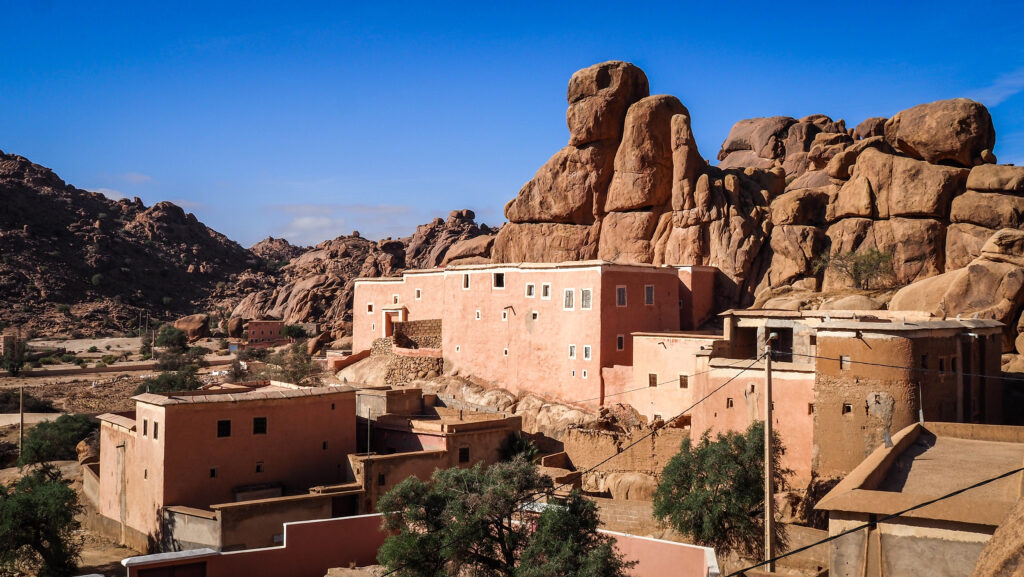
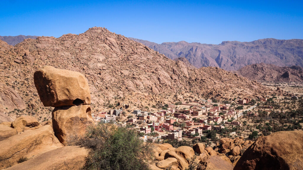
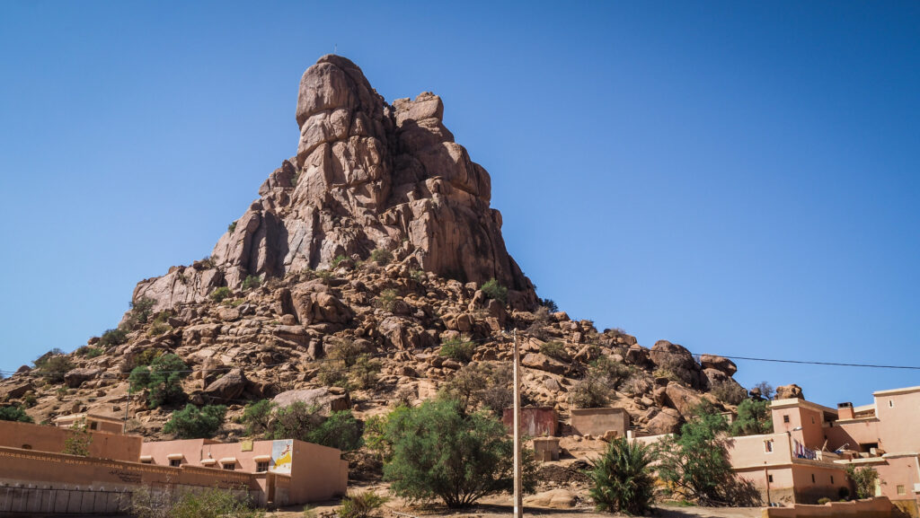
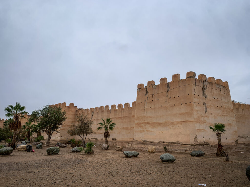
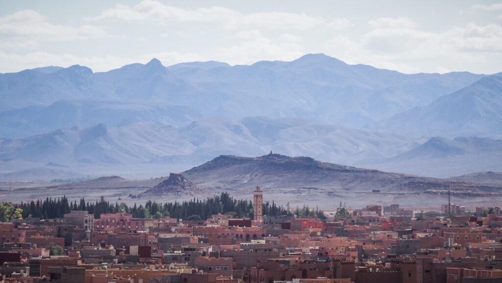
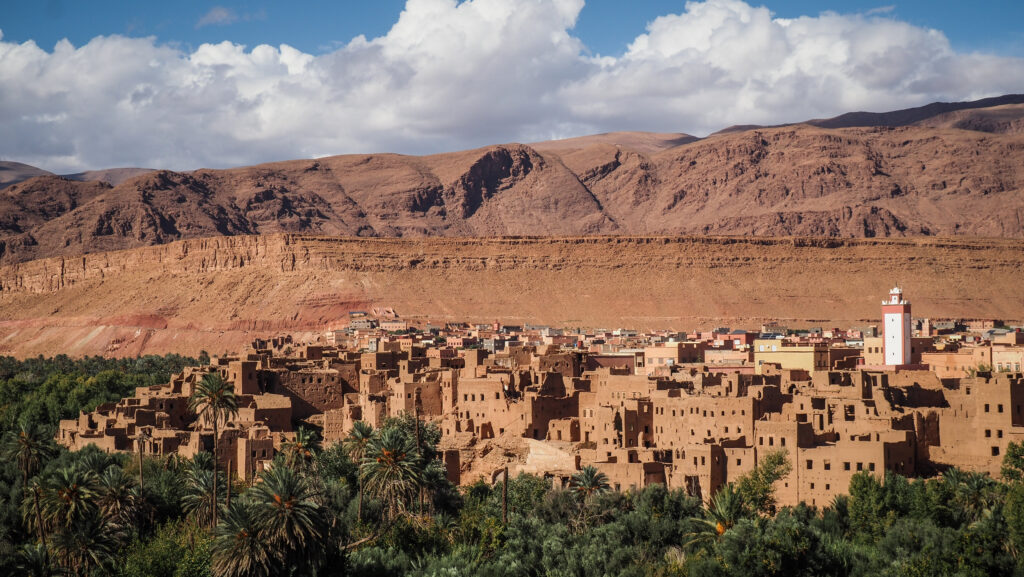
Tinghir
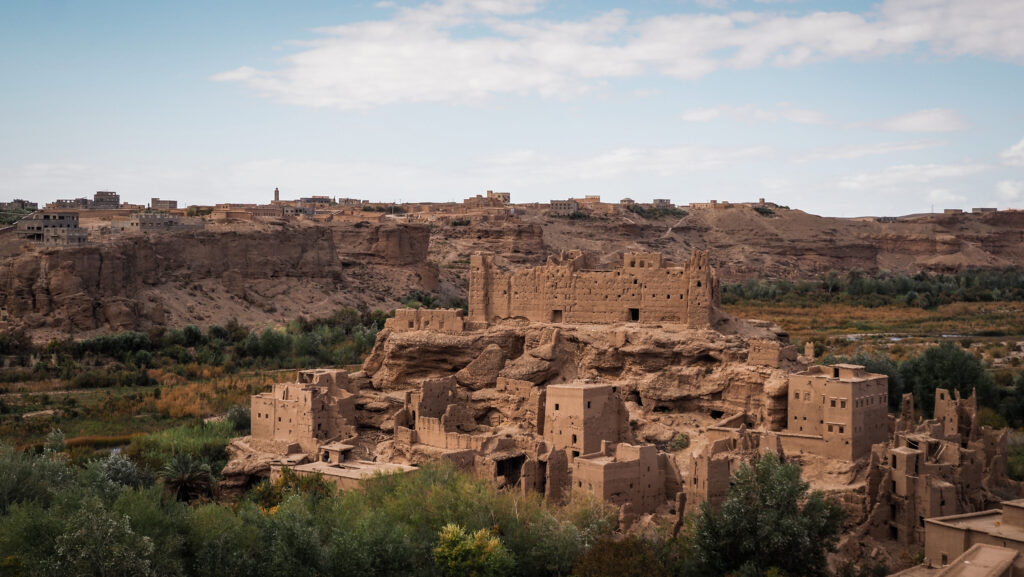
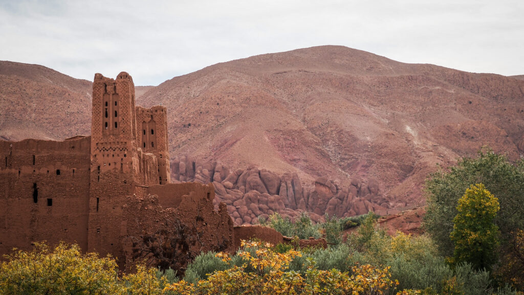
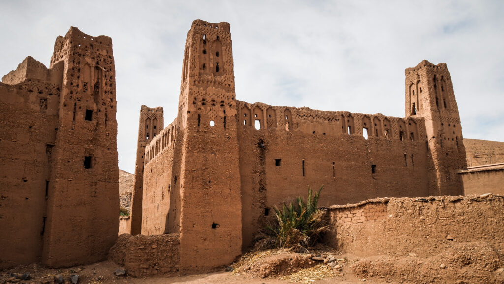
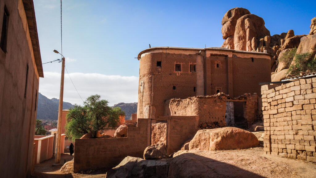
Most tourists just drive through Tinghir without stopping but it’s worth a stop for an hour or two. Check out the historic Kasbah, for a nice view of the city and mountains in the background. Other than that, it’s a ruin and there’s not much to see. Walking around is free of charge.
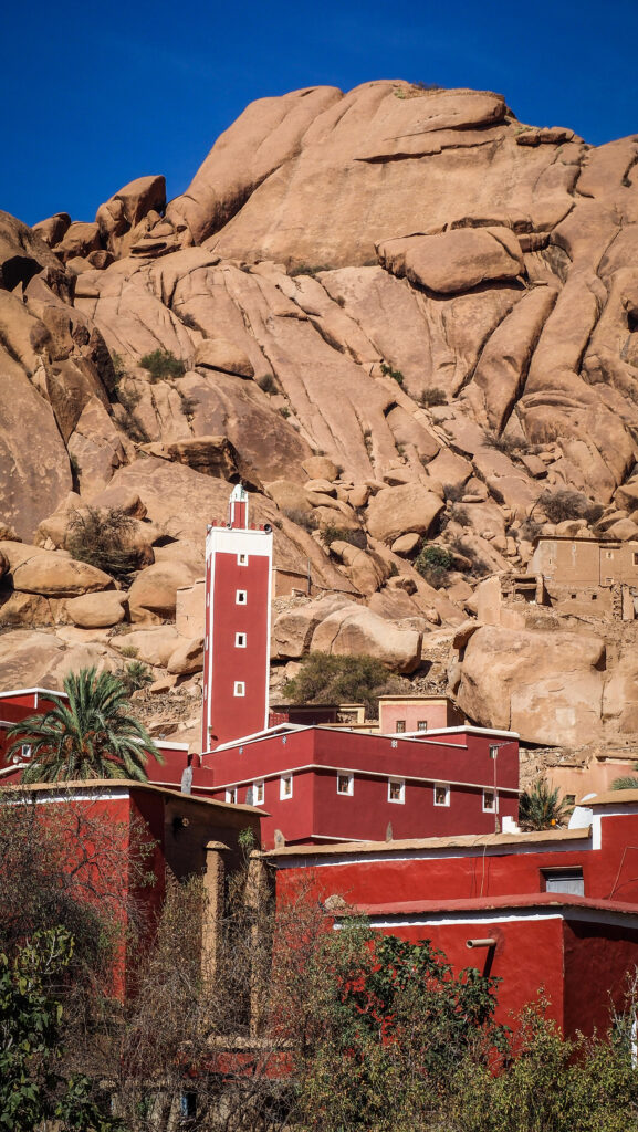
Another sight worth mentioning is Ikalalne Mosque, a beautiful building with an interesting history and unique architecture. There is a guardian, a Berber man who is renovating it by himself and maintaining it. Very kind and enthusiastic person who will certainly show you around for a donation.
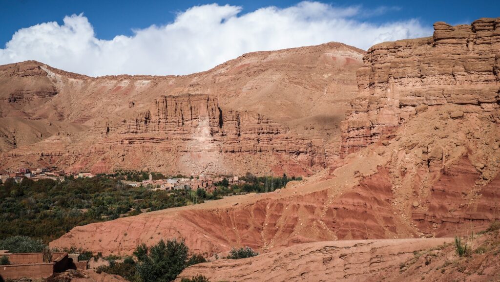
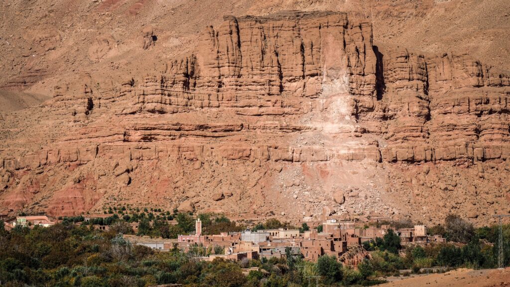
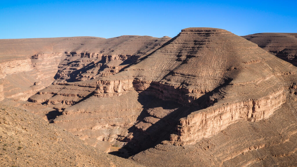
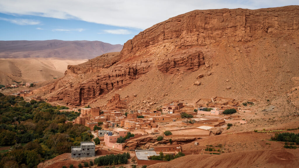
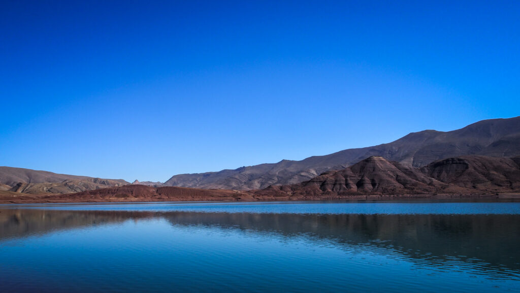
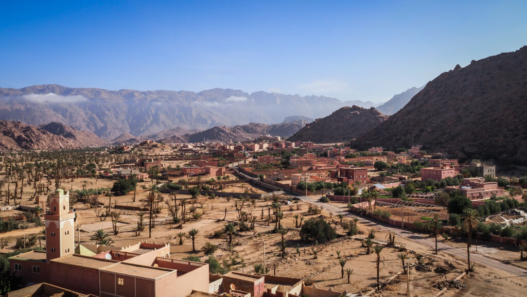
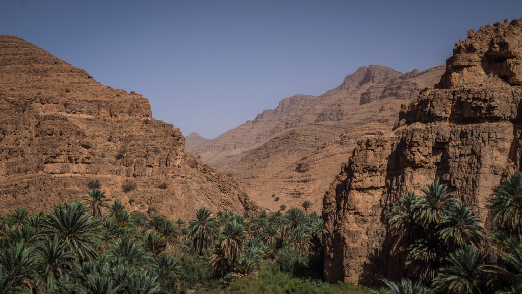
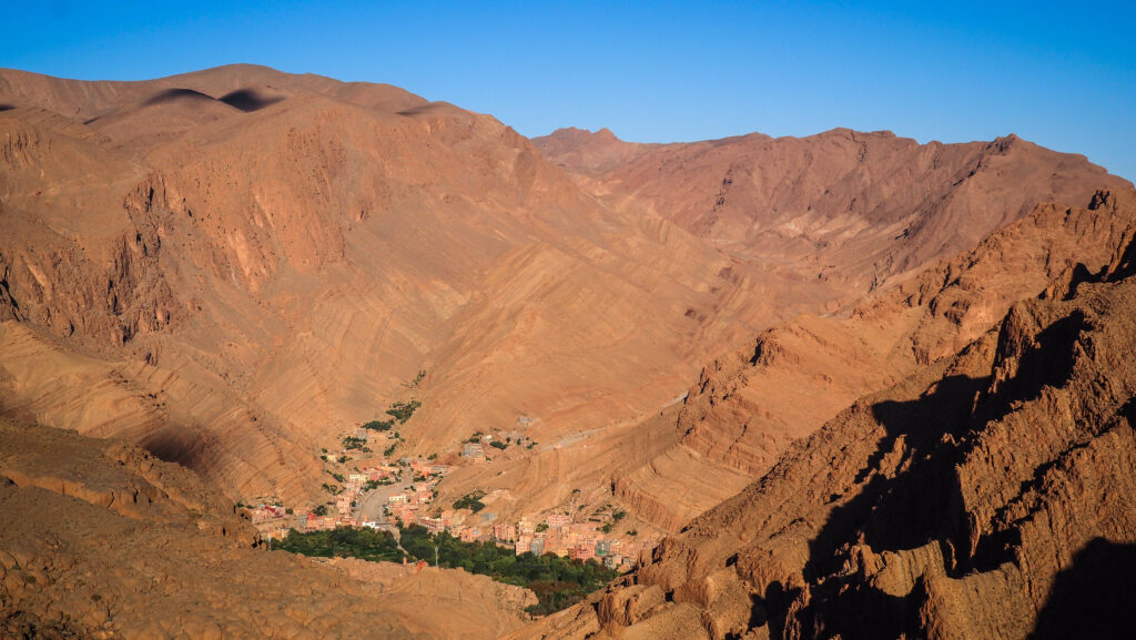
The road R703 which goes towards Todra Gorga, passes by Palmeraie de Tinghir, a stunning haven of greenery in the middle of the arid south of Morocco. The oasis is maintained by a traditional irrigation system called khattara, which dates back centuries. The technique is a marvel of traditional engineering, where underground canals bring water from distant mountains to irrigate fields.
You can admire the panorama from a lookout point along the road or drive down to one of the villages and get closer.

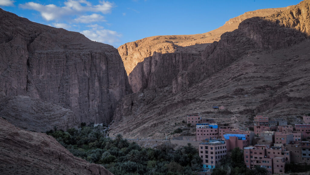
Todra Gorge
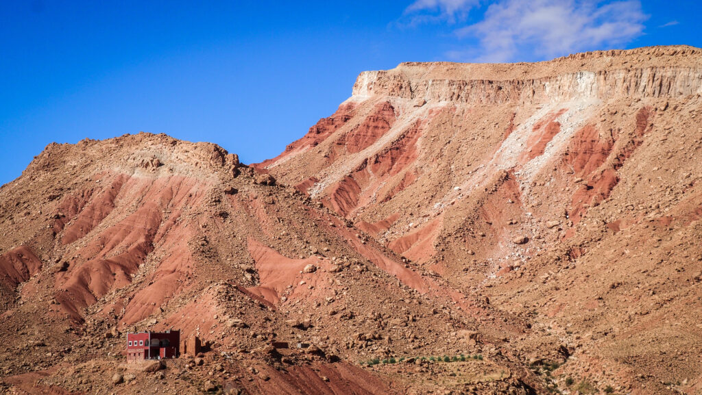
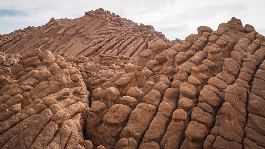
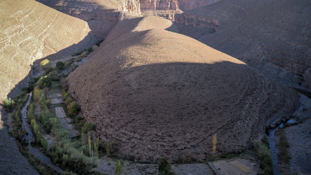
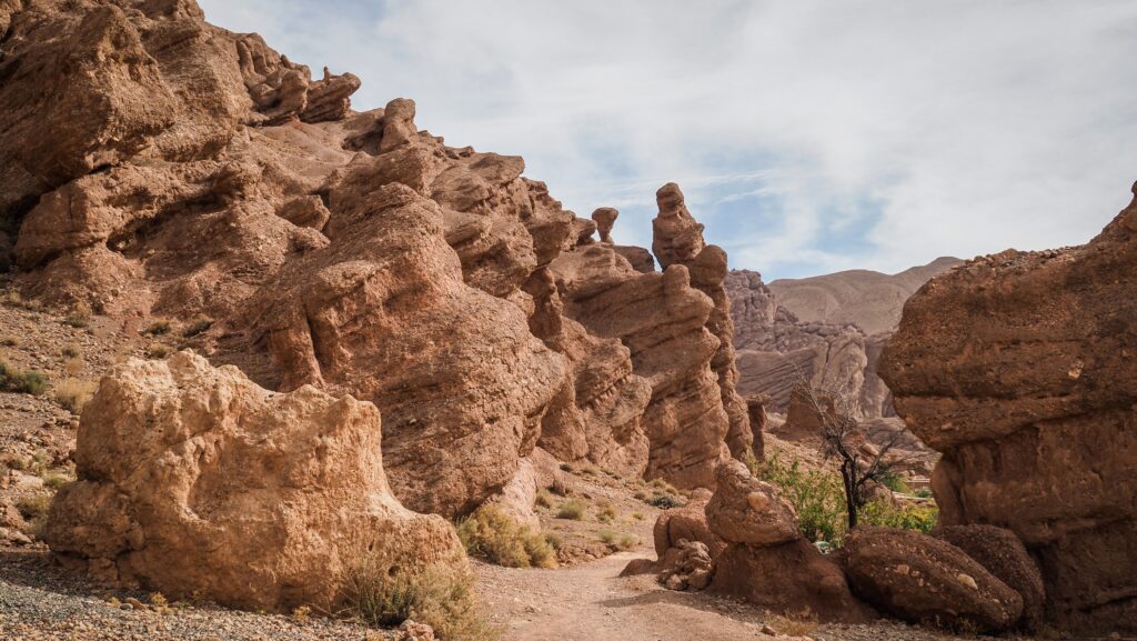
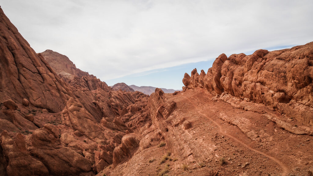
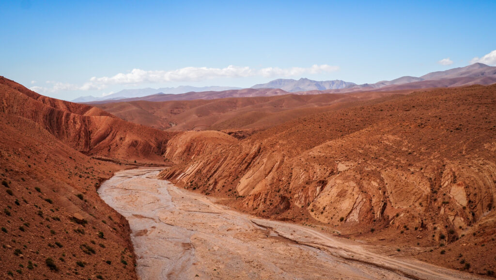
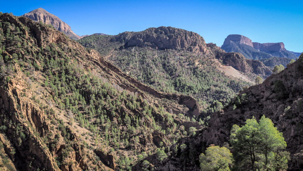
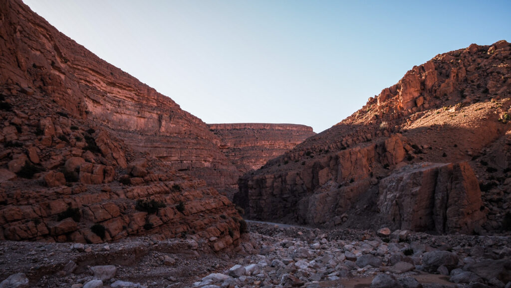
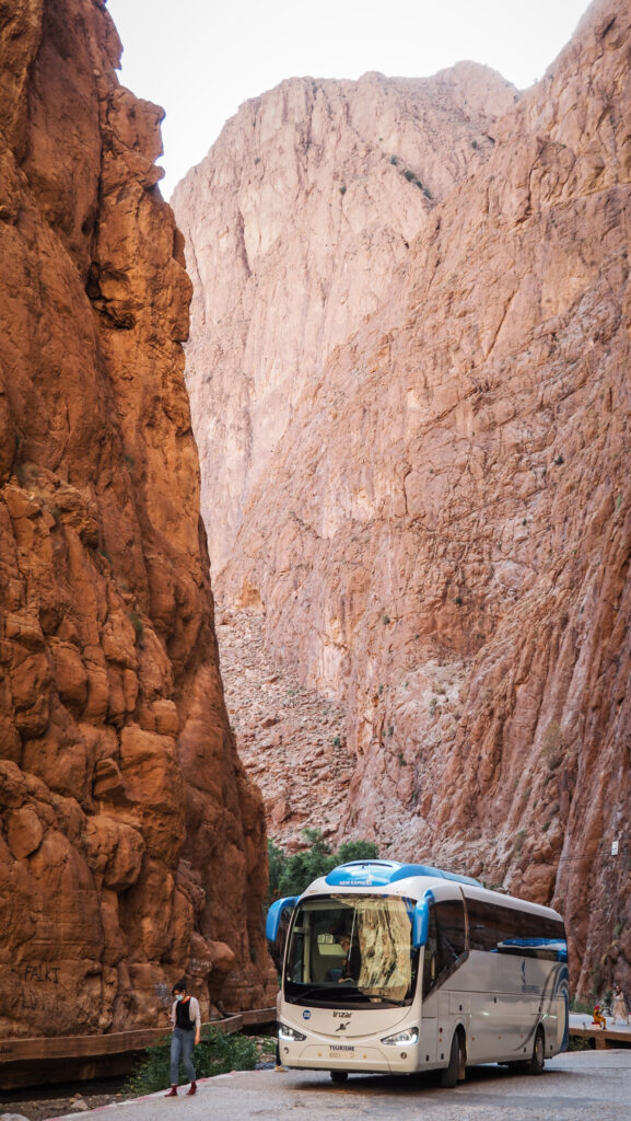
The gorge was formed by the Todra and Dades rivers, which have carved out massive red limestone cliffs over thousands of years. Some of these cliff walls rise up to 400 meters on either side of the canyon, creating a narrow, awe-inspiring passageway. The narrowest point is just 10 meters in width at its most constricted point, emphasizing the height and majesty of the cliffs surrounding it. The best time to visit is early morning or late afternoon. Other than that, expect a lot of bus tours stopping here on the way to Merzouga.

Loop hike
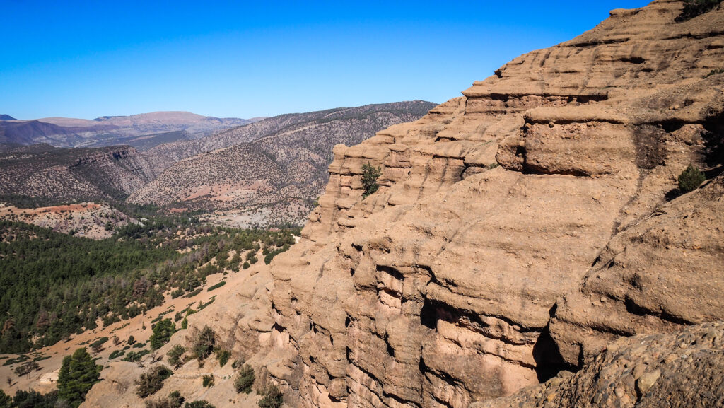
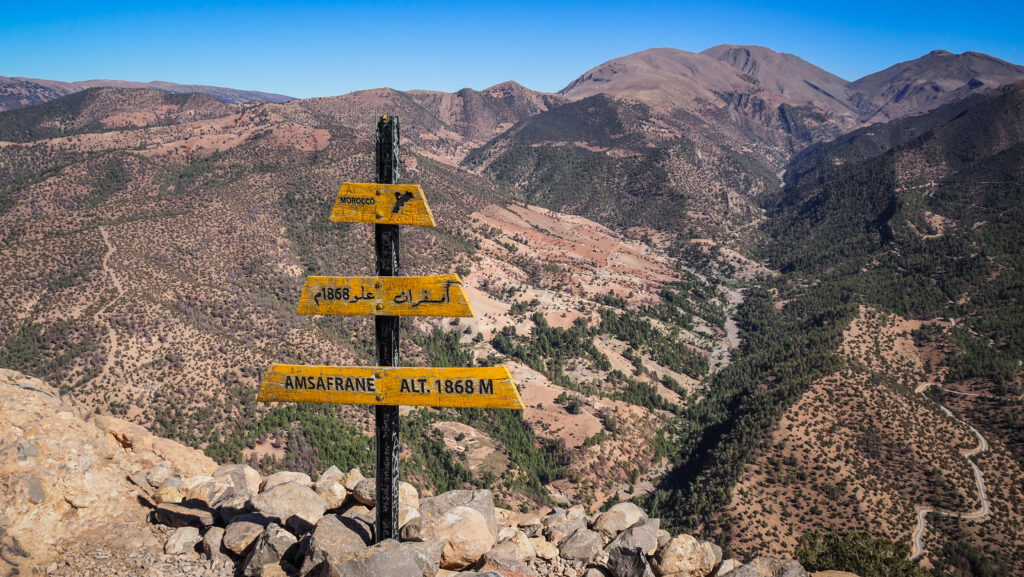
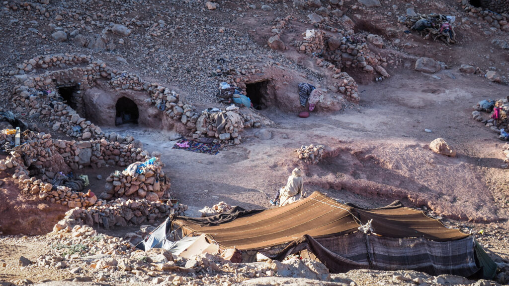
A popular and extremely scenic hike. The distance is 9 kilometres with an elevation gain of ~ 610 meters. It should take about about 3,5 – 4 hours to complete. I started with the ascent from the parking area in Todra Gorge and then descended to Ait Tizgui village and followed the road back to the parking where I left the car. The views of the mountains are breathtaking and about halfway you will come across Berbers living in tents in a nomadic style. They will most likely offer you tea, and it’s hard to imagine a better setting to get one and enjoy it.
The trail is not really marked but with an offline map on Mapy.cz I didn’t have any issues following it and monitoring my current position.
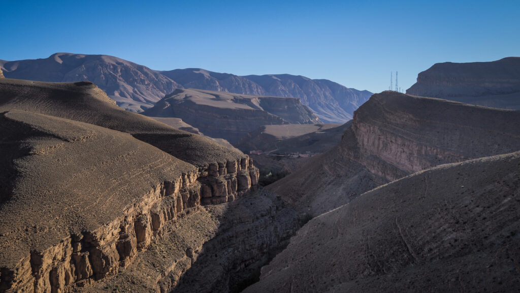
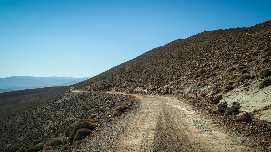
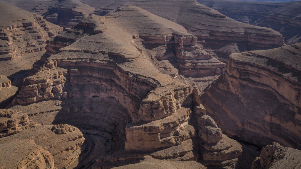
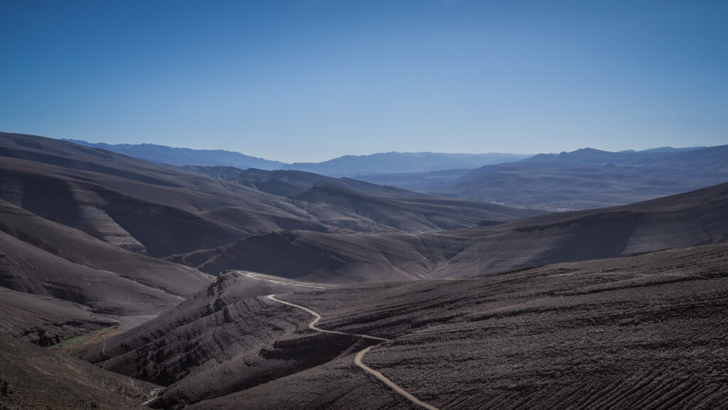
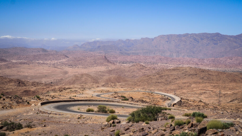
Drive further
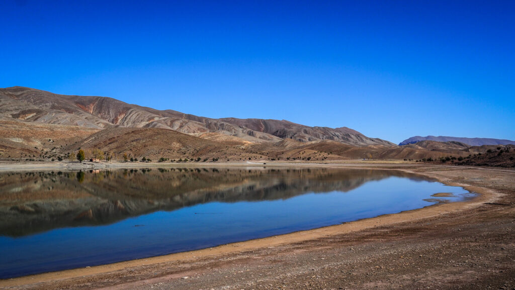
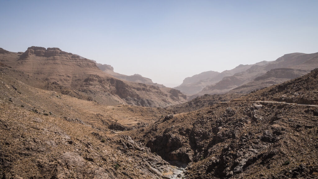
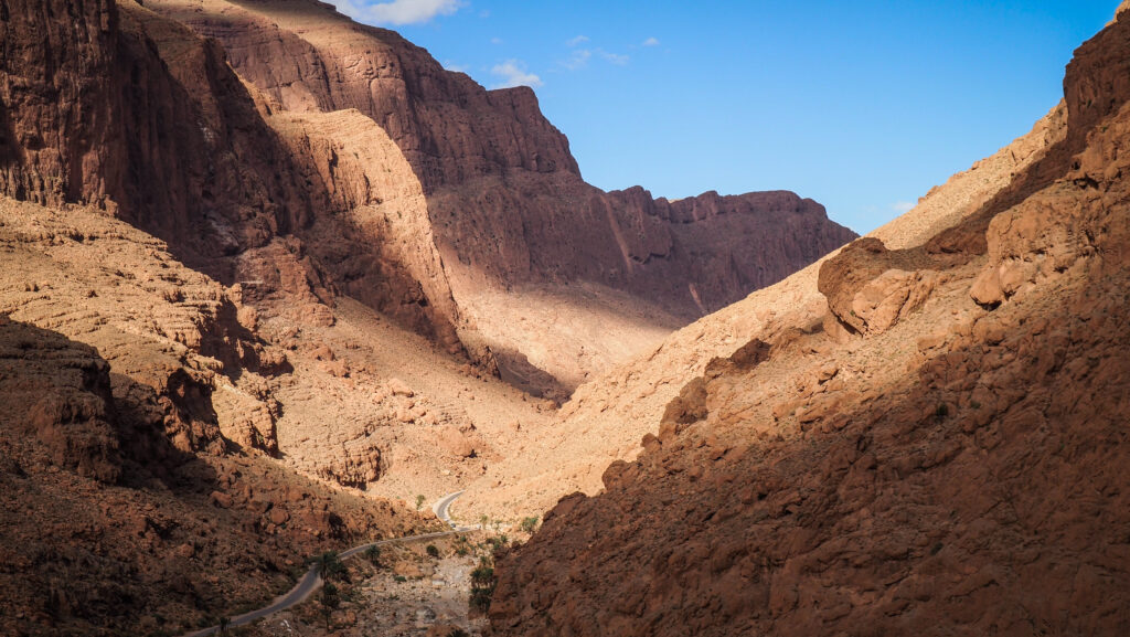
It definitely pays off to continue driving R703 further towards Tamtetoucht. The landscape is still incredible and all bus tours turn around to take another road to Merzouga, so most likely there will be minimal traffic. If you are adventurous and have some extra time, I recommend driving all the way to Er-Rich and then turning towards Merzouga from there, passing by Ziz Canyon on the way. You won’t regret it as the views are breathtaking!