There are 74 islands in the Whitsunday archipelago which lies between the northeast coast of Queensland and the Great Barrier Reef. Most of the islands are uninhabited while the most popular among tourists is definitely Whitsunday Island. Airlie Beach is the major gateway, where you can book lots of tours and activities. For me, it wasn’t any different. I arrived in the early morning and made my way directly to the meeting point of my tour.
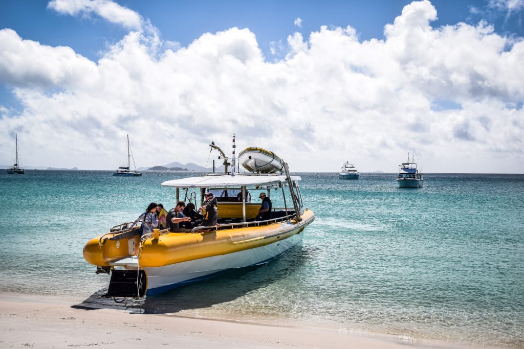
I spent a lot of time browsing different boat tours and looking for the best quality to price ratio. Overnight yachts tours sound to be an amazing experience, however, it’s Australia and such attractions aren’t cheap. That’s why I chose 1-day tour on an open-air speedboat operated by Big Fury. The standard price is 170 AUD but you can usually find a slightly better price on BookMe.
What to bring?
You definitely don’t need much. Pack your swimwear, towel, sunscreen, sunglasses and some warmer hoodie or jacket just in case. There isn’t too much walking involved so don’t worry about your shoes either.
1-day itinerary
The departure time of the tour was at 10 AM and a few minutes before we were greeted by the staff. They checked passengers list and gave us kind of swimsuits that we were supposed to wear while snorkelling. Fins and goggles were available on the deck as well.
We quickly gained speed and soon reached the first spot for snorkelling. Not the best though! Corals and fish were nice but nothing extraordinary. The worst was the temperature of the water was really cold and after a few minutes, I wasn’t interested in swimming but simply wanted to warm up on the deck. The swimsuits were rather designed to protect from the stingers (which wasn’t a problem anyway at this time of the year) rather than keep me warm.
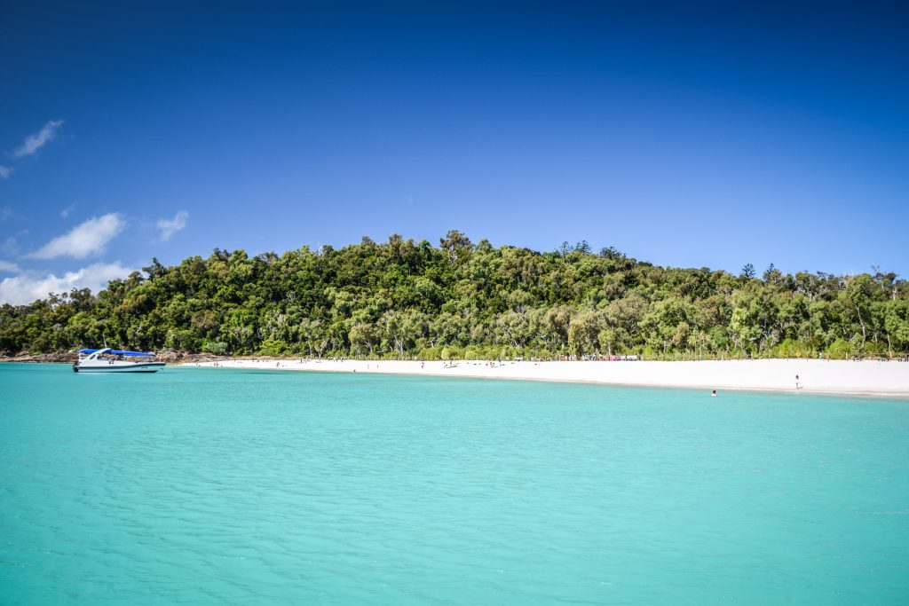
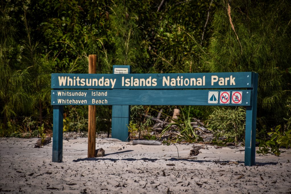
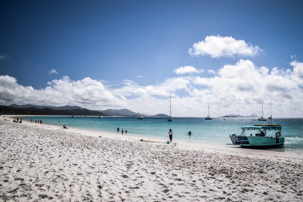
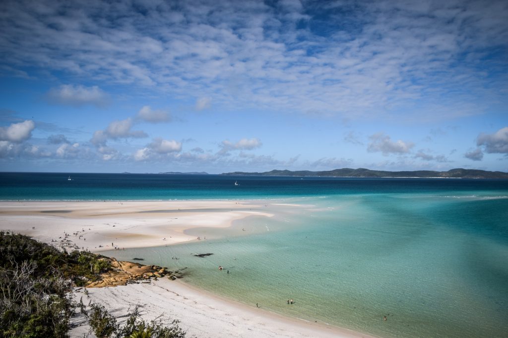
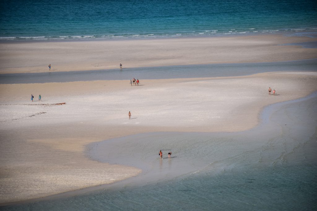
The next stop was on the famous Whitehaven Beach which stretches for 7 kilometres. It is considered to be one of the best in the world, mainly due to its bright white sands, which consist of 98% pure silica. The sand on Whitehaven Beach does not retain heat making it comfortable to walk barefoot on a hot day.
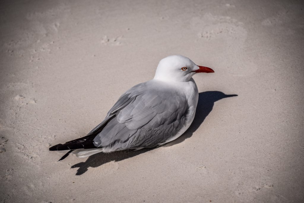
Not too bad colours, right?Let’s get ready to explore the island!Seagulls like the island tooThe whole area is protected as a national parkWhitehaven beach is 7 km long
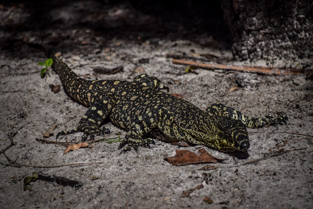
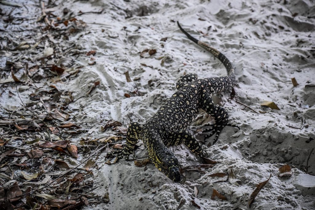
After some chillout time here, it was time for lunch. It came in the form of a buffet in a shaded spot and was really delicious! The smell and noise attracted goannas that came out of the bush to look for an easy meal. Goannas are some species of lizards of the genus Varanus found in Australia and Southeast Asia.
There are plenty of goannas around the shaded lunch spotLooking for food leftovers that was dropped by humans
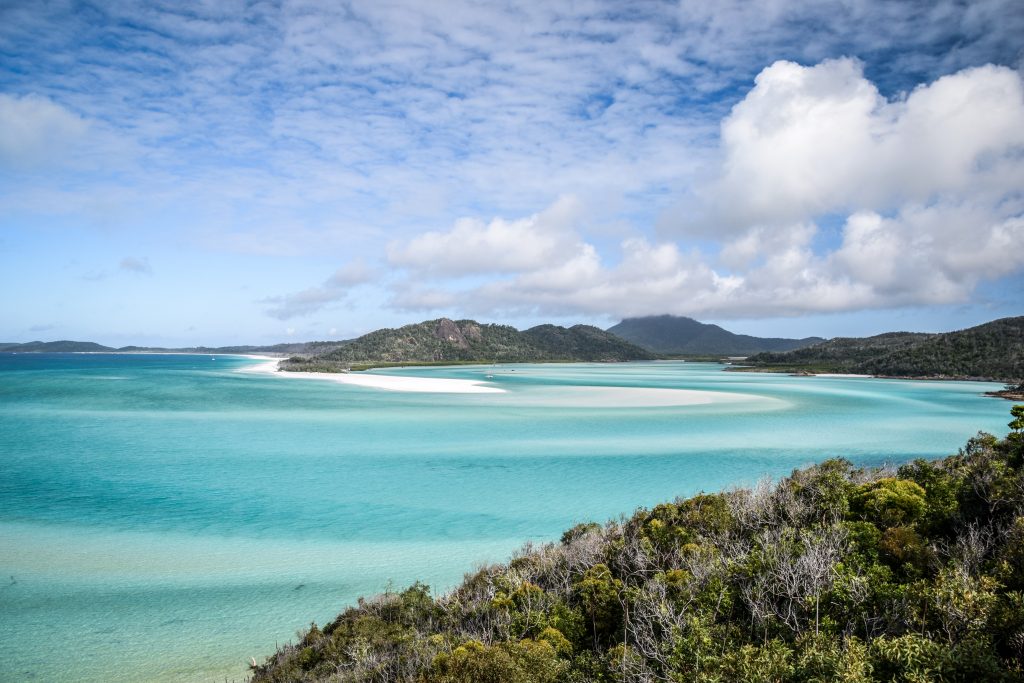
There was still some time left until the departure so I went for a short walk towards South Whitehaven Beach Lookout. The view is really good and there were almost no other people! The last stop was on the other side of Whitehaven Island to see the panorama from the famous Hill Inlet Lookout. It’s one of the best known, postcard style views from Australia with breathtaking swirling sands and unique colour of the water. The distance to walk is 1.3 km (return). Definitely worth seeing, even though the place is usually very crowded as every tour stops here.
Classic view from the Hill Inlet Lookout……and the other side with amazing white sands
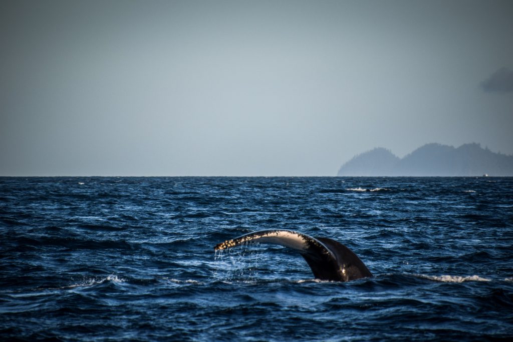
On the way back to the port, the captain reduced the speed couple of times, looking around for humpback whales. There wasn’t any sign of one at first but then one of the passengers spotted one in the distance. Unfortunately, it was quite far away from the boat and I was able to take a picture with maximum zoom, but the quality is far from perfect. Still, better than nothing!
Humpback whale making a splash
We were back in the marina about 5 PM and I was really full of positive emotions after a lovely day. Sure, I could easily imagine cruising around the islands for additional days, exploring them more in detail and sleeping on a campsite or on the deck. However, considering the costs, a 1-day trip with Big Fury is a great deal for backpackers and budget travellers.
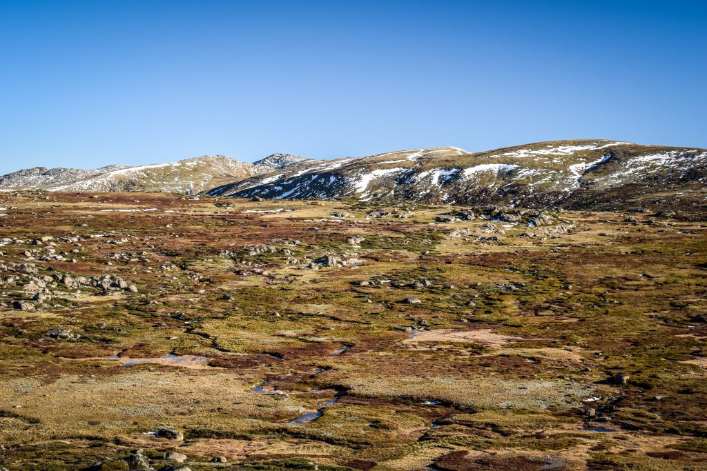
The park is named after Mount Kosciuszko, which at 2,228 metres is Australia’s highest mountain. The best way to discover the area is to go for a walk. Nature enthusiasts will be rewarded with alpine views, crystal clear streams, glacial lakes and historic huts.
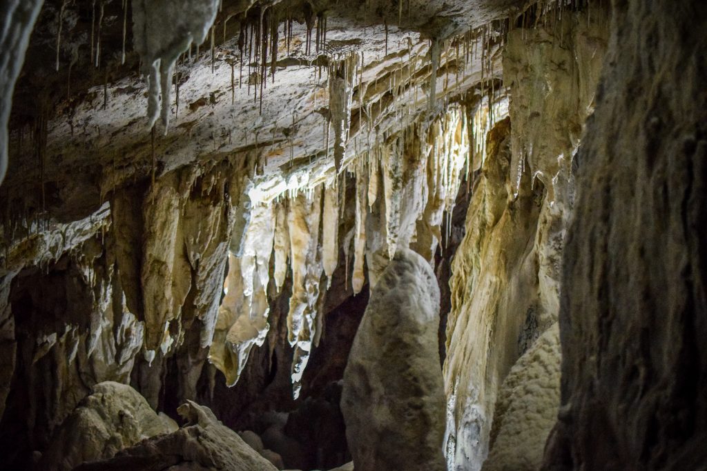
At the northern end of the national park are the Yarrangobilly Caves. The limestone dates back 440 million years. An impressive place to discover with an extra opportunity to relax in a naturally heated thermal pool. Don’t forget your swimmers!
During winter, it’s one of the best places in the country for skiing. All New South Wales alpine resorts are within Kosciuszko National Park: Perisher Blue, Charlotte Pass, Thredbo and Mt Selwyn.
I made my first stop at Yarrangobilly Caves Visitor Centre to purchase 24 hours pass to the National Park. It costs $17 per vehicle per day (24hrs) and includes free entrance to some of the self-guided caves in the area. I was advised to visit South Glory Cave first and that was exactly what I did.
Yarrangobilly’s karst landscapes were created from a belt of limestone laid down about 440 million years ago. Karst environments preserve evidence of climate change, floods, droughts, fires, animal and human activity. All of that makes it an incredible place to discover.
South Glory Cave is the largest one in the Yarrangobilly area of Kosciuszko National Park. I drove past the visitor centre following the signs to the parking. All that area can be easily accessed with a 2WD vehicle. From there, the cave is accessed along a 500m gravel track, leading to Glory Arch. Yarrangobilly river flows just down the escarpment.
The fact that the tour is self-guided makes it much more interesting than just following a group. I was inside completely alone and it took me around half an hour to go through and read information signs. Even though there are sensor lights that switch on as you approach, having your own flashlight is essential. Moreover, the average temperature in this cave is around 10 C so bring a hoodie or a jacket.
After visiting South Glory Cave, it’s a good idea to hike the Castle Cave Walk with the views to limestone cliffs and Mill Creek Gorge. and on to Castle Cave. The track is 3.2 km return and shouldn’t take you more than an hour. Detailed map of the track can be found on the website of NSW National Parks.
If one short track is not enough, head back towards the parking and join Yarrangobilly River Walk. It’s an easy 3 km loop beside the river with an interesting stop on the way – Thermal Pool. Water temperature is on a constant level of 27C so bring your swimsuit and towel! It was nice to jump in and refresh my body, especially after a visit in a cold and damp cave. Detailed map of the track can be found on the website of NSW National Parks.
Glory Farm Walk is a short extension to the thermal pool walk. It’s 2.8 km long (return hike) and follows Yarrangobilly River to the site of Henry Harris’s Glory Hole Farm which provided meat and vegetables for the Kiandra miners in the late 1800s.
There are more caves in the area: Jillabenan Cave, Jersey Cave and North Glory Cave. The first one can be visited on a guided tour. It’s the smallest of the Yarrangobilly Caves with the path through it being 73m long. I didn’t join the tour as visiting South Glory Cave fulfilled all my expectations towards stalagmites and stalactites 🙂 Jersey Cave and North Glory Cave are closed until further notice.
After longer than expected visit in Yarrangobilly Caves, it was time to move on toward Thredbo, which was over 2 hours away.
Mount Kosciuszko Summit (Main Range Walk)
There is not much to do in Thredbo outside of ski season. I had a short walk but then simply made my way to Ngarigo campground which is located along Alpine Way. The place isn’t big but there was only one more campervan parked. I have no idea what the temperature in the night was, but it was damn cold! Definitely the coldest night in Australia during my trip. I used everything I could: blankets, sleeping bag and hoodie.
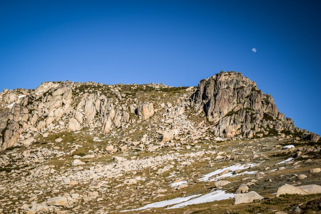
I woke up at dawn I set off without breakfast. It was the first time that I had to turn on the heating as the front windshield got icy! The way to the parking at the end of Kosciuszko Road took me about 1 hour. After breakfast, I packed my backpack and followed the Summit Track. The distance to the summit is 9.3 km (about 2 hours) but I had the plan to take another path on the way back, completing the loop called the Main Range Walk. It’s a 22 km loop that in theory should take between 7-9 hours but in my case, it was rather closer to 5-6 hours.
The morning was very cold but the sun was rising higher and higher warming up the air. Small streams along the track got frozen and there was snow clearly visible in the upper parts of the mountains. I definitely didn’t expect to see it in Australia!
Glacier-carved landscape in Kosciuszko National ParkMornings in late May can be quite cold!Frozen water along the trackAlpine meadows
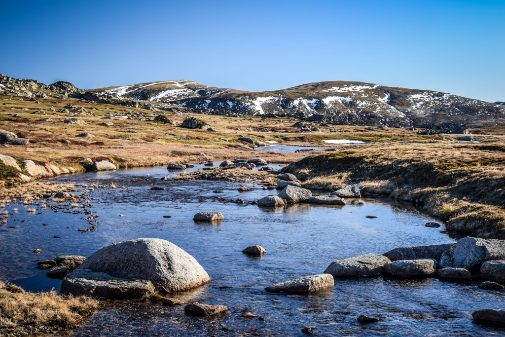
I crossed Snowy River and then, 6 km from the beginning of the track, I passed Seaman’s Hut which is a small safe haven if the weather turns. Rawson Pass is another 1.7 km away. Here it was the time to turn right and make the final ascent to the summit of Mount Kosciuszko.
You may wonder, where the name comes from?
It was given by Polish explorer Count Pawel Edmund Strzelecki who was the first to summit the peak in 1840. It refers to Polish hero General Tadeusz Kosciuszko, a prominent figure in the American revolution. Apparently, the highest Australian mountain looks similar to the sight in which General Kosciuszko was buried.
Approaching the summitViews from the top of Mount Kosciuszko
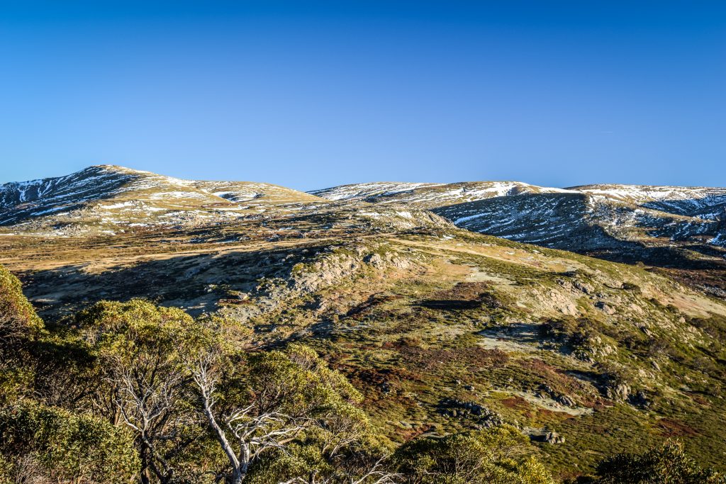
From the distance, the mountain doesn’t look impressive at all. But in sunny weather, the views from 2228 m a.s.l. are decent enough to justify the effort 🙂 Honestly, the landscape here doesn’t feel like Australia at all. Or maybe I just got used to the desert on one side and the ocean on the other?
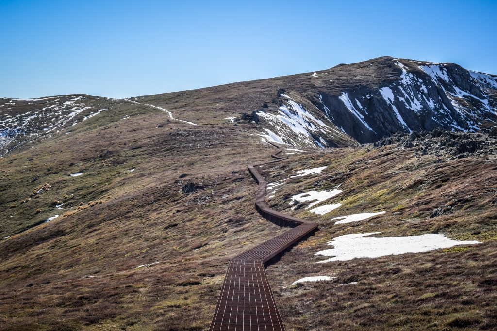
Continuing the hike along the Main Range TrackWalking on the snow? Why not!Moon just hanging over the mountainPart of the track leads on metal platformsThe Main Range Walk is very scenic!Fantastic alpine viewsTrack covered by snowViews along the Main Range TrackUnique Australian landscape in Kosciuszko National Park
I started the descent following the same way as before but shortly after I turned left on the track leading towards Muellers Pass. Then, it continues to Northcote Pass which is just next to Albina Lake. There is an opportunity of a short detour to Blue Lake which is definitely worth doing.
I’m not sure what are the rules of freedom camping in Kosciuszko National Park but I saw two tents pitched on the meadows. Certainly, the nights are cold, but what a great location! If you are a camping enthusiast, consider doing the same.
After crossing the Carruthers Creek, the track goes to the meeting point of Club Lake Creek and Snowy River. From here, the last uphill section leads back to the parking lot.
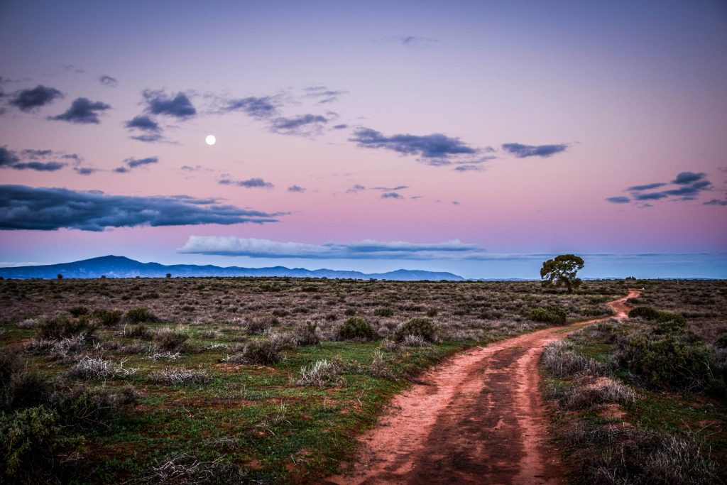
Flinders Ranges National Park was my first stop on the way from Adelaide to Darwin. Well, not exactly on the way as I had to make nearly 200 km detour from Port Augusta. However, the first stop on the way through the iconic scenery of outback Australia. I expected it to be marvellous and pristine. Driving from Melbourne to Adelaide was fun. Great Ocean Road, detour to Kangaroo Island and multicultural city of Adelaide. But now it was a time to get inland. To see the Red Centre. To feel the heartbeat of Australia.
I knew that there are long days of driving ahead of me but all emotions were covered by pure excitement. I love desert landscapes. Silence, remoteness, huge open spaces with me standing in the middle like a small pawn on a giant board. I feel I am self-dependent. Far away from the mess of daily life. Free.
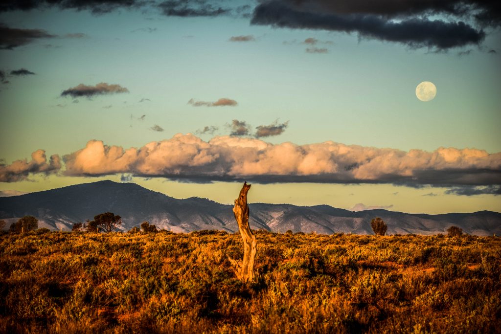
I hit the road in the morning and left Adelaide before traffic jams. The day was beautiful with a blue sky and a pleasant temperature of 20-25C. The plan was to get to Port Augusta with a stop in Mount Remarkable National Park. After a short hike there, I still had enough time to visit Australia Arid Lands Botanic Gardens. I didn’t expect more than boring walk among plants just to kill some time but instead, I got one of the biggest positive surprises in South Australia. Learning about the flora doesn’t come with the thrill of joy in my heart, but the walk through the garden was very relaxing and the landscape around it at sunset time was simply stunning. Look at the pictures below and tell me I’m wrong!
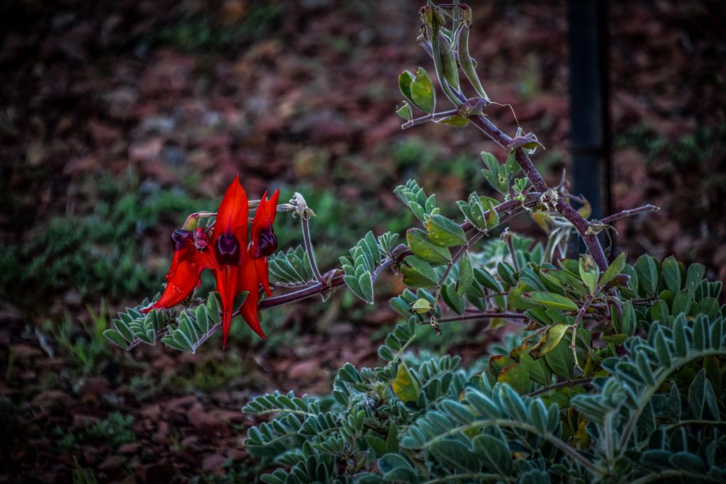
Landscape around Australia Arid Lands Botanic Garden in Port AugustaLandscape around Australia Arid Lands Botanic Gardenin Port AugustaSunset around Australia Arid Lands Botanic Garden in Port AugustaSturt’s Desert Pea
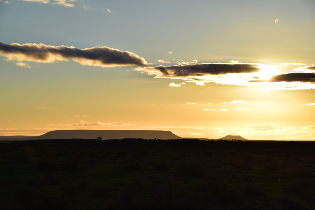
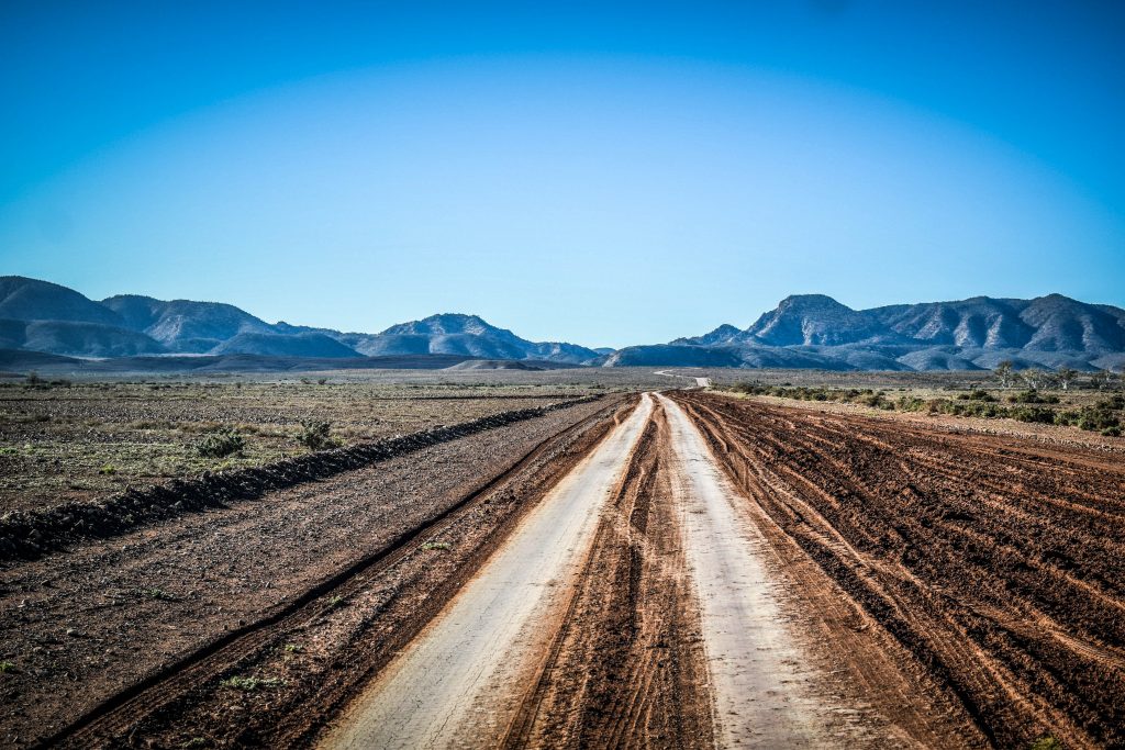
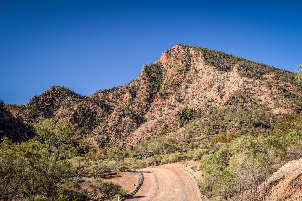
After the night at the gas station, I hit the road well before sunrise. It took me around 2 hours to reach the turn into Brachina Gorge Road. From here, dust road led me as far as I could see, pulling towards mountain ranges growing on the horizon with every second.
Brachina Gorge Road leading towards Flinders Ranges
Flinders Ranges National Park was named for Matthew Flinders, the English navigator who sighted and explored the peaks in 1802.
There is a lot to see here. The largest mountains range in South Australia with stunning gorges rich in wildlife as well as historical sites. Ikara/Wilpena Pound is an ancient meeting or initiation place for Aboriginal people and several ruined buildings around Wilpena, Arkaba and Aroona remind about first settlements of Europeans in this region. Contacts between traditional owners (Adnyamathanha people) and newcomers were not always peaceful, especially when it comes to water and land rights.
Best time to visit
The most comfortable time for exploring the area is between April and October. In summer, the temperatures can rise well over 40ºC, which can already be dangerous for your health and safety.
I would suggest staying at least 2 days to do plenty of bushwalks and admire night sky at the campsite.
How to get there
The easiest way is to start from Adelaide and drive around 450 kilometers to the north in the direction of Hawker and Wilpena. You don’t need 4WD at any point.
Alternatively, you can approach Flinders Ranges from the north, following Birdsville Track or from Broken Hill, turning right at Yunta but in both cases don’t think about it without 4WD.
For getting around the park, a 2WD car with high clearance is enough. Roads are unsealed and sometimes rough, especially in Brachina Gorge, but just take it slowly and it’s gonna be fine. I had no problems driving my Toyota Tarago.
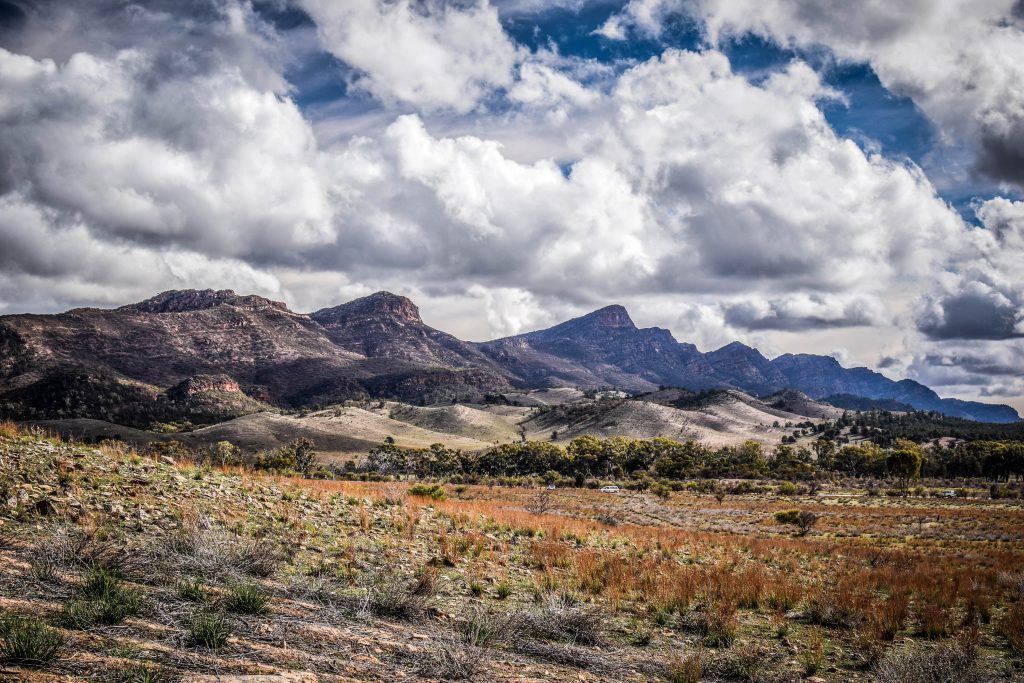
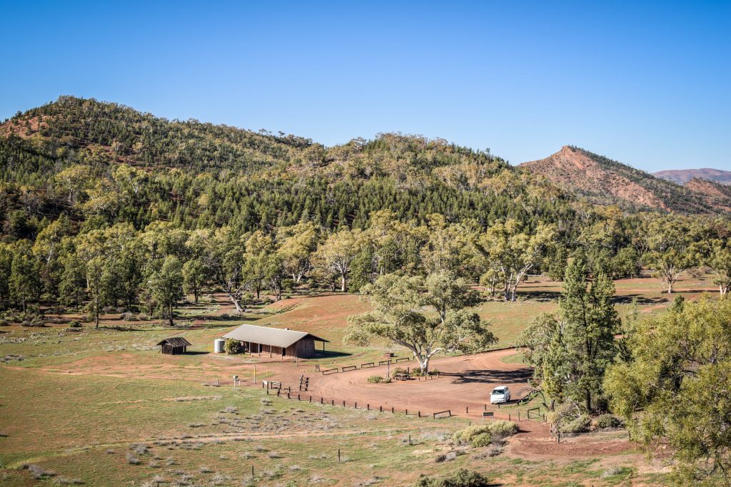
Views around Wilpena Pound Resort
Camping
There are 10 campgrounds in the national park. Most of them have basic facilities, such as toilets and fire pits (can be used outside of the fire danger season). As there is no mobile signal at campgrounds, therefore book your spot and vehicle entry fee online or at the Wilpena Pound Visitor Centre. I really recommend staying for the night in Ikara-Flinders Ranges National Park. There is no light source here, so take your own and don’t forget to just turn it off for a while. Then, enjoy the magical spectacle full of stars.
Worth to know
Take Georama virtual tour – a great chance to have the first look at the national park scenery before heading there in person. Views include Wilpena Pound, Pine Hut, Parachilna Gorge and more.
Download mobile apps: Discover the Flinders Ranges (iOS / Android) and Flinders Ranges Walks (iOS, Android). The first one includes driving and walking tours as well as information about geology, wildlife and plants. On the other hand, the second one covers 16 walking tracks in the national park.
Maps can be downloaded from the website National Parks and Wildlife Service South Australia.
Park Passis required to access the Flinders Ranges National Park and costs 11 AUD per vehicle. It can be purchased at the Wilpena Pound Visitor’s Centre.
Top sights in Ikara-Flinders Ranges National Park
Wilpena Pound – 80 sq km amphitheatre of mountains that is also known by its Adnyamathanha name of Ikara, meaning “meeting place”. According to Dreaming stories, the surrounding mountains are the bodies of two giant snakes that laid around during the initiation ceremony. After feasting on the people, they couldn’t move and died, creating the most iconic landmark of the national park.
If you have some cash to spare, take a scenic flight and admire this miracle of nature from the sky. Scenic flights can be booked through the Wilpena Pound Visitor Centre and such a pleasure costs between 100-200 AUD.
Pound Gap Track and Wangarra Lookouts – there are several walking tracks starting at the Wilpena Visitor centre, including the Pound Gap Track (8 km return). It follows Wilpena Creek through tall river red gums and pines. After some time, you will reach Hill Homestead which is worth a stop to read information about historic inhabitants of the cottage and difficult conditions they struggled with. Refill your body with water and calories and continue to lower and then to the upper Wangarra Lookouts to fully enjoy spectacular Wilpena Pound from the inside.
If you are lazy, there is an option to take a shuttle bus that stops around 1 km from Hill Homestead. It runs 3 or 4 times a day but check the schedule at Wilpena Pound Resort.
View from upper Wangarra Lookout
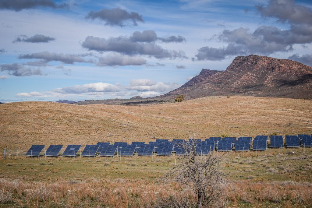
Solar Panel Station – nice short walk on the road towards Wilpena Pound Resort. Nice not because of solar panels but the gang of kangaroos hopping around.
Solar Panel Station
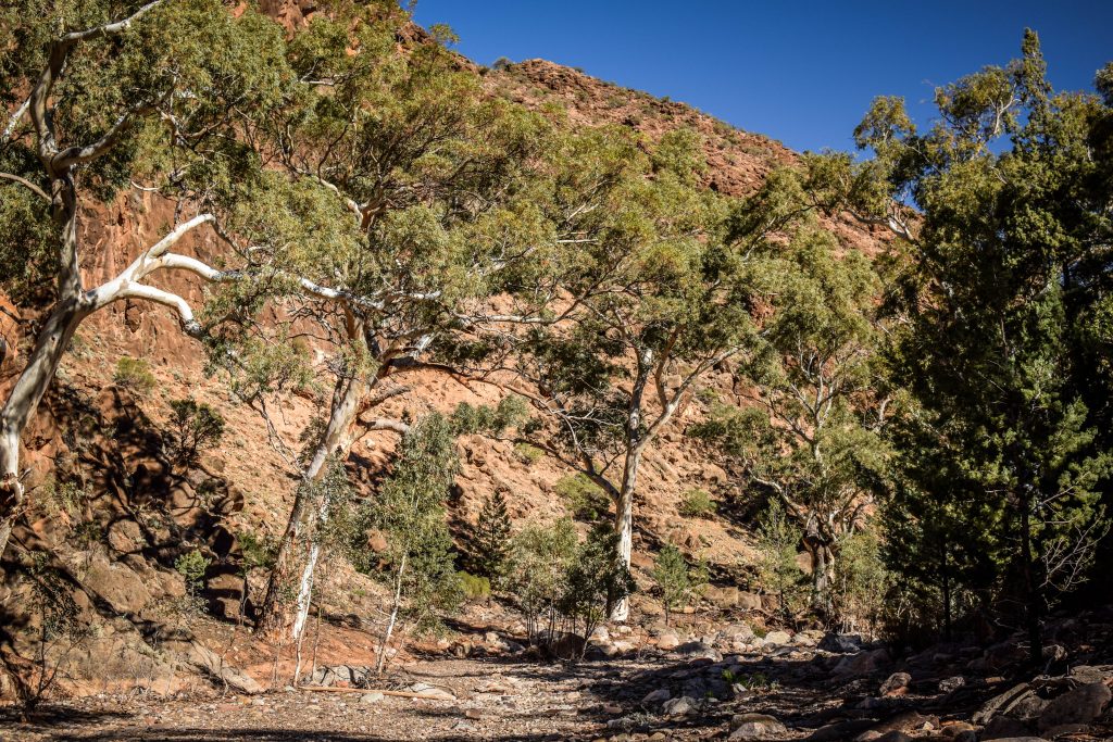
Brachina Gorge – 20 km drive with informative signs along the way telling about the age and formations of the rock and cliffs. Some of the oldest fossils on earth have been found here! If that doesn’t excite you, then just sit back and enjoy the ride with the bumps adding a bit of adventure feel. Amazing experience! If you are lucky, there is a chance to spot a yellow-footed rock wallaby, especially active in the afternoons.
Road through Brachina Gorge
Bunyeroo Gorge – a great opportunity for a walk surrounded by rocks and gum trees. The 7.5 km return hike will take about 3-3.5 hours to complete.
Hiking trail in Bunyeroo Gorge
Razorback Lookout – only a short drive away from the parking at Bunyeroo Gorge following scenic Bunyeroo Valley road lays this iconic viewpoint. Breathtaking panorama of Ikara-Flinders Ranges National Park.
Old Wilpena Station – the oldest pastoral site in South Australia, working until 1985. Remainings of old buildings and cemetery remind about harsh conditions that first European settlers faced after arrival to the region. Two options for a walk here: 1km loop or 3.2km loop.
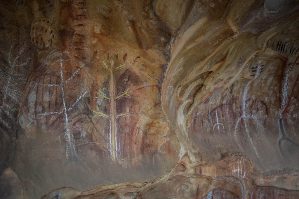
Arkaroo Rock – Short bushwalk taking you to ochre and charcoal rock paintings from the land’s traditional owners. Parking is easily accessible from Ikara/Wilpena Pound (around 17 km). From there, it’s uphill but gentle loop track which shouldn’t take longer than 1-1.5 hours to complete. Other spots to admire aboriginal art are at Perawurtina and Sacred Canyon, however, the last one can be visited only on an organized tour with an Aboriginal guide from Wilpena Pound Resort.
Aboriginal art inside Arkaroo RockLandscape around Arkaroo Rock
St Mary Peak – The highest point of the Flinders Ranges (1171m above sea level) and significant place for aboriginal people of Adnyamathanha. Due to this fact, it’s recommended to respect the summit and not to go beyond Tanderra Saddle. There are two options: the direct route, which is 14.6 km long and takes about 6 hours or the loop route, which is 21.5 km and takes about 8-9 hours. I didn’t do the hike but I heard it’s pretty difficult so take enough supplies and tell someone about your plans.
Aroona Ruins – Above the spring are the remains of sheep station from the early nineteenth century. The area is strongly connected with Hans Heysen, the German watercolour artist.
Parking and campsite around Aroona Ruins
Appealinna Ruins – In the 1850s, Joseph Wills was a local pastoralist who built the homestead and stockyards on the southern side of the creek, while the ruins on the north side were once a busy mining settlement.
Walks and hikes – There are enough tracks to satisfy even the most demanding wanderers and spend several days with nature. Check the full list on the website of the national park and get a map from Wilpena Visitor Centre. Never forget your water and keep in mind safety rules!
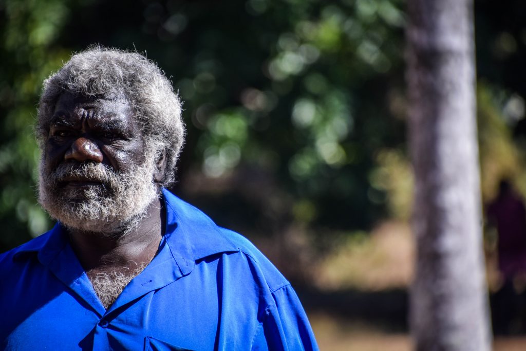
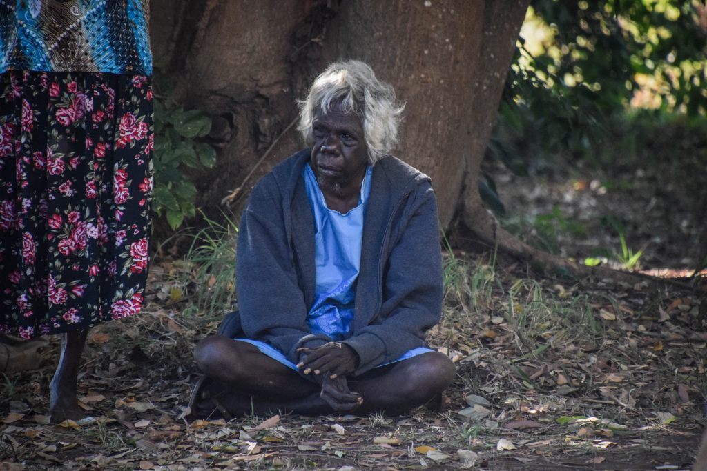
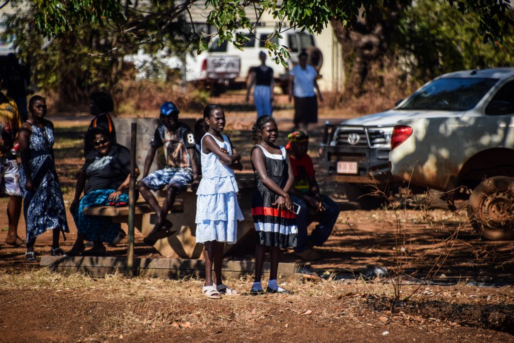
The Tiwi Islands, known as ‘the islands of smiles’, are definitely off the beaten track for tourists visiting Northern Territory. The main settlements are on Melville and Bathurst Islands, located around 80 km off the coast from Darwin where the Timor and Arafura seas meet. Other 9 islands are much smaller. The population size is around 2500 people, nearly 90% of whom are Aboriginal.
It is believed that Aboriginal people have lived in the area known today as Tiwi Island for at least 40,000 years.
First European settlement (British) was established in 1824 but lasted only 5 years due to hostilities. in 1910 the whole Bathurst Island was declared as Aboriginal reserve and Catholic missionaries moved in. Needless to say, it had a significant impact on local culture and created an interesting mix that exists nowhere else in Australia. The traditional church can still be seen in Wurrumiyanga, just next to the ferry pier.
The islands were handed back to the Indigenous owners and today are governed by Tiwi Islands Land Council.
How to get there?
Visiting the Tiwi Islands and going anywhere further than the main settlement Wurrumiyanga at Bathurst Island requires a permit from the Tiwi Islands Land Council and rather isn’t popular among tourists.
Therefore, the best way is to go for a full-day tour or just buy a return ticket for the ferry operated by SeaLink and go independently. A permit is not needed in such cases. Obviously, I opted for the second option and it was great, though to fully learn about Aboriginal culture, a local guide would be beneficial.
Ferry tickets cost 60 AUD one way while organized tours can cost between 190 AUD to 350 AUD.
Ferry travel time is 2.5 hours each way. Check SeaLink schedule as they don’t go every day (at the time of writing it is Thursday, Friday and Sunday).
The ferry leaves Darwin at 11:15 am and departs on the way back at 3:15 pm so you will have less than 2 hours at the island. That’s not much, but enough to get the feeling of this community and have a walk around to visit art galleries and museum.
Much more expensive alternative is taking a flight. It takes 30 min to get to Bathurst Island from Darwin but it comes with the price of 175 AUD one way.
Art & Culture
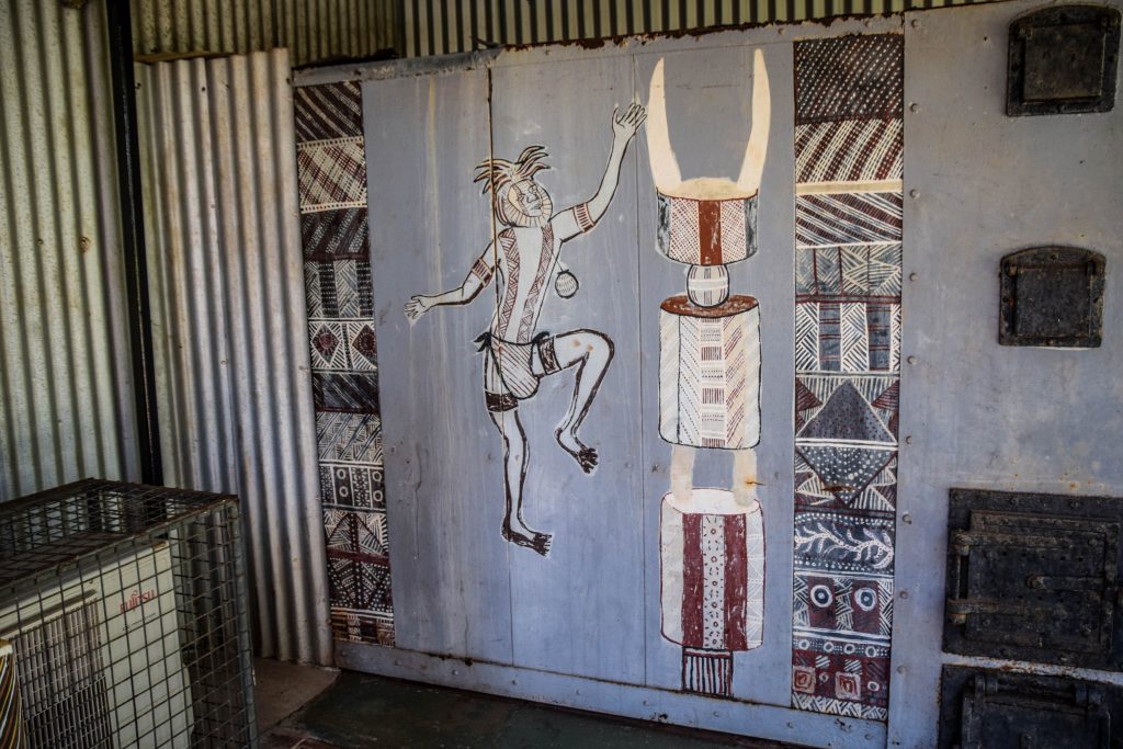
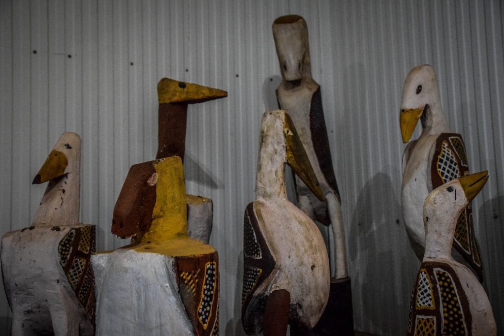
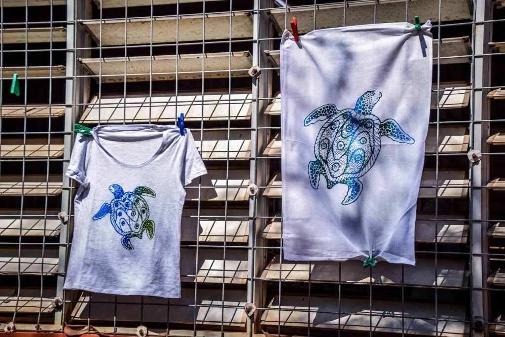
Aboriginal people living on the island are known for their unique arts and crafts scene. It’s a perfect place to purchase souvenirs and items to decorate your home: pottery, wood carvings, pained shells but also textiles and clothing.
There are three art centres, museum, the old Catholic mission precinct and Pukamani (burial) poles in the cemetery, all within walking distance in Wurrumiyanga.
Patakijiyali Culture Museum
Amazing place to dive into thousands of years old and rich Aboriginal culture. Beautifully crafted rooms display traditional art and sculptures depicting Dreamtime stories as well as old photographs, history of Catholic mission, WWII times, local athletes, flora and fauna that can be found on the islands.
Tiwi Design
They produce ochre paintings on canvas and bark, ironwood carvings, screen-printed fabrics, ceramics and bronze and glass sculptures.
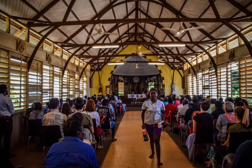
Traditional Church
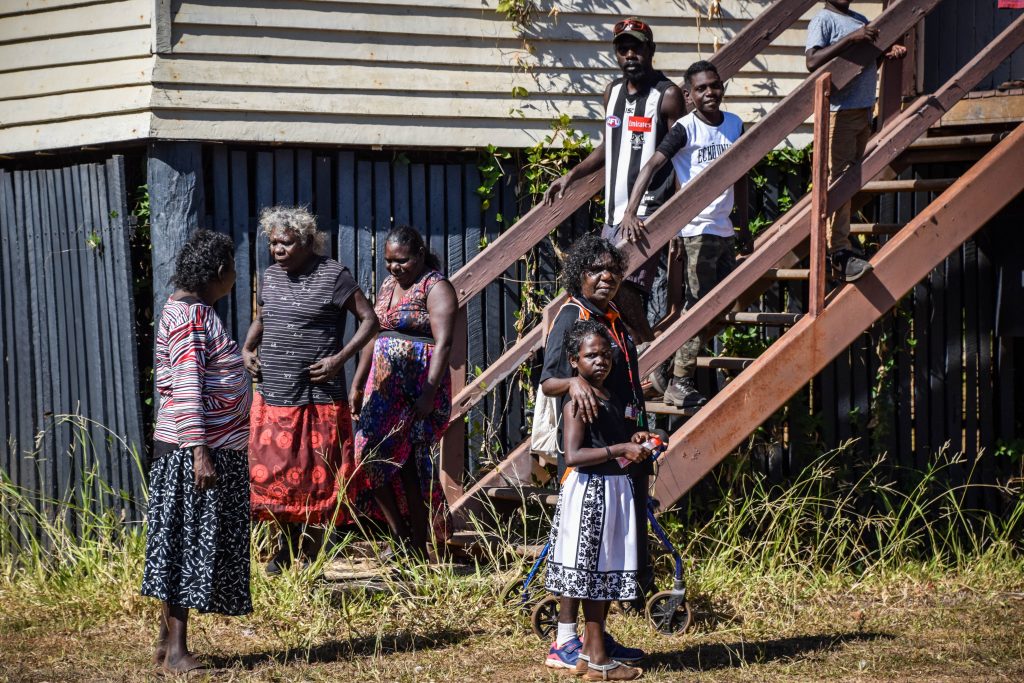
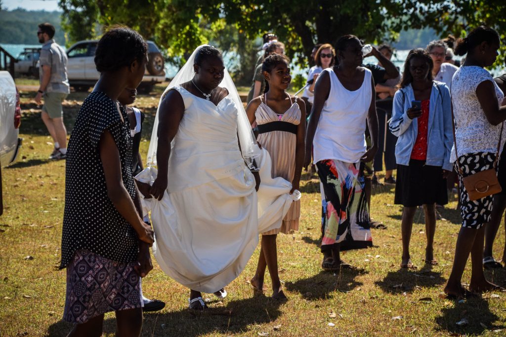
When I’m there, the place is full of worshippers, guests, curious tourists…and dogs cheerfully running around everyone. The wedding was about to take place. It looked like a big deal as the whole village gathered here to celebrate. Art centres were temporarily closed and the museum was open but left without any supervision.
It was definitely the highlight of my trip to Bathurst Island and an amazing opportunity to take great photographies of the people. Moreover, I felt very welcome in the Aboriginal community.
Nguiu Catholic Church Precinct
The Catholic Church precinct was established by Bishop Francis Xavier Gsell MSC in 1940. It includes timber made buildings such as St Therese’s Church, Presbytery and a radio shack.
Cemetery & Pukamani poles
Pukumani poles (also known as tutini) are made from carved wood and painted with natural pigments presenting a deceased person’s life and spiritual journey. Then, they are placed around the burial site as it is believed that the spirit may be present near the body. Rituals involving dance, music, and art are performed at the gravesite to guide the spirit into the afterworld. Painted lines and dots are also applied to the bodies of the living to make them invisible for the spirit. After the ceremony, the burial poles are left to decay.
The ritual originates from the Dreamtime story of Purrukapali and explains how death appeared in Tiwi culture through love, betrayal and rage.
Purrukapali had a wife named Bima and a son named Jinani. One day Bima left their son under the shade of a tree so she could spend some time alone with her lover, Purrukapali’s brother. Unfortunately, the time was passing fast and the shade disappeared leaving young Jinani exposed to the burning sun and imminent death.
Purukaparli was so devastated that he attacked and wounded his brother who flew into the sky and became the moon. Then, he took up his son and carried him in his arms as he walked into the sea towards his own death. At this moment, he declared that no one would avoid death. Bima became the curlew bird, whose wailing cries can be heard at night.
Football mania
Australian rules football was introduced by missionaries and it’s definitely the most popular sport on the islands. Every March, Tiwi Islands Football League final is celebrated at Wurrumiyanga on Bathurst Island which brings thousands of spectators. The teams compete during the wet season, from October to March.
Was it worth coming?
Definitely yes. Even though my time on the island was very limited by the ferry schedule, I had the chance to get to know Aboriginal culture even more and understand their art and beliefs. Without doubts, the highlight was the wedding, where I could see the whole village gathering to celebrate together. Due to the isolation from mainland Australia, the community is bonded together and such events make it very visible.
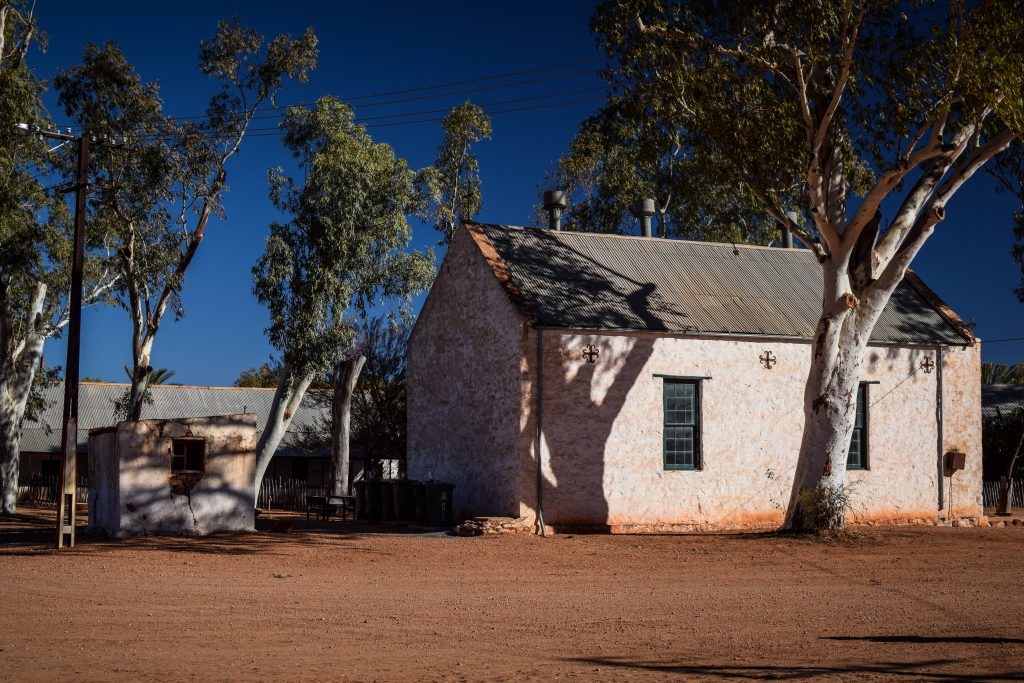
This Aboriginal community is on the way to Palm Valley, therefore its historic precinct is very often visited by organized groups on day tours. It was established in the 1880s as a Lutheran mission by German pastors, hence its name. They constructed characteristical buildings including a church, school and several houses. Today, you can enjoy your time in a tea shop, museum and the Namatjira Gallery.
Albert Namatjira is a world-famous Aboriginal watercolor artist born in Hermannsburg. Due to his art, he gained an appreciation and became the first Aboriginal person to get restricted Australian citizenship allowing him to vote, buy alcohol and claim land rights. In 1953 Namatjira was awarded the Queen’s Coronation Medal and in 1968 he was honored on an Australian postage stamp.
You can admire his works in many museums all around Australia and don’t forget to check the ones in the museum in Hermannsburg Historic Precinct.
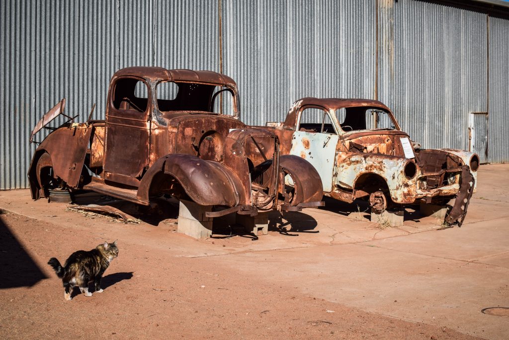
Lutheran mission buildingsOld cars from Lutheran mission timesSchool building in Historic Precinct
Palm Valley
Palm Valley lies within Finke Gorge National Park that covers an area of around 46.000 hectares in Central Australia. Why is it so special? Because it’s like an oasis filled with around 12.000 Red Cabbage Palms after which the valley is named. There is no other place like that in the region and the nearest specimens are 850 km away in Queensland.
Why are there palms on the desert?
One of the very first versions claimed that palms are survivors from prehistoric times when the climate in this region was far more tropical. However, recent studies proved that the same species of palms grow around 1000 north around Mataranka and Katherine. It is believed that the seeds were transported from one place to another by migrating people 15.000 – 30.000 years ago. Why did they move? That remains uncertain and we can only speculate: the rise of sea levels, bushfires, etc.
The theory would, in fact, go in line with Aboriginal legend telling about palm seed brought by the ‘gods form the north’. Is it really possible that the legend survives more than 15.000 years? I don’t know but I like to believe it is. It only adds magical feeling to this already extraordinary place.
The landscape around Palm Valley
While Red Cabbage Palms are the main actors in this theatre, there are about 684 species of plants living in Finke Gorge National Park, 30 of them being rare and 16 that can be found only here.
The Amphitheatre
How to get
there?
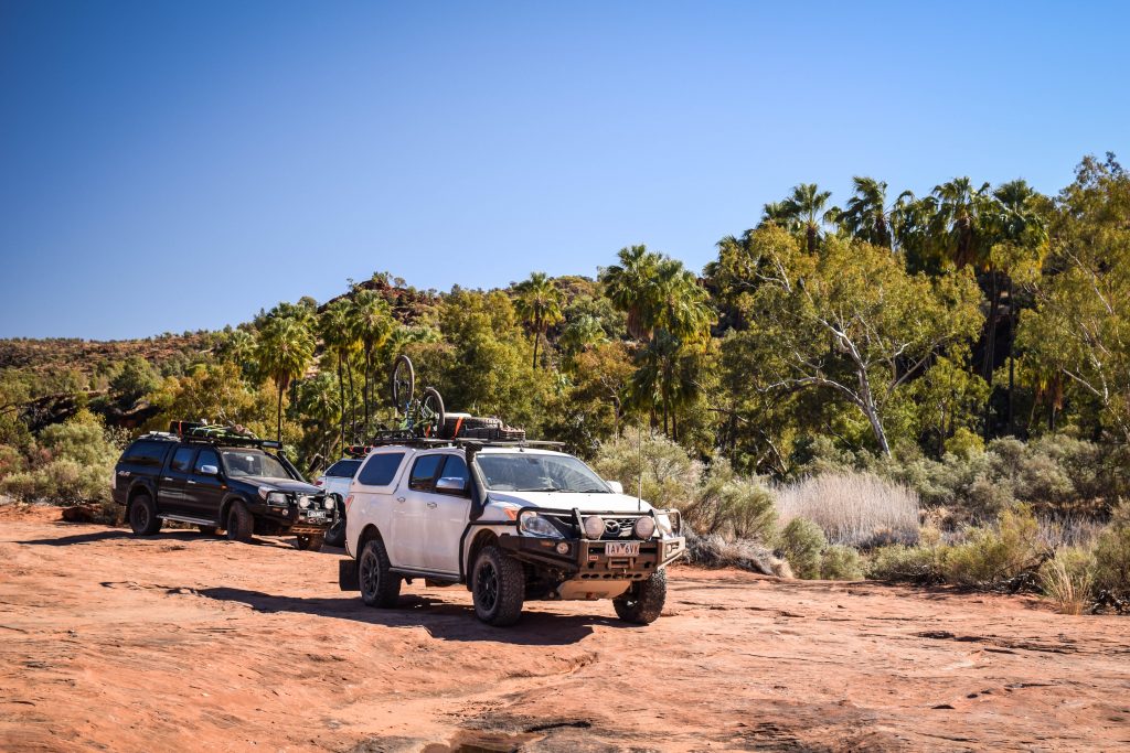
You would need 4WD and I mean it. In many parts of Australia, I managed to access remote attractions with 2WD, just taking it easy and driving on corrugated dirt with care. But here, it certainly wouldn’t be possible. You will drive on a sandy bad of Finke River after all!
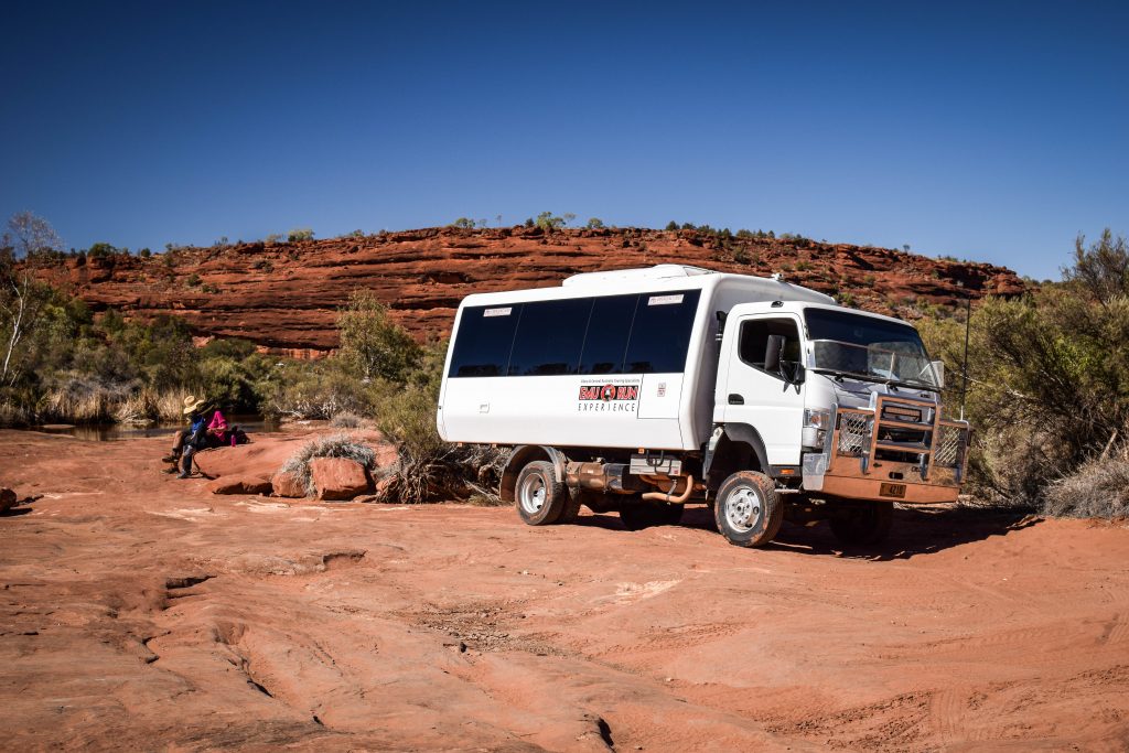
Therefore, without high clearance 4WD, I would suggest going for an organized tour as I did. It was a totally hassle-free experience in a 4WD truck and commentary provided by our guide Bluey from Emu Run Experience was probably the biggest advantage! Daily tours depart from Alice Springs and from there it takes around 2 hours to get to the national park. Besides Finke River National Park, they usually stop at Hermannsburg as well.
The truck from Emu Run Experience tour operator
On the way back we saw 4WD Toyota Hilux in trouble when the driver went too fast and broke suspension which in the result made a puncture in the fuel tank. The fuel leaked out completely in just a few seconds and that was the end of the trip for unlucky ones. Other tourists gave them a lift to Alice Springs where they had to find a mechanic and spare parts and then come back to Palm Valley to fix the car onsite. Difficult Aussie life!
Well prepared 4WD vehicles are essential to access Palm Valley
Overnight
If you travel independently you may want to set your camp at the dedicated spot and spend a night in this remote area. It must be an amazing experience and I would certainly do so next time. There are showers, toilets and barbecues provided. Don’t forget to take some cash to pay onsite.
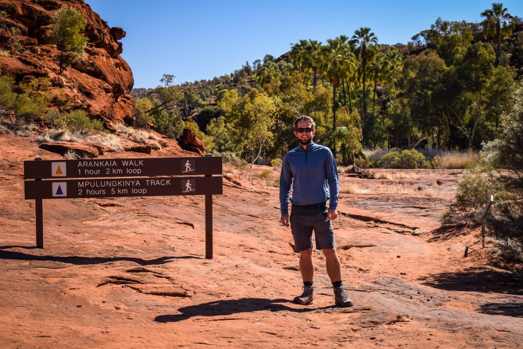
Walks in the area
Arankaia Walk (2 km, 1-hour return) – located in Palm Valley itself it gives you the best opportunity to admire these spectacular plants.
Mpulungkinya Walk (5km, 2-hours return) – the longer version of Arankaia Walk.
Kalarranga Lookout (1.5 km, 45 min return) – easy ascent to the top where I was rewarded by the panoramic view of the national park and surrounding amphitheater of rocks. It’s a breathtaking spot for sunset, so if you camp overnight, get here on time!
Mpaara Walk (5 km, 2 hours return) – it’s a nice walk but also cultural experience describing the mythology of Western Aranda Aboriginal people. The start is at Kalarranga parking.
Trailhead of Arankaia and Mpulungkinya tracksThe arid ground in Palm Valley
A few things to remember
Please don’t ignore the guidance provided by Finke River National Park:
Camping is only permitted in the designated camping areas at Palm Valley and along the Finke River at Boggy Hole.
Collect firewood before entering the park.
At Palm Valley, fires are only permitted in designated fire pits.
Pets are not permitted in the National Park.
Rubbish bins are not provided, so take your rubbish with you.
If traveling the Finke River 4WD route, stay on the marked track.
Be careful where you walk and stay on the marked tracks. Young palms can be destroyed by visitors not realizing what they are walking on. The regeneration of the palms is needed for the survival of this population.