Phan Rang-Thap Cham is a region rich in history, culture, and natural beauty. Its story weaves together the ancient heritage of the Champa Kingdom, colonial influences, and its modern significance.
A brief history
Phan Rang-Thap Cham is best known as the heartland of the Champa civilization, which flourished from the 2nd century CE until the 15th century. The Cham people, an Austronesian ethnic group, built an advanced maritime culture that traded with India, China, and the rest of Southeast Asia. They were deeply influenced by Hinduism and, later, Islam.
The region’s name, Thap Cham, directly refers to its most iconic relics: the Cham towers (tháp), which are ancient brick temples built by the Cham people. The Po Klong Garai Towers, located near Phan Rang, are among the best-preserved examples of Cham architecture. These towers, dedicated to the Hindu deity Shiva, were constructed during the reign of King Jaya Simhavarman III in the late 13th century.
By the 15th century, the Champa Kingdom declined due to repeated conflicts with Đại Việt (the precursor to modern Vietnam). In 1471, much of Champa’s territory was annexed by Đại Việt. Phan Rang remained one of the last Cham strongholds until it was fully absorbed in the 17th century. Despite this, Cham culture persisted, and the region became a melting pot of Cham, Vietnamese, and later French influences.
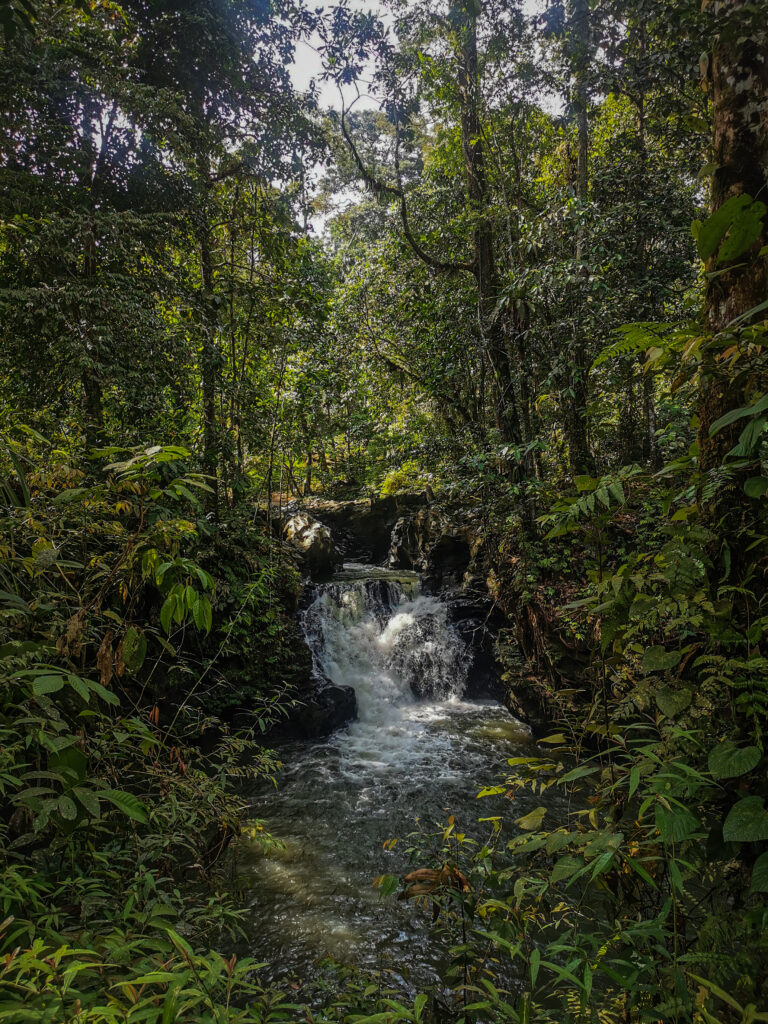
Nui Chua National Park
Under French colonial rule (19th-20th centuries), Phan Rang-Thap Cham gained strategic importance. The French built infrastructure, including roads and railways, linking the region to the rest of Vietnam. They also promoted agriculture, particularly grape and cotton cultivation, which remain vital to the local economy today.
Phan Rang-Thap Cham is now the capital of Ninh Thuận Province. It is known for its stunning natural landscapes, such as Ninh Chữ Beach, Vĩnh Hy Bay, and the nearby Núi Chúa National Park. The area also has a semi-arid climate, making it one of Vietnam’s top regions for solar and wind energy projects.
The Cham people still form a significant part of the local population and have preserved their cultural practices, including traditional weaving, pottery, and festivals like the Kate Festival, honouring their ancestors and deities.
How to get to Phan Rang–Thap Cham?
The city is well-connected to major cities in Vietnam, making it relatively easy to reach. Here’s how you can get there:
By Plane
The nearest airport is Cam Ranh International Airport (CXR), located in Nha Trang, about 60 kilometres north of Phan Rang-Tháp Chàm. From the airport, it is about a 1.5-hour drive to Phan Rang by rental car or taxi. Alternatively, shuttle buses operate from Cam Ranh to Phan Rang.
By Train
Phan Rang-Tháp Chàm has its train station, Tháp Chàm Railway Station, located on the North-South Railway (Reunification Line).
From Ho Chi Minh City (Saigon) travel time is about 6-8 hours and there are many trains, including SE (express) and TN (slower) services.
From Hanoi, travel time is about 20-22 hours. Long-distance trains like SE2 and SE4 pass through Phan Rang. The train is a comfortable and scenic option, especially for those who enjoy experiencing the countryside.
By Bus
Numerous long-distance buses connect Phan Rang-Tháp Chàm to major cities. Check your connections on 12Go.com.
For those who prefer flexibility, renting a private car or motorbike is a great option.
From Ho Chi Minh City: Follow National Highway 1A northward.
From Nha Trang: Head south along National Highway 1A.
The drive offers scenic coastal views and opportunities to explore along the way.
When to go?
The best time to visit Phan Rang–Thap Cham is typically during the dry season from April to August. This period offers sunny weather with lower rain chances, making it ideal for enjoying the beaches and outdoor activities.
Where to stay?
I stayed at Cube Homestay, and it was an extremely clean and comfortable place, located within 800 metres of Binh Son Beach. Highly recommended!
How to get around?
Once in Phan Rang-Tháp Chàm, you can get around by taxi, motorbike taxis, or rented motorbikes. Exploring the city and nearby attractions like the Po Klong Garai Towers, Ninh Chữ Beach, and Vĩnh Hy Bay is easier with a motorbike or private car. Ask for one at your accommodation. They will either have one or get in touch with someone who can deliver it to you within minutes.
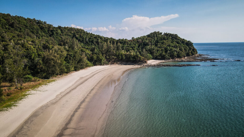
Beach in Núi Chúa National Park
What to do in Phan Rang–Thap Cham?
Ninh Thuận Museum
Thousands of artefacts are on display, bringing to life unique historical and cultural periods. The highlights are stuff related to Cham culture (e.g. pottery and woven looms), as well as testimonies of the anti-American period. The museum has unique architecture and consists of 4 floors.
Po Klong Garai Tower
The historic King Jaya Sinhavarman III constructed a Hindu Cham temple complex in honour of the mythical Po Klaung Garai, who ruled Panduranga from 1151 to 1205. Nonetheless, the existence of multiple steles from a previous age raises the possibility that Jaya Simhavarman only renovated pre-existing structures.
The military triumph of two Cham princes over the inhabitants of Panduranga in southern Champa was memorialized in an inscription dated 1050. The inscription states that the triumphant princes built a victory column and two lingas as a sign of their celebration.
Legend has it that Po Klong Garai, who began his life as a humble cowherd, was destined to become king of Champa and ruled prudently and in the interests of the populace. He held a tower-building competition as a peaceful means of resolving the Khmer invasion of his realm. The invaders were forced to return home after Po Klong Garai won the battle. Po Klong Garai became a god and guardian of humanity after his death. It is reported that the tower he constructed during his battle with the Khmer bears his name today.
Po Klong Garai Tower
Three brick towers make up the temple: a three-story main tower, a smaller gate tower, and an elongated tower with a saddle-like roof. A sculpture of the god Siva, considered a masterpiece of the Thap Mam Style, is located over the main tower’s entrance. According to legend, the tower with the saddle-like roof is devoted to Thang Chuh Yang Pui, the God of Flame. A 16th or 17th-century mukhalinga serves as the temple’s main sacred image. It’s a linga with a human face. The Cham claim that this linga is a statue of King Po Klaung Garai, while generally speaking, it is the symbol of the Hindu deity Siva.
Nam Cương Sand Dunes
Dunes totalling 700 hectares are located about eight kilometres southwest of Phan Rang – Thap Cham City. The place is much less popular than Mui Ne and usually, there are not many people. It’s a great spot for sunset.
Bình Sơn Sea Park and Phan Rang Beach
Long stretch of wide sandy beach, which could be a good alternative to noisy and packed beaches in Nha Trang. A public park is nearby.
Driving through Nui Chua National Park
The park spans an area of about 29,865 hectares and is part of the Ninh Thuận coastal region. It sits on the eastern slopes of the South Central Coast and encompasses a stretch of coastline along the South China Sea.
The park features rugged mountains, dry forests, and rocky coasts. The highest peak, Núi Chúa, rises to 1,039 meters above sea level.
With an average annual rainfall of 650 mm, it is the hottest and driest province in Vietnam. It also receives the least rainfall in south-central Vietnam.
A scooter ride along the coastal road DT702 is very rewarding, and it’s a great detour if you are heading towards Dalat.
Ninh Thuan Stone Park has naturally occurring rock formations of various sizes that are piled on top of one another. Over millions of years, they have been eroded away. The entrance cost is 40.000 VND.
Another interesting rock formation can be found at a place called Hang Rái (Rai Cave).
Hang Rai
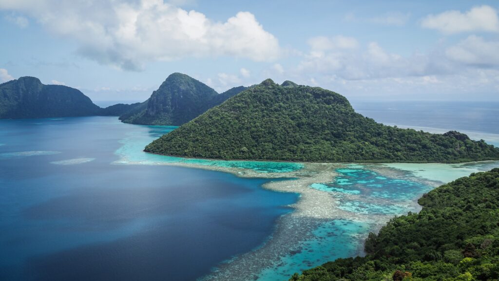
Vinh Hy and its bay is still quite a wild place and majestic beauty without huge resorts. Adjacent to Nui Chua National Park, you have the sea on one side and mountains and forest on the other. Visitors can take boat tours, snorkel, and explore vibrant coral reefs. Don’t miss the excellent Đèo Cây Cóc Viewpoint.
Vinh Hy Bay
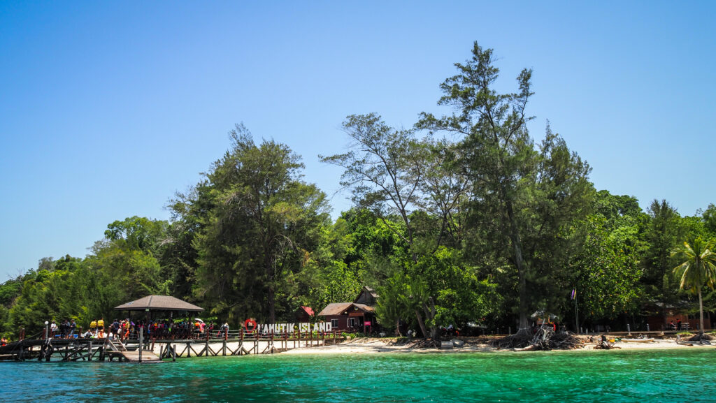
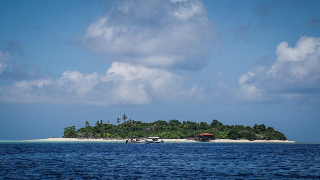
If you have more time to spare, hop on a boat to Binh Hung Island. This place is famous for its long and wide beaches and quiet atmosphere. The sea is not deep so it is suitable for snorkelling and diving to see coral.
Binh Hung IslandBinh Hung Island
When it comes to beaches, you may stop at Hom Beach (Bai Hom), Thung Beach, Bình Tiên or Robinson.
Agdz is a small town located in the Draa River valley in southeastern Morocco. The valley is known for its stunning palm groves and it is ideal for walking, hiking, and exploring the natural landscape.
Historically, Agdz was an important stop on the caravan route linking Marrakech to Timbuktu. This made it a key point for trade and cultural exchange. The town and its surroundings are dotted with old kasbahs (fortified houses) and ksars (fortified villages), which reflect traditional Berber architecture.
N’Kob is situated about 70 km to the east of Agdz, in the Jebel Saghro mountain range and is surrounded by similar rugged terrain and palm groves.
How to get there?
To get to Agdz in Morocco, you have several options depending on your starting point and preferred mode of transport:
By Car
To get to Agdz or N’Kob, the best option is to rent a car either in Marrakesh or Agadir. There are several interesting places to see around town so having a vehicle is essential. The distance to Agdz is 260 kilometres (5-6 hours) from Marrakesh and 360 km (6-7 hours) from Agadir. The distance between Agdz and N’Kob is 70 km and the drive takes about 1 hour, following route R108.
If you decide to start from Agadir, I recommend using the service of Click’n’Go Car Rental. Amiable guys and easy to contact on WhatsApp. I rented a Renault Clio for the whole month and got a nice price.
By Bus
Take a bus from Marrakech to Ouarzazate and then take a local bus or a shared taxi to Agdz or N’Kob. CTM and Supratours are the most popular bus companies.
By Shared Taxi
Shared taxis (called “grand taxis”) are available for longer distances. You can take a shared taxi from Marrakech to Ouarzazate and then another shared taxi from Ouarzazate to Agdz or N’Kob.
Saghro Mountains
The best time to visit
The best time to visit Agdz and N’Kob is during the spring (March to May) and autumn (September to November) months. The weather is pleasantly warm, with daytime temperatures ranging from 20°C to 30°C. This makes it comfortable for exploring towns, hiking, and enjoying outdoor activities.
Summers can be extremely hot, with temperatures often exceeding 40°C. While some travellers can handle the heat, it may be uncomfortable for extended outdoor activities. Winters are mild to cool, with daytime temperatures ranging from 10°C to 20°C.+. Nights can be quite cold, especially in the desert areas.
Where to stay?
I spent a night in Palm Grove Apart in Agdz and it was the best accommodation that I had during my entire trip in Morocco. It’s a fully furnished apartment with a living room, kitchen, bedroom and bathroom. Wi-Fi was fast so I had no issues with online work. The host lives upstairs and he was a very friendly older man. There is a parking just right next to the house.
In N’Kob, I stayed at Berber Nomad Kasbah, which was excellent as well. I was welcomed with mint tea and cookies and I was the only guest in the entire house.
Panorama of the city and Saghro Mountains
How long to stay there?
A minimum of one full day is needed to fully discover the area of Agdz and N’Kob. The best would be to have two days to do it at a comfortable pace without rushing in the heat.
What to see in and around Agdz?
Kasbahs
The surroundings of Agdz are dotted with old kasbahs, which reflect traditional Berber architecture. It is a type of traditional fortress or fortified house that serves both residential and defensive purposes and is found mostly in southern parts of Morocco.
Kasbahs are characterized by high walls, often made of mud bricks or stone, designed to protect against attacks. Many kasbahs feature corner towers, which enhance their defensive capabilities and offer vantage points for monitoring the surroundings. Many kasbahs have been restored and are now popular tourist attractions, while some other ones have been converted into hotels or guesthouses, providing unique lodging experiences for travellers.
Kasbah des Arts is well worth a stop and it’s the closest one to Agdz city centre. The current owner will walk you through the history of the place and his family and how he’s renovating the kasbah step by step maintaining its original architecture and atmosphere. You can spend a night there which must be a very unique experience. Not cheap but you will feel like you are at the Prince of Persia movie set 🙂
The ruins of Kasbah
Another fascinating site is Kasbah des Caids which is a hotel, restaurant and museum – all in one. Unfortunately, the sightseeing experience was ruined by a rude guide who delivered a 10-minute tour basically without any commentary. The entrance is 20 MAD per person but then you are forced to pay more for a ‘guide service’. In my case, he asked for 50 MAD more but it depends on his mood so be careful. It’s not about the money but I really don’t like being scammed!
Kasbah Tamenougalt is abandoned but perfect for studying the architecture of such buildings. There are some elements of street art on the walls. Unfortunately, as it often happens in Morocco, the visit can be ruined by rude “guides” who insist on guiding you for an extortionate price.
Last but not least, Kasbah Timidarte is another treasure that brings you back in time and stimulates your imagination with what it’d be like to travel along the old caravan road and stay in Kasbahs along the way, The rooms have basic amenities but don’t expect a luxury stay in such places. The experience is authentic, the views are amazing and the people are friendly and welcoming. If you don’t want to stay overnight, you will still be able to have a look around and admire the beauty of this building.
Inside Kasbah des CaidsInside Kasbah des CaidsThe tower inside one of the kasbahs
Draa River Panorama
The viewpoint provides a magnificent panorama of one of the largest palm groves in Morocco, located at the feet of Jebel Kissane. It’s definitely worth a stop!
For hiking enthusiasts, Jebel Kissane can be summited but probably it makes sense to hire a guide or at least ensure that you have a good offline map of the trail. The small mountain range is 14 km long and 1.8 km wide at its widest point. There are two ridges on the summit of the mountain, divided in the middle by a ravine. There are multiple peaks but the highest one situated near the western extremity of the range is 1485 m a.s.l.
Tizi’n-Tinififft
If you drive out of Agdz towards Ouarzazate following road N9, you will once again come across a breathtaking landscape full of natural beauty where the man can feel very small. Tizi-n-Tinififft is a high mountain pass at an elevation of 1.693 m a.s.l and the road leading to it is paved. It looks like you are on a completely different planet!
What to see in and around N’Kob?
There is not much to do in N’Kob and it is the mountainous area that surrounds it that makes it worth coming here. The route connecting N’Kob with Boumalne Dades is simply amazing and passes through Tizi’n’Azazarte which is a part of Saghro Mountains Range. The distance is about 90 kilometres and it takes about 2 hours to get to Boumalne Dades but you must plan many stops en route! The rugged plateaus, deep valleys, and volcanic formations show how the force of nature carved the terrain over millennia.
Jebel Saghro Circuit sounds like an amazing, multiday hike in that area and one day I will certainly be back to do it!
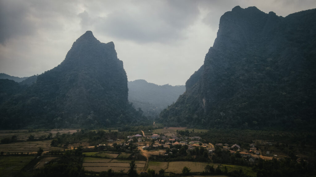
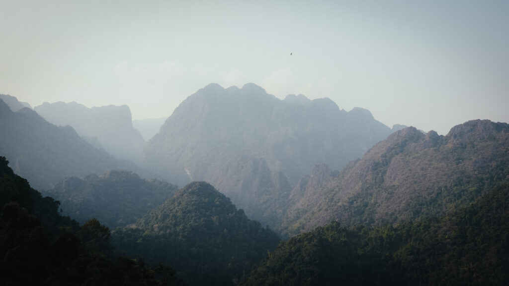
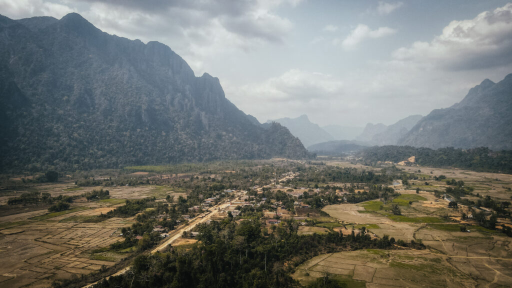
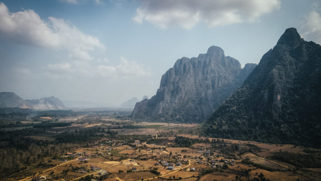
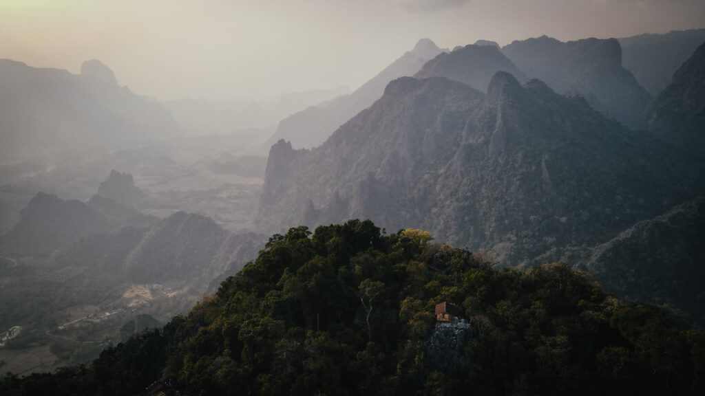
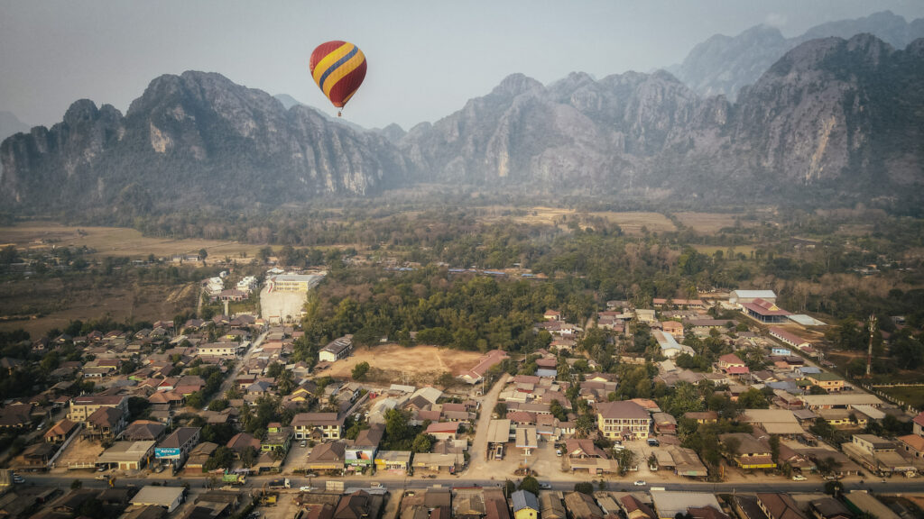
Vang Vieng is a popular tourist town in Laos, located about 150 kilometres north of the capital, Vientiane. It’s known for its stunning natural landscapes, which include limestone karst hills, caves, and the Nam Song River.
The town is famous for its outdoor adventure opportunities, such as tubing, kayaking, rock climbing, and hiking. The river tubing experience, once notorious for its party scene, has been reformed to be more family-friendly and safer. The area is also home to numerous caves, such as Tham Phu Kham and Tham Chang, which are popular for exploration. Hot air balloon rides are available for those who want to see the landscape from above. You definitely won’t get bored here!
When to go?
The most popular time to visit Laos is between November and April, at least if you don’t like rain as it’s the dry season. However, nothing is as easy as it seems. You won’t get wet, but it’s the time of intense agricultural burnouts with dense haze hanging over the mountains and the air quality is regularly rated as unhealthy.
I traveled to Laos in March but next time I would go at the very beginning or the end of the rainy season, so in October or May. Getting a bit wet is certainly better than breathing in all that air pollution!
How to get there?
By train
Laos-China railway is the first railway network in Laos and it’s becoming increasingly popular as it connects the major cities and towns like Vientiane, Vang Vieng, Luang Prabang and Boten. The average travel duration on the route between Vientiane and Vang Vieng is about 1 hour. It’s advised to buy the train tickets in advance to secure your seats.
By road
Regular buses run from the Northern Bus Station (Khua Din Bus Station) in Vientiane to Vang Vieng. The journey typically takes about 4-5 hours and is the most economical option.
Minivans are a bit faster than buses, taking around 3-4 hours. They depart from various locations in Vientiane, including travel agencies and guesthouses. Minivans are more comfortable and often have air conditioning.
There are also regular buses from Luang Prabang, taking around 6-7 hours. The buses depart from the Southern Bus Station.
Similar to buses, minivans are available and offer a slightly faster journey, around 5-6 hours. They also provide more comfort and air conditioning.
By air
There are no direct flights to Vang Vieng, as it does not have an airport. Travellers can fly to Vientiane or Luang Prabang and then take a bus, minivan, or taxi to Vang Vieng.
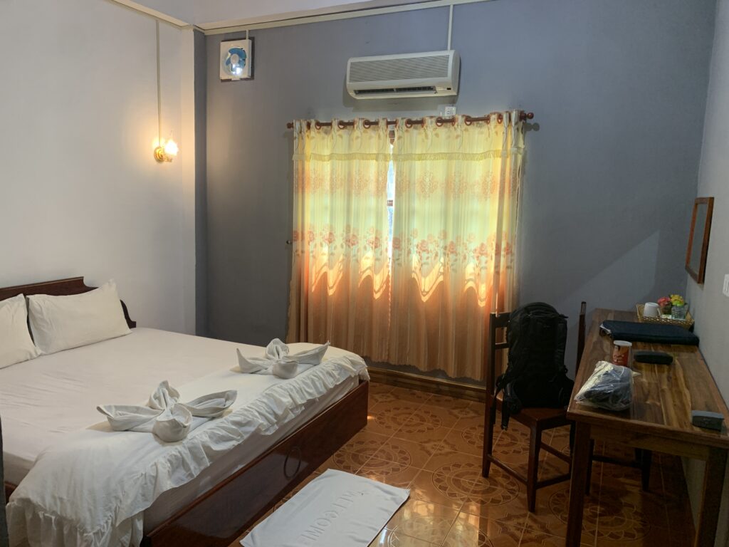
I spent two nights in Saphaothong Guesthousewhich was a good choice. The room was spacious and there was a desk for working. The reception guy was very friendly and he organized a scooter for me, although its quality was far from optimal.
The room in Saphaothong Guesthouse
How long should you stay?
I would recommend a minimum of 2-3 days to cover the sights around Vang Vieng. The countryside around the town is gorgeous and there are so many caves, lagoons, mountains and villages to explore that you don’t want to be in a hurry.
The landscape around Vang Vieng
How to get around?
The town itself is small, and many attractions, restaurants, and accommodations are within walking distance. However, for attractions outside the town centre, you’ll need another mode of transportation.
Bicycles can be rented from various guesthouses, hotels, and rental shops in town. They are fine to explore some nearby attractions like caves and blue lagoons but are definitely not suitable for longer distances or rough terrain.
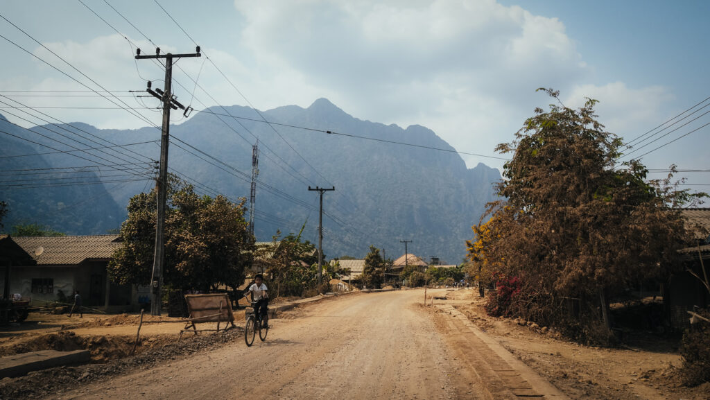
Scooters provide flexibility to explore farther and at your own pace, especially in hot weather. Don’t forget that you need a driving licence, even if no one asks you for one during the renting process. Otherwise, you won’t be covered by your travel insurance. Roads can be rough and safety gear like helmets should always be used. Also, be prepared to get dirty as most of the roads around Vang Vieng are dirt ones and every time someone overtakes you, you will find yourself in a dirt cloud.
A dirt road through the countryside
If you don’t feel comfortable riding a scooter, tuk-tuks can be easily found in the town centre and around popular tourist spots. Can be more expensive than other options, and prices often need to be negotiated.
Another alternative is to rent a buggy, especially if travelling in a group, although it also isn’t the most budget-friendly option. Moreover, check the condition of the vehicle before you hit the road as some of them look like they are going to fall apart…
What to do in Vang Vieng?
Temples
There are a few interesting Buddhist temples in Vang Vieng town centre, e.g. Wat Si Sou Mang, Wat Kang, Wat Simixay Yaram or Wat That.
Tham Chang
The most accessible of the caves in the Vang Vieng area, within walking distance from the town. You have to climb about 150 steps to get to the cave entrance. The ticket costs 20.000 LAK and the cave is very easy to explore with pathways and lights. There are also some food vendors outside selling drinks and snacks.
The aerial view of Ban Nampè village
Blue Lagoon 1 and Phu Kham Cave
The busiest and most popular of the lagoons due to its proximity to Vang Vieng. There is a 5-meter jumping platform and some swings. It can get very crowded and noisy so for sure the place isn’t right for everyone, but the cave with the laying Buddha is impressive and worth exploring. You will most likely be completely alone there if you enter a bit deeper. It’s slippery inside, so bring good shoes and a flashlight is a must. You can rent some at the entrance of the cave.
Blue Lagoons 2, 3, 5
Vang Vieng is surely not short on natural springs. While some lagoons are more picturesque than others, there can be a large number of visitors, particularly at the busiest time of year. The majority of them have rope swings and jumping platforms. Besides popular Blue Lagoon 1, it’s worth visiting more distant but often less crowded lagoons numbered 2, 3 and 5. Blue Lagoon 5 is the most faraway one, however, you will ride through a very scenic village Ban Nampè, which is a great experience in itself.
One of blue lagoonsThe aerial view of a small village near Vang Vieng
Vangvieng Inter Park and Nang Oua Khiam Cave
Nice place with a swimming area and plenty of shaded rest areas. The dinosaur statues are kitschy but nature is worth exploring. I highly recommend climbing up to the cave and the viewpoint. The way to the top is definitely not 30 meters as stated on the information board and it will take you about 20 – 30 minutes to reach the observation platform. The good point is that there are hardly any tourists visiting this viewpoint so most likely you will have it for yourself. If you want to check out the cave, bring your torch!
Spectacular view from the viewpoint at Vangvieng Inter Park
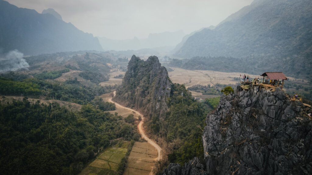
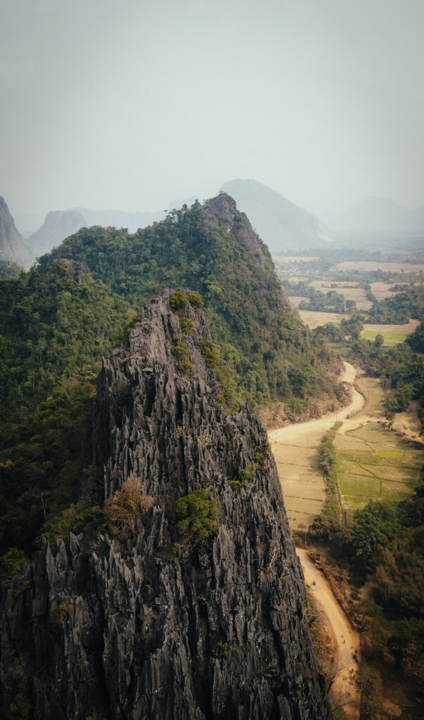
Nam Xay Viewpoint
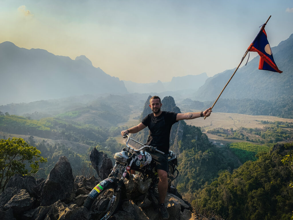
A short but steep and sweaty hike will reward you with breathtaking 360-degree views of dramatic karst rock formations, verdant forests, and stretches of rural land and rice fields when reaching the summit. A wooden viewing deck is placed on top but feel free to explore the vista from all sides by moving around it over the rocks. Just below the summit, on both sides, are oddly positioned motorcycles, which you can sit on to get a fantastic picture!
The hike to the top takes about 30 minutes and the place can get crazily busy at sunset time.
Highly popular photo spot on Nam Xay ViewpointAerial view of Nam Xay Viewpoint
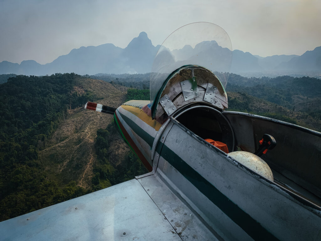
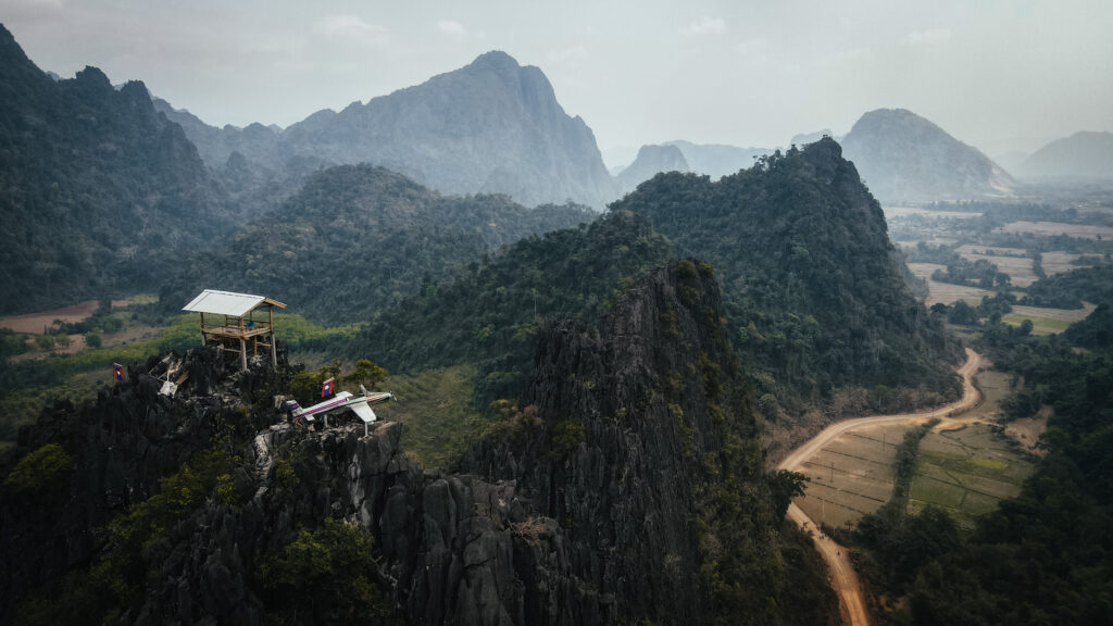
Phapoungkham Cave and Viewpoint
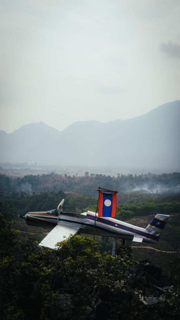
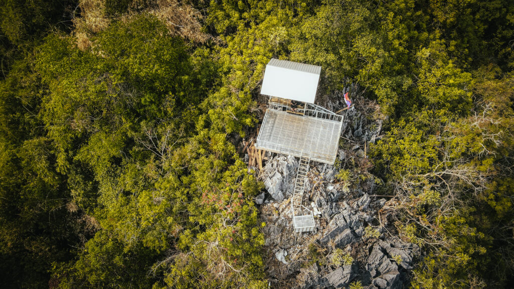
In my opinion, the best short hike and viewpoint in the Vang Vieng area. There’s a lot more to explore than just the viewpoint which makes it well worth the time and effort. You will see a cave, Buddha statues, and the aeroplane at the top. The entrance costs 20.000 LAK per person and it takes about 20-30 minutes to reach the top, mostly walking on slabs and rocks. Wear comfortable shoes. There was no one else besides me which added to the experience, especially after visiting a very busy Nam Xay Viewpoint.
Phapoungkham ViewpointPhapoungkham Viewpoint
Num Bor Keo Cave
If you’re searching for a more daring kind of cave exploring, Num Bor Keo Cave is a bit difficult to find, but well worth the effort. You will pay a 20.000 LAK entrance fee and they give you a small headlamp. The cave is more of a crawling and easy climbing experience. Sometimes you will notice yellow arrows that show you the way to go. It is a nice place to visit, but it is understandable why there are fewer tourists than in other caves in the Vang Vieng area.
Pha Ngern View Point
The physically demanding Pha Ngern hike is divided into two parts. Depending on your speed, it takes about 1 – 1,5 hours to get to the summit, with a stop at the first viewpoint on the way. Most of the trail is pretty steep so take your time and don’t forget water!
You will have to pay 10,000 LAK to enter the path. A small hut at the first viewpoint sells water, soft drinks and snacks. The views are magnificent and there was also a buggy placed on the rocks. Interesting trend to put these kinds of things on top of almost all viewpoints in Vang Vieng!
Pha Ngern View PointPha Ngern View Point
Angel Cave
A nice cave that is well lit up, and easy to walk across as there is a concrete path all the way through. You can find food and drinks right outside after you’re done with sightseeing.
Kaeng Nyui Waterfall
The place is to be visited in the wet season only, otherwise don’t expect any water. From the starting point to the waterfall is only a short walk. As of May 2024, the road to get there was under construction, so it will eventually be a really easy bike ride out there once the works are over.
Loup Cave
One of the best caves in Vang Vieng. If you travel on a scooter, you will have to pay a bridge toll of 5,000 LAK. After that, you arrive at a grassy field with a stand where you are charged 15,000 LAK to access one cave or 30,000 LAK for two of them. The caves are completely dark inside with no lights. You will be given a headlamp, but usually it isn’t very strong, so it’s better to have your own, more powerful one.
Tham Nam (Water Cave)
The most notable cave in the north of Vang Vieng. The 500-meter-long cave has an entrance from which a branch of the Nam Song flows. You can wade inside the cave during the dry season, but when the water is higher, you’ll need to borrow a tube and sit inside it, dragging yourself down the tunnel using the fixed rope. It was a truly unique experience!
Elephant Cave
There is not much to see except for the stone which resembles an elephant and a sleeping Buddha. You should be able to complete the tour in less than 5 minutes. You can stop here on the way to Tham Nam, otherwise don’t bother.
TCK Zipline
The place gets good reviews and I heard that ziplining there is incredible. The superb views and the friendly staff make the experience perfectly enjoyable.
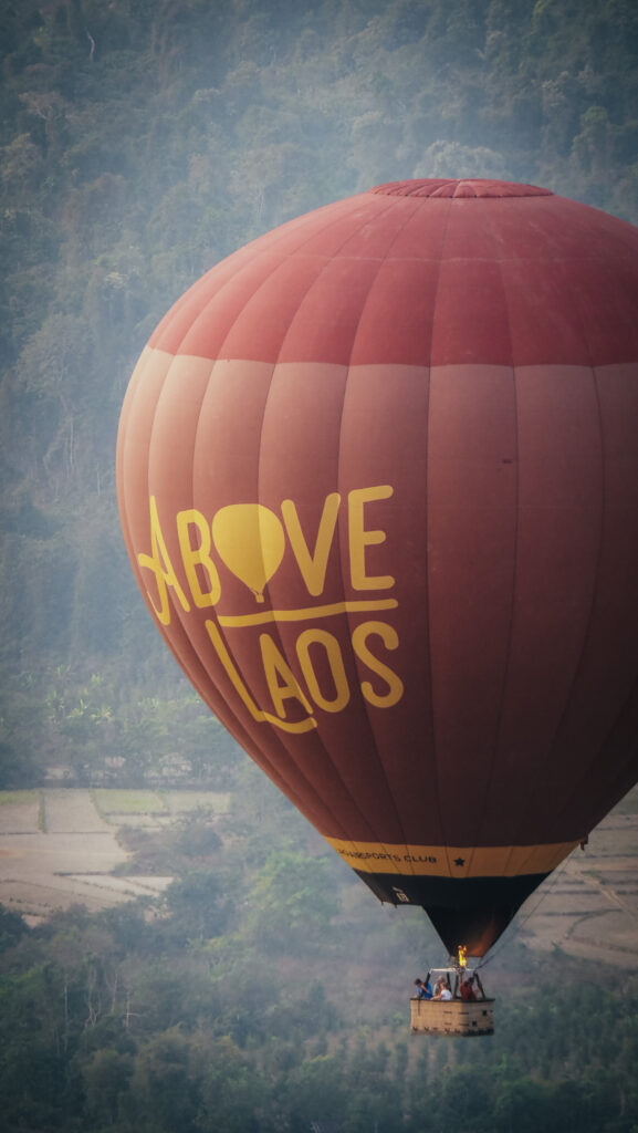
Hot air balloon
A ride in a hot-air balloon is a lovely way to see the cliffs, tapestry of paddy fields and snaking river below. Departures are at sunrise and sunset and a 1-hour ride costs 100 – 150 USD. One of the most reputable operators is Above Laos.
Kota Kinabalu, often referred to as KK, is the capital of the state of Sabah in Malaysia. The town is surrounded by lush rainforests and is close to Mount Kinabalu, the highest peak in Malaysia.
Kota Kinabalu was known as Jesselton during the British colonial period. It was heavily bombed during World War II, leading to extensive rebuilding post-war. Today the city is a melting pot of cultures, including indigenous groups such as the Kadazan-Dusun, Bajau, and Murut, as well as Chinese, Malay, and other ethnicities. The city is also a gateway for oil and gas exploration in the region.
How to get to Kota Kinabalu?
By Air:
Some airlines operate international flights directly to Kota Kinabalu International Airport (BKI). If you are already in Malaysia, you can take a domestic flight from major cities such as Kuala Lumpur, Penang, or Johor Bahru.
By Land:
If you are travelling within Sabah, there are long-distance bus services that connect Kota Kinabalu with other towns and cities in Sabah. Major bus companies operate routes from Sandakan, Tawau, and other locations. Alternatively, you can drive to Kota Kinabalu from other parts of Sabah or Brunei and Sarawak in East Malaysia. Roads are generally in good condition, but it’s best to check current travel conditions.
Kota Kinabalu and offshore islands can be visited the whole year, but the best time is between February and April, during the dry season. The weather during these months is generally more favourable with less rainfall, making it easier to enjoy outdoor activities.
How long should you stay?
2-3 days are enough to visit sights around the town and relax on the nearby islands or do some snorkelling.
Even though Kota Kinabalu is the biggest town in Sabah state, it’s still quite compact and easy to get around. The city centre can be explored on foot, while more distant places can be easily reached by taxi. Order one by using a popular mobile app – Grab.
What to see in Kota Kinabalu?
Atkinson Clock Tower
It’s the oldest wooden building still standing in Kota Kinabalu that survived the destruction of Jesselton during World War II.
Gaya Street Sunday Market
Gaya Street turns into a night market on Friday and Saturday from 5 PM to midnight and it’s an excellent place to try various local snacks and drinks. On Sunday morning, from 6 AM to 1 PM, it changes into a regular market selling plants, fruits, vegetables, clothing, antiques, etc.
Central Market
Tropical fruits, fresh vegetables, fish as well as seafood can be found here.
Night Food Market
From fresh seafood to traditional Malaysian dishes such as satay or laksa, every stall offers a unique taste experience. The market is usually very crowded and extremely hot, so get yourself ready. Don’t be shy to haggle on the price of seafood, it’s perfectly OK to do so.
Bandaraya Mosque
You have to cover up to enter and it’s possible to get clothes at the reception centre. The best is to avoid prayer time as you won’t be allowed inside. There is nothing special to see when it comes to the interior and they charge an entrance fee, which is ridiculous. You can easily take pictures of the mosque from the street outside, catching a nice reflection in the pond. That’s the best thing you can do here!
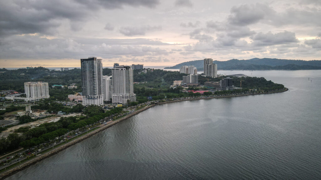
Kota Kinabalu
Taman Awam Teluk Likas
A long stretch of green park and beach along the coastline. Nice place to exercise and relax under the shade enjoying some sea breeze. I wouldn’t swim here though, as the water didn’t look clean.
Sabah State Mosque
The building’s gold accents shine bright and there is some nice greenery around. I wasn’t able to enter the building as it was prayer time.
Sabah State Museum
This museum offers a great introduction to Sabah’s indigenous cultures. Its exhibits include the traditional dress, embroidery, celebrations, rituals, crafts and musical instruments of the Dusun, Murut, Rungus, Bajau and other peoples of Sabah.
The ancient Chinese ceramics discovered in 2013 from the Jade Dragon wreck, which dates back to around AD 1300, are located upstairs. Additionally, the Heritage Village adjacent to the museum features traditional tribal dwellings such as Kadazan bamboo cottages and a Chinese farmhouse.
Sabah Islamic Civilization Museum
The museum presents the history of the spread of Islam in Southeast Asia including the roots of its arrival into Sabah and Malaysia as a whole. It features Islamic artefacts brought from the Middle East countries such as Turkey, Egypt, Iran, Morocco and India as well as local art from Sabah and neighbouring Sarawak and Brunei.
Tanjung Aru Beach
Nice spot to watch sunset with many food stalls nearby. Unfortunately, there is trash all around the place which is hard to ignore. The beach is about 10 – 15 minutes drive from the city centre.
Mari Mari Cultural Village
Mari Mari offers tours that highlight the many traditional residences of the numerous ethnic communities of the Sabahan, including the Bajau, Lundayeh, Murut, Rungus, and Dusun. You will have the opportunity to witness blowpipe construction, tattooing, fire starting, and an understanding of the mystical beliefs of each of these tribes in addition to sampling delicacies from each. Unfortunately, the samples are really microscopic! The visit also includes a buffet meal and a brief dancing performance. Overall, nice but very touristy experience and the guide was sometimes rushing with her explanations.
The morning session starts at 11 AM and the afternoon one at 2 PM. The ticket costs 130 RM for international tourists and 110 RM for Malaysians. You can order a taxi via Grab to get there.
Ulu Kionsom Waterfall
A popular spot for swimming and picnicking among locals, located within walking distance from Mari Mari Cultural Village. After buying a ticket, follow the cemented path with the sound of the rushing water increasing with every step.
To go to the last tier of the waterfall, you have to scramble up the forested slope. The rocks and roots can be very slippery so watch your steps and take a bottle of water.
The ticket costs 10 RM for foreigners and 3 RM for Malaysians.
Monsopiad Heritage Village
A good and less popular alternative to Mari Mari Cultural Village. This traditional village commemorates the life and time of the legendary Kadazan and head-hunter warrior Monsopiad. The schedule is quite typical: presentation of traditional food, medicine, firemaking and hunting techniques followed by music and dance performance. The morning session starts at 11 AM and the afternoon one at 2 PM.
Sabah Art Gallery
The most interesting part is the uniquely shaped building of the gallery. It costs 15 RM to enter for foreigners (compared to 5 RM for locals). The museum itself is extremely small and I was done in 15 minutes. There are some free exhibits outside, so stick to those and save yourself some money for a nice dinner.
Wetland Ramsar Site
A place with lots of potential where among mangroves you can see crabs, monitor lizards and various birds. Unfortunately, the amount of rubbish is overwhelming. The boardwalks are also in dire need of repair so mind your steps.
Puh Toh Si Chinese Temple
A serene and well-kept Chinese temple with a reclining Buddha resting inside. The temple is on a small hill near the highway.
Tunku Abdul Rahman Marine Park
Tunku Abdul Rahman Marine Park is a group of islands and their surrounding waters located off the coast of Kota Kinabalu. The marine park was established in 1974 and is named after Malaysia’s first Prime Minister. The park comprises five main islands: Gaya, Manukan, Mamutik, Sapi and Sulug.
How to get there?
Take a short boat ride from Jesselton Point Ferry Terminal, with services running regularly to the islands. The islands have various facilities, including accommodation options ranging from budget chalets to luxury resorts, as well as restaurants, restrooms, and picnic areas.
As of May 2024, you can visit Mamutik, Manukan and Sapi Islands. Gaya Island is off-limits for day-trippers. You can only go there if you are staying in one of the resorts on the island. There is a large community of illegal migrants from the Philippines which probably has something to do with that.
Boats depart from 8:30 AM and run every 30 minutes. Return time is between 12 PM – 4 PM. Once you reach the island, the tour operator will ask you at what time you would like to be picked up.
Tunku Abdul Rahman Marine Park
Prices
The price depends on the number of islands that you want to visit.
1 island: 35 RM per person
2 islands: 45 RM per person
3 islands: 55 RM per person
The national park entrance fee (25 RM) and terminal fee (9.20 RM) are added to the price.
Gear rental: fins, life jacket for snorkelling, snorkelling mask or beach mat can be rented for 10 RM each.
A day trip to 3 islands
First, we stopped at Manukan, where I had a walk to the other side of the island to the area called Sunset Point. I was trying to find a hiking trail through the jungle to get there and I did find it, but wearing sandals didn’t prove to be a good idea. Instead, I turned back and followed a concrete path. There were so many mosquitos that it was impossible to stop even for a second!
The sunset point wasn’t anything special and there was a lot of rubbish everywhere On the positive side, it was relatively quiet so I managed to fly a drone and take some aerial photos. Then I walked back to the beach and hung around there waiting for the boat to Mamutik Island.
Tunku Abdul Rahman Marine ParkTunku Abdul Rahman Marine Park
Mamutik is the smallest island in the park, with only one resort. I followed a short loop trail and then spent the rest of the time in the shadow of the trees or the warm waters of the South China Sea.
Then it was time for the last stop – Sapi Island, located just next to much bigger Gaya. Tiny place, where I spent most of the time just chilling in the water. Unfortunately, on the next day, I noticed that my legs were full of sandfly bites, so don’t forget the repellent!
Mount Kinabalu is the highest peak in Borneo, standing at 4,095 meters. It is located in the Malaysian state of Sabah and is part of the Kinabalu National Park, which is a UNESCO World Heritage Site.
Mount Kinabalu is a granite massif formed about 10 million years ago. Over time, the mountain has been uplifted, and its distinctive jagged peaks have been sculpted by erosion and glaciation. The mountain is renowned for its rich biodiversity, with distinct vegetation zones ranging from lowland rainforests to alpine meadows. It is home to over 5,000 plant species, including the famous Rafflesia, the world’s largest flower, and numerous endemic orchid species. Kinabalu National Park was established in 1964 and became Malaysia’s first World Heritage Site in 2000.
Mount Kinabalu holds significant cultural and spiritual importance to the indigenous Kadazan-Dusun people, who believe that the mountain is the resting place of their ancestors’ spirits.
The first formal ascent of Mount Kinabalu was recorded in 1851 by Sir Hugh Low, the British colonial secretary on Labuan Island.
On June 5, 2015, an earthquake with a magnitude of 6.0 occurred in Ranau and lasted for 30 seconds. Since the Sabah earthquake in 1976, this was the strongest earthquake to strike Malaysia. There were eighteen confirmed deaths on Mount Kinabalu, comprising six Malaysians, two Chinese, and ten Singaporeans. After becoming stranded on the mountain, about 137 climbers were eventually rescued.
How do you get to Kundasang?
Kundasang is about a 2-hour drive from Kota Kinabalu, the capital of Sabah. You can rent a car at Hikmah Rental & Tours. Excellent contact on WhatsApp and unproblematic rental experience at a good price. The drive offers scenic views of the mountains and countryside.
Shared taxis depart from Merdeka Square in Kota Kinabalu when full. You will pay about 40 RM for a seat and the driver can drop you off at the entrance to Kinabalu National Park.
If you decide to do the hike with a travel agency, transportation by minivan will be included.
Mount Kinabalu
When to go?
The best time to climb Mount Kinabalu is generally during the dry season, which runs from March to September. There is less chance of rain, which makes the trails safer and the views clearer. The summit can be very cold at any time of the year, especially during the early morning hours when climbers aim to reach the peak for sunrise.
Bookings, permits and guides
Let me start by saying that climbing Mount Kinabalu isn’t cheap.
Several operators organize tours to the islands, but the most popular seems to be Borneo Calling. The price of a 2D1N budget hike is 1750 RM for international tourists and 1350 RM for Malaysians. They will organize everything for you: accommodation (Panalaban Hostel or Lemaing Hut), permits and guides.
If you decide to organize your hike independently, you will pay about 1600 RM for accommodation at Laban Rata. On top of that, there is an entrance ticket to Kinabalu National Park (50 RM), a hiking permit (400 RM) and a mountain guide (350 RM). If you arrive at the registration office early enough, you may be lucky to find other people to share the cost of the mountain guide with (max. 5 hikers per 1 guide).
Regardless of the option that you choose, remember that the number of permits is limited and despite the costs, it is a highly popular hike. Therefore, you must book your tour or secure a bed in a hostel a few weeks, or even months in advance.
How long is the hike?
The round trip to the summit of Mount Kinabalu is approximately 17.4 kilometres, typically takes two days and involves two main stages:
Day 1: Trailhead to Laban Rata
Approximately 6 kilometres, 4 to 6 hours with an elevation gain of about 1.400 meters. Hikers usually take a minibus to the Timpohon Gate and start hiking from there, following a well-marked trail through diverse vegetation zones, ranging from tropical rainforest to alpine meadows. The trail is steep and involves many steps. Hikers stay overnight at Laban Rata or one of the other Sutera Lodges Accommodation sites.
Day 2: Laban Rata to summit and back to the trailhead
Approximately 2.7 kilometres to the summit, plus 8.7 kilometres return to the trailhead. It takes between 2 to 4 hours to reach the summit and 4 to 6 hours for the descent. Elevation gain is about 822 meters from Laban Rata to the summit. Hikers usually begin the final ascent around 2 AM to reach the summit for sunrise. The last part of the climb involves steep granite slabs and ropes to assist in the ascent. After reaching the summit, hikers descend back to Laban Rata for breakfast before continuing the descent to the Timpohon Gate.
There is an option to spend an extra night in Laban Rata after the descent from the summit, but it will significantly increase the already high costs of the hike.
There are rest shelters with basic toilets at regular intervals.
Clouds usually roll in after 10 AM
What to pack?
Pack appropriate clothing and gear, including warm layers, waterproof clothing, and sturdy hiking boots. Overall, while the dry season offers the best conditions for climbing, careful planning and preparation can make your climb enjoyable and successful at any time of the year. Here is the list of some essentials:
Fleece or insulated jackets
Waterproof and windproof jacket and pants.
Comfortable and quick-drying pants.
T-shirts
Warm hat and gloves
Socks
Hiking Boots
Backpack (30-40 litres) with a rain cover.
Headlamp
Trekking Poles
Water Bottle or Hydration Bladder
Sunglasses
Sunhat and sunscreen
Camera or smartphone
Climbing permit and ID
Cash
First aid kit
Snacks
Insect repellent
Towel
Optional: power bank (there is an option to charge the devices in Laban Rata)
If you feel that you took too much and there are things you don’t need, leave them in the room at Laban Rata and pick them up on the way back. You don’t want to wear a heavy backpack on the summit push in the night!
Where to stay?
If you go on a hike with a travel agent, they will pick you up in the morning from the hotel in Kota Kinabalu. I based myself there for a few days and can recommend three places: ATAP Hotel, Hotel Tourist by HotSpot Essential and Akinabalu Youth Hostel. All of them were affordable and offered a nice and clean private room.
If you travel to Kundasang independently, I would suggest arriving one day before the hike, to avoid unnecessary rush and morning stress that you won’t make it before 10:30 AM which is the cut-off time to start the hike at Timpohon Gate. I spent the night at Happy Garden, which is a no-frills hostel with a restaurant on-site. It’s within walking distance to the entrance of Kinabalu National Park so you won’t need any further transport in the morning.
Wildlife on the trail 🙂
2D 1N itinerary
Day 1: Timpohon Gate – Laban Rata
I woke up at about 7 AM and had a quick breakfast in the nearby restaurant. Spending the night at Happy Garden meant that I was only 20 20-minute walk away from Kinabalu Park Headquarters.
After arriving at the registration center I quickly succeeded in finding a group of 3 other hikers to share the costs of the guide with. Then, we got our permits, picked up a packed lunch and got ready for departure. The guide was an older man but he spoke quite good English.
To get to the beginning of the trail at Timpohon Gate, we took a minibus. Then, we had a safety briefing and our guide told us that we were a group but if someone wanted to go faster, there was no need to wait for others. Well, fair enough, although in such a case I have no idea why the guide is mandatory at all.
It was exactly as my guide said. Our group soon split and I reached Laban Rata by myself, while the guide simply followed the slower person.
Beginning of the trailOn the trail
Shortly after the beginning of the trail I passed Carson’s Falls and made my way uphill through the beautiful forest. More or less at the halfway to Laban Rata, I made a break for a packed lunch. In the box, there was some fried chicken with veggies. Not particularly delicious but fine enough. The weather was getting worse with more and more fog rolling over the slopes and for a short moment, it was even drizzling. The trail was still forested but soon it changed into a subalpine meadow.
Upon arrival at Laban Rata Resthouse, I got a key to the 4-person dormitory and quickly changed my clothes to the dry set. I didn’t take a shower as the water was freezing cold. Keep that in mind 🙂 After spending some time in the common room, the rest of my group was still not there so I simply took a nap. I felt cold, even though I was wearing my warm puffer jacket from Nepal. Quite strange. Also, even though I felt very tired, I couldn’t fall asleep. It made me a bit worried.
The higher you get, the foggier it becomesLaban Rata Resthouse
Was it because of the altitude? Laban Rata is located at 3,272 metres above sea level, so some people may experience some discomfort. When the rest of my group finally arrived at the dormitory, it was time to get dinner. The problem was that I had zero appetite and only had some sweet jelly for dessert and drank two cups of tea.
After dinner, I preventively took some pills just to make sure that I would be in good shape in the morning. Unfortunately, I still couldn’t sleep at night.
The meal schedule in Laban Rata is as follows:
Dinner: 4:30 PM until 7 PM
Supper: 2 AM until 3:30 AM
Breakfast: 7:30 AM until 10:30 AM
All the meals are served in the form of a buffet.
Electricity is on from 4 PM to 10 OM and from 1 AM to 3:30 AM.
Day 2: Laban Rata – Summit – Timpohon Gate
The second day started with waking up at 2 AM and having a quick breakfast. I wasn’t too hungry but I had to force myself to eat as I felt I needed some calories. We departed at 2:30 AM. Most of the people left at the same time so there was quite a traffic jam at the stairs. The two women from my group stayed behind already at the very beginning and we waited for a while but there was no sign of them. Later we found out that they had turned back. Did they also experience the same health discomfort as me?
I was going up mostly following the stairs. Then the section with steep granite slabs and the line started. There was no vegetation around. The line was just for assecuration, rather than pulling myself up. I was getting weaker and slower as my body didn’t want to continue that adventure. I was struggling both mentally and physically. I made frequent breaks to catch my breath or even sit down for a while. I think it was a nasty combination of altitude impact as well as stomach issues.
The section with the ropeThe section with the rope
I was fighting my way up while the sunrise was getting closer and closer. I could already see the summit but still, it looked quite far away. The last section was really steep and involved some easy scrambling on the rocks.
Finally, I reached the top! The other guy from my group arrived shortly after me. Then, even our guide showed up! We took some pictures with the board showing the name of the mountain and started the descent. It was the last time when I saw the two guys from my group. The way down was certainly much easier and I started taking off layers of my clothes as the sun was quickly warming me up. While looking back, I was impressed that I climbed up all that way in the darkness.
Sunrise at Mount Kinabalu
After reaching Laban Rata, I had a small breakfast with French toast and some fried potatoes. I also met the two women from my group and they confirmed that they turned back as one of them didn’t feel good. I think they expected a way easier adventure climb, the same as me. But Mount Kinabalu isn’t that easy after all!
The remaining distance down to Timpohon Gate was a real pain in the *ss. My knees were done as the total elevation drop was over 2.000 meters! Adding to that, the path was steep and full of rocks and stones. With two breaks en route, I finally made it to the Timpohon Gate and I bought a coke and mineral water there. A minibus was waiting to take hikers back to the Kinabalu Park Headquarters but the driver said we needed to wait for more people to join. We had been waiting for about half an hour and the group of 4 hikers arrived. Once we were on the way to the parking, heavy rain started. What a timing!
Descending from Mount Kinabalu
At the Kinabalu Park Headquarters, I asked about transport options back to KK but they could only offer a private shuttle for 250 RM. It was way too much! I waited a bit for the rain to stop and then walked towards the roadside to try to flag down some minibus. I had been waiting for about 15 minutes when I noticed the first minibus heading in my direction. It was full but shortly after another stopped and then I jumped on board.
Alternative descent: Via Ferrata
Once booked a tour, you can also opt for the itinerary including via ferrata on the descent. Situated on the Panalaban rock face of Mount Kinabalu, Mountain Torq is the highest via ferrata in the world and the first via ferrata in Asia.
Walk the Torq and Low’s Peak Circuit are the two Via Ferrata itineraries that are offered. Climbers with no prior professional mountaineering experience can enjoy the activity on both routes.
Was it worth it?
All in all, it is a great, scenic and challenging hike. But is it worth the price? In my opinion, it isn’t. Before arriving in Borneo, I spent one month in Nepal. The amount of money that I paid for the 2D1N hike to the Kinabalu summit would probably keep me going for over a week or even more in the Himalayas, with definitely much more spectacular views. There are no alternatives to Sutera Sanctuary Lodges which use their monopoly to charge excessively for literally everything, but the quality is just average.
What else to do around Kundasang?
Kinabalu National Park
There are several shorter trails in the park that you can combine into one loop and hike without a guide. From the main entrance, join the Liwagu Trail and then turn left onto Mempening Trail. Follow it until you reach an asphalt road. Then, to come back to the main entrance, join Kiau View Trail or Silau Silau Trail. Kiau Gap View Point is an excellent place in clear weather, so arrive here very early in the morning.
As of May 2024, Liwagu Trail was closed after the crossroad with Mempening Trail.
There is also the mountain garden which is open from 9 AM to 4 PM every day. Visitors can visit the garden and roam by themself at any time during the opening hours, however, guided tours with Sabah Park’s interpretation guide are scheduled at 9 AM, 12 PM and 3 PM.
Aki Aki Trail
The 3.3 km trail with proper facilities such as staircases and platforms with a view of the majestic Mount Kinabalu. However, it goes through private property and you need to hire a guide. I have seen some reports from people saying that they were quoted over 200 RM, which is totally ridiculous and sounds like a scam.
Kundasang War Memorial
It honours the British and Australian detainees who lost their lives during the infamous Sandakan Death Marches and at the Sandakan and Ranau POW camps as well as Borneo natives who lost their lives helping them.
Quite a pity that even in a place like this, there is a double pricing for Malaysians and foreigners.
Maragang Hill
The Maragang Hill, which is 2,232 metres above sea level, was opened to the public in 2017. Hikers can choose from different packages, such as sunrise hikes (3 AM) and regular hikes (6 AM) on the conventional or loop trail. The regular trail takes roughly 3-4 hours to finish on average. I opted for a regular 6 AM version and arrived on time at the meeting point. The guide was late for about 20 minutes and I was slowly getting annoyed because I was aware that shortly after sunrise, Mount Kinabalu could be covered in clouds. Finally, when the guide arrived, we jumped inside a pick-up truck and were taken higher up the road to the trailhead. Having a guide on this trail was ridiculous as it was very easy to follow and the guy was simply walking behind me smoking cigarettes all the way.
After about an hour or so we arrived at the top and the views were great. Mount Kinabalu from that perspective looked simply breathtaking. I flew a drone around and took some nice aerial pictures before we started our descent. I was pretty much overtaking all locals on the trail as they were walking so damn slowly.
The guide can be booked via WhatsApp. Phone numbers are available on the website HERE. As of May 2024, the price is 155 RM if you are going solo.
Maragang HillThe view from Maragang Hill
Sosodikon Hill
Good and both cheaper and easier alternative to Maragang Hill. The entrance ticket costs 10 RM per person for foreigners. It is a very short 1 km return trail with spectacular views of Mount Kinabalu on a clear day. Come early in the morning!
Aerial view os Sosodikon Hill
Last POW Camp Memorial
The Japanese occupiers of Sabah in 1945 forced 641 British and 1793 Australian prisoners of war to march from Sandakan to Ranau. Only six people made it out alive by hiding and getting looked after by locals. The rest died as a result of disease, arduous labour, unfavourable living conditions, or were slain by their captors. The 183 men who perished at this final camp, which was located next to a bend in the Kagibangan River that can be seen below, are listed on the memorial stone. The place is located 6 km away from Ranau.
Poring Hot Spring
The site is made up of about a dozen little pools that are heated by sulfurous water that emerges from an underground spring. The best thing that adventurous people can do here is the hike to Langanan Waterfall, which takes about 2 hours one way. Make sure that you start the hike before noon, as later the entry isn’t allowed.
Another nice activity is climbing up to the canopy walkway, suspended from trees and reaching up to 40 meters above the jungle floor, offering breathtaking views of the surrounding forest.
There is also a butterfly and orchid garden. The problem is that the ticket price to the park is quite steep: 50 RM for foreigners and then you need to pay extra for each activity inside, such as hot springs or canopy walkway (10 RM). The business model of a tourist trap!
Mahua Waterfall
The waterfall is located about 500 meters from the entrance. The water is cold and clear. The entry costs 20 RM for adult foreigners and RM12 for children. There is a BBQ area, tables and chairs. It’s about 1-hour drive following route 500 from Ranau.
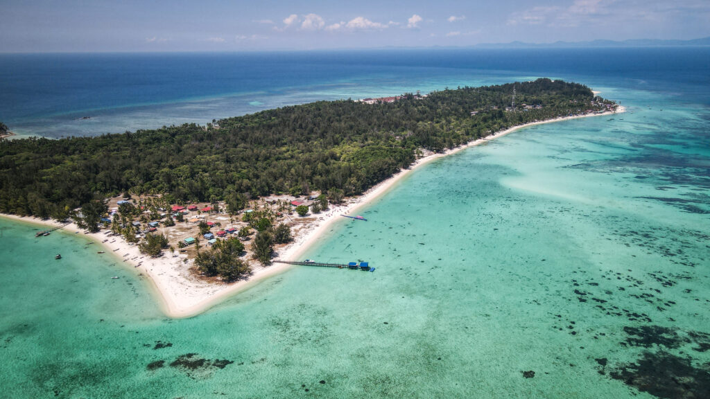
Semporna is a district located on the east coast of Sabah, Malaysia. It is renowned for its stunning marine biodiversity and is a gateway to several of the world’s best diving sites, such as the famous Sipadan Island. The region attracts divers and tourists from around the globe due to its crystal-clear waters, diverse coral reefs, and rich marine life, including sea turtles, sharks, and various tropical fish species.
In addition to diving, Semporna offers activities such as island hopping, snorkelling, and exploring the local markets and seafood restaurants. The town of Semporna itself provides basic amenities and serves as a hub for tourists heading to nearby islands and marine parks.
Semporna is also culturally rich, with a significant population of the Bajau people, known as sea gipsies, who traditionally live a nomadic lifestyle on the sea. The Bajau Laut are known for their unique maritime skills and stilted houses built over water.
How to get to Semporna?
By Air
Several airlines operate flights to Tawau Airport (TAW), including Malaysia Airlines and AirAsia, with direct flights available from Kota Kinabalu (the capital of Sabah) and Kuala Lumpur (the capital of Malaysia). From Tawau, take a minibus going to Semporna. The drive takes about 1.5 – 2 hours.
By Land
There are bus services from Kota Kinabalu to Semporna but be prepared for a very long journey (most probably over 10 hours).
Some ferries connect Tawau with Nunukan and Tarakan in Indonesian Borneo. The ferry services are less frequent, so checking the schedule in advance is important. From Tawau, take a minibus going to Semporna. The drive takes about 1.5 – 2 hours.
Snorkelling in Semporna
When to go?
The best time to visit the Semporna is during the dry season, which typically falls between March and October. The weather during these months is generally more favourable with less rainfall, making it easier to explore the islands (the sea is calm) and enjoy outdoor activities.
Where to stay?
I can recommend staying at Warisan Family Inn or Kuree Hut. Both are well-located, in the town centre with plenty of restaurants and shops. They can also help you to organize trips to the islands. Warisan Family Inn is closer to the waterfront if that matters. The rooms were clean and spacious!
How long should you stay?
Semporna doesn’t have much to offer but you can easily spend a few days visiting nearby islands, so it depends on your preferences. I spent one day in town and three days doing island hopping but some people prefer going just to one island and staying longer there, diving or just chilling at the beach.
Snorkeling at Sibuan Island
What to do in Semporna?
Bukit Tengkorak Archaeological Site
Situated on a slope approximately 600 feet above sea level is this archaeological site. Bukit Tengkorak is a volcanic rock-shelter site and a part of a volcano mouth of 2km in diameter. The location housed Southeast Asia’s greatest ceramic production during the Neolithic era. In the small museum at the foot of the steps, one can learn more details about the discovery of this archaeological site. It’s free to visit.
You will have to climb quite a lot of wooden steps to get on top but it’s worth it. A beautiful panorama of the Semporna area can be admired from there. The best way to reach Bukit Tengkorak Archaeological Site is to use the mobile taxi application: Grab.
The view from Bukit Tengkorak Archaeological SiteThe view from Bukit Tengkorak Archaeological Site
Museum Tun Sakaran
Exhibits about Tun Sakaran, who was Sabah Governor or Head of State, and his role as a community leader can be seen on the museum’s ground floor. On the first floor, there are displays on the history and culture of Semporna and the surrounding area. It’s free to visit.
1-day trips to the islands
The islands are the main Semporna’s appeal as a premier marine tourism destination, offering a range of activities from diving to serene beach vacation. Some people head there directly, without even stopping at the town itself.
Most of the islands can be visited on a one-day trip, which is a great option for those travelling on a budget. You can also arrange longer stays in the resorts, but that will cost you significantly more.
Unfortunately, out of the three tours that I did, only one was organized 100% in line with what was advertised. Some operators insist on skipping certain locations once you are already on the sea, or they just pass by the island without landing on it. Make sure your tour operator has plenty of good reviews!
I was picked up from the hotel in the morning and delivered by car to Pelancong Jetty. The rest of the group was already waiting, so we set off to Mabul Island immediately. We passed by huge Bum Bum Island and soon got a glimpse of our first destination on the horizon. The rest of my group was there for diving, so the boat dropped me and one of the guides off at Mabul Island, and then they left for their dive spot.
The fee to enter the resort area at Mabul Water Bungalows is 50 RM per person, which is way too much, as you only get access to boardwalks and photo spots. At least I found a nice place in the shade to fly a drone. There were lots of sea gipsies on the small boats selling coconuts.
Sea gypsiesMabul Island
We left the territory of the resort and went to the other side of the island, passing through the section where the staff working in the resort must live. The guide recommended another nice spot for flying a drone, in the middle of palm trees. It was quite nice indeed!
Soon, we stepped into a normal village where the local population of the island lives, and it was a much more interesting and authentic place to see than the resort filled with Chinese tourists. When we reached the pier, the rest of my group was already waiting there, and we had lunch together.
After lunch, it was time for the first snorkelling session near Kapalai Island. It was nice, and we could see plenty of fish and even some huge turtles, but unfortunately, swimming around and freediving was hard as fins weren’t provided. We didn’t land on the island, as essentially it’s just a sandbar with a resort built on stilts.
Mabul IslandMabul Island
Then, we went back to Mabul Island for a second snorkelling session. That one was quite disappointing as the water wasn’t clear, and instead of a natural reef, there were just some submerged artificial structures.
We arrived back at Semporna at about 4 PM. Overall, it was a nice trip. Compared to the ones described below, the food was the best, but the underwater world was the least memorable.
The trip cost 150 RM per person, and it was arranged for me by the Kuree Hut where I was staying. Lunch, water and snorkelling equipment (without fins) were provided.
Mataking and Timba Timba Islands
I checked in at Semporna Jetty at 8:30 AM and was welcomed by the staff. Besides me, all the other tourists on the boat were divers. There were 3 snorkelling sessions: 2 at Mataking Island and 1 at Timba Timba Island. All the places were amazing and it was surely one of the best, if not the best, snorkelling that I experienced in Southeast Asia. The equipment was of superb quality, and fins were included. I saw a lot of colorful fish but the highlight was huge green turtles coming up from the depths. Wow!
Turtle seen at Timba Timba IslandSnorkeling at Timba Timba Island
The trip cost 180 RM per person and I arranged it with Seabunny. The snorkelling equipment was in excellent condition (fins included), and the staff was really friendly. However, we weren’t able to set foot on any of the islands and the whole day was spent on the boat only. It was a big disappointment, considering how beautiful the sandbank at Timba Tima Island is. The staff explained that it’s because both islands are private properties, however, I found info online that it’s possible to visit, but you simply need to pay extra. It would be nice to be offered a choice!
Boheydulang, Sibuan and Mantabuan Islands
I was picked up from the hotel in the morning and delivered by car to Pelancong Jetty. The first stop of the day was at Boheydulang Island, where we did a sweaty 20-to 30-minute hike up to the viewpoint. Every few meters there is a ‘guide’ monitoring if everyone is fine, as the place is very popular. The view was really worth the effort, even though I ended up completely soaked in sweat. Don’t forget water!
The view from Boheydulang Island
From there, we were supposed to go to Mantabuan Island but the boat crew was doing everything to discourage us from that. Unfortunately, they wanted to skip it and come back earlier to Semporna, which was absolutely not fair. Luckily, most of the participants protested, so we ended up going there. We didn’t land on the island but the offshore snorkelling was superb with plenty of starfish around!
The view of Mantabuan Island
Next, we stopped at Sibuan Island, where we had our lunch and some free time to walk around the sandbank. Unfortunately, drone flying wasn’t possible as all the islands are part of Tun Sakaran Marine Park, plus there is a Military Zone.
The sandbank at Sibuan Island
Soon, it was time for another snorkeling session, and we boarded the boat only to be dropped off… at another side of Sibuan Island, a few meters from the beach. Hillarious! Basically, we could have just walked there… Snorkeling there was really mediocre, and it was a pretty clear sign that the boat crew wanted to finish the tour as soon as possible.
Overall, we all came back to Semporna with mixed feelings. The beauty of the islands is unquestionable, however, the behaviour of the tour operator was really bad and disrespectful. The trip cost 250 RM per person, and it was arranged for me by the Kuree Hut where I was staying. Lunch, water and snorkelling equipment (without fins) were provided.
Snorkelling at Mantabuan Island
Sipadan Island
The 600-meter vertical drop around the island is covered in coral with much variety and quantity of marine life. A typical day at Sipadan includes seeing numerous enormous green and hawksbill turtles, herds of hundreds of enormous bumphead parrot fish, schools of thousands of jackfish, and enormous schools of barracuda.
There are limited permits shared by tour operators each day, and larger resorts get more permits. Each permit allows a diver to dive for a day at Sipadan Island. Try to book your trip and permit as early as possible, especially during peak season, to avoid disappointment.
Bum Bum Island
It is situated about one kilometre east of Semporna town and is separated from the mainland by a Tando Bulong Channel. There are several floating, homestay-style options for accommodation and snorkelling and diving are offered. To get there, you can easily find a boat at the public jetty in Semporna.
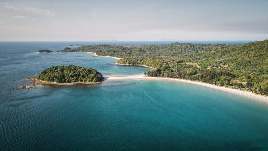
The Tip of Borneo, known locally as Tanjung Simpang Mengayau, is a prominent landmark located in the northernmost part of Borneo Island, within the Malaysian state of Sabah. Local villages are populated by the Rungus ethnic tribe, where traditional lifestyles and skillfully made handicrafts can be seen. They are also particularly notable for their traditional longhouses.
The Kudat Peninsula is definitely worth a visit for those who like nature without crowds!
How to get to the Tip of Borneo?
There is no public transport around the Kudat Peninsula, so renting a car from Kota Kinabalu and making a trip there independently seems to be the best option. I haven’t seen any car rental companies with good reviews in Kudat.
Alternatively, base yourself in Kudat and arrange transportation there from your hotel. Most likely they will help you to find a taxi driver or you can try your luck and look for one in a popular ride-hailing app Grab.
When to go?
The Tip of Borneo can be visited the whole year, but the best time to visit is between February and April, during the dry season. The weather during these months is generally more favourable with less rainfall, making it easier to enjoy outdoor activities, especially in the afternoons.
The beach at the Tip of Borneo
How long should you stay?
Keeping in mind the distance from Kota Kinabalu (nearly 200 km), at least two days are needed to travel comfortably and have enough time to relax on the beach, visit the tip of the peninsula and drop by to Kudat.
Where to stay?
There are a lot of nice accommodation options near the tip, such as Tampat Do Aman which includes walking trails, a watchtower for looking out over the dense forest and a small museum dedicated to the Rungus people. You can also camp near Kelambu Beach which must be an amazing experience while enjoying starry nights.
In Kudat, I recommend staying at The Upper Deck Hotel. Basic, but very clean and spacious room, well located in the centre of the town.
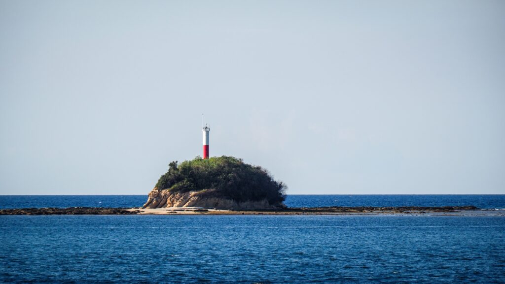
Kalampunian Lighthouse
Places worth seeing
The Tip of Borneo
Situated in the Kudat Peninsula, it is where the South China Sea meets the Sulu Sea, offering stunning panoramic views of both bodies of water. A large bronze globe monument marks the place, symbolizing its geographical significance. It’s a beautiful place to enjoy the sunset and you can spot Kalampunian Lighthouse in the distance.
The aerial view of the Tip of BorneoGlobe monumentThe place where South China Sea meets Sulu Sea
Kalampunian Beach
This beach is truly a gem, offering a serene atmosphere. The fine, white sand is a delight to walk on, perfectly matching with turquoise water.
Kelambu Beach
Another beautiful sandy beach. At low tide, you can walk to the small island across. Be wary not to get stranded when the tide comes in. The only drawback is the rubbish being washed up during high tide. There are nice campsites on the other side of the road, but don’t expect a mobile signal (which may be an advantage).
The aerial view of Kelambu Beach
Kudat
Kudat has historical importance as it was one of the early settlements of the British North Borneo Company in the 19th century. The town was officially established in 1881. You can kill some time here strolling or jogging along the sea at Kudat Park or visiting the Tun Mustapha Museum or Fuk Tek Kung Temple.
Tun Mustapha Museum is the first museum built in Kudat which aims to showcase the life story of Tun Mustapha (the first governor of Sabah) as well as the culture and history found in the Kudat district.
Fuk Tek Kung Temple is one of the few Taoism temples in Sabah. It was built in the early 1970s by the nearby Hokkien Association.
Bak Bak Beach is the nearest recreational spot near the city although it can be quite windy. There are a few stalls selling food.
Banggi Island
The island is well off the beaten track, with limited infrastructure and basic amenities, available in larger settlements like Karakit. It lies within the South China Sea and is close to the southern Philippines. The beaches on the island are littered with rubbish, and there isn’t much to do. On the other hand, you can bargain with fishermen to take you to nearby Maliangin Island, a little island with picture-perfect beaches, lush tropical vegetation, and crystal-clear water. Balambangan Island is a more distant and more expensive to get to but would be another nice idea for a day trip.
To get there, you will need to take a boat from the town of Kudat. The boat ride takes an hour or two, depending on the sea conditions.
The three remote islands known as the Mantanani Islands are situated northwest of Kota Belud, a town roughly an hour and a half drive from Kota Kinabalu, the state capital of Sabah. Depending on the state of the sea, the speedboat voyage from the mainland to these islands takes about 60 minutes. The islands are a great place to go snorkelling, scuba diving, or island hopping because of their beautiful, white sand beaches surrounded by coconut palm trees, and their clear, blue waters that are home to a variety of marine life. The unique dugong, or sea cow, lives in the water there but sightings are not guaranteed as these mammals are very shy and will distance themselves, especially with the sight of crowds.
How to get to Mantanani Island?
The transfer to the island is included in the package for the day trip. If you decide to stay there longer than a day, your resort will organize a transfer for you as well.
The transfer includes the bus or minivan from your hotel in Kota Kinabalu to Kota Belud Jetty and then a speedboat further to Mentanani Island.
Several operators organize tours to the islands. I chose the offer of Borneo Calling as the price was attractive: 260 RM. Amazing Borneo is a bit more expensive and the tour costs about 340 RM. I didn’t see any differences in the itinerary.
When to go?
Tours to Mantanani Island are available the whole year, but the best time to visit is between February and April, during the dry season. The weather during these months is generally more favourable with less rainfall, making it easier to enjoy outdoor activities.
How long should you stay?
One day is enough to relax on the beach and do some snorkelling. However, during the day it is incredibly hot so most probably you will want to spend the time in the shade. Staying overnight is a great idea, as you can enjoy the magnificent sunset and sunrise and the calmness of the island once day trippers leave.
Mantanani Island
Where to stay?
I haven’t spent the night on the island itself, but based myself in Kota Kinabalu and did a day trip from there. I can recommend three places to stay there: ATAP Hotel, Hotel Tourist by HotSpot Essential and Akinabalu Youth Hostel. All of them were affordable and offered a nice and clean private room.
How to get around?
The island is small so you will need nothing else but your legs!
A day trip itinerary
I was met by a minibus driver punctually at 7:30 AM and then we made a loop around the town, picking up a few more tourists. The drive to the jetty in the Kota Belud district took approximately 1.5 hours with a short toilet break halfway. The further speedboat ride took about 60 minutes. The sea conditions were good so it wasn’t too bumpy.
Once we arrived at the island, we were taken to Lovely Mantanani Beach Club. We left our bags there, had a drink and went back to the speedboat to start our snorkelling adventure. The two spots were fine and we could see some colourful fish but definitely, it wasn’t as good as it was in Semporna.
The lunch was served at around 12:30 PM. The food was tasty and plentiful, even though I expected a buffet. After lunch, we were free to take a walk on the white sandy beach, enjoy the kayaks or simply relax in the shade. I used the opportunity to fly a drone, after previously asking the guide if it was allowed as I noticed a small police station nearby.
We departed back to Kota Belud Jetty at around 3 PM. There were dark clouds on the horizon and I was sure we would be caught by heavy rain. Miraculously, we weren’t. But as soon as we changed to the minivan and started driving back to Kota Kinabalu, the heavens got wild and it was pouring almost the whole way. I was back to my hotel at about 6 PM.
Overall, it was a well-organized tour of the beautiful island, but next time I would consider staying overnight to get the full experience. Waking up in such isolated places is always unique.
Included in the tour package are: transportation, lunch, water, and snorkeling equipment.
Sandakan was once the capital of British North Borneo (now Sabah) before the capital was moved to Jesselton (now Kota Kinabalu). It played a significant role during the British colonial period and World War II.
It is known for the Sandakan Death Marches, one of Asia’s most tragic World War II events. Many Australian and British prisoners of war were forced by the Japanese to march under brutal conditions, leading to the deaths of almost all involved.
Sandakan is a gateway to several natural attractions. It is close to the Sepilok Orangutan Rehabilitation Centre, which attracts many visitors interested in wildlife conservation. Other notable sites include the Rainforest Discovery Centre, Turtle Islands Park, and the Gomantong Caves, famous for edible bird nests.
How to get to Sandakan?
By Air
Several airlines operate flights to Sandakan, including Malaysia Airlines and AirAsia, with direct flights available from Kota Kinabalu (the capital of Sabah) and Kuala Lumpur (the capital of Malaysia). The best way to get from Sandakan Airport to the city centre is to use the ride-hailing service, Grab.
By Land
There are bus services from Kota Kinabalu to Sandakan passing through Kundasang and Sepilok. The journey takes about 6-8 hours.
The best time to visit Sandakan is during the dry season, which typically falls between March and October. The weather during these months is generally more favourable with less rainfall, making it easier to explore the rainforest (the trails are less muddy) and enjoy outdoor activities.
How long to stay?
Sandakan itself can be easily discovered in one day. If you are planning to visit natural attractions around Sepilok or Turtle Islands Park, you should plan 2-3 days more.
Where to stay?
I spent two nights in AeCOTEL and would recommend this hotel. The rooms were spacious, everything was very clean and the beds were comfy. They also have scooters for rent and can help you to book a river cruise at Kinabatangan.
How to get around?
You can comfortably get around using the ride-hailing app – Grab. If you want to be more independent, a good idea is to rent a scooter. I rented one at my accommodation: AeCOTEL.
What to do in Sandakan?
Agnes Keith House
A restored colonial mansion called Newlands, presents the story of American writer Agnes Keith and her British husband Harry, the Conservator of Forests in North Borneo. They spent three years in Japanese internment camps during World War II and resided in Sandakan from 1934 until 1952. Keith immortalized the house in her hilarious, engrossing, and award-winning depiction of colonial life in Land Below the Wind.
Agnes Keith House
Sandakan Old Chinese Cemetery
The Chinese Cemetery is spread over the hillside and is quite impressive, especially if you have not seen a similar place previously. It is still used as some of the graves are recent but some parts are overgrown. You can walk through most of it using the steps and pathways.
Berhala Island
An island with a truly local and authentic village. You won’t find any resorts there. The village is not big and it takes about half an hour to visit. Unfortunately, I felt completely overwhelmed with the amount of rubbish, especially plastic bottles that I saw all around.
You can also hike up towards Berhala Island Lighthouse but the trail isn’t easy to find so you will need to ask locals for directions or hire a guide.
To get there, look for a boat at the pier behind the fish market at Sandakan Central Market.
Berhala IslandBerhala IslandBerhala Island
Sandakan Central Market
All seafood, veggies and fruits are fresh and sold at an affordable price here. Very clean place for both dry and wet markets. The surroundings of the market are very lively. Right outside, you can see the waterfront, harbour mall and lots of shops and restaurants.
Sim Sim Water Village
A charming and unique village that is known for its traditional stilt houses and picturesque waterfront views. Known as one of the oldest and most historic water villages in Sabah, Sim Sim can be explored on foot. It’s a must-visit in Sandakan, for anyone interested in admiring the traditional architecture of the stilt houses and sampling delicious local cuisine from the waterfront eateries. I got rice with dried fish and sambal for as little as 1 RM!
Sim Sim Water Village
Trig Hill
A great place to admire the panorama of Sandakan. Unfortunately, the Rotary Tower was closed and I couldn’t climb it.
Puu Jih Syh Temple
One of the finest Chinese temples in Sabah. It’s about 4km west of the city centre centre and provides beautiful panoramic views from its terrace.
St. Michael’s and All Angels Church
This Anglican church, a relic of colonial times and a monument to Christian worship, is the first and oldest stone church in the State of Sabah, completed in 1925.
Sandakan Memorial Park
The location marked by a stunning rainforest garden was a Japanese prisoner of war camp and the beginning of the infamous WWII “death marches” to Ranau. By July 1945, only six Australian escapees remained alive out of the 1793 Australians and 641 British servicemen who had been imprisoned here in the beginning. The only tangible remnants are a concrete water tank and a few rusty machinery from the British agricultural station that was converted into a jail.
Check the offer of guided treks, following the route of death marches.
Astana Height Recreation Park
A very pleasant and interesting loop trail. Breathtaking views from the top toward Berhala Island and Sim Sim Water Village. Be careful on the stairs as they might be a bit shaky.
Sandakan Rainforest Park
Beautiful scenery of nature and you can hear different types of birds singing. There are wide, concrete paths, often used by locals for jogging. If you want to be more adventurous, take a turn into a proper jungle trail. It was surprisingly wild and quite difficult loop with many ups and downs. No fees are required to enter the park.
What to outside of Sandakan?
Sepilok
The place is renowned primarily for the Orangutan Rehabilitation Centre, Bornean Sun Bear Conservation Centre, and hiking opportunities at the Rainforest Discovery Centre. Read more in a separate post HERE.
Bornean Sun Bear Conservation Centre
Turtle Islands Park
40 kilometres to the north of Sandakan is the Turtle Islands Park including three small islands: Selingan, Gulisan, and Bakungan Kechil. It encompasses the nearby reefs and oceans and spans 1,740 hectares. This park is unique since it is home to two different types of turtles: green and hawksbill. They come ashore at night to lay their eggs all year round. Every one of the three islands has hatcheries. The islands offer more attractions than only sea turtles. The crystal-clear, turquoise-coloured ocean and its surrounding coral reefs are perfect for diving, snorkelling, and swimming.
It takes you about 45 minutes by boat from Sandakan to the island. With no day trips allowed at Turtle Island, this overnight package is the shortest option to witness the magic of baby turtles hatching off the coast of Sandakan. Similar to other activities including nature in Sabah, it isn’t cheap and you should expect to pay about 1500 RM per person for the 2D1N package.
Gomantong Caves
It’s a stinky and dirty place but if you are not afraid of cockroaches then this cave is worth going to. You might get lucky and witness how locals collect edible nest swiftlet plus don’t forget to keep your head up as orangutans are hanging around high in the trees from time to time.
For most of the tourists coming here, Gomantong Caves is included in their Kinabatangan River Cruise package. If you are not on tour, you will need to rent a car to reach it.
Tawau is situated on the southeast coast of Sabah, bordered by the Celebes Sea. It is close to the borders with Indonesia’s Kalimantan region and the Philippines.
The area was originally inhabited by indigenous groups and later became a part of the Sultanate of Sulu. In the late 19th and early 20th centuries, Tawau came under British control as part of North Borneo. It developed as a trading port, exporting agricultural products like rubber and tobacco.
During World War II, Tawau was occupied by Japanese forces. Post-war, it continued to grow as a key town in Sabah and a major agricultural hub, known for its palm oil plantations, cocoa, and rubber.
Tawau is a gateway to several natural attractions, including beautiful islands around Semporna where you can check out famous scuba diving destinations around Sipadan, Mabul and Pom PomIsland. It is also a nice idea to spend some time in Tawau Hills Park, known for its hot springs, waterfalls, and diverse flora and fauna. Especially that after diving, you need to wait 24 hours before taking your flight!
How to get to Tawau?
By Air
Several airlines operate flights to Tawau Airport (TAW), including Malaysia Airlines and AirAsia, with direct flights available from Kota Kinabalu (the capital of Sabah) and Kuala Lumpur (the capital of Malaysia).
By Land
Bus services are from Kota Kinabalu to Tawau but be prepared for a very long journey (most probably over 10 hours).
Some ferries connect Tawau with Nunukan and Tarakan in Indonesian Borneo. The ferry services are less frequent, so checking the schedule in advance is important.
When to go?
The best time to visit the Tawau is during the dry season, which typically falls between March and October. The weather during these months is generally more favourable with less rainfall, making it easier to explore the rainforest (the trails are less muddy) and enjoy outdoor activities.
Where to stay?
I can recommend staying at Kingston Executive Hotel. It is well-located, close to plenty of restaurants and shops. The room was clean and really spacious!
How long to stay?
Tawau doesn’t have much to offer but you can easily spend a day visiting Tawau Hills Park. It’s also possible to arrange a multiday trekking there.
What to do in Tawau?
Tawau Hills Park
The third biggest city in Sabah doesn’t have much to offer and a walk at the waterfront at Traulsen Recreation Park is the best what you can do. Most people come here for Tawau Hills Park is a great and much cheaper alternative to Danum Valley or Maliau Basin. This 280 square kilometre natural reserve is made up of lowland rainforest, with hills covered with vegetation rising sharply from the plain below.
The park is great for day and night walks, and bird watching. Just a short walk from the reception, you will find a river with picnic tables and a scenic Table Waterfall a bit further. It isn’t accessible for swimming but you can get some nice shots from a viewing platform.
Bombalai Hill (530m) is just a short, thirty-minute trek through the jungle. Views of Tawau town, cocoa and palm oil farms, and the Sulawesi Sea stretching out in the distance may be seen from the top.
Follow clearly marked main trail which can bring you to several locations: Botanical Garden, The World’s Tallest Tropical Tree, Bukit Gelas Falls and Hot Springs.
The Botanical Garden is home to the variety of plant life found within the park, especially ferns, different species of orchids and begonia. The Elephant Ear Orchid is endemic only in Borneo and in Sabah it can be found only in Tawau Hills Park and Tenom.
Continue walking past the Botanical Garden and turn left on the crossroad. The path will take you to the World’s Tallest Tropical Tree. According to the description, it is 88 meters tall.
Come back the same way and turn left. A walk along the Sungai Tawau ends at Bukit Gelas Falls, which is lovely and worth a plunge. It is 2.4 km from the Park Reception. Enroute, you may also spot another trail, climbing steeply up but you should not proceed there without prior preparation.
It is the most challenging 14-kilometer trail in the park leading to Mount Magdalena, the highest peak in Tawau Hills Park (1280 meters). The stroll winds through lower montane and lowland forests. It is advised to take three days to complete the climb. There’s a hostel at km 10. Prior to your climb, you should get a climbing permit and a guide from the office of Sabah Parks. Mount Lucia (1240 meters) and Mount Maria (1020 meters) can be climbed during the same trip.
On the way back from Bukit Gelas Falls, you will certainly notice a bridge over the river. If you cross it and follow the trail, you will end up in a hot spring with sulfur.
Costs
The general entrance to the park costs 20 RM for international visitors and 6 RM for Malaysians.
If you decide to climb Mount Magdalena, Mount Lucia or Mount Maria, you will need to plan at least two days and get a permit and a guide. The permit costs 50 RM for one peak and 150 RM for multiple peaks per person for international hikers. Malaysians will pay 25 RM for one peak and 65 RM for multiple peaks.
Hiring a mountain guide costs 150 RM per day and you can share the cost among the group of 3 people. Additionally, you will need to pay 7 RM per person per day for insurance and something extra for the hostel.
Park opening hours are from 8 AM to 4 PM (Monday – Friday) and 7:30 AM to 3:30 PM (Saturday – Sunday and public holidays).
How to get there?
From the centre of Tawau, the easiest way is the get a ride using ride hailing app – Grab. Most likely drivers will ask for some extra payment in cash as the park is out of town. It also makes sense to note down the phone number of the driver, so you can text him to come over and pick you up in the afternoon. Tawau Hills Park is in the zone out of Grab coverage. Otherwise, you will need to try your luck hitchhiking as there is no public transport.